You’ll find Wayman’s ghost town ruins southeast of Waynesville in Pulaski County, Missouri, where pioneer families established a farming community in the 1850s. The settlement thrived initially due to railroad access and fire clay operations, but faced decline during the Great Depression. Today, nature has reclaimed the abandoned site, with no visible structures remaining. While specific coordinates remain elusive, the town’s story captures a fascinating glimpse into Missouri’s pioneer settlement patterns and economic struggles.
Key Takeaways
- Wayman was a pioneer settlement in Pulaski County, Missouri established in the 1850s by approximately forty families from the American Southeast.
- The town grew after the Pacific Railroad’s arrival but declined by 1938 due to economic hardship during the Great Depression.
- Military activities during the Civil War, including Union fortifications and troop movements, contributed to civilian displacement and abandonment.
- No visible physical remains of Wayman exist today, with the site completely reclaimed by nature in the Ozark region.
- The ghost town’s exact location southeast of Waynesville remains difficult to pinpoint due to limited historical documentation and photographs.
Location and Geographic Features
The ghost town of Wayman lies in Pulaski County, Missouri, southeast of Waynesville and near St. Robert.
You’ll find this abandoned settlement nestled within the Ozark region, where rolling hills and mixed forests define the natural landscape. While its exact geographic boundaries have been lost to time, Wayman’s position near Interstate 44 and Highway 17 makes the general area accessible to modern visitors. Much like St. Louis native Wayman C. McCreery, the town was situated in a region primed for real estate development. Located approximately 37.8 degrees north latitude, the area experiences typical seasonal variations of the American Midwest.
The town’s location within central Missouri’s diverse terrain placed it amid rich natural resources typical of the Ozark Plateau.
Today, you’re likely to encounter undeveloped rural land where Wayman once stood, as the area has largely returned to its natural state. The surrounding region features proximity to Mark Twain National Park and other preserved areas, showcasing the rugged beauty that characterized this pioneer settlement.
Early Settlement History
You’ll find Wayman’s earliest pioneer roots dating back to the 1850s, when several families from the American Southeast established homesteads near natural water sources in the area.
The settlement’s agricultural focus and strategic location drew more families throughout the decade, creating a small but growing farming community. During the Great Depression, the town faced significant hardships as dust storms decimated local farming operations.
The arrival of regional trade routes connecting to Waynesville helped sustain the settlement’s early development, though Wayman never gained direct rail access like some of its neighboring towns. The lack of railroad infrastructure contrasted sharply with towns like Asbury that thrived due to the Kansas City Pittsburgh Railroad.
Pioneer Origins 1850s
Pioneer settlement of Wayman traced its roots to the broader migration patterns of mid-19th century Missouri, when settlers from Virginia, North Carolina, Tennessee, and Kentucky pushed northward into the region.
These pioneers faced distinct challenges as they established homesteads, choosing locations near streams and waterways rather than the more fertile inland areas. Approximately forty pioneer families arrived in the area between 1838-1840, establishing the foundations of early communities.
You’ll find their survival strategies reflected the harsh realities of frontier life. With limited agricultural capabilities, they relied heavily on hunting, gathering wild honey, and trading pelts. Fur trading emerged as a vital economic activity for these early settlers.
Wolf scalps became a valuable currency, with county bounties providing essential income. Their settlement choices were shaped by the need for immediate resources – wood, water, and wild game – rather than long-term farming potential.
The Platte Purchase of 1836 had opened these territories after Native American land cessions, enabling this wave of settlement.
Rail Access Settlement
During the early 1850s, Wayman’s growth accelerated dramatically after the Pacific Railroad (later Missouri Pacific) established a vital transportation corridor through the settlement.
The railroad influence transformed the area’s settlement patterns, with strategic stations like Cheltenham and Benton becoming focal points for development. You’ll find the rail line attracted both wealthy residents, who built mansions near the stations, and industrial operations that relied on rail transport for shipping fire clay, brick, and metals. Similar to when railroad service began in Carondelet in 1858, the new rail access revolutionized local commerce and transportation. The area included fire clay and brick works south of the railroad tracks.
The railroad’s presence spurred the creation of subdivisions between Macklind and Tamm Avenue, while businesses and hotels emerged near the stations.
Essential community institutions, including a Catholic church and public school, grew alongside the expanding population, all benefiting from the improved transportation access that connected Wayman to the broader region.
Community Life and Development
As a small rural settlement in Pulaski County, Wayman developed around close-knit family units and agricultural pursuits typical of early 20th-century Missouri communities.
You’d find families working their land, sharing resources, and supporting each other through the challenges of frontier life. Their pioneer heritage shaped daily routines, from farming practices to social customs.
The town maintained its cohesion through community events and gatherings, though facilities were basic. You might’ve found a small church or schoolhouse serving as the heart of local activities. Similar to the viral TikTok interest generated by other abandoned Missouri sites, Wayman’s history continues to intrigue visitors.
While Waynesville provided access to larger markets, Wayman’s residents primarily sustained themselves through farming and small-scale trade.
The settlement’s infrastructure remained minimal, with simple wooden structures and dirt roads connecting homesteads. By 1938, these limited amenities had contributed to the community’s ultimate abandonment.
Factors Leading to Abandonment
The economic decline of Wayman, Missouri by 1938 reflects broader regional trends that left many small rural communities struggling to survive during the Great Depression.
You’ll find that Wayman’s fate was sealed by its isolation from major transportation routes and infrastructure developments that instead benefited neighboring towns like Waynesville. Similar to many other Missouri settlements, the town fell victim to infrastructure changes that bypassed its location.
The town’s inability to maintain a viable industrial or commercial base, coupled with the exodus of residents seeking better opportunities elsewhere, ultimately led to its complete abandonment.
Military Expansion Impact
Military expansion during the Civil War fundamentally reshaped Wayman’s fate through the establishment of strategic Union fortifications.
You’ll find that Fort Wyman and Fort Dette’s construction near Rolla created extensive military encampments that dramatically altered the region’s landscape. The Union army’s investment in warehouses, loading docks, and repair facilities transformed the area into an essential logistics hub.
This military buildup led to widespread civilian displacement as settlers abandoned their homes, seeking refuge in woods or safer locations.
The aggressive movement of troops and militia units made it impossible for small settlements like Wayman to maintain their population. You can trace how the military’s need to secure railroad supply lines and establish staging areas effectively pushed residents away from their homes, contributing to the town’s eventual abandonment.
Economic Shifts and Infrastructure
Following World War I, profound economic shifts and infrastructure changes accelerated Wayman’s decline into abandonment.
You’d have witnessed devastating economic decline as the Dust Bowl ravaged local farms’ productivity and the Great Depression strangled purchasing power across rural Missouri. The changeover from small farms to large commercial agriculture operations dealt another blow to the community’s sustainability.
Transportation changes further sealed Wayman’s fate. While railroads initially brought promise to Missouri towns in the late 19th century, later realignments favored larger urban centers, leaving smaller communities behind.
The rise of automobile culture and the strategic placement of major highways bypassed Wayman entirely. Without reliable freight services, local producers couldn’t compete in broader markets, and residents increasingly migrated to larger towns offering better economic opportunities.
Physical Remnants and Current State
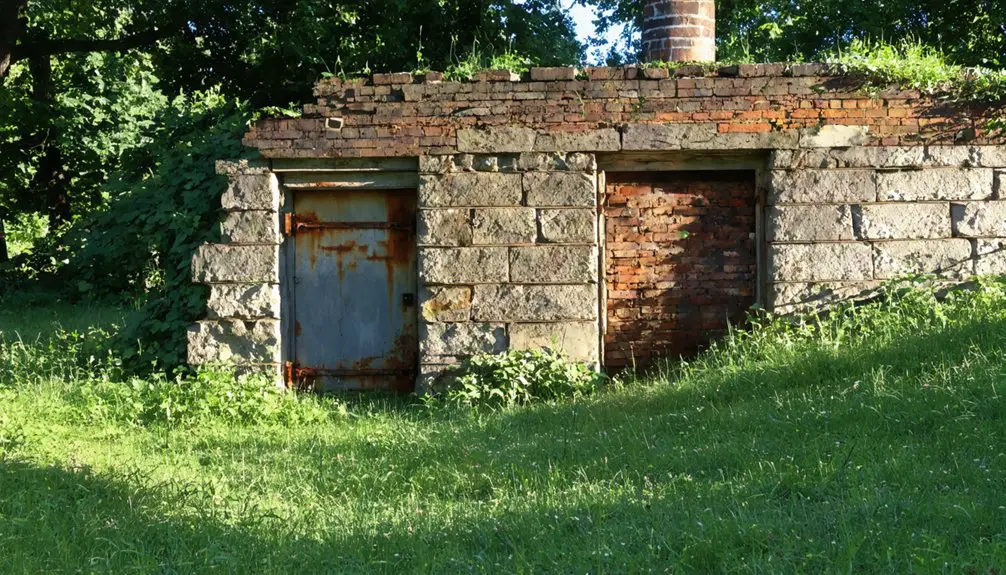
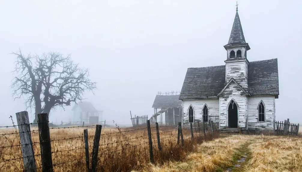
Since Wayman’s abandonment in 1938, virtually no physical remnants of this former Pulaski County settlement remain visible today.
You’ll find no standing structures, foundations, or walls to mark this vanished town’s location. Natural processes and nearly a century of agricultural or woodland development have reclaimed the site, presenting significant archaeological challenges for remnant exploration.
While you might hope to discover traces of old roads or ground depressions, the exact location remains uncertain.
The absence of historical photographs, maps, or documented landmarks further complicates any attempt to pinpoint Wayman’s original footprint.
Modern technology like LIDAR scanning could potentially reveal hidden clues beneath the vegetation, but currently, no formal preservation efforts or heritage markers exist to commemorate this lost piece of Missouri history.
Neighboring Ghost Towns
While Wayman’s physical traces have vanished, several neighboring ghost towns in Pulaski County and adjacent regions share similar fates of abandonment.
The history of ghost towns in Missouri reveals a fascinating narrative of economic booms and subsequent declines, often mirroring the rise and fall of local industries. Many of these towns, once thriving hubs, now stand as silent witnesses to the passage of time, with remnants of their past lives scattered throughout abandoned buildings and overgrown roads. Exploring these sites can provide unique insights into the cultural and social dynamics that shaped the region.
The history of Toonerville, Missouri, is a poignant example of how small towns struggled to maintain their populations as industries shifted and opportunities dwindled. Once flourishing with bustling commerce and community life, Toonerville is now often overlooked, its stories waiting to be unearthed by those willing to delve into the past. Visiting this ghost town reveals echoes of its former vibrancy and the resilience of its inhabitants, reminding us of the delicate balance between growth and decline in rural America.
You’ll find historical connections linking these communities through military expansion, economic shifts, and industrial decline. These ghost town legacies paint a broader picture of Missouri’s changing landscape during the mid-20th century.
- Bloodland in Pulaski County succumbed to military acquisition in the 1940s
- Cookville stands as another abandoned settlement within Pulaski’s borders
- Ark and Arlington fell victim to mining and agricultural declines
- Hamburg, Howell, and Toonerville disappeared for the Weldon Spring Ordnance Works
- Doolittle’s population dwindled after railroad operations ceased
These abandoned communities form a network of historical sites that tell the story of Missouri’s transformation through war, industry, and economic change.
Historical Significance in Pulaski County
As one of Pulaski County’s vanished communities, Wayman represents an essential chapter in Missouri’s pioneer settlement history.
You’ll find its legacy intertwined with the region’s cultural heritage, named after an early pioneer family who helped shape the area’s development during the 19th century.
The town’s historical narratives reflect broader patterns of westward expansion, positioned strategically near Waynesville’s important transport routes including stagecoach connections to St. Louis and Springfield.
While Wayman’s exact location remains unknown today, its existence contributed to Pulaski County’s dynamic growth period, when telegraph lines and stage roads transformed the region from Native American territory into a hub of pioneer activity.
The town’s abandonment by 1938 marks a significant change in the county’s demographic evolution.
Preservation and Documentation Efforts
Despite extensive efforts to document Missouri’s ghost towns, preservation work for Wayman faces significant challenges due to its unknown exact location and lack of physical remains.
You’ll find that local historical societies and preservation organizations attempt to piece together Wayman’s story through archival research, family records, and oral histories.
Documentation strategies primarily rely on secondary historical references, while preservation challenges stem from the absence of physical structures or archaeological sites.
- Local historical societies collect and maintain ghost town records
- Regional heritage trails promote awareness of historic sites
- Preservation groups seek tax incentives for documented locations
- Archaeological surveys remain impossible without site coordinates
- Documentation depends heavily on pioneer family genealogies
The town’s official ghost town classification helps maintain public awareness, though you won’t find specific preservation funding or legal protections without precise site identification and formal historic designation.
Frequently Asked Questions
What Was the Peak Population of Wayman During Its Most Active Period?
Like a fading shadow at sunset, you won’t find exact records, but based on similar railroad towns of that era, the peak population during its most active period didn’t exceed 400 residents.
Were There Any Notable Businesses, Industries, or Churches Established in Wayman?
You won’t find documented business ventures or formal churches in historical records. While informal community gatherings likely occurred, there’s no evidence of established commercial or religious institutions during the settlement’s existence.
What Native American Tribes Originally Inhabited the Wayman Area?
From time immemorial until the early 1800s, you’ll find the Osage were the primary tribe in your area, with their rich tribal heritage and cultural significance later joined by Shawnee and Delaware peoples.
Did Any Famous Historical Figures or Events Connect to Wayman?
You won’t find any significant historical connections or notable residents in this location. Records show only a pioneer family named Wayman founded it, with no famous figures or landmark events documented.
What Natural Disasters or Epidemics Affected Wayman’s Population Over Time?
Picture weathered farmland and quiet meadows – you won’t find specific records of disease outbreaks or flood impacts here. While Missouri faced epidemics and storms, there’s no evidence they directly affected Wayman’s decline.
References
- https://kids.kiddle.co/List_of_ghost_towns_in_Missouri
- https://sites.rootsweb.com/~motttp/history/ghost_towns/holman_mo.htm
- https://www.youtube.com/watch?v=alC1wDdSVvg
- https://www.legendsofamerica.com/avilla-missouri/
- https://en.wikipedia.org/wiki/List_of_ghost_towns_in_Missouri
- https://en.wikipedia.org/wiki/Wayman
- https://www.wikiwand.com/en/articles/Wayman
- https://www.latlong.net/place/waynesville-mo-usa-25223.html
- https://na1.coscoshipping.com/public/scholarship/Download_PDFS/A_Doctor_On_The_California_Trail.pdf
- https://arch.astate.edu/cgi/viewcontent.cgi?article=1416&context=all-etd