You’ll find Wayside at the edge of Palo Duro Canyon in Armstrong County, Texas, where ranchers first settled in the 1890s. Originally named Beulah, this small community grew to 100 residents by the 1960s with three businesses and a consolidated high school serving local families. Today, only 30 residents remain in this unincorporated town, with a single business and post office marking what was once a vibrant ranching hub. The stories of ancient peoples, pioneer settlers, and changing fortunes await along this canyon’s rim.
Key Takeaways
- Wayside, Texas experienced significant population decline from 100 residents in 1967 to approximately 30 residents today.
- The town’s commercial activity diminished after highway bypasses redirected traffic and trade routes away from the community.
- Only one business remains operational, down from three active businesses in 1948, indicating its transformation into a ghost town.
- Located near Palo Duro Canyon, Wayside retains its post office and church despite losing most economic and social infrastructure.
- The mechanization of agriculture and declining cotton markets contributed to Wayside’s depopulation and economic deterioration.
The Birth of a Ranch Town (1893-1897)
Three key events marked the birth of Wayside, Texas in the 1890s: the establishment of its rural school district, the arrival of early ranch hands, and the opening of its post office.
The ranching origins trace back to JA Ranch cowhands who occupied line camps along Palo Duro Canyon’s south rim before 1891. You’ll find Wayside strategically positioned near the canyon’s edge, four miles east of Randall County and three miles north of Swisher County. This location beside the road made it an ideal stopping point for travelers and traders.
The early settlers first called it Beulah, after the McSpadden family’s daughter who donated the school land. Mrs. Hervey J. Bradford changed the community’s name to Wayside in 1897.
From Beulah to Wayside: Origins of a Name
The origins of Wayside’s name tell a story of both faith and function in early Texas settlement.
You’ll find the community’s initial name, Beulah, carried deep biblical significance as a Hebrew word meaning “married” or “bride.” The McSpadden family chose this name for their daughter and the school built on their donated land, reflecting the period’s strong Protestant influences. Like many Puritan settlers before them, they embraced this biblical name as a symbol of hope and divine blessing.
When Mrs. Hervey J. Bradford established the post office in 1897, she initiated the Wayside shift, selecting a name that highlighted the settlement’s strategic location beside Palo Duro Canyon. The community served as a vital retail supply point for the region’s thriving stock raising operations.
The new name captured the community’s emerging role as a crucial stop for ranchers and travelers, marking a change from personal sentiment to practical purpose. This alteration symbolized the town’s evolution from a family-centered settlement to a functional waypoint in Texas ranching country.
Life Along Palo Duro Canyon’s Rim
Perched along one of North America’s most remarkable geological formations, Palo Duro Canyon‘s rim has witnessed over 15,000 years of human history.
You’ll find evidence of indigenous connections stretching back to the earliest hunters who tracked mammoth and giant bison across these plains. The Apache, and later the Comanche and Kiowa, made this their home until the devastating Battle of Palo Duro Canyon in 1874. Today, visitors can explore 30 miles of trails that wind through this historic landscape.
After Colonel Mackenzie’s forces removed the native tribes, ranching practices transformed the landscape. Charles Goodnight and John Adair established the massive JA Ranch in 1876, running over 100,000 cattle along the canyon’s rim. The 800-foot-deep gorge provided natural barriers and water sources essential for successful cattle operations.
The JA Ranch marked a new chapter in Palo Duro’s story, as 100,000 cattle replaced native peoples along these ancient canyon walls.
From Goodnight’s humble dugout dwelling to the sprawling cattle operations, the rim’s legacy reflects both the resilience and conflicts that shaped the Texas Panhandle.
Peak Years and Community Growth
You’ll find Wayside’s most prosperous period between 1940-1967, when the population grew from 40 to 100 residents while supporting multiple businesses and a consolidated high school.
The town’s role as an educational hub strengthened during this time, with the school serving as a central gathering place for local farming and ranching families. Like many ghost towns in Texas, the community’s eventual decline was tied to changing economic conditions and population shifts.
Similar to The Grove, which saw its peak population reach 400 residents during its most successful years, Wayside experienced significant community development during this era.
The presence of three active businesses by 1948 marked the community’s commercial peak, though this growth proved unsustainable as the population dropped sharply to 36 by 1969.
Population Surge 1940-1967
During World War II and the postwar decades, Wayside experienced a steady population surge that transformed this rural Texas community from 40 residents in 1940 to 100 by 1967.
You’ll find this growth particularly remarkable since it contrasted with the broader population dynamics across Texas, where most rural residents were moving to urban areas.
While cities grew by over 20% in the 1940s, Wayside’s modest expansion centered around its role as an agricultural supply point. Census data showed that racial composition trends were shifting significantly throughout Texas during this period. The town’s development came as Texas saw its farm population declining from 1.5 million in 1945 to much lower numbers in subsequent decades.
You could see the town’s importance in its three businesses, school, and cemetery by 1948. The community thrived on stock raising and irrigated farming, though rural challenges remained.
This period marked Wayside’s peak before facing sharp decline – a reflection of the delicate balance of sustaining small Texas towns in changing economic times.
Educational Hub Development
While many Texas towns struggled to establish educational foundations, Wayside’s identity as a learning hub took root in 1893 when it formed its rural school district, initially named Beulah after a land donor’s daughter.
By 1897, with the opening of a post office, the community adopted the name “Wayside” and quickly expanded its educational infrastructure.
You’ll find that community engagement reached new heights around 1909 when the Wayside Educational Club formed, championing a $5,000 bond issue for a new school building.
This frame structure, featuring an assembly hall and recitation rooms, became central to local life. The strategic placement of a church nearby attracted more settlers, and by 1940, Wayside boasted a consolidated high school serving both farming and ranching families throughout the area.
Business Growth Period
Three distinct businesses anchored Wayside’s commercial growth through the mid-20th century, serving as important supply points for the region’s ranching and farming operations.
You’ll find these establishments thrived primarily due to their strategic location near the JA Ranch, where many early settlers worked as cowhands.
The business dynamics reflected the town’s peak prosperity in the 1960s when the population reached 100 residents.
Local merchants adapted to economic trends by focusing on agricultural supplies and general merchandise that supported the farming community.
With the post office established in 1897 and two active stores by 1940, you could access most important goods without traveling to larger towns.
This commercial liveliness helped sustain Wayside’s role as a pivotal hub for local trade until the late 1960s.
Archaeological Discoveries and Native History
If you’re exploring the area around Wayside today, you’ll find evidence of early Native American presence through scattered stone tools and projectile points that date back thousands of years.
The Texas Panhandle region, including Wayside, shows archaeological traces of indigenous peoples from Paleo-Indian cultures who established hunting camps and seasonal settlements over 10,000 years ago.
The discovery of Clovis and Folsom points near Wayside connects this ghost town’s location to ancient migration patterns and hunting territories of early Plains peoples.
Indian Relics Found Nearby
Archaeological discoveries near Wayside reveal extensive prehistoric habitation along the Navasota River, where multiple sites showcase the rich cultural heritage of Native American peoples.
You’ll find evidence of sophisticated trade networks through artifacts like pottery sherds from New Mexico and East Texas Caddo regions, alongside exotic materials including Rocky Mountain obsidian and Gulf of California shells. These native artifacts paint a picture of thriving communities that maintained far-reaching connections across ancient North America.
- Tools uncovered at regional sites demonstrate advanced technical skills used in both daily life and ritual practices.
- Poynor Engraved pottery styles link the area to Late Prehistoric groups of the upper Neches River region.
- Archaeological evidence shows native trails later became important transportation routes for early settlers.
Early Inhabitation Evidence
Decades before Europeans arrived in Texas, diverse indigenous peoples thrived near present-day Wayside, leaving behind a treasure trove of artifacts dating back 16,000-20,000 years.
You’ll find evidence of prehistoric habitation throughout the region, particularly at significant archaeological sites that have yielded over 2.6 million cultural artifacts, including ancient tools and inscribed rocks – the earliest known in North America.
The area’s rich archaeological record challenges traditional views of purely nomadic peoples, suggesting more permanent settlements existed.
Near Wayside, you’ll discover Indian relics from the 15th century, while mammoth kill sites reveal sophisticated hunting practices.
The Texas Panhandle served as an essential crossroads for native trade routes, with the Comanche and other tribes utilizing Palo Duro Canyon’s abundant resources until Anglo-American settlement began.
The Decline of a Prairie Settlement
While Wayside once thrived as a bustling prairie settlement, its decline followed a pattern common to many Texas ghost towns of the mid-20th century.
You’ll find that major economic shifts, including the mechanization of agriculture and declining cotton markets, severely impacted the town’s sustainability. Population migration accelerated as younger residents sought opportunities in urban areas, leaving behind an aging community with dwindling resources.
- The construction of highway bypasses diverted essential trade routes away from Wayside, reducing accessibility and commerce.
- The closure of local businesses and postal services signaled the community’s diminishing liveliness.
- Agricultural challenges, including soil depletion and market changes, made farming increasingly difficult to sustain.
The town’s isolation, combined with deteriorating infrastructure and limited economic opportunities, ultimately led to its abandonment as a viable settlement.
Historic Landmarks and Cultural Heritage
Despite its decline, Wayside’s rich historical legacy lives on through its remaining landmarks and cultural touchstones.
You’ll find the Wayside Community Church standing as the town’s spiritual anchor, accompanied by a Quanah Parker Trail arrow marker that commemorates the area’s Native American heritage. The church’s historical significance extends beyond religious services, as it once served as a crucial hub for social gatherings and community organization.
The town’s cultural preservation efforts highlight its fascinating origins, from its 1893 founding as “Beulah” to Mrs. Bradford’s selection of the name “Wayside” in 1897.
Early settlers, mainly JA Ranch cowhands, shaped the community’s development, while discovered Indian relics from the fifteenth century reveal an even deeper indigenous history along the rim of Palo Duro Canyon.
Modern Day Remnants and Legacy
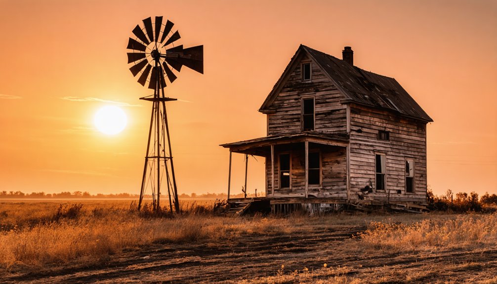
Today’s Wayside stands as a tribute to rural Texas decline, with only about 30 residents calling this unincorporated community home. You’ll find this small settlement at the intersection of Farm to Market Road 211 and U.S. Highway 87, maintaining its community identity through its operational post office and active church.
While outsiders might label Wayside a ghost town, the remaining residents dispute this classification, emphasizing their cultural continuity despite significant population losses since the late 1960s.
Wayside’s resilient locals refuse the ghost town label, pointing to their enduring community spirit despite dwindling numbers.
- The town sits at 3,169 feet elevation on the high plains of the Llano Estacado
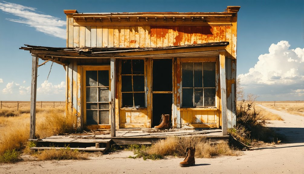
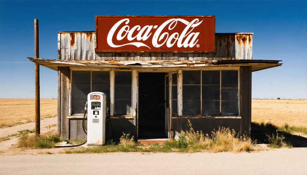
- Only one business remains operational, down from three in earlier decades
- The community church serves as a crucial gathering point for the dispersed population
Frequently Asked Questions
What Happened to the Original Beulah After Whom the Town Was Named?
You won’t find direct records of Beulah’s personal fate beyond her family’s land donation. Beulah’s legacy lives on mainly through historical references, while her family likely merged into the broader Wayside community.
Were There Any Famous Outlaws or Gunfights in Wayside’s History?
Unlike wild towns where outlaws roamed free, you won’t find any famous outlaws or historical gunfights in Wayside’s past. The town’s story was about ranching and farming, not frontier violence.
How Did Residents Get Water Before Modern Infrastructure Was Built?
You’d rely on deep wells for well water and set up rain catchment systems using barrels and cisterns. When those sources failed, you’d have to haul water from nearby rivers or creeks.
What Was the Highest Price Ever Paid for Land in Wayside?
You won’t find specific records of historical transactions or land valuations for this area. While nearby ghost towns have sold for around $100,000, the highest price paid remains undocumented in accessible records.
Did Any Notable Films or Television Shows Feature Wayside’s Landscape?
You won’t find any documented film locations or television features showcasing Wayside’s landscape. While Texas hosts many productions in ghost towns, there’s no evidence of major filming ever taking place here.
References
- https://www.tshaonline.org/handbook/entries/wayside-tx-armstrong-county
- https://kfyo.com/texas-ghost-town-the-mysterious-and-gruesome-story-of-baby-head/
- https://www.youtube.com/watch?v=phjUE19A8HM
- https://talesfromthewayside.com/blog-1/2016/10/23/ir2dpb5t3olgachpohdwy2v1t9l43y
- https://mix941kmxj.com/do-you-know-why-texas-would-need-6-different-towns-named-wayside/
- https://en.wikipedia.org/wiki/List_of_ghost_towns_in_Texas
- https://mix941kmxj.com/dont-believe-what-youve-heard-wayside-is-not-a-ghost-town/
- https://www.texasescapes.com/TexasPanhandleTowns/Wayside-Texas.htm
- https://en.wikipedia.org/wiki/Wayside
- https://texastimetravel.com/directory/wayside/


