New Mexico harbors several fascinating abandoned Old West settlements. You’ll find Dawson, a former coal mining community with a haunting cemetery, and Cuervo, a deserted Route 66 settlement. White Oaks preserves its gold rush heritage, while Chloride maintains 27 original silver boom structures. Loma Parda, once Fort Union’s notorious outpost, sits largely forgotten today. These ghost towns offer silent testimonies to the state’s frontier boom-and-bust cycles.
Key Takeaways
- Dawson was a coal mining town with 6,000 residents at its peak before closing in 1950 after two major mining disasters.
- Cuervo emerged in 1901 along the railroad and Route 66, but was abandoned by 2011 after Interstate 40 bypassed it.
- White Oaks boomed after gold was discovered in 1879, growing to 4,000 residents before declining when bypassed by the railroad.
- Chloride thrived as a silver mining town with 3,000 residents in the 1880s before collapsing after the 1893 Silver Panic.
- Loma Parda grew to 400 residents as Fort Union’s notorious entertainment district before being abandoned when the fort closed around 1900.
Dawson: The Lost Coal Mining Community With Haunting Cemetery
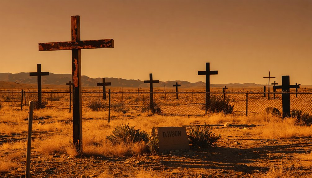
Nestled in the northeastern corner of New Mexico lies the ghostly remnants of Dawson, a once-thriving coal mining community whose rise and fall mirrors the boom-and-bust cycle of many Western industrial settlements.
Following coal’s discovery in 1895, Dawson rapidly developed into a modern company town after Phelps Dodge acquired it in 1906. At its peak, 6,000 residents enjoyed extensive amenities while the mines produced valuable coking coal. The town was originally founded by John Barkley Dawson who purchased 250,000 acres from the Maxwell Land Grant.
Coal transformed Dawson from barren land to bustling hub, where thousands lived comfortably amid the industrial promise of black gold.
However, this prosperity was punctuated by devastating Dawson disasters – a 1913 explosion killed 263 miners and rescuers, while another in 1923 claimed 123 lives. When coal demand declined by the late 1940s, the mines closed permanently in 1950.
Today, you’ll find little except the haunting cemetery with its distinctive white iron crosses marking disaster victims’ graves – a solemn reminder of industrial sacrifice. Visitors researching Dawson should note that it appears on disambiguation pages to distinguish it from other locations sharing the same name.
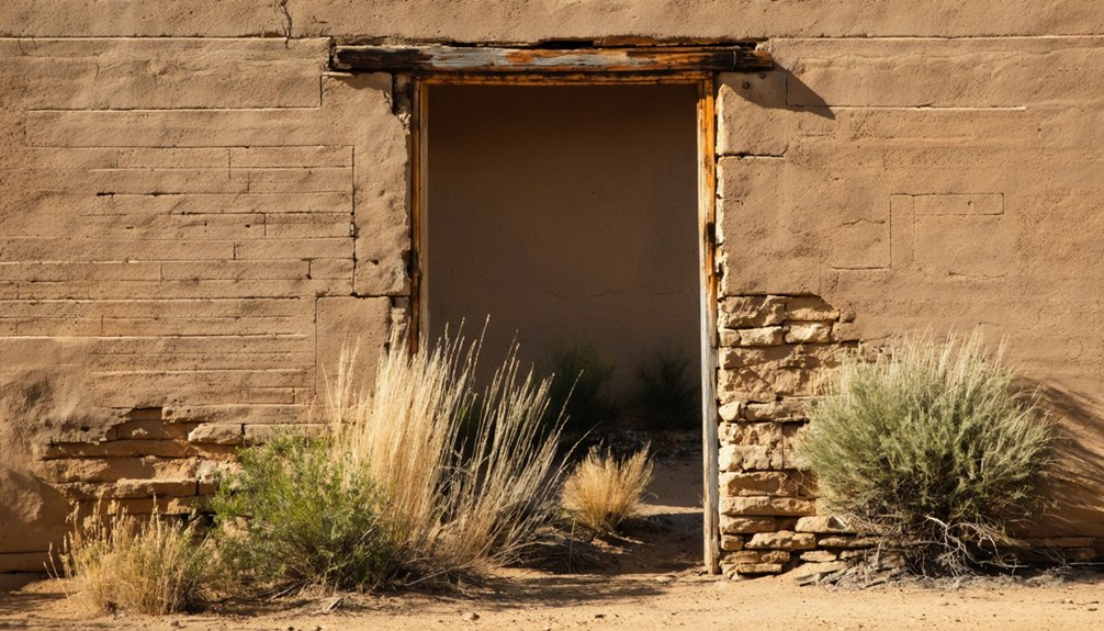
Cuervo: Route 66’s Forgotten Roadside Settlement
When you travel through what remains of Cuervo, you’ll first notice the crumbling adobe structures that once served as bustling businesses during the railroad prosperity era of the early 1900s.
The town’s prosperity ended abruptly when Interstate 40 bypassed the settlement in the 1960s, physically dividing the community and redirecting the steady flow of Route 66 travelers who’d sustained local commerce. Today, the Santo Niño Church from 1915 stands as one of the few preserved historical structures in this abandoned landscape.
These abandoned buildings now stand as weathered sentinels along the old highway, their deteriorating walls and collapsed roofs silently documenting the dramatic socioeconomic shifts that transportation infrastructure changes imposed on small Western settlements. The once thriving town reached its peak population of around 300 residents before steadily declining after the highway changes.
Railroad Prosperity Era
Cuervo emerged as a critical transportation node in eastern New Mexico when the Chicago, Rock Island & Gulf Railroad established it as a water stop in 1901, laying the foundation for what would later become a quintessential Route 66 settlement.
The town’s formal recognition came with its post office opening around 1902, signaling its growing significance along the expanding rail corridor.
During this railroad expansion period, Cuervo transformed from a simple water stop into a functional community supporting both railroad operations and regional commerce.
Cattle ranching flourished by 1910, with the railroad providing essential market access for local ranchers.
The town experienced significant economic boom in 1926 when Route 66 was established, bringing thousands of travelers through the area.
Named after the distinctive Cuervo Hill nearby, the settlement’s early identity and economy were inextricably linked to the railroad, positioning it as a small but strategic outpost in New Mexico’s developing transportation network.
At its height in the early 1940s, the town boasted a peak population of approximately 300 residents who supported the local businesses and community services.
Interstate Bypass Effects
The fate of many Route 66 settlements dramatically shifted during the interstate highway era of the mid-twentieth century, and nowhere is this transformation more evident than in Cuervo, New Mexico.
When Interstate 40 bypassed this once-thriving village, the traffic diversion initiated catastrophic economic decline.
The bypass consequences manifested in multiple dimensions:
- I-40 physically bisected Cuervo, fragmenting the community’s cohesion
- Local businesses collapsed as highway travelers no longer stopped for services
- Population plummeted from 300 in the 1940s to complete abandonment by 2011
- Essential infrastructure deteriorated without commercial sustainability
- Historic structures like the 1915 sandstone church became isolated relics
You’ll find Cuervo’s remaining structures—abandoned gas stations, weathered storefronts, and adobe homes—standing as silent testimonials to how transportation policy decisions can determine a community’s survival. Today, the century-old Catholic Church built during World War I remains one of the most recognizable landmarks amidst the town’s ruins. Visitors can reach the ghost town via a scenic drive from Newkirk along a beautiful 1926 bouncy road with railroad tracks visible on the right side.
Adobe Ruins Today
Despite its nearly complete abandonment, Cuervo’s adobe ruins persist as compelling archaeological remnants of Route 66’s golden era.
You’ll find these structures in various states of decay, yet remarkably intact compared to similar ghost towns. The church stands defiant despite vandalism, while the hotel, gas station, and medical clinic buildings offer tangible connections to the town’s vibrant past. The town experienced dramatic decline after being severed by Interstate 40 in the late 1960s, diverting traffic away from the once-bustling settlement.
These adobe structures exemplify traditional Southwestern New Mexico building techniques, their preservation highlighting regional architectural heritage.
The historical significance of these ruins extends beyond mere buildings—they represent the rise and fall of transportation-dependent settlements. For historians, photographers, and Route 66 enthusiasts, Cuervo’s adobe relics provide critical insights into early 20th-century village life and serve as physical links to New Mexico’s distinctive Old West and Route 66 legacy.
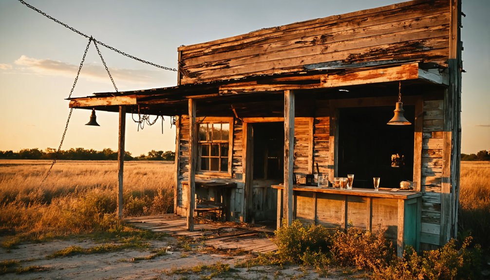
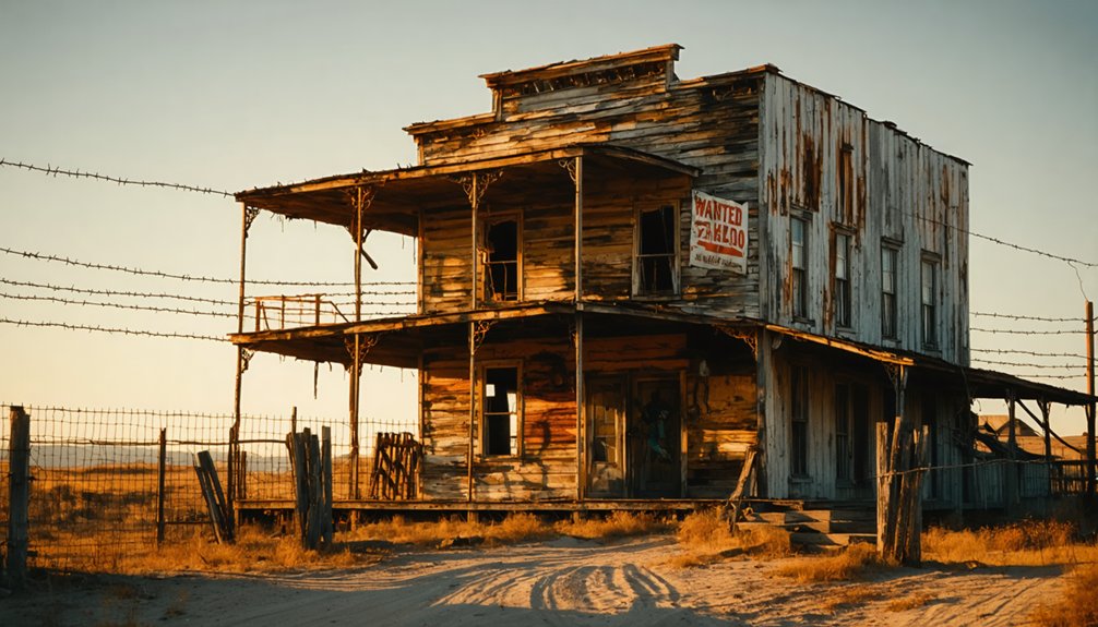
White Oaks: Gold Rush Frontier Town Near Carrizozo
In White Oaks, you’ll witness the remarkable legacy of a once-thriving gold rush town that flourished after John Wilson’s 1879 discovery in the Jicarilla Mountains.
The frontier settlement, which reached a population of up to 2,500 residents, balanced mining prosperity with cattle industry connections, supporting dozens of businesses including hotels, saloons, and an opera house during its heyday.
Though now reduced to approximately 15 residents, the preserved rock, adobe, and brick structures—including the still-operating No Scum Allowed Saloon—offer authentic architectural testimony to New Mexico’s western frontier era. The town’s mining operations extracted an impressive estimated $20 million in gold and minerals before its eventual decline.
Prospector’s Mining Boom Legacy
When gold was discovered in the Jicarilla Mountains in 1879, White Oaks rapidly transformed from an unsettled wilderness into a thriving boomtown with significant economic influence.
The prospector’s legacies began with John Wilson, a Texas fugitive who shared his discovery before departing, followed by Jack Winters and Harry Baxter who established lucrative mining operations.
You’ll find White Oaks’ mining heritage reflected in:
- Population explosion to 4,000 residents at its peak
- Development of 50+ businesses including opera house and bank
- Shift from lawless frontier to established community by 1885
- Economic infrastructure powered by nearby coal deposits
- Connection to Wild West figures like Billy the Kid
The town’s decline came with depleted resources and failed railroad negotiations, leaving behind a ghost town that preserves the authentic spirit of frontier prospecting.
Frontier Cattle Town Roots
White Oaks began not as a mining boomtown, but as a humble cattle settlement nestled among its namesake white oak trees before gold transformed its destiny.
This frontier community’s pastoral origins along a stream quickly vanished after the 1879 gold discovery in the Jicarilla Mountains. Within months, the economy shifted from cattle ranching to mining operations that eventually extracted up to 50 tons of gold ore daily.
The town’s rapid metamorphosis exemplifies the volatility of frontier life. Population exploded from 800 residents in 1880 to 4,000 by 1882, making it New Mexico Territory’s second-largest settlement.
You’d have found a vibrant community with four newspapers, three churches, and an opera house—until the railroad’s fateful decision to bypass White Oaks led to its eventual abandonment.
Preserved Old West Architecture
Architectural remnants of the Wild West stand frozen in time throughout White Oaks, offering visitors a tangible connection to New Mexico’s gold rush era.
The town’s historical significance emerges through its shift from temporary encampments to substantial structures of rock, adobe, and brick. These architectural styles reflect the evolution from frontier settlement to prosperous mining community.
White Oaks’ preserved structures showcase:
- The No Scum Allowed Saloon, still standing as proof of frontier social life
- Churches, hotels, and an opera house representing sophisticated cultural development
- A watermill system that harnessed nearby coal deposits for steam-powered operations
- Commercial buildings that once housed four newspapers, multiple stores, and services
- Adaptively repurposed buildings that survived the town’s economic collapse when railroads bypassed it
Chloride: Silver Boom Village With Preserved Western Architecture
Hidden among the Black Range Mountains of New Mexico, Chloride stands as one of the best-preserved silver boom towns from the Old West era. Discovered by Harry Pye in 1879, the town’s name reflects the silver chloride ore that sparked its existence.
During its 1880s heyday, Chloride’s population swelled to 3,000, with Wall Street—its 60-foot-wide main thoroughfare—bustling with commerce.
The once-mighty Chloride, where 3,000 souls walked the wide expanse of Wall Street during silver’s golden age.
You’ll find approximately 27 original structures still standing today, including the Pioneer Store Museum and Monte Cristo Saloon. These preserved buildings offer glimpses into Chloride history when silver mining dominated the economy.
The Silver Panic of 1893 and subsequent demonetization of silver triggered Chloride’s decline, transforming it from a mining powerhouse to a near ghost town with only 125 residents by 1900.
Loma Parda: Fort Union’s Notorious Wild West Outpost
While Chloride’s silver industry shaped its legacy, the small settlement of Loma Parda emerged from a different catalyst altogether—military proximity.
Following Fort Union’s 1851 establishment, this once-quiet farming village transformed into a notorious frontier outpost, earning the unflattering nickname “Sodom on the Mora.”
Loma Parda’s legacy remains intrinsically tied to vice industries that flourished alongside legitimate commerce.
- The whiskey trade dominated local commerce, fueling gambling establishments and brothels
- Population surged to over 400 residents during the 1870s height of military activity
- Prostitutes established operations in nearby caves, later named “Cañon de Las Pelones”
- Military commanders repeatedly attempted to declare the town off-limits
- The McMartin brothers operated legitimate mercantile businesses amid the lawlessness
When Fort Union closed around 1900, Loma Parda faded into abandonment, its wild history preserved only in frontier lore.
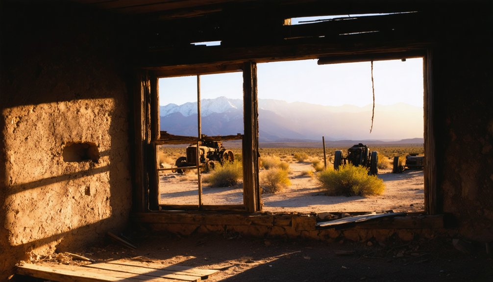
Mogollon: Mountain Mining Town in Gila National Forest
Nestled in the rugged Gila Mountains of southwestern New Mexico, the mining town of Mogollon emerged following Sergeant James C. Cooney’s 1870s gold discovery.
This mining history powerhouse transformed from tent encampments to a thriving community with electricity, water systems, and telephone service by 1915.
At its peak, Mogollon extracted $1.5 million in precious metals in 1913 alone—40% of New Mexico’s production that year.
The Little Fannie Mine dominated operations but subjected workers to deadly silicosis, limiting employment to three years before health failure forced departure.
Despite economic prosperity, Mogollon couldn’t survive the 1893 market crash, WWI’s declining demand, and a devastating 1942 fire.
Today, this remote ghost town offers you a glimpse into the boom-and-bust cycle that defined New Mexico’s mining frontier.
Frequently Asked Questions
Are These Ghost Towns Legally Accessible to the Public?
Many ghost towns have legal restrictions on public access. You’ll find varied accessibility—some welcome visitors, others require permits, while those on private property demand permission to avoid trespassing.
Can You Camp Overnight in Any New Mexico Ghost Towns?
You’ll find limited legal overnight camping directly in New Mexico ghost towns due to strict camping regulations. Most sites lack ghost town amenities, requiring you to utilize nearby public lands with proper permits instead.
However, for those intrigued by haunted locations in New Mexico, numerous tours and local guides can provide insights into the eerie histories of these towns. Exploring these sites can offer a unique blend of adventure and the supernatural, perfect for enthusiasts and skeptics alike. Just ensure to respect the rules and preserve the history of these remarkable places.
What Paranormal Activity Has Been Reported in These Locations?
You’ll encounter numerous ghost sightings across these haunted locations, including spectral miners in Dawson, apparitions of cowboys in Loma Parda, poltergeist activity in Chloride, and disembodied voices in White Oaks.
Are Metal Detectors Permitted for Artifact Hunting?
Metal detector regulations limit your artifact hunting freedoms. You’ll need permits for state trust lands and can’t detect on federal or tribal lands without authorization. Consider ethical implications of context removal.
Which Ghost Towns Offer Guided Historical Tours?
You’ll find guided tours highlighting historical significance at Shakespeare (daily), Cerrillos (weekends), and Albuquerque’s Old Town Ghost Tours (nightly), while Mogollon offers seasonal self-guided experiences with occasional narrative hikes.
References
- https://newmexicotravelguy.com/new-mexico-ghost-towns/
- https://compaslife.com/blogs/journal/abandoned-enchantment-ghost-towns-of-new-mexico-1
- https://www.legendsofamerica.com/nm-ghostwesttucumcari/
- https://a-curious-nature.com/2023/10/20/pseudo-ghost-towns-of-new-mexico-a-late-september-road-trip/
- https://www.newmexico.org/places-to-visit/ghost-towns/
- https://www.youtube.com/watch?v=0i7Ucc4vtsw
- https://www.atlasobscura.com/things-to-do/new-mexico/ghost-towns
- https://kids.kiddle.co/List_of_ghost_towns_in_New_Mexico
- https://www.visitlascruces.com/blog/post/5-local-ghost-towns-you-dont-want-to-miss/
- https://en.wikipedia.org/wiki/Dawson