You’ll find numerous abandoned riverfront settlements across America’s waterways, including Hopefield, Arkansas, which now lies submerged beneath the Mississippi River, and Rodney, Mississippi, where a shifting river port led to its decline. Matildaville, Virginia’s stone foundations still stand in Great Falls Park, while Arizona’s Millville and Charleston showcase mining’s boom-and-bust legacy. The sunken villages of Maine’s Flagstaff Lake emerge during low water, offering glimpses into these fascinating lost communities that shaped America’s expansion.
Key Takeaways
- Hopefield, Arkansas lies submerged beneath modern infrastructure after the Mississippi River consumed the former railway hub in 1912.
- Rodney, Mississippi stands abandoned after the Mississippi River’s 1870 course change left its once-bustling port two miles inland.
- Matildaville, Virginia exists only as stone foundations within Great Falls Park, following the Patowmack Canal’s failure in the 1830s.
- Charleston and Millville, Arizona were deserted after flooding, labor strikes, and an 1887 earthquake ended their silver processing operations.
- Flagstaff Village, Maine remains underwater beneath Flagstaff Lake, occasionally visible during low water periods since its 1950 flooding.
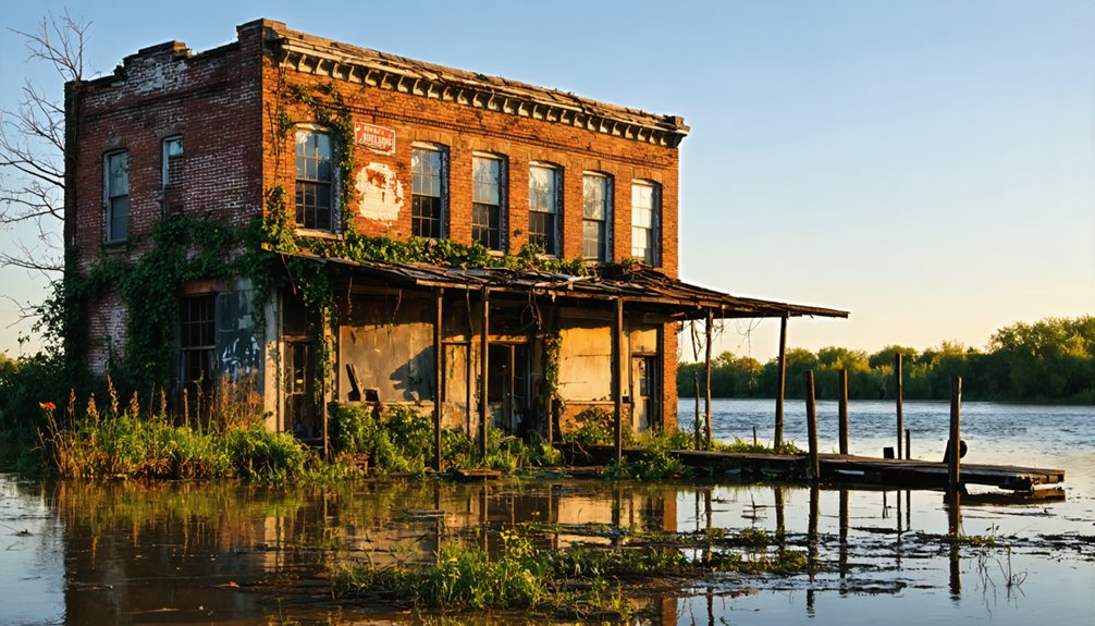
The Lost Frontier Outpost: Hopefield, Arkansas
Three distinct phases marked the birth of Hopefield, Arkansas, beginning with its establishment as Foy’s Point in 1795 by Dutch immigrant Benjamin Fooy. The settlement, renamed Campo de la Esparanza in 1797, evolved from a modest collection of log cabins into an essential ferry terminal and railway hub connecting Arkansas to Memphis by the mid-1800s.
Hopefield’s significance grew under Fooy’s leadership until 1823, establishing it as a moral and prosperous community. A military road connecting Hopefield to Little Rock was built, enhancing transportation and commerce in the region. During the operation to destroy the town, Union forces discovered sixteen horses and nine mules hidden by Confederate sympathizers. However, the Civil War brought devastating changes when Union forces burned the entire town in 1863, destroying its role as a Confederate guerrilla base.
Though rebuilt by 1871, the town faced continuous challenges from yellow fever outbreaks, flooding, and river erosion. By 1912, the Mississippi River had consumed most of Hopefield, leaving it submerged beneath modern infrastructure today.
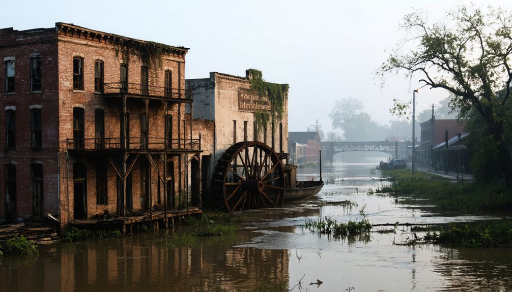
Rodney’s Fading Legacy Along the Mississippi
If you’re following the fading legacy of Rodney today, you’ll find that the Mississippi River’s migration two miles westward in 1870 transformed this once-bustling port into an architectural graveyard.
The historic Rodney Cemetery, established in 1828, stands as a silent chronicler of the town’s prosperity and decline, with weathered headstones documenting generations of merchants, riverboat captains, and prominent families. The cemetery’s grounds reveal traces of Confederate Civil War trenches that overlook the old riverbed.
The devastating yellow fever epidemic of 1843 marked the beginning of the town’s struggles, causing widespread deaths and forcing all businesses to close temporarily. Among the few surviving structures, the Federal-style Presbyterian Church remains the sole original building from Rodney’s heyday, its bullet-scarred facade and embedded Civil War cannonball offering evidence to the town’s turbulent past.
River’s Changing Migration Path
While Rodney once thrived as a major Mississippi River port rivaling the traffic between New Orleans and St. Louis, nature had other plans for this bustling settlement.
In 1870, a devastating river migration permanently altered the town’s destiny when a massive sandbar formed, forcing the Mississippi to shift its course two miles westward. This geographical transformation dealt a fatal blow to Rodney’s economic significance.
Key impacts of the river’s changing path:
- Complete loss of crucial river port access that had been the town’s economic lifeline
- Recurring floods that continuously damaged remaining structures and infrastructure
- Accelerated economic decline as businesses shuttered and residents departed
The river’s westward shift effectively sealed Rodney’s fate, transforming it from a prosperous commercial hub into an isolated community cut off from the maritime trade that had sustained it. Before this decline, the town had grown from its early days as Petit Gulf to become a thriving port of nearly 1,000 residents by the 1850s. The town’s importance during its peak was so significant that it nearly became Mississippi’s capital, losing by just three votes.
Cemetery Tales Since 1828
Beyond the abandoned storefronts and crumbling structures of Rodney lies a haunting memorial to its past – the historic Rodney Cemetery, established in 1828.
Perched atop a steep bluff behind the Presbyterian Church, this three-acre burial ground contains at least 200 graves, though many markers have succumbed to time and gravity.
At its height in the 1860s, four thousand residents called this Mississippi river port home before disasters struck.
The cemetery’s historical markers tell a grim tale of yellow fever epidemics, Civil War violence, and vigilante justice.
You’ll find the final resting places of early settlers, prominent citizens, and victims of the devastating outbreaks of 1843 and 1847.
The cemetery symbolism reflects Rodney’s dramatic arc from bustling river port to ghost town, with weathered tombstones and overgrown paths serving as silent witnesses to the community’s rise and fall.
Vanishing Antebellum Architecture Remnants
Along the Mississippi River’s storied banks, Rodney’s vanishing antebellum architecture represents a vital chapter in American architectural history.
You’ll witness the stark reality of architectural preservation challenges through estates like Arlington Plantation, where a 2002 fire left only ghostly remnants of its former grandeur. These antebellum legacies face continuous threats from natural disasters and neglect. The multi-million-dollar renovation of Nottoway Plantation demonstrates rare successful preservation of these historic structures. Like the haunting Windsor Ruins, these structures serve as poignant reminders of lost architectural splendor.
- Natchez’s concentration of surviving mansions showcases Greek Revival splendor with iconic white columns and classical details.
- Slave cabins and outbuildings, essential to understanding the complete architectural story, have largely disappeared.
- Only about 2% of original plantation complexes remain intact, with Evergreen Plantation’s 37 buildings offering a rare glimpse into complete antebellum design.
You’re witnessing history’s slow erosion as these architectural treasures fade from the landscape, despite preservation efforts.
The Haunted Halls of Cahawba, Alabama
Deep in the heart of Alabama’s Black Belt region stands the haunting remnants of Cahawba, the state’s first capital established in 1819 at the strategic confluence of the Alabama and Cahaba Rivers.
This ghost town‘s haunted history traces back to its turbulent past, from Native American settlements to its role as a thriving antebellum city and later a Civil War prison site. Originally designed in a grid-like pattern similar to Philadelphia’s layout, the town featured streets named after trees.
You’ll find the Crocheron Columns rising from empty lots where grand mansions once stood, while Castle Morgan’s ruins whisper tales of 3,000 imprisoned Union soldiers.
Cahawba legends persist through the preserved St. Luke’s Episcopal Church and two historic cemeteries, where graves tell stories spanning from slavery through emancipation.
Today, as Alabama’s most haunted ghost town, the Old Cahawba Archaeological Park protects these atmospheric ruins for researchers and visitors.
Mining Dreams: Millville and Charleston, Arizona
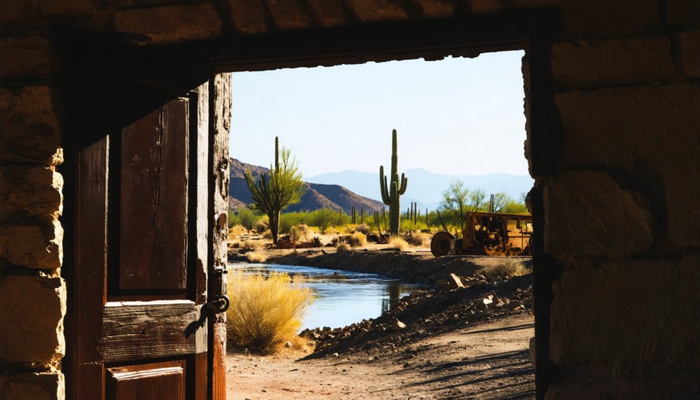
The twin ghost towns of Millville and Charleston, Arizona stand as weathered monuments to Tombstone’s silver mining legacy. Along the San Pedro River, you’ll find Millville’s stone foundations across from Charleston’s ghostly remnants of adobe walls.
These once-bustling settlements processed over $1.3 million in silver bullion during their 1881-1882 peak, with Charleston growing into a frontier town of 400 residents.
During their heyday, these silver boomtowns churned out fortunes in precious metal while Charleston swelled with frontier prosperity.
- Millville’s massive stamp mills converted Tombstone’s raw ore into transportable silver bars.
- Charleston boasted a thriving commercial district with stores carrying up to $100,000 in merchandise.
- The towns’ decline began in 1886 when flooded mines, a workers’ strike, and an 1887 earthquake sealed their fate.
Today, you can explore these preserved ruins within the San Pedro Riparian National Conservation Area, where desert winds whisper tales of Arizona’s mining era.
Beneath the Waters: The Sunken Villages of Flagstaff Lake
Hidden beneath Maine’s pristine Flagstaff Lake lies a remarkable story of three submerged communities. In 1950, Central Maine Power completed the Long Falls Dam, intentionally flooding Flagstaff Village, Dead River Plantation, and parts of Bigelow Plantation to create a 20,000-acre reservoir.
This sunken history began in the 1930s when CMP acquired properties through eminent domain, forcing residents to abandon their homes and businesses.
The submerged architecture reveals itself during low water periods, exposing stone foundations, mill remnants, and cellar holes along the shoreline. You’ll find traces of a once-thriving valley where Benedict Arnold’s troops planted their flag in 1775.
Today, you can explore these ghostly ruins on foot during drawdowns or dive beneath the surface, where cold waters preserve the remnants of Maine’s drowned communities.
Matildaville: The Canal Town That Never Was
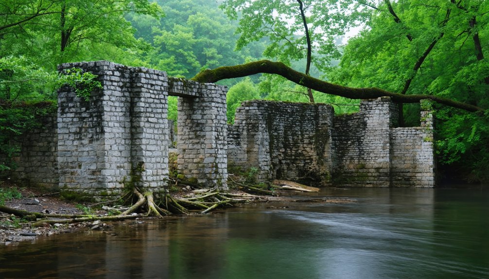
If you’re seeking remnants of early American industrial ambition, you’ll find Matildaville’s ruins along Virginia’s Potomac River trails, where George Washington’s grand canal venture aimed to connect the eastern seaboard to the Ohio Valley.
The town emerged in 1790 as an ambitious 40-acre industrial hub, complete with mills, foundries, and boarding houses supporting the Patowmack Canal construction.
Despite its promising start, Matildaville succumbed to the canal’s technical limitations and financial troubles by 1830, leaving only stone foundations and weathered walls within today’s Great Falls Park.
Canal Dreams Gone Wrong
Among America’s most ambitious early canal ventures, Matildaville emerged in 1790 as a speculative settlement destined for industrial greatness along Virginia’s Great Falls.
You’ll find its ruins tell a story of failed canal infrastructure and elusive economic sustainability, where grand visions of manufacturing prosperity met harsh realities.
The Patowmack Company’s ambitious plans included:
- A 314-mile canal system with five locks and guard gates
- Water-powered industrial facilities including forges and mills
- A 40-acre commercial center with markets and boarding houses
Despite these plans, you’d have seen Matildaville’s rapid decline as the canal proved usable only one to two months yearly.
When the Patowmack Company ceased operations in 1828, the town’s fate was sealed.
The C&O Canal’s construction on Maryland’s side finally bypassed Matildaville entirely, leaving it to fade into history.
Ruins Along Potomac Trails
Today’s visitors to Great Falls National Park can explore the haunting stone remnants of Matildaville along the 1.7-mile trail that was once Canal Street.
You’ll discover fragments of the town’s industrial past scattered throughout the riverfront ruins – including foundations of the inn, market, and sawmill that once served this ambitious canal settlement.
As you walk the historical trails, you’ll find cellar holes and structural remains that tell the story of a failed dream.
These archaeological treasures reveal how the town transformed from a bustling community of canal workers into an abandoned settlement by the 1830s.
Interpretive signs guide you through the site’s significance, highlighting George Washington’s vision for the Potomac canal and the diverse workforce, including indentured servants and enslaved people, who built this frontier industrial hub.
Nature’s Role in Riverfront Town Abandonment
While many ghost towns emerged from economic downturns or resource depletion, nature’s raw power along America’s major rivers has proven to be an especially destructive force in town abandonment.
You’ll find stark evidence of riverbank erosion and failed flood management in places like Kaskaskia, Illinois, where the Mississippi River’s relentless forces literally cut the town off from its own state.
The river’s might has reshaped entire communities through:
- Channel migrations that left ports like Rodney, Mississippi, stranded miles from navigable water
- Catastrophic flooding that forced entire towns like Valmeyer, Illinois, to relocate to higher ground
- Erosional forces that completely erased settlements like Napoleon, Arkansas, from the landscape
Today, these abandoned riverfronts stand as proof of nature’s dominance over human engineering efforts.
Preserving America’s Forgotten River Settlements
Despite the relentless forces of nature that claimed countless riverfront settlements, a complex network of preservation efforts now safeguards America’s forgotten river towns through legal protections, community initiatives, and institutional support.
You’ll find cultural preservation thriving through federal programs like the National Register of Historic Places, which provides tax incentives and grants for stabilization work. Community stewardship plays an essential role, with volunteer societies organizing cleanups, documenting oral histories, and maintaining historic cemeteries.
Federal agencies, from the U.S. Fish and Wildlife Service to the Army Corps of Engineers, must consider these sites in their river management projects. While flooding and erosion pose ongoing threats, local zoning ordinances, state preservation offices, and tribal authorities work together to protect these irreplaceable pieces of American history.
Ghost Towns as Historical Time Capsules
Abandoned riverfront ghost towns serve as remarkable historical time capsules, preserving layers of American life frozen at the moment of their decline.
Abandoned towns in California, like those found in the Sierra Nevada, offer a haunting glimpse into the past. Many of these locations were once bustling hubs during the gold rush, now left to be overtaken by nature. Exploring these deserted streets and crumbling structures, one can almost hear the echoes of the lives once lived there.
You’ll find these settlements’ historical significance etched into their remaining structures, artifacts, and documented accounts, offering invaluable insights into America’s riverfront development and demise.
- Cahaba, Alabama stands as a rare preserved example of early Black civic engagement, with its courthouse ruins witnessing both antebellum power and post-Civil War African American political gatherings.
- Rodney, Mississippi’s Presbyterian church and cemetery chronicle the rise and fall of river commerce, with graves dating to 1828 telling stories of social and racial dynamics.
- Flagstaff, Maine’s submerged remnants beneath the reservoir waters represent the sacrifice of entire communities for modern infrastructure, with its occasionally visible chapel steeple serving as a haunting reminder.
Frequently Asked Questions
What Daily Life Activities Took Place in These Ghost Towns?
You’d find residents mining coal and silver, operating ferries, attending community gatherings in courthouses, processing ore, fishing along riverbanks, building infrastructure, and maintaining homes despite floods and hardships.
How Many Undiscovered Riverfront Ghost Towns Might Still Exist Today?
You’ll find hundreds of hidden locations with historical significance still undiscovered along America’s rivers, though exact numbers remain elusive due to flooding, erosion, and nature’s reclamation of these architectural remains.
Did Native American Settlements Previously Exist at These Ghost Town Sites?
You’ll find it’s no coincidence that Native American settlements predated many riverfront ghost towns – they’d established these strategic waterside locations for their historical significance long before European colonization transformed the landscapes.
What Artifacts Are Commonly Found in Riverfront Ghost Towns?
You’ll discover abandoned structures ranging from wooden buildings to stone foundations, plus historical artifacts like bottles, ceramics, mining equipment, and transportation remnants scattered throughout these weathered riverside settlements.
How Do Modern Flood Control Methods Affect Preservation of These Sites?
You’ll find that modern flood management systems greatly impact site preservation, creating challenges through submersion, erosion, and altered water patterns that can either bury or expose historic structures to decay.
References
- https://www.youtube.com/watch?v=s2a3hAf5d-Y
- https://www.mentalfloss.com/geography/wanderlust/creepiest-ghost-towns-united-states
- https://mississippifolklife.org/articles/haunted-by-a-ghost-town-the-lure-of-rodney-mississippi
- https://www.geotab.com/ghost-towns/
- https://www.blueridgeoutdoors.com/go-outside/southern-ghost-towns/
- https://www.youtube.com/watch?v=l_ogVgvyw7Y
- https://www.mythfolks.com/haunted-us-ghost-towns
- https://www.atlasobscura.com/lists/americas-best-preserved-ghost-towns
- https://en.wikipedia.org/wiki/Lists_of_ghost_towns_in_the_United_States
- https://encyclopediaofarkansas.net/entries/burning-of-hopefield-5079/