You’ll find Wheat Basin’s concrete foundations at 3,947 feet elevation, where a thriving railroad town once stood. Originally named Nora in 1919, this Northern Pacific Railroad stop quickly grew into an agricultural hub of 1,000 residents by the 1920s. After a tragic 1937 double homicide, coupled with severe drought and the railroad’s withdrawal, the town declined until its abandonment in 1936. The site’s remaining depressions and historical marker tell a complex tale of boom, tragedy, and bust.
Key Takeaways
- Wheat Basin was established in 1919 as a railroad town in Montana, reaching its peak population of nearly 1,000 residents during the 1920s.
- The town thrived as an agricultural hub with a grain elevator, bank, stores, and dance hall until economic decline struck in the 1930s.
- A tragic double homicide in 1937, severe drought, falling wheat prices, and the railroad’s withdrawal contributed to the town’s abandonment.
- The post office closed in 1936, marking the official end of Wheat Basin as an active community.
- Today, only concrete foundations and ground depressions remain, with the last major structure burning down in 1997.
Origins and Early Settlement
While Wheat Basin began as a railroad construction camp called Nora, it transformed into an official township when John Stolte platted the settlement in 1919.
Much like the early Salish people who sought education and religious guidance in Montana’s history, you’ll find this strategic location, positioned at 3,947 feet elevation in Stillwater County, was chosen for its proximity to rail transport and agricultural potential. The settlement patterns emerged around 1915, with the town situated between Rapelje and Molt near Big Lake’s mouth.
The U.S. Postal Service‘s 1918 decision to rename Nora to Wheat Basin reflected the area’s agricultural development and emerging identity.
Early infrastructure quickly followed, with enterprising families like the Riopels establishing essential businesses. By 1917, you’d have found a bustling main street complete with a grain elevator, bank, mercantile store, dance hall, and lumber yards.
Life Along the Northern Pacific Railroad
You’ll find that Wheat Basin’s development was intimately tied to the Northern Pacific Railroad‘s arrival in Montana during the early 1880s, which transformed the region into a bustling commerce hub.
The railroad’s presence attracted settlers through promotional campaigns while facilitating the transport of timber, minerals, and agricultural products to larger markets. The railroad’s extensive land grant holdings helped fund the development of settlements along its route. After facing severe financial difficulties, the Northern Pacific constructed the Butte short line in 1889 to capitalize on the area’s lucrative mining traffic.
The town’s strategic location along the tracks meant you could witness a steady stream of freight traffic and passenger service, contributing to the community’s growth until the railroad’s eventual decline.
Railroad Commerce Hub
As the Northern Pacific Railroad expanded across Montana in the early 1900s, Wheat Basin emerged from a modest construction camp named Nora into a bustling commerce hub along the railway line.
The Dakota Division extended service through this region, connecting it to major markets in Bismarck and beyond.
By summer 1917, you’d have found a thriving town centered on railroad expansion and agricultural trade, with the Riopel family’s mercantile store among its first businesses.
The town’s strategic location made it an ideal shipping point for the region’s wheat farmers.
You’d see grain elevators rising above Main Street, alongside a bank, retail stores, and lumber yards.
The promotional railroad campaigns between 1909-1916 helped boost development of towns like Wheat Basin by attracting settlers and businesses to the region.
The railroad’s policy of placing depots every 10 miles supported local economies by connecting isolated communities to wider markets.
However, when the railroad departed and the post office closed in 1936, Wheat Basin’s significance faded into ghost town status.
Community Growth Along Tracks
The Northern Pacific Railroad’s expansion through Montana sparked an unprecedented wave of community development in the early 1900s.
The Northern Pacific Railway brought economic prosperity to Billings and surrounding areas. You’d find vibrant community dynamics emerging as entire families claimed adjacent lands, sharing resources and labor while building their homes near the tracks. Cultural exchanges flourished in these railway towns, where diverse immigrant groups established ethnic enclaves reflecting the railroad’s multicultural workforce.
- Newly-arrived settlers could step off the train and immediately file homestead claims, as evidenced by 250 families arriving in Havre in a single evening.
- Daily mail delivery and payroll distribution through the Northern Pacific Express Company connected these communities.
- Schools and churches rapidly developed to serve growing populations.
- Both impoverished immigrants and well-funded settlers found opportunities to establish permanent homes near the tracks.
Peak Years and Community Growth
You’ll find that Wheat Basin reached its zenith in the 1920s with nearly 1,000 residents settling in this bustling railroad town.
The Northern Pacific Railroad‘s presence spurred rapid economic growth, enabling the establishment of grain elevators, lumber yards, and mercantile businesses essential for the agricultural community. Much like ghost town artifacts, these structures stand as silent reminders of the once-thriving settlement.
A vibrant main street featured a local bank, multiple stores, and a dance hall, transforming what began as a construction camp into a self-sustaining prairie town.
Population Growth and Settlement
While originally established as Nora in 1911, Wheat Basin experienced its most significant growth following the 1917 railroad completion and 1918 name change. Settlement patterns reflected the town’s emergence as an agricultural hub, with population dynamics closely tied to farming activities and railroad service. Similar to the boom and bust cycles seen in Montana’s mining communities, the town’s prosperity was linked to the success of local industries.
- John Stolte’s official platting in 1919 formalized the town’s layout, encouraging structured development of businesses and homes.
- The Riopel family’s mercantile operations and post office services attracted settlers seeking economic opportunities.
- Agricultural workers and merchants established a vibrant community centered around grain shipping and storage.
- The town’s growth supported diverse businesses including a bank, lumber yards, and a dance hall, indicating a sustainable population base during its peak years.
Railroad Brings Economic Prosperity
Following its completion in summer 1917, railroad service transformed Wheat Basin from a modest construction camp into a thriving agricultural hub. The railroad’s impact revolutionized the town’s economic landscape, enabling farmers to efficiently transport their grain to distant markets while bringing essential supplies and materials to local businesses.
You’ll find the railroad’s economic transformation most evident in the bustling infrastructure that emerged along Main Street. A prominent grain elevator anchored the town’s agricultural commerce, while lumber yards, general stores, and a local bank created a vibrant business district.
The railroad depot became the heart of community life, handling mail, passengers, and freight. Dance halls and social venues sprung up as the town prospered, marking Wheat Basin’s golden age of rail-driven growth.
Town Services and Commerce
During its peak years between 1918 and 1936, Wheat Basin developed into a thorough service center for the surrounding agricultural community.
You’d find essential town services centered around the bustling main street, where the Riopel family’s mercantile and other stores supplied farmers with daily necessities. The post office, managed by Frances Riopel, became a significant communication hub for residents and businesses alike.
- A grain elevator anchored the town’s agricultural commerce, facilitating wheat storage and shipping.
- The local bank provided critical financial services to farmers and merchants.
- Lumber yards supplied materials for farm structures and building maintenance.
- A dance hall served as the social heart of the community.
This vibrant period of commercial activity lasted until the town’s decline, marked by the post office’s closure in 1936.
The 1937 Tragedy That Changed Everything
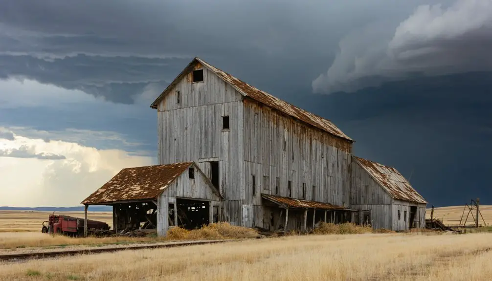
A brutal double homicide in 1937 forever altered Wheat Basin’s identity when Frank Robideau murdered Michael and Frieda Kuntz at the Occidental Grain Elevator.
Their five-year-old son Larry survived the attack, escaping with a latch he’d keep as a lifelong memento of that horrific night.
The murder legacy rippled through the community, transforming a once-prosperous agricultural town into a place haunted by tragedy.
Justice came swiftly as Robideau faced execution by hanging just two months later, on January 15, 1938.
Swift frontier justice delivered its verdict as Robideau met the gallows mere weeks after his heinous crime.
The community trauma lingered for decades, preserved through Larry’s eventual testimony in “Death Ride: A Little Boy’s Night of Terror” and extensive historical documentation.
Though the town’s last grain elevator burned in 1997, the story remains alive through historical markers and regional chronicles.
Economic Decline and Abandonment
While Montana’s broader agricultural crisis unfolded between 1919-1925, Wheat Basin’s economic decline reflected a devastating convergence of forces that would ultimately seal its fate.
You’ll find that economic hardship struck from multiple angles, dismantling the town’s foundations piece by piece.
- Severe drought and plummeting wheat prices forced half of Montana’s farmers off their land, driving rural migration that saw 70,000 people leave the state.
- The railroad’s withdrawal and post office closure in 1936 cut off essential economic lifelines.
- Bank failures and business closures eliminated access to credit and basic services.
- The shift to mechanized farming meant fewer workers could manage larger plots, making small homesteads unsustainable.
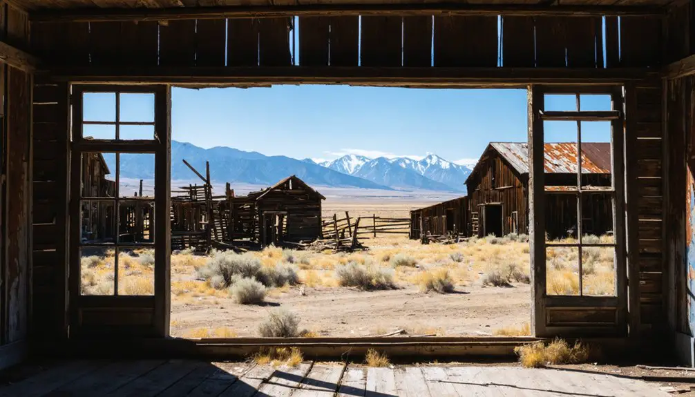
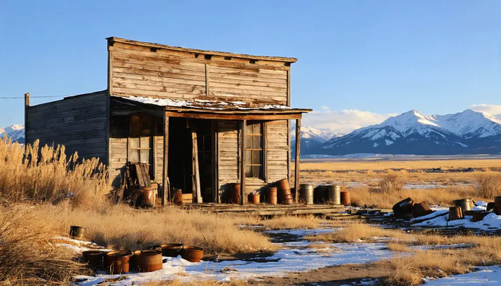
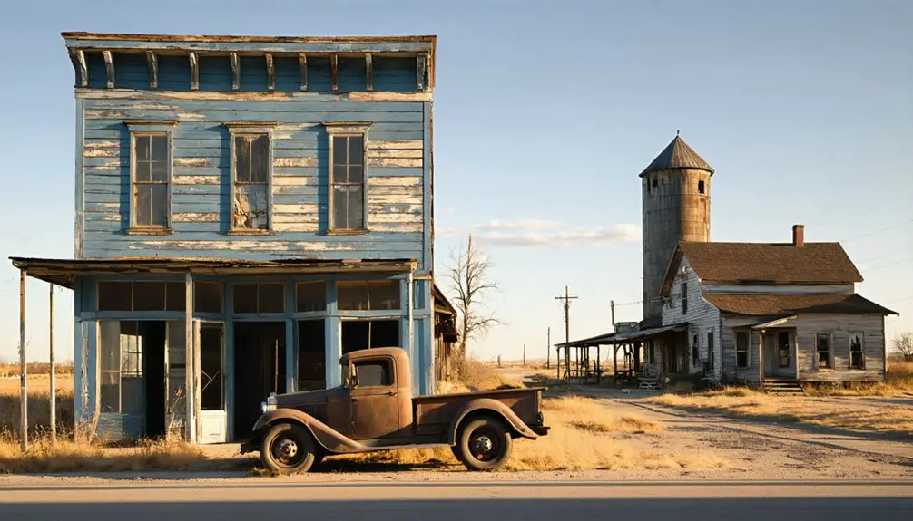
What Remains Today
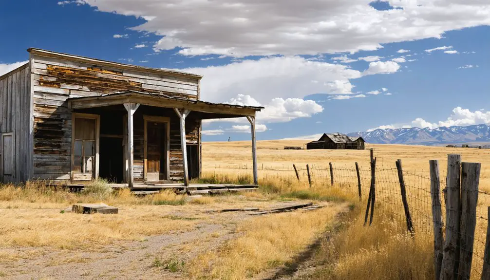
Today’s visitor to Wheat Basin encounters only sparse remnants of what was once a bustling agricultural community.
You’ll find concrete foundations scattered across the 6.5-acre site, with ground depressions marking where buildings once stood. The original street layout remains visible, though the last major structure – the grain elevator – burned down in 1997.
While Ken Mesch has owned the property since 2006, using it primarily for hunting activities like falconry, the site’s historical significance persists.
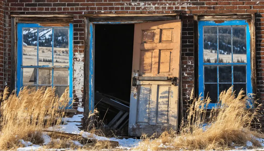
Two shops owned by blacksmith descendants remain in the area, and a historical marker helps interpret the remnants today.
At an elevation of 3,947 feet, this ghost town offers no standing buildings or maintained facilities, serving more as a historical reference point than a tourist destination.
Legacy in Montana’s Railroad History
Northern Pacific Railroad’s expansion into Montana during the 1910s transformed Wheat Basin from a construction camp named Nora into an important agricultural hub. The town’s railroad infrastructure played a significant role in Montana’s agricultural expansion, connecting local farmers to national markets during the homesteading boom of 1909-1919.
- You’ll find Wheat Basin’s story mirrors many Montana settlements that flourished with railroad access, serving as essential grain shipping points.
- The town’s grain elevator and depot exemplified the engineering achievements of rapid railroad construction.
- Northern Pacific’s investment supported Montana’s farming economy through reliable transport routes.
- The town’s eventual abandonment in 1936, following railroad withdrawal, demonstrates how these communities depended on rail service for survival.
Frequently Asked Questions
What Happened to the Town’s Original Buildings and Structures?
You’ll find the architectural history shows little building preservation, as time’s march led structures to deteriorate naturally, while the remaining grain elevator met its end in flames in 1997.
Were There Any Native American Settlements in the Wheat Basin Area?
While Native tribes like the Crow moved through the region, you won’t find direct evidence of permanent settlements in Wheat Basin. Historical artifacts suggest nomadic peoples passed through this area seasonally.
What Crops Were Primarily Grown by Farmers Around Wheat Basin?
With yields reaching 55 bushels per acre by 1909, you’ll find farmers primarily grew hard red wheat, implementing crop rotation with barley, lentils, and dry peas to maintain soil fertility.
Did Any Famous People or Notable Figures Visit Wheat Basin?
You won’t find any famous visitors in Wheat Basin’s history. The town’s notable residents were mainly local figures like the Riopel family merchants and the Kuntz family elevator operators.
How Did Local Weather Patterns and Climate Affect the Town’s Development?
When it rains, it pours – and you’d have seen how weather patterns shaped everything. Climate impact determined crop success, with rising temperatures extending growing seasons but variable precipitation challenging your farming community’s survival.
References
- https://www.spokesman.com/stories/2015/feb/08/new-book-tells-story-of-1937-double-homicide-and/
- https://www.mountain-home.com/blog/vacation-planning/guide-montana’s-ghost-towns
- https://www.youtube.com/watch?v=IJgUQP20dQc
- https://www.youtube.com/watch?v=VfbLq3IvJfU
- https://en.wikipedia.org/wiki/Wheat_Basin
- http://sites.rootsweb.com/~mttttp/history/ghost_towns/wheat_basin.htm
- https://en.wikipedia.org/wiki/History_of_Montana
- https://www.blm.gov/sites/default/files/docs/2021-07/THE ROAD TO GARNET’S GOLD (002).pdf
- http://mmrh.org/mt_rr_history.html
- https://www.bonnermilltownhistory.org/northern-pacific-railroad