You’ll find that U.S. river ghost towns primarily emerged from massive dam construction between 1950-1970, when federal flood control projects submerged over 800 communities beneath artificial reservoirs. These infrastructure developments, which now supply water and electricity to millions, fundamentally altered river landscapes and displaced entire populations. While some flooding occurred naturally from extreme weather events, 70% of America’s dams were built before 1973, permanently transforming river communities. The full story of these submerged towns reveals complex social and environmental consequences.
Key Takeaways
- Dam construction for flood control and hydroelectric power created artificial lakes that submerged entire communities, forcing relocation of residents.
- Historical dam-building projects, particularly between 1950-1970s, required flooding of towns to create reservoirs for water management.
- Infrastructure development necessitated relocation of railways and highways, leaving original riverside settlements abandoned and submerged.
- Federal flood control policies led to intentional flooding of communities to protect larger population centers downstream.
- Discriminatory land-use policies placed certain communities, especially minority populations, in flood-prone areas that eventually became uninhabitable.
The Rise of Dam Construction and Reservoir Development
While the United States’ earliest dam projects originated in colonial times, with structures like Connecticut’s Mill Pond Dam in 1677, the nation’s most intensive dam-building period occurred between the late 1950s and 1970s.
You’ll find that the 1960s alone added over 18,800 dams, marking an unprecedented surge in reservoir development across America.
The scale of dam construction expanded dramatically, as federal agencies and private entities transformed the nation’s waterways. Nearly 70% of existing U.S. dams were built before 1973, with development concentrated in southern states, which now contain 45% of all dams. This extensive development led to increased river fragmentation, particularly affecting humid basins across the country.
Major projects like the Hoover Dam revolutionized water management, controlling floods and irrigating 1.5 million acres while supporting 16 million people. This massive development came at a cost, as over 40 percent of historical salmon spawning habitat in the Columbia River Basin was permanently blocked.
This massive infrastructure push permanently altered America’s river systems, driven by demands for flood control, navigation, hydroelectric power, and water supply.
Natural Disasters and Extreme Weather Patterns
You’ll find that extreme precipitation events have intensified across 70% of the US, with catastrophic floods increasing from 0.6 per year in the 1980s to 1.9 per year between 2015-2024.
Your risk of experiencing flash floods has grown considerably, as extreme rainfall events now correlate with a 10% rise in flash flooding incidents, particularly in areas with ghost streams and aging infrastructure. Recent storms in Detroit dumping nearly 8 inches of rain within 24 hours demonstrate this growing threat. Studies reveal that over 85% of streams from 1905 have been buried or removed due to urban development in Detroit.
In vulnerable communities near rivers or in narrow valleys, you’re facing a perfect storm of topographical challenges and social factors that amplify flood damage, especially where historical redlining has led to neglected flood protection.
Flash Floods Strike Communities
Over the past four decades, flash floods have intensified dramatically across U.S. river communities, with catastrophic events increasing from 0.6 per year in the 1980s to 1.9 per year between 2015-2024.
You’ll witness unprecedented rainfall intensities of 2-6 inches per hour overwhelming drainage systems, while record-breaking river crests demolish previous marks – like Kentucky’s North Fork reaching 22 feet versus its former 14.7-foot record. Summer thunderstorms are fueling this devastation as intense daytime heat creates ideal conditions for flash flooding.
Your flash flood preparedness becomes critical as urban development and climate shifts amplify these risks. Scientists predict a 26% flood cost increase by 2050. Impervious surfaces accelerate runoff while aging infrastructure can’t handle the load.
For community resilience, you’re facing a harsh reality: extreme precipitation patterns, stalled weather systems, and climate-driven rainfall intensity increases of 8% since the 1970s mean these devastating floods aren’t slowing down.
Rising Waters Reshape Towns
The reshaping of America’s riverside communities stems from a complex interplay of buried waterways, climate intensification, and infrastructure limitations.
You’ll find ghost town resilience tested as extreme precipitation events have nearly tripled since the 1980s, while urban water management struggles with aging systems that can’t handle increasing stormwater volumes.
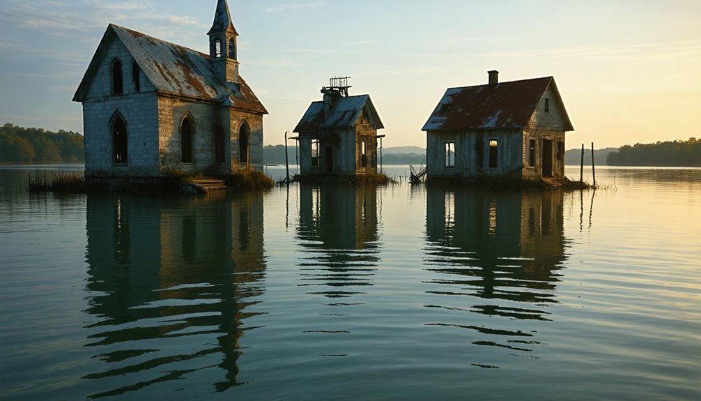
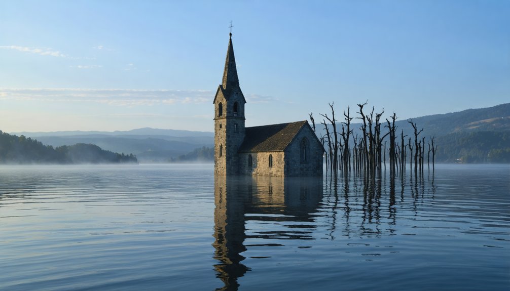
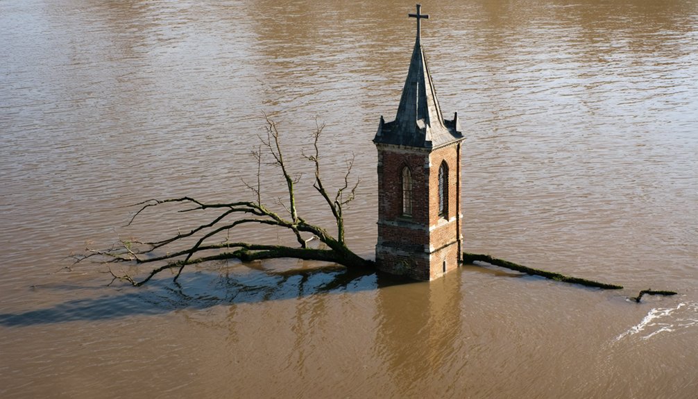
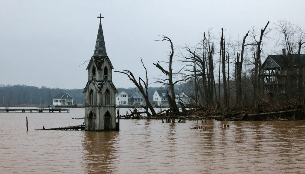
Your risk of flooding has grown substantially, especially if you live near ghost streams or wetlands where flood risks increase tenfold. Towns like Bull Shoals Dam demonstrate how infrastructure projects can permanently submerge entire communities, erasing their physical presence from the map.
- Historical burial of 85% of original urban streams since 1905 has disrupted natural water flow patterns
- Climate projections show a 26% increase in flood loss costs by 2050, reaching $40.6 billion
- Infrastructure failures and dam releases have permanently altered settlement patterns, forcing community abandonment
Environmental Changes and Flood Risk Amplification
As climate patterns shift dramatically in recent decades, multiple environmental changes have amplified flood risks in America’s river valleys, creating a complex web of hydrological challenges.
You’ll find environmental degradation intensifying these risks through widespread loss of wetlands and increased urban development, which reduces natural water absorption capacity. The introduction of impervious surfaces has fundamentally altered floodplain management dynamics.
You’re witnessing unprecedented changes in precipitation patterns, with warmer atmospheres carrying more moisture and creating sustained rainfall events. The creation of Lake Texoma in 1944 submerged multiple thriving communities that were vital economic centers.
When combined with soil hardened by extended droughts, these conditions generate excessive runoff.
In Appalachian regions, mountaintop removal mining has compacted soil and stripped vegetation, dramatically increasing flash flood potential in river systems. The Tennessee Valley Authority constructed numerous dams that permanently submerged entire communities, drastically altering the region’s landscape.
These factors compound to create flooding scenarios that far exceed historical norms.
Historical Flood Events That Shaped River Communities
Throughout America’s river history, catastrophic floods have fundamentally reshaped communities and triggered sweeping policy changes in flood management.
Major floods have not only devastated American communities but revolutionized how we approach river management and flood control nationwide.
You’ll find historical floods like the 1913 Texas disaster that inundated 3,000 square miles and claimed 177 lives, while the 1936 Merrimack River flood in Lowell catalyzed federal intervention in flood control measures. The devastating Great Mississippi Flood of 1927 forced the evacuation of 500,000 people and caused massive economic damage.
- The 1938 Lowell floods led directly to expanded federal responsibility for protecting America’s waterways
- March 2019 Midwest flooding caused $10.8 billion in damages across millions of acres
- Historic Vermont river flooding devastated communities along the White, Winooski, Lamoille, and Missisquoi rivers
These watershed moments tested community resilience and transformed how we manage flood risks, from local initiatives to extensive federal programs.
The data shows recurring patterns of destruction that’ve shaped America’s relationship with its rivers.
Climate Change Impact on River Towns
You’re witnessing an unprecedented shift in U.S. river flood patterns, with the Northeast and Midwest experiencing larger floods from 1965-2015. Flood frequency is intensifying across the Pacific Northwest and northern Great Plains.
Climate change has triggered a surge in displacement from river towns, as flood damage from climate-related precipitation changes now accounts for 37% of total U.S. inland flood losses since 1988.
Your riverside infrastructure faces mounting pressure from these intensified weather patterns, with traditional flood control methods proving increasingly inadequate against the rising frequency of historically rare flood events.
Rising Flood Frequency Patterns
Recent climate data reveals a stark escalation in US river flooding events, jumping from 0.6 incidents annually in the 1980s to 1.9 events per year between 2015-2024.
You’ll find that human-induced warming now drives intense precipitation across 70% of the nation, with flood prediction models showing a 26% rise in damage costs by 2050.
Urban planning failures compound these risks, as aging infrastructure struggles to handle the surge in extreme weather events.
- Northeast regions face a 60% increase in extreme rainfall, overwhelming storm systems
- Record-breaking flash floods strike with less warning time, as seen in Central Texas’s 2025 crisis
- Annual flood damages now exceed $32 billion, threatening river communities nationwide
Extreme Weather Displacement Surge
While global temperatures continue to rise, climate-driven river flooding has emerged as a primary force behind population displacement, with each 1°C increase correlating to a 50% surge in flood-related relocations.
You’ll witness displacement rates potentially skyrocket by 350% under current emissions trajectories, pushing annual displacement figures to 50 million people by 2100.
Your risk of displacement intensifies if you’re living in areas with limited climate adaptation infrastructure or inadequate displacement policies.
The impact doubles when you factor in socioeconomic vulnerabilities and population density.
You’re facing a complex web of primary and secondary displacement, where initial flood-driven relocation triggers subsequent community shifts.
This creates ripple effects as displaced populations move inland, often sparking climate gentrification and transforming previously affordable neighborhoods into high-cost zones.
Riverbank Infrastructure Under Threat
Climate-driven erosion and flooding pose direct threats to riverbank infrastructure across the nation, with natural buffer zones experiencing unprecedented degradation rates.
You’ll find that riverbank restoration efforts are becoming critical as extreme weather intensifies, overwhelming conventional flood defenses. Without proper erosion control measures, you’re looking at accelerated infrastructure damage that’s costing communities millions in repairs and replacements.
- Permafrost thaw in northern regions is destabilizing riverbanks at rates 5-10 times faster than historical averages.
- Nature-based solutions can reduce infrastructure costs by up to 30% compared to traditional engineering approaches.
- Remote sensing data shows that poor land use practices near riverbanks increase erosion rates by 40-60%.
Your infrastructure’s survival depends on implementing integrated green-blue corridors and sustainable land management strategies that boost natural resilience against intensifying climate impacts.
Social and Economic Disparities in Flood-Prone Areas
Persistent social and economic inequalities shape flood vulnerability across the United States, with data showing that 5 in 6 homeowners lack flood insurance protection.
You’ll find these disparities most pronounced in historically redlined neighborhoods, where infrastructure inadequacies compound flood risks for minority and low-income residents.
Housing instability intensifies after floods, particularly affecting renters and mobile home residents who face limited disaster preparedness options.
Environmental justice concerns emerge as these communities often border industrial sites, multiplying health risks during flooding events.
Social vulnerability factors, including linguistic isolation and limited educational access, restrict your ability to navigate recovery systems.
Recovery disparities persist as disaster aid programs consistently favor white communities, while economic recovery lags in minority areas.
This pattern undermines community resilience and perpetuates cycles of post-flood poverty.
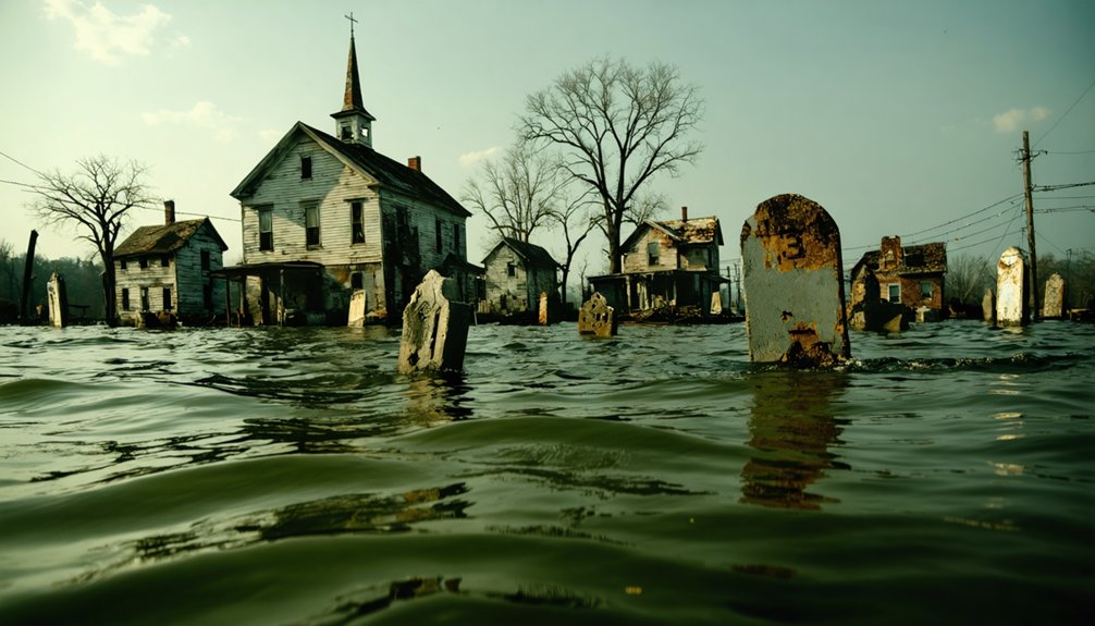
Infrastructure Projects and Community Displacement
Throughout the 20th century, large-scale infrastructure projects transformed America’s river landscapes by intentionally flooding communities to create reservoirs for hydropower, irrigation, and drinking water supply.
You’ll find that these projects displaced entire towns with minimal compensation, forcing residents to abandon their homes, farms, and generational landmarks. The lack of infrastructure equity meant that rural and economically disadvantaged populations bore the brunt of these displacements, undermining community resilience.
- Historic dam construction submerged over 85% of natural waterways in some regions, creating “ghost streams” beneath urban development.
- Displaced communities faced abrupt relocations without adequate support for finding new housing on safer ground.
- Municipal neglect of flood defenses in affected areas continues to compound risks, especially in historically redlined neighborhoods.
Legacy of Discriminatory Land Use Policies
While America’s river ghost towns emerged from infrastructure projects, their locations weren’t randomly selected but systematically determined by discriminatory land use policies dating back to the early 20th century.
Through discriminatory zoning, cities confined Black communities to flood-prone “barnyard” areas while reserving safer “parlor” neighborhoods for white residents.
Racist zoning laws forced Black families into flood-prone areas while protecting white neighborhoods from environmental hazards.
You’ll find these patterns reinforced by redlining practices of the 1930s, where federal agencies deemed minority neighborhoods “high risk,” denying them mortgage insurance and infrastructure investment.
This housing inequality forced Black families into overcrowded areas near industrial zones and unstable riverbanks.
When floods struck these vulnerable locations, the communities lacked resources to rebuild, leading to abandonment.
The placement of hazardous facilities and weak environmental regulation in these areas further destabilized local ecosystems, increasing flood risks.
Geographic Vulnerabilities and River Basin Development
Beyond discriminatory policies, the physical landscape itself plays a decisive role in flooding vulnerability. You’ll find that river basin development has drastically altered natural flood patterns through the burial of historic streams and wetlands. These “ghost” waterways can increase flood risk tenfold, while aging stormwater infrastructure further compromises flood management efforts.
- Development on floodplains creates impervious surfaces that eliminate natural flood buffers.
- Buried wetlands and streams disrupt traditional drainage patterns, leading to catastrophic flooding.
- Dam construction for flood control paradoxically submerges entire communities under artificial lakes.
When you examine flood-prone areas, you’ll notice how geographic features combine with infrastructure choices to amplify risk. The creation of reservoirs often forces the relocation of railroads and highways, permanently reshaping river landscapes and leaving once-thriving communities underwater.
The consequences are evident in sunken towns along US rivers, which now serve as haunting reminders of past lives. These submerged settlements tell stories of resilience as former residents grapple with memories of their lost communities. As climate change intensifies, the threat of further inundation looms, challenging current planning efforts for flood management and disaster recovery.
Frequently Asked Questions
Can Flooded Ghost Towns Be Restored or Reclaimed From Underwater?
You can restore flooded ghost towns through underwater restoration techniques, but community reclamation efforts are often limited by structural damage, high costs, and environmental challenges that require specialized equipment.
How Do Archaeologists Study and Document Submerged Towns?
Like treasure hunters of truth, you’ll find archaeologists using sonar mapping, ROV surveys, and systematic grid-based excavation to document submerged artifacts, while employing underwater photography and 3D modeling for precise site preservation.
What Happens to Property Rights When Towns Become Submerged?
You’ll face property disputes when your town submerges, as ownership shifts to government under public trust doctrine. Legal implications include inverse condemnation claims for compensation and restricted access to remaining structures.
Are There Underwater Tourism Opportunities at Flooded Ghost Towns?
You’ll find epic underwater exploration opportunities through scuba diving, boat tours, and guided excursions at numerous submerged ghost towns, where visibility reaches 50 feet and you’re free to document historical structures.
How Do Former Residents Maintain Connections to Their Flooded Communities?
You’ll maintain flooded town connections through family reunions, organized community events, storytelling sessions, cemetery visits, digital archives, and social networks that preserve shared histories and cultural traditions.
References
- https://pacinst.org/the-growing-threat-of-catastrophic-flooding-in-rural-america/
- https://www.abandonedspaces.com/towns/natural-disaster-ghost-towns.html
- https://cedarbayoumarina.com/four-ghost-towns-under-lake-texoma/
- https://www.weather.gov/unr/summary-of-historic-floods-and-flash-floods
- https://www.youtube.com/watch?v=l3D4hSQcWbk
- https://en.wikipedia.org/wiki/List_of_flooded_towns_in_the_United_States
- https://smartgrowthamerica.org/how-historic-land-use-policies-lead-to-flooding-disasters-in-communities-of-color/
- https://scholarcommons.sc.edu/cgi/viewcontent.cgi?article=1052&context=geog_facpub
- https://www.nwcouncil.org/history/DamsImpacts/
- https://www.nature.com/articles/s41467-023-39194-x