You’ll find Brisco’s haunting remains in Pine Township, Warren County at coordinates 40°24’40″N 87°21’18″W. This former hamlet, established around 1850 near Old US 41, centered around a one-room schoolhouse that served as the community hub until 1929. The town declined mid-20th century as residents left for urban opportunities, leaving behind building foundations and scattered ruins near SR-141 and CR-650N. The site’s archaeological findings tell a deeper story of human settlement stretching back to Early Archaic times.
Key Takeaways
- Brisco was established around 1850 in Pine Township, Warren County, Indiana, and became a ghost town by the late 20th century.
- The town’s decline began mid-20th century when younger residents left for urban opportunities, leading to widespread abandonment.
- Archaeological remnants and building foundations can be found near SR-141 and CR-650N, marking the town’s original location.
- The community originally centered around a one-room schoolhouse built in 1856, which served as a social hub until 1929.
- Economic deterioration accelerated between 1950-1970 due to mine depletion, decreased railroad activity, and closure of essential services.
Origins and Settlement History
While many Indiana settlements thrived during the mid-1800s, Brisco emerged as a modest hamlet in Pine Township, Warren County around 1850.
You’ll find this ghost town‘s original location near Old US 41, about a quarter-mile east of County Road 650 North, where it once stood at an elevation of 679 feet. Similar to other ghost towns like Wehrum and Claghorn, the settlement patterns followed typical rural development of the era, with Mud Pine Creek serving as a crucial water source for early settlers. Local residents used the nearby gravel roads for transportation, though these paths proved challenging during inclement weather.
Brisco’s community dynamics centered around essential institutions, particularly a one-room schoolhouse built in 1856.
At the heart of Brisco, a one-room schoolhouse served as the focal point of community life after 1856.
Located 9 miles north-northwest of Williamsport, the county seat, Brisco maintained its small-town character throughout its existence. The area’s agricultural focus and limited urban development reflected the practical needs of its pioneering residents.
Life in Early Brisco
Daily life in early Brisco revolved around a tight-knit rural community where local families gathered at key spots like the 1856 schoolhouse and nearby farms.
You’d find the community dynamics centered on shared experiences at the one-room schoolhouse, where children received their early education for over seven decades until 1929.
Like the town of Liberty, which declined due to poor health conditions, Brisco faced its own challenges that would eventually lead to its abandonment.
If you’d visited Brisco during this era, you’d have seen how the schoolhouse served as more than just a place of learning – it was a social hub that brought township families together.
The town’s modest size meant you knew your neighbors well, with community events typically focused around school functions and agricultural activities.
Life moved at a rural Indiana pace, with residents staying connected through daily interactions at local gathering spots and shared work in the surrounding farmlands.
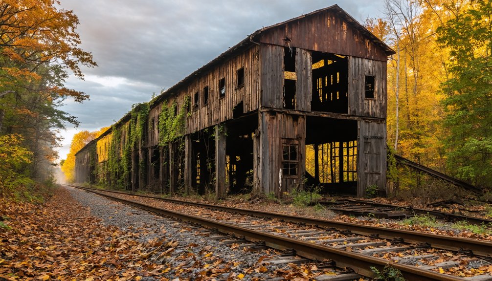
Notable Landmarks and Structures
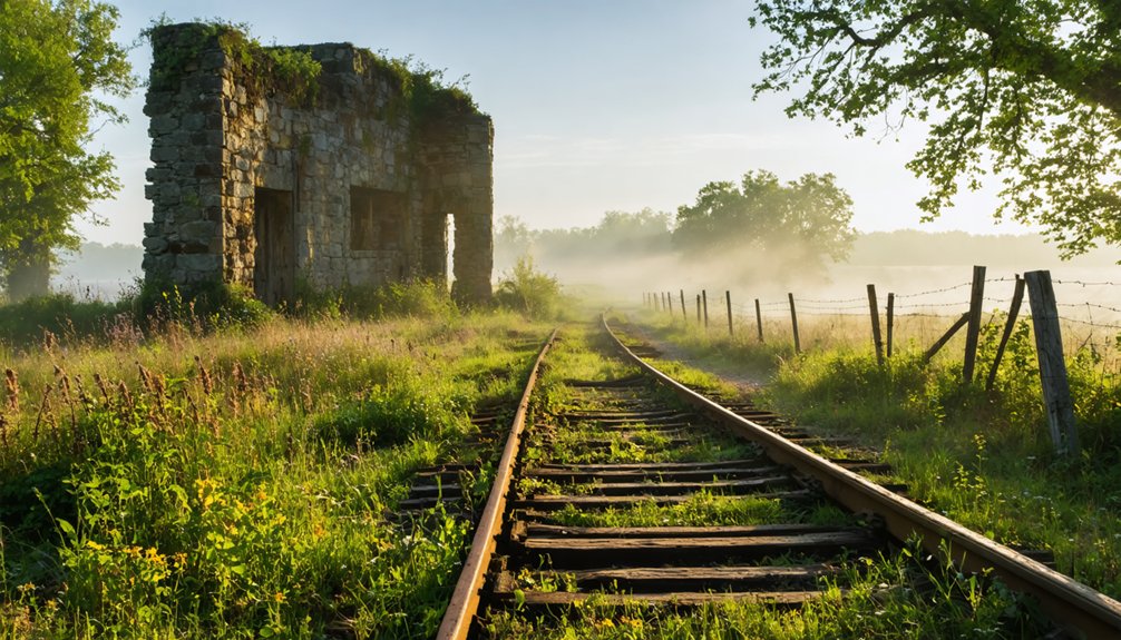
Today’s visitors to Brisco will find extensive remnants of the original town’s foundations and street outlines near the intersection of Indiana State Road 141 and Warren County Road 650 North.
Standing at SR-141 and CR-650N, Brisco’s ghostly foundations and street patterns reveal traces of a forgotten Indiana town.
The town’s decline mirrors the pattern of many other ghost towns established around clean water sources, though no wells or springs remain visible today. These abandoned settlements often serve as time capsules, preserving moments from their past.
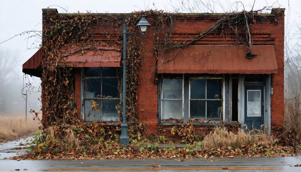
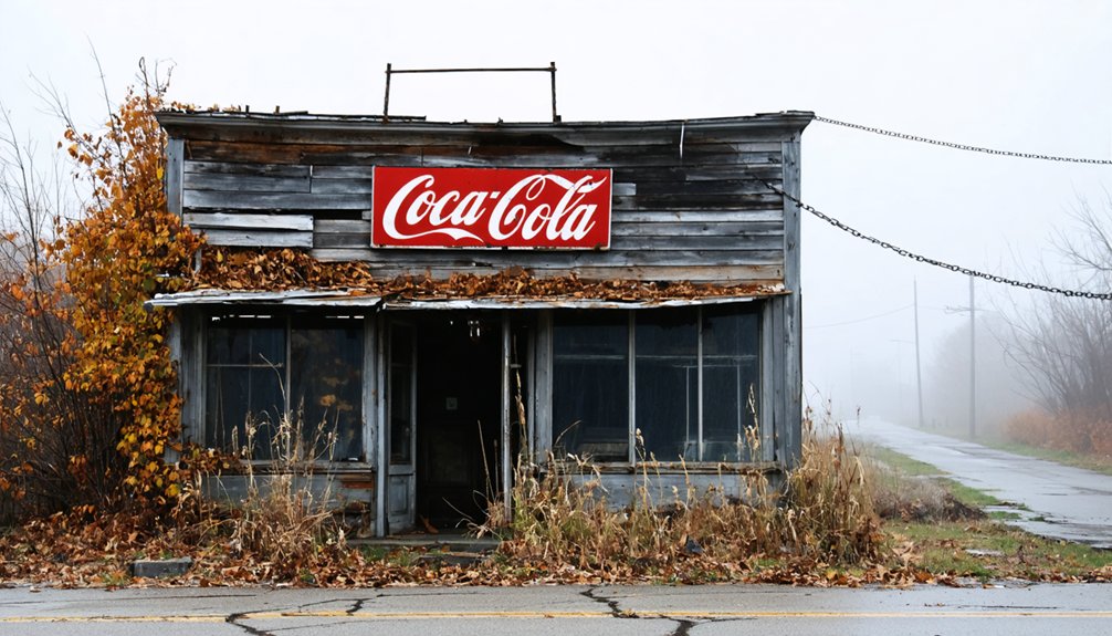
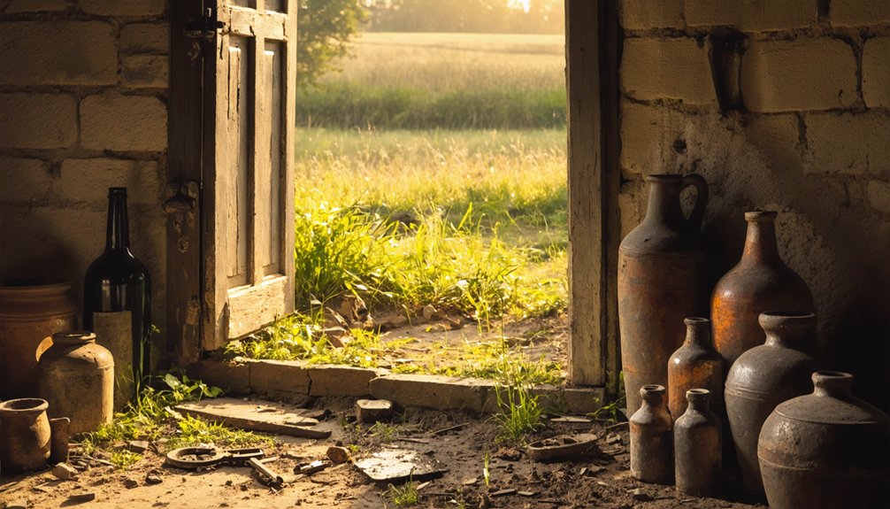
As you explore this ghost town, you’ll discover scattered ruins of early 20th-century residential and commercial buildings, with deteriorated wooden and brick structures dotting the landscape. While no fully intact buildings remain, the rural infrastructure is still traceable through old road intersections and pathways that reveal the original town layout.
The surrounding region features other historic sites, including Tunnelton with its 1857 railway tunnel, and the ghost towns of English, Marengo, and Greenville.
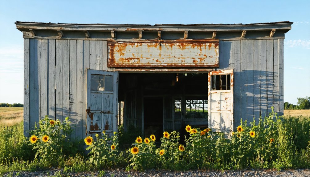
Agricultural remnants like old grain elevators in the area hint at Brisco’s former economic activity, though they’re now weathered by time and surrounded by overgrown farmland.
Decline and Abandonment Timeline
Brisco’s decline started in the mid-20th century when younger residents left for urban opportunities, leaving behind an aging population that gradually dwindled through natural attrition.
Like many ghost towns in Indiana, Brisco’s story reflects the shifting population patterns and economic changes that transformed the state’s landscape over time.
Much like the 1993 TV series that would later share its name, the town was known for blending old and new elements of American culture.
You’ll find that the town’s economic deterioration accelerated in the 1950s-1970s with the closure of essential services and the loss of railroad connectivity that once sustained local commerce.
The final phase of abandonment occurred as remaining elderly residents passed away or relocated, leading to widespread infrastructure decay and Brisco’s eventual classification as a ghost town by the century’s end.
Population Loss Patterns
When the early twentieth century brought significant changes to transportation routes, the once-thriving community of Brisco began its steady march toward abandonment.
You’ll find that population migration followed predictable demographic shifts, with younger residents leading the exodus toward industrial opportunities in urban centers. Like many Indiana communities shaped by the post-Civil War industrialization, Brisco’s residents sought better prospects in manufacturing hubs.
- Initial decline saw families dispersing rather than moving together, dropping from hundreds to fewer than 100 residents by 1920.
- Agricultural mechanization and the Great Depression accelerated the outflow, pushing numbers below 50 by mid-century.
- Most residents relocated to Indianapolis and Bloomington, seeking better economic prospects.
- Older inhabitants remained longest, staying until essential services disappeared in the early 1960s.
The pattern mirrors classic ghost town evolution: economic downturn, institutional closures, then rapid depopulation until Brisco’s complete abandonment by the late 1960s.
Economic Deterioration Phases
The economic deterioration of this Indiana mining town followed a distinct four-phase decline between 1910 and 1968.
Brisco’s initial economic dependency on mining and railroad industries left it vulnerable when these sectors began to falter. You’d have witnessed the first signs of trouble as mines depleted and railroad activity decreased, triggering widespread job losses and business closures.
The town’s industrial shifts accelerated through the mid-century as commercial activity dwindled and property values plummeted.
Without a stable workforce, remaining businesses struggled to stay open. Essential services like the post office and local stores shuttered as the population dwindled.
Geographic Features and Location
You’ll find Brisco at coordinates 40°24’40″N, 87°21’30″W, nestled in Warren County’s Pine Township at an elevation of 679 feet above sea level.
The ghost town‘s site is accessible via Old US 41 and its intersection with County Road 650 North, making it relatively easy to reach despite its abandoned status.
The surrounding landscape features rolling hills and flat plains typical of rural Indiana, with Mud Pine Creek flowing just east of the former settlement. The Brisco Cemetery remains as one of the few tangible remnants of the original community. The area once supported a one-room schoolhouse that served local farming families before the town’s decline.
Site Coordinates and Access
Located in Pine Township of Warren County, Indiana, Brisco’s remains can be found at coordinates 40°24’40″N 87°21’18″W, sitting at an elevation of 679 feet above sea level.
For ghost town exploration enthusiasts, site accessibility is straightforward via County Road 650 North and Old US 41, though you’ll find minimal remaining infrastructure at this abandoned settlement.
- The site appears on USGS maps but isn’t shown on current county maps
- You can access the historic Brisco cemetery northeast of the former town site
- Mud Pine Creek flows just east of the ghost town’s location
- The area operates on Eastern Standard Time (UTC-5)
When planning your visit, you’ll find several notable landmarks nearby, including Kickapoo State Recreation Area and Forest Glen Preserve, which can complement your exploration of this historic location.
Regional Landscape and Terrain
Situated within Indiana’s western uplands and prairie change zone, Brisco’s terrain exemplifies the subtle beauty of northwestern Indiana’s landscape.
You’ll find this ghost town resting at 679 feet above sea level, where flat to gently rolling farmland stretches across the horizon. The site’s ecological change is evident in the mix of prairie and woodland elements that surround the former settlement.
Mud Pine Creek flows just east of the townsite, while Old US 41 cuts through the area less than a quarter mile from County Road 650 North.
The land use history reveals a shift from native prairie and wetlands to cultivated fields, though you can still spot traces of the original landscape near the remnant cemetery northeast of town.
Local Stories and Folklore
While many Indiana ghost towns carry rich supernatural lore, Brisco’s ghostly reputation stems primarily from its desolate atmosphere and mysterious abandonment.
Unlike other regional haunts with documented local legends, Brisco’s spectral tales remain largely unverified yet persist through oral tradition and its forgotten status.
You’ll find these common elements in stories about Brisco:
- Unexplained presences felt near abandoned structures
- Shadowy figures glimpsed in peripheral vision
- Mysterious sounds echoing through empty buildings
- Ghostly encounters linked to the town’s undocumented demise
The town shares thematic elements with other Southern Indiana ghost towns, where tales of tragic deaths and unsolved mysteries fuel paranormal folklore.
While specific spirits aren’t named in Brisco’s lore, its abandoned state continues to draw those seeking evidence of supernatural activity.
Archaeological Findings
Archaeological surveys have revealed dozens of significant sites around Brisco, designated by codes like 12FU12 and 12FU16 within Fulton County.
You’ll find evidence of continuous human occupation spanning multiple periods, from Early Archaic through Protohistoric times. The archaeological significance of these sites is heightened by discoveries of distinctive pottery, stone tools, and fire-cracked rock indicating ancient settlements.
The area’s rich cultural interactions are documented through Hopewell-related ceramics and unique figurines showing non-local influences.
Near Potawatomi settlements, you’ll encounter burial grounds that correspond with historical records of Chief Aubbeenaubee’s people.
The density of sites varies across the landscape, with surveys showing one archaeological location per 7-30 acres, making Brisco’s surroundings a treasure trove of prehistoric and historic artifacts.
Preservation Efforts
Building upon the rich archaeological heritage of Brisco, local residents and history enthusiasts have launched thorough preservation initiatives to protect the ghost town’s remaining structures and artifacts.
Community engagement efforts have sparked various preservation activities, though significant challenges persist due to limited funding and natural decay.
You’ll find several key preservation initiatives in action:
- Regular volunteer clean-up days to combat vegetation overgrowth and debris
- Educational partnerships with local schools to integrate Brisco’s history into curricula
- Walking tours led by local historians to share the town’s story
- Installation of interpretive signage and monuments to guide visitors
The Indiana Division of Historic Preservation and Archaeology provides guidance for these efforts, while regional heritage organizations assist with surveying and documenting the site.
Despite private property complications, preservationists continue working to balance public access with protecting these valuable historical remains.
Historical Significance in Warren County
Throughout Warren County’s rich history, Brisco emerged as a quintessential example of Indiana’s rural development in the 1850s.
You’ll find its significance deeply rooted in Pine Township, where it served as a crucial hub for local farmers and residents along Old US 41, about 9 miles from Williamsport.
Brisco’s commitment to rural education stood out with its one-room schoolhouse, established in 1856, which educated local children for over 70 years.
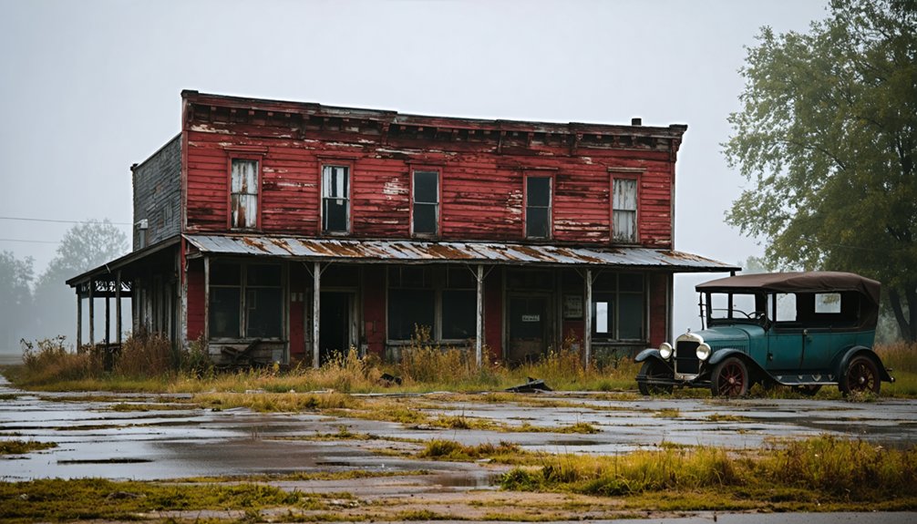
After the school’s closure in 1929, Jim Marquess’s general store became the town’s social anchor for five decades.
While the town eventually succumbed to rural depopulation, its legacy lives on through the Brisco cemetery northeast of the original settlement, telling the story of a once-thriving community that shaped Warren County’s agricultural heritage.
Visiting the Ghost Town Today
What remains of Brisco today offers intrepid explorers a glimpse into Indiana’s vanishing rural heritage.
You’ll find the site along Old US 41, though you’ll need to do thorough research before your ghost town exploration, as Brisco doesn’t appear on most modern maps.
The former one-room schoolhouse site and Mud Pine Creek provide focal points for historical photography enthusiasts.
- Bring necessary permissions if exploring private property sections
- Pack essential gear including maps, cameras, and weather protection
- Consider visiting the Warren County Historical Society first for valuable insights
- Watch for structural hazards in any remaining abandoned buildings
The remote location demands careful planning, but you’ll be rewarded with a genuine piece of Indiana’s past, where you can experience both historical discovery and natural solitude along Mud Pine Creek.
Frequently Asked Questions
Were There Any Documented Criminal Activities or Outlaws in Brisco’s History?
You won’t find documented Brisco crime or Brisco outlaws in historical records. This tiny Indiana hamlet’s history shows no evidence of notorious criminals or significant lawless activities before vanishing.
What Happened to the Cemetery and Burial Records From Brisco?
Like scattered pages in the wind, you’ll find Brisco’s burial documentation incomplete after the 1907 Williamsport courthouse fire. The cemetery still exists along Old US 41, but records remain fragmented despite preservation efforts.
Did Any Famous People Ever Live in or Visit Brisco?
You won’t find evidence of famous visitors or historical figures in Brisco’s records. While Al Capone’s presence is rumored in Warren County, no documented proof links any notable personalities to Brisco specifically.
What Businesses and Industries Operated in Brisco Before Its Decline?
Like a small-town Mayberry, you’d have found Marquess’s general store in the old schoolhouse, plus farming-related businesses serving local agricultural needs, though railroad influence was significantly absent.
Were There Any Native American Settlements in the Brisco Area?
While Native Americans likely passed through this area, you won’t find direct historical evidence of permanent settlements there. The region’s historical significance mainly relates to later tribal movements and migrations.
References
- https://www.onlyinyourstate.com/trip-ideas/indiana/ghost-town-road-trip-indiana
- https://kids.kiddle.co/Brisco
- https://www.youtube.com/watch?v=YENGw3D73t4
- https://dbpedia.org/page/Brisco
- http://ingenweb.org/inlawrence/abandoned.htm
- https://www.onlyinyourstate.com/experiences/indiana/ghost-towns-in
- https://en.wikipedia.org/wiki/List_of_ghost_towns_in_Indiana
- https://kids.kiddle.co/List_of_ghost_towns_in_Indiana
- https://indianacountyparks.org/our-trails/ghost-town-trail/ghost-town-trail-history/
- https://picryl.com/topics/u+s+route+41+in+indiana/ghost+towns+in+indiana