You’ll find Churchs Ferry, North Dakota’s poignant story in its transformation from an 1883 railroad town to a modern ghost town. Founded as a ferry crossing point along Mauvais Coulee, the community thrived until Devils Lake’s rising waters forced most residents to leave. The lake’s expansion from 44,000 to 211,000 acres between 1993-2011 led to the town’s unincorporation in 2022. The remaining foundations and memories paint a deeper picture of this resilient pioneer community.
Key Takeaways
- Churchs Ferry became a ghost town after Devils Lake’s rising waters threatened the community, leading to its unincorporation in 2022.
- Founded in 1883 alongside the railway, the town was named after Irvine Church who operated a vital ferry service.
- Rising water levels expanded Devils Lake from 44,000 to 211,000 acres between 1993-2011, destroying farmland and infrastructure.
- Only 9 residents remained when the town dissolved, with Ramsey County assuming control of assets and essential services.
- Few historical buildings remain standing, with most structures abandoned or relocated due to flooding threats.
The Birth of a Ferry Town (1883)
Among the town founders who joined Church that year was Thomas Engelhorn, who brought his family to homestead in the promising new territory.
The railway’s arrival in 1883 spurred further growth, transforming the ferry crossing into a strategic settlement point.
While Church would later leave for California, his ferry service proved essential to the community’s early development, helping countless pioneers reach Devils Lake and establish homesteads throughout the surrounding area.
The operation ended when the Mauvais Coulee dried in the late 1890s, marking the conclusion of an important chapter in the town’s pioneering history.
The town was named after Irvine Church, who operated the original ferry service that became vital to the area’s development.
From Crossing Point to Settlement
The establishment of Churchs Ferry centered on a challenging natural barrier – the Mauvais Coulee.
You’ll find the story of this settlement’s transformation began with Irvine Church’s ferry operation in 1883, which helped travelers navigate the deep ravine’s turbulent waters. As settlers pushed westward, this crossing point evolved into a crucial hub for migration and commerce.
When the Mauvais Coulee dried up in the late 1890s, you’d witness remarkable community resilience as residents adapted their focus from transportation to agriculture and rural town life.
The settlement expanded with new homes, schools, and community buildings, creating a distinct local culture. While the ferry operation ended, the town’s strategic location along future transportation routes, including U.S. Highway 2, continued to shape its development and identity. Sadly, the town’s fate changed dramatically when rising Devils Lake waters forced most residents to abandon their homes by 2000.
Life Along Mauvais Coulee
If you’d crossed Mauvais Coulee in the 1880s, you’d have joined countless pioneers who relied on ferry services to navigate this challenging waterway.
The ferry crossings became crucial community gathering points where settlers shared news, traded goods, and helped one another traverse the coulee’s unpredictable waters.
As the settlements grew along Mauvais Coulee’s banks, the water’s role shifted from being primarily a transportation obstacle to becoming an indispensable resource for farming and livestock operations.
Early homesteaders like John L. Solberg were among the first to establish themselves near the coulee in 1883, setting the foundation for future settlement patterns.
The region’s continental climate brought dramatic temperature swings throughout the year, challenging early settlers to adapt their farming and transportation methods.
Pioneer Ferry Crossings
When you imagine the scene of early settlement patterns around Mauvais Coulee, you’ll find:
- Furious waters that made crossings treacherous before ferry infrastructure.
- Settlers gathering at crossing points to transport goods between emerging communities.
- A bustling hub of activity as pioneers accessed trade routes to Devils Lake.
The ferry operation thrived until the late 1890s when the Coulee dried up, marking a significant shift in local transportation.
Church eventually departed for California, concluding this pioneering chapter in regional mobility.
Water’s Historic Role
Living alongside Mauvais Coulee meant adapting to its fierce waters, which shaped every aspect of early settler life.
You’d find communities strategically positioned near the coulee’s banks, where the rushing waters influenced everything from agriculture to transportation patterns.
The French name itself, meaning “bad ravine,” speaks to the challenges settlers faced crossing these turbulent waters.
Devils Lake’s Rising Waters
Since 1993, Devils Lake has undergone a dramatic transformation, with water levels surging from 1,422.6 feet to a record high of 1,454.4 feet in 2011.
This dramatic rise in lake ecology has reshaped the entire region, expanding from 44,000 acres to over 211,000 acres and increasing its volume more than sevenfold.
The flooding impacts on your community have been severe:
- You’ve witnessed the loss of 167,000 acres of productive farmland
- You’ve seen the displacement of rural infrastructure and landowners
- You’re now dealing with recurring algae blooms that turn the water green, especially notable in 2018
If the lake continues rising to its natural overflow point of 1,458 feet, you’ll see even more dramatic changes as water spills into the Sheyenne River, threatening downstream communities and agricultural areas.
The Last Residents Standing
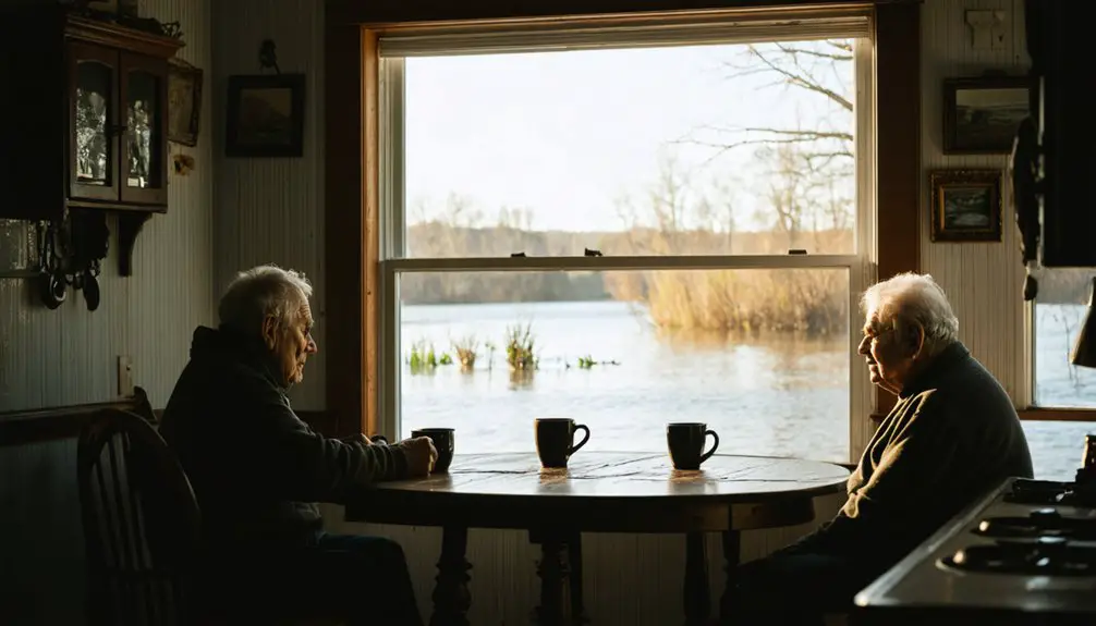
The resilient few who remained in Churchs Ferry witnessed their community dwindle from 110 residents in 1999 to just 11 by 2022.
These last residents live on higher ground, surrounded by wetlands and cattails where their neighbors’ homes once stood. While most accepted federal buyouts and relocated, these determined individuals chose to stay, adapting to life in an increasingly isolated landscape.
Despite the town’s unincorporation in 2022, you’ll find community spirit endures through annual reunions that draw former residents from across the country.
Explorers and history enthusiasts often seek out ghost towns near Red Oak, Missouri, to uncover the stories of those who once called these places home. Each visit offers a glimpse into the past, revealing remnants of structures and the echoes of vibrant lives that were once lived. The charm of these forgotten places continues to attract those curious about the rich history of the region.
The remaining inhabitants now rely on Ramsey County for essential services, living among the few surviving buildings.
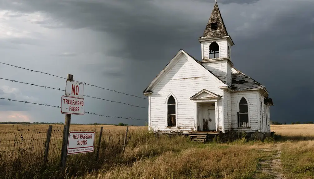
Though the iconic bridge lies submerged and Zion Lutheran Church is gone, these steadfast residents maintain their connection to this transformed land they call home.
Unincorporation and County Governance
You’ll find that Churchs Ferry’s changeover to county jurisdiction marked a significant shift, as Ramsey County assumed full administrative control of the former municipality on September 30, 2022.
The financial implications were immediate, with the county taking over management of assets, liabilities, and the responsibility for essential community services previously handled by the city government.
While the change dissolved local municipal structures, residents can still access critical services through county-level administration, including public safety coordination and infrastructure maintenance.
County Jurisdiction Transfer Process
When municipalities face unincorporation in North Dakota, county jurisdiction transfers follow strict protocols outlined in Chapter 40 of the North Dakota Century Code. The governance shift requires detailed documentation and public participation to guarantee transparency and community input throughout the process. Ghost towns often emerge when economic viability diminishes, leading communities to pursue unincorporation.
As communities navigate these changes, exploring the history of melville becomes increasingly relevant, offering insights into how past decisions shape current landscapes. Understanding the factors that contributed to the rise and fall of municipalities can inform better strategies for sustainability and growth. By examining historical precedents, leaders can develop more effective policies that support thriving communities in the face of economic challenges.
Key steps in the county oversight process include:
- Publishing official notices weekly for two consecutive weeks in county newspapers, detailing hearing times, locations, and proposed changes.
- Making all relevant documents available at the city auditor’s office for public review and copying.
- Holding public hearings where citizens can voice concerns before the board of county commissioners makes final decisions.
You’ll find the board must verify proper notifications and create written findings documenting their assessment of community viability, municipal responsibilities, and service delivery implications before approving any jurisdiction transfer. The city auditor must submit equalized assessments to the county auditor within ten days of the jurisdiction transfer completion.
Financial Impact After Change
Following county jurisdiction transfer, Churchs Ferry’s unincorporation brought substantial financial shifts for both residents and local government entities.
You’ll find Ramsey County now shoulders the responsibility for maintaining infrastructure and providing essential services to the remaining population of just 9 residents, down from 110 in 1999.
The financial challenges extend beyond basic services. Property values have declined sharply, reducing tax revenues that once supported local operations. Based on current county records, the area maintains an unrestricted cash balance of $9,567,316.66 for managing regional services.
While federal relocation funds helped displaced residents move to nearby towns, the area’s revenue fluctuations continue to impact county budgets. The county must now balance increased administrative costs with decreased tax income from the sparsely populated region.
This shift in financial responsibility has reshaped how public services are funded and delivered in the former municipality.
Community Services Post-Unincorporation
Since Churchs Ferry’s unincorporation in September 2022, Ramsey County has assumed full responsibility for essential community services and infrastructure maintenance.
You’ll find service accessibility has remained steady through the shift, with the county managing everything from public safety to utility operations.
Key changes in community engagement include:
- Emergency services and flood response now coordinated through county-level dispatch systems
- Social support services and healthcare programs administered by county agencies
- Public infrastructure maintenance, including roads, water, and sewer systems, overseen by county personnel
While the community retains its cultural identity and ZIP code 58325, you’ll now access most services through Ramsey County frameworks.
This arrangement guarantees continued support for the area’s roughly 11 residents despite the challenges of ongoing flooding and population changes.
Geographic Challenges and Environmental Impact
The geographic challenges facing Churchs Ferry stem primarily from Devils Lake’s relentless expansion, which has dramatically altered the region’s landscape and ecosystem. You’ll find the town’s modest 0.43 square miles increasingly threatened by rising water levels, despite its elevation of 1,450 feet.
The environmental impact extends far beyond flood mitigation concerns. You’re witnessing profound ecological shifts as farmland transforms into wetlands, disrupting traditional agricultural practices and wildlife migration patterns.
As Devils Lake swallows surrounding farmland, entire ecosystems transform, forever altering both human activities and natural wildlife behaviors.
Native plant and animal habitats have undergone significant changes, while soil conditions and hydrology continue to evolve. The lake’s expansion has created new water barriers, forcing both wildlife and residents to adapt.
These geographic changes have made infrastructure maintenance costly and complicated, ultimately contributing to the town’s decision to unincorporate in 2022.
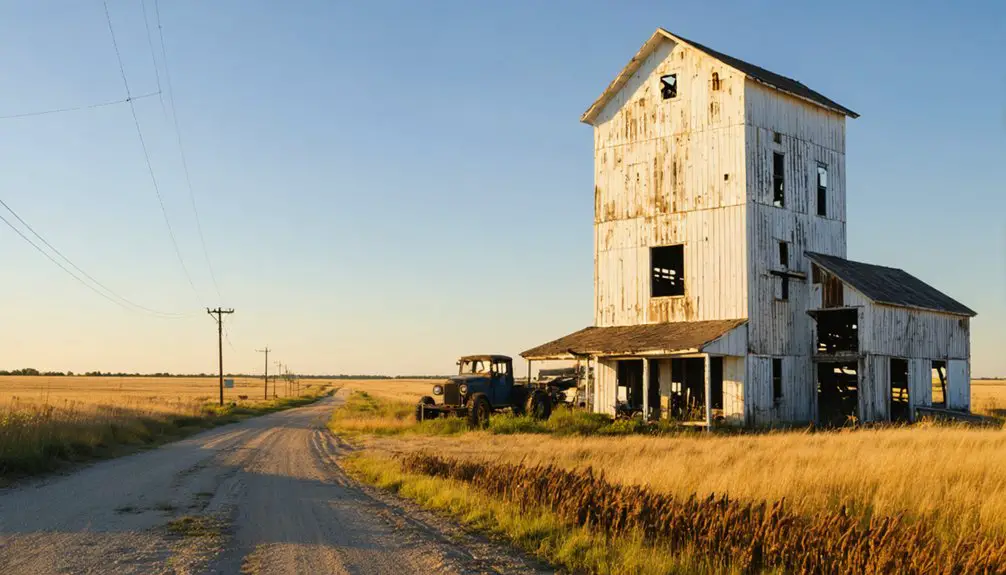
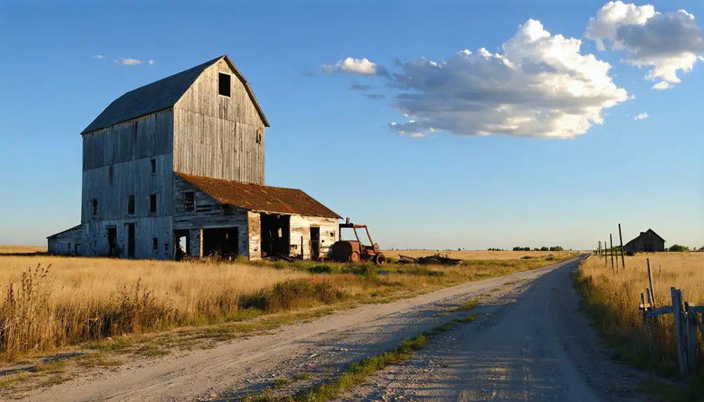
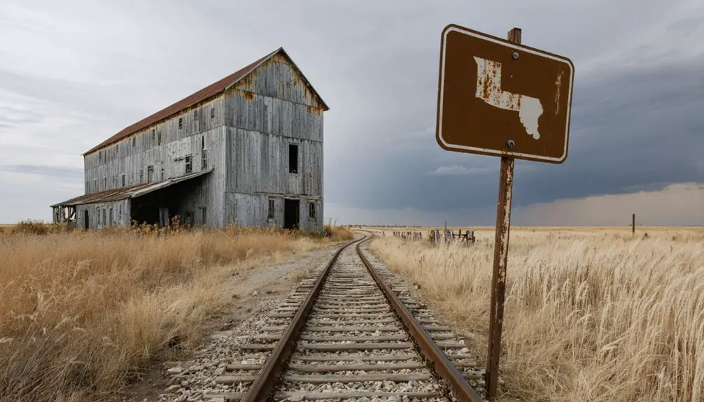
Historical Buildings Lost to Time

While Churchs Ferry‘s founding in 1883 brought numerous pioneering structures to life, you’ll find virtually none of these historical buildings standing today.
The town’s building decay mirrors the community decline that followed the drying of Mauvais Coulee and later flooding from Devils Lake. Much like in Burt’s post office closure around 1975, the town’s vital services gradually disappeared. Similar decay can be seen in Lincoln Valley’s homes, abandoned since the last residents departed in the 1970s.
The devastating loss of historical structures includes:
- The original ferry-related buildings and settler homes near the coulee crossing
- The town’s significant church, which succumbed to environmental forces
- Commercial and residential buildings that were either submerged by rising waters or deliberately dismantled
You can witness the impact of these losses through limited photographs showing deteriorated foundations and abandoned structures.
Most remaining sites are now fenced off, marking the end of an era for this once-thriving pioneer community.
Transportation Legacy and Highway 2
If you’d visited Churchs Ferry in 1883, you’d have found Irvine Church operating his essential ferry service across the Mauvais Coulee, helping settlers reach Devils Lake.
By the late 1890s, the dried-up coulee ended the ferry’s necessity, but the town’s transportation role evolved with the construction of U.S. Highway 2.
Today, while Highway 2 remains a major east-west corridor through North Dakota, it couldn’t prevent Churchs Ferry’s eventual decline due to Devils Lake’s rising waters and changing regional traffic patterns.
Historic Ferry Crossing
Located at a critical juncture where settlers needed to cross the Mauvais Coulee streambed, Irvine Church established his pioneering ferry service in 1883, creating what would become the foundation for Churchs Ferry town.
His ferry operations opened essential transportation routes between farms and Devils Lake, shaping early settlement patterns in Ramsey County.
You’ll appreciate how the ferry crossing transformed the region:
- It provided the first reliable crossing point over the “bad flow” ravine that French fur trappers had warned about.
- The service attracted settlers who built homes and businesses around the crossing point.
- It established a crucial trade route that connected farmers to Devils Lake’s bustling markets.
The ferry’s significance diminished in the late 1890s when the Mauvais Coulee dried up, but its legacy lived on through the community it created.
Modern Highway Transportation
Although Churchs Ferry‘s original transportation legacy began with a ferry service, today the town sits along U.S. Highway 2, a major east-west corridor spanning 358 miles across North Dakota.
You’ll find this modern four-lane highway connecting the state’s major northern cities of Williston, Minot, and Grand Forks, marking a significant evolution from the area’s early dirt roads.
The highway’s expansion from two to four lanes has dramatically improved traffic flow and highway safety for travelers passing through Churchs Ferry.
Completed in 1996, the Grand Forks to Minot section established essential transportation infrastructure that continues to serve regional commerce and connect rural communities.
While the town itself has largely faded, its location along this important transportation artery maintains its connection to North Dakota’s broader economic network.
Preserving Churchs Ferry’s Memory
Despite its unincorporation in 2022, Churchs Ferry’s legacy lives on through dedicated preservation efforts spanning historical documentation, physical landmarks, and community initiatives.
Though Churchs Ferry no longer exists as a town, its rich history endures through community dedication and preservation work.
You’ll find memory preservation efforts taking shape through local newspapers, public archives, and oral histories from longtime residents like Duane Holien.
Community storytelling remains vibrant through:
- Annual commemorations and reunions where former residents share their experiences
- Digital platforms like Ghosts of North Dakota that showcase photos and firsthand accounts
- Local museums and archives collecting family histories tied to the town
Physical reminders endure as some residents relocated their homes to safer ground, while others maintain St. John’s Lutheran Church as a focal point for preserving the town’s heritage.
Frequently Asked Questions
What Happened to the Original Ferry Boat Used by Irvine Church?
You’ll never know what happened to Irvine Church’s ferry boat – its historical significance vanished when the Mauvais Coulee dried up in the 1890s, leaving no documented trace of its final fate.
Are There Any Annual Events or Reunions Held by Former Residents?
You’ll find former residents still gather at their annual alumni reunion each summer, with community gatherings including Friday suppers, Saturday meetings, and social activities that preserve cherished hometown connections.
What Native American Tribes Originally Inhabited the Churchs Ferry Area?
You’ll find the Dakota (Sioux) were predominant, while Mandan, Hidatsa, and Arikara tribes established agricultural settlements nearby. The Assiniboine and Cheyenne also shared historical significance in this territory.
Did the Town Ever Have Its Own School District?
Yes, you’ll find Churchs Ferry maintained its own school district until 1987, marking a century of local educational impact through a high school that served both town and rural students.
What Was the Peak Historical Population of Churchs Ferry?
You’ll find the highest population was 457 residents in 1910, though significant population decline followed. After that historical significance, the numbers steadily dropped until reaching single digits in recent years.
References
- https://news.prairiepublic.org/show/dakota-datebook-archive/2022-06-09/churchs-ferry-a-town-diminished-but-not-forgotten
- https://en.wikipedia.org/wiki/Churchs_Ferry
- https://ghostsofnorthdakota892857007.wordpress.com/tag/benson-county/
- https://www.youtube.com/watch?v=59hzueQkmok
- https://ghostsofnorthdakota892857007.wordpress.com/tag/ramsey-county/
- https://theengelhornfamily.com/familytree/Mathias-JohannThomas1840.htm
- https://kids.kiddle.co/Churchs_Ferry
- https://www.history.nd.gov/archives/manuscripts/inventory/10157counties/10157 Ramsey.html
- https://commons.und.edu/cgi/viewcontent.cgi?filename=9&article=1000&context=oers&type=additional
- https://news.prairiepublic.org/local-news/2021-06-18/tiny-town-big-memories-churchs-ferry-alumni-continue-traditions