You’ll find Freeman Township 15 miles northwest of Farmington, Maine – a ghost town that tells a compelling story of rural decline. Once home to 838 residents in 1840, this former agricultural powerhouse saw its population plummet as the Industrial Revolution drew workers to urban centers. The township’s official dissolution in 1937 marked the end of its incorporated status, though its Revolutionary War heritage and abandoned structures offer fascinating glimpses into early American frontier life.
Key Takeaways
- Freeman Township was officially dissolved in 1937 after experiencing severe population decline from 838 residents in 1840 to 222 by 1920.
- The township’s transformation into a ghost town stemmed from economic pressures during the Industrial Revolution and competition from larger urban mills.
- Failed agricultural operations and closed mills led to mass exodus, with residents leaving Freeman for manufacturing jobs in more accessible urban centers.
- The township’s isolation worsened when Maine’s expanding transportation network bypassed the area, while connected neighboring towns continued to thrive.
- Former village sites and abandoned properties throughout Freeman Township now serve as historical remnants of early American rural life.
The Story Behind Freeman Ridge’s Revolutionary War Origins
While many colonial settlements played essential roles during the American Revolution, Freeman Ridge emerged as a strategic frontier outpost amid Maine’s Revolutionary War activities.
You’ll find evidence of Revolutionary mobilization through the Freeman family’s involvement in local militia and town leadership, reflecting the community’s dedication to the colonial cause.
The area’s significance grew as nearby military engagements unfolded, including the Battle of Freeman’s Farm in 1777 and subsequent conflicts at Bemis Heights. During this period, General Philip Schuyler led early resistance efforts by destroying infrastructure to slow British advances.
Local residents participated in supply efforts and defensive operations, connecting to important battles along the Lake Champlain corridor. The Cumberland County Regiment provided crucial military support under Colonel Edmund Phinney in 1775. Town selectmen armed civilian defenders with powder, while prominent leaders like Enoch Freeman coordinated regional resistance efforts.
Freeman Ridge’s militia and civilians united in defense, with leaders like Enoch Freeman organizing crucial supply lines for Revolutionary forces.
This grassroots organization transformed Freeman Ridge into an essential link in Maine’s revolutionary network.
From Thriving Farm Town to Ghost Town: A Historical Timeline
You’ll find Freeman Township’s agricultural zenith in 1840, when 838 residents operated thriving farms across the region, including some of Maine’s largest sheep operations.
Settled initially by Revolutionary War survivors who fled the burning of Portland, Freeman Township was officially incorporated in 1808.
The first sawmills were established in Freeman Village and other key locations, supporting the area’s early development.
The township’s decline accelerated through the late 19th century as industrialization drew people away, with the population plummeting to 397 by 1900 and 219 by 1930.
Agricultural Peak Years
As Freeman Township emerged from its humble beginnings as Little River Plantation in 1808, the community experienced remarkable agricultural growth throughout the 19th century.
You’d have witnessed dramatic market shifts as railroad connections transformed local subsistence farming into thriving commercial operations.
Agricultural innovations like horse-powered thrashing machines and steel plows revolutionized productivity on Freeman’s fertile soil, particularly along Freeman Ridge. The farmers utilized hay production extensively to supply East Coast markets and logging operations.
The farms in Freeman Township, like many across Maine, participated in agricultural fairs to showcase their finest livestock and produce during this era of prosperity.
Ghost Town Transformation
Once a thriving agricultural community of 838 residents in 1840, Freeman Township’s transformation into a ghost town unfolded through a series of dramatic demographic and economic shifts.
Unlike ghost town myths of sudden abandonment, Freeman’s decline occurred gradually over eight decades. You’ll find the population dropped steadily: 608 by 1870, 397 by 1900, and just 222 in 1920’s final census.
The Civil War and Industrial Age drew residents away, while local sawmills and farms struggled to sustain the economy. Native Americans had inhabited this region millennia before European settlement began.
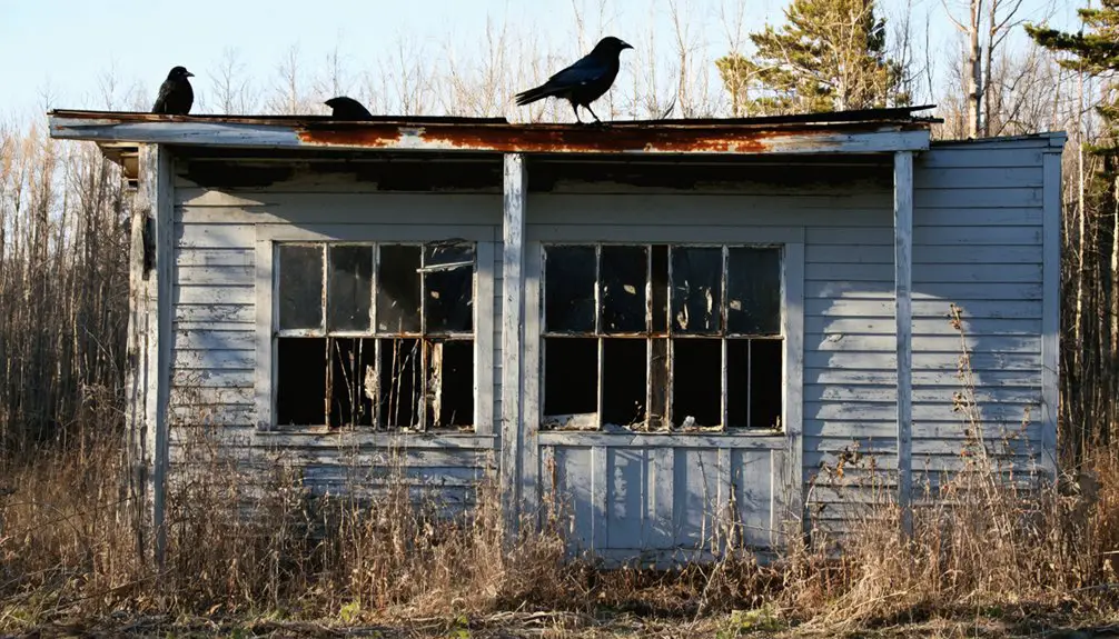
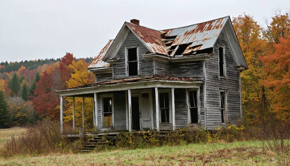
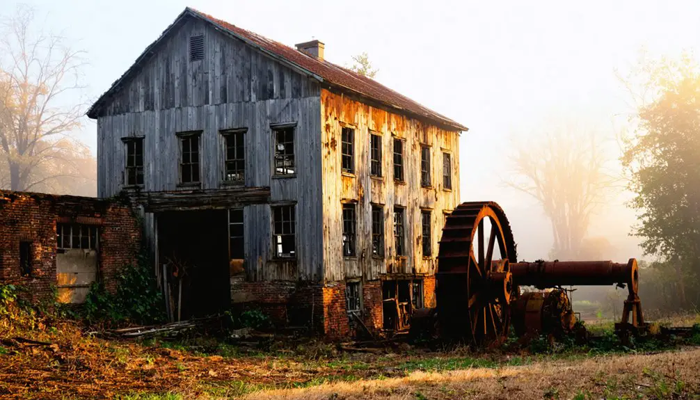
Urban exploration enthusiasts today won’t find classic abandoned structures – the township’s dissolution was formalized in 1937 when it repealed incorporation.
The former villages of Freeman, West Freeman, and North Freeman have vanished, leaving only quiet forests where ten schoolhouses and busy post offices once served the community. Today, history enthusiasts and adventurers frequently visit to explore the remnants of this once-bustling township.
Peak Agricultural Era and the Great Sheep Farming Legacy
The fertile valleys and ridges of Freeman Township supported a thriving agricultural economy during its peak era, with Freeman Ridge in the northern section providing some of the township’s most productive tillage land.
Though the soil proved challenging to cultivate, agricultural innovations helped farmers adapt to the region’s short growing seasons and damp summers.
The area’s farming history dates back to when the land was first platted in 1791, marking the beginning of organized agriculture in the region.
Life After Incorporation: Modern Demographics and Settlement
While Freeman Township’s incorporation marked a new chapter in its history, modern demographic patterns reveal a complex tapestry of population growth and socioeconomic diversity.
You’ll find significant variation across nearby ZIP codes, with some areas experiencing robust 2.9% annual growth while others show more modest increases of 0.6%. The region’s demographic shifts reflect an aging population, with a median age of 48.1 years shaping evolving community needs. Current projections estimate the population will reach 23,813 residents by 2025.
The area maintains a primarily White population of about 90%, though you’ll notice small but growing Hispanic and multiracial communities.
Economic disparities are evident in household incomes, ranging from $125,642 in more affluent zones to $58,893 in others. Family structures remain traditional, with 2.4 to 2.5 persons per household, while roughly 30% of residents live alone.
The Impact of Industrial Revolution on Freeman’s Decline
Freeman’s decline directly stemmed from the Industrial Revolution’s impact on its traditional mills and factories, which couldn’t compete with larger, mechanized operations in urban centers.
You’ll find this economic pressure triggered a mass exodus of rural populations, as workers and their families abandoned Freeman Township for manufacturing jobs in cities like Lewiston and Portland.
The expansion of modern transportation networks, particularly improved railways and highways, further accelerated this migration by making urban centers more accessible while simultaneously reducing Freeman’s geographic advantages in resource extraction and processing.
Mills and Factory Competition
As industrial advances swept through Maine during the late 19th century, small mills like those in Freeman Township faced mounting pressure from larger, technologically superior facilities.
The mill evolution was stark – while Freeman’s traditional timber-frame mills struggled, operations like the Sparhawk Mill were producing thousand grain bags daily.
Competition dynamics proved ruthless as machine speeds increased tenfold, but only larger mills could afford these upgrades.
You can trace Freeman’s decline through the Fuller brothers’ gristmills, where production plummeted from 15,000 to 8,000 bushels, with values dropping from $12,000 to $7,000 by 1880.
While industrial centers near Saco and Biddeford thrived with cotton production and textile machinery, Freeman’s inability to diversify or modernize ultimately sealed its fate.
Rural Population Mass Migration
The dramatic exodus from Freeman Township reflected broader demographic shifts across rural Maine during the late 19th century.
You’d have witnessed Freeman’s population plummet from 838 residents in 1840 to just 222 by 1920, mirroring the rural exodus happening throughout the state. While America’s population doubled between 1870-1910, Maine’s rural areas stagnated or declined as residents sought opportunities elsewhere.
You’ll find the roots of this mass migration in the changing economic landscape. The Civil War’s disruption of Maine’s merchant marine, coupled with the rise of mechanized industry and new energy sources, drew workers away from farming communities.
Freeman’s residents left for manufacturing jobs in places like Farmington, leaving behind abandoned properties, closed schools, and shuttered churches – the skeletal remains of a once-thriving community.
Transportation Network Expansion
While Maine’s transportation network expanded dramatically during the mid-19th century, Freeman Township found itself increasingly isolated from the economic arteries that would define industrial growth.
You’ll find that Maine Central Railroad’s consolidation and John A. Poor’s ambitious rail projects reshaped the state’s commercial landscape, but they bypassed Freeman entirely.
The transportation impact proved devastating – while connected towns flourished with new industries and markets, Freeman’s economic isolation deepened.
The town’s sawmills and sheep farms couldn’t compete when rail lines prioritized resource-rich areas and urban ports.
Instead of bringing prosperity, the expanding transportation network actually accelerated Freeman’s decline by making it easier for residents to abandon their farms and seek opportunities in rail-connected industrial centers.
Geographical Features and Regional Connections
Located approximately 15 miles northwest of Farmington in Franklin County, Maine, Freeman Township occupies a heavily wooded landscape bounded by several neighboring settlements.
You’ll find Freeman Ridge dominating the northern section, offering superior tillage despite the area’s topographical challenges. The township’s waterways include Curvo Stream and tributaries of the Sandy River, which have historically shaped local agriculture and transit routes.
The township’s position between mountains fostered both isolation and essential connections with surrounding communities.
You’ll notice how Freeman’s development intertwined with neighboring town interactions, particularly Salem Township and New Portland, which were once part of Freeman’s original territory.
The surrounding settlements of Kingfield, Strong, New Vineyard, and Phillips continue to serve as critical access points to this remote area.
Freeman’s Legacy in Maine’s Cultural Landscape
Deeply rooted in Maine’s post-Revolutionary history, Freeman Township stands as a tribute to early American resilience and adaptation.
You’ll find its cultural identity woven into the fabric of Maine’s rural transformation, from its origins as a relief settlement for Portland’s fire survivors to its peak as a thriving agricultural community of 838 residents.
Today, Freeman’s historical preservation efforts keep its story alive through local folklore, cemetery grounds, and architectural remnants.
While you can no longer visit an active township, you’ll discover its legacy in the seasonal retreats and commuter communities that now occupy the area.
Freeman’s evolution from colonial settlement to ghost town mirrors broader New England themes of rural change, offering valuable insights into Maine’s shifting demographic landscape.
exploring ghost towns in maine history reveals a tapestry of stories from the past, highlighting the factors that led to their abandonment. These sites serve as poignant reminders of economic shifts and population migrations that occurred throughout the years. As Maine continues to evolve, the remnants of these ghost towns offer a unique lens through which to view the state’s rich heritage.
The history of Falling Creek, Virginia, illustrates similar themes of decline and transformation. As economic opportunities shifted, many residents relocated, leaving behind a landscape marked by nostalgia and forgotten stories. The remnants of these once-thriving communities invite exploration and reflection on the cycles of prosperity and loss that shape our towns and identities.
Frequently Asked Questions
What Happened to Freeman’s Original Town Records After Its Incorporation Was Repealed?
You’ll find most of Freeman’s town records were likely transferred to Franklin County or Maine State Archives for historical preservation, though their exact location isn’t definitively documented in primary sources.
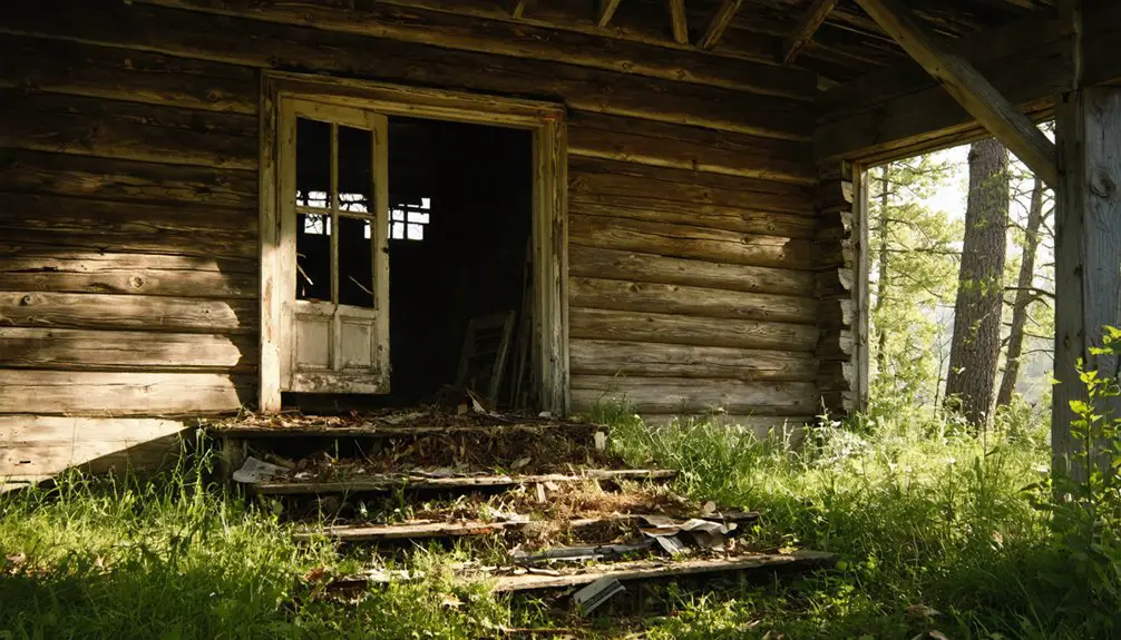
Are There Any Remaining Historical Buildings or Landmarks in Freeman Township Today?
You’ll find the historic Barn on Lot 8, Range G, a significant remaining structure from 1825. Beyond that, there’s just an old cemetery and scattered building foundations as historical markers.
What Was the Average Land Price in Freeman During Its Peak Years?
You won’t find exact land prices from Freeman’s peak years, but land value trends during the 1840s followed rural Maine’s patterns, with economic shifts keeping agricultural land prices relatively modest compared to urban areas.
Did Any Notable Historical Figures or Families Originate From Freeman Township?
You’ll find the Freeman family was the most notable, with Enoch Freeman and his son Samuel wielding significant influence, though they weren’t direct residents of the township that bears their name.
What Traditional Crafts or Industries, Besides Farming, Were Practiced in Freeman?
You’d find sawmilling, basket weaving, and blacksmithing were prominent alongside clock making, buggy whip production, and barrel making. Local craftsmen also produced wooden shingles, horse collars, and brooms.
References
- http://strangemaine.blogspot.com/2012/02/ghost-towns-of-maine.html
- https://949whom.com/first-haunting-happened-in-maine/
- https://en.wikipedia.org/wiki/List_of_ghost_towns_in_Maine
- https://kids.kiddle.co/List_of_ghost_towns_in_Maine
- https://b985.fm/6-maine-ghost-towns-you-never-knew-existed/
- https://www.battlefields.org/learn/articles/battle-freemans-farm-september-19-1777
- https://www.me.ng.mil/About/Our-History/The-Revolutionary-War/
- https://www.battlefields.org/learn/articles/battle-bemis-heights
- https://allthingsliberty.com/2016/09/fort-pownal-colonial-maine-1775/
- https://www.kellscraft.com/FalmouthNeck/FalmouthNeckinTheRevolutionPage.html