If you’re planning a ghost town road trip to Sacaton Village, Arizona, you’ll need to recalibrate your expectations. Sacaton isn’t abandoned — it’s a living tribal headquarters with over 3,000 residents and deep ancient roots. The real ghost town you’re seeking is Socatoon Station, hiding four miles east in the desert. Once a Butterfield Overland Mail stop, it’s now scattered foundations and forgotten fragments. Keep going to uncover everything this remarkable landscape holds.
Key Takeaways
- Sacaton Village is not a ghost town but a thriving tribal headquarters with 3,000+ residents; nearby Socatoon Station is the actual abandoned site.
- Socatoon Station, four miles east of Sacaton Village, was a Butterfield Overland Mail stop abandoned after Civil War disruptions and water scarcity.
- Visit between November and March for cooler conditions; bring water, sun protection, and a reliable vehicle as no public transit exists.
- Gila River Indian Community land is sovereign territory; obtain proper permissions before photographing or exploring any sacred or restricted sites.
- The C.H. Cook Memorial Church ruins and ancient irrigation patterns offer compelling historical insights into cultural resilience and frontier survival.
Is Sacaton Village Actually a Ghost Town?
Sacaton Village isn’t a ghost town — it’s the living tribal headquarters of the Gila River Indian Community, home to over 3,000 residents and a continuous cultural presence stretching back to ancient times. You’ll find modern infrastructure supporting active governance, cultural institutions, and local businesses rooted in Maricopa and Akimel O’otham heritage.
Yet history runs deep beneath this urban development. Water diversions in the late 19th century gutted the region’s farming economy, leaving abandoned farmlands that carry an undeniable ghost town atmosphere. That tension — between resilient living community and historically scarred landscape — is exactly what makes Sacaton worth exploring.
You’re not visiting ruins frozen in time. You’re stepping into a place that survived devastation and kept moving forward on its own terms.
The Real Ghost Town Near Sacaton: Socatoon Station
Four miles east of Sacaton’s living community, the actual ghost town you’re looking for sits quietly in the desert — Socatoon Station, a former Butterfield Overland Mail stop that operated from 1858 to 1861 before Civil War disruptions and water scarcity finished it off for good.
What you’ll find here tells a harder story than simple abandonment. The same water diversion schemes that gutted the region’s agricultural history — redirecting rivers upstream for expanding Anglo settlements — made survival impossible for outposts like Socatoon Station.
Without reliable water, the communication and supply functions it once served became unsustainable.
Structural foundations and scattered pottery fragments remain visible, connecting you directly to that brutal shift period. Walk the site carefully, respect the surrounding tribal lands, and let the silence do its work.
Ruins and Remnants at Socatoon Station Today
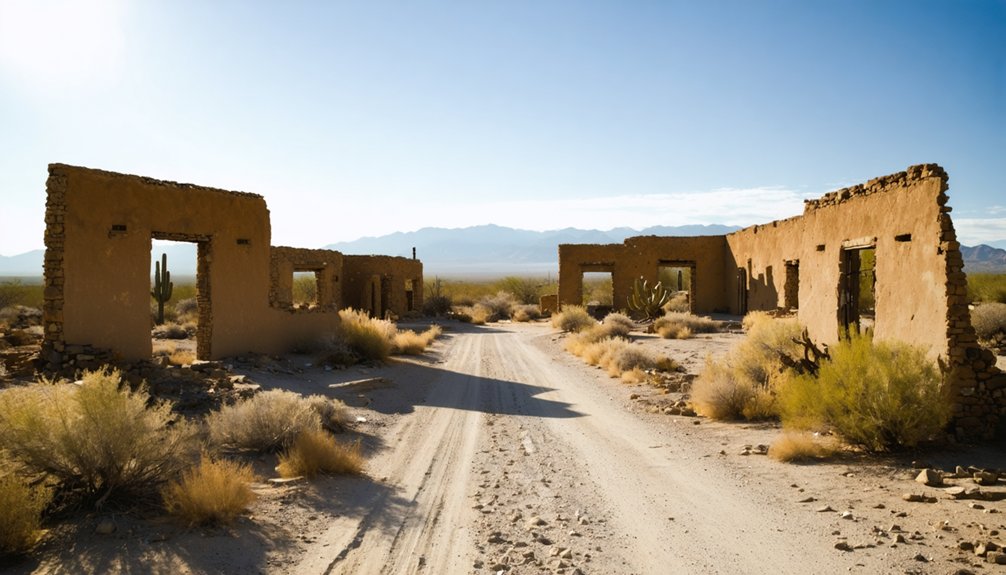
What remains at Socatoon Station isn’t much, but it’s enough. You’ll find structural foundations from the Butterfield Overland Mail era, pottery fragments, and scattered metal hardware dating to 1858–1861.
These quiet remnants carry the weight of frontier survival, where mail riders pushed through brutal desert heat and Civil War tensions threatened every route.
There’s no modern infrastructure here — no visitor center, no signage, no community events marking the site’s significance. That rawness is exactly what draws independent explorers.
You’re standing on ground where westward expansion collided with harsh desert reality until water scarcity finally won.
Come prepared. Bring water, wear sun protection, and visit during cooler months. The silence at Socatoon Station speaks clearly — you just have to show up ready to listen.
How to Drive to Sacaton Village
Once you’ve walked the barren ground of Socatoon Station, reaching modern Sacaton Village is a straightforward drive — head west along the desert highway roughly four miles, where the tribal capital of the Gila River Indian Community anchors itself as a living counterpoint to everything you just left behind.
Travel safety demands you arrive prepared — no public transit serves this corridor, so vehicle requirements aren’t negotiable: you’ll need a reliable personal car capable of handling remote desert roads.
Stock up on water and sun protection before departing. The desert heat turns punishing fast, and cooler months give you far better odds of exploring comfortably.
Sacaton itself offers supplies, so use it as your resupply point before venturing further into surrounding historical territory.
Best Time to Visit and What to Bring
Timing shapes everything out here. Desert heat turns brutal by late spring, so plan your visit between November and March. You’ll move more freely through the landscape, absorbing the layers of cultural preservation woven into every remnant foundation and pottery shard.
Pack essentials like you mean it — adequate water, sun protection, sturdy footwear, and a charged phone. No public transportation reaches these remote stretches, so your vehicle is your lifeline.
Before heading into outlying historical areas, stop in modern Sacaton first. As the seat of tribal governance for the Gila River Indian Community, it offers supplies and important context. Respect that you’re moving through living tribal lands, not a forgotten relic.
This place breathes history alongside a present-day community that never disappeared.
What to Know Before Visiting Tribal Lands
Stepping onto Gila River Indian Community land means entering a sovereign nation with its own governance, cultural protocols, and legal jurisdiction. Cultural sensitivity isn’t optional here—it’s foundational. The Akimel O’otham and Maricopa peoples maintain living traditions, not museum displays.
Gila River Indian Community is a sovereign nation—enter with the cultural awareness that demands.
Follow these tribal protocols before exploring:
- Obtain proper permissions — Contact the Gila River Indian Community administration before photographing people, ceremonies, or sacred sites.
- Respect posted boundaries — Restricted areas exist for cultural and legal reasons; crossing them carries genuine legal consequences under tribal jurisdiction.
- Leave artifacts untouched — Pottery fragments and structural remnants you’ll encounter belong to the community’s ancestral heritage, not your collection.
You’re visiting someone’s homeland. Move through it accordingly—with curiosity, yes, but also deliberate respect.
Other Historical Sites Near Sacaton Village
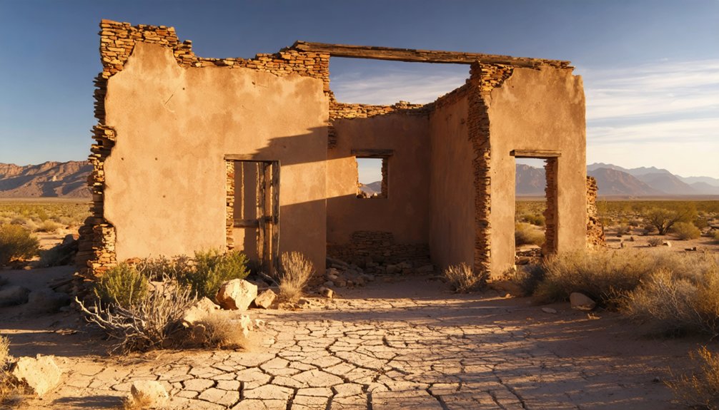
Beyond Sacaton Village itself, you’ll find remnants of Socatoon Station four miles east, where pottery fragments and metal hardware mark what was once a crucial Butterfield Overland Mail stop abandoned in the 1870s.
Traces of ancient irrigation systems still scar the desert floor, silent evidence of the water diversions that unraveled an entire agricultural civilization.
You can also visit the fire-damaged C.H. Cook Memorial Church, a haunting structure that anchors the area’s more recent colonial and missionary history.
Socatoon Station Remnants Nearby
Four miles east of Sacaton, Socatoon Station‘s crumbling foundations mark where the Butterfield Overland Mail once pushed its routes through the Sonoran Desert. This essential communication and supply post operated from 1858 until the 1870s, when water scarcity finally forced abandonment. Civil War territorial conflicts accelerated its decline before nature finished the job.
When you visit, watch for:
- Pottery fragments and metal hardware scattered across the barren site dating to active operational years
- Foundation remnants revealing the station’s original footprint against the desert floor
- Ancient irrigation channels reflecting cultural preservation efforts that predate European settlement entirely
Tribal governance of surrounding lands means you’ll respect boundaries throughout your exploration. Bring water, arrive during cooler months, and let this forgotten outpost speak for itself.
Ancient Irrigation System Traces
Ancient irrigation channels cut through the desert floor here tell a story older than any European map of the region. You’re walking terrain that Akimel O’otham farmers engineered centuries before colonial contact, moving water across miles of desert with remarkable precision.
Archaeological evidence scattered throughout the area reveals just how sophisticated these systems were. Stone alignments, subtle depressions, and eroded canal beds mark where crops once thrived before upstream diversions choked the flow in the late 1800s.
You don’t need a guided tour to feel the weight of what happened here. Crouch low, study the ground, and let the ancient irrigation patterns speak. This landscape carries its own testimony — one of ingenuity, resilience, and a civilization that understood water as life itself.
Cook Memorial Church Ruins
Shift your gaze from the earth beneath your feet to what once rose — or once rose — above it. The fire-damaged C.H. Cook Memorial Church stands as a weathered sentinel of cultural preservation, marking where community and faith once intersected.
Before you approach, keep these in mind:
- Document everything — photograph the char patterns and remaining structural details carefully.
- Respect the space — traditional ceremonies and spiritual practices connect this land to living communities.
- Research beforehand — understanding the church’s missionary history deepens what you’ll witness standing there.
The ruins aren’t simply decay; they’re a complicated record of indigenous resilience meeting outside influence. You’re reading architecture as testimony. What collapsed here, and what survived, tells you more than any placard ever could.
Frequently Asked Questions
What Language Do the Akimel O’otham People Traditionally Speak?
The Akimel O’otham people traditionally speak O’odham, a Uto-Aztecan language. You’ll discover that traditional language preservation keeps Akimel O’otham dialects alive, connecting you to ancient voices that’ve shaped this desert’s free, untamed spirit.
How Large Is the Gila River Indian Community’s Total Land Area?
The knowledge provided doesn’t specify the total land area, but tribal sovereignty stretches like an ancient river across historical land use. You’ll want to contact the Gila River Indian Community directly for exact acreage figures.
Are There Guided Tours Available for Socatoon Station Ruins?
No formal guided tour options exist for Socatoon Station’s archaeological site access. You’ll explore independently, so prepare well — bring water, respect tribal boundaries, and let the desert’s raw, untamed history speak directly to your adventurous spirit.
What Crops Did Sacaton Farmers Grow Before Water Diversions Occurred?
Can you imagine the abundance? Before water diversions struck, Sacaton’s farmers used historical irrigation to cultivate remarkable crop diversity—wheat, corn, beans, and melons thrived, sustaining generations who’d freely worked this fertile desert land.
Can Visitors Attend Cultural Events Hosted by the Tribal Community?
You’ll want to check with the Gila River Indian Community directly, as they host cultural celebrations honoring Maricopa and Akimel O’otham traditions. Tribal storytelling events connect visitors to ancient heritage, but permission and protocols must respectfully guide your exploration.
References
- https://en.wikipedia.org/wiki/List_of_ghost_towns_in_Arizona
- https://da.abcdef.wiki/wiki/List_of_ghost_towns_in_Arizona
- https://en.wikipedia.org/wiki/Sacate_Village
- https://www.ghosttowns.com/states/az/azalphabetical.html
- https://en.wikipedia.org/wiki/Sacaton_(village)
- https://azmemory.azlibrary.gov/nodes/view/328149
- http://www.ghosttownaz.info/sitemap.php
- https://www.tripadvisor.com/Attractions-g28924-Activities-c47-t14-Arizona.html
- https://www.visittucson.org/blog/post/8-ghost-towns-of-southern-arizona/