Planning a ghost town road trip to Santa Rita, New Mexico means chasing a town that no longer exists. Founded in 1803, Santa Rita del Cobre grew from a copper mining settlement into a thriving company town of 6,000 residents — before an open-pit mine slowly swallowed it whole by 1967. Today, only a massive excavation marks where streets and homes once stood. Stick around to uncover the full story of Santa Rita’s rise, erasure, and what remains.
Key Takeaways
- Santa Rita del Cobre, founded in 1803, is a ghost town consumed by the Chino open-pit mine, leaving no physical ruins to explore.
- The massive open-pit mine offers scenic viewpoints showcasing copper-stained excavation terraces, making it the primary visual attraction today.
- Visit the Shrine to Santa Rita at Hwy 152 and Hwy 356 in Hanover for a tangible historical connection.
- Use Silver City as your base, as it provides lodging, fuel, and nearby museums offering historical context for the area.
- Bring water, offline maps, and check road conditions, since the site has minimal tourist infrastructure and no curated attractions.
What Was Santa Rita Del Cobre?
Before it became a pit in the earth, Santa Rita del Cobre was a thriving copper town founded in 1803 by Francisco Manuel Elguea. It was carved out of the rugged New Mexico terrain roughly 15 miles east of present-day Silver City. The name itself tells you everything — “Santa Rita of Copper” — a settlement built entirely around extraction, not agriculture or trade.
You’re looking at a place with deep mining heritage, where early operations reportedly pulled over six million pounds of copper annually.
Apache raids forced repeated evacuations, and the town endured at least three by the 1820s. That pattern of disruption never truly ended.
Town relocation became a recurring reality as the open pit expanded, ultimately erasing Santa Rita from the map entirely by 1967.
How Copper Turned a Remote Desert Outcrop Into a Company Town
When Francisco Manuel Elguea founded Santa Rita del Cobre in 1803, he wasn’t building a community so much as extracting one from the earth—copper ore was the reason the settlement existed, and it shaped everything that followed.
By the early 19th century, the mine was pulling over six million pounds of copper annually, drawing workers, infrastructure, and eventually corporate ownership into a landscape that had no other reason to support a town.
Once the Chino Copper Company launched open-pit operations in 1910 and Kennecott took control in 1932, Santa Rita became a textbook company town—its fate tied entirely to the pit that would ultimately swallow it.
Copper Ore Sparks Settlement
Though Apache people had known about the copper outcrops for generations, Spanish sources didn’t formally document the ore until around 1800. By 1803, Francisco Manuel Elguea had already turned that knowledge into a settlement. He named it Santa Rita del Cobre — Santa Rita of Copper — and built it around extraction from day one.
You’re not walking into a place shaped by agriculture or trade. You’re stepping into ground where local legends and cultural traditions ran headlong into colonial ambition. The Apache had their own relationship with this land, and the Spanish simply claimed what others already understood.
Early production hit over 6 million pounds of copper annually. That kind of output doesn’t come from careful planning — it comes from relentless drive and a willingness to take what the desert holds.
Mine Shapes Company Town
By 1884, Santa Rita had roughly 500 residents clustered around the mine — and that number more than quadrupled to 2,500 by 1915. Advancing mining technology drove that growth, pulling workers into a landscape increasingly shaped by industrial demand.
Town architecture reflected corporate control: company-owned homes, stores, and facilities defined daily life.
Here’s what shaped Santa Rita’s company town identity:
- Open-pit mining began under Chino Copper Company in 1910
- Population surged to 6,000 residents by 1920
- Mining technology continuously expanded the pit’s footprint
- Town architecture served the mine’s workforce, not independent settlers
- Kennecott Copper Corporation absorbed operations in 1932
You’re not visiting a town that grew organically — you’re tracing a settlement that existed entirely on the mine’s terms.
Industrial Growth Erases Community
As the open pit expanded through the early 20th century, it didn’t just consume land — it consumed the town itself. Kennecott Copper took control in 1932, and the excavation kept growing, swallowing streets, homes, and history one blast at a time.
Residents relocated repeatedly, chasing stable ground that kept disappearing beneath them.
By the 1950s, the pit had surrounded what remained of Santa Rita. The town was formally abandoned in 1967, the school system gone by 1972. No ruins mark the spot today — just an open wound in the earth.
Ghost town myths usually involve decay and silence. Santa Rita offers something rawer: erasure. Mining legends often romanticize extraction, but here, the mine didn’t just shape the community — it deleted it entirely.
Why Santa Rita Was Evacuated Three Times Before 1830
Before the open pit swallowed the landscape, Santa Rita del Cobre had already earned a reputation as one of the most difficult settlements in the Southwest to keep alive. Apache raids, mining accidents, and brutal settler conflicts forced residents to abandon the town three separate times before 1830. You’re looking at a place where survival wasn’t guaranteed.
Santa Rita del Cobre didn’t just struggle — it collapsed entirely, three times, before 1830.
Here’s what drove those evacuations:
- Apache warriors viewed the copper outcrops as their territory long before Spanish arrival
- Settler conflicts escalated quickly when mining disrupted traditional Apache land use
- Mining accidents compounded danger for an already-vulnerable population
- The remote location made resupply and reinforcement nearly impossible
- Each evacuation erased months of hard-won infrastructure and progress
Santa Rita’s early story isn’t romantic — it’s a raw testament to how fiercely this land resisted occupation.
How the Open Pit Swallowed the Town
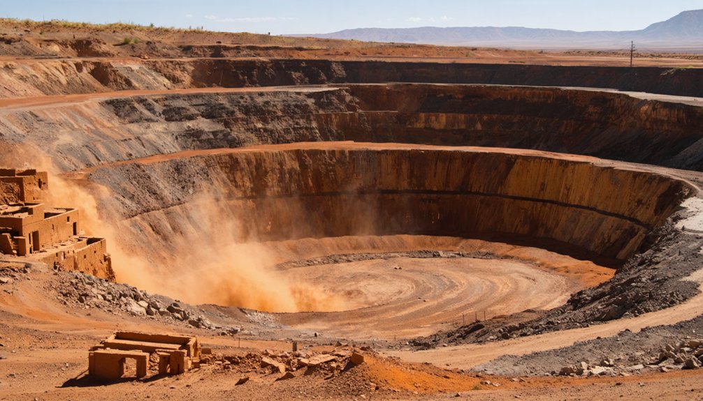
What Chino Copper Company started in 1910 reshaped Santa Rita from a living town into a footnote. Advancing mining technology turned pick-and-shovel extraction into industrial-scale excavation, and the pit grew faster than anyone anticipated.
By the 1950s, you’d have watched the open pit creep toward neighborhoods, swallowing streets block by block. Kennecott Copper Corporation took control in 1932 and accelerated that expansion relentlessly.
Local legends say residents felt the ground shift before the bulldozers arrived. The town relocated several times, each move buying a few more years before the pit caught up.
What’s Left to See at the Santa Rita Site Today
Standing where Santa Rita once stood, you’ll find no streets, no foundations, no markers hinting at 6,000 residents who called this place home through the 1950s. The pit consumed everything. What remains tells a raw, industrial story worth chasing.
- The vast Chino open-pit mine, visible from overlooks, dominates the landscape.
- Photographic opportunities abound where copper-stained earth meets massive excavation terraces.
- The Shrine to Santa Rita at Hwy 152 and Hwy 356 in Hanover offers a quiet, tangible connection.
- Local legends about Apache knowledge of copper outcrops predate every Spanish claim here.
- Interpretive context from Silver City’s nearby museums fills historical gaps the landscape can’t.
You’re not visiting ruins. You’re standing at an erasure, and that distinction makes this stop unforgettable.
The Hanover Shrine: A Quick Stop Worth Making
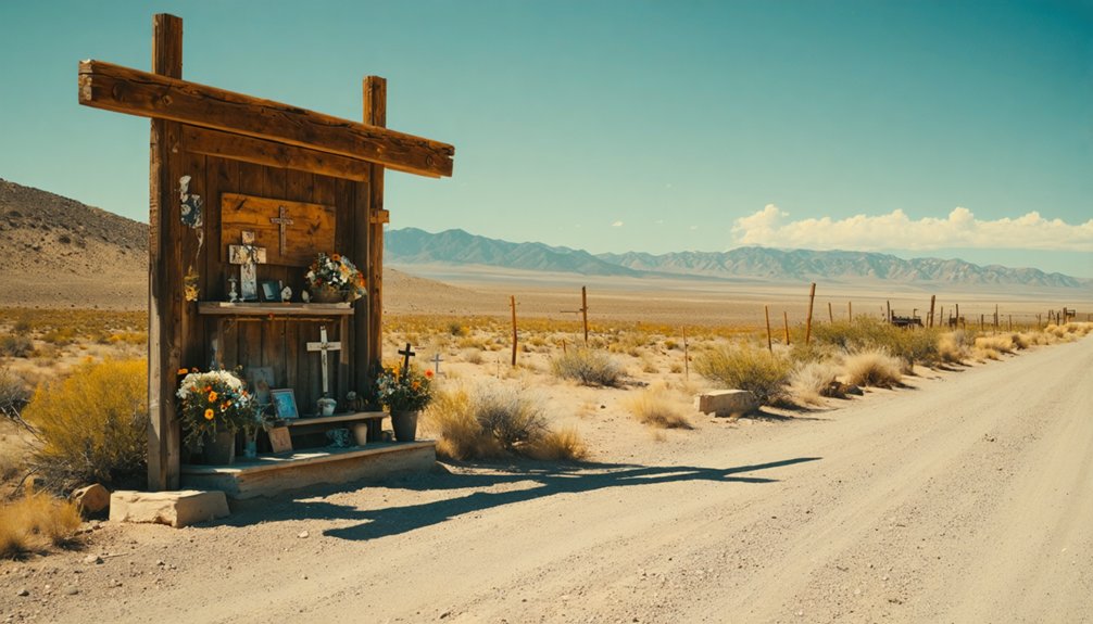
Before you leave the area, make a quick stop at the Shrine to Santa Rita, tucked at the intersection of Hwy 152 and Hwy 356 in nearby Hanover. You’ll find it easy to access from the road, requiring little more than a brief pull-off.
The shrine carries real historical weight, honoring the same Santa Rita del Cobre whose name once defined an entire copper-mining community before the pit swallowed it whole.
Shrine Location And Access
If you’re driving between the Chino mine site and Silver City, a small shrine at the intersection of Hwy 152 and Hwy 356 in Hanover marks one of the more quietly resonant stops on the route.
Local legends tie this roadside landmark to the broader story of abandoned structures and displaced communities that define Santa Rita’s arc.
- Sits at a clearly marked highway intersection in Hanover
- Accessible by standard vehicle with easy roadside parking
- No admission, gates, or restricted hours
- Pairs naturally with a westward drive toward Silver City
- Adds historical texture without requiring a detour
Pull over, take five minutes, and let the landscape speak. The shrine connects the copper country’s past to the open road in front of you.
Historical Significance Explained
The shrine’s presence at that crossroads isn’t accidental. Hanover sits near the edge of what was once a thriving copper settlement, and the surrounding landscape carries the weight of local legends, displacement, and lives interrupted by industrial ambition.
You’re standing near ground where Spanish colonists, Apache warriors, and mining laborers all clashed, traded, and disappeared. Ghost stories from this region don’t require much imagination — the land itself tells them.
The shrine marks something older than tourism: a community’s attempt to hold onto identity even as the earth beneath Santa Rita was being systematically removed. When you stop here, you’re not just reading a roadside marker. You’re touching the edge of a history that got swallowed by one of America’s most aggressive open-pit mining operations.
Plan Your Drive to the Chino Mine Area
Sitting about 15 miles east of Silver City along Highway 152, the Chino Mine area marks what was once Santa Rita del Cobre, a copper settlement founded in 1803 that’s since been swallowed whole by the open pit that replaced it. You’re driving into erased history here, where scenic viewpoints reveal a crater-sized wound in the earth instead of a town.
Before or after your visit, explore Silver City’s local cuisine to ground the trip in present-day culture.
- Watch for the mine overlook pull-offs along Hwy 152
- Stop at the Shrine to Santa Rita at Hwy 152 and Hwy 356 in Hanover
- Bring a camera for the open-pit scale
- Research Kennecott’s 1932 takeover for context
- Note the pit’s eastern expansion toward the original townsite
What to Know Before You Visit Ghost Towns in Grant County
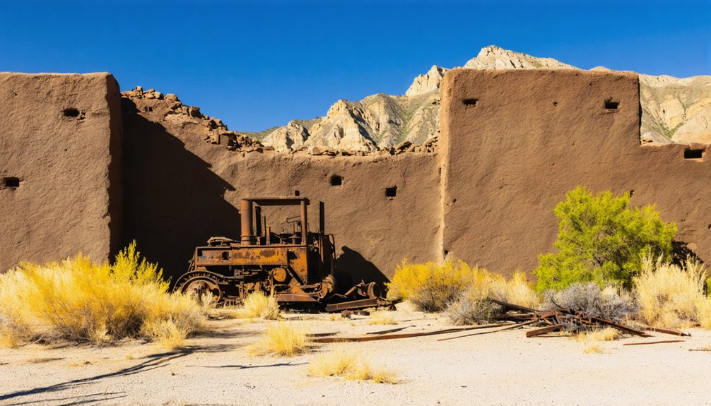
Ghost towns in Grant County don’t give themselves up easily, and Santa Rita is the starkest example of that resistance—what was once a copper settlement of 6,000 residents has been excavated out of existence, leaving an open pit where a town used to stand.
Tourist infrastructure here is minimal by design; the mine is an active operation, not a curated attraction. You’re visiting a landscape shaped by industrial necessity, not cultural preservation.
Bring water, download offline maps, and check road conditions before heading out on Highway 152.
Silver City, about 15 miles west, serves as your practical base with lodging and fuel.
Approach the site with realistic expectations—what you’ll find is absence, and understanding that absence is the entire point of the trip.
Frequently Asked Questions
Are There Guided Tours Available at the Chino Open-Pit Mine Site?
The knowledge doesn’t confirm tour availability at Chino’s open-pit mine site. You’ll want to contact Chino Mine directly to uncover your access options and explore this mine history that’s swallowed an entire town whole.
Is There an Admission Fee to Visit the Santa Rita Area?
You’ll pay no admission fee to explore the Santa Rita area—you’re free to roam its mining history, chase local legends, and witness the vast Chino open-pit landscape that swallowed an entire town whole.
What Is the Best Time of Year to Visit Grant County?
Spring and fall offer the best seasonal weather for your Grant County visit. You’ll enjoy mild temperatures perfect for exploring ghost town remnants, and you can time your trip around local festivals celebrating the region’s rich mining heritage.
Are Pets Allowed When Exploring Ghost Town Sites in New Mexico?
Pet policies vary by site, but you can often bring leashed dogs to New Mexico ghost towns. Respect wildlife considerations — desert creatures reclaim these forgotten places, and your pet’s presence can disturb that fragile, hard-won wildness.
How Long Does a Typical Visit to the Santa Rita Site Take?
You’ll spend about two hours exploring the Santa Rita site, where photography opportunities unfold across a vast industrial landscape steeped in history. Seek historical artifacts, breathe the open air, and let the erased town’s story move freely through you.
References
- https://blaknissan.wordpress.com/2017/12/11/santa-rita-new-mexico-ghost-town-in-the-sky/
- https://www.youtube.com/watch?v=5nE-alI5vhg
- https://westernmininghistory.com/towns/new-mexico/santa-rita/
- https://www.onlyinyourstate.com/state-pride/new-mexico/chino-mine-santa-rita-nm
- https://en.wikipedia.org/wiki/Santa_Rita
- https://www.ghosttowns.com/states/nm/santarita.html
- https://upcolorado.com/media/acfupload/9781607321538.pdf
- https://es.wikipedia.org/wiki/Santa_Rita_(Nuevo_México)
- https://blaknissan.wordpress.com/2019/10/28/return-to-santa-rita-ghost-town-in-the-sky/