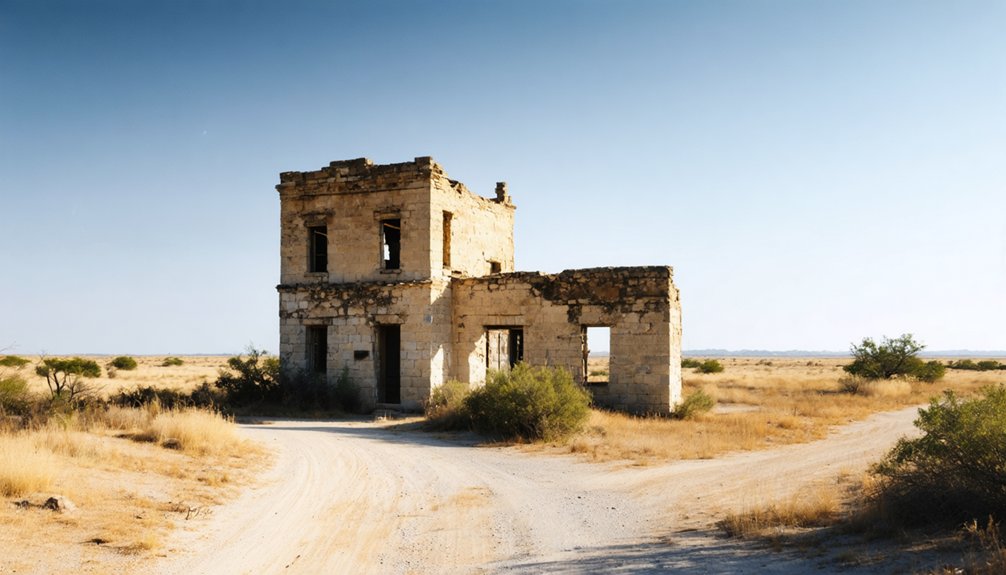
Planning a ghost town road trip to Santa Rita, Texas, means chasing a place that’s virtually vanished. You’ll find no ruins or standing structures — just a Texas historical marker near Villa Nueva off Highway 281. Santa Rita was once Cameron County’s first Anglo-American settlement and county seat, but the Rio Grande’s shifting course erased it by the 1930s. Stick around to uncover everything you need to make this haunting road trip unforgettable.
Key Takeaways
- Santa Rita, Texas, once Cameron County’s first Anglo-American settlement, vanished by the 1930s, leaving only a Texas historical marker near Villa Nueva off Highway 281.
- No structures or ruins remain, so visiting involves reading the historical marker and imagining the town’s past across open terrain.
- Visit during winter or early spring to avoid extreme summer heat, and bring water, sunscreen, a hat, and sturdy shoes.
- Use Brownsville as your base, located just 1–2 miles away, offering hotels, restaurants, and easy access to the site.
- Extend your road trip by combining Santa Rita with Clarksville, Old Bagdad, and Palo Alto Battlefield National Historic Site nearby.
Why Santa Rita Was Texas’s First County Seat?
When Cameron County was officially created in February 1848, Santa Rita already had roots stretching back to the late 18th century, making it the natural choice for the county’s first government seat. The settlement predated even Matamoros, established in 1826, giving it a legacy rich enough to fuel local legends for generations.
You’ll find that Santa Rita’s authority was short-lived. Brownsville won the county-seat election that December, and residents quickly packed up and moved.
How the Rio Grande Erased Santa Rita From the Map
When you trace Santa Rita’s decline, you find that the Rio Grande itself delivered the first blow — around 1830, the river shifted course and stranded the settlement on the north bank, cutting it off from its Mexican roots.
That geographic isolation chipped away at the town’s identity and economic footing, accelerating its slide into irrelevance after Brownsville claimed the county seat in late 1848.
River’s Changing Course
Around 1830, the Rio Grande shifted course and quietly sealed Santa Rita’s fate. The river’s movement placed the town on the north side of the water, cutting it off from its Mexican roots and reshaping everything the community had built.
What once felt like solid ground became contested, uncertain territory.
Local legends suggest residents held onto their celebration traditions even as the land changed beneath them, refusing to let geography erase their identity overnight. But the river didn’t negotiate.
In 1834, the Mexican government granted the banco de Santa Rita to John Stryker, signaling that outside forces were already redrawing the map.
You can’t fight a river, and Santa Rita’s people eventually stopped trying. The shift didn’t just move water — it dismantled a way of life.
North Bank Isolation
Once the Rio Grande shifted north, it didn’t just redraw a boundary — it stranded Santa Rita in political and cultural limbo. Residents who’d built their lives on Mexican soil suddenly found themselves standing on Texas ground, caught between two governments, two legal systems, and two identities.
That isolation accelerated Santa Rita’s decline faster than any flood could. Without clear jurisdiction or protection, cultural preservation became nearly impossible. Local legends survived longer than the buildings did, passed through families who remembered what the town once meant.
Town’s Final Disappearance
By the 1930s, Santa Rita had vanished completely — not through dramatic collapse, but through slow erasure. The Rio Grande’s shifting course had already isolated the settlement decades earlier, and time did the rest. Residents drifted toward Brownsville, structures crumbled, and the land reclaimed itself quietly.
You won’t find ruins here. There’s no ghost town preservation effort protecting old walls or foundations — nothing survived long enough to save. What remains is purely historic significance, carried forward through a single Texas historical marker near Villa Nueva.
That marker is your anchor point when you visit. It tells you what once stood here: the first Anglo-American settlement on the lower Rio Grande, a county seat, a community that shaped early Cameron County before disappearing without ceremony.
What You’ll Actually Find at the Santa Rita Site Today?
When you arrive at the Santa Rita site today, you won’t find standing buildings or visible remnants of the town — everything vanished by the 1930s.
What you *will* find is the Texas historical marker near Villa Nueva, reachable by heading west on Highway 281 from Brownsville for one mile, then south about 100 yards.
The small nearby colonia of Villa Nueva serves as your only modern landmark in an otherwise quiet stretch of the Rio Grande Valley.
The Historic Marker Remains
Although Santa Rita once served as Cameron County’s first government seat, you won’t find any standing structures, foundations, or ruins when you visit the site today. The site’s cultural significance lives almost entirely through one surviving artifact — the Texas historical marker near Villa Nueva.
Here’s what that marker delivers:
- Location context — It sits off Highway 281, roughly one mile west of Brownsville, then south about 100 yards.
- Historical confirmation — It formally identifies Santa Rita as Cameron County’s first Anglo-American settlement and 1848–1849 county seat.
- Archaeological findings acknowledgment — It honors a vanished community that disappeared completely by the 1930s, with no physical remains left to excavate or explore.
The marker is modest but meaningful — your clearest window into Santa Rita’s forgotten story.
No Original Structures Survive
Since Santa Rita vanished completely by the 1930s, you won’t find ruins, foundations, or any trace of the town’s original footprint when you arrive at the site today. The landscape offers open terrain, modest surroundings near Villa Nueva, and little visual evidence that a county seat once stood here.
No archaeological findings have been publicly documented or made accessible to visitors, leaving the site without physical artifacts to explore. That absence doesn’t diminish Santa Rita’s cultural significance — it actually sharpens it.
You’re standing where Texas history pivoted, where early Rio Grande settlement shaped an entire region’s identity. The experience demands imagination rather than observation. Bring your curiosity, read the historic marker carefully, and let the emptiness remind you how completely time can erase even meaningful places.
Villa Nueva Nearby Today
What you’ll find at the Santa Rita site today isn’t a ghost town in the cinematic sense — it’s the quiet colonia of Villa Nueva, a modest residential community that now occupies the surrounding area near where the old county seat once stood.
Locals carry fragments of local legends and ghost stories tied to the land, keeping Santa Rita’s memory alive in conversation rather than crumbling walls.
When you visit, here’s what to expect:
- The historic marker near Villa Nueva — your primary physical connection to Santa Rita’s past
- Residential streets replacing any trace of the original settlement
- Rio Grande views offering geographic context for understanding how the river shaped the town’s fate
How to Get to Santa Rita From Brownsville
Getting to Santa Rita from Brownsville is a quick and straightforward drive. Head west on Highway 281 for about one mile, then turn south and travel roughly 100 yards toward the colonia of Villa Nueva. That’s where you’ll find the Texas historical marker commemorating one of the region’s most significant historic landmarks.
The drive takes only minutes, leaving you plenty of freedom to explore the broader Rio Grande Valley at your own pace.
Don’t expect standing structures — Santa Rita’s value lies in its local legends and layered borderlands history, not its architecture.
The marker itself anchors the experience, giving you a tangible connection to a town that served as Cameron County’s first seat of government before disappearing entirely by the 1930s.
When to Visit Santa Rita
Winter and early spring are your best windows for visiting Santa Rita, when South Texas temperatures stay mild and the Rio Grande Valley’s humidity hasn’t yet climbed into uncomfortable territory. You’ll move freely around the historic site signage without battling oppressive heat, making ghost town preservation details easier to absorb and photograph.
Plan your visit around these three timing tips:
- November through March offers the coolest, most comfortable outdoor conditions near Villa Nueva.
- Weekday mornings give you quieter access to the marker area without weekend traffic on Highway 281.
- Avoid summer months — July and August bring brutal heat that shortens any outdoor stop considerably.
Keep your visit flexible; Santa Rita rewards curiosity, not rigid schedules.
What to Bring for Your Santa Rita Stop?
Since Santa Rita offers no shade structures, water stations, or facilities of any kind, you’ll want to pack smart before leaving Brownsville. Bring plenty of water, sunscreen, and a wide-brimmed hat — the Rio Grande Valley sun is relentless year-round.
Wear sturdy, closed-toe shoes since the terrain near Villa Nueva is uneven and brushy. You’ll also encounter local wildlife, including birds, lizards, and insects common to South Texas borderlands, so light long sleeves help.
Don’t underestimate the photographic opportunities here. The historic marker, the open Rio Grande landscape, and the raw, empty terrain tell a compelling visual story. Bring a fully charged camera or phone.
A printed or downloaded map is wise too, since cell service can be inconsistent near the site.
Nearby Historic Stops to Pair With Santa Rita
Since Santa Rita’s historic marker takes only minutes to visit, you’ll want to round out your trip with Brownsville’s rich heritage sites, including the Stillman House Museum and the Historic Brownsville Museum.
From there, you can trace the Rio Grande borderlands by exploring nearby landmarks that reflect the region’s layered Spanish, Mexican, and American past.
Cameron County rewards curious road-trippers with enough historical stops to turn a brief ghost-town detour into a full, meaningful day along the valley.
Brownsville Heritage Sites
Because Santa Rita’s ghost town site leaves little to see beyond a historic marker, pairing your visit with Brownsville’s heritage stops turns a brief roadside detour into a fuller day of borderlands history. The city anchors serious cultural preservation efforts and archaeological research that bring this region’s layered past to life.
- Stillman House Museum – Tour one of Brownsville’s oldest surviving homes and trace the city’s founding-era story firsthand.
- Brownsville Heritage Museum – Explore exhibits covering Rio Grande Valley settlement, ranching culture, and the Mexican-American War period that shaped Cameron County.
- Fort Brown Memorial Center – Walk grounds where U.S. military presence defined the borderlands during the 1840s conflict that made Santa Rita historically significant.
Brownsville gives your ghost town road trip genuine historical depth.
Rio Grande Borderlands Landmarks
Brownsville’s museums ground your visit in local history, but the Rio Grande Valley stretches well beyond the city limits with borderlands landmarks worth adding to your route. Follow Highway 281 west and you’ll find yourself tracing a corridor rich with cultural influences that shaped life on both sides of the river for centuries.
Presidio La Bahía’s regional legacy echoes here, and local legends tied to early ranching families still color the landscape around Villa Nueva. Stop at the Palo Alto Battlefield National Historic Site, where the first major engagement of the Mexican-American War unfolded.
Each stop builds context, transforming Santa Rita from an isolated marker into one thread of a larger, living borderlands story you can explore entirely on your own terms.
Cameron County Historical Stops
Cameron County holds enough history to fill a full road-trip day once you’ve checked Santa Rita off your list. The region rewards curious travelers who value cultural preservation and want to understand how land grant disputes and borderlands politics shaped this corner of Texas.
Pair your Santa Rita stop with these nearby landmarks:
- Fort Brown – The former U.S. military post in Brownsville where the Mexican-American War’s first shots echoed across the Rio Grande.
- Stillman House Museum – A preserved 1850s home offering direct insight into early Brownsville settlement and merchant life.
- Palo Alto Battlefield National Historical Park – A federally protected site commemorating the first major battle of the Mexican-American War on Texas soil.
Each stop deepens the story Santa Rita started.
Brownsville Bases for Your Santa Rita Day Trip
Since Santa Rita’s historic marker is only about a mile or two from downtown Brownsville, you’ll find it easy to use the city as your home base for this day trip. Brownsville offers plenty of hotels, restaurants, and fuel stops, so you can move freely without worrying about logistics.
Start your morning in Brownsville, then head west on Highway 281 toward Villa Nueva to reach the marker.
You’ll gain a deeper appreciation for Santa Rita’s historical significance when you realize how close this forgotten first county seat sat to the city that replaced it.
Understanding Santa Rita’s settlement origins makes Brownsville itself feel richer with meaning.
After visiting the marker, you’ve got the rest of the day to explore Brownsville’s own borderlands history nearby.
Combining Santa Rita With Other Rio Grande Ghost Towns
The Rio Grande Valley holds more ghost town history than a single marker can satisfy, so pairing Santa Rita with other vanished borderlands communities turns a short stop into a fuller road trip. The region rewards explorers chasing local legends and ghost town myths across forgotten settlements.
Consider building your route around these stops:
- Clarksville, Texas – An early Rio Grande landing site with deep borderlands history and its own erasure story.
- Old Bagdad – A once-thriving port community swallowed by time and river shifts near the Gulf coast.
- Edinburgh (original townsite) – A relocated county seat carrying layers of political and cultural history.
Each stop adds context, making Santa Rita feel less like an isolated curiosity and more like one chapter in a larger, gripping story.
Why Santa Rita’s History Makes the Drive Worth It?

Few ghost towns carry the historical weight that Santa Rita does — you’re standing at what’s believed to be the first county seat of Cameron County, a settlement that predates Brownsville and once anchored early Anglo-American life along the lower Rio Grande.
Santa Rita isn’t just a ghost town — it’s the forgotten birthplace of Cameron County itself.
Beyond ghost town legends, this site holds early settlement stories stretching back to the late 18th century, when ranching families shaped the borderlands long before modern Texas existed.
The Rio Grande literally shifted course around 1830, redrawing boundaries and sealing Santa Rita’s fate. By the 1930s, nothing remained.
That erasure makes the drive even more meaningful — you’re not chasing ruins but reclaiming forgotten history. The Texas historical marker near Villa Nueva becomes your connection to a community that governed, survived conflict, and quietly disappeared.
Frequently Asked Questions
Is There an Entrance Fee to Visit the Santa Rita Historic Marker?
You don’t pay a fee to visit the Santa Rita historic marker — it’s free to all. Its historical significance and preservation efforts guarantee you can freely explore this landmark and connect with Texas’s earliest county seat.
Are There Restrooms Available Near the Santa Rita Historic Marker Site?
You won’t find restroom facilities at the Santa Rita historic marker site. For nearby amenities, head back to Brownsville, where you’ll discover plenty of stops to refresh before continuing your free-spirited ghost town adventure.
Can You See the Rio Grande From the Santa Rita Marker Location?
You might catch glimpses of the Rio Grande near the marker, adding scenic viewpoints to your ghost town history experience. The river’s proximity makes your visit feel connected to Santa Rita’s vanished riverside past.
Is the Road to the Santa Rita Marker Paved or Unpaved?
The knowledge doesn’t confirm whether the road’s paved or unpaved, so check local conditions before heading out. Road conditions and trail difficulty can vary, so you’ll want to verify with Cameron County before your adventure begins.
Is the Santa Rita Historic Marker Accessible for Visitors With Disabilities?
Over 26% of Americans live with a disability. The knowledge base doesn’t confirm specific accessibility features or visitor amenities at the Santa Rita marker, so you’ll want to contact Cameron County or TxDOT directly before visiting.
References
- https://en.wikipedia.org/wiki/Santa_Rita
- https://www.texasescapes.com/TexasGulfCoastTowns/Santa-Rita-Texas.htm
- https://en.wikipedia.org/wiki/List_of_ghost_towns_in_Texas
- https://www.texasescapes.com/TOWNS/Texas_ghost_towns/Texon_Texas/Texon_Texas.htm
- https://www.tshaonline.org/handbook/entries/santa-rita-tx
- https://atlas.thc.texas.gov/Details/5061004586
- https://www.tshaonline.org/handbook/entries/rita-santa-tx
- https://www.texasstandard.org/stories/best-texas-the-ghost-town-with-the-worst-reputation/
- https://de.abcdef.wiki/wiki/Santa_Rita
- https://www.youtube.com/watch?v=LoKzmuCpSYc



