Planning a ghost town road trip to Simonsville, Nevada means embracing a different kind of discovery. You won’t find crumbling facades or dusty relics waiting for you on the east bank of the Muddy River. Modern flood control infrastructure and road realignments have erased nearly every trace of this once-thriving Moapa Valley settlement. What remains is a place-name, a landscape, and a layered history worth understanding. Stick around to uncover everything this vanished town still has to offer.
Key Takeaways
- Simonsville sits on the east bank of the Muddy River in Nevada’s Moapa Valley, west of Overton Airport in Clark County.
- No standing structures, ruins, or markers remain; modern flood control infrastructure has almost entirely replaced the original townsite.
- Access Simonsville via I-15 northeast from Las Vegas, approximately 60 miles, then follow local roads toward Overton Airport.
- Visit between October and April to avoid extreme desert heat and enjoy comfortable exploration conditions.
- Pair Simonsville with Rhyolite or Belmont for a layered ghost town itinerary balancing historical and visual experiences.
What Was Simonsville and What Happened to It?
Simonsville once occupied the east bank of the Muddy River in Nevada’s Moapa Valley, but today it’s little more than a place-name on a map.
Like many Nevada settlements shaped by frontier boom cycles and mining history, Simonsville couldn’t outlast the forces that eventually erased it.
Settlement decline came not just from economic shifts but from physical transformation — a Clark County flood control bridge and Airport Road realignments consumed much of the original townsite.
You won’t find standing structures or preserved districts here.
The site sits west of the south end of Overton Airport, now defined more by modern infrastructure than pioneer origins.
If you’re drawn to lost places and regional history, Simonsville still carries meaning — just don’t expect the town itself to be waiting for you.
Where Is Simonsville Located in Nevada?
Tucked into Nevada’s Moapa Valley, the former townsite of Simonsville sits on the east bank of the Muddy River in Clark County. You’ll find it west of the south end of Overton Airport, though don’t expect abandoned structures or sprawling ruins waiting for you. Modern infrastructure has reshaped this landscape considerably.
Simonsville once thrived along the Muddy River — today, only geography remembers its name.
Three key location facts help you plan your visit:
- The site sits within Clark County, placing it inside southeastern Nevada’s road-trip corridor.
- A Clark County flood control bridge and Airport Road realignments now occupy much of the original townsite.
- Hidden histories here survive in name and geography rather than standing buildings.
Understanding this geography sets realistic expectations, letting you appreciate Simonsville for what it truly is — a place where history whispers rather than shouts.
What’s Left to See at the Simonsville Ghost Town Site?
What you’ll find at Simonsville today is far less dramatic than a classic ghost town. Unlike sites wrapped in ghost town legends and urban decay, Simonsville offers almost nothing standing.
A Clark County flood control bridge and road realignments have consumed most of the original townsite, leaving the location largely erased rather than frozen in time.
You’re not walking through crumbling storefronts or photographing collapsed homesteads here. The site sits west of the south end of Overton Airport, but don’t expect markers or preserved structures pointing you toward history.
What remains is fundamentally a place-name tied to a vanished settlement.
Your visit draws value from knowing what once existed, not from what you can see. Come prepared with historical context, and you won’t leave disappointed.
What to Expect on the Ground at a Largely Vanished Ghost Town Site
Visiting a largely vanished ghost town means adjusting your expectations before you arrive. Simonsville won’t greet you with dramatic ruins or famous legends carved into crumbling facades. Instead, you’ll find a flood control bridge, realigned roads, and the quiet weight of local legends tied to a place the landscape has nearly swallowed whole. That contrast is exactly what makes it worth understanding.
Here’s what to keep in mind on the ground:
- Infrastructure has replaced the original townsite almost entirely.
- No commercial services, museums, or preserved structures exist at the location.
- Historical context carries more value here than any physical remains.
Come prepared with research, not a checklist of ruins. The story of Simonsville lives in its disappearance, not its buildings.
How to Reach Simonsville From Las Vegas

From Las Vegas, you’ll head northeast on I-15 toward the Moapa Valley, a drive of roughly 60 miles that carries you into the quieter stretch of Clark County where Simonsville once stood.
Exit toward Overton and follow the local roads into the valley, keeping the Muddy River corridor as your geographic anchor.
Once you’re near the south end of Overton Airport, look for Airport Road, where flood-control infrastructure and road realignments have largely replaced what was once the townsite.
Las Vegas Starting Point
Heading northeast out of Las Vegas, you’ll follow US-93 through the Mojave Desert before the Moapa Valley opens up around you near Overton. The drive runs roughly 60 miles and sets the stage for separating ghost town myths from reality.
Simonsville sits on the east bank of the Muddy River, west of Overton Airport’s south end. Keep these navigation points in mind:
- Take US-93 North from Las Vegas toward the Valley of Fire interchange.
- Continue into Moapa Valley, following signs toward Overton.
- Locate Airport Road near Overton Airport, where historic preservation efforts have largely given way to flood-control infrastructure.
Expect a straightforward desert drive with minimal stops until you reach the Moapa Valley corridor.
Route Through Moapa Valley
Once you’ve cleared Las Vegas’s northern sprawl on US-93, the Mojave gives way to the broader, quieter stretch of the Moapa Valley, and that’s where your route to Simonsville takes shape.
Stay on I-15 North, then exit toward Overton via Nevada State Route 169. The drive runs roughly 60 miles from Las Vegas, cutting through open desert before the valley floor opens up around you.
You’re heading for the east bank of the Muddy River, west of Overton Airport’s south end. Don’t expect abandoned structures greeting you at the roadside — modern flood-control infrastructure and Airport Road realignments have reshaped this ground considerably.
Simonsville’s historical significance lies beneath that pavement now. Treat the drive itself as part of the experience, not just a means to reach it.
Navigating Airport Road
Airport Road is your final approach to Simonsville, and it’s changed considerably from what early settlers would’ve traveled. Road realignments tied to flood control infrastructure have reshaped this corridor, so don’t expect a straightforward historic path.
Use these directions before you arrive:
- Locate the Clark County flood control bridge as your primary landmark near the former townsite.
- Position yourself west of the south end of Overton Airport to confirm you’re in the right area.
- Cross-reference digital archives and local preservation efforts to understand what stood here before development erased it.
You’re essentially steering through modern infrastructure layered over a lost town.
The road won’t signal anything dramatic, so arrive informed, move independently, and let the historical context guide your experience.
How Simonsville Compares to Rhyolite and Belmont
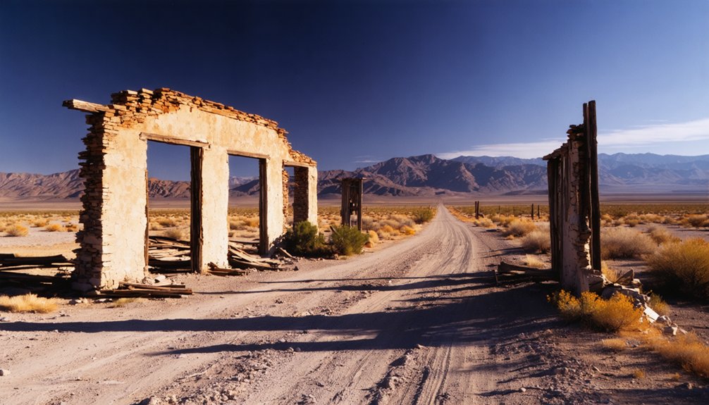
When you stack Simonsville against Rhyolite or Belmont, the visibility gap is immediate — Rhyolite once held more than 5,000 residents and still draws tourists with standing ruins, while Belmont remains well-preserved with ongoing activity.
But Simonsville’s site is mostly lost to road realignments and flood-control infrastructure. That difference in tourist appeal means you won’t find museums, guided tours, or photo-ready ruins waiting for you here.
Use Simonsville as a brief historical stop and pair it with Rhyolite or Belmont to build an itinerary that balances vanished townsites with more visually intact destinations.
Visibility Of Remains
Simonsville doesn’t give you much to look at, and that’s the honest truth of visiting a ghost town that’s been largely swallowed by modern infrastructure. Urban decay never really had a chance here — preservation challenges eliminated most traces before anyone could document what stood.
Compare that to what you’ll find elsewhere:
- Rhyolite delivers striking ruins, bottle houses, and a well-documented boom-era story for thousands of visitors.
- Belmont still holds standing structures and an active sense of history you can physically walk through.
- Simonsville offers a flood control bridge, realigned roads, and a place-name that outlasted the town itself.
You’re not here for dramatic ruins. You’re here because knowing a place existed — even erased — carries its own kind of freedom.
Tourist Appeal Differences
Tourist appeal breaks down fast when you line these three towns up side by side. Rhyolite pulls crowds with its iconic ruins, documented history of 5,000 residents, and strong visual payoff.
Belmont rewards explorers with standing structures and a well-preserved atmosphere that makes the past feel tangible.
Simonsville can’t compete on those terms. Its archaeological significance is real, but preservation challenges have erased most of what once stood there. Bridge construction and road realignments claimed the physical evidence, leaving you with a location rather than an experience.
That distinction matters when you’re mapping a road trip. If visual impact drives your itinerary, prioritize Rhyolite or Belmont first. Then add Simonsville for what it represents — a place where history survives in name more than in structure.
Itinerary Pairing Value
Building a Nevada ghost-town itinerary means balancing visual payoff against historical depth, and that’s exactly where Simonsville earns its place. Pair it strategically with stronger destinations and you’ll cover Nevada’s full ghost-town spectrum.
- Rhyolite delivers mining history at scale — boom-era ruins, a documented population above 5,000, and established tourist infrastructure.
- Belmont offers well-preserved pioneer settlements with standing structures that reward photographers and history enthusiasts equally.
- Simonsville anchors the “nearly erased” category, where the place-name outlives the physical town — a compelling contrast that deepens your understanding of how settlements vanish.
You’re not choosing between these stops; you’re building layers. Simonsville works because it reframes what ghost towns mean — not just ruins, but lost geography worth tracking down.
Best Nevada Ghost Towns to Pair With Simonsville
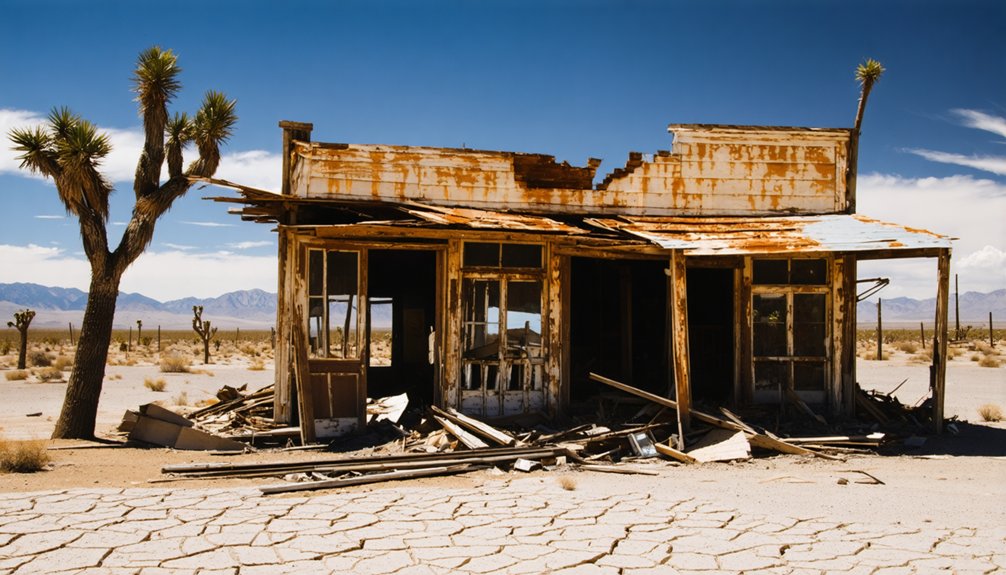
Because Simonsville’s remains are largely lost to flood-control infrastructure and road realignments, you’ll want to pair it with ghost towns that offer more to see.
Rhyolite is Nevada’s most famous option, giving you genuine ghost town architecture from its early 1900s boom era when more than 5,000 residents called it home. Despite preservation challenges, its ruins remain striking and well-documented.
Belmont offers a different experience as a well-preserved ghost town with some ongoing activity, making it a strong visual contrast to Simonsville’s near-invisible footprint.
Together, these stops create an itinerary that spans Nevada’s ghost-town spectrum, from nearly erased townsites to partially standing settlements.
You’ll leave with a clearer sense of how differently time and development treat forgotten places across the state.
When Is the Best Time to Visit Simonsville?
Since Simonsville sits in Nevada’s Moapa Valley, timing your visit around the desert climate makes a real difference in comfort. You’ll want conditions that let you explore freely without heat cutting your time short.
The three best windows for visiting are:
- October through November – Mild temperatures and clear skies make walking the site easy, giving you space to absorb its historical context.
- February through April – Cool mornings support unhurried exploration, ideal for those interested in historic preservation details and what little ghost town architecture survives.
- Early December – Quiet roads and low crowds suit travelers who prefer solitude when visiting lost townsites.
Avoid July and August entirely. Desert heat above 100°F turns even a brief historical stop into an uncomfortable experience.
Planning a Moapa Valley Ghost Town Route Around Simonsville
Pairing Simonsville with more visually intact ghost towns turns a brief historical stop into a rewarding full-day route through southeastern Nevada. Since Simonsville’s site is mostly lost to flood-control infrastructure and road realignments, its value leans heavily on archaeological significance rather than standing ruins.
Use that context to your advantage by anchoring your route in Moapa Valley, then extending toward better-preserved destinations like Belmont or Rhyolite, where historic preservation efforts have left far more to explore.
Treat Simonsville as your opening chapter — a place where the name outlasted the town — and let each subsequent stop build on that story.
This approach gives you both the raw, vanished-settlement experience and the visual payoff that makes a ghost-town road trip genuinely satisfying.
Frequently Asked Questions
Is There an Entrance Fee to Visit the Simonsville Ghost Town Site?
You won’t pay an entrance fee to explore Simonsville’s largely vanished site. It’s freely accessible, supporting historical preservation efforts while offering modest photography opportunities near the flood control bridge and Airport Road realignments defining this lost townsite.
Are Pets Allowed When Visiting the Simonsville Area in Clark County?
Ah yes, your dog’s *dying* to see a flood control bridge! Pet safety matters here — you’re on public roads, so leashed pets are generally fine, but watch for wildlife encounters in the Moapa Valley desert surroundings.
Can I Find Simonsville Marked on Google Maps or GPS Navigation Apps?
You’ll likely find Simonsville marked on Google Maps and GPS apps, but don’t rely solely on them. Cross-reference historical landmarks guides and scout photography opportunities once you’ve confirmed the Clark County flood control bridge location yourself.
Is the Simonsville Site Accessible to Visitors With Mobility Limitations?
You’ll face real mobility challenges at Simonsville since it’s tied to road infrastructure and flood-control areas with uneven terrain. Accessibility options are extremely limited, so plan accordingly and prioritize better-preserved ghost towns if mobility matters to you.
Are There Any Guided Ghost Town Tours That Include Simonsville?
Like Brigadoon, Simonsville’s ghost is elusive — no guided tours currently include it. You’ll uncover its local legends and historical artifacts independently, forging your own trail through this vanished Nevada townsite.
References
- https://en.wikipedia.org/wiki/Simonsville
- https://travelnevada.com/ghost-town/
- https://www.youtube.com/watch?v=Bp2IcEQsWEM
- https://www.carsonnvmuseum.org/ghost-town/
- https://en.wikipedia.org/wiki/List_of_ghost_towns_in_Nevada
- https://cowboycountry.com/ghost-towns/