You’ll find over two dozen ghost towns scattered across eastern North Dakota’s prairies, remnants of the 1880-1920 railroad and agricultural boom. Notable examples include Brisbane, which lost crucial businesses after devastating fires in 1916 and 1920; Sherbrooke, once Steele County’s seat until losing that status in 1919; and Omemee, a railroad junction that peaked at 650 residents before track rerouting caused its decline. These abandoned settlements feature preserved structures like Crystal Springs’ 1916 brick school and Arena’s St. John’s Lutheran Church, with detailed locations available through archival resources and mapping tools that reveal the full story of each vanished community.
Key Takeaways
- Notable ghost towns include Brisbane (founded 1910), Sherbrooke (1884 former county seat), and Omemee (peaked at 650 residents in 1906).
- Towns declined due to railroad rerouting, fires, loss of governmental status, and economic shifts from livestock to grain farming.
- Preserved structures include Lincoln Valley’s bar, Arena’s St. John’s Lutheran Church, and Crystal Springs’ 1916 brick school and fountain.
- Access varies by location; Crystal Springs is reachable from I-94, while sites like Nanson require navigating remote terrain.
- Ghost stories persist at several towns, including Crystal Springs’ fire-related presence and Sims’ “Gray Lady Ghost” haunting melodies.
Brisbane: A Vanished Community in Grant County
The prairie winds sweep across section 9 of Township 133 north, Range 86 west, where Brisbane once stood as a thriving agricultural hub five miles southeast of present-day Carson.
You’ll find little evidence today of what the 1913 Leith Index called a “hustling little town,” though Brisbane History reveals a community that peaked with two banks, grain elevators, and essential businesses serving homesteaders who’d shifted from livestock to grain farming.
The post office application filed in 1910 marked Brisbane’s formal establishment, but fires in 1916 and 1920 devastated recovery efforts.
By 1993, when the post office closed, Brisbane’s Community Legacy had already faded into memory.
At 2,402 feet elevation, only spirits remain where dairymen and merchants once built their dreams.
The town once featured a general store and school that served the surrounding farming families.
Among the businesses that contributed to Brisbane’s brief prosperity was a hardware store and restaurant.
Sherbrooke: The Former County Seat That Lost Its Crown
If you’d driven through Steele County in 1896, you might’ve spotted President McKinley checking into the Sherbrooke House Hotel in a thriving county seat established in 1884.
The town served as Steele County’s governmental center for thirty-four years, hosting the courthouse, officials’ residences, and supporting businesses until voters chose Finley as a more accessible location in 1918.
What followed was a slow exodus—the county seat transferred in 1919, and by the 1980s, the last occupied home stood empty, leaving only ruins and a cemetery where a presidential stopover once brought prestige. Unlike the Canadian city sharing its name, which saw rapid growth in the 1850s due to railway connections, North Dakota’s Sherbrooke never secured the transportation links needed to sustain its population. The Canadian Sherbrooke, located in Quebec’s Eastern Townships, grew into a significant cultural and educational center that continues to thrive today.
Founded 1884, County Seat
In 1884, settler D. P. Baldwin named this new community after Sherbrooke, Quebec, establishing it within Sherbrooke Township in Steele County.
You’ll find its settlement history rooted in North Dakota’s territorial expansion—the legislature created Steele County in 1883, honoring Edward H. Steele of the Red River Land Company.
By 1885, Sherbrooke claimed the county seat designation, wresting it from Hope’s brief two-year tenure. Baldwin’s general store anchored early community development, joined by essential infrastructure: a courthouse, officials’ homes, hotel, post office, and livery stable.
The town even supported its own newspaper chronicling county commissioners’ activities. Without railroad or river access, Sherbrooke nonetheless functioned as governmental center until 1919, its importance demonstrated when President William McKinley lodged at Sherbrooke House Hotel in 1896. Like Wells County, which changed its county seat from Sykeston to Fessenden in 1894, Sherbrooke eventually lost its governmental status as populations shifted.
Loss to Finley 1919
Sherbrooke’s prominence as Steele County’s governmental center ended abruptly when voters chose relocation on June 28, 1918.
You’ll find that Finley’s transportation advantages—particularly railroad access—proved decisive in the election.
Sherbrooke residents challenged the results through North Dakota’s Supreme Court, but the justices upheld the voters’ decision in 1919.
The official county seat transfer triggered immediate community decline:
- Government buildings and county employees departed for Finley
- Businesses followed the economic activity to the new location
- Population dwindled as residents sought opportunities elsewhere
Without railroad or river access, Sherbrooke couldn’t sustain itself after losing its primary economic driver.
The town had been established as the county seat in 1885, with a county office building constructed the following year and a fire-proof vault added in 1891 to protect official records.
The town’s transformation into a ghost town became inevitable once the courthouse doors closed.
Today, you’ll discover only ruins where Steele County’s government once operated.
Presidential Visit and Decline
D. P. Baldwin’s vision for Sherbrooke began in 1881 when he established his general store in Steele County, naming the settlement after Sherbrooke, Quebec.
You’ll find the community’s presidential significance emerged when voters elected it county seat in 1885. County offices rose in 1886, expanded in 1888, housing officials whose homes dotted the landscape.
Yet infrastructure challenges sealed Sherbrooke’s fate—no railroad, no navigable river, just isolation. Business leaders demanded relocation to better-connected Finley.
When voters approved the move in 1918, Sherbrooke residents fought through North Dakota’s Supreme Court but lost. The 1919 transfer devastated the town.
Today, you’ll discover its community legacy in ruins: the imposing government building and the red treasurer’s residence, reoccupied by a schoolteacher’s family in the 1940s.
Omemee: From Bustling Railroad Junction to Empty Buildings
Two major railroads converged on Omemee in the early 1900s, transforming this Bottineau County settlement into one of eastern North Dakota’s most promising communities.
Starting in 1887 in Willow Vale Township, the town gained its first depot when Great Northern Railroad arrived in 1893. The Soo Line followed in 1905, creating a crucial junction. By 1906, you’d find 650 residents supporting thriving commerce.
Omemee’s railroad impact drove remarkable growth:
- Grain elevators, bank, blacksmith shop, hotel, and opera house served daily needs
- The Omemee Herald documented local affairs
- Dozens of homes housed families building futures
Railroad rerouting after 1910 devastated this hub. Businesses shuttered, residents departed, and population plummeted. The town initially aspired to become the county seat of Bottineau County, which would have secured its prominence in the region. Today, only a few empty structures stand as silent witnesses to Omemee’s prosperous past.
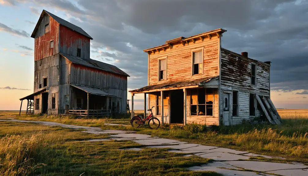
Exploring the Remnants of Abandoned Settlements
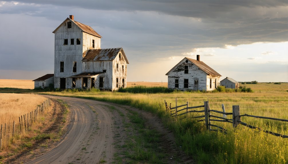
When you visit these abandoned settlements, you’ll find varying degrees of structural preservation, from Lincoln Valley’s intact bar and ice cream parlor to Nanson’s four isolated homes standing without power lines or telephone poles.
Accessing sites like Nanson in Rolette County requires traversing remote terrain, as it’s documented as the most isolated ghost town in the eastern region.
Arena’s St. John’s Lutheran Church and Sims’ active church represent the few structures that continue to serve their original purpose amid the surrounding abandonment.
Arena’s St. John’s Lutheran Church and Sherbrooke’s few remaining buildings serve as tangible evidence of communities that once thrived before rail connectivity and economic shifts forced residents elsewhere.
Many of these locations still maintain cemeteries that remain as the sole physical markers of their former communities.
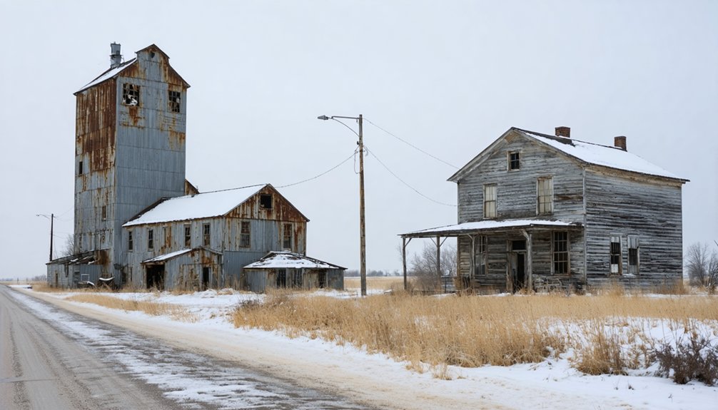
Historical Structures Still Standing
The remnants of Eastern North Dakota‘s abandoned settlements stand as weathered monuments to communities that once thrived across the prairie.
You’ll discover architectural remnants that tell stories of self-sufficient towns claimed by economic shifts and population decline.
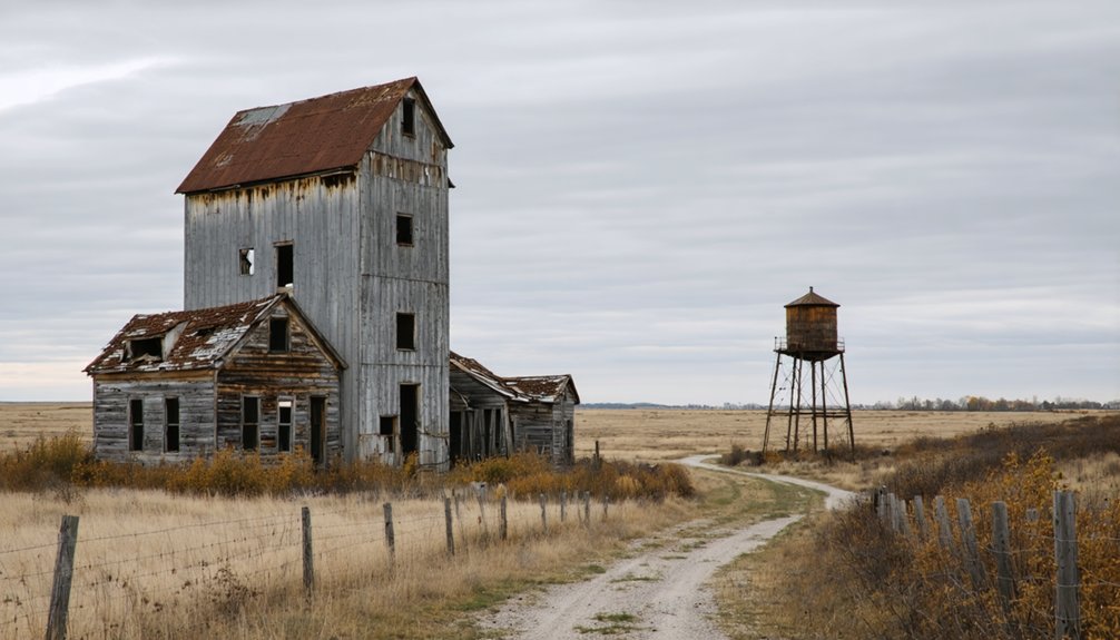
Crystal Springs showcases preserved landmarks from its prosperous era:
- The 1916 brick school commanding the hilltop, visible from I-94
- A 1935 fieldstone fountain earning National Register recognition in 2010
- The old church positioned across from the school
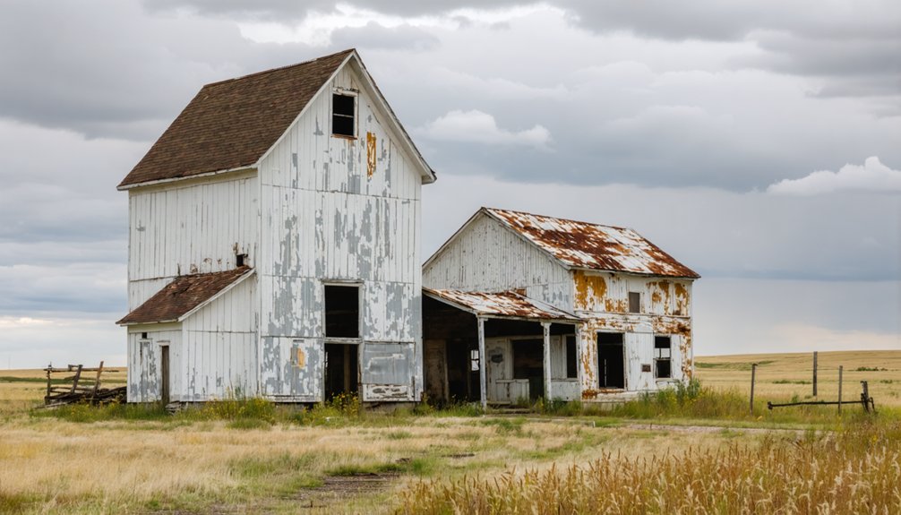
Sims maintains St. John’s Lutheran Church as an active landmark, while Charbonneau’s grain elevators and two-room schoolhouse persist as skeletal monuments.
These structures embody haunted history—not from supernatural forces, but from the tangible absence of bustling communities that once animated these buildings with purpose and life.
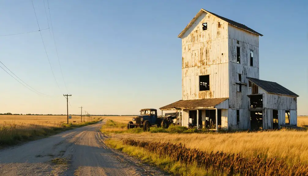
Accessing Remote Ghost Towns
Reaching these abandoned settlements requires careful maneuvering across North Dakota’s expansive prairie landscape, where deteriorating infrastructure and minimal road maintenance present genuine challenges to modern explorers.
Remote accessibility varies greatly—Nanson stands as the most isolated, lacking roads, power lines, or telephone poles entirely. You’ll find better-maintained routes to towns like Crystal Springs, visible directly from I-94, seven and a half miles east of Tappen.
Navigating ghost towns near Minot proves easier, with Tagus, Ruso, and Bergen reachable within thirty to sixty minutes via scenic drives. Blue Grass, thirty-five miles northwest of Mandan, never saw railroad service, complicating access.
The Ghosts of North Dakota website provides essential mapping tools and GPS coordinates for planning expeditions into these forgotten communities.
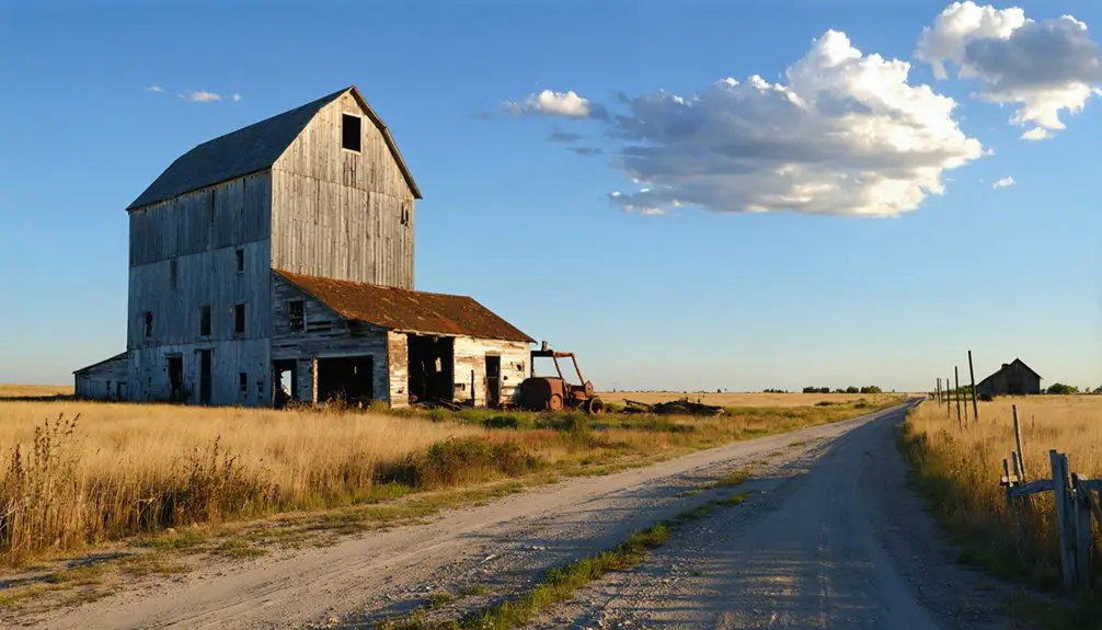
The Role of Railroads in Town Survival
Consider these stark realities:
- Ludden relocated one mile east in 1886 to reach the railroad, growing to 400 residents by 1890.
- Williamsport lost its county seat when tracks bypassed it by three miles, creating Hazelton instead.
- Bellmont withered without rail access and was destroyed by the 1897 flood.
Towns like Gascoyne (1907) and Wheelock (1902) sprang up specifically as railroad establishments, while bypassed settlements simply vanished.
Historic Structures That Still Stand Today
While railroad access determined which settlements survived, physical remnants of those abandoned communities continue to mark the prairie landscape.
You’ll find churches anchoring most ghost town sites—St. John’s Lutheran in Arena, Sims Scandinavian Lutheran Church still holding services, and Eastedge’s stone church visible from the interstate. Former Seventh Day Adventist Church at Deisem stands alone among tall grass concealing store and post office ruins.
These structures represent community heritage beyond mere buildings; they’re monuments to settlers who shaped eastern North Dakota. Historic preservation efforts remain minimal in remote locations like Nanson, where four abandoned homes lack power lines entirely.
Arena’s relocated country school and Eastedge’s collapsing white house demonstrate how time claims unprotected structures, leaving cemeteries as final markers of forgotten settlements.
Ghost Stories and Legends of Forgotten Places
Beyond the crumbling foundations and weathered tombstones, eastern North Dakota’s abandoned settlements harbor tales that refuse to die with their towns.
the ghost towns of northern North Dakota hold remnants of life that once thrived, with empty streets echoing the laughter of families that called these places home. Each site serves as a haunting reminder of the hopes and dreams that built entire communities, now left to the silence of the windswept plains. Exploring these forgotten areas offers a glimpse into the past, where history lingers like a whispered secret waiting to be unearthed.
As adventurers seek ghost towns available in North Dakota, they uncover remnants of a time when dreams were vividly alive. The stories behind each deserted house and abandoned storefront weave a rich tapestry of human experience that sparks curiosity and introspection. With every step taken through these eerie landscapes, one can almost hear the echoes of laughter blending with the whispers of the past, urging us to remember those who once walked these roads.
You’ll discover legends rooted in genuine historical tragedy and unexplained phenomena that captivated early settlers.
Crystal Springs’ persistent spiritual presence stems from its devastating fires and persistent church activity among remaining residents.
At Sims Scandinavian Lutheran Church, visitors report haunting melodies from the organ, attributed to the “Gray Lady Ghost” who plays intermittently in this Morton County sanctuary.
Griffin’s ghost stories trace back to spectral gatherings during the 1918 flu epidemic:
- Year-round square dances continued through deadly blizzards
- A carrier milkman died three days after contracting influenza
- His widow raised three children, including unborn daughter Olga
These documented events transformed into enduring supernatural folklore.
Visiting Eastern North Dakota’s Abandoned Sites
The folklore draws visitors, but the physical sites themselves offer tangible connections to North Dakota’s settlement era.
You’ll find Sherbrooke in Steele County accessible for ghost town exploration, while Eastedge and Straubville mark Barnes and Sargent Counties’ abandoned settlements.
Crystal Springs sits 7.5 miles east of Tappen along I-94, where its school remains visible from the Interstate. The Ghosts of North Dakota website provides searchable pins with maps and directions, letting you navigate rural roads independently.
Arena’s St. John’s Lutheran Church stands 35 miles northeast of Bismarck, showcasing the historical significance of frontier religious architecture.
Hamberg’s church displays no trespassing signs, but you can view it from the road. Most drives from regional hubs take 30-60 minutes through scenic countryside.
Preserving the Memory of Lost Communities
Documenting these vanished settlements requires piecing together fragments from county courthouses, newspaper archives at the North Dakota Historical Society, and Douglas Wick’s “North Dakota Place Names,” which records peak populations like Blabon’s 150 residents in 1914.
You’ll find cultural heritage preserved through multiple independent efforts:
- The “Ghosts of North Dakota” project photographs pioneer-era sites without critiquing decline
- YouTube videos and blogs capture intact remnants like Charbonneau’s schoolhouse
- RootsWeb listings include historical vignettes documenting forgotten places
These volunteer archivists safeguard community memories before structures disappear—many buildings in towns like Pickert were removed or burnt within the last decade.
You’re free to explore this history yourself, honoring the over 1,000 former towns that shaped North Dakota’s independent spirit.
Frequently Asked Questions
What Legal Permissions Are Needed to Explore Abandoned Buildings in Ghost Towns?
Like homesteaders once staked claims, you’ll need written consent from current owners before exploring. Property rights persist despite abandonment. Check county records, contact landowners, and secure permits from North Dakota’s State Historical Society for legal access.
Are There Organized Tours Available for Visiting Multiple Ghost Towns Together?
No organized tours exist for multiple Eastern North Dakota ghost towns. You’ll need to create your own route using self-guided resources, though local groups occasionally coordinate informal trips. Guided experiences focus on urban haunted sites, not rural abandonments.
For those interested in exploring abandoned towns in North Dakota, a bit of research can uncover fascinating histories and eerie landscapes. Many visitors are drawn to these sites for the opportunity to photograph the haunting remains of what once was. As you navigate these forgotten places, keep an eye out for remnants of the past that tell stories of the communities that thrived there.
Exploring ghost towns in North Dakota offers a unique glimpse into the state’s history and the lives of those who once populated these areas. Each town has its own story, filled with tales of prosperity and eventual decline, waiting to be uncovered. As you wander through the remnants, you may feel a connection to the past that can be both haunting and inspiring.
What Safety Precautions Should Visitors Take When Exploring Abandoned Structures?
You’ll want to assess structural integrity before entering any building—watch for sagging floors and unstable walls. Stay alert for wildlife encounters, wear protective gear, travel with others, and always inform someone of your plans beforehand.
Can Artifacts or Items Be Legally Collected From Ghost Town Sites?
You can’t legally collect artifacts from ghost town sites without explicit permission. State law mandates artifact preservation on public lands for historical significance, while private property owners control collection rights. Federal regulations restrict most removals entirely.
How Do Weather Conditions Affect Accessibility to Ghost Towns Year-Round?
You’ll face seasonal challenges traversing unpaved rural routes to remote sites. Winter snow and spring mud create treacherous road conditions, while summer’s dry months offer your best access. County roads often lack maintenance, restricting exploration opportunities.
References
- https://us1033.com/a-haunting-look-at-some-real-life-north-dakota-ghost-towns/
- https://northernsentry.com/2025/06/26/north-dakota-ghost-towns/
- https://ghostsofnorthdakota892857007.wordpress.com/2015/10/30/true-ghost-towns-population-zero/
- https://www.onlyinyourstate.com/experiences/north-dakota/ghost-towns-nd
- https://freepages.history.rootsweb.com/~gtusa/usa/nd.htm
- https://www.youtube.com/watch?v=8GO57Im_dss
- https://cdn.saffire.com/files.ashx?t=fg&rid=DickinsonCVB&f=DixCVB_Cemetery_Map.pdf
- http://www.ghosttowns.com/states/nd/nd.html
- https://us1033.com/the-7-closest-ghost-towns-50-miles-or-less-from-bismarck/
- https://www.wikidata.org/wiki/Q4968527