You’ll find several ghost towns within what’s now Indiana Dunes National Park, though sand and time have erased most physical traces. City West, platted in 1836 as a Chicago rival, collapsed after the Panic of 1837 and disappeared beneath migrating dunes by the 1850s. Baileytown existed only on paper after founder Joseph Bailly’s death in 1835. Tremont thrived as an early 20th-century resort before federal acquisition transformed it back into wilderness in the 1960s. The stories behind these vanished communities reveal how economic ambition, environmental forces, and conservation priorities shaped this landscape.
Key Takeaways
- City West, founded in 1836 to rival Chicago, collapsed by 1839 due to economic panic and was later destroyed by wildfire.
- Baileytown, platted in 1833 by Joseph Bailly, never developed beyond paper plans after his death in 1835, leaving only mapped streets.
- Tremont transformed from an early 20th-century resort into wilderness when Indiana Dunes State Park was created in 1926.
- Federal acquisition in the 1960s for Indiana Dunes National Lakeshore erased residential communities, leaving minimal physical evidence like gravel roads.
- Dune migration, wildfires, and economic collapse caused settlements to be abandoned and physically buried beneath advancing sand over time.
City West: The Doomed Rival to Chicago
While Chicago was transforming into a bustling metropolis in the 1830s, ambitious investors set their sights on establishing a rival city directly across Lake Michigan.
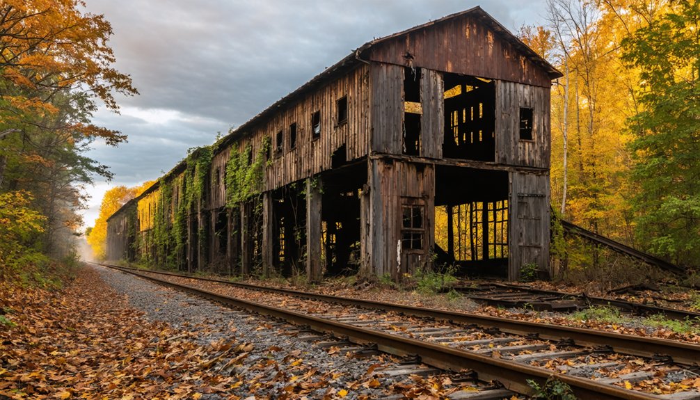
City West emerged in 1836 near the former Petit Fort trading post, envisioned as a competing trade metropolis that would challenge Chicago’s dominance. Developers plotted 25 blocks and constructed approximately 40 homes, a 22-room hotel, and essential infrastructure including a sawmill and pier.
The settlement peaked at 200 residents before the Panic of 1837 triggered its collapse. By 1839, City West became a ghost town. A devastating forest fire in the 1850s destroyed remaining structures, and Lake Michigan eventually reclaimed the pier. The community lacked basic amenities like churches and schools, contributing to its inability to sustain long-term settlement. The only structure surviving from this era is a 1930s bathhouse located near the park entrance.
Today, Indiana Dunes State Park conceals all traces of this ambitious venture.
Baileytown: A Fur Trading Settlement That Existed Only on Paper
You’ll find Joseph Bailly’s 1833 plat on historical maps, showing a grid of streets and lots that never materialized beyond paper.
The ambitious town plan bore little resemblance to the actual settlement, which remained centered on Bailly’s trading post and homestead complex along the Little Calumet River.
When Bailly died in 1835, his vision for the town died with him, leaving only the platted streets as evidence of what might have been.
Management of the property passed to Francis Howe in 1843, who focused on timber sales rather than town development.
Cartographers continued to label the area “Baillytown” for decades, perpetuating the ghost of a community that existed more in speculation than in built reality.
Joseph Bailey’s 1833 Plat
On December 14, 1833, French-Canadian fur trader Joseph Bailly formally described a platted town that would never be built. His vision encompassed a commercial harbor on Lake Michigan’s south shore, positioned to rival emerging ports like Chicago.
The plat, officially recorded December 10, 1834, with LaPorte County, laid out formal blocks and lots across his 2,000-acre dune landscape holdings near the Little Calumet River.
Bailly’s port aspirations reflected the era’s speculative fever, as declining fur trade profits pushed traders toward land development. Bailly had built a trading post in the region in 1822, becoming the first settler in northwestern Indiana. Swedish immigrants would later settle in the area, with many eventually buried in unmarked graves at the Bailly Cemetery despite family objections.
The Bailly legacy endures not in urban infrastructure but in surveyor’s maps—a paper community that captured one entrepreneur’s ambitions during the shift from wilderness trading post to anticipated settlement boom, preserved today within Indiana Dunes National Park boundaries.
Never Built, Still Mapped
Bailly’s formal plat never translated into an actual town. The 1833 Bailleytown speculation reflected the era’s fever for paper towns, but reality proved far more modest. What emerged was a dispersed rural corridor along the Chicago–Detroit Road, centered on Bailly’s trading post rather than organized town lots.
Trading post history reveals the gap between mapped ambition and frontier reality:
- The homestead functioned as an isolated fur-trading hub and inn, not an urban grid.
- Settlement spread loosely across several miles of the stage road, never coalescing into a municipality.
- By the 1830s, locals referred to the area as “Baillytown”—a community zone, not a platted town.
- The site received National Historic Landmark designation in 1962, recognizing its significance to American frontier history.
Today you’ll find this “ghost town on paper” preserved within Indiana Dunes National Park, where federal protection guarantees the landscape remains closer to Bailly’s trading post era than any speculator’s vision.
Tremont: From Resort Community to Reclaimed Wilderness
Named for the “three mountains”—Mount Tom, Mount Holden, and Mount Green—that dominated its landscape, Tremont emerged in the early 20th century as a modest seasonal resort along Lake Michigan’s Indiana shoreline.
The 1908 South Shore Line station brought hordes of Chicago visitors, transforming the area into north Porter County’s tourism hub for sixty years. The Prairie Club of Chicago accelerated this growth, building a beach house atop a 50-foot dune in 1913 and popularizing organized nature excursions. The club’s conservation committee advocated for Sand Dunes National Park status starting around 1913, raising concerns over industrial destruction threatening the dunes.
Tremont’s transformation began with Indiana Dunes State Park‘s 1926 creation, then accelerated when the National Lakeshore was established in 1966. The community had previously flourished with travel-oriented businesses including gas stations, hotels, and restaurants serving Highway 12 motorists.
Federal land acquisitions systematically surrounded and constrained the community, ultimately reclaiming it for wilderness. Conservation impacts erased what the railroad once built.
The Panic of 1837 and the Collapse of Lake Michigan Port Dreams
While Chicago’s early boosters imagined transforming Lake Michigan’s southern shore into a network of bustling ports rivaling New York’s harbor system, the Panic of 1837 shattered these ambitions with devastating swiftness.
The economic repercussions rippled across frontier communities as British capital dried up and 850 unregulated banks issued worthless notes. You’ll find the infrastructure decline most visible in Chicago’s harbor, which became impassable by April 1839 when dredging operations halted. Mayor Ogden borrowed funds to pay city debts and attempted to restore public confidence during the recession.
Chicago’s harbor became impassable by 1839 as British capital vanished and hundreds of unregulated banks collapsed across the frontier.
The crisis’s impact included:
- Federal appropriations for harbor projects were dramatically reduced, leaving completed infrastructure to deteriorate
- Banks suspended specie payments, forcing commerce to a standstill throughout the region
- Land speculation collapsed after government sales exceeded 50,000 square miles in just two years
Many port communities never recovered from this financial devastation.
How Shifting Sand Dunes Consumed Early Settlements
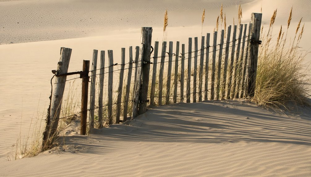
You’ll find that the same powerful winds that built the Indiana Dunes also destroyed settlements, as sand migration buried structures and made permanent habitation nearly impossible in certain areas.
Shifting dunes consumed burial grounds at City West, forcing residents to relocate their dead before the sand could desecrate the graves.
Wildfires periodically swept through the dry dune vegetation, and when combined with the relentless advancement of sand ridges, these forces accelerated abandonment and eventually erased physical evidence of early communities.
City West Burial Grounds
The ghost town of City West arose in 1837 as an ambitious lakefront development platted along the Lake Michigan shore near Fort Creek, where promoters envisioned a metropolis complete with wharves, hotels, and commercial streets to rival nearby Michigan City.
Despite the town’s brief existence, burial practices established two distinct cemeteries near the settlement—a Euro-American graveyard positioned just back from the shoreline and a Potawatomi burial ground that remained active through 1838.
Today, you’ll find no trace of these sacred grounds. Wind-driven sand migration consumed both sites:
- The “graveyard blow-out” exposed Native burials, including a skull and vertebra with an embedded arrowhead, before erosion destroyed the evidence
- City West’s cemetery vanished beneath advancing dunes
- Community memories survive only through fragmentary historical accounts describing these lost burial grounds
Wildfire Accelerated Abandonment
When wildfire swept through City West in the 1850s, it delivered the final blow to a settlement already crippled by the Panic of 1837.
Flames raced through dry dune grasses and oak savanna, consuming frame buildings and lumber piles within hours. You’ll find that wildfire impact extended beyond immediate destruction—it eliminated any chance of recovery.
Survivors salvaged what timbers they could, moving them to Chesterton and Coffee Creek, erasing the town’s physical remnants. The combination of economic collapse and fire damage created abandonment causes that were insurmountable for frontier investors.
Without fire brigades or insurance, rebuilding was financially impossible. When subsequent storms destroyed the burned pier, City West’s last connection to lake trade vanished, cementing its transformation into a true ghost town.
Dune Migration Erased Structures
Unlike fire or economic collapse, dune migration operated as a slow, relentless force that consumed settlements grain by grain.
Dune encroachment effects**** reshaped the lakeshore corridor across decades. Dominant northwest winds pushed sand inland at several feet annually, burying farms, roads, and entire hamlets.
When logging and grazing stripped protective vegetation, previously stable dunes reactivated, accelerating encroachment onto Swedish immigrant homesteads and lumbering villages.
You’ll find historical settlement patterns preserved in buried cultural layers—ceramics, tool fragments, and structural debris entombed within advancing sand:
- Swedish farms on back-dune flats watched sand bury fences and fields
- Resort enclaves required constant clearing of drifted boardwalks and stairways
- Cottage foundations undermined, forcing abandonment of marginal lots
Lake-level fluctuations triggered new pulses of sand movement, erasing what fire couldn’t reach.
Federal Conservation and the Erasure of Twentieth-Century Communities
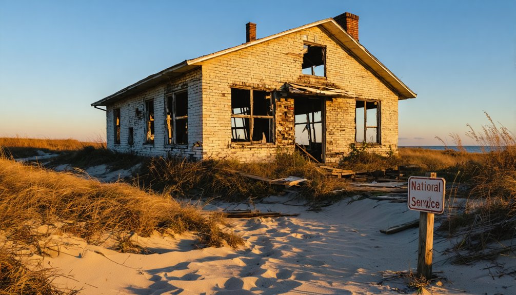
During the 1960s, federal conservation efforts fundamentally reshaped the Indiana Dunes landscape, transforming thriving residential communities into protected wilderness.
The establishment of Indiana Dunes National Lakeshore initiated systematic community displacement as the government purchased private properties and demolished homes to achieve ecological restoration goals.
Federal acquisition systematically displaced established communities through property purchases and demolitions to restore the Indiana Dunes to natural conditions.
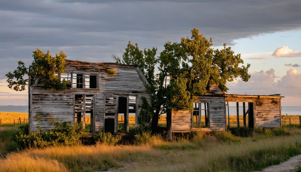
Tremont, a successful vacation resort that had flourished for decades, became a ghost town as federal acquisition prevented expansion and isolated remaining structures.
You’ll find minimal evidence of these communities today—just scattered gravel roads, isolated cabins, and commemorative picnic shelters bearing their names.
The government prioritized returning land to natural conditions over preserving twentieth-century settlement history.
Federal conservation ultimately erased thriving communities, replacing private property rights with protected parkland that restricts development and limits visitor access.
Walking Through History: Visiting Former Townsites Today
The physical landscapes where City West, Tremont, and Baileytown once stood remain accessible to visitors today, though you’ll find few obvious remnants of their former communities.
Nature reclamation has transformed platted streets into dune trails and forest paths within Indiana Dunes State and National Parks. You can explore these sites freely by following historic trails that roughly parallel original town corridors.
What you’ll encounter walking these former townsites:
- Shifting sands at City West that buried foundations, gardens, and the cemetery—demonstrating complete geomorphic erasure
- Gravel roads and isolated picnic shelters at Tremont marking where residential blocks once stood
- Riparian forests and wetlands along Little Calumet River where Baileytown’s speculative plat never materialized into actual buildings
You’ll need historical maps and interpretive materials to visualize former communities against today’s restored landscapes.
The Contrast Between Industrial Development and Preserved Ghost Towns
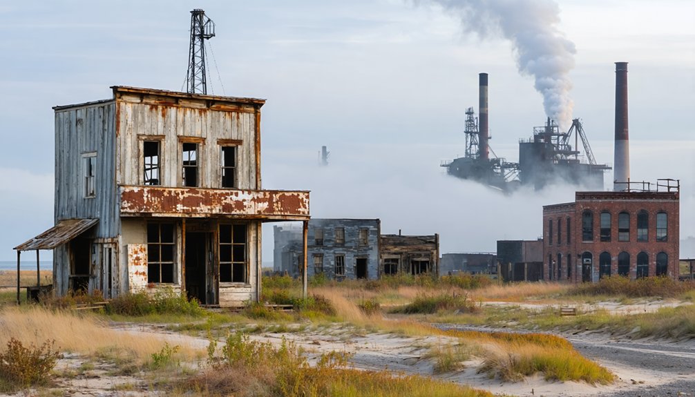
Standing today at Indiana Dunes, you’ll witness a jarring juxtaposition between preserved wilderness and sprawling industry. Gary’s steel mills loom just beyond the protected dunes where City West once dreamed of rivaling Chicago.
This industrial legacy ironically surrounds the ghost town sites now reclaimed by nature. While speculative development failed in the 1830s, twentieth-century industrialization succeeded—transforming neighboring landscapes into manufacturing powerhouses.
The federal government’s 1960s land acquisition reversed this trajectory, systematically demolishing surviving communities like Tremont to restore ecological conditions.
You’ll find yourself exploring terrain where ambitious settlers envisioned prosperity, now protected from the very industrial forces that dominated surrounding regions. The park’s creation preserved these ghost town remnants, offering freedom to experience what development destroys—untouched shoreline amid Indiana’s industrial heartland.
Lessons From Indiana’s Vanished Communities Along the Lakeshore
Beyond the stark contrasts visible in today’s landscape, Indiana’s lakeshore ghost towns offer practical insights into what makes communities endure—or vanish.
City West’s 1837 collapse teaches you that speculative infrastructure without genuine social ties—schools, churches, civic bonds—creates fragile settlements.
Environmental risks proved equally decisive:
- Shifting sands buried cemeteries and foundations, revealing how dynamic dune geology undermines permanent structures
- Periodic wildfires consumed hastily built wooden towns, exposing poor site selection in fire-prone terrain
- Financial panics turned hundred-dollar lots into penny parcels overnight, demonstrating extreme volatility in frontier land markets
These cultural landscapes vanished because builders ignored both natural constraints and community-building essentials.
Understanding why these towns failed helps you recognize what authentic, resilient places require beyond mere economic ambition.
Frequently Asked Questions
Are Any Original Structures From City West Still Visible Today?
No original structures from City West remain visible today. Fire, shifting sand dunes, and natural processes completely destroyed all architectural remnants by the 1870s, leaving no historical preservation of the 1830s–1850s settlement’s buildings.
Can You Visit the Exact Location Where Baileytown Was Platted?
You can’t pinpoint Baileytown’s exact location without historical plat maps. The Baileytown history shows it was platted in northern Porter County, but private development now covers the original Baileytown location near present-day Porter and Burns Harbor.
Were Residents of Tremont Compensated When Their Homes Were Demolished?
Yes, Tremont residents received residential compensation under eminent domain law when Indiana acquired their properties for park creation. Historical context shows they were paid fair market value, following standard legal procedures rather than uncompensated seizure.
What Happened to the Cemeteries Mentioned in City West?
City West’s cemetery was completely lost to shifting sand dunes and vegetation after the 1853 fire destroyed the settlement. Despite its historical significance, you’ll find no cemetery preservation efforts occurred, leaving burial locations permanently obscured.
Are There Guided Tours Specifically Focused on These Ghost Towns?
No dedicated ghost town tours exist for City West, Tremont, or Baileytown. You’ll find their historical significance woven into broader ranger programs about dunes ecology and regional settlement, but you’re free to explore independently using trails and maps.
References
- https://www.islands.com/1754423/city-west-ghost-town-abandoned-buildings-once-dreamy-town-indiana-coastal-eerie-dune-beach/
- http://www.gribblenation.org/2019/05/ghost-town-tuesday-ghost-towns-of.html
- https://www.atlasobscura.com/places/city-west-ghost-town
- https://gregandbirds.wordpress.com/2017/11/21/lost-to-nature-1-city-west-and-tremont-indiana/
- https://houseofhighways.com/usa/midwest/indiana/tremont
- https://www.youtube.com/watch?v=eJVTMgozgcM
- https://www.nps.gov/subjects/abandonedplaces/about.htm
- https://en.wikipedia.org/wiki/Tremont
- http://ingenweb.org/intippecanoe/ghosttowns.htm
- https://www.nps.gov/slbe/learn/historyculture/ghosttowns.htm