Fairview, NV
County:
Churchill
Zip Code:
Latitude / Longitude:
39°15′59″N 118°11′51″W / 39.26639°N 118.19750°W / 39.26639
Elevation:
Time Zone:
Pacific (PST) (UTC-8)
Established:
Disestablished:
Comments:
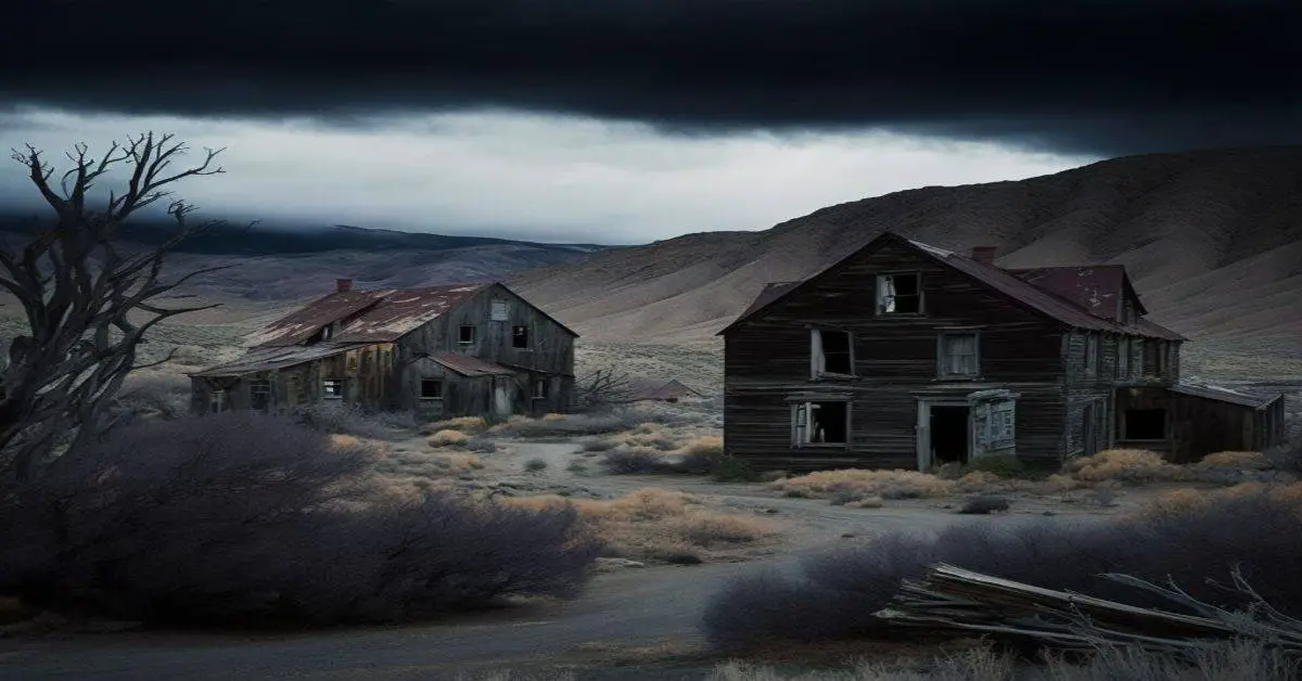
Fairview is a ghost town in Churchill County, Nevada, in the United States of America.
Remains:
Fairview changed locations twice, once to move closer to the mines and mills in which the town’s residents worked, and once because the town outgrew the narrow canyon in which the second town was sited. It is currently a ghost town. One of the few remnants of the old town is the bank vault from the first town site’s bank; the vault can be seen from the nearby Austin-Lincoln Highway.
Current Status:
Fairview and Bermond Station Nevada in southeast Churchill County in 1910. The town grew as a result from a discovery of ore in 1904. The town was prosperous from 1907 to 1912. Post office closed 1919.
Remarks:
A very large earthquake doublet occurred on December 16, 1954. The Dixie Valley/Fairview earthquakes occurred four minutes apart, each with a maximum Mercalli intensity of X (Extreme). The initial shock measured 7.3 Mw and the second shock measured 6.9 Mw. Damage to man-made structures was minimal because the region was sparsely populated at the time, but oblique-slip motion on a normal fault resulted in the appearance of large fault scarps.
Ferguson, NV
County:
Zip Code:
Latitude / Longitude:
Elevation:
Time Zone:
Pacific (PST) (UTC-8)
Established:
Disestablished:
Comments:
Remains:
Current Status:
Remarks:
Fish Lake Valley, NV
County:
Esmeralda
Zip Code:
Latitude / Longitude:
37° 41′ 40.88″ N, 118° 4′ 41.91″ W
Elevation:
Time Zone:
Pacific (PST) (UTC-8)
Established:
Disestablished:
Comments:
Fish Lake Valley is a ghost town located in the geographic Fish Lake Valley, within Esmeralda County, Nevada and Inyo County, California. It is just east of the White Mountains, the highest range entirely within the Great Basin at 14,252 feet (4,344 m). There is sufficient rain and snow at high elevations to feed permanent streams from the mountains, providing irrigation for alfalfa and other crops, although the valley’s elevation, in excess of 4,000 feet (1,200 m), is a serious constraint.
Remains:
Fish Lake Valley was originally settled in 1866, when the ‘Palmetto Mining District’ in Esmeralda County was formed, and settlement in Fish Lake Valley began. During the 1870s two companies, ‘Griffing & Nyman’s’ and ‘Pacific Borax Works’ were located here extracting borax at Fish Lake.
Current Status:
Today a historical marker near the site commemorates the life of W.O. Harrell, known as “Harrell, the Irrepressible, Citizen Extraordinaire”, of Fish Lake Valley in the 1870s.
Remarks:
The Carson and Columbus Stage Line ran north from Fish Lake Valley to Aurora and Carson City, also connecting with Logsprings, Nevada in the Sylvania Mining District as well as Lida in the Sylvania Mountains. Local ranches supplied food to the freight industry and mining communities such as Fish Lake Valley. A post office opened in Fish Lake Valley in 1881.
Flanigan, NV
County:
Washoe
Zip Code:
89510
Latitude / Longitude:
40°10′15″N 119°53′12″W / 40.17083°N 119.88667°W / 40.17083
Elevation:
4,006 ft (1,221 m)
Time Zone:
Pacific (PST) (UTC-8)
Established:
1909
Disestablished:
1973
Comments:
Flanigan is a ghost town and former crossroads village in Washoe County, Nevada, in the United States. It is located in Honey Lake Valley, 5 miles (8.0 km) east of the California border (Lassen County), and west of Pyramid Lake. Flanigan is located in a high desert region, mostly alkali flats with some sagebrush and cheatgrass. Flanigan Playa is located south of the Flanigan townsite.
Remains:
Flanigan was established in 1909 with the building of the Western Pacific Railroad Feather River Route between Oakland and Salt Lake City. The station in Honey Lake Valley was named after Patrick L. Flanigan, a landowner and businessman whom Western Pacific purchased right of way from in the area. In 1913, the Southern Pacific Railroad built its Fernley & Lassen branch, with the two lines crossing at Flanigan. A deed for Flanigan Townsite was filed on July 16, 1913.
Current Status:
Later in the 1970s, investors bought land just east of Flanigan, established dirt streets and planned to sell parcels for $200-$300 each, as a novelty to capitalize on Flanigan’s Western ghost town history, intending to give parcels to celebrities like John Wayne and Clint Eastwood to draw publicity. However, the Interstate Land Sales Full Disclosure Act of 1968 requires new developments with plots sold over $100 to have basic infrastructure such as sewer and street lighting, which made the plan unprofitable, and the venture was abandoned. In 1985, a wildfire swept through the area and destroyed the few remaining structures in Flanigan.
Remarks:
Population slowly dwindled, with only a handful of residents remaining by the 1950s. In March 1959, Southern Pacific Railroad closed the Flanigan station. By fall 1960, only one permanent resident remained, schoolteacher Gertrude Milne, who tended the store and taught 7 children from surrounding areas. The post office closed in March 1961, and a fire destroyed the store in January 1969. The school was closed by the Washoe County School District at the end of the spring 1969 semester, and Milne moved to Reno in 1973, where she would die later that year.
Fort Churchill, NV
County:
Lyon
Zip Code:
Latitude / Longitude:
39°17’33″N 119°16’18″W
Elevation:
4,255 ft (1,297 m)
Time Zone:
Pacific (PST) (UTC-8)
Established:
1957
Disestablished:
Comments:
Fort Churchill State Historic Park is a state park of Nevada, USA, preserving the remains of a United States Army fort and a waystation on the Pony Express and Central Overland Routes dating back to the 1860s. A 1994 addition forms a corridor along the Carson River. The park is in Lyon County south of the town of Silver Springs. Fort Churchill was designated a National Historic Landmark in 1961. The site is one end of the historic Fort Churchill and Sand Springs Toll Road. It is located on U.S. Route 95 Alternate, 8 miles (13 km) south of U.S. Route 50.
Remains:
In 1860 a band of Paiutes and Bannocks attacked Williams Station along the Carson River in retaliation for the kidnap and rape of two young Paiute girls by the proprietors of the station. In retaliation a small group of volunteer soldiers and vigilantes led by Maj. William Ormsby attacked the Native Americans, starting the so-called Pyramid Lake War. Ormsby’s force was defeated and in response Colonel John C. Hays and Captain Joseph Stewart led a larger force of volunteers and U.S. Regulars to defeat the Natives at the Second Battle of Pyramid Lake.
Current Status:
In 1957, the fort became a part of Nevada’s state park system. it was declared a National Historic Landmark in 1961, and added to the National Register of Historic Places in 1966. The visitor center has exhibits on the history of Fort Churchill, Native Americans that inhabited the area, and natural features of the surrounding countryside. A 20-site campground is situated along the Carson River within a grove of cottonwood trees with an adjacent group-camp and day-use picnic areas. A primitive camp lies further along the Carson River in the Carson River Ranches unit.
Remarks:
Hiking trails include a self-guided trail around the fort ruins with interpretative signs explaining each of the buildings. The Orchard Trail runs along the Carson River from the campground to Buckland Station. A continuation of this trail runs the length of the Carson River in the Carson River Ranches unit. Twice a year the Nevada Civil War Volunteers put on a civil war encampment at Fort Churchill.
Gold Acres, NV
County:
Zip Code:
Latitude / Longitude:
Elevation:
Time Zone:
Pacific (PST) (UTC-8)
Established:
Disestablished:
Comments:
Remains:
Current Status:
Remarks:
Gold Butte, NV
County:
Clark
Zip Code:
Latitude / Longitude:
36° 16′ 51.6″ N, 114° 12′ 3.6″ W
Elevation:
Time Zone:
Pacific (PST) (UTC-8)
Established:
Disestablished:
Comments:
Gold Butte is the name of a ghost town and nearby mountain peak in Clark County, Nevada. Both are protected as part of the Gold Butte National Monument, managed by the Bureau of Land Management. Gold Butte, the mountain, is 5,013 feet (1,528 m) high and rises 1,280 feet (390 m) above the town of Gold Butte. This peak lies within the Virgin Mountains and its name apparently refers to the Gold Butte Mining District.
Remains:
Gold Butte, Nevada is also a ghost town located in Clark County, Nevada that was established in 1908 when gold was discovered in the area. Mining was active from about 1905 through 1910. Little remains at the site: a couple of foundations, two graves, and several old mine shafts. The BLM’s Jumbo Springs Wilderness is south of the Gold Butte townsite.
Current Status:
The Bundy standoff, which pertains in part to the Gold Butte area, was caused in spring 2014 as the result of a 20-year-old land use disagreement between the Bureau of Land Management and Cliven Bundy, a local rancher. Senator Harry Reid, along with local business leaders and conservation groups, have campaigned to make Gold Butte and the surrounding area into National Conservation Area. On December 28, 2016, President Barack Obama established Gold Butte National Monument, protecting the public lands surrounding Gold Butte.
Remarks:
The Gold Butte Mining District includes the territory south of Gold Butte lying between the Nevada-Arizona state line to the east and the Virgin River (now Lake Mead) to the west. Mining began in the 1880s. The total production from the district has been about $75,000. There has been prospecting and small-scale mining for gold, mica, magnesite, copper and zinc. No significant deposits were found.
Gold Center, NV
County:
Nye
Zip Code:
Latitude / Longitude:
36° 52′ 6″ N, 116° 46′ 2″ W
Elevation:
Time Zone:
Pacific (PST) (UTC-8)
Established:
Disestablished:
Comments:
Gold Center was a mining town in Nye County, Nevada. Located in the Bullfrog Mining District south of Tonapah, Gold Center was established in December 1904 with a United States Post Office being authorized on January 21, 1905. The town began publishing its own newspaper in 1907. The location of the town was ideal as it was on the stagecoach route to Rhyolite and Beatty. It was also near the Amargosa River, allowing sufficient water for drinking and for two mills and an ice house. Gold Center also sold water to Rhyolite and Carrara. The Tonopah and Tidewater Railroad, the Las Vegas & Tonopah Railroad and the Bullfrog Goldfield Railroad all ran through Gold Center. Gold Center also had the first brewery in the area which was built underground to maintain a cool temperature.
Remains:
Current Status:
Today, little remains of the original town other than the foundations of a stamp mill, the footers for a tank at the cyanide plant and sections of the water line that ran between Gold Center and Carrara. It is a ghost town. However, what is left of the town does now sit along the paved road connecting U.S. Highway 95 to Beatty’s airport. On January 22, 2011, new life came to the area in the form of Nevada’s newest legal bordello when, somewhat appropriately given the area’s railway history, a retired short-line railroad owner by the name of Guy Brenkman opened Bikini’s Gentlemen’s Club off Airport Road in Gold Center.
Remarks:
Gold Point, NV
County:
Esmeralda
Zip Code:
Latitude / Longitude:
37°21′17″N 117°21′54″W / 37.35472°N 117.36500°W / 37.35472
Elevation:
Time Zone:
Pacific (PST) (UTC-8)
Established:
Disestablished:
Comments:
Gold Point, Nevada is a well preserved ghost town in Esmeralda County, Nevada. The area that would become Gold Point was first settled by ranchers and a few miners during the 1880s. The small camp of Lime Point was formed a few hundred yards west of the present town, at an outcropping of limestone.
Remains:
When new discoveries of gold and silver established the major mining towns of Tonopah and Goldfield, Nevada in the early 1900s, a flood of prospectors returned to Lime Point. In 1902 silver was discovered in the area, and the old camp was revived and renamed Hornsilver (an informal name for the silver mineral chlorargyrite). Scarcity of water in the area required that the ore be shipped to nearby Lida for milling. The nearest major supply town was about 250 miles north at Unionville, a mining town northeast of present-day Lovelock. The miners did not find silver in abundance, the costs of shipping the ore to Lida became too high, and, within a year, the settlement was abandoned.
Current Status:
The old camp is a living history lesson with about 50 buildings still standing, including former Senator Harry Wiley’s home and the post office that now serves as a museum. The Post Office Museum is open on most weekends and for large parties. Memorial Day Weekend is the annual Chili Cook-Off with prizes and drawings, food and drink, games and live music all day and through the night. For a few days of the year, the population soars to 400, but is usually seven. Gold Point is home to the High Desert Drifters Western Historical Society; the club routinely performs western reenactment and gunfights in the plaza. Guest services are available year round, including electric hook-ups for RVs. Nearby nature sites include waterfalls and watering holes frequented by wild horses and burros, Indian petroglyphs, fossils, petrified woods, and a view of Death Valley National Park from Big Molly.
Remarks:
In addition to the above, Rotary members of the Recreational Vehicle Fellowship of Rotarian’s NA. make an annual four-day trek to Gold Point in mid to late October. At that time an average of eighteen coaches arrive at Gold Point where RV camping is available, electricity and sewer hookups are available. The weather at this time is about 70 degrees during the day and 40 degrees or so at night, the temperature does drop a little more toward the end of the month.
Goldfield, NV
County:
Esmeralda
Zip Code:
89013
Latitude / Longitude:
37°42’31″N 117°14’08″W
Elevation:
5,690 ft (1,730 m)
Time Zone:
Pacific (PST) (UTC-8)
Established:
1902
Disestablished:
Comments:
Goldfield is an unincorporated community and the county seat of Esmeralda County, Nevada, United States. It is a census-designated place (CDP), with a resident population of 268 at the 2010 census, down from 440 at the 2000 census. It is located 247 miles (398 km) southeast of Carson City, along U.S. Route 95.
Remains:
Goldfield was a boomtown in the first decade of the 20th century due to the discovery of gold — between 1903 and 1940, Goldfield’s mines produced more than $86 million. Much of the town was destroyed by a fire in 1923, although several buildings survived and remain today, notably the Goldfield Hotel, the Consolidated Mines Building (the communications center of the town until 1963), and the schoolhouse. Gold exploration continues in and around the town today.
Current Status:
While the unoccupied buildings of the town remain an attraction, they are not abandoned. Each building has an owner, many with plans to renovate the property. In addition, the Goldfield Days festival is held in August each year. The festival includes parades, booths, historical displays, and a land auction.
Remarks:
Among the buildings located within the Goldfield Historic District are: The 1906–08 Goldfield High School, which survived the fire of 1923/24, is in poor condition, but the Goldfield Historical Society has received a matching grant of $296,000 from the National Park Service under the “Save America’s Treasures Grant Program”. Esmeralda County Courthouse The 1907–1908 Goldfield Hotel at Crook Avenue (U.S. 95) and Columbia Street has remained unoccupied since the end of World War II.
Grantsville, NV
County:
Zip Code:
Latitude / Longitude:
Elevation:
Time Zone:
Pacific (PST) (UTC-8)
Established:
Disestablished:
Comments:
Remains:
Current Status:
Remarks:
Hamilton, NV
County:
White Pine
Zip Code:
Latitude / Longitude:
39°15′11″N 115°29′6″W / 39.25306°N 115.48500°W / 39.25306
Elevation:
8,050 ft (2,450 m)
Time Zone:
Pacific (PST) (UTC-8)
Established:
1868
Disestablished:
Comments:
Hamilton is an abandoned mining town located in the White Pine Range, in western White Pine County, Nevada, United States. Hamilton rapidly came into being after discovery of rich silver ore in the area. The first settlers found shelter in local caves, which were numerous. By May 1868, the settlement, then known as “Cave City” was formed.
Remains:
The town boomed following the discovery of rich silver deposits nearby. By that winter, it had approximately 600 inhabitants. It was soon renamed for mine promoter W.H. Hamilton. The post office first opened for business on August 10, 1868 while the community was still part of Lander County, Nevada. White Pine County was formed in March 1869 and Hamilton was selected as the first county seat. By its peak during the summer of 1869, Hamilton’s population was estimated at 12,000. There were close to 100 saloons, several breweries, 60 general stores, and numerous other businesses. There were also theaters, dance halls, skating rinks, a Miners’ Union Hall, and a fraternal order located in the thriving community. Close to 200 mining companies were operating in the area
Current Status:
The Hamilton post office closed in 1931. Hamilton is now a ghost town, with only scattered ruins remaining at the site.
Remarks:
However, Hamilton’s prosperity was not to last. It was soon discovered that the local ore deposits proved shallow. Subsequently, by 1870, less than two years after its founding, the community was already in decline. Once the shallow nature of the local ore deposits became known, many of the mining companies left the area. Hamilton’s population and economy began a rapid decline. At the census of 1870, the population was 3,915, less than a third of what it had been estimated at the previous summer. On June 27, 1873, a large fire spread throughout the business district and caused an estimated $600,000 in damage, a huge sum at the time. Most businesses that burnt down were abandoned, and not rebuilt. By this time, the town’s population was estimated to have shrunk to only 500. Another fire destroyed the courthouse at Hamilton along with all of the records in January 1885. County records began to be kept at the Ely courthouse begin January 5, 1885. Although Hamilton was the first county seat of White Pine County, the rapidly shrinking community lost that designation to the town of Ely in 1887.
Helene, NV
County:
Zip Code:
Latitude / Longitude:
Elevation:
Time Zone:
Pacific (PST) (UTC-8)
Established:
Disestablished:
Comments:
Remains:
Current Status:
Remarks:
Henry, NV
County:
Zip Code:
Latitude / Longitude:
Elevation:
Time Zone:
Pacific (PST) (UTC-8)
Established:
Disestablished:
Comments:
Remains:
Current Status:
Remarks:
Hiko, NV
County:
Lincoln
Zip Code:
89017
Latitude / Longitude:
37°35′49″N 115°13′27″W / 37.59694°N 115.22417°W / 37.59694
Elevation:
3,869 ft (1,179 m)
Time Zone:
Pacific (PST) (UTC-8)
Established:
Disestablished:
Comments:
Hiko is a small, agrarian community in the Tonopah Basin on State Route 318 in Lincoln County, Nevada, United States. It is a census-designated place, with a population of 119 at the 2010 census.
Remains:
Hiko was the county seat of Lincoln County from 1867 to 1871 and a few hundred residents lived nearby, due largely to silver mines in the area. Today, the area is a farming and ranching area, and not much remains of the old town except the cemetery, some mill ruins and a red rock building that was a general store. Although populated, Hiko appears on at least two ghost town lists. Most of the residents of Hiko own farms or ranches, and little to no industrial activity takes place there. In 1871 Hiko was replaced as the county seat of Lincoln County with the current seat, Pioche.
Current Status:
The Hiko and Crystal Springs provide a large supply of water for the Hiko farms and ranches. The Hiko farming community is located in the north end of the Pahranagat Valley and lies at an elevation of 3,869 feet (1,179 m), with a ZIP code of 89017.
Remarks:
Ione, NV
County:
Nye
Zip Code:
Latitude / Longitude:
38°56′54″N 117°35′15″W / 38.94833°N 117.58750°W / 38.94833
Elevation:
Time Zone:
Pacific (PST) (UTC-8)
Established:
Disestablished:
Comments:
Ione, Nevada is a ghost town in Nye County, Nevada, located approximately 23 miles east of Gabbs, Nevada. Current services include one grocery store.
Remains:
Ione came into existence in November, 1863 after silver was discovered by one Mr. P. A. Havens in the Shoshone Range. While most of the mining in the area (the Union Mining District) was closer to communities such as Union and Grantsville, Ione developed as a trade and milling center. Members of the community were shortly petitioning the territorial government for the formation of a new county and in January, 1864 Nye county was organized within the Nevada Territory; Ione was granted a stipend of $800.00 with which to construct the county’s first courthouse. Within three years development at Belmont had created enough excitement to lure away a great percentage of Ione’s population, and in February 1867 the county seat was removed to that location.
Current Status:
The town would see one more resurgence, about 1912, when attention was drawn to abundant cinnabar deposits in the area. This last boom was again short lived, ending in 1914, although the recovery of mercury would persist in the district into the 1930s. Ione’s post office closed for the last time on April 30, 1959.
Remarks:
Ione would find its second boom in 1896 when a new 10-stamp mill was built by one E. W. Brinell. In 1897 A. Phelps Stokes arrived in the Union District and purchased the majority of the mining and milling interests in the district, further facilitating Ione’s resurrection. July, 1898 saw a significant drop in the value of silver, and Ione deflated once again.
Jarbidge, NV
County:
Zip Code:
Latitude / Longitude:
Elevation:
Time Zone: Pacific (PST) (UTC-8)
Established:
Disestablished:
Comments:
Remains:
Current Status:
Remarks:
Johnnie, NV
County:
Zip Code:
Latitude / Longitude:
Elevation:
Time Zone:
Pacific (PST) (UTC-8)
Established:
Disestablished:
Comments:
The Johnnie mine is an abandoned gold mine in Pahrump Valley, Nevada, about 15 miles north of Pahrump, Nevada. It was discovered in 1890. The mine produced between $382,681 and over a million dollars by 1913.
Remains:
Current Status:
In 2014, ownership of the abandoned mine was transferred to the Pahrump Valley Museum and Historical Society.
Remarks:
Jungo, NV
County:
Humboldt
Zip Code:
Latitude / Longitude:
40°55′00″N 118°22′55″W / 40.91667°N 118.38194°W / 40.91667 -118.38194
Elevation:
1,270 m (4,170 ft)
Time Zone:
Pacific (PST) (UTC-8)
Established:
Disestablished:
Comments:
Jungo is a ghost town located on Humboldt County Route 55 (former Nevada State Route 49), between Winnemucca, Nevada and Sulphur, Nevada. At one time, Jungo boasted a hotel, store, filling station and blacksmith’s shop, though no buildings remain. The town of Jungo is named for Jungo Point, a survey peak located 11 miles away; in 1888, Jungo Point was a stage stop on a mail route between Winnemucca and “Denio’s”. The post office at Jungo was in operation from January 1911 until May 1952. Jungo was a station on the Feather River Route of the Western Pacific Railroad.
Remains:
George Austin lived in Jungo in 1915 and operated the hotel, filling station and general store at Jungo in the 1930s. In 1935, Austin purchased the Jumbo Mine, located 36 miles away, from two prospectors for $10,000 ($178,000 today) with $500 due immediately. Mining engineer and former U.S. President Herbert Hoover visited Jungo in 1936 and advised Austin to retain ownership of Jumbo. Austin offered to pay Hoover for the advice and Hoover replied, “That kind of advice is free.” Austin received many offers for the mine and stated that if he sold the mine for $1,000,000, then he would owe the $420,000 in taxes, but that the taxes don’t apply if the gold is in the ground. Austin was also concerned about his sons becoming “loafers” if they were rich.
Current Status:
In 2012, Recology received a permit to build a Municipal Solid Waste Disposal site at Jungo.
Remarks:
In 1937, a group of Texas oilmen including H. L. Hunt placed an option to buy Jumbo Mine with a $250,000 ($4,256,000 today) down payment. The Jungo Hotel was in operation in 1955.
Jessup, NV
County:
Churchill
Zip Code:
Latitude / Longitude:
39°56’N 118°52’W
Elevation:
4,550 ft (1,390 m)
Time Zone:
Pacific (PST) (UTC-8)
Established:
Disestablished:
Comments:
Jessup, also briefly known as White Canyon, is a ghost town in Churchill County, Nevada and was founded in 1908 after gold and silver mine claims were located. At its peak, it supported a population of around 300, with grocery stores and a post office, among other things. There are at least eight formerly active mines in the area. It is located a few miles north of Interstate 80 between Fernley and Lovelock. Southern Pacific provided prospectors access to the town by stopping in nearby White Plains. All that remains today is a few delapitated wood buildings and abandoned mines.
Remains:
The area was discovered by Frank Jessup and L.H. Murray in January or February 1908. Within a month of its founding, there were more than 300 people present with the population steadily growing. The Jessup Mining District was quickly established as the discovery was found to be of more worth than earlier expected. By April of that year, it was reported by the Reno Evening Gazette that lumber was coming in by the carloads and that wooden structures were quickly being erected to replace the tents located at the camp. There was such a shortage of wood that construction of a hotel and other buildings had to be put on hold until enough lumber could arrive in the town.
Current Status:
Despite no longer having any residents, Jessup can be found on signs at Exit 78 on Interstate 80. It is accessible via the gravel road leading north from the junction. At the site, there is not much left aside from an old pickup and some rusted metal. There are abandoned mines in the area. Many of these mines have barbed wire fences around them. The area is heavily littered. A few miles west of Jessup there is the remains of a cabin at one of the old claims. A little to the northeast there is the remains of another mining operation. Visitors can find the remains of a cabin there, as well as some old equipment.
Remarks:
A year after it was founded, citizens petitioned the county to build a new road to connect Jessup to Miriam. This new road would allow heavy loads and ore shipments to access the railroad without traversing the salt flats. These salt flats were often muddy, which caused delays. By summer of 1909, work had began to slow. Despite this, there were continued investments made in the area surrounding Jessup.
Lahontan City, NV
County:
Zip Code:
Latitude / Longitude:
39°27’45″N 119°3’53″W
Elevation:
Time Zone:
Pacific (PST) (UTC-8)
Established:
1915
Disestablished:
Comments:
The Lahontan Dam is a dam situated on the Carson River in the Carson Desert between Carson City, Nevada and Fallon, Nevada in the United States. Its impoundment is known as the Lahontan Reservoir or Lake Lahontan. It is currently operated by the Truckee-Carson Irrigation District.
Remains:
The Lahontan Dam was built by the Bureau of Reclamation as part of the Newlands Project. It is an earthen structure, 162 ft (49 m) high by 1,700 ft (520 m) long and contains 733,000 cu yd (560,000 m3) of fill. When it was completed in 1915, it was the largest earth-fill dam in the United States. The reservoir receives water from an area of 1,450 sq mi (3,800 km2) and provides a storage capacity of 295,500 acre·ft (364,500 dam3) at spillway crest. An additional 23,900 acre·ft (29,500 dam3) can be stored by raising the gates, bringing the total capacity to 319,400 acre·ft (394,000 dam3).
Current Status:
Construction began as part of the Truckee-Carson Project in 1911 and Lahontan City, Nevada, a company town, was built for the workers. Water distribution for irrigation began in 1916 and in the same year the project was renamed to the Newlands Project.
Remarks:
The primary purpose of the dam is to impound water for irrigation use. The site also includes hydroelectric generators with a total capacity of 4,000 kilowatts.
Logan, NV
County:
Zip Code:
Latitude / Longitude:
37° 36′ 35″ N, 115° 23′ 34″ W
Elevation:
Time Zone:
Pacific (PST) (UTC-8)
Established:
Disestablished:
Comments:
Logan, Nevada, is a ghost town located in the hills about 9.5 mi (15.3 km) west of Hiko and 2.5 mi (4.0 km) south of Mount Irish Peak. Logan had its brief existence as a mining camp when silver ore was discovered in 1865 in the Mount Irish Range just to the north in Silver Canyon on the east flank of Mount Irish.
Remains:
Current Status:
A small spring of water called Logan Springs provided an essential resource for survival in such a harsh arid region.
Remarks:
Louisville, NV
County:
Zip Code:
Latitude / Longitude:
Elevation:
Time Zone:
Pacific (PST) (UTC-8)
Established:
Disestablished:
Comments:
Louisville, which is now a ghost town, was a mining camp in El Dorado Canyon near the Techatticup Mine in the Eldorado Mining District, of New Mexico Territory. The camp was probably named for Nat S. Lewis, the superintendent of the Techatticup Mine in the 1860s, and camp doctor.
Remains:
Current Status:
Remarks:
Lucky Jim Camp, NV
County:
Clark
Zip Code:
Latitude / Longitude:
35° 42′ 8″ N, 114° 48′ 12″ W
Elevation:
Time Zone:
Pacific (PST) (UTC-8)
Established:
1862
Disestablished:
Comments:
Lucky Jim Camp sometimes called Lucky Camp is a ghost town site in Clark County, Nevada. It was within New Mexico Territory when founded in 1862. It was a mining camp in El Dorado Canyon in the Colorado Mining District in the 1860s. Its site lies on the north side of the canyon, south of the Techatticup Mine, at an elevation of 2444 feet and above the mouth of January Wash at its confluence with El Dorado Canyon.
Remains:
How Lucky Jim Camp was named is unknown. Lucky Jim Camp was the home of miners sympathetic to the Confederate cause during the American Civil War. A mile up the canyon, above Huse Spring, was a camp with Union sympathies called Buster Falls.
Current Status:
The site of Lucky Jim Camp appears barren of any trace of ruins viewed by satellite photos.
Remarks:
El Dorado City with its stamp mill, established in late 1863, was located just a short distance down the same side of the canyon as the older Lucky Jim Camp, and may have supplanted it by the end of the war or shortly thereafter when the mines had a period of idleness.
Mazuma, NV
County:
Pershing
Zip Code:
Latitude / Longitude:
40°28′18″N 118°45′50″W / 40.47167°N 118.76389°W / 40.47167
Elevation:
4,846 ft (1,477 m)
Time Zone:
Pacific (PST) (UTC-8)
Established:
Disestablished:
Comments:
Mazuma, Nevada was a small mining town in Pershing County, Nevada where eight people were killed in a flash flood on July 11, 1912. Mazuma was founded in 1907 and a post office was established on August 28, 1907. The name “Mazuma” is derived from a Yiddish slang word for money: m’zumon. Other sources indicate that m’zumon means “the ready necessary”.
Remains:
Just after 5pm on July 12, 1912, a 10-foot (3.0 m) wall of water was observed upstream from Mazuma at the Seven Troughs Canyon. The Seven Troughs Cyanide Plant was destroyed, releasing dozens of gallons of cyanide into the flood. A phone call was made, but due to the electrified atmosphere, the only word that could be heard at Mazuma was “water.” The warning was not received in time, the 20-foot (6.1 m) high, 150-foot (46 m) wide flash flood hit Mazuma and killed almost a tenth of the population. Over the following weeks, relief efforts included visits by doctors and nurses from as far as Reno. A statewide relief fund was set up. In addition, a relief fund was set up by the San Francisco Examiner, where William Randolph Hearst personally donated $100.
Current Status:
The Mazuma Hills Mill, located upstream of Mazuma, burned down 13 days after the flood, though the Darby Mill located southwest of Mazuma, operated from 1909 until it was dismantled in 1918.
Remarks:
Postmistress Maude Ruddell was killed in the flood when the post office collapsed on her. The post office formally moved from Mazuma to Seven Troughs on November 30, 1912.
Marietta, NV
County:
Mineral
Zip Code:
Latitude / Longitude:
38° 14′ 36″ N, 118° 20′ 19″ W
Elevation:
4,947 ft (1,508 m)
Time Zone:
Pacific (PST) (UTC-8)
Established:
Disestablished:
Comments:
Marietta, Nevada, was a town in Mineral County, Nevada. It is now a ghost town. The area was extensively prospected by the well-known prospector F.M. “Borax” Smith, and Teel’s Marsh near Marietta is often credited with providing Smith his start in the borax business (having earlier been a more common silver and gold prospector). However, before Smith came to the area it had been periodically mined for salt, which was used in the processing of ore in the Virginia City, Aurora, NV, and Bodie, CA mills. The use of camels to transport salt to Virginia City has often been quoted, although there is some dispute whether this actually took place. Mule teams were the more usual method of transporting the salt. F.M. Smith began serious scraping and processing of the borax and salt deposits starting in 1872, mainly from deposits on nearby Teels Marsh.
Remains:
Marietta was formally established as a town in 1877, and soon contained several hundred people. Exact figures are hard to verify, because many of the workers involved in the scraping process, and at the processing plant on Teels Marsh were Chinese, whose population figures were not accurately kept. The town soon boasted 13 saloons, a post office, several stores (including the one owned and operated by ‘Borax’ Smith), and many stone and adobe structures. Marietta was a rowdy camp, despite its size, and seemed to garner more than its fair share of criminal activity. The stage service working to and from Marietta was reportedly robbed 30 times in 1880, within one week of that year alone it was robbed 4 times. The town’s isolated site made it an easy target for robberies, and for criminals to run freely.
Current Status:
Since 1991 the area is a federally (BLM) managed Wild Burro Range. This 68,000-acre (280 km2) range, which includes the site of Marietta and Teels Marsh, is home to about 85 burros. Small groups of the burros can often be found roaming among the ruins of Marietta.
Remarks:
Metropolis, NV
County:
Elko
Zip Code:
Latitude / Longitude:
41°13′41″N 115°3′22″W / 41.22806°N 115.05611°W / 41.22806
Elevation:
Time Zone:
Pacific (PST) (UTC-8)
Established:
Disestablished:
Comments:
Metropolis, Nevada is a ghost town in Elko County, Nevada, 12 mi (19 km) northwest of Wells. During the early twentieth century, many homesteaders attempted to farm in the Great Basin, especially in western Utah but also in northeastern Nevada. Creating the town of Metropolis was the project of an eastern businessman, Harry L. Pierce of Leominster, Massachusetts, and investors from both Massachusetts and Salt Lake City. During the second decade of the twentieth century, Pierce’s Pacific Reclamation Company intended to make the optimistically named Metropolis the center of a huge farming district.
Remains:
The Company purchased 40,000 acres (16,000 ha) of desert land in 1910 and hired a respected Salt Lake City contractor, P. J. “Pat” Moran, to build a dam on Bishop Creek, 15 mi (24 km) east of the planned city, hoping to use the reservoir for irrigation. Once the dam was complete, the Company stepped up its promotional campaign, and the LDS Church encouraged members to move there. The town became predominately Mormon, and no church was ever built in Metropolis because the Mormons used the town amusement hall as a meetinghouse.
Current Status:
Dry-farming had been possible for a few years only because of unusually high precipitation. Lower rainfall and Mormon crickets ended the experiment. Pacific Reclamation declared bankruptcy in 1920. In 1922 the railroad discontinued service. By 1924, only 200 people remained. The amusement hall and hotel burned, and the last store closed in 1925, the post office in 1942. The few remaining residents turned to ranching. By 1950 Metropolis was a ghost town. Today ranches surround the town site. The ruins of the hotel and school and a cemetery are all that remain.
Remarks:
After settlers killed marauding coyotes, the jackrabbit population rose dramatically. Rabbits systematically ate the wheat, and farmers retaliated with guns, poison, and organized drives. They killed thousands of jackrabbits and sold them in San Francisco.
Midas, NV
County:
Elko
Zip Code:
Latitude / Longitude:
41°14′39″N 116°47′48″W / 41.24417°N 116.79667°W / 41.24417 -116.79667
Elevation:
Time Zone:
Pacific (PST) (UTC-8)
Established:
Disestablished:
Comments:
Midas is a small Unincorporated community in Elko County, Nevada. Although its population has fluctuated greatly over the years and it often appears on ghost town lists, it has never been completely abandoned.
Remains:
In June 1907, James McDuffy discovered gold at the base of Owyhee Bluffs in Elko County, Nevada. Two towns, Gold Circle and Summit, were quickly created. Summit disappeared in 1909 and the federal government changed the name of Gold Circle to Midas.
Current Status:
Remarks:
Miller’s, NV
County:
Esmeralda
Zip Code:
Latitude / Longitude:
38° 8′ 12″ N, 117° 27′ 27″ W
Elevation:
Time Zone:
Pacific (PST) (UTC-8)
Established:
Disestablished:
Comments:
Miller’s is a ghost town located in Esmeralda County, Nevada. Deserted today, Miller’s sprang up as a mining boomtown after the Tonopah boom began.
Remains:
Miller’s came to life as a result of the furor in Tonopah. In 1901 the Tonopah and Goldfield Railroad was constructed and by 1904 Miller’s was founded as a station and watering stop along the rail line. The name of the town honors Charles R. Miller, a director of the railroad who was also once the Governor of Delaware. Miller also worked as vice president of the Tonopah Mining Company and played a key role in bringing that company’s 100-stamp cyanide mill built in Miller’s in 1906. In 1907 the railroad company constructed repair shops in Miller’s and another large mill went up. By 1910 Miller’s had a post office, a business district and a population of 274. A year later, in 1911, the railroad shops and mill had moved and the town began a slow decline.
Current Status:
When the railroad went under in 1947 the town of Miller’s followed suit and became a ghost town.
Remarks:
Miriam, NV
County:
Zip Code:
Latitude / Longitude:
Elevation:
Time Zone:
Pacific (PST) (UTC-8)
Established:
Disestablished:
Comments:
Remains:
Current Status:
Remarks:
Mountain City, NV
County:
Elko
Zip Code:
Latitude / Longitude:
41°50′19″N 115°57′55″W / 41.83861°N 115.96528°W / 41.83861 -115.96528
Elevation:
Time Zone:
Pacific (PST) (UTC-8)
Established:
Disestablished:
Comments:
Mountain City is a small unincorporated community in Elko County, Nevada, United States, within the Mountain City Ranger District of the Humboldt-Toiyabe National Forest. This ghost town on State Route 225, approximately 16 miles (26 km) south of the Idaho border, is situated on the Owyhee River at an elevation of approximately 5,620 feet (1,710 m).
Remains:
Mountain City, along with the rest of Nevada except for the city of West Wendover, is legally in the Pacific Time Zone, but, along with other Idaho border towns such as Jackpot, Jarbidge and Owyhee, unofficially observes the Mountain Time Zone due to closer proximity to and greater connections with towns in southern Idaho.
Current Status:
Remarks:
Mule Lick, NV
County:
Zip Code:
Latitude / Longitude:
Elevation:
Time Zone:
Pacific (PST) (UTC-8)
Established:
Disestablished:
Comments:
Remains:
Current Status:
Remarks:
Nelson, NV
County:
Zip Code:
Latitude / Longitude:
Elevation:
Time Zone:
Pacific (PST) (UTC-8)
Established:
Disestablished:
Comments:
Remains:
Current Status:
Remarks:
Nevada City, NV
County:
Churchill
Zip Code:
Latitude / Longitude:
39° 26′ 15″ N, 118° 40′ 17″ W
Elevation:
Time Zone:
Pacific (PST) (UTC-8)
Established:
Disestablished:
Comments:
Nevada City is a ghost town in Churchill County, Nevada, United States, located just east of Fallon, Nevada near the current intersection of State Route 116 and U.S. Highway 50. It was founded in 1916 as a socialist community known as the Nevada Cooperative Colony, but due to misleading advertising, mismanagement, and possibly dubious financial dealings by the Nevada Colony Corporation’s directors, who were connected with the similar Llano del Rio colony near Los Angeles, the project folded in 1919. Another contributing factor to its demise was the unpopularity of its anti-war position during World War I, which led to bloodshed when Churchill County Sheriff Mark Wildes attempted to arrest colonist Paul Walters as a draft evader.
Remains:
Current Status:
By 1919 most of the families had moved away and the colony fell into receivership.
Remarks:
Ocala, NV
County:
Zip Code:
Latitude / Longitude:
39°05’26″N 114°23’08″W
Elevation:
Time Zone:
Pacific (PST) (UTC-8)
Established:
Disestablished:
Comments:
Osceola, Nevada, is a ghost town in the eastern part of the U.S. state of Nevada. The town was a placer camp devoted to mining gold. Gold was first discovered in 1872, followed by exploitation of the deposits using hydraulic mining techniques. Two ditches, the Osceola West Ditch and the Osceola East Ditch were built to convey water from the mountains for use in mining. Water production was less than hoped and hydraulic mining ceased in 1900, when the population had declined from 1500 at its peak to 100.
Remains:
Current Status:
A fire in the 1940s destroyed much of the town, but a few buildings and a cemetery remain.
Remarks:
The town is just to the west of Great Basin National Park. Some small-scale mining activities continue.
Osceola, NV
County: White Pine
Zip Code:
Latitude / Longitude: 39°05′26″N 114°23′08″W / 39.09056°N 114.38556°W / 39.09056
Elevation:
Time Zone: Pacific (PST) (UTC-8)
Established:
Disestablished:
Comments:
Remains:
Current Status:
Remarks: