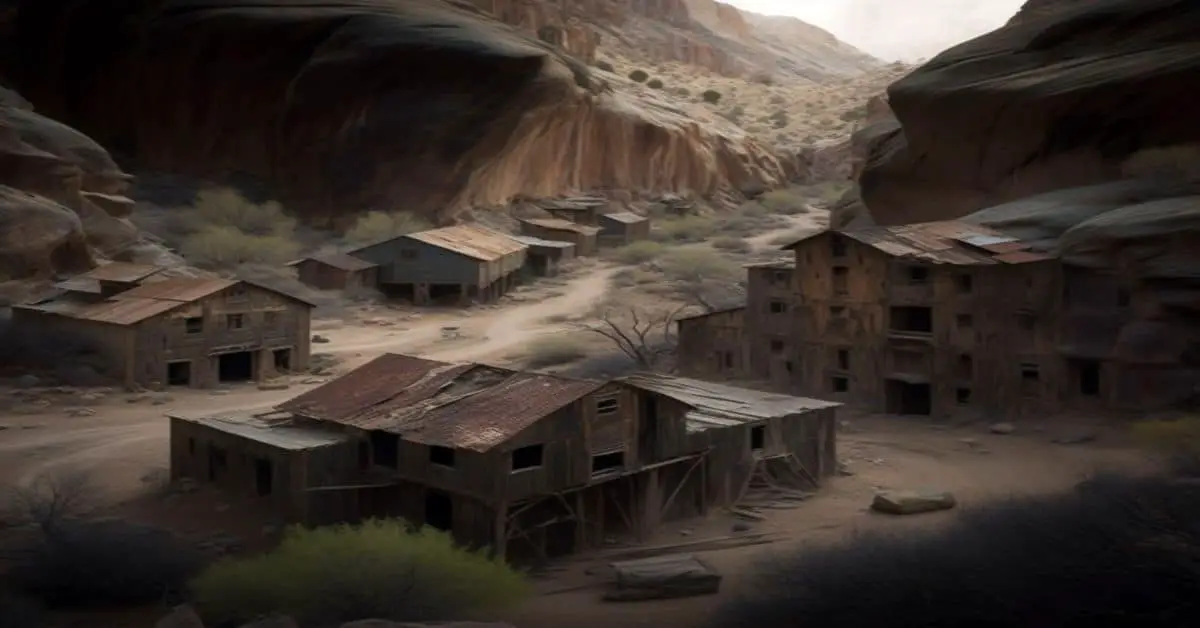
Macksville, TX
County:
Comanche
Zip Code:
Latitude / Longitude:
Elevation:
Time Zone:
Central (CST) (UTC-6)
Established:
Disestablished:
Comments:
Remains:
Current Status:
Remarks:
Madera Springs, TX
County:
Jeff Davis
Zip Code:
79734
Latitude / Longitude:
30°51’19″N 103°57’00″W
Elevation:
4,961 ft (1,512 m)
Time Zone:
Central (CST) (UTC-6)
Established:
Disestablished:
Comments:
Madera Springs, Texas is a ghost town in Jeff Davis County, Texas, located fourteen miles southwest of Toyahvale.
Remains:
Current Status:
Remarks:
Manda, TX
County:
Travis
Zip Code:
Latitude / Longitude:
Elevation:
Time Zone:
Central (CST) (UTC-6)
Established:
Disestablished:
Comments:
Remains:
Current Status:
Remarks:
Mangum, TX
County: Eastland
Zip Code:
Latitude / Longitude: 32° 19′ 12″ N, 98° 51′ 34″ W
Elevation:
Time Zone: Central (CST) (UTC-6)
Established:
Disestablished:
Comments: Mangum was an unincorporated town in Eastland County, Texas. It was founded in the late 1890s at the intersection of the Missouri-Kansas-Texas Railway (abandoned in 1967) and the Eastland, Wichita Falls, and Gulf Railroad (abandoned in 1944). Mangum was named for the Bob Mangum family. The town’s population peaked in 1915 at 125; by 1936, only a handful of residents remained. Sometime in the late 1980s’ the town was removed from highway maps.
Remains:
Current Status: In 2000 the population of Mangum was estimated at 15. Today the site is a ghost town.
Remarks:
Manning, TX
County:
Angelina
Zip Code:
Latitude / Longitude:
31° 8′ 20″ N, 94° 32′ 11″ W
Elevation:
Time Zone:
Central (CST) (UTC-6)
Established:
Disestablished:
Comments:
Manning is a ghost town in Angelina County, Texas in East Texas.
Remains:
Current Status:
Remarks:
Mantua, TX
County:
Collin
Zip Code:
Latitude / Longitude:
Elevation:
Time Zone:
Central (CST) (UTC-6)
Established:
Disestablished:
Comments:
Remains:
Current Status:
Remarks:
Marcelina, TX
County:
Wilson
Zip Code:
Latitude / Longitude:
Elevation:
Time Zone:
Central (CST) (UTC-6)
Established:
Disestablished:
Comments:
Remains:
Current Status:
Remarks:
Marysville, TX
County: Cooke
Zip Code:
Latitude / Longitude: 33°46’14″N 97°20’03″W
Elevation:
Time Zone: Central (CST) (UTC-6)
Established:
Disestablished:
Comments: Marysville is a small, unincorporated community in northwestern Cooke County, Texas, USA. It lies approximately 3 miles from the Texas-Oklahoma border.
Remains: In the spring of 1859, California natives Richard Corn and his wife, Mary Fitch Corn, settled in the vicinity of Sivell’s Bend just south of the Red River. After residing in the community for several years, Corn decided to move a few miles southwest along Fish Creek in the area that came to be known as Marysville in the winter of 1866-67. Corn soon discovered that the loose sandy soil wasn’t adequate for farming, so he began erecting a large sawmill in the valley of South Fish Creek that spring. When D.H. Sapp and his family arrived later in the summer, Corn was building the mill with the assistance of mechanic William DeWees. The Sapps aided in the mill’s completion the following spring.
Current Status: The Baptist church, which still operates today, was built in 1872. In 1873, a post office opened. By 1900, the small community reported 250 citizens, a drugstore, livery, school, churches, and multiple cotton gins. By 1942, Marysville reported a population of 160. With the establishment of Camp Howze that same year, Marysville farmers and residents lost most of their land to eminent domain as the camp virtually enveloped the community. Land to the north, east, and south of the community became part of the camp and farmers were forced to move. With the loss of farm land, many residents moved to Gainesville or elsewhere to start anew and Marysville rapidly declined. During the operation of Camp Howze, Marysville was so remote that residents were allowed permanent passes to cross the army camp to get to and from Gainesville. When World War II ended and Camp Howze was deemed excess in 1946, the original farmers were offered their land back. Most had settled elsewhere and were not interested in returning, but a few repurchased their land and moved back to the area. The damage was done and Marysville never recovered. Today it has a church, a Masonic Lodge known as Fish Creek Lodge #344 and no businesses, and is not reachable by paved road. One local resident of the Marysville Cemetery is Daniel Montague, after whom Montague County, Texas, is named.
Remarks: The sawmill encompassed approximately 3,000 square feet of space, according to D.H. Sapp’s accounts, and boasted a forty-foot treadmill powered by 6-10 oxen. It proved to be a successful investment for Corn. There was no other local sawmill in the area for several more years afterwards, so people from Montague and Clay Counties and southern Indian Territory would travel to Corn’s mill to have their wheat and corn ground.
Maxdale, TX
County:
Bell
Zip Code:
Latitude / Longitude:
Elevation:
Time Zone:
Central (CST) (UTC-6)
Established:
Disestablished:
Comments:
Remains:
Current Status:
Remarks:
McGirk, TX
County:
Hamilton
Zip Code:
Latitude / Longitude:
31°31’05″N 98°19’53″W
Elevation:
Time Zone:
Central (CST) (UTC-6)
Established:
Disestablished:
Comments:
McGirk is a ghost town located in Hamilton County near the Lampasas River in Central Texas. It was established in the 1870s and is believed to have become uninhabited by 1950.
Remains:
Current Status:
Remarks:
Medicine Mound, TX
County:
Hardeman
Zip Code:
Latitude / Longitude:
34° 11′ 16″ N, 99° 35′ 40″ W
Elevation:
Time Zone:
Central (CST) (UTC-6)
Established:
Disestablished:
Comments:
Medicine Mound is a ghost town in southeastern Hardeman County in West Texas. It consists of two buildings, the former Hicks-Cobb general store and the W.W. Cole Building, a combination bank, drugstore, gasoline station (with rusty pumps still standing), and post office. The Hicks-Cobb building has been turned into a regional history and cultural museum by its former owner, Myna Potts (born 1927), of nearby Chillicothe, the daughter of store co-owner Ira Lee Hicks (1886-1966). The museum is a personal testimony of Potts’ life. It contains a large collection of photographs of area pioneers. Potts considers the preservation a way to honor the contributions of rural Americans.
Remains:
A sign proclaims: “Medicine Mound: Population Zero”, but the Texas road map claims fifty individuals live in the general area. Medicine Mound can be accessed southward from Chillicothe via Farm to Market Road 91, which connects with F-M Road 1167 at the ghost town and proceeds northward to U.S. Highway 287 several miles west of Chillicothe. The ghost town is southeast of the county seat of Quanah. southeast of Lake Pauline, and north of the Pease River.
Current Status:
Medicine Mound has received non-profit status and has been placed in the domain of the newly established Downtown Medicine Mound Preservation Group, a 501(c)(3) public charity. Potts operates the museum on Saturday from 10 a.m. to 2 p.m., and by appointment through her Chillicothe telephone. There are four historical markers in Medicine Mound to commemorate the community itself, the Hicks-Cobb store, a Works Progress Administration sanitation project in the 1930s, and a small 19th century cemetery.
Remarks:
Mendota, TX
County:
Hemphill
Zip Code:
Latitude / Longitude:
Elevation:
Time Zone:
Central (CST) (UTC-6)
Established:
Disestablished:
Comments:
Remains:
Current Status:
Remarks:
Mentone, TX
County:
Loving
Zip Code:
79754
Latitude / Longitude:
31°42’23″N 103°35’54″W
Elevation:
2,684 ft (818 m)
Time Zone:
Central (CST) (UTC-6)
Established:
Disestablished:
Comments:
Mentone (/”m”n’to”n/) is a small town in Loving County, Texas, United States. As the county’s only community, it serves as the county seat and has a 2010 population of 19, almost a quarter of the county’s 82 people. Mentone was until recently the least-populated unincorporated county seat in the United States, but lost that distinction with the 2010 census to Gann Valley, South Dakota, which has a population of 14. It was designated a Recorded Texas Historic Landmark in 1967 as the “Smallest County Seat in Texas”.
Remains:
Mentone is located at an elevation of 2,684 feet (818 m). It is situated on State Highway 302, 75 miles west of Odessa.
Current Status:
Remarks:
Merle, TX
County:
Burleson
Zip Code:
Latitude / Longitude:
Elevation:
Time Zone:
Central (CST) (UTC-6)
Established:
Disestablished:
Comments:
Remains:
Current Status:
Remarks:
Mesquite, TX
County:
Borden
Zip Code:
Latitude / Longitude:
32°52’13″N 101°37’49″W
Elevation:
2,966 ft (904 m)
Time Zone:
Central (CST) (UTC-6)
Established:
1905
Disestablished:
Comments:
Mesquite is a former town in Borden County, Texas, United States. From its inception, Mesquite remained a rural farming community. A school, established in 1905, served the area until 1952, after which the building appears to have been abandoned. Today all that remains at the site of Mesquite are a Church of Christ, and the abandoned schoolhouse. The rest of the town appears to have been subsumed by private farms for crop land.
Remains:
Mesquite is a former town in Borden County, Texas, United States. From its inception, Mesquite remained a rural farming community. A school, established in 1905, served the area until 1952, after which the building appears to have been abandoned. Today all that remains at the site of Mesquite are a Church of Christ, and the abandoned schoolhouse. The rest of the town appears to have been subsumed by private farms for crop land.
Current Status:
Mesquite is a former town in Borden County, Texas, United States. From its inception, Mesquite remained a rural farming community. A school, established in 1905, served the area until 1952, after which the building appears to have been abandoned. Today all that remains at the site of Mesquite are a Church of Christ, and the abandoned schoolhouse. The rest of the town appears to have been subsumed by private farms for crop land.
Remarks:
Mill Creek, TX
County:
Guadalupe
Zip Code:
Latitude / Longitude:
Elevation:
Time Zone:
Central (CST) (UTC-6)
Established:
Disestablished:
Comments:
Remains:
Current Status:
Remarks:
Millville, TX
County:
Rusk
Zip Code:
Latitude / Longitude:
Elevation:
Time Zone:
Central (CST) (UTC-6)
Established:
Disestablished:
Comments:
Remains:
Current Status:
Remarks:
Mineral Springs, TX
County:
Panola
Zip Code:
Latitude / Longitude:
Elevation:
Time Zone:
Central (CST) (UTC-6)
Established:
Disestablished:
Comments:
Mineral Springs is a ghost town in Panola County, Texas, United States.
Remains:
The town was once a flag stop on the Texas, Sabine Valley, and Northwestern Railway.
Current Status:
Remarks:
Minters Chapel, TX
County:
Tarrant
Zip Code:
Latitude / Longitude:
Elevation:
Time Zone:
Central (CST) (UTC-6)
Established:
Disestablished:
Comments:
Remains:
Current Status:
Remarks:
Mobeetie, TX
County:
Wheeler
Zip Code:
79061
Latitude / Longitude:
35°32’1″N 100°26’21″W
Elevation:
2,641 ft (805 m)
Time Zone:
Central (CST) (UTC-6)
Established:
Disestablished:
Comments:
Mobeetie is a city in northwestern Wheeler County, Texas, United States, located on Sweetwater Creek and State Highway 152. The population was 101 at the 2010 census, six below the 2000 figure.
Remains:
Mobeetie (formerly known as “Cantonment Sweetwater”) was a trading post for hunters and trappers for nearby United States Army outpost Fort Elliott. It was first a buffalo hunter’s camp unofficially called “Hidetown.” Connected to the major cattle-drive town of Dodge City, Kansas by the Jones-Plummer Trail, Mobeetie was a destination for stagecoach freight and buffalo skinners. As it grew, the town supported the development of cattle ranches within a hundred-mile radius by supplying the staple crops.
Current Status:
At its peak in 1890, the town had over four hundred people, but Mobeetie’s boom days ended when Fort Elliott closed that same year. Further decline came with the tornado of May 1, 1898, and then the loss of the county seat, in 1907, to Wheeler. In 1929, Wheeler moved two miles when the Panhandle and Santa Fe Railway built nearby tracks. The town steadily grew again until the start of World War II brought a peak of about five hundred. The Pioneer West Museum in Shamrock, Texas, preserves the heritage of the Old Mobeetie region. Its contains an exhibit on Fort Elliott.
Remarks:
Because of the presence of Fort Elliott and Mobeetie’s importance as a commercial center, Wheeler County became the first politically organized county in the Texas Panhandle, in 1879, followed by Oldham County at Tascosa, now a ghost town. Mobeetie became the first county seat for Wheeler County. From 1880 to 1883, the notorious Robert Clay Allison ranched with his two brothers, John William and Jeremiah Monroe, twelve miles northeast of town, at the junction of the Washita River and Gageby Creek. One day, Allison rode through Mobeetie drunk and naked. Allison married America Medora “Dora” McCulloch in Mobeetie on February 15, 1881.
Monte Christo, TX
County:
Hidalgo
Zip Code:
Latitude / Longitude:
Elevation:
Time Zone:
Central (CST) (UTC-6)
Established:
Disestablished:
Comments:
Remains:
Current Status:
Remarks:
Monthalia, TX
County:
Gonzales
Zip Code:
78614
Latitude / Longitude:
29° 28′ 8″ N, 97° 36′ 31″ W
Elevation:
393 ft (120 m)
Time Zone:
Central (CST) (UTC-6)
Established:
Disestablished:
Comments:
Monthalia is a small unincorporated rural community in Gonzales County, Texas. The community had only 65 people as of the 2000 census. It is primarily home to livestock ranchers and has no schools or businesses. As a testament to its livestock ranching, Nolan Ryan Beef operates several ranches in the area raising cattle. It is located 14 miles (23 km) from Gonzales, Texas.
Remains:
Monthalia was first settled in 1846. It progressed to have a church and masonic lodge by 1868 and a post office was established in 1893. The community later built a school and even an auto shop and butcher. The town declined and many functions were later operated as a co-op with the residents. The school closed in 1948 and the post office was closed in 1968; both were moved a short distance to neighboring Cost, TX.
Current Status:
Monthalia is located at 29°28’08″N 97°36’31″W and sits at an elevation of about 400 feet (120 m). The Guadalupe River borders it to the north. The vegetation of the area consists of Bermuda grass pastures, stands of post oaks, and dense fields of mesquite.
Remarks:
Morales, TX
County:
Jackson
Zip Code:
Latitude / Longitude:
Elevation:
Time Zone:
Central (CST) (UTC-6)
Established:
Disestablished:
Comments:
Remains:
Current Status:
Remarks:
Morman Mill, TX
County:
Burnet
Zip Code:
Latitude / Longitude:
30°38’13″N 98°14’02″W
Elevation:
814 ft (248 m)
Time Zone:
Central (CST) (UTC-6)
Established:
Disestablished:
Comments:
Mormon Mill is a vanished Mormon colony established in 1851 on Hamilton Creek in Burnet County, in the U.S. state of Texas. The site is located on Mormon Mills Road 5 miles (8.0 km) north of Marble Falls and 10 miles (16 km) south of Burnet. Mormon Mill has also been known as Mormon Mills, Mormon Mill Colony and Mormon Mill Historical Site. Designated a Recorded Texas Historic Landmark in 1936, Marker number 9733. The population moved to another county in 1853, and no buildings remain of the colony.
Remains:
Upon leaving Zodiac in Gillespie County in 1851, Lyman Wight led a group which settled at Hamilton Creek to establish their new colony. As they had at Zodiac, the colonists set up mills for flour, grist, lumber and cotton, along with their furniture factories. One of their achievements was a three-story mill and 26 feet (7.9 m) water wheel by a wooden dam they had erected on the creek. Self-sustaining, while also supplying needed goods and services to nearby communities, the colonists engaged in agriculture, the blacksmith and furniture trades, as well as basketry and clothing manufacturing. Forty-five of the colonists signed the 1851 petition to create Burnet County.
Current Status:
Noah Smithwick eventually sold Mormon Mill to his nephew John R. Hubbard. A post office was established on May 23, 1856, with Hubbard as the first postmaster.The post office had four postmasters before being discontinued in April 10, 1860, only to be re-established May 17, 1860, with Joshua H. Eubank as postmaster. The post office was again discontinued January 20, 1869, but re-established June 6, 1870 with Louis Thomas as postmaster. It was then discontinued October 3, 1871, but re-established November 13, 1871, with Louis Winter as postmaster. The post office was discontinued permanently May 6, 1875. The mill had several owners, and the population declined after the post office closed for the last time in 1875. The mill closed permanently in 1901, and most of the structures either later burned down, or the materials recycled elsewhere. The Mormon cemetery remains.
Remarks:
In Burnet County, the Mormons suffered religious persecution, lived in fear of Indian depredations, and found themselves in financial debt. Wight decided to move the group elsewhere, and sold the property to Noah Smithwick. Some of the Mormons remained in Burnet County to work at the mill. Smithwick opened a store and a school for the remaining Mormons, and made mill modifications to encourage use by local farmers. In December 1853 Wight and his followers moved to Bandera County, establishing Mormon Camp in March 1854. While working to establish Mormon Camp, Wight died and was returned to Zodiac for burial. Mormon Camp is now located beneath the man-made Medina Lake in Bandera County.
Morris Ranch, TX
County:
Gillespie
Zip Code:
Latitude / Longitude:
30°13’02″N 99°00’44″W
Elevation:
1,742 ft (531 m)
Time Zone:
Central (CST) (UTC-6)
Established:
Disestablished:
Comments:
Morris Ranch is a ghost town, located 8.5 miles (13.7 km) southwest of Fredericksburg in Gillespie County, in the U.S. state of Texas. The area was begun as a thoroughbred horse ranch by New Yorker Francis Morris in 1856, and the town grew up around it. In 1962, the school district was merged with Fredericksburg Independent School District, and the Morris Ranch school ceased operations. The Morris Ranch school was designated a Recorded Texas Historic Landmark in 1980, Marker number 10086.
Remains:
In 1856, New York City broker Francis Morris bought 23,000 acres (93.08 km2; 35.94 sq mi) of land in Gillespie and Kerr counties for twenty-five cents an acre. He eventually sold off all but 16,000 acres (64.75 km2; 25.00 sq mi), and hired his nephew Charles Morris to manage the acreage for horse breeding. Charles was ranch manager until 1910.
Current Status:
Clayton Morris succeeded Charles Morris as manager, and in 1902 sold the horses and subdivided the ranch into tenant cotton farms. Clayton’s son Reginald inherited the ranch from his father, but it was no longer a vital business. Although some of the original buildings were still standing in the year 2000, the population began a decline after the subdivision happened. By 1968, no population was listed.
Remarks:
When the Morris Ranch post office opened in 1893, Guy D. Anderson was the first postmaster. He was succeeded by Charles Morris in 1894, who was subsequently succeeded by Clayton Morris in 1910. Clayton Morris served as postmaster until the post office closed in 1954 when the Morris Ranch store was shut down. The town has been the subject of a ghost story involving the death of Morris Ranch resident Mary Elizabeth Simmons Byrd in 1948.
Mount Blanco, TX
County:
Crosby
Zip Code:
Latitude / Longitude:
33°47’29″N 101°15’11″W
Elevation:
3,074 ft (937 m)
Time Zone:
Central (CST) (UTC-6)
Established:
Disestablished:
Comments:
Mount Blanco is a small white hill — an erosional remnant — located on the eastern border of the Llano Estacado within Blanco Canyon in Crosby County, Texas. It is the type locality of the Blanco Formation and Blancan Fauna, which occurs throughout North America.
Remains:
The term “Blanco Canyon beds”, later shortened to “Blanco beds”, was first applied to this formation in 1890 by William F. Cummins of the Geological Survey of Texas. The Blanco beds are considered to be of lacustrine origin – deposited in a Pleistocene lake basin set in the Ogallala formation of Pliocene age which underlies the upper surface sediments of the Llano Estacado. The thickness of the Blanco beds varies from around 22 to 26 m (72 to 85 ft) thick at the most. The formation mainly consists of light-gray fine-grained mudstone, sandstone, and some conglomerate. These light-colored sediments contrast sharply with the rust-colored sediments of the Ogallala Formation.
Current Status:
Remarks:
Mount Olive, TX
County:
Mills
Zip Code:
Latitude / Longitude:
Elevation:
Time Zone:
Central (CST) (UTC-6)
Established:
Disestablished:
Comments:
Remains:
Current Status:
Remarks:
Mustang Prairie, TX
County:
Falls
Zip Code:
Latitude / Longitude:
Elevation:
Time Zone:
Central (CST) (UTC-6)
Established:
Disestablished:
Comments:
Remains:
Current Status:
Remarks:
Narcisso, TX
County:
Cottle
Zip Code:
Latitude / Longitude:
34° 0′ 1″ N, 100° 28′ 24″ W
Elevation:
Time Zone:
Central (CST) (UTC-6)
Established:
Disestablished:
Comments:
Narcisso is a ghost town in southwest Cottle County, Texas, United States.
Remains:
Current Status:
Remarks:
Neighborsville, TX
County:
Comal
Zip Code:
Latitude / Longitude:
Elevation:
Time Zone:
Central (CST) (UTC-6)
Established:
Disestablished:
Comments:
Remains:
Current Status:
Remarks:
Neuse Store, TX
County:
Comal
Zip Code:
Latitude / Longitude:
Elevation:
Time Zone:
Central (CST) (UTC-6)
Established:
Disestablished:
Comments:
Remains:
Current Status:
Remarks:
New Birmingham, TX
County:
Cherokee
Zip Code:
Latitude / Longitude:
31°46’25″N 95°7’15″W
Elevation:
Time Zone:
Central (CST) (UTC-6)
Established:
Disestablished:
Comments:
New Birmingham, Texas is an abandoned town-site in central Cherokee County, Texas, now a ghost town. New Birmingham once seemed destined to be a major industrial mecca in the heart of east Texas. Lying just off U.S. Highway 69, the site was about two miles southeast of the county seat of Rusk, Texas.
Remains:
Conceived in 1887, New Birmingham was the brainchild of Anderson Blevins, a sewing machine salesman originally from Alabama. Traveling though east Texas, he became aware of copious deposits of iron ore in the area of Rusk, Texas, and having familiarity with Birmingham in his home state, was struck with the possibility of a similar industrial mecca in east Texas. Discovering that some small-scale iron processing was already occurring at Rusk Penitentiary, he approached his brother-in-law, W. H. Hamman, who enthusiastically supported the venture. Hamman was an attorney, an ex-Confederate General and a wealthy, well-established oil-man. Together, they brought in a number of local investors, formed a company to develop the idea and began taking options on ore-laden acreage. Venture capital was also raised from H. H. Wibirt of New York and Richard Coleman of St. Louis, and by 1888 the company, under the name of Cherokee Land & Iron Company, was purchasing land suitable for mining. Eventually, some 20,000 acres had been acquired and construction of a smelting plant to develop the ore was begun.
Current Status:
Apocryphal, almost certainly. The greater damage to the future of New Birmingham was the death of W. H. Hamman, whose money, influence and business acumen had been instrumental from the beginning. But in any case, by the end of the year the town was virtually abandoned.
Remarks:
An historical marker was erected at the site of New Birmingham in 1966. Tassie Belle Historical Park contains vestigial ruins of that furnace.
New Danville, TX
County:
Gregg
Zip Code:
Latitude / Longitude:
Elevation:
Time Zone:
Central (CST) (UTC-6)
Established:
Disestablished:
Comments:
Remains:
Current Status:
Remarks:
New Fountain, TX
County:
Medina
Zip Code:
Latitude / Longitude:
29°23’12″N 99°03’36″W
Elevation:
853 ft (260 m)
Time Zone:
Central (CST) (UTC-6)
Established:
Disestablished:
Comments:
New Fountain is a ghost town established in 1846. It is located 1.8 miles (2.9 km) west of Quihi and 5.6 miles (9.0 km) east northeast of Hondo in Medina County in the U.S. state of Texas. It was part of empresario Henri Castro’s colonization of the Medina River valley in the Republic of Texas.
Remains:
New Fountain, was a settlement founded in 1846, by Henri Castro’s colonists from the nearby settlement of Vandenburg. When the springs upstream on Verde Creek dried up they moved to a new water source found four miles downstream, calling their settlement New Fountain for the spring. In 1857, New Fountain was the fourth post office to be established in Medina County which remained until 1914. By 1858, Rev. John Schaper had organized a Methodist church, which with its cemetery, is now the last vestige of this old settlement remaining. By 1860 New Fountain had besides the Methodist church, a mill, and a Masonic lodge and was a stagecoach stop on the San Antonio-El Paso Road. A New Fountain School was established in 1876, and by 1896 it had a population of 400.
Current Status:
Remarks:
New Gulf, TX
County:
Wharton
Zip Code:
Latitude / Longitude:
29° 15′ 19″ N, 95° 54′ 0″ W
Elevation:
Time Zone:
Central (CST) (UTC-6)
Established:
Disestablished:
Comments:
Newgulf (or New Gulf) is an unincorporated community in Wharton County, Texas, United States. Newgulf, founded as a company town for Texas Gulf Sulphur Company, once boasted a population of over 1,500, but today is little more than a ghost town. Some downtown buildings remain as well as a few company houses, the country club clubhouse, and the massive twin smokestacks and building shell from the sulphur mine, which provide a glimpse of the town’s history. Newgulf’s functioning elementary school is part of the Boling Independent School District.
Remains:
Current Status:
Remarks:
New Lynn, TX
County:
Lynn
Zip Code:
Latitude / Longitude:
Elevation:
Time Zone:
Central (CST) (UTC-6)
Established:
Disestablished:
Comments:
Remains:
Current Status:
Remarks:
Newport, TX
County:
Clay
Zip Code:
Latitude / Longitude:
33° 28′ 4″ N, 98° 0′ 59″ W
Elevation:
Time Zone:
Central (CST) (UTC-6)
Established:
Disestablished:
Comments:
Newport is on Farm to Market Road 1288 and SH 59 24 miles (39 km) southeast of Henrietta in far southeastern Clay County, Texas. Farm to Market Road 2127 also passes just south of town. Its population is estimated at 70.
Remains:
The town was initially established by L. Hancock in 1872 as Bear Hill. It received a post office in 1878, and in 1879, the name of the town and post office was changed to Newport. The town is far from any navigable water and never was a port of any kind; the name derives from the initials of seven founding families: Norman, Ezell, Welch, Pruitt, Owsley, Reiger, and Turner.
Current Status:
By 1900 Newport’s population reached 176. It increased to 280 by the mid-1920s and stayed at that level through the 1940s. By the 1950s the population had dropped to 85. From the 1960s through today, the population of Newport was 70. Townspeople of Newport have long associated more closely with Jacksboro and Jack County than either Henrietta or Clay County, though the town is actually closer to Bowie in Montague County. Its post office remained open until the early 1990s.
Remarks:
New Sweden, TX
County:
Travis
Zip Code:
Latitude / Longitude:
30°24’31″N 97°30’47″W
Elevation:
Time Zone:
Central (CST) (UTC-6)
Established:
Disestablished:
Comments:
New Sweden is a small unincorporated community in northeast Travis County, Texas. New Sweden is on Farm Road 973 five miles northeast of Manor, Texas. It is the site of New Sweden Lutheran Church, a member of the Evangelical Lutheran Church in America.
Remains:
The community was established in 1873 and was known then as Knight’s Ranch. The first pioneers of this settlement, with a few exceptions, came from the province of Småland. The Swedish Evangelical Lutheran Congregation was established on February 23, 1876 and initially carried the name Manor until 1887 when it was renamed New Sweden. With the establishment of the New Sweden Lutheran Church, the community became known as New Sweden. A cotton gin began operation at New Sweden in 1882, and a post office opened in 1887.
Current Status:
As of 2009, the current estimated population is 60.
Remarks:
Nix, TX
County:
Lampasas
Zip Code:
Latitude / Longitude:
31°06’29″N 98°22’01″W
Elevation:
1,362 ft (415 m)
Time Zone:
Central (CST) (UTC-6)
Established:
Disestablished:
Comments:
Nix is an unincorporated community in southwestern Lampasas County, Texas, United States. Nix was once a stop on a stagecoach route.
Remains:
The Fort Phantom Hill Road, a Texas Fort Trail, ran through the Nix in the 1850s. The community was settled in the early 1880s on the stagecoach and mail route which ran west from Lampasas. In 1883, David Coterell started a blacksmith shop, and Elizabeth Wallace opened a general store. Wallace was the first postmistress when she opened a post office in her store. The post office was discontinued in 1906. Nix had two mills and gins by 1892, and churches had been established by 1896.
Current Status:
The population of Nix reached its peak of 27 in 1896. In 2000, six people were living in Nix. A Texas historical marker was placed in front of the school in 2007.
Remarks:
There was considerable interest in drilling for gas and oil in the area during the 1920s and 1930s, though Nix was the site of the county’s only dry test well. By 1947, a combination church/school had been established west of the community.
Nockenut, TX
County:
Wilson
Zip Code:
Latitude / Longitude:
Elevation:
Time Zone:
Central (CST) (UTC-6)
Established:
Disestablished:
Comments:
Remains:
Current Status:
Remarks:
Nogal, TX
County:
Ochiltree
Zip Code:
Latitude / Longitude:
Elevation:
Time Zone:
Central (CST) (UTC-6)
Established:
Disestablished:
Comments:
Remains:
Current Status:
Remarks:
Norfleet, TX
County:
Lampasas
Zip Code:
Latitude / Longitude:
Elevation:
Time Zone:
Central (CST) (UTC-6)
Established:
Disestablished:
Comments:
Remains:
Current Status:
Remarks:
Nottawa, TX
County:
Wharton
Zip Code:
77435
Latitude / Longitude:
29°32’21″N 96°8’56″W
Elevation:
135 ft (41 m)
Time Zone:
Central (CST) (UTC-6)
Established:
Disestablished:
Comments:
Nottawa is a ghost town in northeast Wharton County, in the U.S. state of Texas. The former community is situated in a rice-growing area midway between East Bernard and Lissie at the junction of U.S. Route 90 Alternate (US 90A) and Farm to Market Road 1164 (FM 1164). There was a gas compressor station on the site in 2016.
Remains:
The site of Nottawa is located at the intersection of US 90A and FM 1164. East Bernard is 4.8 miles (7.7 km) to the east while Lissie is the same distance to the west. US 90A is south of and parallel with the Union Pacific Railroad. There are a few homes on County Road 270, which runs parallel to the railroad on its north side. Rice fields dominate the area, which is bracketed by Middle Bernard Creek on the east and West Bernard Creek on the west.
Current Status:
The post office closed in 1930. With the advent of better highways, the inhabitants were able to travel to East Bernard to go shopping or to church. This resulted in the closing of the store in the late 1940s. The Tennessee Gas Pipeline Company opened a booster plant nearby in 1944 and several homes and a community center were built for its employees. Even though the plant still operated, the homes were mostly moved or sold in the 1970s. In the late 1970s, Occidental Petroleum set up a research farm on FM 1164 for the purpose of testing new varieties of rice and soybeans for Asian farmers. The research center closed in 1991 and the community of Nottawa ceased to exist.
Remarks:
Noxville, TX
County: Kimble
Zip Code:
Latitude / Longitude: 30°23’24″N 99°28’02″W
Elevation: 2,077 ft (633 m)
Time Zone: Central (CST) (UTC-6)
Established:
Disestablished:
Comments: Noxville is a ghost town on the James River, 21 miles (34 km) east of Junction on Ranch to Market Road 479, in Kimble County, in the U.S. state of Texas.
Remains: Noxville has actually had two locations in the area. Old Noxville was the site of the 1879 post office, begun by Noah Nox (also Knox), in his general store on the Little Devil’s River. His wife Persis was the first postmaster. When James Milam became the postmaster in 1911, he moved the post office and town to the west side of the James River.
Current Status: Among the first non-indigenous residents of the area in addition to Nox were farmers and ranchers Creed Taylor, Munroe McDonald and James H. Parker. Parker was originally from Alabama and settled in the area at the end of the Civil War. He had been a 2LT in the 30th Texas Cavalry and eventually owned 12,000 acres in the area. He donated the land for the old school house. Taylor retired to Noxville after the death of his first wife, and after a career of military service to Texas. In Kimble County, he remarried and remained in Noxville the rest of his life.
Remarks: