Alturas, NV
County:
El Dorado
Zip Code:
Latitude / Longitude:
Elevation:
Time Zone:
Pacific (PST) (UTC-8)
Established:
Disestablished:
Comments:
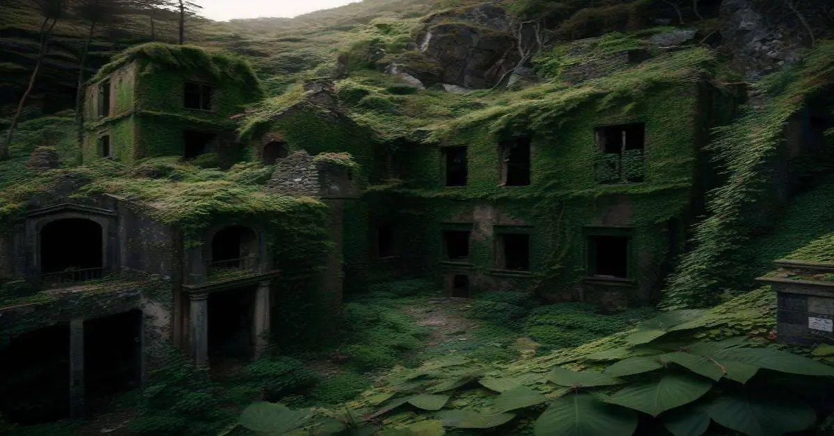
Alturas, now a ghost town, was a mining camp in El Dorado Canyon near the Techatticup Mine in the Colorado Mining District of New Mexico Territory.
Remains:
Current Status:
Remarks:
Aurora, NV
County:
Mineral
Zip Code:
Latitude / Longitude:
38°17′21″N 118°53′57″W / 38.28917°N 118.89917°W / 38.28917
Elevation:
Time Zone:
Pacific (PST) (UTC-8)
Established:
1860
Disestablished:
Comments:
Aurora is a ghost town in Mineral County in the west central part of the US state of Nevada, approximately 22 mi (35 km) southwest of the town of Hawthorne, three miles from the California border. The road to Aurora was once difficult to navigate except via four-wheel drive, as the winter snows and spring run-off damaged the road in the canyon leading to the town. In recent years the operations of a nearby mine have improved the road so that even non-4WD vehicles can reach the town site.
Remains:
James M. Cory, James M. Braly and E.R. Hicks founded the town in 1860. When Esmeralda County was founded a few years later, Aurora was one of the few places that were explored in the county. Cory is credited with having named the strike Esmeralda but, in the late 1860s, he is reported to have changed the name to Aurora for the goddess of dawn. At one point its population was approximately 10,000. Aurora’s mines produced $27 million worth of gold by 1869. The town was governed by both California and Nevada until it was determined that the town lay entirely in Nevada. At one point it was simultaneously the county seat of both Mono County, California and Esmeralda County, Nevada. Its California assemblyman was the speaker of the house while the Nevada legislative member was elected as president of the Nevada Territorial Legislature.
Current Status:
Today the townsite is much diminished, having been damaged by vandals. After World War II many of the buildings were razed for their brick. There are small remains of Aurora in the area. The streets and the foundations of some of the buildings are still somewhat visible. Most of the buildings were dismantled, its materials used in homes in California as used brick became fashionable. Mark Twain briefly lived in Aurora
Remarks:
The town cemetery has suffered from vandalism over the years. The most notable destruction was the headstone of William E. Carder, a notorious criminal and gunfighter who, on the night of December 10, 1864 was “assassinated” by a man whom he had threatened in the preceding days. The headstone erected by his wife Annie was toppled by thieves who attempted to steal it, and broken into several pieces, where they now lie sunken into the ground.
Belleville, NV
County:
Mineral
Zip Code:
Latitude / Longitude:
38° 13′ 9″ N, 118° 10′ 47″ W
Elevation:
Time Zone:
Pacific (PST) (UTC-8)
Established:
Disestablished:
Comments:
Belleville, Nevada, in Mineral County, Nevada, United States, was a mining town that rose up around the milling of ore shipped in from nearby mines. Today it is a ghost town.
Remains:
Belleville was founded in 1872 and its primary industry was the mill processing ore from the Northern Belle Mine at Candelaria. The mill was located just east of the present-day historical marker. Its first bullion bar shipment of $9,200 was made in April 1875. The town was famed for a “Wild West” atmosphere; murders, drunken brawls, and “sporting” practical jokes were commonplace. When the Carson and Colorado Railroad reached the town in 1882 its population was 500, and the town was served by a doctor, assay office, express office, telegraph station, livery stable, school, two hotels, restaurants, and blacksmith shops as well as by seven saloons.
Current Status:
Remarks:
By 1892 water piped to Candelaria allowed the ore to be milled nearer the mine, and Belleville was deserted.
Belmont, NV
County:
Nye
Zip Code:
Latitude / Longitude:
38°35′33″N 116°52′16″W / 38.59250°N 116.87111°W / 38.59250
Elevation:
Time Zone:
Pacific (PST) (UTC-8)
Established:
1865
Disestablished:
Comments:
Belmont is a ghost town in Nye County, Nevada, United States along former State Route 82. The town is a historic district listed in the National Register of Historic Places. It is Nevada Historical Marker number 138.
Remains:
Belmont was established following a silver strike in 1865. Other minerals, such as copper lead and antimony, were also mined in addition to the silver. The boom brought settlers in and the town of Belmont grew. In 1867, Belmont became the county seat of Nye County. The town boasted four stores, two saloons, five restaurants, livery stable, post office, assay office, bank, school, telegraph office, two newspapers, and a blacksmith shop. As the price of metals fluctuated, so did the fortunes of the town. By 1887, several of the mines closed. In 1905, the county seat of Nye County was relocated from Belmont to Tonopah. The mine dumps were reworked in the early part of the 20th century
Current Status:
Some of the buildings are still standing, including the courthouse, the Cosmopolitan Saloon, the Monitor-Belmont Mill, and the combination mill. Currently, the old Combination Mine and Mill office and Belmont Courier Newspaper office and associated buildings are under restoration and preservation, known as the Philadelphia House, a reference to the name of the lodging house in the 1880s, and the Philadelphia mining district. This building complex was a business for about 15 years known as the Belmont Inn and Saloon, and also the Monitor Inn. Restoration volunteers are being solicited.
Remarks:
During the 1870s it was known as a major mining boomtown producing silver, and was rumored to have a population of 15,000. Like many towns which are now ghost towns, this one lasted for only a short time. To the south of the site there is the Belmont Courthouse now belonging to Nye County and cared for by the “Friends of the Belmont Courthouse”. The transfer from the Belmont Courthouse State Historical Park to Nye County took place in 2012.
Beowawe, NV
County:
Eureka
Zip Code:
Latitude / Longitude:
40°35’31″N 116°28’34″W
Elevation:
Time Zone:
Pacific (PST) (UTC-8)
Established:
Disestablished:
Comments:
Beowawe (/”be”o”‘w”””wi”/ bay-“-WAH-wee) is a small town, misnomered on the internet as a ghost town, in Eureka County in northeastern Nevada in the western United States. It is the site of a mining operation and a geothermal power plant, and has a public library. Beowawe is a Paiute Native American word meaning “gate”, so named for the peculiar shape of the hills close to town which gives the effect of a gateway opening to the valley beyond. The town is located at an elevation of 4,695 feet (1,431 m), and is situated on State Route 306 5 miles (8 km) south of Interstate 80. The Humboldt River runs through northern Nevada near Beowawe. At approximately 300 miles (480 km) long, it is the second longest river in the arid Great Basin of North America. It has no outlet to the ocean, but instead empties into the Humboldt Sink.
Remains:
Beowawe was founded in 1868 with the arrival of the railroad. Gravelly Ford, a noted site on the California Trail, is a few miles east of Beowawe on Pioneer Pass Road. The famous “Maiden’s Grave” marker overlooks the ford. A tall cross in the Beowawe cemetery commemorates the burial of Lucinda Duncan, a grandmother who died on the trail in 1863. Workers building the Central Pacific Railroad first noted the grave along the Humboldt River, and in 1906 it was moved to the hillside cemetery when the Union Pacific realigned its tracks. The town reached its peak around 1881 with a population of 60 people. The town consisted of an elementary school, church, post office, store, and library. In 1909 a power plant was built but, like many ghost towns, the boom had ended by 1916 and many of the residents had moved on. Currently, Beowawe is once again tied to energy production, the home to both a geothermal power plant and a large propane tank farm near the railroad.
Current Status:
The man-made geyser at Beowawe in central Nevada is similar to Fly Geyser in northwestern Nevada in that both were artificially produced by geothermal drilling, but the former area was developed for clean energy production and the latter area was not. Another striking difference between the localities is an aesthetic one: more travertine has precipitated from the hydrothermal fluids at Fly Geyser than at Beowawe, generating spectacular mounds at Fly Geyser’s uncapped wellhead, thus suggesting dissimilar water chemistry between the two geothermal systems.
Remarks:
Photos of hot springs and fumaroles – photos ‘9-67’ (1931) and ‘9-56’ (date unknown) – show hydrothermal activity prior to power-generation. It is unknown if those smaller hydrothermal surface features are still active as of 2015, post-power plant development; field reconnaissance would be required to assess the activity of the hydrothermal features. Photos ‘9-69’ (close-up, date unknown) and ‘9-108’ (distant, 1971) show the uncapped well that is not a natural geyser, which was active prior to power-production. Geyser activity at the wellhead ceased circa 1985/1986 as the local dual-flash geothermal power plant began operations.
Berlin, NV
County:
Nye
Zip Code:
Latitude / Longitude:
38°52′56″N 117°36′26″W / 38.88222°N 117.60722°W / 38.88222
Elevation:
Time Zone:
Pacific (PST) (UTC-8)
Established:
1897
Disestablished:
Comments:
The Berlin Historic District encompasses the ghost town of Berlin in Nye County, Nevada. The town was established in 1897 as part of the Union Mining District after the opening of the Berlin Mine the previous year. The town never prospered to the same extent as other boom towns like Tonopah and Goldfield, and declined following the Panic of 1907. The town was largely abandoned by 1911. The site was acquired by the state of Nevada as part of Berlin–Ichthyosaur State Park in 1970.
Remains:
The town is on the western side of the Shoshone Range on the edge of Toiyabe National Forest at an elevation of about 6,676 ft (2,035 m) above sea level. At elevations above the townsite the forest becomes more dense and provided a source of building materials for the town. The town is arranged in a U shape, opening to the east. At its peak, the town had about 75 buildings and 300 residents. Berlin was a company town, operated by the Nevada Company and was maintained until its acquisition by the state in 1970. This accounts for the town’s excellent state of preservation.
Current Status:
The preserved buildings in Berlin include the mine supervisor’s house, now the park office, the assay office and a machine shop. The 30-stamp mill, one of the best of its type in the state, has been stabilized. The town was added to the National Register of Historic Places in 1971.
Remarks:
The town of Union, a mile to the east, functioned as a suburb to Berlin. The Berlin Mine had three miles of tunnels, but produced less than $1 million worth of gold and silver during its lifetime. The Diana mine connects to the Berlin Mine at the fourth level and is preserved as a mining museum. Tours of the Diana Mine were halted in 2007 until a safety review could be completed.
Bermond Station, NV
County:
Churchill
Zip Code:
Latitude / Longitude:
39°16’46″N 118°16’12″W
Elevation:
4,157 ft (1,267 m)
Time Zone:
Pacific (PST) (UTC-8)
Established:
Disestablished:
Comments:
Frenchman, also known as Frenchman’s Station or Bermond, was a community in Churchill County, Nevada, United States. Frenchman was located along U.S. Route 50 30 miles (48 km) east-southeast of Fallon. The community was founded in 1904 as a stagecoach stop; it took its name from Aime “Frenchy” Bermond, a French immigrant. During its existence, the community primarily consisted of a hotel and restaurant along the highway.
Remains:
Current Status:
The U.S. Navy bought out the community in 1985 due to its proximity to the Dixie Valley bombing range, and its remaining buildings were demolished two years later.
Remarks:
Blair, NV
County:
Esmeralda
Zip Code:
Latitude / Longitude:
37°47’35″N 117°38’57″W
Elevation:
4,616 ft (1,407 m)
Time Zone:
Pacific (PST) (UTC-8)
Established:
Disestablished:
Comments:
Blair, Nevada is a mining ghost town in Esmeralda County, Nevada.
Remains:
By 1920, Blair was a ghost town. Besides the historical marker the only reminders of the town are the remains of stone buildings and the foundation of the old mill.
Current Status:
Today a historical marker commemorates Blair along State Route 265 just north of Silver Peak. At one time Blair was a thriving, albeit short-lived, mining boom town. As mining reached a fever pitch in Nevada during the Tonopah boom, the effects spidered out in all directions to revive many a dormant mining town. Nearby, in Silver Peak, land speculators were driving land prices so artificially high that the 100-stamp mill planned for Silver Peak was relocated and built a mile and a half west, where it became the hub of Blair. It was the Pittsburg-Silver Peak Gold Mining Company that was responsible for the large mill that went up in 1907; at the time it was Nevada’s largest such facility. They constructed the 17 and half mile Silver Peak Railroad the previous year. Blair had a post office from November 1906 to December 1915.
Remarks:
Bristol, NV
County:
Lincoln
Zip Code:
Latitude / Longitude:
38°6’22″N 114°41’42″W
Elevation:
Time Zone:
Pacific (PST) (UTC-8)
Established:
1870
Disestablished:
Comments:
Bristol Wells, also known as National City, Bristol City and Tempest, is a ghost town in Lincoln County, Nevada. The mining town was located on the west side of Bristol Mountain, 14 miles (23 km) northwest of Pioche, Nevada.
Remains:
The first mining claims were staked in 1870. The district was organized the next year when the settlement of National City grew around the National Mine. In 1872 a furnace was built to treat silver-lead ore from the Bristol Mine, 4 miles (6.4 km) to the east. In 1878 a richer deposit was found, resulting in the construction of a stamp mill. The settlement was renamed Bristol City the same year. The stamp mill expanded in 1880 and a smelter was built, while stone ovens were built to provide charcoal for the smelter. The town’s wells provided water to the mines. By 1890 a new smelter was built to treat copper ore, and the town’s population reached 400.
Current Status:
Activity declined after 1893. A leach-recovery plant built in 1900 operated for two years, recovering copper. In 1913 an aerial tramway was built to Jackrabbit, Nevada, 2 miles (3.2 km) to the northeast, where ore could be loaded on the Los Angeles and Salt Lake Railroad. Mining activity continued intermittently, sharply declining after 1918. The town was briefly renamed Tempest after the Tempest Mine in 1922, returning to Bristol in 1929. The post office continued until 1950.
Remarks:
The townsite was listed on the National Register of Historic Places in 1972.
Broken Hills, NV
County:
Mineral
Zip Code:
Latitude / Longitude:
39° 2′ 59″ N, 118° 0′ 37″ W
Elevation:
Time Zone:
Pacific (PST) (UTC-8)
Established:
Disestablished:
Comments:
Broken Hills is a ghost town in Mineral County, Nevada. It was developed in 1913, after gold was discovered in the area.
Remains:
Broken Hills was founded by two Englishmen, Joseph Arthur and James Stratford. They were the first people to find ore within Broken Hills. After five years of labor, both Arthur and Stratford were only rewarded with $68,000. Arthur and Stratford then sold their claims to George Graham Rice, who promoted the mine and sold shares of property. Rice invested $75,000 of stockholder money into the mine to produce only $7,000 of revenue.
Current Status:
Remarks:
Bullfrog, NV
County:
Nye
Zip Code:
Latitude / Longitude:
36°53′25″N 116°50′01″W / 36.89028°N 116.83361°W / 36.89028
Elevation:
3,560 ft (1,085 m)
Time Zone:
Pacific (PST) (UTC-8)
Established:
Disestablished:
Comments:
Bullfrog is a ghost town in Nye County, in the U.S. state of Nevada. It is located at the north end of the Amargosa Desert about 4 miles (6.4 km) west of Beatty. Less than 1 mile (1.6 km) north of Bullfrog are the Bullfrog Hills and the ghost town of Rhyolite. The two ghost towns are about 120 miles (190 km) northwest of Las Vegas, 60 miles (97 km) south of Goldfield, and 90 miles (140 km) south of Tonopah.
Remains:
To the west, roughly 5 miles (8.0 km) from Bullfrog, the Funeral and Grapevine Mountains of the Amargosa Range rise between the Amargosa Desert in Nevada and Death Valley in California. Bullfrog is near the Goldwell Open Air Museum and its Red Barn Art Center. The Bullfrog jail, the barn, the museum’s information center and its outdoor sculptures are located along a spur road leading from State Route 374 to Rhyolite.
Current Status:
It is probable Original was added to the name of the mine to distinguish it from the mining camp. By the winter of 1904, Bullfrog had about a thousand people living in tents, dugouts and congested traffic made a demand for rail connections The Bullfrog-Goldfield Railroad reached Rhyolite on May 22, 1907.
Remarks:
Bullfrog Mine was discovered by Frank “Shorty” Harris and Eddie Cross on August 9, 1904. The name Bullfrog was the name chosen either because Eddie Cross was fond of singing ‘O, the bulldog on the bank and the bullfrog in the pool…’ or because the ore sample of rich gold was found in green-stained rock and was frog-shaped.
Bullionville, NV
County:
Zip Code:
Latitude / Longitude:
37°47′28″N 114°23′20″W / 37.79111°N 114.38889°W / 37.79111
Elevation:
729 feet (1 441 m)
Time Zone:
Pacific (PST) (UTC-8)
Established:
Disestablished:
Comments:
Remains:
Current Status:
Remarks:
Cactus Springs, NV
County:
Nye
Zip Code:
Latitude / Longitude:
37°32′09″N 116°52′58″W / 37.53583°N 116.88278°W / 37.53583
Elevation:
Time Zone:
Pacific (PST) (UTC-8)
Established:
Disestablished:
Comments:
Cactus Springs is a ghost town in Nye County, Nevada. It is currently within the boundaries of the Nellis Air Force Range.
Remains:
Activity began in 1901 with the discovery of turquoise on Cactus Peak. Silver was discovered nearby in 1904, and by 1910 the Lincoln Gold Mining Company had constructed a small camp near its holdings called Camp Rockefeller.
Current Status:
Activity in the Cactus Range ended by 1935 and the camp never had a population greater than approximately 50 persons.
Remarks:
Callville, NV
County:
Clark
Zip Code:
Latitude / Longitude:
36° 6′ 48″ N, 114° 41′ 20″ W
Elevation:
Time Zone:
Pacific (PST) (UTC-8)
Established:
Disestablished:
Comments:
Callville is a former settlement of Clark County in the U.S. state of Nevada. Abandoned in 1869, it was submerged under Lake Mead when the Colorado River was dammed, Callville Bay retaining the name. At one time, it was noted to be the southernmost outpost of the Mormon settlement.
Remains:
Callville was established on December 2, 1864 by Anson Call, Dr. James M. Whitmore, A. M. Cannon, Jacob Hamblin and son. It was at the time the southernmost outpost of Mormon settlement. The settlement was made by Call “as agent for the Trustee in Trust (the President) of the Church in December, 1864, according to a plan which was conceived of at that time to bring the Church immigration from Europe to Utah via Panama, the Gulf of California and up the river to this landing.” A number of Salt Lake City merchants worked in conjunction with the plan to build a warehouse on the Colorado River for goods portage. On November 1, 1864 Call was directed to put together a suitable company, find a road to the Colorado River, explore it, locate a suitable locale for a warehouse, build it, and create a settlement by the landing. In order to accomplish this, in St. George, he employed Hamblin and son, Cannon and Whitmore. Their travels included leaving the mouth of the Muddy River, traveling down the Virgin River for 12 miles (19 km), continuing through Echo Wash for 12 miles (19 km), before heading southwestward for 20 miles (32 km) to the Colorado River, a mile below the mouth of the narrows of Boulder Canyon and above the mouth of Black Canyon, where they located a black rocky point, which was considered a suitable spot for the construction of a warehouse, above high-water mark. It was located just below the confluence of Callville Wash with the Colorado River.
Current Status:
Callville was submerged under 400 feet (120 m) of water after the Colorado River was dammed to form Lake Mead. Callville Bay recreation area is located at the site.
Remarks:
Callville was one of seven Mormon settlements on or near the Muddy River, the others being St. Thomas, Saint Joseph, Overton, West Point, Mill Point later Simonsville and Rioville on the Colorado River above its confluence with the Virgin River. Callville became the county seat of Pah-Ute County, Arizona Territory, in December 1865, before the seat was moved on October 1, 1867 to St. Thomas.
Candelaria, NV
County:
Mineral
Zip Code:
Latitude / Longitude:
38°09′32″N 118°05′21″W / 38.15889°N 118.08917°W / 38.15889
Elevation:
Time Zone:
Pacific (PST) (UTC-8)
Established:
Disestablished:
Comments:
Candelaria is a ghost town in Mineral County, Nevada, approximately 121 miles southeast of Fallon. Today the site of Candelaria is dominated by the Kinross Gold Candelaria Mine on Mt. Diablo.
Remains:
The area where Candelaria developed first attracted notice in 1864 when Mexican prospectors working the area near Mt. Diablo discovered silver deposits on the northern slopes of the mountain. However, word of the find was slow to spread, and Candelaria wasn’t truly a town, or even a camp, until a group of European prospectors, mainly German and Slovakian, came into the area in 1879 and established a camp, which soon became a boomtown. The earlier Mexican presence in the area had named the location Candelaria, and this name stuck.
Current Status:
Because of its remote location, much of Candelaria remained somewhat undisturbed for many years. Although not completely immune to vandalism, much of the damage to remaining buildings was a result of the harsh environment: bitter cold and snow in winter, and the dry, very hot, and often windy weather in the summer. In the mid- to late-1980s an open-pit mine on the south side of Mt. Diablo was started. As the mine expanded, the town site of Candelaria came under close guardianship of the mine’s operators. Visitors to Candelaria were turned away by security guards from the mine, and signs were posted along the road through the town stating that it was private property, and that trespassing was prohibited. Because of this oversight, Candelaria was spared much of the destruction suffered by other ghost towns, and even today the remains of many of its buildings are easily seen and recognizable.
Remarks:
The location of Candelaria is approximately 121 miles from Fallon on US 95S; from there turn W on dirt road for 6 miles to the location of the town site. Candelaria was at 38°09’32″N 118°05’21″W, at an elevation of 5714 feet (1742m).
Caselton, NV
County:
Zip Code:
Latitude / Longitude:
Elevation:
Time Zone:
Pacific (PST) (UTC-8)
Established:
Disestablished:
Comments:
Remains:
Current Status:
Remarks:
Chafey, NV
County:
Pershing
Zip Code:
Latitude / Longitude:
Elevation:
Time Zone:
Pacific (PST) (UTC-8)
Established:
Disestablished:
Comments:
Dun Glen (later Chafey) is a ghost town in Pershing County, Nevada, United States, north of the present community of Mill City. Found in 1862, it was a silver mining community founded at a site then within Humboldt County.
Remains:
In 1862 the town was founded and soon had a population of 250. It was named after Angus Dunn, its first settler. Early on it was variously called Dunn Glen or Dunglen. However its post office, opened on July 18, 1865 was called Dun Glen, and it operated as such until April 7, 1894. In 1863 the Sierra Mining district was formed 10 miles northeast of Mill City, with Dun Glen as its business center. In 1863 and 1865 to 1866, at the town’s request, a small army garrison was stationed at Camp Dun Glen within the town to protect the miners from Indians in the early part of the Snake War. Dun Glen in the 1860s was one of the largest towns in northern Nevada. By the 1870s it had three stamping mills, but by 1880 mining declined and the population also had declined to 50 persons, supported only by the local cattle ranching in the area. By 1894 it was nearly deserted.
Current Status:
Little is left of the old towns except a few deteriorated stone foundations and dugouts, foundations the stamp mills, a cemetery, tailings from mining operations, and tracks leading to abandoned mines and building sites.
Remarks:
The Dun Glen Placer Mine is situated in Pershing County, Nevada, along Dun Glen Creek, which drains from the west side of the East Range Mountains. Reports indicate lode gold was discovered and vein deposits were mined in Dun Glen Canyon during the early 1860s. Chinese miners attempted drift mining of the gold laden placer gravels between 1880 and 1890 with limited success due to the water table. Further exploration of the deposits in the 1920s to 1930’s led to the first mechanized placer operation in 1931. The area has been mined for placer gold since that time and various production totals have been poorly documented.
Charleston, NV
County:
Elko
Zip Code:
Latitude / Longitude:
41°40′15″N 115°30′38″W / 41.67083°N 115.51056°W / 41.67083
Elevation:
6,076 ft (1,852 m)
Time Zone:
Pacific (PST) (UTC-8)
Established:
Disestablished:
Comments:
Charleston is a ghost town in Elko County, Nevada, United States. It lies along the Bruneau River just south of the Mountain City and Jarbidge Ranger Districts of the Humboldt-Toiyabe National Forest and is near the southwest edge of the Jarbidge Wilderness.
Remains:
Current Status:
Remarks:
Coaldale, NV
County:
Esmeralda
Zip Code:
Latitude / Longitude:
38° 1′ 39″ N, 117° 52′ 59″ W
Elevation:
Time Zone:
Pacific (PST) (UTC-8)
Established:
Disestablished:
Comments:
Coaldale is a ghost town in Esmeralda County, Nevada, located at the junction of U.S. Route 95 and U.S. Route 6 about 40 miles east of Tonopah, Nevada.
Remains:
Coal near Coaldale was discovered in 1894 by William Groszenger who sold 150 tons to the Columbus Marsh Borax works. In 1911, the Darms Mine and the Nevada Coal and Fuel Co. mines were in operation. Coal was found 4 miles SSE of Coaldale in the north end of the Silver Peak Range. In the early 1900’s, there was renewed interest in the coal, when Dr. Frances Williams of Goldfield, Nevada personally restaked claims. At the time, Groezenger retained the majority of the claims.
Current Status:
Coaldale had a store, cafe, motel, and service station as late as 1993, but is now abandoned. The service station was closed down due to EPA testing in 1993 that found that its underground fuel tanks were leaking. Soon, the restaurant and motel closed, since the service station was the primary attraction for travelers.
Remarks:
In 1994, the movie The Stranger was filmed at Coaldale. The Stranger features Kathy Long, female kickboxing champion, who battles bikers and saves the town. At some point before 2006, a fire destroyed the restaurant.
Cobre, NV
County:
Elko
Zip Code:
Latitude / Longitude:
41°06′43″N 114°24′03″W / 41.11194°N 114.40083°W / 41.11194
Elevation:
5,922 ft (1,805 m)
Time Zone:
Pacific (PST) (UTC-8)
Established:
Disestablished:
Comments:
Cobre is a ghost town in Elko County, Nevada, United States.
Remains:
The town was located at the former interchange point between the Southern Pacific Railroad and the Nevada Northern Railway, and came into being when construction of the Nevada Northern began in 1905. The Nevada Northern was constructed primarily to serve the copper mines and smelter near Ely, Nevada; cobre is Spanish for “copper.” In 1910, Cobre reached its peak population with a total of 60 residents. Over the next few decades Cobre’s population slowly declined due to travelers’ preference for the automobile over the train.
Current Status:
This led to the Southern Pacific Railroad abandoning the Cobre passenger station in November 1948. The station remained an active railroad section townsite for a few families and crew. Homes and facilities that supported the train crew also remained; the train crew covered the section from Cobre to Shafter. The Nevada Northern Railroad ran a train that made a weekly trip to Cobre until June 20, 1983. The 5 homes were sold in 1986 for $1 a building and were dismantled and removed from their foundations. A post office was established at Cobre in 1906. It was discontinued in 1956.
Remarks:
Colorado City, NV
County:
Clark
Zip Code:
Latitude / Longitude:
35° 42′ 27″ N, 114° 42′ 42″ W
Elevation:
Time Zone:
Pacific (PST) (UTC-8)
Established:
Disestablished:
Comments:
Colorado City is now a ghost town, in Clark County, Nevada, located under Lake Mohave at the mouth of El Dorado Canyon.
Remains:
Colorado City was a mining camp in the Colorado Mining District (New Mexico Territory) and a steamboat landing at the mouth of the El Dorado Canyon on the Colorado River, for shipments via steamboats of the Colorado River. :33,35 Founded in 1861, Colorado City, was at first located in New Mexico Territory, until 1863, when it became part of Mohave County of Arizona Territory. In 1867 it became part of Lincoln County in the state of Nevada.
Current Status:
The site of Colorado City, and the Colorado River it was adjacent to, was submerged under Lake Mohave following the construction of the Davis Dam in 1951. What remains of Colorado City lies offshore from the site of Nelson’s Landing.
Remarks:
In 1866, Colorado City became the site of two stamp mills, located there for ease of supplying wood to operate its steam driven mechanism. One was the old Colorado Mill brought down the canyon from El Dorado City, and refurbished. The other was the new New Era Mill.
Columbus, NV
County:
Esmeralda
Zip Code:
Latitude / Longitude:
38°06′37″N 118°01′09″W / 38.11028°N 118.01917°W / 38.11028
Elevation:
Time Zone:
Pacific (PST) (UTC-8)
Established:
Disestablished:
Comments:
Columbus was a borax mining boom town in Esmeralda County. Its remnants are located on the edge of the Columbus Salt Marsh.
Remains:
Settlement came to the Columbus Salt Marsh in 1865 with the raising of a quartz mill. Columbus was the ideal location for a mill, as it was the only stop for several miles with sufficient amounts of water for the operation of a mill. It wasn’t until 1871 that borax was discovered near the town’s site, and as a result Columbus increased substantially in its importance. Shortly after the discovery of borax by William Troop four borax companies were actively working the deposits on the marsh. Columbus’ zenith occurred around 1875 when there was around 1,000 people in the town. By that same year many businesses flourished in Columbus as well as a post office and local newspaper, The Borax Miner.
Current Status:
By 1881 borax mining activity had practically ceased and approximately 100 people were left in the community. Shortly thereafter, all mining and milling operations completely ceased.
Remarks:
William Caruthers, in his “Loafing Along Death Valley Trails” (Ontario: Death Valley Publishing Co., 1951) says that Francis M. “Borax” Smith discovered the borax at Columbus Marsh.
Como, NV
County:
Lyon
Zip Code:
Latitude / Longitude:
39°10′21″N 119°28′36″W / 39.17250°N 119.47667°W / 39.17250
Elevation:
6,096 ft (1,858 m)
Time Zone:
Pacific (PST) (UTC-8)
Established:
Disestablished:
Comments:
Como is a ghost town in Lyon County, Nevada, in the United States.
Remains:
Gold was found in the Pine Nut Mountains of western Nevada. In June 1860, was created a mining district in Palmyra. Como was established in 1863 during the gold rush in Palmyra Mining District. By May 1863, there were six buildings in the growing town, and the town eventually reached a population of as many as 700 people. Como’s first mill a steam driven contraption called “The Solomon Davis” arrived with much fanfare in 1863. Although several sources have stated that Como was the first seat of Lyon County, nearby Dayton was officially appointed as the first county seat by the Nevada Territorial Legislative Assembly on November 29, 1861.
Current Status:
Como’s post office operated during two periods, opening originally December 30, 1879 and closing January 3, 1881. During a subsequent revival of the old camp, another post office operated between May 29, 1903 to February 28, 1905. The town’s last inhabitant, 63-year-old Judge G. W. Walton, died in a fire that destroyed his cabin on the night of November 22, 1874. Perhaps the most famous resident of the Como region was Chief Truckee, father of chief Winnemucca, befriender of white men, purported savior of emigrant wagon trains and scout for Kit Carson and John C. Fremont. Today is totally abandoned and rests only some foundations of the old buildings. In addition to abandoned mines and ghost ruins of the old town, the region also contains Indian caves and petroglyphs.
Remarks:
New discoveries a short distance away lead to the platting of Como townsite and Palmyra waned. Tunnels were opened and a small mill was built by J.D. Winters. But it proved to be unsuccessful and Winters later drifted to Virginia City and became an employee of the Yellow Jacket Mine. The business sector of the camp had all the usual amenities of frontier life. A highlight of town was the Cross Hotel, a first class establishment with a parlor, bar, carpeted rooms, and a meeting hall. Como had a newspaper, “The Como Sentinel”, published between April 16, 1864 to July 9, 1864 by T.W. Abraham and H.L. Weston (the latter formerly of the Petaluma, California JOURNAL. After the last issue of the Como SENTINEL, Abraham and Weston went on to publish the Lyon County SENTINEL at nearby Dayton.
Cortez, NV
County:
Zip Code:
Latitude / Longitude:
Elevation:
Time Zone:
Pacific (PST) (UTC-8)
Established:
Disestablished:
Comments:
Remains:
Current Status:
Remarks:
Crystal Springs, NV
County:
Lincoln
Zip Code:
Latitude / Longitude:
37°31′54″N 115°14′02″W / 37.53167°N 115.23389°W / 37.53167 -115.23389
Elevation:
Time Zone:
Pacific (PST) (UTC-8)
Established:
Disestablished:
Comments:
Crystal Springs is a ghost town in the Pahranagat Valley region of Lincoln County, Nevada in the United States. The ghost town is located at the junction of State Route 318 and State Route 375 (Extraterrestrial Highway), just northwest of U.S. Route 93. It is a popular destination for passersby who want to visit the towns of Hiko and Rachel. The namesake of the ghost town, the Crystal Springs, lies nearby; it is a large group of marshes and springs along the White River. Crystal Springs provides irrigation for multiple nearby ranches and farms, some of which lie over 5 miles away from the springs.
Remains:
The ghost town is marked as Nevada Historical Marker 5 (Crystal Springs). The earliest reported uses of the spring were by a Native American village. The springs provided water for people traveling the Mormon Trail.
Current Status:
In 1865, Crystal Springs was the first area in Lincoln County where mining grade silver ore was discovered. This led to Crystal Springs becoming the first county seat of Lincoln County from 1866 to 1867, although it was later replaced by Hiko.
Remarks:
Currant, NV
County:
Nye
Zip Code:
Latitude / Longitude:
38° 44′ 27.6″ N, 115° 28′ 44.4″ W
Elevation:
Time Zone:
Pacific (PST) (UTC-8)
Established:
1868
Disestablished:
Comments:
Currant is an unincorporated community in Nye County, Nevada. Settled in 1868, it was first a farming town with a small population. Its current population is 65. Creeks nearby were named for the wild currants growing with the town, taking the name from Currant creek.
Remains:
Currant post office opened April 16, 1883, was reestablished September 19, 1892, and again August 31, 1926, operations suspended December 31, 1943. In 1914, a small amount of gold was discovered.
Current Status:
In the late 1930s, small but highly productive claims of magnesite deposits were discovered in Nye County while major deposits were in Ely in White Pine County, Nevada, and magnesite mining stopped in 1942.
Remarks:
Currant is located on U.S. Route 6 at the junction of State Route 379. The area is served by the Currant Ranch Airport.
Daveytown, NV
County:
Humboldt
Zip Code:
Latitude / Longitude:
41°17’42″N 117°54’11″W
Elevation:
1,284 m (4,213 ft)
Time Zone:
Pacific (PST) (UTC-8)
Established:
Disestablished:
Comments:
Daveytown is a ghost town located in Humboldt County, Nevada about twenty four miles north-northwest of Winnemucca and east of the Slumbering Hills. Daveytown is named for the Davey Mine.
Remains:
Daveytown was an active mining area from 1910 until the 1930s.
Current Status:
In 1938, the Davey Mine was no longer owned by the Davey family and was known as the Mayday Mine. The Mayday Mine had a ten stamp mill and a tailings mill at Daveytown.
Remarks:
Deeth, NV
County:
Elko
Zip Code:
Latitude / Longitude:
41°03′56″N 115°16′29″W / 41.06556°N 115.27472°W / 41.06556
Elevation:
Time Zone:
Pacific (PST) (UTC-8)
Established:
Disestablished:
Comments:
Deeth is an unincorporated community near the intersection of Interstate 80 and Nevada State Route 230 in Elko County, Nevada, United States. The population is approximately 28.
Remains:
Current Status:
It used to be more populous, with a water tower, a saloon, a hotel, and other businesses and structures. However, many people have left to find better opportunities. Now only a small population and a few buildings remain. The Post Office remains open as it serves the needs of surrounding ranching areas.
Remarks:
Delano, NV
County:
Elko
Zip Code:
Latitude / Longitude:
41°40′04″N 114°16′25″W / 41.66778°N 114.27361°W / 41.66778 -114.27361
Elevation:
6,398 ft (1,950 m)
Time Zone:
Pacific (PST) (UTC-8)
Established:
Disestablished:
Comments:
Delano is a ghost town located in northeastern Elko County, Nevada, about 36 miles north of Montello. Delano was the center of a small gold-mining district that saw production from the 1870s to the 1960s. The post office closed in 1927.
Remains:
Current Status:
The remaining buildings at Delano were destroyed by a wildfire in the 1990s, and only archaeological remains survive at the site today.
Remarks:
Delamar, NV
County:
Lincoln
Zip Code:
Latitude / Longitude:
37°27′29″N 114°46′12″W / 37.45806°N 114.77000°W / 37.45806
Elevation:
Time Zone:
Pacific (PST) (UTC-8)
Established:
Disestablished:
Comments:
Delamar, Nevada, nicknamed The Widowmaker, is a ghost town in central eastern Nevada, USA along the east side of the Delamar Valley. During its heyday, primarily between 1895 and 1900, it produced $13.5 million in gold.
Remains:
In 1889, prospectors John Ferguson and Joseph Sharp discovered gold around Monkeywrench Wash. A mining camp was then born west of the Monkeywrench Mine. It was called Ferguson. In April 1894, Captain Joseph Raphael De Lamar bought most of the important mines in the area and renamed the Ferguson camp as Delamar. In the same year, a newspaper called the Delamar Lode began publication and a post office was opened. Soon, the new settlement boasted more than 1,500 residents, a hospital, an opera house, churches, a school, several businesses and saloons. Most buildings were made of native rock.
Current Status:
Many ruins now stand semi-intact in the Delamar ghost town region. Foundations can easily be seen from adjacent hills. There are two graveyards, which have been vandalized. The area is honeycombed with mines and mine shafts, but in recent years the main shaft has been blasted closed. Wild horses roam the area. The nearby dry lake is known to pilots as Texas Lake, because its outline resembles the state of Texas.
Remarks:
The gold in the Delamar mines was embedded in quartzite, which created a fine dust when crushed. Miners breathing the dust often developed silicosis and the town became known as a “widow-maker.”
Dixie Valley, NV
County:
Churchill
Zip Code:
Latitude / Longitude:
39°43′23″N 118°4′49″W / 39.72306°N 118.08028°W / 39.72306
Elevation:
Time Zone:
Pacific (PST) (UTC-8)
Established:
Disestablished:
Comments:
Dixie Valley, Nevada, was a small ranching town in Churchill County, Nevada until the area was acquired in 1995 by the US Navy for the Fallon Range Training Complex (FRTC). The town had no retail businesses, most residents were more than a mile from their nearest neighbor, and a 1-room school (grades 1–8) was the teacher’s residence and served as a meeting, dance, & election hall (grades 9–12 were bussed 75 miles to Fallon, Nevada). The abandoned town of Dixie was established at the head of Dixie Valley in 1861 and named by Southern sympathizers. The medium-sized Dixie Valley geothermal power plant (1988, 66 megawatts) employs ~30 people and has 12 production steam wells and ~24 injection wells.
Remains:
Current Status:
A very large earthquake doublet occurred on December 16, 1954. The Dixie Valley–Fairview earthquakes occurred four minutes apart, each with a maximum Mercalli intensity of X (Extreme). The initial shock measured 7.3 Mw and the second shock measured 6.9 Mw. Damage to man-made structures was minimal because the region was sparsely populated at the time, but oblique-slip motion on a normal fault resulted in the appearance of large fault scarps.
Remarks:
Dun Glen, NV
County:
Pershing
Zip Code:
Latitude / Longitude:
Elevation:
Time Zone:
Pacific (PST) (UTC-8)
Established:
Disestablished:
Comments:
Dun Glen (later Chafey) is a ghost town in Pershing County, Nevada, United States, north of the present community of Mill City. Found in 1862, it was a silver mining community founded at a site then within Humboldt County.
Remains:
In 1862 the town was founded and soon had a population of 250. It was named after Angus Dunn, its first settler. Early on it was variously called Dunn Glen or Dunglen. However its post office, opened on July 18, 1865 was called Dun Glen, and it operated as such until April 7, 1894. In 1863 the Sierra Mining district was formed 10 miles northeast of Mill City, with Dun Glen as its business center. In 1863 and 1865 to 1866, at the town’s request, a small army garrison was stationed at Camp Dun Glen within the town to protect the miners from Indians in the early part of the Snake War. Dun Glen in the 1860s was one of the largest towns in northern Nevada. By the 1870s it had three stamping mills, but by 1880 mining declined and the population also had declined to 50 persons, supported only by the local cattle ranching in the area. By 1894 it was nearly deserted.
Current Status:
Little is left of the old towns except a few deteriorated stone foundations and dugouts, foundations the stamp mills, a cemetery, tailings from mining operations, and tracks leading to abandoned mines and building sites.
Remarks:
The Dun Glen Placer Mine is situated in Pershing County, Nevada, along Dun Glen Creek, which drains from the west side of the East Range Mountains. Reports indicate lode gold was discovered and vein deposits were mined in Dun Glen Canyon during the early 1860s. Chinese miners attempted drift mining of the gold laden placer gravels between 1880 and 1890 with limited success due to the water table. Further exploration of the deposits in the 1920s to 1930’s led to the first mechanized placer operation in 1931. The area has been mined for placer gold since that time and various production totals have been poorly documented.
El Dorado City, NV
County:
Clark
Zip Code:
Latitude / Longitude:
35° 42′ 7″ N, 114° 48′ 5″ W
Elevation:
Time Zone:
Pacific (PST) (UTC-8)
Established:
Disestablished:
Comments:
El Dorado City, which is now a ghost town, was a mining camp in the Colorado Mining District at the mouth of January Wash at its confluence with El Dorado Canyon. It was located about a mile down the canyon from Huse Spring, at an elevation of 2382 feet. Its site was located nearby to the south southeast of the Techatticup Mine the primary source of the ore its mill processed.
Remains:
El Dorado City was the site of the El Dorado Mills or Colorado Mills, first stamp mill in the canyon, and perhaps in all of Arizona Territory. In late 1863, Col. James Russell Vineyard at the time a State Senator from Los Angeles, completed a mill from parts of abandoned or closed mills brought from in California, at what became El Dorado City, to process the ore of the Techatticup Mine and other mines in the canyon. That cut out the cost of shipping the ore down the Colorado River by steamboat, and by sea to San Francisco for processing, thus cutting costs in half for those mine owners.
Current Status:
The site of El Dorado City is now in Clark County, Nevada.
Remarks:
In 1866, the Colorado Mills were moved down the canyon from El Dorado City, to the landing at the mouth of the canyon and refurbished. El Dorado City, was first located in the Mohave County of Arizona Territory before it became part of the state of Nevada in 1867. However the dispute over this transfer was not settled in favor of Nevada until 1870 when El Dorado City became part of Lincoln County, Nevada. El Dorado City remained in existence into the 1880s.
Etna, NV
County: Lincoln
Zip Code:
Latitude / Longitude: 40°22′16″N 118°19′14″W / 40.37111°N 118.32056°W / 40.37111
Elevation: 4,236 ft (1,291 m)
Time Zone: Pacific (PST) (UTC-8)
Established:
Disestablished:
Comments: Etna is an unincorporated community in Lincoln County, Nevada.
Remains:
Current Status:
Remarks: