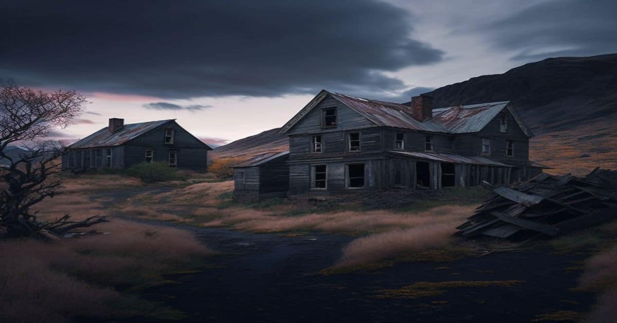
Eagle City, UT
County:
Garfield
Zip Code:
Latitude / Longitude:
38°04’12″N 110°44’48″W
Elevation:
7,789 ft (2,374 m)
Time Zone:
Mountain (MST) (UTC-7)
Established:
1890
Disestablished:
1970s
Comments:
Eagle City is a ghost town located in Garfield County, Utah, United States. Nestled in Bromide Basin high in the remote Henry Mountains of southern Utah, it was a gold mining camp. Eagle City was settled about 1890, but was almost abandoned by the start of World War I. A single resident remained until the 1970s.
Remains:
In 1889 a pair of prospectors discovered gold deposits in the Bromide Basin area, setting off a small gold rush. Owners of the Bromide and Oro mines built mills on Crescent Creek, where a small town grew up. Eagle City soon had a store, hotel, doctor’s office, and saloon. As many as 100 people lived here at one point. Eagle City had a rough reputation, and members of Butch Cassidy’s Wild Bunch were known to visit.
Current Status:
Remarks:
As the mine shafts reached the 300-foot (91 m) depth, the mines began to fill with water. A 3,000-foot (910 m) drain tunnel was planned, but never completed due to lack of capital. In 1911 the Bromide Mill burned down. Soon World War I took most of the remaining young men. Only Frank Lawler stayed behind at Eagle City. He lived there alone for the next 60 years, searching for the legendary Lost Josephine Mine.
Elgin, UT
County:
Emery
Zip Code:
84525
Latitude / Longitude:
Elevation:
Time Zone:
Mountain (MST) (UTC-7)
Established:
Disestablished:
Comments:
In 1883 the line commonly known as the Utah Division of the Denver and Rio Grande Western Railroad was built and a train station was opened. The west side of the river became known as “Greenriver” (later changed to “Green River”), and the east side of the river became known as “Elgin”, and is still referred to by that name today.
Remains:
Current Status:
Remarks:
Fish Springs, UT
County:
Juab
Zip Code:
Latitude / Longitude:
39°51’29″N 113°22’01″W
Elevation:
Time Zone:
Mountain (MST) (UTC-7)
Established:
1959
Disestablished:
Comments:
Fish Springs National Wildlife Refuge is at the southern end of the Great Salt Lake Desert, part of the Great Basin in Juab County, Utah. The Refuge is managed by the United States Fish and Wildlife Service. As an oasis in the Great Basin Desert in western Utah, Fish Springs serves a variety of species including fish, migratory birds, deer, coyotes, pronghorn, cougars and other native species. The reserve can be reached by paved road from Lynndyl, Utah to Topaz Mountain and then by improved dirt road to the Pony Express Road/Lincoln Highway improved dirt road which runs through the Refuge. The Refuge also is a recreational area for permitted outdoor activities. The Fish Springs Range runs north to south and is immediately west of the Wildlife Refuge.
Remains:
Fish Springs started as a Pony Express and Overland Stage station, and got its name from the fish that populated the springs, which were reported to be over 6 inches (15 cm) in length.
Current Status:
The fish are left over from ancient Lake Bonneville which receded about 14,000 years ago. Several natural springs feed the wetlands. These are along a linear path at the range front (that is, fault controlled), and include North Springs, Deadman Springs, House Springs, Middle Springs, Thomas Springs, South Springs, and Percy Springs. Fish Springs is thought to be the end of a long flowpath of groundwater, starting in the Schell Creek Range and Snake Range area and flowing along permeable bedrock (for example, limestones) or faults toward Fish Springs. This comes from the fact the annual discharge of the springs is 27,500 acre feet (33,900,000 m3)/year, and the annual recharge for the drainage area (the range front and Fish Springs Flat) is about 4,000 acre feet (4,900,000 m3)/year, meaning over 6 times more water flows out of the springs than falls in the valley annually by precipitation. The springs and several wells in the area are monitored by Fish and Wildlife personnel and/or the Utah Geological Survey. The water of Fish Springs is not suited for human consumption, being warm (~80 °F (27 °C)) and highly saline.
Remarks:
Forest City, UT
County:
Utah
Zip Code:
Latitude / Longitude:
40°31’40″N 111°36’10″W
Elevation:
Time Zone:
Mountain (MST) (UTC-7)
Established:
1871
Disestablished:
1880
Comments:
Forest City is a ghost town in Utah County, Utah, United States. It is located in the valley of Dutchman Flat in the upper part of American Fork Canyon, in the Uinta National Forest. A silver mining town just over the mountain from Alta, Forest City was inhabited about 1871–1880. The town grew up around the smelter that was built to process ore from the canyon’s mines. The American Fork Railroad, which was intended to serve Forest City and the smelter, stopped short of its destination due to engineering difficulties. Transportation costs rose too high for the mines to continue operating profitably. As the smelter, mines, and railroad closed down, Forest City was abandoned.
Remains:
Soon after the discovery of silver in Little Cottonwood Canyon in the late 1860s, prospectors crossed the mountain ridge to the south and staked more claims in American Fork Canyon. The largest mine, the Miller Hill Mine, developed quickly, and in 1871 was purchased for $120,000 by the Aspinwall Steamship Company of New York City. They built a smelter at Dutchman Flat called the Sultana Smelting Works, which employed 250–300 men in 1871. It was one of the most costly smelters in Utah Territory. The town that grew around the smelter was named Forest City.
Current Status:
Little is left of Forest City today. The foundations of the smelter and of some houses are still visible. The cemetery at Graveyard Flat was preserved for some time, but people have driven snowmobiles and all-terrain vehicles over it and have even torn down the picket fence surrounding it. As of 2004, only a wooden sign remained. On National Public Lands Day in September 2012, Forest Service employees and volunteers from local four wheeling clubs gathered at Graveyard Flat, built a new sturdier fence around the graveyard, and replaced the old wooden sign with two nice, well-built information signs depicting the history of the town and the cemetery.
Remarks:
The smelter’s production soon outpaced the ability to transport bullion and ore out of the canyon. In April 1872 the Aspinwall Steamship Company organized the American Fork Railroad Company to address this problem. They planned to build a narrow gauge railway from the city of American Fork up the canyon to Forest City. The Utah Southern Railroad, which at the time went no further south than Sandy, was scheduled that year to extend its track southward through Utah Valley, and the new railroad was to join it at American Fork. Construction on the line began from American Fork in May 1872, and by August it had reached the mouth of the canyon.
Frisco, UT
County:
Beaver
Zip Code:
Latitude / Longitude:
38°27’35″N 113°15’32″W
Elevation:
6,421 ft (1,957 m)
Time Zone:
Mountain (MST) (UTC-7)
Established:
1879
Disestablished:
1929
Comments:
Frisco is a ghost town in Beaver County, Utah, USA. It was an active mining camp from 1879 to 1929. At its peak in 1885, Frisco was a thriving town of 6,000 people.
Remains:
Frisco developed as the post office and commercial center for the San Francisco Mining District, and was the terminus of the Utah Southern Railroad extension from Milford. The Horn Silver Mine was discovered in 1875, and had produced $20,267,078 worth of ore by 1910. By 1885, over $60,000,000 worth of zinc, copper, lead, silver, and gold had been transported from Frisco from the many mines in the area.
Current Status:
In 1905 a Latter Day Saint ward was organized, but in 1911, with the closing of many of the mines, so many church members had left that the ward was discontinued. After many years of desertion, another company made an attempt to mine here in 2002.
Remarks:
With 23 saloons, Frisco was known as the wildest town in the Great Basin. Murder was common, and drinking water had to be freighted in. Frisco’s fortunes changed suddenly on February 13, 1885, when the Horn Silver Mine caved in completely. It was an unconventional mine, an open pit 900 feet (270 m) deep braced with timbers, and could have collapsed at any time.
Fruita, UT
County:
Wayne
Zip Code:
Latitude / Longitude:
38°17’08″N 111°14’39″W
Elevation:
5,436 ft (1,657 m)
Time Zone:
Mountain (MST) (UTC-7)
Established:
1880
Disestablished:
1955
Comments:
Fruita is the best-known settlement in Capitol Reef National Park in Wayne County, Utah, United States. It is located at the confluence of Fremont River and Sulphur Creek.
Remains:
Fruita was established in 1880 by a group of Mormons led by Nels Johnson, under the name “Junction.” The town became known as Fruita in 1902 or 1904. In 1900, Fruita was named The Eden of Wayne County for its large orchards. Fruita was abandoned in 1955 when the National Park Service purchased the town to be included in Capitol Reef National Park.
Current Status:
Today few buildings remain, except for the restored schoolhouse and the Gifford house and barn. The orchards remain, now under the ownership of the National Park Service, and have about 2,500 trees. The orchards are preserved by the NPS as a “historic landscape” and a small crew takes care of them by pruning, irrigating, replanting, and spraying them.
Remarks:
The one-room schoolhouse was built and opened in 1896. The few students were instructed mainly in reading, writing, and arithmetic, but when the teachers were capable, they also studied other subjects such as history or geography. The room was also used for balls and religious services. It was renovated in 1966 by the National Park Service. Fruita is currently the heart and administrative center of Capitol Reef National Park.
Fry Canyon, UT
County:
San Juan
Zip Code:
Latitude / Longitude:
37°38’06″N 110°09’24″W
Elevation:
5,374 ft (1,638 m)
Time Zone:
Mountain (MST) (UTC-7)
Established:
1950s
Disestablished:
1950s
Comments:
Fry Canyon was a small community in San Juan County, Utah, United States, located in Fry Canyon, just south of White Canyon, 50 miles (80 km) west on State Route 95 from its junction with U.S. Route 191 at Blanding.
Remains:
Fry Canyon was a uranium boom town during the 1950s, and the Fry Canyon Lodge opened in 1955, but it has since closed in 2007. The tiny hamlet, now a ghost town, is 19 miles (31 km) west-southwest of Woodenshoe Butte, and 8 miles (13 km) west-northwest of Natural Bridges National Monument.
Current Status:
The activities of a uranium ore upgrader mill (1957-1960) and a subsequent copper heap leach operation (1963-1968) at Fry Spring, two miles southeast of Fry Canyon, caused uranium, copper and radium contamination of groundwater in colluvial channel deposits within Fry Creek. The U.S. Geological Survey (with funding from the U.S. Environmental Protection Agency, and other agencies) installed three permeable reactive barriers, containing three different reactive materials (foamed zero-valent iron (ZVI) pellets, bone charcoal pellets, amorphous ferric oxyhydroxide (AFO) slurry mixed with pea gravel), at the site, which is managed by the U.S. Bureau of Land Management.
Remarks:
Garfield, UT
County:
Zip Code:
Latitude / Longitude:
Elevation:
Time Zone:
Mountain (MST) (UTC-7)
Established:
Disestablished:
Comments:
Remains:
Current Status:
Remarks:
Georgetown, UT
County:
Zip Code:
Latitude / Longitude:
Elevation:
Time Zone:
Mountain (MST) (UTC-7)
Established:
Disestablished:
Comments:
Remains:
Current Status:
Remarks:
Giles, UT
County:
Wayne
Zip Code:
Latitude / Longitude:
38°22’10″N 110°50’53″W
Elevation:
4,436 ft (1,352 m)
Time Zone:
Mountain (MST) (UTC-7)
Established:
1883
Disestablished:
1919
Comments:
Giles is a ghost town located along the Fremont River in the Blue Valley of Wayne County, Utah, United States. The town was inhabited about 1883–1919.
Remains:
In the early 1880s, several settlements in Wayne County were started by Mormon farmers under the leadership of Hyrum Burgess. By 1883 some Burgess family members had moved to the Blue Valley area, constructing a dam and irrigation canal by 1884.
Current Status:
The early 1900s brought frequent devastating floods of the Fremont River. The flooding in 1909–1910 was so severe that local church authorities gave up on trying to maintain a permanent dam. Unable to irrigate their crops, the residents began to leave. By 1919 Giles was a ghost town. Two rock buildings still stand at the site, and numerous foundations and old corrals show where the town once was.
Remarks:
The land along the Fremont River was fertile, and the growing season longer than in western Wayne County. The valley’s farming potential soon brought other settlers. The settlement was known as Blue Valley for its blue-gray soil, colored by Bentonite clay and Mancos Shale. The town was built on both banks of the river, but most people lived on the south side. A footbridge connected the two halves. A school building was erected in 1888, but a proper townsite was not laid out until June 1895. At that time residents renamed their settlement Giles, in honor of the late Bishop Henry Giles, who had been one of Blue Valley’s most prominent residents. The crops in Giles grew well, and by 1900 the population had increased to 200. A new meetinghouse went up in 1901, said to be the largest in the county. There was a sawmill in the nearby Henry Mountains, and the town included a grocery store, blacksmith shop, and boarding house.
Gold Hill, UT
County:
Tooele
Zip Code:
Latitude / Longitude:
40°09’59″N 113°49’50″W
Elevation:
5,298 ft (1,615 m)
Time Zone:
Mountain (MST) (UTC-7)
Established:
1871
Disestablished:
Comments:
Gold Hill is a small, unincorporated community in far western Tooele County, Utah, United States, near the Nevada state line.
Remains:
The town, located near the Deep Creek Mountains, was the center of a mining district that was active in the late nineteenth and early twentieth centuries, producing gold, copper, arsenic, silver, lead and tungsten. Gold Hill was the southern terminus of the Deep Creek Railroad. Although gold was first discovered at Gold Hill in 1858, settlement didn’t begin until 1871, when a smelter was built. The town itself was established in 1892. As other nearby mines started to fail, Gold Hill began to grow famous in the mining industry. Its ore was among the richest known at the time. After the rich copper and gold mines were worked out, the area enjoyed a resurgence when World War I created a demand for arsenic. A smaller period of growth occurred during World War II, after which mining was discontinued. Gold Hill is now nearly a ghost town, with only a few remaining residents.
Current Status:
Originally called the Western Utah Mine, Gold Hill Mine was created in the 1890s, and expanded with the arrival of the railroad in 1917. Mining ended in 1925, when the market for arsenic collapsed. The mine will likely be permanently closed in the near future. According to a United States Geological Survey (USGS) report published in 1935, the property was owned at the time by Western Utah Copper Company. The mine produced over half of the total of 33,960 tons of ore valued at $705,957 from the entire district.
Remarks:
Jack Dempsey mined there before beginning his boxing career. A United States post office operated at Gold Hill from 1911 to 1949. The site is currently a ghost town with many structures still intact and available to explore.
Golden, UT
County:
Box Elder
Zip Code:
Latitude / Longitude:
Elevation:
Time Zone:
Mountain (MST) (UTC-7)
Established:
1900
Disestablished:
1907
Comments:
Golden is a ghost town in Box Elder County, Utah, United States. It is located 6 miles (9.7 km) west of Park Valley, near the southern base of the Raft River Mountains.
Remains:
In 1899 and 1900, several gold ore-rich strikes were made in the Raft River Mountains, and the principal camp that grew around them was named Golden. As the mining progressed, the ore changed from gold to silver, with quantities of up to 1,000 ounces (28 kg) per ton. The population of Golden grew to an estimated 500 residents.
Current Status:
In 1910, several mines reopened, and the town had a short resurgence, then a boom in 1920, when a silver-rich ore was struck in Vipont. A tramway was built from the Vipont Mine to a concentrating mill, and 300 well-paid workers were hired. Ore was shipped from the area into the 1940s.
Remarks:
An American financial crisis, the panic of 1907, damaged the mining industry severely. Legal tender currency was replaced with nearly worthless scrip, so the miners left. The general store moved its wares to Park Valley and Rosette, and the town was abandoned.
Grafton, UT
County:
Washington
Zip Code:
Latitude / Longitude:
37°10’02″N 113°04’48″W
Elevation:
3,665 ft (1,117 m)
Time Zone:
Mountain (MST) (UTC-7)
Established:
1859
Disestablished:
1921
Comments:
Grafton is a ghost town, just south of Zion National Park in Washington County, Utah, United States. Said to be the most photographed ghost town in the West, it has been featured as a location in several films, including 1929’s In Old Arizona—the first talkie filmed outdoors—and the classic Butch Cassidy and the Sundance Kid. The nearest inhabited town is Rockville.
Remains:
The site was first settled in December 1859 as part of a southern Utah cotton-growing project ordered by Brigham Young (see Utah’s Dixie). A group from Virgin led by Nathan Tenney established a new settlement they called Wheeler. Wheeler didn’t last long; it was largely destroyed on the night of January 8, 1862 by a weeks-long flood of the Virgin River, part of the Great Flood of 1862. The rebuilt town, about a mile upriver, was named New Grafton, after Grafton, Massachusetts. The town grew quickly in its first few years. There were some 28 families by 1864, each farming about an acre (0.4 hectare) of land. The community also dug irrigation canals and planted orchards, some of which still exist. Grafton was briefly the county seat of Kane County, from January 1866 to January 12, 1867, but changes to county boundaries in 1882 placed it in Washington County.
Current Status:
In June 1997, the Grafton Heritage Partnership was organized to protect, preserve, and restore the Grafton Townsite. With cooperation from former Grafton residents, the Utah State Historical Society, the BLM, the Utah Division of State History, and others, the old church, Russell Home, Louisa Foster Home, the Berry fence in the cemetery, and John Wood home were restored, with new windows, doors, roofing and other structural enhancements to represent the period in which they were built. In addition, 150 acres (61 ha) of farmland were purchased, on which agricultural operations are performed to enhance the farming appearance. The site is under 24-hour surveillance. The partnership is currently looking for a live-in caretaker to oversee the preservation of the townsite.
Remarks:
Continued severe flooding discouraged resettlement, and most of the population moved permanently to more accessible locations on the other side of the river. By 1890 only four families remained. The end of the town is usually traced to 1921, when the local branch of the Church of Jesus Christ of Latter-day Saints was discontinued. The last residents left Grafton in 1944. A United Press news item dated May 23, 1946, stated that the town was purchased by movie producer Harry Sherman as a film location site. He bought it from William Russell, 80, a descendant of the co-founder, and one the town’s three current inhabitants.
Grass Creek, UT
County:
Summit
Zip Code:
Latitude / Longitude:
40°59’25″N 111°18’55″W
Elevation:
6,348 ft (1,935 m)
Time Zone:
Mountain (MST) (UTC-7)
Established:
1860
Disestablished:
1940
Comments:
Grass Creek is a ghost town in Summit County, Utah, United States. Lying some 8 miles (13 km) northeast of Coalville, it was once an important coal mining town. Grass Creek was inhabited about 1860–1940.
Remains:
After coal was discovered along the Weber River and the town of Coalville founded in 1859, Brigham Young sent more searchers in 1860 to explore further. They discovered other coal beds 10 feet (3.0 m) thick just north over the hill, in Grass Valley Canyon. The Church of Jesus Christ of Latter-day Saints soon opened a coal mine in the canyon. A few miners’ families settled around the mine, calling their settlement Grass Creek.
Current Status:
Grass Creek’s coal was found in soft clay, and the mines began to fill with water, causing dangerous cave-ins. The cost and risk of mining coal here made it hard to compete with safer mines that yielded better quality coal. By 1921 only two mines remained in operation, but they were still producing about 200 short tons (180 t) per day. By 1931 the only remaining buyer of Grass Creek coal was the cement plant at Croydon. That year the cement plant shut down, and in 1932 the Union Pacific asked permission to abandon the Grass Creek spur line. The coal mines continued a few more years when the cement plant won a contract to supply the construction of Boulder Dam, but the Grass Creek mines and railroad were permanently closed by 1940. All of Grass Valley Canyon is now privately owned and closed to the public.
Remarks:
The silver mining boom in the Park City area in the 1870s created a sudden demand for coal. Non-Mormon investors quickly moved in to develop the canyon’s mines. The Grass Creek Fuel Company established its own company town at Grass Creek. The company built homes on the north side of the canyon, with the business district on the south. As the population grew, Grass Creek added numerous buildings, from miners’ shacks to fine stone homes for mine owners. There was even a Chinatown. Until 1873 the coal was hauled by ox teams through Parley’s Canyon into Salt Lake City. In that year a narrow gauge railway called the Summit County Railroad was built from the Union Pacific Railroad line at Echo through Coalville to Grass Creek. Despite high Union Pacific freight charges, the railroad was still a more efficient way to ship the coal.
Greendale, UT
County:
Daggett
Zip Code:
Latitude / Longitude:
40°53’N 109°29.5’W
Elevation:
8,779 ft (2,676 m)
Time Zone:
Mountain (MST) (UTC-7)
Established:
1900s
Disestablished:
1960s
Comments:
Greendale was the community name given to a small ranching area in the Uinta Mountains of south-central Daggett County, Utah, USA. During the early and mid twentieth century, the Greendale area was home to a small number of homestead families who primarily operated small cattle ranches in the remote and rugged terrain. Enough families lived in Greendale to support a one-room school in the 1920s and 1930s.
Remains:
Current Status:
Major changes came to the Greendale area in the 1950s and 1960s due to the construction of Flaming Gorge Dam nearby. The region received its first paved roads, and increasing land values helped encourage most of the ranch families to sell out. Today some of the original homestead land is occupied by summer homes, while the former Oscar Swett ranch is maintained as an interpretive site by the United States Forest Service. The Swett Ranch is listed on the National Register of Historic Places. A United States post office operated at Greendale from 1915 to 1916.
Remarks:
Hailstone, UT
County:
Wasatch
Zip Code:
Latitude / Longitude:
40° 36′ 30″ N, 111° 24′ 40″ W
Elevation:
Time Zone:
Mountain (MST) (UTC-7)
Established:
Disestablished:
Comments:
Hailstone, Utah was a town in Wasatch County. It was submerged in 1995 by the waters of Jordanelle Reservoir along with Keetley, Utah.
Remains:
Hailstone was located at the junction of US-40 and US-189, seven miles north of Heber. Originally known as Elkhorn, Hailstone was homesteaded in 1864 by William Paret Hailstone, Ann Davis Hailstone, and others. The town was a base for mining, ranching, and logging.
Current Status:
Remarks:
Hale, UT
County:
Carbon
Zip Code:
Latitude / Longitude:
39° 47′ 14″ N, 111° 6′ 29″ W
Elevation:
Time Zone:
Mountain (MST) (UTC-7)
Established:
Disestablished:
Comments:
Hale is a ghost town in Carbon County, Utah. The site lies just to the east of Scofield Reservoir, at an elevation of 7598 feet (2316 meters). The reservoir covers the upper part of town. Like the other nearby towns of Scofield and Winter Quarters, Utah, Hale was a coal mining camp.
Remains:
Current Status:
Remarks:
Hamblin, UT
County:
Washington
Zip Code:
84725
Latitude / Longitude:
37°32’38″N 113°36’24″W
Elevation:
5,832 ft (1,778 m)
Time Zone:
Mountain (MST) (UTC-7)
Established:
1856
Disestablished:
Comments:
Hamblin, now a ghost town, was a Mormon pioneer town along the Mormon Road, from 1856 to 1905. It was located at an elevation of 5,832 feet in Mountain Meadow in western Washington County, Utah, United States.
Remains:
Jacob Hamblin started a ranch and built a house for his family in 1856 overlooking Mountain Meadow soon after the building of the 1855 Leach Cutoff of the Mormon Road, a wagon road that passed from Mountain Meadow to Pinto, through Leach Canyon to Cedar City was built nearby. This saved 15 miles from the older route from Cedar City through Iron Springs, Antelope Springs, Pinto Creek (at modern Newcastle, Utah), to the north end of Mountain Meadow, in Holt Canyon. Other settlers soon came to ranch or farm, forming a settlement with homes that were built along a street with the church and school at the far end. It was called Fort Hamblin, later shortened to Hamblin. Drinking water for the town came from Hamblin Spring, a clear spring near the village at 37°32’34″N 113°36’20″W. Farms were irrigated springs in the Meadow. These settlers sold food and supplies to drovers of herds using the meadow, and immigrants, and teamsters passing along the wagon road. At the time of the 1858 Mountain Meadow Massacre, the seventeen children who survived, were brought to the town and were cared for there before they were returned to their relatives in Arkansas. In 1869, Jacob Hamblin received a call from Brigham Young to establish an Indian mission at Fort Kanab and left with his family.
Current Status:
Hamblin Cemetery 37°32’11″N 113°36’28″W and a few foundations of homes are all that remains of this town, in the Hamblin Historical Site. The site is off Pinto Road, a dirt road heading east off of State Highway 18 around Mile Marker 34. There are signs leading to the Hamblin Cemetery on FR010 and FR732. The town site is about a mile northeast of the cemetery.
Remarks:
After the railroads came to Utah in 1869 the Mormon Road ceased to be a major thoroughfare and Hamblin became a backwater. Over the decades since 1847 when the wagon road was established, the 16 mile long, lush spring fed meadow Fremont described was overgrazed by the passing herds, pack and wagon teams, causing increasing floods and consequent erosion, that also lowered the water table and dried up the springs that watered the meadow. Eventually this caused the people of Hamblin to relocate, many going to Enterprise, and the site became mostly deserted by 1890.
Harper, UT
County:
Carbon
Zip Code:
Latitude / Longitude:
39°48’10″N 110°21’15″W
Elevation:
Time Zone:
Mountain (MST) (UTC-7)
Established:
1866
Disestablished:
1930s
Comments:
Harper is a ghost town located in Nine Mile Canyon in the southern part of Duchesne County, Utah, United States. This stagecoach town came into existence in 1886. The nearest inhabited town is Wellington. The remaining buildings are located mostly on private property and permission must be granted before accessing them.
Remains:
Alfred Lund came from Nephi in the spring of 1885 with his cattle and was the first homesteader in Argyle Canyon. Mr. Lund’s first home, a log cabin, stands in ruins on the south side of the creek. Tom Taylor also homesteaded this ground before the Army built the road through to Fort Duchesne and the Uintah Basin in 1886. In the 1890s, the government was freighting to Fort Duchesne over a road which passed through Nine Mile Canyon. This road is the lowest in elevation of any road between Price and the Uintah Basin. During the years 1888 to 1895 there were 600 soldiers at Fort Duchesne who hauled their supplies over this route. As nothing of any consequence was raised at the Post everything had to be shipped in: hay, grain, and other produce.
Current Status:
Today, only a few structures remain, including the old stagecoach stop and some other log dwellings. The two-story Harper Hotel burned to the ground in the late 1980s or early 1990s; only the stone foundation remains now. Most of the town site is on private property, so permission is required to explore the area.
Remarks:
Starting sometime before 1895, residents of Nine Mile Canyon struggled to keep a school district going. The first school house, built of logs by residents, sat in the mouth of Argyle Canyon. Until 1916 there were two schools, one in Carbon County and one in the Duchesne district. From 1916 to 1924, one school was maintained. This was closed for good in 1931 and moved to Wellington in the 1930s; it later burned.
Harrisburg, UT
County:
Washington
Zip Code:
Latitude / Longitude:
37°12’21″N 113°23’40″W
Elevation:
2,995 ft (913 m)
Time Zone:
Mountain (MST) (UTC-7)
Established:
1859
Disestablished:
1895
Comments:
Harrisburg is a ghost town in Washington County, Utah, United States. Established as Harrisville in 1859, the town was flooded by the Virgin River in 1862, causing the residents to move farther up Quail Creek. Soon after, the town’s name was changed to Harrisburg. By 1868, 200 people lived in Harrisburg; however, over the course of the next few years, floods, Native American raids, and a grasshopper plague caused people to relocate to the nearby towns of Leeds and Silver Reef. By 1895, Harrisburg was abandoned.
Remains:
In 1859, Moses Harris, who had previously established a Mormon colony near San Bernardino, moved into the area that was to become Harrisburg and established a town near where Quail Creek flowed into the Virgin River. Several families settled in the town, which had recently been named Harrisville. When the Virgin River flooded Harrisville in 1862, the town’s residents relocated further up Quail Creek and renamed the town Harrisburg, after Moses Harris. Many of the buildings were constructed of stone because of the abundance of rocks in the area. Fences that signified the boundaries of homes were also constructed of stone. The school, however, was made of cedar posts that were inserted into the ground. The roof was constructed of cedar logs and cedar bark held together with soil. By 1864, there were 128 people living in Harrisburg. Between 1875 and 1888, the nearby mining town of Silver Reef purchased many agricultural goods from Harrisburg, which created a cash market.
Current Status:
Harrisburg is currently the site of a real estate project called “Harrisburg Estates”. Numerous stone houses and foundations remain of historic Harrisburg. Among the remaining buildings is the Orson Adams House. Constructed in 1864, the two-room stone building was occupied by Orson B. Adams, his wife, two sons, and two granddaughters. John Kemple stayed in the Orson Adams House on his way to Nevada to mine silver. Kemple is credited as the person who discovered the silver in the area that was to become the silver mining town of Silver Reef. After Orson Adams died, the property changed owners several times. When it was purchased by William Emett in 1910, he and his family lived in the Orson Adams House until Emett’s death in 1945. In 2001, the Bureau of Land Management acquired the Orson Adams House property and restored it.
Remarks:
In 1868, Harrisburg’s population was 200; however, a year later, a grasshopper plague and a Navajo raiding party caused a few residents to leave. Drought also caused many residents to leave Harrisburg. Most of the residents that left moved to the nearby settlements of Leeds and Silver Reef. By 1892, only six families lived in Harrisburg, and by 1895, Harrisburg was abandoned.
Hatton, UT
County:
Millard
Zip Code:
Latitude / Longitude:
38° 50′ 20″ N, 112° 27′ 24″ W
Elevation:
4,826 ft
Time Zone:
Mountain (MST) (UTC-7)
Established:
Disestablished:
Comments:
Hatton, formerly Petersburg, is a ghost town in Millard County, Utah. It lies at an elevation of 4,826 feet / 1,471 meters.
Remains:
In 1859, Peter Robison and Peter Boyce from Fillmore and other settlers from nearby settled where the Mormon Road crossed Corn Creek 3 miles northwest of Kanosh’s Pahvant village on the creek and downstream from the Corn Creek Indian Farm.:166 The settlement was sometimes called Lower Corn Creek but was named Petersburg for Peter Robison, later its first postmaster. Boyce succeeded Anson Call as Indian agent at Corn Creek, appointed by Brigham Young. Petersburg was one of the larger stations and rest stops on the Gilmer and Salisbury Stage Company line from the Utah Southern Railroad rail-head in Juab County to the mining boom town of Pioche, Nevada from 1864 to 1871. Between 1867 and 1869, most of its inhabitants moved upstream to build the town of Kanosh at the original Pahvant village site. In 1869 the Petersburg schoolhouse was moved and reconstructed at Kanosh. From 1877 to 1940, Petersburg, now a small agricultural settlement, was renamed and had a post office called Hatton.
Current Status:
This settlement is now a ghost town, with little to see of its past existence among the irrigated fields along Hatton Lane.
Remarks:
Hebron, UT
County:
Washington
Zip Code:
Latitude / Longitude:
37°34’36″N 113°49’11″W
Elevation:
5,476 ft (1,669 m)
Time Zone:
Mountain (MST) (UTC-7)
Established:
1862
Disestablished:
1902
Comments:
Hebron is a ghost town located on Shoal Creek in Washington County in southwestern Utah, United States. Hebron was inhabited from 1862 until 1902, when the already-declining town was mostly destroyed by an earthquake. The present-day city of Enterprise, 6 miles (9.7 km) to the east, was settled largely by people leaving Hebron.
Remains:
This area was explored in 1862 by a group of men led by John and Charles Pulsipher, who were herding livestock owned by The Church of Jesus Christ of Latter-day Saints. They drove the cattle from the St. George area as far north as Mountain Meadows, then explored much of the land lying south of the Escalante Desert. They were favorably impressed with the Shoal Creek area and decided it would be a good place to settle with their families. Encouraged by the local Paiutes, the pioneers brought their families and organized a ranching community called Shoal Creek. The Pulsiphers’ father, prominent LDS leader Zera Pulsipher, moved here in the fall of 1862 and became the local presiding church officer.
Current Status:
On November 17, 1902, Hebron was severely damaged by an earthquake centered at Pine Valley, with an estimated magnitude of 6 and an intensity of VIII. Most of the rock homes in Hebron were irreparably ruined, and the exodus to Enterprise accelerated. The rest of Hebron’s residents moved, selling their water rights to the Enterprise Reservoir Company. In 1904, what was left of the town of Hebron sold all remaining water rights. The departing residents tore down the damaged buildings for the materials, leaving only rubble and a small cemetery.
Remarks:
A small fort was built here in 1866, when the outbreak of the Black Hawk War caused widespread fear of Indian attacks. The larger community of Clover Valley, located in the Clover Valley of present-day Nevada, was evacuated and its residents moved to the Shoal Creek fort. Gardens and fodder grew well, and the settlement began to thrive. It became an important source of supplies for the silver mining camps of eastern Nevada, particularly Pioche, and later for nearby Silver Reef, Utah. In 1867 a schoolhouse was built.
Heiner, UT
County:
Zip Code:
Latitude / Longitude:
Elevation:
Time Zone:
Mountain (MST) (UTC-7)
Established:
Disestablished:
Comments:
Remains:
Current Status:
Remarks:
Hiawatha, UT
County:
Carbon
Zip Code:
Latitude / Longitude:
39°29’3.61″N 111°00’47.05″W
Elevation:
7,264 ft (2,214 m)
Time Zone:
Mountain (MST) (UTC-7)
Established:
1911
Disestablished:
1992
Comments:
Hiawatha is a ghost town, formerly a coal-mining town in southwestern Carbon County, Utah, United States. While the town’s former corporate limits were almost entirely within Carbon County, the western part was within the Manti-La Sal National Forest and a very small part extended west into Emery County.
Remains:
The town is located at the base of Gentry Mountain, some 12 miles (19 km) southwest of Price. It used to be a vibrant mining town, with a population of above 1,500 in the 1940s. Coal was discovered here in 1909, a mine was built, a railroad was constructed, and the city was incorporated in 1911. Another nearby village called Blackhawk was merged with Hiawatha in 1915. Hiawatha was a company town. The United States Fuel Company, which owned the Hiawatha mine and had its headquarters there, essentially ran the town. After the 1940s, production began to drop and people moved away. The population fell from 439 in 1960, to 43 in 1990. The city was disincorporated on November 20, 1992.
Current Status:
On December 12, 1997, the permit for the Hiawatha Mines Complex was transferred from U.S. Fuel Company to Hiawatha Coal Company. The company plans to recommence mining in the near future. In September 2006, the Carbon County commission approved the rezoning of three of Hiawatha’s six sections as residential, at the request of the property owner ANR Inc. It is estimated that around three or four families currently live in Hiawatha. Some homes have been remodeled, and further construction is ongoing.
Remarks:
Hiawatha was also notable for having a vibrant Greek immigrant community, particularly from the island of Crete.
Hite, UT
County:
Garfield
Zip Code:
Latitude / Longitude:
37°48’27″N 110°26’23″W
Elevation:
3,704 ft (1,129 m)
Time Zone:
Mountain (MST) (UTC-7)
Established:
1881
Disestablished:
Comments:
Hite is a ghost town at the north end of Lake Powell along the Colorado River in eastern Garfield County, Utah, USA. Lake Powell, and all of its points of interest, is in the Glen Canyon National Recreation Area, managed by the National Park Service and available to the public for recreation. The town existed on land that Lake Powell now covers. Hite was named for Cass Hite, an early settler. The name was transferred to a marina to the northeast in San Juan County, but it is no longer there because Lake Powell is usually too low to support boating there. The Hite Crossing Bridge, near the marina, carries Utah State Route 95 over the Colorado River and connects the area to the north of the lake.
Remains:
Current Status:
Remarks:
Homansville, UT
County:
Zip Code:
Latitude / Longitude:
Elevation:
Time Zone:
Mountain (MST) (UTC-7)
Established:
Disestablished:
Comments:
Remains:
Current Status:
Remarks:
Home of Truth, UT
County:
San Juan
Zip Code:
Latitude / Longitude:
38°03’40″N 109°23’02″W
Elevation:
Time Zone:
Mountain (MST) (UTC-7)
Established:
1933
Disestablished:
1937, empty 1977
Comments:
Home of Truth is a ghost town located in San Juan County in southeastern Utah, United States. The settlement was a short-lived utopian religious intentional community in the 1930s, led by a spiritualist named Marie Ogden. The Home of Truth started in 1933 with an initial population of 22 people, but grew to around 100 at its peak.
Remains:
During its brief history the town was isolated from the surrounding community socially as well as physically, its residents keeping to themselves in a strict, simple lifestyle. Ogden took over the local newspaper and used it to introduce outsiders to her beliefs. The crisis that led to the downfall of the Home of Truth resulted from her writings about efforts to raise a woman from the dead. The investigations by local authorities and the intense media attention that followed drove most of the members to abandon the group by the end of 1937. A handful of residents continued to occupy Home of Truth until 1977.
Current Status:
Today the empty buildings at Home of Truth, lying on fenced private land, are little-noticed curiosities along Utah State Route 211, seen mainly by visitors to the Needles district of Canyonlands National Park. The site of Home of Truth lies about 15 miles (24 km) north of Monticello, Utah, and some 3 miles (4.8 km) west of Church Rock. The settlement was spread out along Dry Valley, bounded on the north and south by irregular mountain ridges that come close together at the western end, in a place called Photograph Gap. Utah State Route 211, the road to Newspaper Rock and the entrance to the Needles district of Canyonlands National Park, passes through the site.
Remarks:
As of 2008 there is nothing left of the Outer Portal, but buildings still stand at the other two. The property owner has worked to preserve the Inner Portal, and has announced plans to allow public tours once the site is restored. Both remaining Portals are fenced off from the road, and a sign reading “Marie’s Place” hangs over the gate to the Inner Portal, on a ridge just north of State Route 211. A small cemetery holds five graves.
Iosepa, UT
County:
Tooele
Zip Code:
Latitude / Longitude:
40°32’31″N 112°44’02″W
Elevation:
4,400 ft (1,341 m)
Time Zone:
Mountain (MST) (UTC-7)
Established:
1889
Disestablished:
1917
Comments:
Iosepa (/jo”‘s”p”/ or /jo”‘si”p”/, with the I like an English Y) is a ghost town in Utah’s Skull Valley, located approximately 75 miles (120 km) southwest of Salt Lake City in Tooele County. Once home to over 200 Polynesian members of The Church of Jesus Christ of Latter-day Saints (LDS Church), Iosepa was inhabited during the period 1889–1917. Today it is the site of an annual Memorial Day gathering that draws islanders and others from all over the Western United States.
Remains:
Mormon missionaries were sent to Polynesia starting in the 1850s. Many of their converts wanted to emigrate or “gather” to Utah with the main body of the Church, but were restricted by law, particularly in Hawaii. In the 1870s the Hawaiian government began to allow emigration, and by 1889 some 75 Native Hawaiians had gathered in the northern Salt Lake City neighborhood near Warm Springs Park. Despite their common faith, the immigrants experienced significant culture shock, as well as mistreatment by the white majority. The Polynesians were barred from staying in white-owned hotels and were refused service at restaurants in Salt Lake City. Church leaders began searching for a location to set aside as a Hawaiian enclave, but 40 years of settlement had occupied most of the desirable land in the Salt Lake area.
Current Status:
In 1915, Joseph F. Smith, then President of the LDS Church, announced plans for the construction of a temple at La’ie, Hawai’i. The first such temple to be built outside of continental North America, the Laie Hawaii Temple brought Iosepa to an end. Although Mormon leaders did not advise the Iosepans to emigrate to Hawaii, the Church did offer to pay the passage of any who could not afford it. Most of Iosepa’s residents chose to return to Hawaii. By January 1917 Iosepa was a ghost town, and the land was sold to the Deseret Livestock Company.
Remarks:
The settlement was well-planned, but is considered an unsuccessful attempt at colonization. Iosepa never managed to become self-sufficient; Latter-day Saint leaders had to allocate church funds to pay the town’s expenses. The harsh environment was hard on Iosepans’ health. Infectious disease took a heavy toll, including deaths from pneumonia, smallpox, and diphtheria. In 1896 there were even three cases of leprosy, and a pest house was built outside of town to isolate the lepers. Sensationalized newspaper reports of the outbreak alienated Iosepa even further from mainstream Utah society. Times became harder after several crop failures, and many of the men sought work as miners in the nearby gold and silver mines. Iosepa continued to grow despite all these challenges. The population increased from around 80 in 1901 to 228 at its peak in 1915. Most residents were Hawaiians, but there were also Samoans, Maori, Portuguese, Scots, and English
Iron City, UT
County:
Iron
Zip Code:
Latitude / Longitude:
37°36’00″N 113°27’01″W
Elevation:
5,846 ft (1,782 m)
Time Zone:
Mountain (MST) (UTC-7)
Established:
1868
Disestablished:
1876
Comments:
Old Iron Town, originally Iron City, is a ghost town in Iron County, Utah, United States. It is located in Dixie National Forest, about 22 miles (35 km) from Cedar City. The settlement was founded in 1868 as a second attempt to mine iron from Iron Mountain after a disappointing yield from Cedar City. The colony lasted until 1876, when strife from the Edmunds–Tucker Act and the Panic of 1873 forced its closure. The site was added to the National Register of Historic Places in 1971.
Remains:
Brigham Young left Nauvoo, Illinois to establish Salt Lake City in 1847. Young quickly realized that the fastest way to an independent Mormon state was to make the new colony self-sufficient. One important resource in this regard was iron, which was very expensive to ship from the eastern United States. The city of Parowan was founded in 1851 to provide iron for the settlers, which was mined in nearby Iron Mission (Cedar City). Mismanagement plagued these new settlements, and only 400 short tons (360 t) of iron were produced over a six-year period.
Current Status:
Today, the ruins feature a preserved beehive style charcoal oven and a furnace known as an “Arastra”, which prepared sands for molds. Parts of the original foundry remain, including the chimney. The site was fenced off by the Sons of Utah Pioneers. It is currently within grounds designated as the Dixie National Forest. The Frontier Homestead State Park Museum in Cedar City provides information about and artifacts from the site. The ruins are found on Iron Town Road, which intersects with Utah State Route 56. The site was added to the National Register of Historic Places on May 14, 1971 as Old Iron Town.
Remarks:
Iron was nonetheless needed for continued Mormon prosperity, so a second attempt at mining the region was made in 1868. The newly formed Union Iron Works organized an establishment at the southern base of Iron Mountain on Pinto Creek, west of Cedar City. By the third year, over 2,500 pounds (1,100 kg) of iron was mined every day. The company expanded in 1873 and continued to mine ore for three more years. At its peak, the settlement included a schoolhouse, blacksmith, charcoal furnaces, and a foundry. The city was abandoned in 1876. An attempt was made to revive mining from Iron Mountain, but the church was struggling with litigation over the Edmunds–Tucker Act and the Panic of 1873.
Jackson, UT
County:
Box Elder
Zip Code:
Latitude / Longitude:
41°19’00″N 113°38’34″W
Elevation:
Time Zone:
Mountain (MST) (UTC-7)
Established:
Disestablished:
Comments:
Jackson is a ghost town in the western desert of Box Elder County, Utah, United States. It lay on the western end of the Lucin Cutoff, just west of the Great Salt Lake. Jackson was never much more than a railroad siding, named by the railroad for a prospector who operated a mine in the area.
Remains:
Current Status:
On February 20, 1904, during a collision between two Southern Pacific trains, a carload of dynamite exploded, wrecking everything within a half a mile radius, including the majority of lives within the town of 45. The effects are credited to concussion, although officials at the time were surprised by the disaster’s magnitude.
Remarks:
Johnson, UT
County:
Zip Code:
Latitude / Longitude:
Elevation:
Time Zone:
Mountain (MST) (UTC-7)
Established:
Disestablished:
Comments:
Remains:
Current Status:
Remarks:
Joy, UT
County:
Zip Code:
Latitude / Longitude:
Elevation:
Time Zone: Mountain (MST) (UTC-7)
Established:
Disestablished:
Comments:
Remains:
Current Status:
Remarks: