Indiana harbors forty-one documented ghost towns where nature’s reclamation erases human ambition. You’ll find Monument City’s foundations emerging only when Salamonie Reservoir drops, while Elkinsville’s street grid lies beneath Lake Monroe since 1964. River Ridge represents modern abandonment—streets transforming into forest trails after the 1992 INAAP closure, captured in 2002 photographs before wilderness consumed everything. Hindostan Falls, once home to 1,200 frontier residents, left only stone remnants after disease triggered 1853 abandonment. These submerged foundations and overgrown infrastructure document settlement patterns spanning 1800-1950, revealing how economic collapse, reservoir construction, and disease transformed thriving communities into underwater archaeological sites where concrete withstands submersion better than memory.
Key Takeaways
- River Ridge gradually abandoned after 1992 INAAP closure, with streets becoming forest trails and community centers overtaken by vegetation.
- Monument City and Elkinsville remain underwater, with foundations visible only when reservoir levels drop significantly.
- Hindostan Falls abandoned by 1853 after epidemic, leaving only foundations now reclaimed by natural overgrowth.
- Forty-one Indiana settlements experienced total abandonment, with nature reclaiming sites through decades of decay and vegetation.
- Ghost town remains include gravel roadbeds and concrete foundations slowly deteriorating beneath forest growth and water submersion.
Monument City: A Civil War Era Settlement Beneath Salamonie Reservoir
When the Army Corps of Engineers flooded the Salamonie River valley in 1967, Monument City became one of three communities erased from Indiana’s landscape—a settlement that had anchored itself around a marble Civil War memorial for nearly a century.
The town’s Monument History began in 1869 when Polk Township residents erected an eagle-topped obelisk honoring 27 fallen soldiers, creating a landmark at the crossroads of 800 W and 350 S. This Civil War Significance drew settlers who platted their community around the memorial in 1874, transforming a commemorative site into a town center. The community grew to include early businesses such as a sawmill, mercantile, and blacksmith shop.
By 1965, federal engineers bulldozed the 30-resident settlement, relocated the cemetery, and moved the original monument. The completed dam in 1967 has since averted an estimated $325 billion in flood damage.
The federal government dismantled Monument City in 1965, removing buildings, graves, and the memorial that gave the town its name.
Today, you’ll find Monument City’s foundations visible only when reservoir levels drop.
Elkinsville: The Brown County Community Lost to Eminent Domain
While Monument City disappeared beneath Salamonie Reservoir as an accepted sacrifice for water management, Elkinsville’s 1964 submersion beneath Lake Monroe tells a more contested story of eminent domain in Brown County. Founded in 1817 by William Elkins, this Salt Creek Watershed settlement thrived for nearly 150 years before the Army Corps of Engineers forced complete relocation.
You’ll find evidence of community resilience in the annual reunions started in 1987, where displaced families transform governmental overreach into tradition rather than bitterness. The restored 1879 post office stands as historical remembrance against the broader teardown trend.
Corporate deforestation caused the flooding crisis that justified seizure, yet political calculations spared lands near Bloomington. The displacement affected more than 300 homes alongside 3 schools and 10 churches that formed the community’s foundation. The displacement occurred during a period when property investment opportunities emerged as discouraged residents sold their holdings to newcomers like Peace Corps veteran Bill Miller. Today’s wilderness-reclaimed valley represents both nature’s persistence and bureaucratic power over individual property rights.
Hindostan Falls: When Disease Emptied a Frontier Boomtown
Unlike Monument City’s planned sacrifice or Elkinsville’s bureaucratic displacement, Hindostan Falls collapsed under nature’s indiscriminate assault—a biological catastrophe that transformed Indiana’s largest frontier settlement into a cautionary tale about disease vectors and boomtown fragility.
By 1820, you’d find 1,200 residents here, outnumbering Indianapolis itself, thriving on stagecoach commerce between New Albany and Vincennes. Founded in 1808 by Frederick Schultz, the settlement occupied strategic ground along the East Fork of the White River. Then epidemic struck—likely cholera or yellow fever—killing 138 documented victims in three months, over half the population.
Court records reveal the disease impact: mass graves holding 100 bodies, entire families perished, survivors fleeing en masse. Despite frontier resilience demonstrated through mills, factories, and ferries, economic depression compounded the plague.
The post office closed in 1830; total abandonment came by 1853. Surviving residents relocated to the neighboring township of Loogootee, abandoning their riverside houseboats and storefronts. Today, carved foundation holes mark where ambition met mortality.
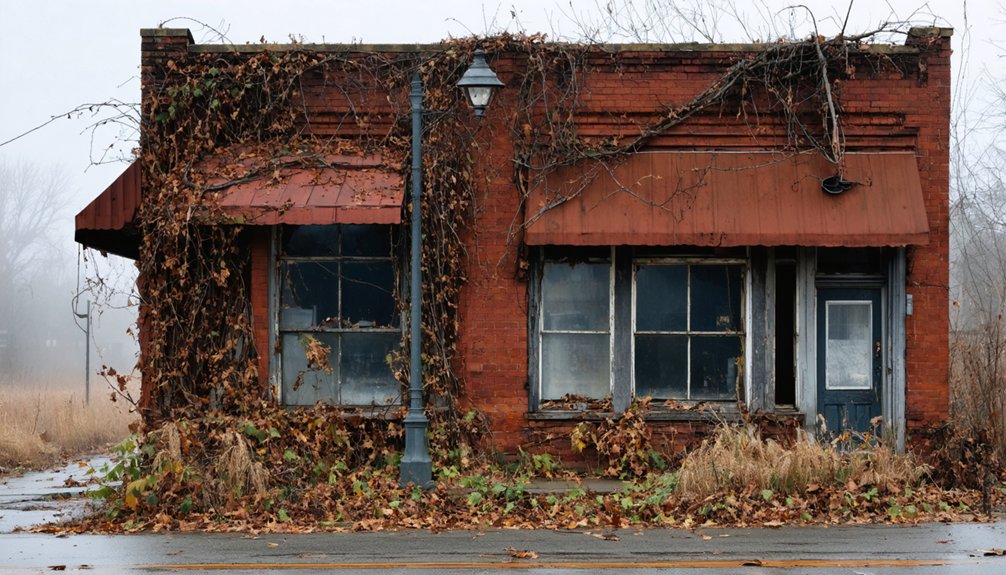
The Scope of Indiana’s Abandoned Communities
Across Indiana’s 36,000 square miles, forty-one documented settlements have experienced near-total or complete abandonment—a geographic dispersal revealing that ghost town formation wasn’t confined to any single region or era.
Understanding ghost town origins requires examining the diverse forces that shaped settlement patterns:
- Transportation shifts – Railroad abandonment erased Hoosier Line stops like McCoysburg, Lee, and Guernsey.
- Natural disasters – The 1937 Great Flood reduced Hartford to under twenty residents.
- Economic collapse – Gary plummeted from 178,000 residents in 1960 to 78,000 by 2014.
- Infrastructure projects – Dunlapsville was flooded by dam construction in 1975, becoming part of the Brookville Lake reservoir.
Southern Indiana hosts thirteen visitable examples, while two communities now rest underwater as drowned towns. Elkinsville was condemned in the 1960s for Lake Monroe construction, yet most of the town’s land remained above the water line and was never actually flooded.
Their cultural significance extends beyond mere curiosity—these abandoned settlements chronicle how vulnerability to economic and environmental forces shaped Indiana’s development across two centuries.
What Remains: Physical Traces in Forgotten Places
You’ll find Indiana’s ghost towns preserved in three primary forms: submerged foundations beneath reservoir waters, relocated cemeteries marking former population centers, and decaying mill infrastructure from the state’s frontier economy.
These physical traces serve as archival records of settlement patterns spanning 1800-1950, documenting the rise and abandonment of approximately 41 communities across the state.
The remnants reveal how transportation shifts, resource depletion, and infrastructure projects systematically erased towns while leaving scattered evidence of their existence. In Aberdine, remnants of the feed mill stand among the few surviving structures from a town that once supported multiple general stores and a post office before most historical buildings faced demolition. Towns like Sloan demonstrate this pattern of erasure, where railroad track removal in the 1990s left only scattered buildings before nature began reclaiming the site.
Foundations Beneath Reservoir Waters
When reservoir levels recede during winter pool drawdown periods, Monument City’s physical foundations emerge from beneath approximately 25 feet of water, offering tangible evidence of a community that vanished in the 1960s.
Foundation visibility follows predictable cycles rather than random chance, granting you access to history without bureaucratic gatekeeping.
The archaeological significance becomes apparent through preserved remnants:
- Stone foundations from the general store, with concrete supports intact despite decades underwater
- Gravel roadbeds outlining the original street grid, identifiable through satellite imagery
- Brick fragments and sidewalk pieces marking building sites across the former township
Google’s satellite tools and documented exposure events let you explore independently.
These durable materials—concrete slabs, foundation stones—withstand submersion better than surface structures, preserving authentic traces free from institutional intervention.
Cemeteries and Monument Relocations
Cemetery relocations reveal bureaucratic disregard for community memory more starkly than any other aspect of Indiana’s ghost town phenomenon.
You’ll find Monument City’s Civil War memorial relocated uphill before Salamonie Reservoir swallowed the original town in the 1960s—streets now underwater pathways where families once walked.
Bethel Cemetery’s 2018 relocation for Indianapolis International Airport expansion exposed this indifference: officials initially identified 196 marked graves, but ground-penetrating radar revealed 543 actual burials. That discrepancy matters.
Meanwhile, Elkinsville Cemetery remains isolated in Hoosier National Forest after Monroe Lake condemnations dispersed the community, though most land never flooded.
These displacements demonstrate how cemetery preservation becomes afterthought when development demands displacement. Historical significance survives only through relocated monuments—physical proof that bureaucrats valued control over continuity.
Mills and Frontier Infrastructure
Indiana’s frontier infrastructure tells its abandonment story through what survives rather than what’s documented.
You’ll find sawmill history buried beneath shifting dunes where City West’s 1836 operation once processed timber, its pier reclaimed by Lake Michigan decades before anyone bothered recording the details.
Frontier decay reveals itself in three distinct layers:
- Complete erasure – City West’s foundations smothered by Indiana Dunes, accessible only through archaeological inference
- Skeletal persistence – Tunnelton’s 1857 Big Tunnel standing while the town crumbles around it
- Functional ghosts – Aberdeen’s feed mill structures still upright, stripped of purpose but refusing collapse
Fort Ritner and Morango showcase this spectrum between total disappearance and stubborn material evidence.
What nature doesn’t reclaim, time simply oxidizes into unrecognizable forms.
Drowned Towns: When Reservoirs Claimed Indiana Communities
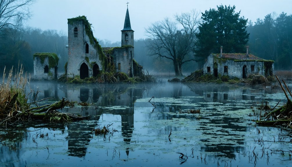
Among Indiana’s most poignant ghost towns are those that didn’t simply fade away—they were deliberately erased beneath rising reservoir waters.
You’ll find Monument City under Salamonie Reservoir, where Civil War monuments were relocated before 1960s flooding left foundations that emerge during droughts.
Germantown vanished beneath Geist Reservoir in 1943 when Indianapolis Water Company claimed 1,800 acres, submerging houses, mills, and a post office.
In southern Indiana, Elkinsville and Salt Creek Valley communities disappeared under Monroe Reservoir, displacing entire populations for water projects.
These drowned communities represent state-sanctioned erasure—at least 41 Indiana ghost towns, many underwater.
Former streets now shelter fish where citizens once walked, transforming forgotten histories into submerged archaeological sites accessible only when water levels drop.
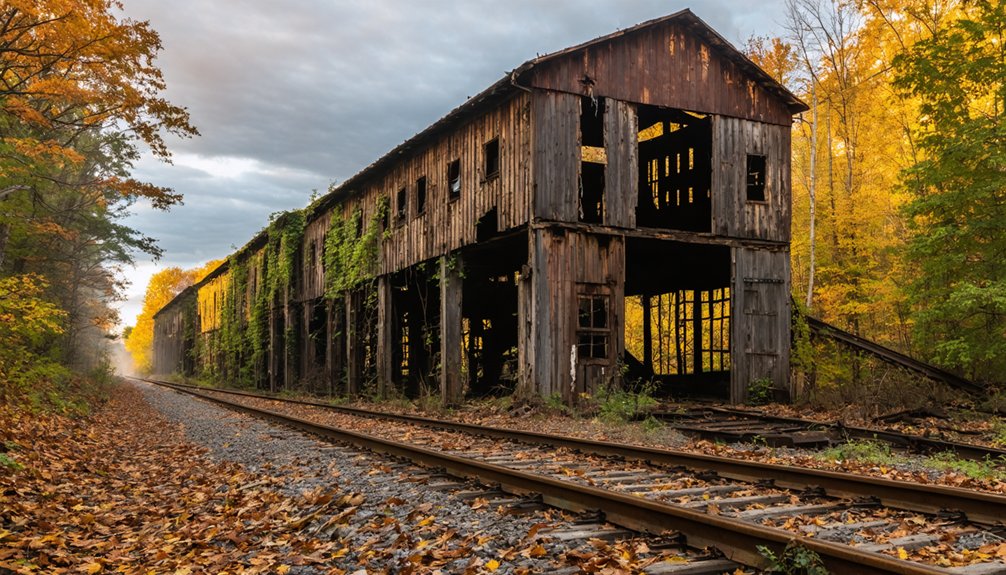
River Ridge: A Modern Neighborhood Surrendering to Nature
Unlike Indiana’s drowned towns that vanished beneath reservoir waters in singular catastrophic events, River Ridge died gradually—its 1990s-era streetlights and identical officer housing frozen in time since the INAAP’s 1992 closure, creating what you’ll find documented in 2002 photographs as a peculiarly modern abandonment.
You’re witnessing an unnatural death: a purpose-built military community of 27,000 residents emptied not by disaster but by geopolitical shifts, leaving infrastructure intact while nature methodically reclaimed basketball courts, dried lakebeds, and vegetation-choked community centers.
This temporal peculiarity—a late-20th-century neighborhood reverting to wilderness within a single generation—offers you evidence of how quickly human landscapes dissolve without maintenance, the 25-year span from caretaker status to complete natural takeover representing mere seconds in ecological time.
Unnatural Abandonment, Natural Death
During World War II, the United States federal government acquired land in Charlestown, Indiana to construct a smokeless powder ordnance plant, transforming a quiet rural area into an industrial powerhouse virtually overnight.
By 1941, 27,500 workers flooded the facility. River Ridge emerged as housing for officials and families—a manufactured community serving wartime necessity.
When production ceased in 1991, you’ll find unnatural decay replacing human ambition. Nature’s reclamation proves unstoppable:
- Streets you’d mistake for forest trails wind through skeletal houses consumed by vegetation
- A community center that once hosted gatherings now stands swallowed by overgrowth
- Basketball courts and dried lakebeds return to wilderness, erasing human intention
The government sold everything by 2016.
What authorities built through industrial might, they abandoned to biological inevitability—proof that nature outlasts even federal power.
Frozen Moment Before Takeover
When you examine photographs from November 2002, River Ridge appears suspended between civilization and wilderness—streetlights from the mid-1990s still standing watch over homes that would never see another upgrade.
This snapshot captures urban decay‘s initial stages, where identical post-2001 model houses stand amid encroaching vegetation. The community center, once hosting dances and celebrations, sits overtaken by flora.
Basketball courts and recreational fields blend into naturalized landscapes, their boundaries dissolving under nature’s reclamation. Streets transform into walking paths as weeds consume pavement.
The dried lakebed, diving boards still visible, symbolizes recreation yielding to abandonment. These images document the precise moment before wilderness swallows human infrastructure—a decade after production ceased, yet five years before federal property transfer finalized this manufactured neighborhood’s return to wildness.
Time Capsules of Ambition: Lessons From Indiana’s Ghost Towns

The scattered remains of Indiana’s ghost towns preserve a narrative about American frontier optimism that census records and land deeds alone can’t convey.
These communities reveal how economic aspirations and community dreams collided with harsh realities:
- LaGrange’s founders invested heavily to challenge Lafayette’s dominance, constructing infrastructure that vanished without achieving its competitive purpose.
- New Harmony housed 700-800 intellectuals by 1825, dissolving completely within four years when financial support evaporated.
- Hindostan operated as a county seat with mills and taverns, serving stage coaches before abandonment erased its administrative significance.
You’ll find these ruins demonstrate that ambition alone couldn’t sustain settlements.
Resource depletion, catastrophic floods, and migration patterns determined survival more decisively than determination or planning ever could.
Frequently Asked Questions
Can Visitors Legally Explore Indiana’s Ghost Town Sites?
You can legally explore Indiana’s ghost towns through public roads and sites, though you’ll need to follow local legal guidelines. Visitor access remains open to preserved locations and public areas, but respect private property boundaries and municipal restrictions.
What Diseases Caused the Abandonment of Hindostan Falls?
You’ll find cholera epidemics devastated Hindostan Falls in the 1820s, though historical records remain incomplete. While tuberculosis outbreaks plagued many frontier settlements, archival evidence primarily points to cholera, possibly combined with yellow fever, decimating this once-thriving community.
Are There Maps Showing Underwater Streets in Indiana’s Drowned Towns?
You won’t find detailed underwater mapping of drowned towns’ streets in public archives. Historical topographic maps and aerial photos preserved pre-flood layouts, but drought conditions remain your best tool for revealing Monument City’s and Elkinsville’s submerged foundations firsthand.
How Were Residents Compensated When Elkinsville Was Taken by Eminent Domain?
Elkinsville history lacks documented records of eminent domain compensation when the town was taken for Monroe Lake. You’ll find archival evidence scarce, as individual settlement amounts weren’t publicly preserved, leaving residents’ financial outcomes largely unrecorded in long-term historical accounts.
Which Indiana Ghost Town Was Abandoned Most Recently?
Gary represents the most recent abandonment among these ghost towns. You’ll find structures vacant for only 20-30 years there, making its ghost town history far more contemporary than Elkinsville’s mid-20th century or Mollie’s 1920s decline.
References
- https://everafterinthewoods.com/these-deserted-ghost-towns-in-indiana-are-full-of-forgotten-stories/
- https://www.youtube.com/watch?v=45D4dbASJyE
- https://wkdq.com/southern-indiana-ghost-towns/
- https://sites.rootsweb.com/~tnghstwn/owengt2.html
- https://www.onlyinyourstate.com/experiences/indiana/abandoned-and-reclaimed-by-nature-in
- https://en.wikipedia.org/wiki/List_of_ghost_towns_in_Indiana
- https://www.indianaconnection.org/a-monument-to-memories/
- https://theclio.com/entry/181841
- https://joejansen.blogspot.com/2017/02/road-ends-in-water.html
- https://www.cem.va.gov/history/Bloedner-Monument.asp