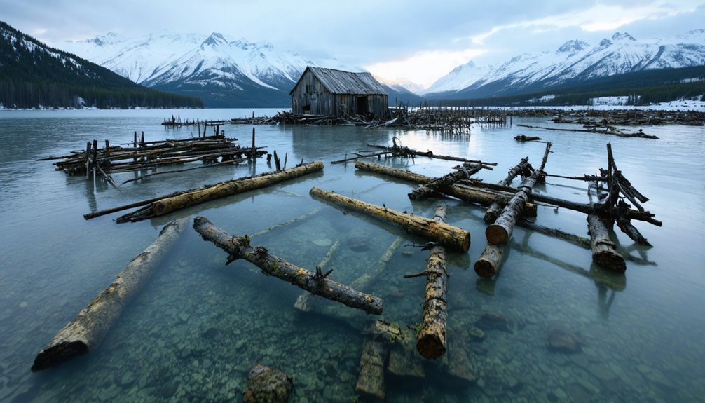
You’ll find Alaska’s underwater ghost towns are products of seismic catastrophe: Portage sank 6-10 feet during the 1964 magnitude 9.2 Good Friday Earthquake, leaving skeletal “ghost forests” along Seward Highway. The Treadwell Mine flooded with 3 million tons of seawater in 1917, submerging 45 miles of tunnels beneath Gastineau Channel. Unga Island’s community evacuated following the 1946 Aleutian earthquake and subsequent tsunamis. These sites now serve as marine archaeology locations where geologic forces, structural preservation, and Indigenous heritage intersect beneath Alaska’s coastal waters.
Key Takeaways
- Portage sank 6-10 feet after the 1964 Good Friday Earthquake, flooding the town and creating a ghost forest of skeletal trees.
- Unga on Unga Island was evacuated after the 1946 Aleutian earthquake and tsunamis submerged structures and infrastructure permanently.
- Portlock on the Kenai Peninsula was abandoned in 1949-1951, with coastal remains now significant for underwater archaeological investigations.
- Frequent seismic activity preserves wooden structures beneath the sea, documented through underwater mapping at sites like Unga.
- Ground subsidence and tsunamis from major earthquakes transformed inhabited settlements into submerged archaeological sites across Alaska.
Portage: The Town That Sank Beneath the Tides
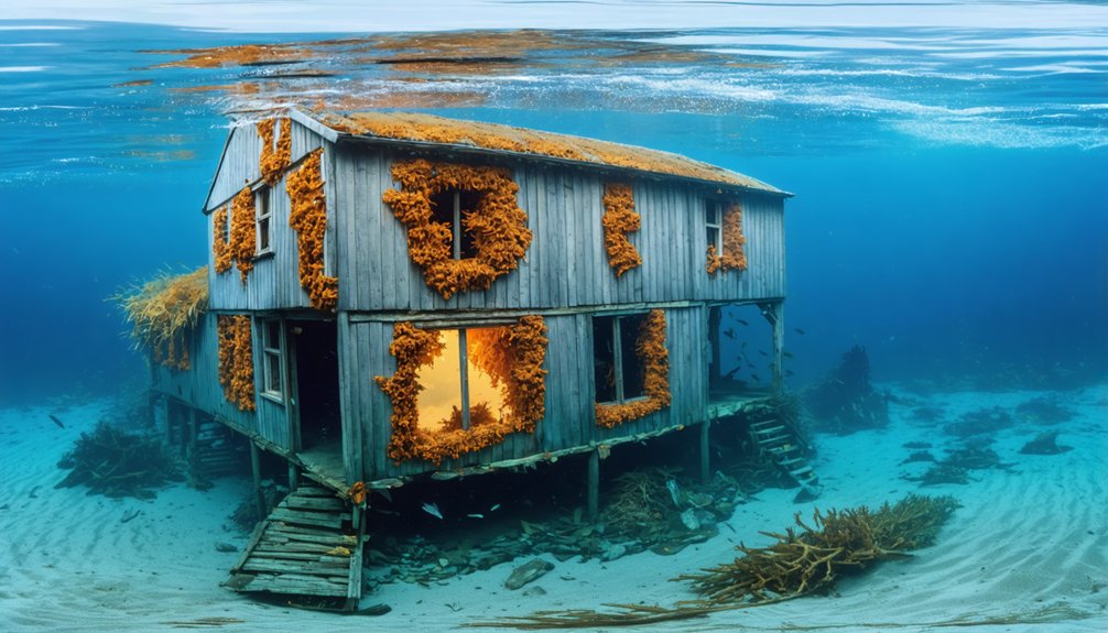
When the magnitude 9.2 Good Friday Earthquake struck Alaska on March 27, 1964, it triggered a geological transformation that permanently erased the settlement of Portage from viable habitation. The seismic event caused ground subsidence of 6-10 feet, placing the town below Cook Inlet’s high tide level. Salt water inundation created immediate urban decay as flooding destroyed infrastructure and killed root systems, producing the distinctive “ghost forest” you’ll observe today.
The environmental impact proved irreversible—reconstruction wasn’t feasible with land permanently submerged during tidal cycles. Residents evacuated immediately, abandoning this strategic transportation junction 47 miles southeast of Anchorage.
You can still examine structural remnants from the Seward Highway, where skeletal tree trunks rise from marshland as testament to nature’s capacity for reshaping human settlements. Before the disaster, travelers stopped at Portage for gas, lunch, and drinks featuring miniature icebergs from the nearby glacier. During the earthquake, muddy water erupted up to 50 feet high from cracks that split the ground into large blocks.
Pilgrim Hot Springs: Where Geothermal Waters Meet Abandonment
You’ll find Pilgrim Hot Springs occupying 320 acres of geothermally active terrain on the Seward Peninsula, where thermal groundwater discharge has sustained structures since 1900 despite creating unstable soil conditions.
The site’s recognition on the National Register of Historic Places acknowledges its contributions to Arctic agriculture and religious history, though its designation doesn’t address the ongoing subsidence affecting the remaining 15 deteriorating buildings. The Indigenous Iñupiaq name Queiaraq, meaning “warm waters”, reflects thousands of years of use for bathing and medicinal purposes before European settlement.
The property was deeded to the Jesuit Province of California on October 12, 1917, after Father Bellarmine LaFortune sought a new mission site to expand the church’s regional presence.
Since 2010, Unaatuq, LLC—a consortium of seven Bering Strait organizations including Kawerak Inc. and Bering Straits Native Corporation—has maintained legal ownership of this former Jesuit mission and orphanage.
Sinking Structures and Springs
At Pilgrim Hot Springs, geothermal heat disrupts the landscape’s frozen equilibrium, preventing permafrost formation while the surrounding terrain remains locked in ∼100m thick unthawed permafrost. This geothermal stability creates thermally anomalous zones where structures face unique challenges—foundation materials respond differently to heating cycles than frozen ground, leading to differential settlement.
You’ll observe the permafrost impact most clearly along the Pilgrim River, where open water persists through winter months, heated by subsurface outflow.
The thawed corridors surrounding hot springs support stunted sub-arctic vegetation, marking boundaries where thermal energy overcomes arctic conditions. Normal faulting from the Kigluaik Mountains compounds structural instability, while the E-W trending Imuruk Basin graben’s downthrown block positions the site within an active tectonic framework.
The N-S aligned spring groupings discharge at 81°C, maintaining 3.8 MW heat output. The valley’s approximately 0.5 square miles of thawed permafrost creates a unique microclimate that has attracted human settlement since early residents used the springs for wintering. The Northeast Fault controls the shallow geothermal fluid flow, funneling deep fluids from beneath the sediment basin to the surface where the springs emerge.
Historic Registry Recognition
How does a remote geothermal site maintain cultural relevance decades after abandonment? You’ll find the answer in Pilgrim Hot Springs‘ April 11, 1977 National Register designation.
This 320-acre property earned recognition for its centuries-old thermal spring utilization and direct-use geothermal applications. The listing acknowledges Iñupiaq traditions spanning millennia, mission-era structures from 1918-1941, and self-sustaining agricultural systems powered by geothermal energy.
Cultural preservation efforts document the site’s transformation from Indigenous gathering place to Jesuit mission complex. While underwater archaeology typically examines submerged settlements, Pilgrim’s registry status protects above-ground thermal features and archaeological contexts. The 1918 Spanish Flu pandemic transformed the springs into Our Lady of Lourdes, sheltering orphans until the facility’s closure in 1941.
U.S. Geological Survey studies from 1973-2013 provide technical documentation supporting sustainable development initiatives. The Pilgrim River carries heat energy equivalent to nearly 5,000 barrels of oil daily, demonstrating the magnitude of thermal resources flowing through this protected landscape. You’re witnessing how federal recognition safeguards both tangible infrastructure and intangible heritage—preserving autonomy through historical acknowledgment rather than regulatory restriction.
Alaska Native Ownership
When the Fairbanks Catholic Diocese liquidated Pilgrim Hot Springs in late 2009 for $1.9 million to fund sexual assault settlements, a consortium of seven Bering Strait region organizations reclaimed what the Qawiaraqmiut people had never truly relinquished.
This acquisition represents a critical restoration of Indigenous land rights, with Sitnasuak Native Corporation, Bering Straits Native Corporation, Kawerak Inc., and Norton Sound Economic Development Corporation each holding 23.08% stakes, while Mary’s Igloo, White Mountain, and Council Native Corporations maintain smaller positions.
The formation of Unaatuq LLC established permanent Alaska Native ownership over 320 acres of geothermal territory. Bering Straits Native Corporation and Kawerak, Inc. handle the daily operations of the site, ensuring ongoing Indigenous stewardship of this historically significant location.
You’ll find this governance structure honors Alaska native history—the Qawiaraqmiut utilized these thermal springs for subsistence hunting and healing ceremonies without establishing permanent settlements, preserving the site’s sacred designation through centuries of non-Native incursion. The name Unaatuq, meaning “it is warm”, reflects the geothermal characteristics that make this sub-Arctic location a natural oasis.
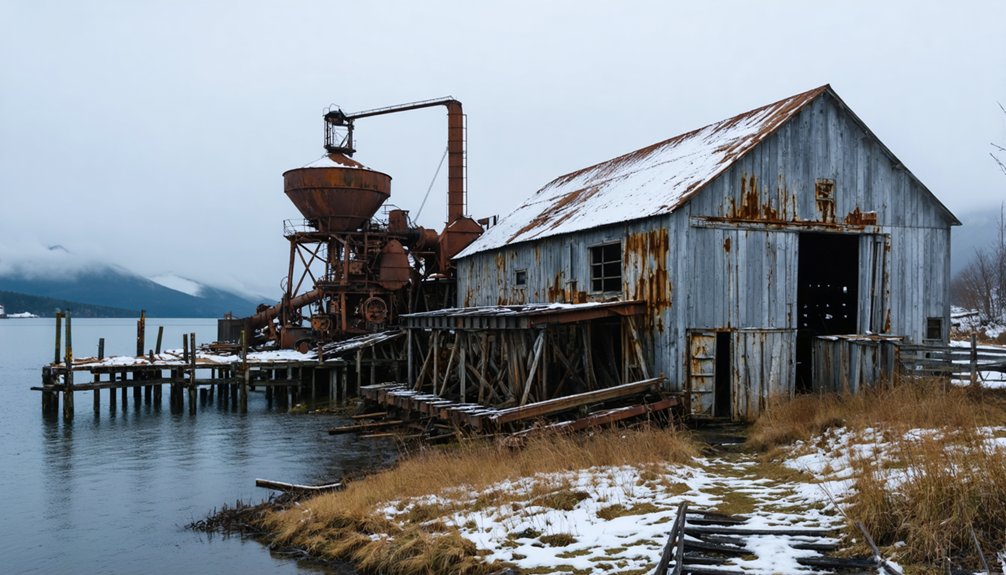
Treadwell Ruins: Gold Rush Glory Lost to Flooding
Gold prospectors’ discovery of ore deposits at Ready Bullion Creek on Douglas Island in December 1880 catalyzed the establishment of what would become the world’s largest low-grade gold mining operation.
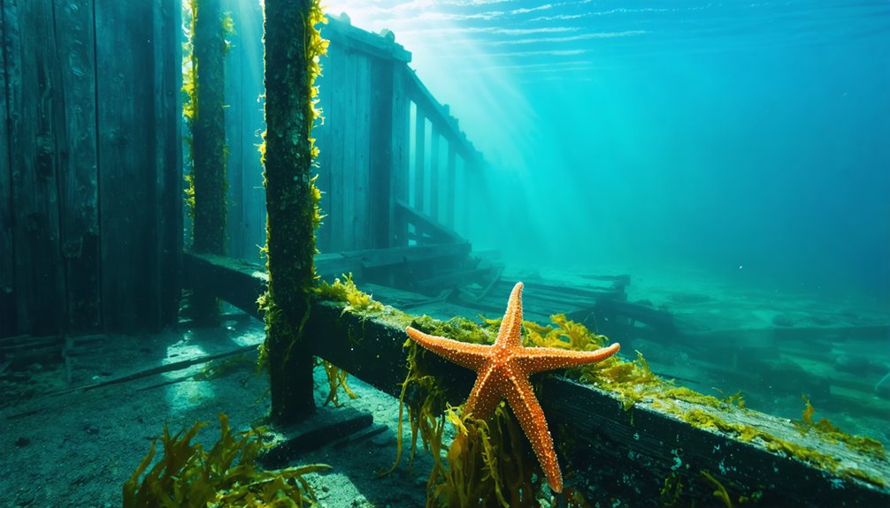
You’ll find Treadwell’s interconnected mines extended 2,000 feet below sea level through 60 miles of tunnels beneath Gastineau Channel.
On April 21, 1917, compromised stone pillars and a fault line triggered catastrophic flooding, submerging 45 miles of passages with 3 million tons of seawater in under four hours.
While no human fatalities occurred, the disaster terminated operations employing nearly 1,000 workers.
Today’s wooded ruins south of Douglas represent a unique marine archaeology site where underwater preservation conditions maintain submerged infrastructure. You’re free to explore these accessible remnants of Alaska’s industrial heritage.
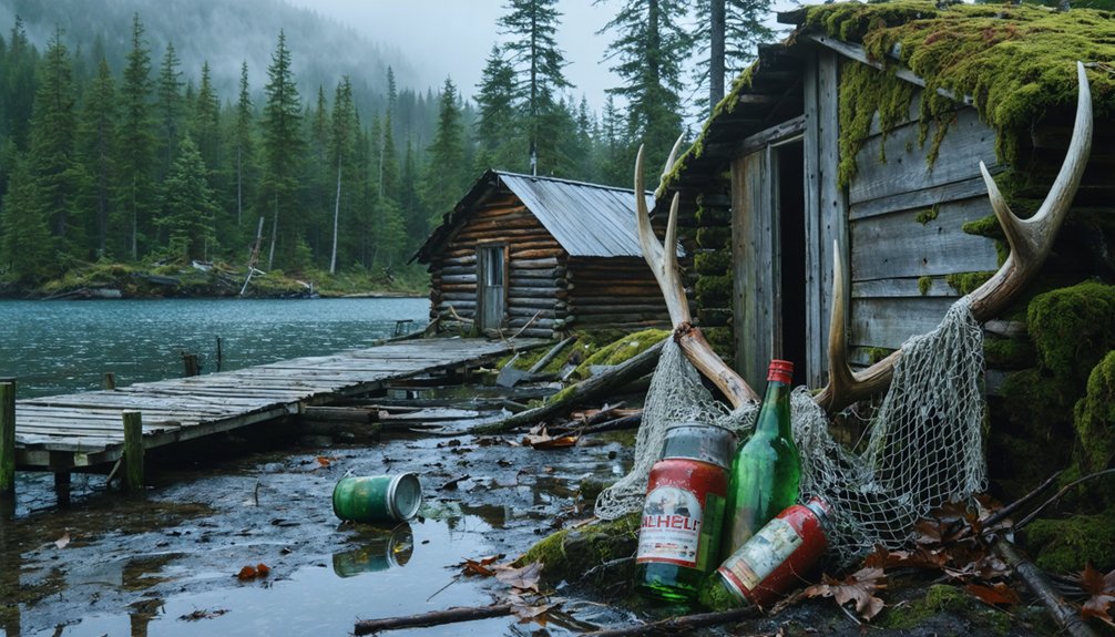
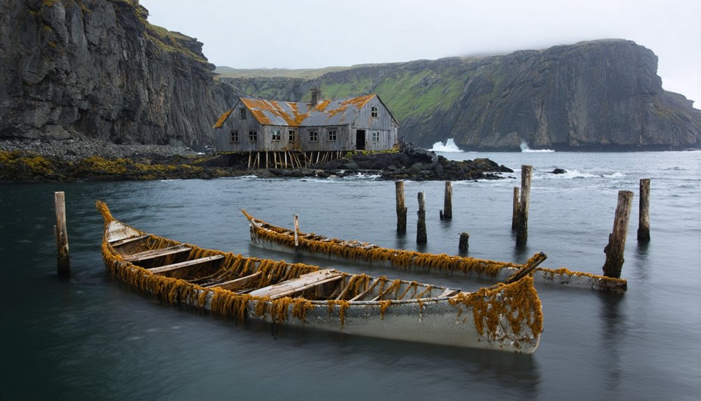
Unga: Earthquake Devastation in the Aleutians
You’ll find Unga on the Shumagin Islands in the eastern Aleutian chain, where a historic community thrived until seismic activity forced its abandonment.
The 1946 Aleutian earthquake generated tsunamis that devastated coastal infrastructure, compelling residents to evacuate permanently by the mid-1960s.
Today’s archaeological remnants include deteriorating wooden structures that mark this remote settlement’s transformation from inhabited village to abandoned site.
Island Settlement and Location
As one of the earliest permanent settlements in the Aleutian chain, Unga occupies a strategic position on the southeast coast of Unga Island at Delarof Harbor, the largest landmass within the Shumagin Islands archipelago spanning 15 miles in width. The settlement’s geographic coordinates place it 9.5 miles south of Sand Point and 73 miles southwest of Perryville, separated from the Alaska Peninsula by Unga Strait.
Geographic Characteristics:
- Eastern terrain exhibits mountainous topography, culminating at 2,030 feet elevation.
- Coastal position facilitated maritime navigation for Russian-American trading vessels.
- Harbor accessibility enabled year-round anchorage despite Aleutian weather patterns.
- Surrounding waters supported local birdlife populations and marine mammal migration routes.
This isolated location initially attracted Aleut settlers in 1833, establishing Delarov as a strategic fur trading outpost within Shelikhov-Golikov Company operations.
Earthquake Forces Mass Evacuation
Unga’s strategic harbor location that once facilitated maritime commerce would later prove problematic when seismic forces threatened the broader Aleutian region.
You’ll find the Alaska-Aleutian Trench experiences frequent M8+ ruptures, with 12 M7+ earthquakes documented since 2000.
The July 16, 2023 M7.2 event—occurring 13 miles deep on a north-northwest-dipping thrust fault—triggered immediate tsunami warnings across the Alaska Peninsula.
Sirens activated throughout coastal communities as officials ordered residents to higher ground.
The earthquake registered as a late aftershock of 2020’s M7.8 Simeonof event, generating a 0.5-foot tsunami at Sand Point.
Increased volcanic activity beneath the Tanaga-Takawangha complex compounds seismic risks, potentially impacting submerged settlement remains that now constitute significant marine archaeology sites.
Wooden Ruins Stand Today
Perched at 55°N latitude within the Pacific Ring of Fire‘s most seismically active corridor, Unga Island’s wooden remnants display remarkable structural persistence despite catastrophic ground motion events. You’ll find structures that resisted the 1938 earthquake’s force, though partially submerged sections now require underwater mapping techniques to document fully.
Marine archaeology efforts reveal:
- Wooden frames maintain vertical orientation despite 2m tsunami runup and continuous seismic stress
- Artifacts like flat irons remain positioned as occupants left them during sudden evacuation
- Erosion patterns expose foundation techniques used during 1890s construction boom
- Submerged pier sections demonstrate cannery-era engineering adapted to tidal extremes
These ruins offer unrestricted exploration opportunities, presenting tangible evidence of industrial-era resilience against geological forces that ultimately reclaimed this settlement.
Ukivok: King Island’s Cliffside Settlement
The Iñupiat settlement of Ukivok occupied one of North America’s most geologically challenging inhabited sites—a 30° to 45° slope on the south face of Ugiuvak (King Island), a volcanic remnant in the Bering Strait situated 64 kilometers from Alaska’s Seward Peninsula.
You’ll find wooden stilt-houses engineered to anchor into Paleozoic rock formations, maximizing limited habitable terrain. The Aseuluk (“people of the sea”) sustained themselves through traditional fishing, hunting walruses and seals, and harvesting marine resources that defined their autonomy.
Climate effects and Bureau of Indian Affairs intervention precipitated abandonment in the late 1960s when authorities closed the school citing boulder-collapse hazards. This forced families mainland-ward, depopulating a thousand-year-old settlement.
The King Island Native Community maintains federal recognition, though their ancestral structures now stand vacant against 700-foot cliffs.
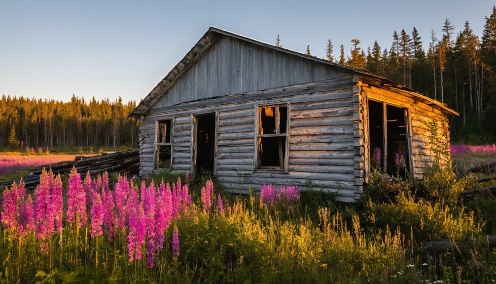
Portlock: Mysteries and Legends of Cook Inlet
Positioned at coordinates 59°12′52″N 151°44′46″W on the southern terminus of the Kenai Peninsula, Portlock (Sugpiaq: Arrulaa’ik) represents a distinct category of abandonment—one driven not by economic collapse or natural disaster, but by documented fatalities and unexplained disappearances that generated persistent folklore.
The salmon cannery settlement‘s wholesale evacuation between 1949-1951 spawned narratives of Nantinaq, a cryptid attributed with supernatural capabilities. While marine archaeology hasn’t confirmed submersion, the site’s 70-year isolation altered underwater perception of Cook Inlet’s coastal settlements.
Documented abandonment characteristics:
- Post office closure 1950-1951 marked administrative dissolution
- Population relocated to Nanwalek following mortality events
- Suqpiaq oral histories pre-dating settlement warned against habitation
- 2000s media investigations later identified fabricated story elements
You’ll find this ghost town challenges conventional abandonment narratives through its intersection of verified deaths and culturally-embedded supernatural explanations.
The history of Lick Creek settlement reveals layered stories of resilience and adaptation among its former inhabitants. As the town metamorphosed over the decades, both community ties and cultural beliefs evolved, blending local folklore with the stark realities of harsh living conditions. This interplay of histories continues to shape the narrative of the area, drawing interest from historians and ghost hunters alike.
Preserving Alaska’s Submerged Heritage
How can researchers protect archaeological evidence when coastal erosion claims up to 3.6 meters annually from Alaska’s northwestern shorelines? You’ll find that advanced technology offers critical solutions.
The SUNFISH® autonomous underwater vehicle explores submerged paleo sites without exposing divers to dangerous conditions, while side-scan sonar identifies rock shelters and cave entrances on the continental shelf.
GIS-based vulnerability models integrate climate scenarios with erosion data, pinpointing at-risk locations before they’re lost forever.
These submerged caves preserve organic materials better than terrestrial sites, potentially revealing ancient maritime trade patterns from 10,600–17,000 years ago.
State and federal laws protect these non-renewable resources, but documentation remains urgent.
Digital elevation models and multibeam mapping create permanent records of ancestral Inupiat settlements before permafrost melting and thermal degradation erase them completely.
Frequently Asked Questions
Can You Scuba Dive to Explore Alaska’s Underwater Ghost Towns?
Submerged ruins symbolize Alaska’s fragile past. You can’t safely dive most sites—Portage’s structural instability, extreme cold-water conditions, and poor visibility create lethal hazards. Historical preservation regulations restrict access, protecting artifacts while ensuring you’re not risking hypothermia or entrapment.
Are Any Alaska Ghost Towns Currently at Risk of Flooding?
You’ll find Pilgrim Hot Springs actively subsiding, while Ukivok faces accelerating coastal erosion from storms. Climate change impacts threaten these sites’ historic preservation, as rising seas and permafrost thaw destabilize Alaska’s archaeological heritage through documented geomorphological processes.
How Do Underwater Ruins Affect Marine Ecosystems in Alaska?
Like artificial reefs colonizing barren seafloors, you’ll find underwater ruins create habitat alteration through structural surfaces attracting invertebrates and algae. This foundation enhances marine biodiversity, as fish species utilize submerged buildings and pilings for shelter and feeding zones.
What Artifacts Have Been Recovered From Alaska’s Submerged Settlements?
You’ll find over 1,000 recovered artifacts from Alaska’s eroded coastal settlements, including ancient pottery fragments and wooden tools preserved 500-600 years in permafrost. Notable discoveries include intact Yupik masks and organic materials requiring specialized waxy preservation treatments.
Do Archaeologists Actively Study Alaska’s Underwater Ghost Town Sites?
Yes, you’ll find archaeologists actively documenting submerged sites like Portage, which sank 6-10 feet post-1964. Their systematic surveys examine settlement decline patterns and potential ancient trade networks, employing multibeam sonar and sediment analysis to reconstruct coastal occupation histories.
References
- https://thealaskafrontier.com/ghost-towns-in-alaska/
- https://www.thealaskalife.com/blogs/news/portage-the-sunken-alaska-ghost-town-that-nature-is-reclaiming
- https://getlostinamerica.com/alaska-ghost-towns/
- https://www.youtube.com/watch?v=TC_KPrhDByY
- https://www.youtube.com/watch?v=AtwCPa7jiNc
- https://kids.kiddle.co/List_of_flooded_towns_in_the_United_States
- https://en.wikipedia.org/wiki/List_of_ghost_towns_in_Alaska
- https://www.alaska-stories.com/p/how-portage-alaska-became-a-ghost
- https://www.youtube.com/watch?v=sd4x4k-GBk0
- https://www.route-fifty.com/cards/geography-disaster-risk-and-resiliency-america-alaska/4/