You’ll find North Dakota’s most significant underwater ghost towns beneath Lake Sakakawea, where Garrison Dam’s 1953 completion submerged eight communities including Elbowoods and Sanish across 156,000 acres of Fort Berthold Reservation. Over 325 families were displaced between 1949–1954, with entire towns like Van Hook disbanded and Red Butte lost by 1956. Devils Lake presents another case, where natural flooding since 1993 expanded the lake from 44,230 acres to 261 square miles, causing approximately $200 million in annual damages. Below the surface lie preserved structures, cemeteries, and artifacts that reveal these communities’ complete histories.
Key Takeaways
- Lake Sakakawea submerged eight communities including Elbowoods, Sanish, Van Hook, and Red Butte when Garrison Dam was completed in 1953.
- Over 325 families were displaced and 156,000 acres flooded, erasing towns, churches, schools, and ancestral burial sites beneath the reservoir.
- Sanish received no salvage efforts and lies completely submerged, while some structures like churches were relocated to higher ground.
- Devils Lake expanded from 44,230 acres to 261 square miles by 2011, submerging homes, farmland, and entire communities beneath rising waters.
- Preserved artifacts include Charbonneau grain elevators and relocated cemeteries, serving as monuments to communities lost underwater since the 1950s.
The Creation of Lake Sakakawea and Its Purpose
When Congress passed the Flood Control Act of 1944, it set in motion one of the most ambitious water resource projects in American history—the Pick-Sloan Missouri River Basin Program.
You’ll find that Garrison Dam, completed in 1953, became the centerpiece of this $1.26 billion initiative. The dam created Lake Sakakawea, North Dakota’s largest reservoir at 480 square miles with 1,500 miles of shoreline.
Engineers designed it for flood control, hydroelectric generation (producing 160,000 kilowatts), navigation, and irrigation for over one million acres. The impounded Missouri River waters formed new aquatic ecosystems across 178-200 miles, fundamentally altering water quality patterns. The reservoir’s primary inflows include the Missouri River, Milk River, Yellowstone River, and Little Missouri River, draining a massive catchment area of 122,500 square miles. The lake now serves water recreation, fishing, and boating for visitors and residents throughout the region.
The dam’s multi-purpose design reshaped both the Missouri’s flow and its ecological character across nearly 200 miles of new reservoir.
While you can now access extensive recreational opportunities, this engineering feat permanently submerged 152,360 acres—including eight communities that became North Dakota’s underwater ghost towns.
Beyond the waters of North Dakota, similar tales can be found in other states, including the mysterious underwater ghost towns in Missouri. These submerged communities provide a haunting glimpse into the past, left behind as reservoirs formed and landscapes changed. Exploring these sites reveals fascinating histories and stories of the lives once lived above the surface.
Towns Lost Beneath the Waters
Lake Sakakawea submerged eight complete towns—Elbowoods, Sanish, Red Butte, Lucky Mound, Nishu, Beaver Creek, Independence, and Shell Creek—when Garrison Dam’s embankments closed in April 1953.
You’ll find these former communities, which once supported schools, hospitals, and stores, now rest beneath North Dakota’s second-largest reservoir.
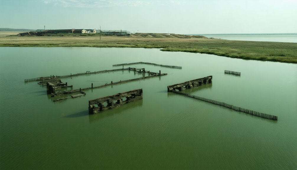
During dry periods, fluctuating water levels expose foundations and structural remnants of these submerged towns, offering glimpses of their former existence.
The reservoir’s completion in 1956 transformed the region into a major hydroelectric power and flood control facility.
Devils Lake’s expansion separately displaced over 300 Minnewaukan residents as rising waters encroached 13 kilometers westward from the lake’s original boundaries.
Lake Sakakawea’s Submerged Communities
Complete towns vanished beneath the rising waters:
- Elbowoods: Mandan, Hidatsa, and Arikara tribal center with sacred sites
- Sanish: Thriving community with grocery stores, grain elevators, and post office
- Van Hook: Original townsite relocated to current lakeside location
- Additional settlements: Red Butte, Lucky Mound, Nishu, Beaver Creek, Independence, Shell Creek, Charging Eagle
The reservoir submerged 155,000 acres of prime farmland, eight Native communities, and displaced over 1,700 residents between 1949-1954—fundamentally altering the region’s landscape. Established in 1891, Elbowoods served as a Native American hub for the tribes before its destruction. The flooding occurred gradually over months, allowing residents time to relocate as waters slowly consumed their communities.
Devils Lake Flooding Impact
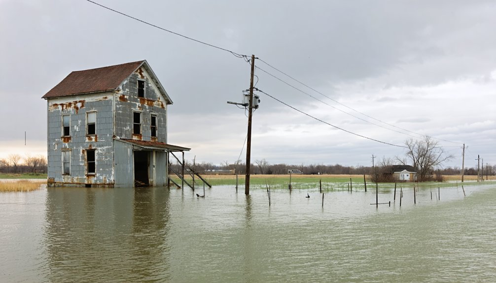
Unlike the planned inundation that created Lake Sakakawea, Devils Lake’s expansion resulted from natural flooding that transformed this closed-basin lake into a relentless force consuming communities. You’re witnessing documented devastation: from 1993’s low of 1,422.62 feet, the lake rose 31.68 feet by 2011, expanding from 44,230 acres to 261 square miles.
This surge destroyed hundreds of homes and businesses while submerging tens of thousands of agricultural acres. Water management failures compounded ecological impacts—farmers paid taxes on drowned land as the lake devoured hundreds of thousands of trees.
Economic losses approached $200 million annually. Though authorities spent over $1 billion on outlets and flood protection, communities couldn’t escape the advancing waters, forcing permanent abandonment of developments that once thrived miles from shore. Two outlets to the Sheyenne River were constructed to manage the unprecedented water levels, operating at lake elevations of 1,445 feet and 1,446 feet respectively. The lake’s volume increased sevenfold over two decades following the initial 1993 flooding event.
The Evacuation Process and Community Displacement
As Garrison Dam’s embankments closed in April 1953, you’d witness residents beginning their forced evacuation to higher ground ahead of the rising waters that would form Lake Sakakawea by 1956.
Most displaced Fort Berthold Reservation members relocated to the newly established city of New Town, while crews worked to salvage structures—including churches and homes from Elbowoods—and Boy Scouts assisted in relocating cemeteries before complete inundation.
The evacuation eliminated eight towns and displaced hundreds of families who lost generational homesteads, agricultural land, and established businesses beneath what would become the nation’s second-largest man-made lake by area. Among the submerged communities were Red Butte, Lucky Mound, and Nishu, each containing vital infrastructure like schools and hospitals. The Verendrye Bridge, a steel truss structure completed in 1927 that had spanned the Missouri River at Sanish, was among the infrastructure lost to the rising waters of the reservoir.
Timeline of Resident Evacuations
When construction crews broke ground on Garrison Dam in the early 1950s, they set in motion a systematic displacement that would erase entire communities from North Dakota’s landscape.
The engineering challenges of creating Lake Sakakawea demanded precise evacuation schedules, regardless of environmental impact on established communities.
The displacement followed this progression:
- 1950-1953: Elbowoods residents, including over 325 families from the Three Affiliated Tribes, relocated while salvaging movable structures.
- April 1953: Sanish evacuated as dam embankments closed, submerging the town shortly after.
- Mid-1950s: Van Hook disbanded, its resort community scattered from shoreline properties.
- 1956: Reservoir completion finalized submersion of eight additional towns—Red Butte, Lucky Mound, Nishu, Beaver Creek, Independence, Shell Creek, and Charging Eagle.
You’ll find no monuments marking these forced removals.
Relocation to New Town
The federal government’s 1952 Urban Relocation Program converged with Garrison Dam construction to dismantle the Three Affiliated Tribes’ territorial cohesion through a dual mechanism of policy and infrastructure.
You’ll recognize that Lake Sakakawea’s rising waters in 1953 displaced hundreds of families to newly constructed towns, creating immediate economic impact through loss of agricultural lands and disruption of established trade networks.
The relocation wasn’t technically forced—you were presented with “opportunities” requiring abandonment of language, practices, and reservation connections.
This displacement severed your family support systems, producing poverty and homelessness among those who couldn’t maintain cultural preservation outside tribal boundaries.
Those who survived the transition eventually developed protective legal mechanisms and governance structures, transforming federal coercion into institutional resilience that would define subsequent treaty negotiations.
Salvaging Buildings and Graves
Before Garrison Dam’s embankments closed in April 1953, residents of Sanish and seven other communities confronted immediate logistical challenges: salvaging physical infrastructure and relocating human remains ahead of Lake Sakakawea’s rising waters.
Documentary evidence reveals limited preservation efforts:
- Elbowoods’ church and select homes relocated to higher ground, preserving fragments of cultural heritage
- Van Hook’s original structures abandoned as residents established new resort community nearby
- Sanish structures received no salvage operations—complete urban decay beneath reservoir waves
- Grave relocation practices remained undocumented for Fort Berthold Reservation’s displaced tribal communities
Over 325 families from Elbowoods, plus residents from Red Butte, Lucky Mound, Nishu, Beaver Creek, Independence, Shell Creek, and Charging Eagle faced federally mandated displacement.
You’ll find minimal records confirming systematic cemetery transfers, suggesting prioritization of land acquisition over comprehensive cultural preservation protocols.
Fort Berthold Indian Reservation and the Move to New Town
During the 1950s, Garrison Dam construction flooded 156,000 acres of Fort Berthold Reservation, destroying Elbowoods, Sanish, and Van Hook—communities where the Mandan, Hidatsa, and Arikara had maintained traditions spanning 900 years.
Nine centuries of Mandan, Hidatsa, and Arikara tradition vanished beneath Garrison Dam floodwaters during the 1950s.
You’ll find that 300 families lost 153,000 acres when Lake Sakakawea divided the reservation into isolated segments in 1951.
The environmental impact fragmented tribal lands, forcing relocation to New Town by fall 1954. Federal authorities moved the Fort Berthold Indian Agency headquarters from Elbowoods, constructing roads, schools, and churches.
However, cultural preservation suffered—poor water supplies displaced rural residents, while land division created new factions among the Three Affiliated Tribes.
Today, New Town houses 2,400 residents, Fort Berthold Community College, and Four Bears Casino, employing 500 tribal members maintaining sovereign governance.
Preserving History: Relocated Structures and Memories
Relocation efforts preceding Lake Sakakawea’s flooding rescued what federal authorities and residents couldn’t bear to abandon entirely. Before waters rose in 1953, Sanish residents evacuated structures and historical artifacts to higher ground.
Boy Scouts coordinated cemetery relocations and preserved items that might’ve fueled ghost stories and folklore legends for generations. You’ll find tangible evidence of this preservation work scattered across the region:
- Four Bears Bridge floated downstream and re-erected at its current location
- Christmas celebration photographs rescued from trash bins document pre-flood community life
- Cemetery headstones and remains relocated before submersion, preventing desecration
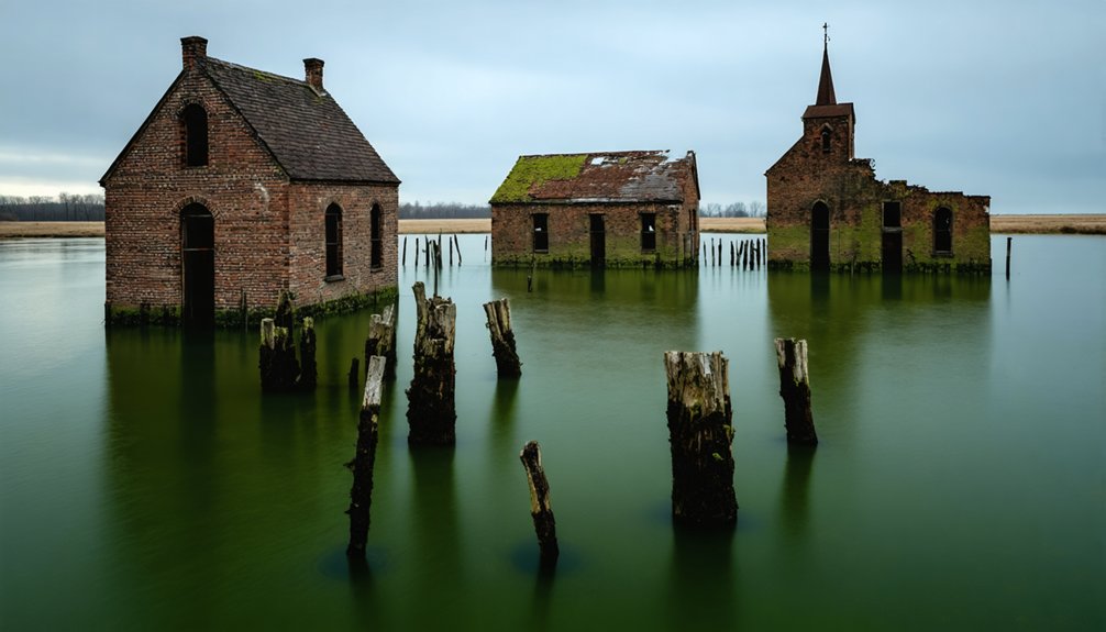
- Building foundations remain visible from buttes during seasonal drawdowns
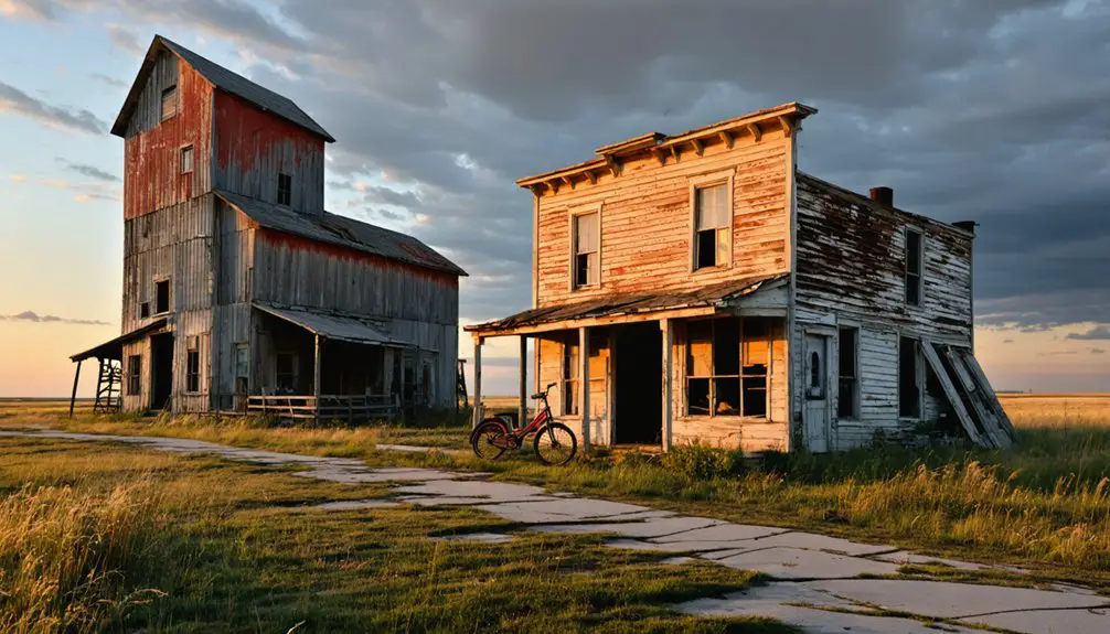
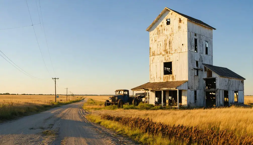
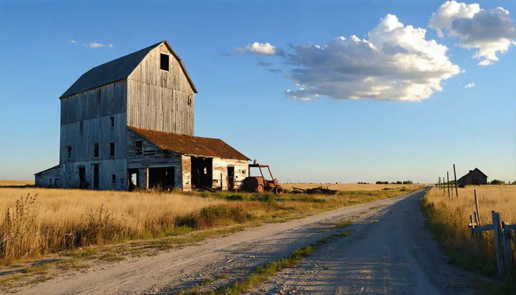
At Charbonneau, grain elevators stand as skeletal monuments while maintained cemeteries anchor memory despite infrequent visits. These deliberate preservation choices transformed potential loss into documented history you can still access today.
Devils Lake Flooding and Other Submerged North Dakota Communities
Unlike the deliberate reservoir creation that consumed Sanish and Fort Berthold communities, Devils Lake’s expansion since 1993 represents an unpredictable natural disaster you can still witness evolving.
The lake rose 31.68 feet from 1993 to 2011, reaching 1,454.3 feet elevation and expanding its volume seven times. This relentless growth devoured hundreds of homes, businesses, and farmland while destroying hundreds of thousands of trees. You’re looking at economic losses approaching $200 million annually, with mitigation costs exceeding $1 billion.
The flooding erased cultural heritage as entire communities disappeared underwater, while ecological effects transformed 300 square miles of landscape. Farmers still pay taxes on submerged land.
The 2012 Tolna Coulee control structure now prevents catastrophic overflow at the natural spill elevation of 1,458 feet.
Frequently Asked Questions
Can Divers Explore the Submerged Towns Beneath Lake Sakakawea Today?
You can’t explore submerged towns beneath Lake Sakakawea. Historical preservation concerns and diving technology limitations prevent access—structures were demolished or relocated, and remaining sites lie buried under decades of sediment, making exploration impractical and likely restricted.
Were Residents Compensated for Their Lost Property and Homes?
The sources don’t specify compensation details for displaced residents, leaving a gap in documented history. Unlike ghost town tourism sites with clear buyout records, these underwater communities lack verified financial settlement data, fueling urban legends about inadequate restitution.
What Artifacts Remain Visible Underwater From the Original Towns?
Time’s curtain lifts during droughts, revealing concrete foundations and monument tips—not preserved artifacts. You’ll find underwater archaeology here limited to building bases and shorelines, as structures were demolished before flooding, leaving minimal visible remnants for documentation.
How Did the Flooding Affect Native American Burial Grounds?
You’ll find documented cultural impact on tribal lands through flooding, but specific burial ground details weren’t recorded. Historical preservation efforts failed Native communities as Lake Sakakawea submerged Colville lands, prioritizing dam construction over protecting sacred indigenous sites.
Are There Any Plans to Memorialize the Submerged Communities?
You’ll find no active plans for new community memorials beyond existing relocated cemeteries and photographic archives. Historical preservation efforts currently focus on documenting submerged sites through digital mapping and maintaining relocated structures from Elbowoods and Sanish.
References
- https://www.traceyourpast.com/newsletters/ghost-towns
- https://ghostsofnorthdakota892857007.wordpress.com/category/sanish-nd/
- https://us1033.com/do-you-know-about-north-dakotas-underwater-ghost-towns/
- https://us1033.com/uncovering-north-dakotas-underwater-ghost-towns/
- https://en.wikipedia.org/wiki/Van_Hook
- https://www.youtube.com/watch?v=E0mfoxW3XIs
- https://www.americanscientist.org/article/runaway-devils-lake
- https://www.worldatlas.com/lakes/lake-sakakawea.html
- https://www.onlyinyourstate.com/state-pride/north-dakota/underwater-ghost-towns-nd
- https://www.ndstudies.gov/gr8/content/unit-iv-modern-north-dakota-1921-present/lesson-1-changing-landscapes/topic-1-garrison-dam-and-diversion/section-1-introduction