You’ll find between 20 and 43 documented ghost towns in North Dakota, though the count depends on how strictly you define abandonment. Most emerged along railroad lines built between 1879 and 1886, then disappeared when bypassed by routes or flooded by the Garrison Dam in 1956. Eight entire communities now rest beneath Lake Sakakawea, while others like Sherbrooke and Arena still show physical remnants. The exact number remains debated because 53 counties have experienced significant depopulation, and many settlements vanished without trace beyond historical records.
Key Takeaways
- Estimates range from approximately 20 to 43 ghost towns in North Dakota, depending on how strictly abandonment is defined.
- Some definitions include towns with zero population, while broader counts consider 53 counties experiencing significant depopulation.
- Railroad placement between 1879 and 1886 determined which towns thrived or declined based on proximity to routes.
- Eight towns were completely submerged beneath Lake Sakakawea following the 1956 Garrison Dam construction.
- Many ghost towns retain minimal structures like churches and cemeteries, while others vanished entirely without physical trace.
Conflicting Estimates of North Dakota’s Ghost Towns
When attempting to quantify North Dakota’s ghost towns, researchers encounter immediate difficulties stemming from definitional inconsistencies and data collection methodologies.
You’ll find estimates ranging from 20 strictly defined locations with zero population to 43 designated sites across the state. These mystery stories unfold differently depending on whether you’re counting abandoned settlements or declining communities.
The strictest approach lists only places like Griffin and Sherbrooke—true ghost town legends where populations reached absolute zero. Alternatively, broader counts encompass 53 counties experiencing depopulation, including towns like Perth (population dropped from 124 to 9) and Ruso (4 residents remaining).
State historical archives offer scarce records, complicating accurate tallies. Some settlements like Nanson represent extreme rural abandonment, characterized by the complete absence of telephone poles or power lines around their few remaining structures. Minimal historical records, including few photographs or documents, further complicate efforts to document these abandoned communities comprehensively. This numerical variation reflects ongoing debates about what constitutes abandonment versus severe decline in North Dakota’s rural landscape.
The Rise and Fall of Prairie Settlements
Understanding these numerical discrepancies requires examining how North Dakota’s settlements came into existence and why they ultimately disappeared.
You’ll find the prairie’s transformation began when railroads displaced Native culture and attracted over 100,000 settlers between 1879-1886.
Towns sprouted rapidly along rail lines, fueled by wheat farming and bonanza operations that mechanized the grasslands.
However, multiple forces triggered agricultural decline and abandonment:
- Prairie fires destroyed structures despite plowed firebreaks.
- Grasshoppers and floods repeatedly devastated crops.
- Economic pressures mounted after the initial boom collapsed.
- Automobiles transformed travel patterns, rendering rail-dependent towns obsolete.
The Northern Pacific Railway reached the Missouri River by 1872-1873, establishing the infrastructure that would spawn numerous settlements along its route.
Reckless soil exploitation over half a century caused land exhaustion that accelerated the abandonment of marginal farming communities.
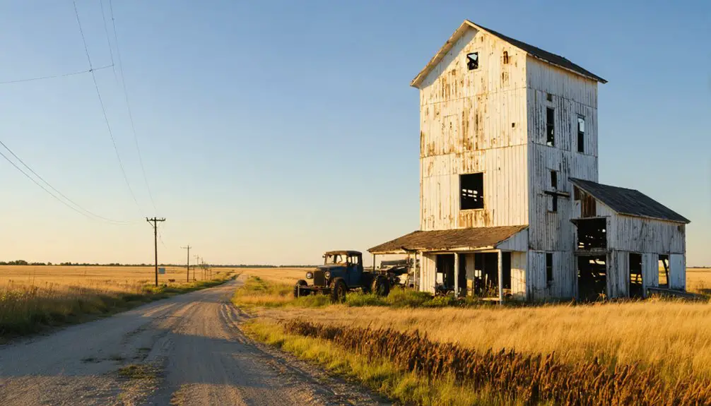
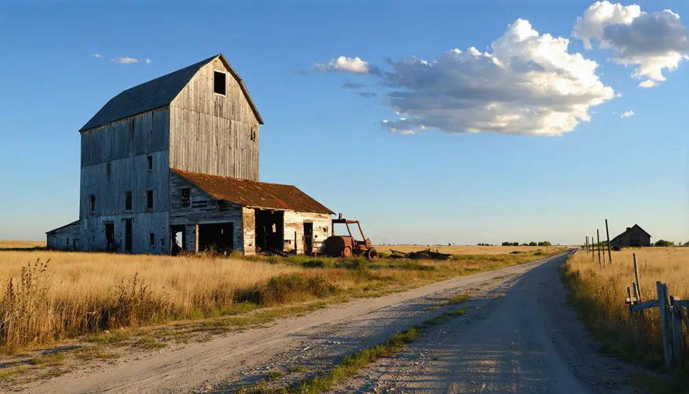
How Railroads Determined Which Towns Survived
Railroad companies wielded absolute power over town survival through their route selection between 1905 and 1930, creating a geographic lottery where placement within seven miles of track meant prosperity while bypassed settlements withered.
You’ll find that competition between Great Northern Railway and Soo Line spawned over 50 towns in a single year.
Yet this same system doomed communities like Williamsport when railroads built three miles away at Hazelton.
The stark reality emerged quickly: towns situated along main lines with grain elevators at 6- to 7-mile intervals thrived, while those missing rail access by even a few miles faced immediate economic collapse. When crop prices fell sharply after 1919, the post-war depression triggered mass abandonment of over 100 miles of rail track by 1930, accelerating the demise of already struggling communities. Many settlements that lost their rail connections also faced county seat relocations, which stripped them of governmental functions and hastened their transformation into ghost towns.
Railroad Routes Chose Winners
By 1920, more than 5,300 miles of track crisscrossed North Dakota, and the companies that laid those rails wielded absolute power over which settlements would flourish and which would fade into obscurity.
The economic impacts of route selection determined a town’s fate.
When railroads chose winners, they created lasting technological innovations that connected communities to distant markets:
- Milwaukee Road established Gascoyne and other Bowman County towns in 1907-1908, spacing them strategically across previously empty prairie
- Soo Line integrated Balfour’s depot, elevators, and stockyards by 1910, cementing its viability
- Great Northern connected Grand Forks to Williston, completing the only remaining west coast route
- Northern Pacific dominated the mainline from Fargo to Beach
Towns bypassed by these decisions lost their economic foundations and eventually disappeared.
The Milwaukee Road’s transcontinental rail line created Gascoyne to serve railroad operations, establishing it as a townsite in 1907 before the name change in 1908.
The Soo Line’s completion in July 1893 from Henkinson to Portal determined which settlements along its path would survive as economic centers.
Bypassed Towns Faced Decline
The consequences of railroad route decisions became starkly apparent when North Dakota’s farm economy collapsed in the 1920s. Towns bypassed by rail lines couldn’t compete when agricultural depression struck post-WWI.
You’ll find Williamsport lost its county seat to railroad-connected Hazelton, while Winona declined after Linton’s 1899 establishment.
Schafer’s 1914 land dispute with Great Northern Railway doomed it against Watford City.
The Great Depression and 1932-1938 drought accelerated abandonment as over 100 miles of track disappeared by 1930.
McCumber became a ghost town while nearby Rolette thrived.
Today, historical preservation efforts document these failures, though few sites attract tourist attractions status.
Wikipedia lists 23 completely barren ghost towns, yet many bypassed settlements like Baden, Brisbane, and Charging Eagle remain forgotten in archival records. Towns often relocated entire buildings closer to the tracks when railroad routes were announced, demonstrating the desperate measures communities took to survive.
Geographic Positioning Mattered Most
When Milwaukee Road’s board authorized $45 million in construction costs in November 1905 (equivalent to $1.24 billion today), they didn’t just build tracks—they engineered North Dakota’s future settlement patterns.
Railroad companies deliberately positioned towns every seven miles for ideal grain hauling distances, creating communities like Gascoyne (originally Fischbein) and Griffin with its extensive stockyards.
This calculated spacing determined survival prospects:
- Towns at rail intersections gained economic diversification through multiple shipping routes
- County seat designations provided governmental stability beyond rail dependency
- Communities with road access to larger cities adapted when rails vanished
- Cultural influences from varied immigrant groups strengthened towns with broader economic bases
Ghost Towns Still Visible Today
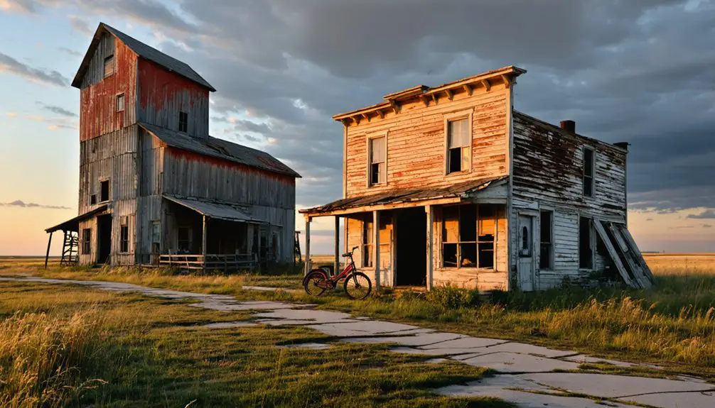
Several ghost towns scattered across North Dakota’s prairie landscape retain visible structures that document their brief existence in the state’s settlement history.
You’ll find Sherbrooke in Steele County with two homes and a well-tended cemetery, while Arena maintains St. John’s Lutheran Church and two residences 35 miles northeast of Bismarck.
Sims, located 50 miles west of Mandan in Morton County, features an active church and hilltop cemetery alongside abandoned structures.
Straubville’s crumbling ruins stand in Sargent County as proof to failed settlement.
These sites now serve as historical preservation examples and potential tourist attractions.
Bluegrass in Morton County reached just twenty residents before its service station burned, leaving nothing but memory.
Each location offers tangible evidence of North Dakota’s settlement patterns and agricultural community failures.
Completely Vanished Communities
While some North Dakota settlements left behind churches and homes, many communities disappeared so completely that only documentary records confirm their existence.
Historical preservation efforts face unique challenges when entire towns vanish without physical remnants.
Communities like Baden, Charging Eagle, Leipzig, and Sully Springs left no buildings, roads, or infrastructure.
You’ll find only empty prairie where settlers once built lives.
Their cultural significance survives solely through archives and memories.
Complete erasure occurred through systematic processes:
- Railroad bypasses forced entire populations to relocate, leaving settlements to natural reclamation
- Structural removal saw homes moved, burned, or buried rather than abandoned in place
- Infrastructure absence meant no utility poles, roads, or commercial buildings remained
- Economic collapse eliminated any reason for maintaining physical presence
These vanished communities represent North Dakota’s most absolute ghost towns—erased from landscape yet documented in history.
Towns Lost Beneath Lake Sakakawea
The completion of Garrison Dam in 1956 created Lake Sakakawea and erased at least eight North Dakota towns from existence through deliberate flooding. Elbowoods, Red Butte, Lucky Mound, Nishu, Beaver Creek, Independence, Shell Creek, and Charging Eagle disappeared beneath what became the nation’s second-largest man-made lake by area.
The reservoir’s 200-mile span particularly devastated Fort Berthold Indian Reservation, submerging up to 98% of its arable land and displacing 325 families—80% of the population. Sacred sites, businesses, and 1,700 lives were uprooted. Residents relocated to newly established New Town, though promised irrigation for over one million acres never materialized.
Today’s lake recreation occurs directly above these drowned communities, transforming forced community relocation into a tourist destination where fluctuating water levels occasionally reveal remnants of what was sacrificed.
San Haven Sanatorium: North Dakota’s Most Haunted Ghost Town
North Dakota’s 1909 legislature authorized creation of a Tuberculosis Sanitarium through Senate Law Chapter 137, initiating what would become one of the state’s most historically significant and architecturally complex medical facilities. Dunseith’s site opened November 1912, treating thousands until antibiotics rendered it obsolete in 1973.
The facility’s evolution encompassed:
- Fresh air treatment cottages expanded from initial capacity to over 1,300 residents
- Shift from tuberculosis care to mental health services by 1979
- Judge Van Sickle’s 1985 deinstitutionalization ruling preceded 1987 closure
- 1993 sale to Turtle Mountain Chippewa for $1,100
Despite preservation efforts following its abandonment, haunted legends now surround the decaying complex.
You’ll find San Haven represents both medical progress and institutional care’s darker chapters—a ghost town embodying humanity’s struggle against disease and society’s treatment of vulnerable populations.
Frequently Asked Questions
Can Visitors Legally Explore North Dakota’s Ghost Towns?
You’ll find freedom exploring North Dakota’s ghost towns legally on public lands and unposted sites. While urban legends and haunted stories draw visitors, you must respect private property boundaries, confirm land status through county records, and heed no-trespassing signs.
What Artifacts Remain at North Dakota Ghost Town Sites?
You’ll find historic artifacts including churches, grain elevators, cemeteries, and Yellowstone Trail markers across North Dakota’s ghost towns. Preservation challenges persist as abandoned homes deteriorate, though some ecclesiastical structures remain active despite surrounding town abandonment.
Are Any North Dakota Ghost Towns Being Restored or Preserved?
You’ll find limited restoration efforts, though historical preservation transforms sites like San Haven Sanatorium and St. John’s Lutheran Church into tourist attractions. Most ghost towns remain authentically abandoned, offering you unregulated exploration freedom rather than managed, commercialized experiences.
Which North Dakota Ghost Town Disappeared Most Recently?
San Haven in Rolette County disappeared most recently, closing in 1987 after serving as a tuberculosis sanatorium. Unlike abandoned mining settlements, you’ll find this site lacks historic preservation efforts, representing North Dakota’s institutional rather than industrial decline.
Do Property Owners Still Hold Deeds to Ghost Town Land?
You’ll find ghost town ownership remains murky—deed legality persists where structures stand, suggesting private holders maintain rights. However, barren sites likely reverted to public domain through tax abandonment, freeing land from historical claims over decades.
References
- https://ghostsofnorthdakota892857007.wordpress.com/2015/10/30/true-ghost-towns-population-zero/
- https://northernsentry.com/2025/06/26/north-dakota-ghost-towns/
- https://www.youtube.com/watch?v=QKxWY4tHTOU
- https://freepages.history.rootsweb.com/~gtusa/usa/nd.htm
- https://www.geotab.com/ghost-towns/
- https://en.wikipedia.org/wiki/List_of_ghost_towns_in_North_Dakota
- https://digitalhorizonsonline.org/digital/collection/uw-ndshs/id/16304/
- https://www.youtube.com/watch?v=hRFfy3HQaus
- https://mydakotan.com/2022/06/upside-down-under-ghosts-of-north-dakota-past/
- https://www.ndstudies.gov/sites/default/files/LessonPlans/LessonPlan-HighSchool-GhostTownsOfNorthDakota.pdf