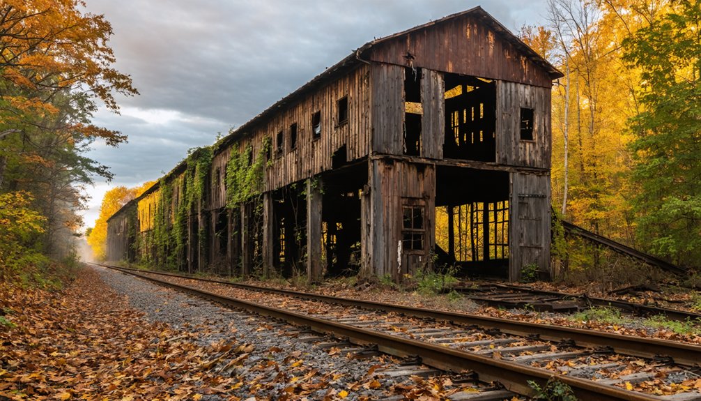
You’ll find Kickapoo, Indiana plotted along the Chicago and Great Southern Railway in 1885 by Lewis Davisson. Named after Native American tribes in Illinois, this promising railroad settlement featured Railway Street running parallel to tracks and Elm Street intersecting at right angles. While the town’s early life centered around rail commerce and modest wood-frame houses near the depot, economic challenges and seasonal flooding along the Wabash River led to its decline. The site’s archaeological significance remains a subject of ongoing investigation.
Key Takeaways
- Kickapoo was established in 1885 by Lewis Davisson alongside the Chicago and Great Southern Railway, designed for optimal rail access.
- The town’s name originates from the Shawnee word meaning “wanderer” or “one who moves about.”
- Early settlement life centered around the railroad, with residents living in wood-frame houses near tracks and socializing at the depot.
- Despite promising railway connections, Kickapoo declined by the early 1900s due to limited infrastructure and competition from nearby towns.
- Seasonal flooding, particularly the devastating 1913 flood, contributed significantly to the town’s eventual abandonment and ghost town status.
The Birth of a Railroad Town
When Lewis Davisson officially platted Kickapoo on February 2, 1885, he envisioned a thriving railroad settlement in Warren County, Indiana.
You’ll find the town’s origins deeply intertwined with the Chicago and Great Southern Railway, which sparked its strategic placement in section 29, township 22, range 7 west. The railroad’s significance shaped every aspect of Kickapoo’s initial layout, from Railway Street running parallel to the tracks to Elm Street intersecting at right angles.
Like many frontier settlements of its era, Kickapoo’s design maximized access to the rail line, reflecting the period’s emphasis on rail-based commerce and transportation. The arrival of the railroad typically led to a business district expansion as towns developed along the tracks. While the Kickapoo name echoed the heritage of Native tribes in Illinois, who had claimed these lands through descent and conquest decades earlier.
The town served as an essential link in the regional railway network, though it would never grow into the bustling hub its founders imagined.
Origins of the Kickapoo Name
Although several interpretations exist, the name “Kickapoo” likely derives from the Shawnee word for “wanderer,” reflecting the tribe’s historical patterns of migration across the Midwest.
The Kickapoo themselves use kiikaapoa, which some translate as “one who moves about” or “those who walk the earth.” This etymology speaks to their deep connection with the land and their adaptive spirit. The tribe’s earliest documented encounters with Europeans occurred during the La Salle Expeditions of the late 17th century.
The tribe maintains a strong oral tradition, and their language retention remains high particularly among communities in Mexico and Oklahoma.
You’ll find the Kickapoo’s cultural identity preserved in various Native American languages, with neighboring tribes using names like A’-uyax (Tonkawa), Tékapu (Huron), and Higabu (Omaha).
The name’s Algonquian linguistic roots tie closely to the Fox and Sauk languages, though its precise meaning within the Kickapoo language remains somewhat uncertain.
European settlers first documented the name in 1722, solidifying its place in Midwestern history.
Life Along the Wabash River
You’ll find that the Wabash River shaped daily life in Kickapoo through its crucial role as a major trade artery, connecting Native American settlements with French trading posts and later American frontier communities.
The river’s seasonal flooding cycles influenced settlement patterns, with both Native peoples and subsequent settlers carefully positioning their homes and trading posts on higher ground while still maintaining access to the waterway.
Along these banks, the Kickapoo people established seasonal settlements that took advantage of the river’s abundant resources, from fishing spots to fertile bottomlands for agriculture, before European expansion altered the landscape. The local Native Americans called this waterway Wah-Bah Shik-Ki, which translates to “pure white” in their language. The construction of the Wabash & Erie Canal in 1832 transformed the region into a bustling commercial hub, stretching an impressive 468 miles from Fort Wayne to Evansville.
River Trade Routes
As one of North America’s most essential commercial arteries, the Wabash River created a significant trade network connecting the Great Lakes to the Mississippi River system and ultimately the Gulf of Mexico.
You’d find French fur traders and Native Americans, particularly the Miami tribe, dominating Wabash commerce through strategic control of key portages and trading posts.
River navigation brought diverse goods through this crucial corridor – everything from grain and lumber heading south to coffee and manufactured goods moving north.
The Miami tribe’s control of the Maumee-Wabash portage gave them power to regulate trade and collect tolls at this critical junction. This nine-mile portage served as the shortest route among major Midwestern trade paths.
Local merchants and farmers built their own vessels, enabling independent participation in the bustling river trade that shaped the region’s economic development throughout the 18th and early 19th centuries.
Two prominent villages, Kethtippecanuck and Miamitown, emerged as dominant trading hubs along the Wabash River valley, facilitating extensive commercial networks.
Seasonal Flooding Impact
The bustling river trade along the Wabash came with significant challenges, particularly the river’s destructive seasonal floods that repeatedly transformed the landscape.
You’d have witnessed the river’s fierce unpredictability, with water levels rising dramatically within hours during events like the Great Flood of 1913, which saw the Wabash surge 28.7 feet high.
Despite attempts at flood prevention, the combination of spring thaws, ice gorges, and heavy rains regularly overwhelmed riverside communities. The devastating impact left over 720 residents homeless, forcing many to rely on charitable support and emergency aid.
Seasonal preparedness became essential as the river’s cycles brought devastation – destroying bridges, flooding homes, and shutting down critical infrastructure. The Eighteenth Street Bridge remained the only passable connection during severe flooding events.
The floods of 1883, 1913, 1959, and 2011 serve as stark reminders of nature’s power, with waters taking days or weeks to recede, forever altering the region’s economic and social fabric.
Native Waterway Settlements
Long before European settlers arrived, Native American tribes established thriving communities along the Wabash River‘s strategic high ground, with the Miami, Wea, Potawatomi, Kickapoo, Mascouten, and Piankashaw peoples building settlements atop protective bluffs and knolls.
These Indigenous settlements masterfully balanced defense and sustenance, taking advantage of the rich river ecosystems while maintaining vigilant positions above flood levels.
- Villages operated through collaborative leadership among tribal headmen
- Indigenous agriculture focused on cornfields near summer settlements
- Communities utilized the river for drinking, fishing, and trade routes
- Over 100 mounds marked the landscape, showing complex social practices
You’ll find evidence of this sophisticated river culture in the numerous archaeological sites dotting the Wabash region, where Native Americans maintained a harmonious relationship with the waterway until forced displacement in the late 1700s.
Railroad Dreams and Economic Reality
During Indiana’s ambitious railroad expansion of the late 1800s, Kickapoo emerged alongside the Chicago and Great Southern Railway with dreams of becoming a thriving transport hub.
You’ll find its origins traced to Lewis Davisson’s 1885 plat, when railroad fever swept across Warren County, promising economic prosperity through newfound connections to Chicago and other Midwest markets.
Despite the optimism that accompanied the railroad’s arrival, Kickapoo’s dreams never materialized as expected. The town’s economic dependency on a single rail line proved insufficient to sustain growth.
While other Indiana communities flourished with the expansion of the state’s 4,000-mile rail network by 1880, Kickapoo remained small and eventually succumbed to the changing times.
Today, its abandoned site stands as a monument to the unpredictable nature of frontier development.
Daily Life in Early Settlement Years
You’ll find that early settlers’ daily routines in Kickapoo centered around the railroad, with workers rising before dawn to maintain tracks and operate freight services along the developing line.
Local families lived in modest wood-frame houses clustered near the tracks, where they’d gather on porches to watch trains pass and exchange news of the day.
The settlement’s social life revolved around the railway depot, which served as both a cargo hub and an impromptu meeting spot where residents would congregate while waiting for mail deliveries and supply shipments.
Railway Life and Work
Life in early Kickapoo revolved around Edwards Station, a bustling mining hamlet along the Peoria and Galesburg division of the Chicago, Burlington & Quincy Railroad.
Railroad expansion transformed this once-quiet region into an industrial hub, where you’d find coal miners laboring in deep shafts just 14 miles west of Peoria. The demanding mining labor shaped every aspect of daily life, from the haphazard placement of workers’ homes to the seasonal rhythms of coal extraction.
- Miners built their cabins near coal shafts without formal planning
- Work centered on extracting coal to fuel passing trains
- Local businesses, like the Kickapoo House, served railway workers
- Daily schedules followed the railroad’s industrial demands
The railway brought both opportunity and challenge, forever changing the landscape of Kickapoo and the lives of those who called it home.
Housing and Community Activities
While the region’s early European settlers built conventional log cabins, the indigenous Kickapoo people had already established a sophisticated community structure centered around their distinctive wickiups – dome-shaped dwellings crafted from bent saplings and covered with bark or cattail-reed mats.
You’d find about 100 of these wigwams clustered near natural springs, with a central council house serving as the heart of community gatherings.
The Kickapoo’s daily life revolved around cooperative farming of the “three sisters” – corn, beans, and squash – alongside hunting deer and small game.
They’d tap maple trees for sugar and maintain pawpaw orchards, often trading surplus with settlers.
This sustainable lifestyle reflected their deep connection to the land and their commitment to communal living.
The Legacy of Native American Heritage
Before European settlement transformed the landscape of Indiana, the Kickapoo people maintained a rich cultural presence in the region, with their heritage deeply rooted in the Great Lakes area. Their cultural preservation efforts centered on a sustainable lifestyle that combined agriculture, hunting, and gathering.
The historical significance of their settlements is evident in the architectural remnants of their distinctive wickiups and agricultural practices.
- Practiced traditional farming of the “three sisters” – corn, beans, and squash
- Built unique oblong lodges using local materials like saplings and bark
- Maintained strong spiritual connections to the land through communal ownership
- Established seasonal movement patterns between prairie and forest resources
Today, you’ll find heritage markers throughout Indiana commemorating the Kickapoo’s lasting impact on the region’s history, though their forced displacement westward forever changed the cultural landscape.
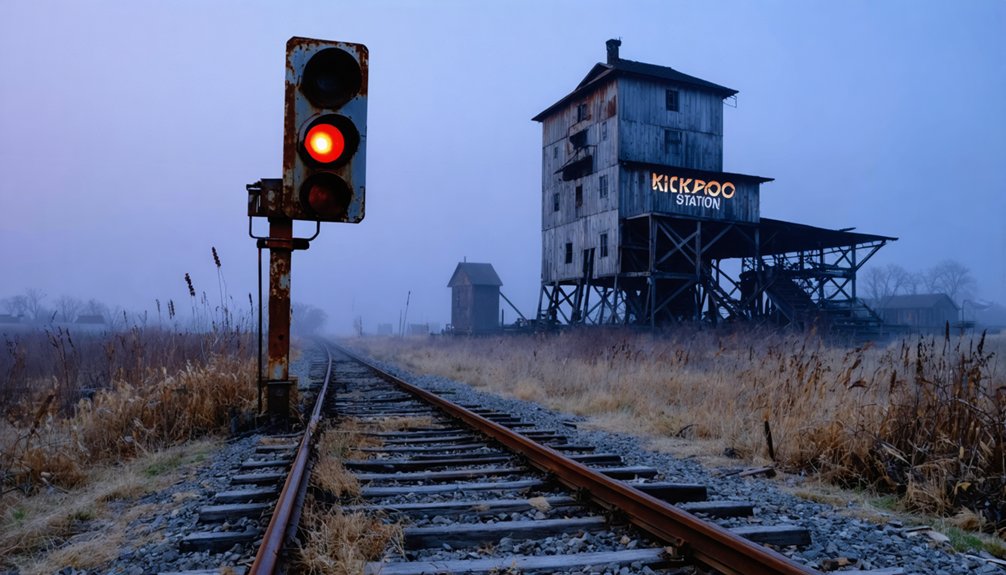
Mapping a Lost Community
If you’re searching for Kickapoo on modern maps, you’ll find its location in Warren Township, Warren County, though little remains of the original settlement.
Historical maps from Indiana’s early development period mark this ghost town‘s position, providing researchers with a geographical reference point for studying the area’s past.
While the exact boundaries of the former community aren’t precisely documented, you can still trace its general location through plat maps and historical surveys of Warren County.
Historical Map References
Thanks to Lewis Davisson’s meticulous plat map created on February 2, 1885, we can trace the original layout of Kickapoo, Indiana with remarkable precision.
Historical cartography reveals the town’s strategic position along the Chicago and Great Southern Railway, while mapping techniques documented significant hydrological features like Kickapoo Creek and the nearby Wabash River.
- Original plat maps show street arrangements and building plots adjacent to rail infrastructure
- Survey records place Kickapoo in section 29, township 22, range 7 west of Warren Township
- Railroad maps highlight the town’s role as a transport node, though growth remained limited
- Government archives preserve essential documentation of land divisions and property ownership
You’ll find these historical maps important for understanding how Kickapoo developed and ultimately faded, with natural landmarks helping pinpoint its former location today.
Location Through Time
Located in Warren County’s Warren Township, Kickapoo’s precise coordinates at 40°19′48″N latitude and 87°13′59″W longitude mark the ghostly remnants of this once-hopeful rail town.
You’ll find the site along today’s Kickapoo Road (County Road 425 E), which traces the original settlement’s footprint in section 29, township 22, range 7 west.
The town’s geographic significance stems from its strategic placement near the Chicago and Great Southern Railway and Kickapoo Creek, which flows south to meet the Wabash River.
When Lewis Davisson platted the town in 1885, he positioned it within a historical context of mixed prairie and timber lands once favored by the indigenous Kickapoo people.
Though the settlement’s built environment has vanished, the natural landscape endures, preserving the site’s fundamental character.
The Path to Abandonment

Despite having promising beginnings with its railway connection and strategic location near Kickapoo Creek, the town of Kickapoo’s path toward abandonment became evident by the early 1900s.
The community decline reflected broader national trends as residents sought opportunities elsewhere, leading to economic stagnation that proved insurmountable.
Like countless small towns of its era, Kickapoo fell victim to the American exodus toward brighter economic horizons.
You’ll find that several key factors contributed to Kickapoo’s eventual abandonment:
- Limited infrastructure development failed to support long-term growth
- Competition from nearby towns offered more attractive prospects for settlers
- The railway connection alone couldn’t sustain meaningful economic expansion
- Regional migration patterns favored larger urban centers over small rural communities
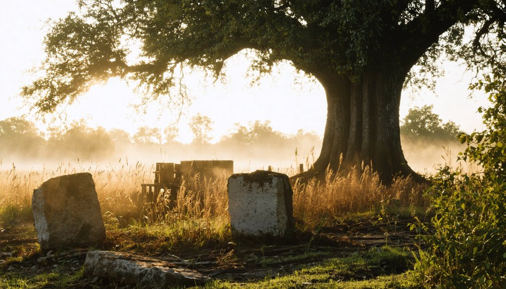
Archaeological Significance Today
The archaeological record of Kickapoo presents significant challenges for modern researchers and preservationists.
While contemporary archaeological methods have successfully mapped Indigenous Kickapoo villages near Fort Ouiatenon, there’s no confirmed evidence of a Euro-American ghost town site in Indiana’s archaeological record.
The history of Marshfield, Indiana ghost town remains a subject of intrigue for historians and local enthusiasts alike. Despite its absence from archaeological studies, various accounts and lore suggest that the town was once bustling with life before it was abandoned. Exploring these tales can provide insight into the broader patterns of settlement and migration in the region.
You won’t find the typical ghost town markers here – no visible foundations, artifact assemblages, or documented cultural layers that would help establish the historical context of a 19th-century settlement.
Unlike other Indiana ghost towns with clear physical remains, Kickapoo’s archaeological significance remains uncertain.
The site, if it exists, likely faces threats from agricultural activity and development.
Without proper documentation or protection, this potentially important piece of Indiana’s settlement history risks being lost to time.
Preserving Indiana’s Ghost Town History
While Indiana’s ghost towns face constant threats from development and decay, a robust network of preservation initiatives works tirelessly to protect these valuable historic sites.
You’ll find organizations like Indiana Landmarks leading the charge, operating through nine regional offices to support ghost town preservation efforts statewide. Through their work, these historic places don’t just survive—they thrive as economic drivers and cultural touchstones.
Indiana Landmarks breathes new life into ghost towns, transforming abandoned places into vibrant centers of heritage and economic growth.
- The Ghost Town Trail attracts 75,000+ annual visitors, proving preserved sites can boost local economies
- Community groups like the Decay Devils transform abandoned structures into functional spaces
- Educational programs and workshops strengthen cultural identity through interactive experiences
- Partnerships between preservationists and tourism bureaus market ghost towns as heritage destinations
You’re witnessing a renaissance in how communities value and protect their forgotten places, ensuring future generations can connect with Indiana’s rich history.
Frequently Asked Questions
Were There Any Reported Accidents or Disasters in Kickapoo During Its Existence?
You’ll find no confirmed accident reports or disaster timeline for this location. Historical records don’t mention major catastrophes, train wrecks, epidemics, or structural failures during the town’s active years.
What Happened to the Original Property Deeds of Kickapoo’s Early Settlers?
Like vanished footprints in desert sand, you won’t find the original deeds today. Property transfers were likely destroyed in Warren County’s 1907 courthouse fire, erasing essential deed records forever.
Did Any Notable Outlaws or Historical Figures Ever Visit Kickapoo?
You won’t find documented outlaw sightings or historical visits by famous figures. Local records and regional archives show no evidence of notable personalities passing through this small railroad settlement.
What Was the Average Property Value in Kickapoo During Its Peak?
You won’t find specific real estate trends or property values from Kickapoo’s peak era, as economic factors weren’t well documented in this small railway town’s limited historical records.
Were There Any Documented Paranormal Activities Reported in Kickapoo’s Abandoned Areas?
You won’t find any documented ghost sightings or paranormal investigations in historical records. Despite the area’s abandonment, there’s no credible evidence of supernatural activity in available research sources.
References
- https://hintsandechoes.wordpress.com/2018/07/13/a-kickapoo-kidnapping-a-true-story/
- https://en.wikipedia.org/wiki/Kickapoo
- https://kids.kiddle.co/Kickapoo
- https://mchistory.org/digital-exhibits/making-a-home/native-groups/the-kickapoo
- https://www.legendsofamerica.com/kickapoo-indians/
- http://freepages.rootsweb.com/~gtusa/history/usa/in.htm
- https://wikipedia.nucleos.com/viewer/wikipedia_en_all_maxi_2024-01/A/Kickapoo
- https://storymaps.arcgis.com/stories/9a3b3f4a63ba4031a46cb53907a0515c
- https://kickapoovillage.com/mobile-home-and-rv-park/kickapoo-history/
- http://bradlfhist.blogspot.com/2009/10/kickapoo-railroad.html