You’ll find Mapes, North Dakota‘s stone church and weathered structures four miles east of Lakota, marking where a thriving agricultural community once reached over 100 residents. Founded in 1883 by Emery Mapes, co-creator of Cream of Wheat, the town flourished with grain elevators, a creamery, and a newspaper before fires and economic hardship took their toll. By 1980, only eight residents remained, leaving behind remnants that whisper tales of prairie pioneers.
Key Takeaways
- Mapes was founded in 1883 in North Dakota and grew to 100 residents by 1890 before declining to a ghost town status.
- The town featured key structures including grain elevators, a creamery, school, and stone church during its prosperous years.
- Multiple devastating fires, including the 1890 barn fire and 1997 grain elevator fire, contributed significantly to the town’s decline.
- By 1980, Mapes’ population dropped to just 8 residents following the closure of its post office and essential businesses.
- Today, only a few structures remain, including Mapes Hall and the stone church, where occasional services and reunions occur.
The Rise of a Prairie Town
When Emery Mapes founded his namesake town in 1883, he envisioned more than just another dot on North Dakota’s prairie landscape.
You’ll find that his strategic placement of Mapes, just north of Highway 2 and four miles east of Lakota, proved vital for agricultural development and commerce in the region.
The town quickly became a vibrant hub of activity, where you’d have discovered a remarkable array of amenities: a school, creamery, cheese shop, hotels, and the bustling Mapes Messenger newspaper, which Emery himself edited. Like many places sharing the Mapes surname, the town’s identity became closely tied to its founder’s legacy.
By 1890, the town had grown to a population of 100 and continued to thrive as a prairie settlement.
The construction of grain elevators and the Old Diamond Milling Company transformed Mapes into a vital agricultural center, while the town hall and Nelson County’s first church created natural community gathering spaces where settlers could forge lasting connections in their new prairie home.
Emory Mapes’ Legacy and Influence
Beyond establishing a prairie settlement, Emory Mapes shaped North Dakota’s agricultural and business landscape through his entrepreneurial vision.
As co-founder of the Grand Forks Diamond Milling Company, he’d revolutionize breakfast culture by launching Cream of Wheat in 1893. Mapes’ entrepreneurial spirit shone through his innovative marketing approaches, including the creation of the “Rastus” character for Cream of Wheat’s branding, which he personally stamped on early shipments.
While you’ll find his influence extending beyond the town’s borders, Mapes’ legacy reflects both triumph and change. His skill in agriculture was evident early on, as he became the Hancock County champion at corn husking in 1929.
Mapes’ influence transcended local boundaries, weaving a complex tapestry of success and transformation in America’s commercial landscape.
After a devastating barn fire in 1890 and the Panic of 1893, he shifted his focus to larger ventures in Minneapolis. Though his departure contributed to the town’s eventual decline, his marketing innovations and business acumen left an indelible mark on American commerce.
A Town Haunted by Flames
Throughout its existence, Mapes endured a devastating series of fires that systematically dismantled the town’s crucial infrastructure.
You can trace the fire impact through every decade: the 1890 barn fire that killed over 100 cattle, the church’s destruction in 1902, and the loss of essential businesses like the general store in 1908 and grain elevator in 1911.
Despite showing remarkable community resilience by rebuilding Mapes Hall in 1929, the town couldn’t overcome the relentless pattern of destruction. Like the town of Griffin, which faced decline after the post office closure in 1930, Mapes struggled to maintain its population as key services disappeared.
Today, with only two families remaining as permanent residents, the town stands as a testament to the devastating impact of these historical fires.
Each blaze chipped away at the population, from the school’s closure in 1963 to the post office’s burning in 1976.
The Slow Exodus: Population Decline
Despite North Dakota’s remarkable statewide population growth in recent decades, Mapes exemplifies the stark reality of rural decline that’s consumed countless small towns across the Great Plains.
You can trace the town’s population trends through a relentless downward spiral – from over 100 residents to just 55 by 1960, then plummeting to a mere 8 people by 1980.
While North Dakota’s urban centers flourished, adding over 100,000 residents between 2012-2022, Mapes’ community resilience crumbled under the weight of repeated disasters and economic hardship.
The state’s significant demographic shifts tracked over time reveal a broader pattern of rural-to-urban migration.
The closure of essential businesses like the Old Diamond Milling Company and the loss of critical infrastructure through devastating fires pushed residents to seek opportunities elsewhere.
Final Days of a Dying Community
You’d find the final chapter of Mapes written in flames, as the Old West Tavern’s destruction in 1998 marked the end of the town’s last operating business.
The devastating fire came on the heels of the 1997 grain elevator blaze, which had erased another historic landmark from Mapes’ landscape.
These final commercial losses, coupled with the post office’s earlier closure in 1980, sealed Mapes’ fate as families gradually abandoned their homes, leaving only scattered houses as silent witnesses to the community’s existence.
Last Business Burns Down
The final chapter of Mapes’ commercial life came to a dramatic close in 1998 when the Old West Tavern, the town’s last operating business, burned to the ground.
The business impact was devastating, as this fire marked the end of all commerce in what was once a thriving rural community.
You’ll find this wasn’t an isolated incident, but rather the culmination of a series of destructive fires that had plagued the town.
Just a year earlier, in 1997, the last grain elevator had burned down, and Mapes Hall had already ceased operations.
The community loss was profound – with the tavern’s destruction, residents lost their final gathering place.
Families Leave Their Homes
While Mapes once bustled with over 55 residents in 1960, its population steadily dwindled as families sought better opportunities elsewhere, leaving just eight inhabitants by the early 1980s.
You can trace the wave of family relocations to several devastating blows: the school’s closure in 1963, which forced parents to send their children elsewhere; the 1976 fire that destroyed both homes and the relocated post office; and the economic desperation that followed as businesses shuttered one by one.
When the train stopped bypassing Mapes and the post office permanently closed in 1980, you’d find even more families packing up for larger towns with better prospects.
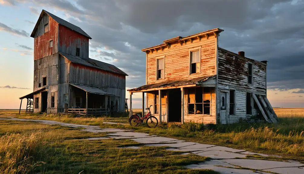
What Remains: A Historical Landmark
If you visit Mapes today, you’ll find Mapes Hall standing as the town’s most significant remaining historical structure, having survived multiple fires since its 1929 reconstruction to serve as a symbol of the community’s resilience.
Similar to many mechanized agriculture operations that reshaped rural communities across North Dakota, Mapes experienced a steady decline as farming practices evolved.
The scattered remnants of the Old West Tavern, damaged by fire in 1998, and several still-inhabited houses provide glimpses into the town’s more vibrant past. Much like the grain elevators in Josephine, these agricultural remnants tell the story of the region’s farming heritage.
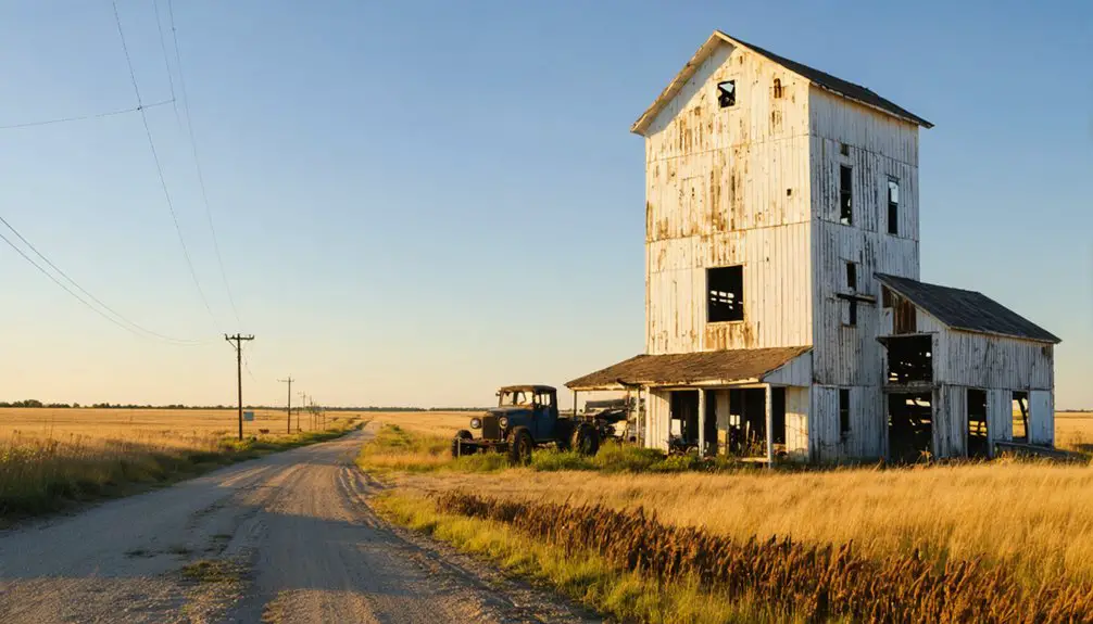
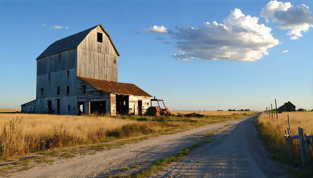
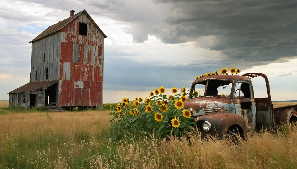
These few surviving structures, along with the ruins of burned grain elevators and long-demolished commercial buildings, mark what remains of a once-thriving agricultural community that played a pivotal role in Nelson County’s early development.
Standing Structures Today
Visitors exploring Mapes today will find only a handful of structures still standing in this North Dakota ghost town. The most prominent remaining structure is a stone church visible on the horizon, which still occasionally hosts services and reunions for former residents.
Like many communities that became abandoned in territorial days, Mapes represents the pattern of towns that emerged and disappeared during North Dakota’s railroad expansion era.
The area’s history mirrors places like Crystal Springs, where the construction of Interstate 94 led to significant decline.
While most buildings have succumbed to time and weather, you’ll notice commemorative markers indicating where important civic buildings once stood, including the former post office and city hall.
Surrounding the original townsite, you’ll spot several maintained farmhouses and outbuildings on private property, contrasting sharply with the abandoned core.
Foundation outlines and ruins dot the landscape, telling silent stories of what once was. Without active utilities or infrastructure, these remnants serve as a poignant reminder of Mapes’ past glory.
Notable Historical Features
Despite the ravages of time and numerous fires, Mapes retains several historical features that tell its story as a pioneering North Dakota settlement.
You’ll find the most significant remaining landmark is the hilltop cemetery, which provides essential genealogical links to the town’s early settlers and their descendants.
While most structures succumbed to devastating fires throughout the 1900s, the community’s resilience showed in their repeated rebuilding of Mapes Hall, which stood from 1913 until its final closure.
The town’s agricultural heritage is evident in the sites of former grain elevators, though they’re now lost to fire.
The post office’s various locations, ending with its 1980 closure, and the cemetery’s enduring presence mark the progression from thriving farm town to historic site.
Preserving Physical Memories
Through decades of natural decay and devastating fires, Mapes’ physical remnants tell a compelling story of pioneer life in rural North Dakota. You’ll find foundations, scattered wood remnants, and archaeological treasures that highlight the town’s vibrant past.
Multiple fires between 1890 and 1998 severely impacted artifact preservation, claiming numerous buildings including the Mapes Hall, churches, and grain elevators.
Today, you can explore the site where excavations have unearthed early ceramics, pottery stamps, and glass fragments that showcase the community heritage.
Historical maps from 1893 help pinpoint former building locations, though access is sometimes restricted to protect these delicate remains.
While vandalism and natural deterioration pose ongoing challenges, these physical memories serve as powerful representations of North Dakota’s rural history.
Frequently Asked Questions
Were Any Paranormal Activities Reported in Mapes After It Became Abandoned?
While millions roam ghost towns searching for ghost sightings, you won’t find documented paranormal activity here. Despite neighboring towns having rich local legends, there’s no verified supernatural evidence from abandoned Mapes.
What Happened to the Original Residents’ Belongings When They Left?
You’ll find most residents took their belongings when relocating, while abandoned artifacts were lost to fires, decay, or neglect. Some personal effects were sold locally, but resident memories largely vanished with time.
How Much Would It Cost to Buy Property in Mapes Today?
Like finding buried treasure, you’ll discover property prices in this ghost town ranging from $25,000 to $179,900, with only four homes currently listed. Market trends show values below regional averages.
Are There Any Annual Events or Gatherings Held at the Ghost Town?
You won’t find any ghost town festivals or community gatherings held annually at this location. With just eight remaining residents and limited infrastructure, organized events aren’t feasible in this remote setting.
Can Visitors Legally Explore the Remaining Structures in Mapes?
You can’t legally enter remaining structures since they’re on private property with access restrictions. Any exploration requires explicit permission from landowners and must comply with trespassing laws.
References
- https://news.prairiepublic.org/podcast/dakota-datebook/2023-02-22/mapes-and-its-many-fires
- https://en.wikipedia.org/wiki/Mapes
- https://northernsentry.com/2025/06/26/north-dakota-ghost-towns/
- https://www.youtube.com/watch?v=-E2DA6Ryd1g
- https://ghostsofnorthdakota892857007.wordpress.com/2017/03/28/the-story-of-how-ghosts-of-north-dakota-began/
- https://www.ghosttowns.com/states/nd/mapes.html
- https://freepages.rootsweb.com/~bryant/genealogy/obits/Mapes_Emory_Freeman.html
- https://www.history.nd.gov/archives/manuscripts/family.html
- https://www.myheritage.com/names/emery_mapes
- https://ghostsofnorthdakota892857007.wordpress.com/2015/10/30/true-ghost-towns-population-zero/