When exploring America’s submerged ghost towns, you’ll need to time your visit during drought conditions or reservoir drawdowns when remnants emerge. Key accessible sites include St. Thomas in Nevada, Livermore in Pennsylvania, and Andersonville in South Carolina. Bring appropriate watercraft, navigation tools, and protective footwear for unstable structures. Always check water level forecasts and dam release schedules before visiting. These temporary windows into history offer rare archaeological insights for those who know when to look.
Key Takeaways
- Access flooded towns only during confirmed low water periods when drought conditions expose concrete foundations and structural remnants.
- Pack appropriate gear for navigation, as exposed riverbanks present structural hazards and potential wildlife encounters.
- Notable accessible sites include St. Thomas in Nevada, Andersonville Island in South Carolina, and Livermore in Pennsylvania.
- Droughts create temporary windows for exploration, revealing intact foundations, walls, streets and archaeological artifacts.
- Former communities like Judson, Proctor, Loyston and Elbowoods offer insights into communities displaced by infrastructure development.
The Hidden History of America’s Submerged Settlements
While America’s landscape features countless ghost towns abandoned due to economic decline, a distinct category remains largely invisible: communities deliberately submerged beneath man-made lakes and reservoirs.
You’re walking on water that covers forgotten towns like Judson and Proctor in North Carolina, victims of 1940s dam construction. These hidden narratives span the nation—Loyston, Tennessee disappeared in 1935 under TVA projects, while St. Thomas, Nevada vanished beneath Lake Mead after Hoover Dam’s completion.
Beneath calm reservoir waters lie America’s drowned communities—sacrificed for progress, their streets and stories forever submerged.
Your submerged heritage includes not just settler communities but significant Native American sites—historic Cherokee towns like Chota and Tanasi now rest silently under Tellico Lake. The name “Jocassee” itself means “Place of the Lost One” in Cherokee, reflecting the poignant history of these submerged lands.
In the Northeast, entire communities like Enfield, Massachusetts were disincorporated, with 1,200 bodies relocated from graveyards. Andersonville, South Carolina, once a thriving community established in 1801, now exists only as Andersonville Island accessible by watercraft. During droughts, these watery tombs occasionally reveal themselves, briefly exposing America’s drowned history.
Pennsylvania’s Underwater Legacy: Towns Beneath Conemaugh River Lake
You’re examining Pennsylvania’s forgotten history when observing Conemaugh River Lake, which submerged the once-thriving canal town of Livermore in 1952.
During periods of drought, the lake’s receding waters occasionally reveal foundations and artifacts from this 19th-century settlement located between Blairsville and Saltsburg.
The region has a long history of water management challenges, tragically demonstrated by the 1889 Johnstown Flood that claimed 2,209 lives when the South Fork Dam failed after days of torrential rainfall.
The devastating flood sent a 40-foot wave of water and debris through the valley, destroying everything in its path before reaching Johnstown.
These archaeological remnants provide researchers with precise data points for mapping the underwater town’s layout and understanding the cultural impact of flood control projects on displaced communities.
Pennsylvania’s Forgotten Pasts
Beneath the surface of Conemaugh River Lake lies a submerged landscape that bears silent testimony to one of America’s most devastating natural disasters.
You’re looking at forgotten landmarks from communities like Mineral Point, whose sawmill and structures were violently swept away when 20 million tons of water surged through the valley on May 31, 1889.
This submerged heritage includes remnants of 2,500 destroyed homes and the altered topography where 2,209 lives ended—396 of them children.
When you navigate these waters, you’re floating above the catastrophic path where floodwaters rose 40 feet high, traveling 14 miles downstream from the negligently maintained South Fork Dam.
The underwater landscape preserves the convergence of human error and natural forces that transformed these Pennsylvania towns into America’s deadliest flood disaster. Despite early warning signs, residents received no official alerts as telegraph messages failed to reach Johnstown before the catastrophe struck. The devastating debris collected at the Pennsylvania Railroad Stone Bridge and burned for three days, adding to the horrific toll of the catastrophe.
Water Reveals History
During periods of drought and low water levels, Conemaugh River Lake reluctantly reveals its underwater archive of Pennsylvania’s past. You’ll witness the ghostly remnants of Livermore, sacrificed for flood control when the dam was completed in 1952.
Water documentation efforts intensify during these rare exposure events, capturing data before rising waters reclaim these historical treasures.
Submerged archaeology highlights include:
- Former Pennsylvania Canal infrastructure with intact locks and stonework
- Building foundations from Livermore’s commercial district and residences
- Original road networks and bridge abutments from the 19th century
- Railroad infrastructure predating the 1952 inundation
The July 2020 drawdown provided researchers unprecedented access to document these artifacts.
This underwater landscape represents both engineering triumph and community displacement—physical evidence of how water management reshapes both geography and memory. The Conemaugh dam project echoes the tragic legacy of the 1889 Johnstown Flood when the South Fork Dam breached due to structural failures and inadequate maintenance.
The catastrophic flood claimed 2,200 lives and devastated towns throughout the Conemaugh Valley.
When Waters Recede: Ghost Towns That Periodically Resurface
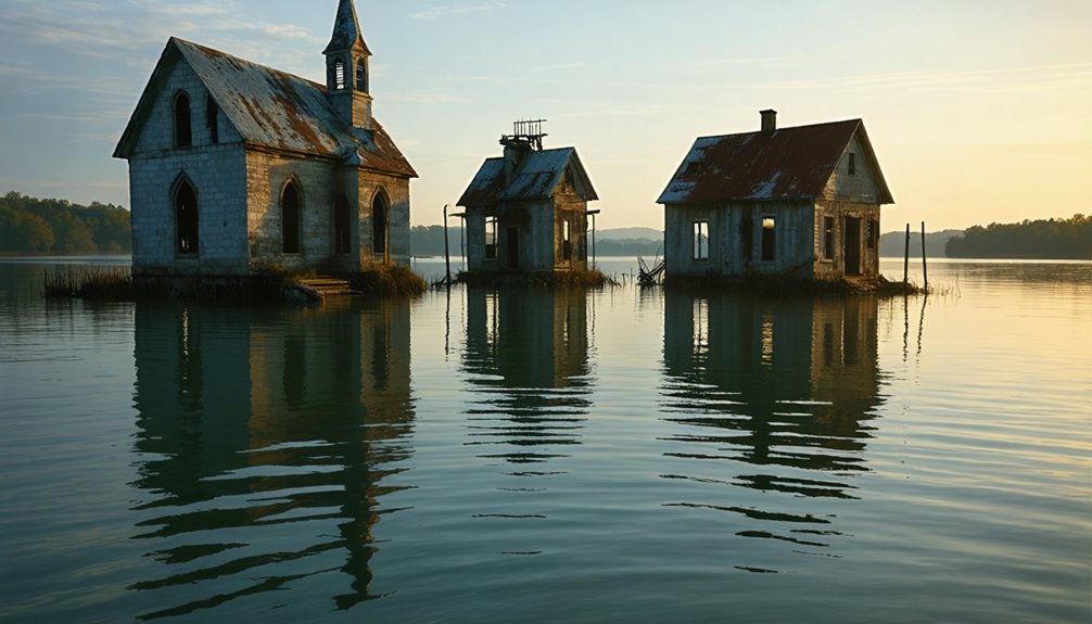
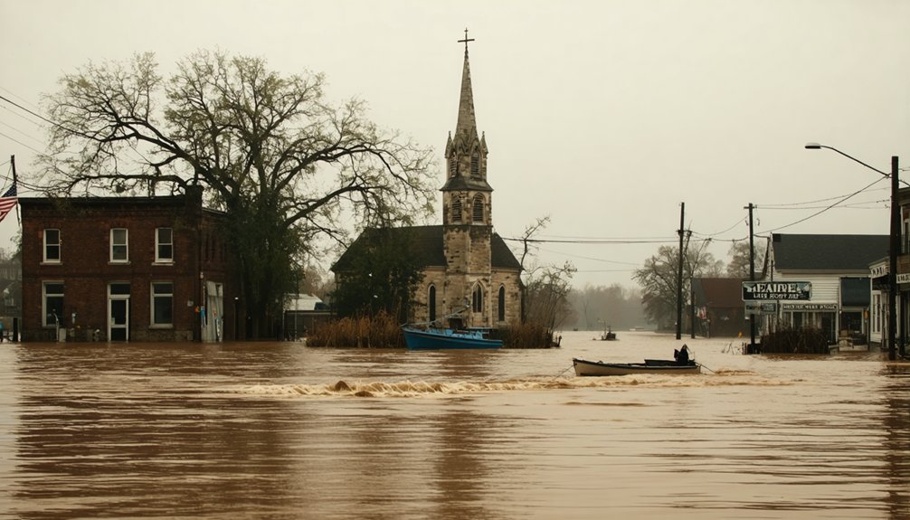
You’ll encounter unique exploration opportunities when drought conditions cause reservoir levels to drop, exposing the concrete foundations and structural remnants of towns like St. Thomas, Nevada and Proctor, North Carolina.
These temporary windows into history reveal the stark evidence of communities displaced by dam projects, with visible ruins including home foundations, school structures, and occasionally cemetery plots. St. Thomas was inundated by water in the late 1930s when the Hoover Dam created Lake Mead, forcing residents to relocate to other towns. The Ashokan Reservoir construction resulted in the displacement of approximately 2,000 people and the flooding of four hamlets in the Catskill Mountains.
Water level fluctuations in locations such as Lake Hartwell and the Ashokan Reservoir create time-sensitive access to these archaeological sites, where the past emerges briefly before disappearing beneath the waters again.
Drought Reveals History
Across America’s vast network of reservoirs and dammed rivers, prolonged drought conditions periodically expose the haunting remnants of communities sacrificed for water management infrastructure.
When water levels recede, you’ll witness the drought impact on these submerged landscapes, disclosing archaeological treasures with significant historical significance.
These disclosures offer rare opportunities for examination:
- Towns like St. Thomas in Lake Mead emerge with foundations, walls, and streets intact.
- 113-million-year-old dinosaur tracks become visible in Central Texas.
- Sunken vessels like the North Alabama in Yukon River reappear after 150+ years.
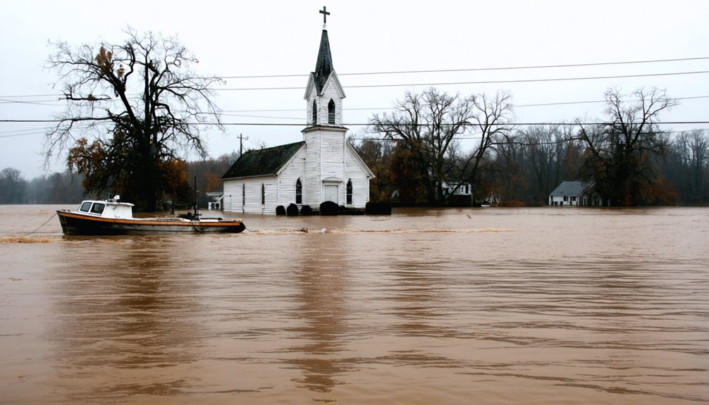
- Religious structures from churches to Buddhist statues resurface globally.
This cyclical revelation provides critical data points about pre-flood communities while documenting the price paid for modern water management—knowledge that remains mostly submerged until nature temporarily releases these historical archives.
Memories Beneath Water
Dozens of submerged communities resurface periodically as water levels fluctuate in America’s reservoirs and lakes, creating temporary windows into history.
You’ll discover lost landscapes like St. Thomas, Nevada, which emerges from Lake Mead during droughts, revealing foundations and streets once bustling with life.
These submerged stories become accessible when water recedes at sites like Elbowoods, North Dakota, where Native American heritage briefly returns to daylight.
The artifacts and architectural remnants you’ll encounter provide rare glimpses into bygone eras, though they deteriorate with each exposure.
When exploring these temporarily accessible ghost towns, you’ll face unstable structures and unpredictable water levels.
Local preservation teams race against time, documenting these vanishing treasures before rising waters reclaim them, potentially for decades.
Exploring Temporary Ruins
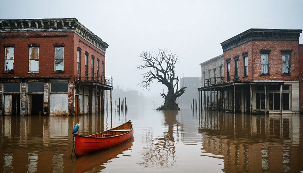
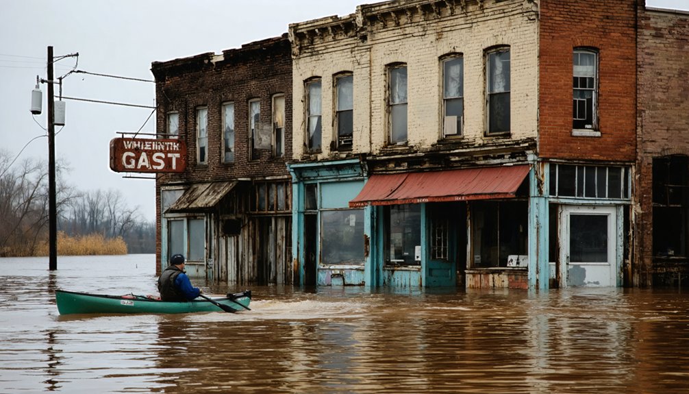
When water levels drop in American reservoirs due to seasonal droughts or long-term climate shifts, submerged ghost towns emerge from their watery tombs, creating narrow windows for exploration.
Your ghostly explorations at sites like St. Thomas in Lake Mead or Elbowoods in North Dakota provide unique archaeological insights into communities displaced by infrastructure projects.
Similarly, haunted sites in the Pacific Northwest often reveal rich histories intertwined with local lore. Investigating places like the Oregon State Hospital or the former Old Washougal Grade School can uncover stories of both past inhabitants and lingering spirits. Each location serves as a reminder of the complex narratives that continue to shape these regions.
When planning your submerged discoveries, consider:
- Access limitations – Only visit during confirmed low water periods
- Structural hazards – Navigate unstable buildings with appropriate gear
- Wildlife encounters – Watch for venomous snakes near exposed riverbanks
- Archaeological sensitivity – Avoid disturbing artifacts or cemetery sites
These temporary ruins face accelerated decay from weather exposure and human interference.
Document what you find responsibly, as these fleeting windows into flooded communities may soon vanish again beneath rising waters.
The Engineering Behind Intentional Flooding and Dam Construction
The engineering behind intentional flooding and dam construction encompasses complex hydrological analysis and structural design principles that determine a reservoir’s capacity to mitigate flood risks.
Dam engineering balances complex hydrology with structural design to create reservoirs that protect communities from nature’s fury.
When you observe these massive structures, you’re witnessing the culmination of risk-informed decision-making that classifies dams as High, Significant, or Low hazard.
Dam engineering requires balancing multiple priorities: spillways prevent catastrophic overtopping while outlet works regulate downstream flow.
The intentional flooding that creates reservoirs provides dual benefits—storing water for consumption while maintaining empty flood control pools to capture excessive rainfall.
Engineers must navigate the tension between maximizing storage capacity and preserving adequate freeboard for extreme events. This balance determines which lands remain dry and which become permanently submerged, creating the ghost towns you can explore during drought conditions.
Exploring Submerged Ruins: Safety and Accessibility Guidelines
Steering through submerged ruins requires strict adherence to detailed safety protocols that protect both explorers and historical sites.
You’ll need appropriate safety gear, including PFDs, first aid kits, and emergency communication devices, especially when exploring remote locations with limited cell service.
Before visiting, verify:
- Local water levels and weather forecasts to avoid sudden changes
- Required permits from authorities or land management agencies
- Seasonal accessibility windows during drawdowns or low water periods
- Legal restrictions regarding artifact disturbance and site preservation
Access regulations vary by location, with many sites only accessible during scheduled periods or via specific transportation methods.
Monitor for environmental hazards including unstable structures, contaminated floodwaters, and wildlife.
Document your findings responsibly without sharing precise coordinates publicly, preserving these historical resources for future exploration.
Cultural Impact and Preservation Efforts for Underwater Communities

Beyond the physical challenges of exploring underwater towns lies the profound cultural significance these submerged communities hold. When you visit these sites, you’re witnessing the direct impact of infrastructure development on cultural heritage—particularly for indigenous communities.
The Cherokee beneath Fontana Lake and the Fort Berthold families forcibly relocated to New Town represent community resilience against systematic displacement.
During droughts, you’ll find pottery and human remains resurface, igniting preservation efforts among descendant communities. Archaeological surveys confirm Mississippian villages beneath Lake Marion, while some locations like St. Thomas receive National Park Service protection.
These underwater towns aren’t just historical curiosities but represent profound cultural loss—with approximately 6,000 graves relocated before the Quabbin Reservoir flooding and countless others left undisturbed beneath the waters, their stories waiting to be acknowledged.
Frequently Asked Questions
Can I Scuba Dive to Explore Underwater Ghost Towns?
Yes, you can scuba dive to explore underwater ghost towns, but you’ll need proper permits, technical dive training, and specialized equipment for safety. Underwater exploration requires understanding visibility conditions and depth limitations.
Do Property Rights Still Exist for Submerged Town Lands?
Like Atlantis, you’ll find your property ownership rights typically extinguished underwater. Submerged lands become state-owned under the Public Trust Doctrine, with legal implications severely restricting private claims despite rare statutory exceptions.
What Artifacts Are Commonly Found in Flooded Ghost Towns?
You’ll encounter bottles, brickwork, pottery shards, machinery remnants, and personal items underwater. These artifacts possess significant historical significance, requiring careful preservation to maintain their value as cultural data points.
Are There Any Successfully Relocated Submerged Communities?
You’ll find 90% of Valmeyer’s residents successfully relocated after the 1993 Mississippi flood. Other successful relocations from submerged communities include Soldiers Grove, Wisconsin, and Rhineland, Missouri—all preserving community identity despite displacement.
How Do Ecological Changes Affect Submerged Town Preservation?
You’ll find ecological impacts considerably alter preservation outcomes through sediment accumulation, aquatic organism colonization, and chemical transformations. Modern preservation techniques must account for these dynamics when documenting submerged architectural remains.
References
- https://devblog.batchgeo.com/ghost-towns/
- https://www.lonelyplanet.com/articles/coolest-ghost-towns-us
- https://www.geotab.com/ghost-towns/
- https://en.wikipedia.org/wiki/Lists_of_ghost_towns_in_the_United_States
- https://whakestudios.com/us-ghost-towns/
- https://www.atlasobscura.com/lists/americas-best-preserved-ghost-towns
- https://www.smithsonianmag.com/travel/americas-coolest-ghost-towns-180952954/
- https://www.blueridgeoutdoors.com/go-outside/sunken-secrets-the-underwater-ghost-towns-of-the-blue-ridge/
- https://www.thewanderingappalachian.com/post/the-underwater-towns-of-appalachia
- https://cedarbayoumarina.com/four-ghost-towns-under-lake-texoma/