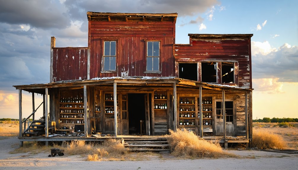
You’ll find Nottawa at the intersection of U.S. Route 90A and FM 1164 in South Texas, where a once-thriving rice farming community flourished from 1898 until its decline. The town’s agricultural success peaked in 1940, producing 24 million pounds of rice through advanced irrigation systems and Japanese farming techniques. While most structures are gone, Tennessee Gas Pipeline Company’s 1944 compressor station remains active, marking an industrial evolution that tells a broader story of Texas ghost towns.
Key Takeaways
- Nottawa originated as a rice farming community in 1898, reaching peak production of 24 million pounds by 1940.
- Located at the intersection of U.S. Route 90A and FM 1164, with the Union Pacific Railroad providing transportation infrastructure.
- Tennessee Gas Pipeline Company’s compressor station remains the only significant industrial presence, established in 1944.
- The town experienced gradual population decline as younger generations left for urban opportunities, leading to business closures.
- Agricultural heritage included Japanese-influenced farming techniques and extensive irrigation systems that supported rice cultivation.
The Rise and Fall of a Rice Farming Community
While many Texas ghost towns emerged from mining or oil booms, Nottawa’s story began with rice farming in 1898, when settlers discovered the area’s ideal soil and climate conditions.
You’ll find that this discovery transformed the region’s economic trajectory, as farmers developed sophisticated irrigation systems and embraced new seed varieties from Japan to maximize their yields.
The community’s economic resilience was tested through market fluctuations and environmental challenges.
Despite efforts to diversify crops, Nottawa’s dependence on rice farming proved to be both its strength and ultimate weakness.
Local businesses, homes, and infrastructure grew to support the burgeoning agricultural community, but when global competition increased and environmental stressors took their toll, the town’s fortunes began to decline.
The region’s rice production reached an impressive 24 million pounds by 1940, marking the peak of agricultural prosperity.
The shift away from agricultural land use ultimately sealed Nottawa’s fate.
The Tennessee Gas Transmission Company brought temporary industrial activity to the area with its booster plant in 1944.
Geographic Location and Natural Features
Located in South Texas, Nottawa’s geographic footprint illustrates the typical characteristics of the region’s natural landscape.
You’ll find the terrain defined by flat to gently rolling prairies, interspersed with patches of woodland that add texture to the horizon. The area’s geographic significance stems from its position in South Texas’s subtropical climate zone, where hot summers and mild winters create conditions that once supported farming activities. The San Antonio River flows nearby, which historically provided essential water access for early settlers and ranchers.
While specific natural resources and features unique to Nottawa aren’t well-documented, the surrounding region offers insights into what you might encounter. Many ghost towns in the area were established near natural landmarks that served as navigation points for early settlers.
Though Nottawa’s exact features remain unclear, examining the broader South Texas landscape helps paint a picture of its natural setting.
The land features soil that’s historically been suitable for agriculture, and you’re in an area where the natural environment supports diverse wildlife populations.
Like many South Texas locations, the ghost town exists within a landscape shaped by regional weather patterns and ecological systems.
the ghost towns of Texas history often tell stories of thriving communities that once played significant roles in the state’s development. As the population shifted and resources dwindled, these towns faded into obscurity, leaving behind remnants of their past glory. Today, they serve as a poignant reminder of the region’s rich and diverse heritage.
Agricultural Legacy in Wharton County
You’ll find that Wharton County’s agricultural transformation included the rise of rice farming, which reshaped the area’s rural landscape after initial plantation and ranching periods.
The county’s farmers converted vast tracts of prairie into productive rice fields, capitalizing on the region’s abundant water resources and suitable soil conditions. Along with rice, early settlers cultivated corn and potatoes as key crops. Companies like the El Campo Rice Milling helped establish processing facilities that supported the growing industry.
The shift to rice cultivation marked a significant change from the earlier cotton and sugar cane dominated plantation system, helping establish Wharton County as an important rice-producing region in Texas.
Rice Farming Heritage
As the Colorado River carved its path through Wharton County in the late 1800s, the region transformed into a powerhouse of rice production, sparked by the construction of three major canal systems around 1900.
You’ll find evidence of pioneering rice farming techniques in areas like Nottawa and Lissie Prairie, where Japanese settlers introduced advanced cultivation methods using seeds gifted by the Emperor of Japan himself.
The community’s resilience shone through as they established two of Texas’s largest pumping plants and expanded irrigation to over 21,000 acres by 1930.
While exploring these historic farmlands, you’ll discover how deep water wells and chemical fertilizers helped overcome initial soil depletion, enabling farmers to achieve remarkable production levels of one million bushels, cementing Wharton County’s position as a leader in Texas rice cultivation.
Today, farmers like Daniel Berglund maintain this legacy by implementing GPS-guided levee systems to ensure precise water management across their paddies.
The county’s subtropical humid climate and abundant rainfall provided ideal conditions for sustaining successful rice farming operations throughout the region.
Rural Land Transformation
Before rice became king in Wharton County, the land bore witness to dramatic agricultural shifts spanning generations.
You’d have seen the county’s rural development unfold from vast sugar and cotton plantations to extensive cattle operations. Eli Mercer pioneered this agricultural diversity when he produced the first sugarcane in Texas. The economic change became most apparent after the Civil War, when pioneers like “Shanghai” Pierce transformed thousands of acres into cattle country, eventually building a half-million-acre ranching empire.
By 1906, the introduction of Brahman cattle revolutionized local ranching, establishing Wharton as Texas’s second-largest cattle producer.
Beyond livestock, you’ll find the county’s agricultural legacy in its diverse crops – from sugar cane and cotton to specialty products like honey and figs – reflecting how generations of settlers adapted to and shaped this once-wild landscape.
Transportation Routes and Accessibility
While Nottawa’s ghost town status might suggest isolation, the site actually maintains strong transportation connectivity through its strategic location at the intersection of U.S. Route 90A and FM 1164. Similar to its disambiguation page status, this location serves as a navigational hub for travelers seeking different destinations.
Though abandoned, Nottawa remains surprisingly accessible, serving as a well-connected crossroads between major transportation routes in rural Texas.
You’ll find well-maintained roads that support rural connectivity, with the Union Pacific Railroad running parallel to US 90A. County Road 270 provides additional access options, making the site easily reachable for those seeking adventure in Texas ghost towns.
- Experience the freedom of the open road as you navigate between East Bernard and Lissie, with Nottawa perfectly positioned between these landmarks.
- Discover the historic significance of the Tennessee Gas Pipeline Company compressor station, which serves as a distinctive waypoint.
- Travel through authentic Texas terrain, surrounded by sprawling rice fields and bordered by Middle and West Bernard Creeks.
Modern Industrial Presence and Infrastructure
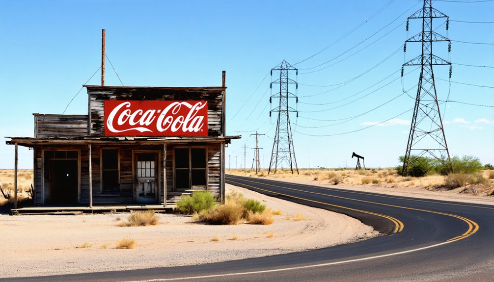
Industrial activity in Nottawa centers around the Tennessee Gas Pipeline Company‘s compressor station, a key piece of infrastructure established in 1944 that remains operational today.
You’ll find this energy infrastructure represents the area’s industrial evolution from its agricultural roots to its current role in Texas’s natural gas network.
While the original booster plant once supported a thriving community with employee housing and a community center, these residential facilities were largely dismantled by the 1970s.
The site’s agricultural legacy includes Occidental Petroleum’s research farm, which operated until 1991, developing rice and soybean innovations for Asian markets.
Today, you’ll see few traces of the town’s former industrial diversity – the gas compressor station stands as the primary industrial presence, surrounded by open fields where research crops once grew.
Historical Context Among Texas Ghost Towns
You’ll find Nottawa’s history follows common patterns seen in Texas ghost towns, where population losses often stemmed from the town’s reliance on either mining or agriculture rather than a diversified economy.
Like many failed settlements, Nottawa’s trajectory mirrors other ghost towns where shifting transportation routes critically impacted community sustainability.
The town’s gradual population decline exemplifies how Texas ghost towns typically lost residents in waves rather than all at once, with each economic setback driving more people to seek opportunities elsewhere.
Agricultural Versus Mining Towns
Although both types of ghost towns dot the Texas landscape, agricultural and mining settlements followed distinctly different paths to abandonment.
You’ll find that agricultural practices relied on family homesteads of 150 acres, while mining operations centered around extracting valuable minerals like mercury and silver.
Agricultural communities built lasting infrastructure with schools and churches, reflecting their commitment to permanent settlement. In contrast, mining towns rushed to construct temporary facilities serving their transient, mainly male workforce.
- Picture families toiling for generations on their farmland, only to watch their dreams blow away in the Dust Bowl.
- Imagine the feverish excitement of striking silver in Shafter, followed by the crushing reality of depleted mines.
- Envision abandoned homesteads slowly decaying while mining towns stand as sudden snapshots of mass exodus.
Town Population Loss Patterns
Since the mid-20th century, Texas ghost towns have followed predictable patterns of population decline, particularly in the High Plains and West Texas regions.
You’ll find that population losses often begin with the younger generation leaving for urban opportunities, triggering a cascade of departures. As residents move away, local businesses close, tax revenues drop, and essential services disappear.
The cycle of rural migration has hit towns under 10,000 residents especially hard, with many seeing their populations plummet by more than 60% since 2010.
In the High Plains alone, 27 counties lost residents through outward migration between 2022 and 2023. When critical infrastructure like schools and hospitals shut down, the exodus accelerates until some communities, like Mustang, TX, eventually reach zero population.
Transportation Access Impact
Transportation networks played a pivotal role in both the rise and decline of Nottawa, reflecting a pattern common among Texas ghost towns. The transportation evolution began with the 1859 Buffalo Bayou, Brazos and Colorado Railway, which initially spurred growth.
However, as highways like US 90A and FM 1164 developed, dramatic economic shifts occurred. You’ll find this paradox throughout Texas ghost towns, where improved accessibility ultimately led to their decline.
- The railway that once brought life to Nottawa became less crucial as residents found freedom in the expanding road network.
- Local stores closed their doors in the late 1940s as you could easily drive to larger towns like East Bernard.
- The combination of railways and highways transformed Nottawa from a thriving community into a historical reminder of changing times.
Frequently Asked Questions
When Was the Last Known Permanent Resident Recorded in Nottawa?
Like a fading photograph lost to time, you won’t find Nottawa’s last resident date recorded in history books. The town’s economy dried up gradually, leaving no documented final inhabitant to mark its end.
Were There Any Schools or Churches Established in Nottawa?
You’ll find records confirm one school operated until 1945 when it merged with East Bernard’s district. While ghost stories and historical significance surround the area, there’s no evidence of established churches.
What Caused the Initial Settlement of Nottawa?
You’ll find that railroad expansion in 1859 and agricultural development drew settlers to the area, with Czech, English, and Welsh immigrants arriving by 1878 as part of the New Philadelphia project.
Did Nottawa Have a Post Office During Its Active Years?
Yes, you’ll find that Nottawa’s history includes a post office that operated from 1904 to 1930, with Frank C. Boyden serving as the first postmaster during this significant period of Nottawa’s commerce.
What Was the Peak Land Value of Properties in Nottawa?
You won’t find specific peak land values, as records weren’t preserved through Nottawa’s economic decline. Any land speculation would’ve reached its height before local businesses closed and residents departed.
References
- https://www.buchananlaketexas.com/news–entertainment–Ghost-Town-Under-Lake-Buchanan-Old-Bluffton/7262
- https://en.wikipedia.org/wiki/Nottawa
- https://mix941kmxj.com/see-how-two-texas-ghost-towns-battled-for-the-county-and-lost/
- https://texashighways.com/travel-news/four-texas-ghost-towns/
- https://www.youtube.com/watch?v=phjUE19A8HM
- https://en.wikipedia.org/wiki/List_of_ghost_towns_in_Texas
- https://knue.com/texas-gulf-ghost-town-indianola/
- https://kids.kiddle.co/Nottawa
- https://www.texasescapes.com/TexasGulfCoastTowns/East-Bernard-Texas.htm
- https://discovertexasoutdoors.com/places/nottawa-texas-the-crossroads-community-that-rice-built/


