Planning a ghost town road trip to Ivanhoe, Iowa means heading to Highway 1 between Solon and Mount Vernon, near the Cedar River crossing. You won’t find signs or tourist markers — just a weathered cemetery, overgrown land, and frontier silence. Established in 1838, Ivanhoe was among Linn County’s first settlements before larger towns claimed its future. Stick around, and you’ll uncover the full story of how this forgotten frontier crossroads shaped early Iowa history.
Key Takeaways
- Ivanhoe, Iowa, sits near the Cedar River crossing on Highway 1, between Solon and Mount Vernon, at approximately 41.883°N, 91.463°W.
- No standing structures remain; expect overgrown land, solitude, and a small cemetery with weathered, partially unreadable gravestones.
- No official signage or markers exist, so navigation and exploration are essential for locating the site.
- Nearby Solon offers small-town cafes, while Mount Vernon features historic architecture and Cornell College for additional stops.
- Ivanhoe’s frontier legends of horse thieves and counterfeiters add historical intrigue to the ghost town experience.
What Was Ivanhoe, Iowa?
Before it faded into history, Ivanhoe was one of the first three communities to take root in Linn County, Iowa. Anton Cowles laid it out in 1838 at a strategic crossing of the Red Cedar River along the Old Military Road.
Ivanhoe was among Linn County’s first communities, strategically established by Anton Cowles in 1838 along the Old Military Road.
By 1839, William H. Merritt had already opened the county’s second store there. A post office operated from 1845 to 1849, signaling a brief but real period of growth.
You won’t find historical artifacts or preserved buildings waiting for you today, but local legends paint a vivid picture of a frontier settlement shaped by traders, travelers, and reportedly, horse thieves and counterfeit-money dealers.
Ivanhoe never got formally platted, and as Cedar Rapids, Marion, and Mount Vernon expanded, Ivanhoe quietly disappeared.
Why Ivanhoe Lost Out to Cedar Rapids, Marion, and Mount Vernon
Ivanhoe had geography working in its favor early on, but that same geography eventually worked against it. The Old Military Road crossing gave the settlement early purpose, but as Iowa’s population grew, larger towns grabbed the cultural significance that Ivanhoe couldn’t hold onto.
Cedar Rapids secured better trade infrastructure, Marion established stronger political footing, and Mount Vernon attracted steady settlers. Ivanhoe simply couldn’t compete. Residents packed up and relocated to wherever opportunity moved.
Though no major archaeological findings have surfaced to tell the full story, historical records confirm the pattern clearly — small frontier stops either grew fast or disappeared. Ivanhoe disappeared. A state legislative act formalized what residents had already decided with their feet. The town was finished before it ever fully started.
What Remains at the Ivanhoe Site Today?
When you arrive at the Ivanhoe site today, don’t expect buildings, storefronts, or any standing structures — none survive. Your best reason to stop is the small cemetery, where only a few gravestones remain, at least one too worn to read.
You’ll also find a quarry and an Ivanhoe Sand Pit operating nearby, keeping the name alive even as the town itself exists only in historical records.
The Surviving Cemetery Remnants
Though little survives of Ivanhoe’s frontier past, the town’s small cemetery stands as its most tangible remnant. When you visit, you’ll find only a handful of gravestones, and at least one marker has worn completely unreadable — a quiet testament to how thoroughly time erases forgotten places.
These historical artifacts connect you directly to the earliest settlers of Linn County, people who built a community from raw Iowa wilderness.
Local legends paint Ivanhoe’s later days as rough and lawless, haunted by horse thieves and counterfeit-money dealers, adding an intriguing edge to your exploration.
Don’t expect a maintained historic site — expect solitude, overgrown ground, and the raw feeling of standing where a real frontier town once breathed and then simply disappeared.
Quarry And Sand Pit
Beyond the cemetery’s weathered stones, two industrial landmarks carry Ivanhoe’s name into the present: a quarry and an Ivanhoe Sand Pit. These sites represent something unexpected — a ghost town that didn’t just vanish but transformed, its ground still being worked long after its people moved on.
When you visit, you’ll find that sand extraction has replaced the frontier commerce that once defined this riverside settlement. The quarry and sand pit aren’t picturesque historical remnants in any romantic sense, but they’re honest markers of how land outlasts the communities built upon it.
They tell Ivanhoe’s story in a different register — industrial rather than nostalgic.
If you’re exploring the area, these landmarks confirm you’ve found the right location, even if what surrounds you looks nothing like an 1838 frontier town.
No Standing Structures Remain
What’s left of Ivanhoe when you arrive? Honestly, almost nothing. No standing structures survive from this once-active frontier settlement. You won’t find restored buildings, interpretive signs, or historical artifacts displayed along a walking path.
The town that Anton Cowles laid out in 1838 has vanished entirely above ground.
What remains lives in the landscape itself and in local legends about horse thieves and counterfeit-money dealers who allegedly called this place home. You’ll need to use your imagination here, picturing a busy river crossing along the Old Military Road where settlers once traded and traveled.
Visit expecting silence, open land, and the quiet weight of forgotten history. Ivanhoe rewards curious travelers who appreciate what’s missing just as much as what’s visible.
How to Reach Ivanhoe From Highway 1 Between Solon and Mount Vernon

If you’re driving Highway 1 between Solon and Mount Vernon, you’re already on the right road to find Ivanhoe’s ghost town site. Watch for the northeast side of the Cedar River crossing, where the old settlement once straddled the historic Old Military Road.
Once you’ve reached that river crossing area, you’re fundamentally standing at the heart of what was once Linn County’s early frontier community.
Highway 1 Starting Point
Traveling along Highway 1 between Solon and Mount Vernon, you’ll find the ghost town site of Ivanhoe tucked near the northeast side of the Cedar River crossing. This stretch of road puts you within easy reach of one of Linn County’s earliest settlements, making it a natural starting point for anyone drawn to frontier history.
Watch for the Cedar River crossing as your anchor landmark. The historical significance of this spot runs deep — Anton Cowles laid out Ivanhoe here in 1838, where the Old Military Road once connected early Iowa communities.
The elevation sits around 699 feet, and the surrounding landscape still carries quiet echoes of that territorial era. Pull off safely, get your bearings, and prepare for a ghost town stop that rewards curiosity over comfort.
Turning Toward Ivanhoe
Once you’ve got the Cedar River crossing locked in as your reference point on Highway 1, orient yourself to the northeast side of that crossing — that’s where Ivanhoe’s footprint once stood. You’re traveling between Solon and Mount Vernon, so watch for the Red Cedar River area as your turn signal to slow down and look around.
There aren’t official signs pointing toward historic landmarks here — Ivanhoe doesn’t advertise itself. That’s part of its appeal for independent travelers who prefer discovery over guided tours.
Local legends about horse thieves and counterfeit dealers once gave this crossing a rough reputation, adding texture to what now feels like quiet farmland.
Navigate toward the cemetery and quarry area — those are your anchors. Trust your coordinates: approximately 41.883°N, 91.463°W.
Arriving At The Site
When you reach the stretch of Highway 1 running between Solon and Mount Vernon, you’re already close — Ivanhoe’s former footprint sits on the northeast side of the Cedar River crossing, roughly at coordinates 41.883°N, 91.463°W. Pull over and take in what the land tells you:
- Quiet fields replacing streets that once carried frontier traffic
- A small cemetery holding the last visible historic artifacts of the settlement
- A nearby sand pit and quarry still carrying Ivanhoe’s name
- River bottomland whispering local legends about horse thieves and counterfeit dealers
No buildings greet you. No markers explain the full story. What you’ll find instead is raw, honest terrain — the kind that rewards curious travelers who prefer discovering history over having it packaged for them.
The Ivanhoe Cemetery, Sand Pit, and Red Cedar River Crossing
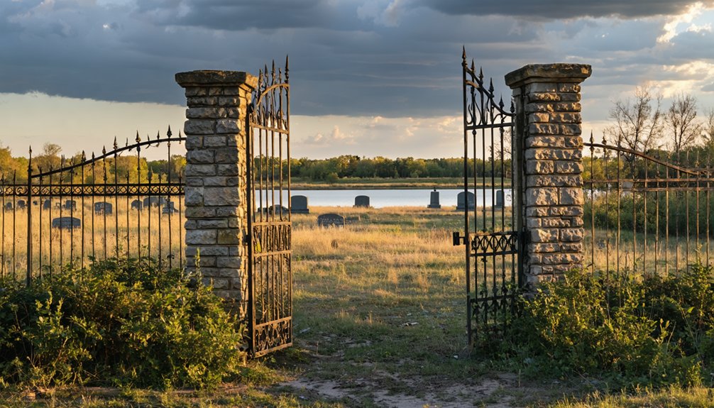
Though little remains of Ivanhoe itself, three landmarks anchor your visit: the cemetery, the sand pit, and the old Red Cedar River crossing.
The cemetery holds a handful of weathered gravestones — some unreadable — connecting you directly to the town’s earliest settlers. These historical artifacts ground you in a frontier world that vanished over a century ago.
Local legends about horse thieves and counterfeit-money dealers once shadowed this settlement, adding an outlaw edge to its quiet memory.
Nearby, the Ivanhoe Sand Pit carries the town’s name into the present. Walk toward the river crossing where the Old Military Road once pushed westward, and you’ll feel the strategic logic that drew Anton Cowles here in 1838. The landscape still tells that story.
How to Pair Ivanhoe With Solon and Mount Vernon
After absorbing Ivanhoe’s quiet remnants, you’re already positioned perfectly for a short but rewarding loop. Highway 1 connects this ghost town directly to two living communities worth exploring, making your drive feel intentional rather than random.
Follow the same transportation routes early settlers once traveled and let the contrast tell the story:
- Solon offers locally owned cafes and a relaxed small-town main street.
- Mount Vernon draws you in with historic architecture and Cornell College’s walkable campus.
- Highway 1 itself traces the old movement corridors that determined which towns survived.
- The Cedar River corridor visually anchors the entire route in natural landscape.
Together, these three stops create a layered experience — abandoned past, living present, and the open road connecting them both.
Why Crowds and Signage Are Absent From This Former Town
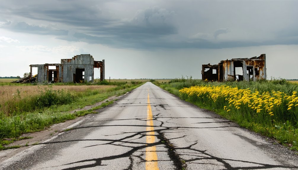
Ivanhoe never made it onto the map in any official sense — it was never platted, never anchored by the kind of civic infrastructure that earns a town a highway marker or a historical plaque. That absence explains everything you won’t find here: no welcome signs, no tour buses, no interpretive panels.
The post office closed in 1849, residents drifted toward Cedar Rapids and Marion, and abandoned structures eventually disappeared entirely. What’s left runs on local legends — stories of horse thieves and counterfeit dealers who once worked these river crossings.
You’ll navigate this site on your own terms, reading the landscape rather than signage. That freedom is exactly the point. Ivanhoe rewards curiosity, not convenience.
How Ivanhoe Shaped the Earliest Days of Linn County
Before Cedar Rapids dominated the regional map, a small river crossing community called Ivanhoe was helping define what Linn County could become. You’re looking at one of the county’s first three towns, built where the Old Military Road met the Red Cedar River.
Ivanhoe left its mark through:
- A frontier store William H. Merritt opened in spring 1839, the county’s second
- Local legends of horse thieves and counterfeit-money dealers haunting its later years
- Historical artifacts tied to early territorial-era settlement dating back to 1838
- A post office that connected isolated settlers from 1845 to 1849
When Marion and Mount Vernon grew, Ivanhoe emptied. Residents simply left, carrying its history with them and leaving behind only a quiet cemetery.
Frequently Asked Questions
Was Ivanhoe Ever Officially Incorporated as a Legal Iowa Town?
Coincidentally, no — Ivanhoe was never officially incorporated. You’ll find it wasn’t formally platted either, making ghost town preservation tricky. Local folklore keeps its memory alive, though only a cemetery and quarry remain today.
Who Was Anton Cowles, and Why Did He Choose That Location?
You’ll find Anton Cowles was an early Iowa settler who laid out Ivanhoe in 1838, choosing that spot for its ghost town history — a strategic Red Cedar River crossing along the Old Military Road, perfect for rural exploration.
Can Visitors Legally Access the Ivanhoe Cemetery on Private Property?
The knowledge doesn’t confirm private property access or legal considerations for the cemetery—you’d need to verify this locally before visiting. Don’t risk trespassing charges ruining your entire adventure; always contact Linn County authorities first!
What Novel Inspired the Naming of Ivanhoe, Iowa?
You’ll find that Sir Walter Scott’s classic novel *Ivanhoe* inspired the town’s name. It’s a ghost town legend tied to historical preservation, connecting you to frontier Iowa’s literary roots and early settlers’ cultured aspirations.
Were Any Notable Historical Figures Buried in the Ivanhoe Cemetery?
You won’t find records of notable historical figures buried there. The Ivanhoe cemetery’s few remaining gravestones, tied to historic landmark preservation efforts, hold more local ghost stories than celebrated names, making your visit hauntingly mysterious.
References
- https://en.wikipedia.org/wiki/Ivanhoe
- https://dungherder.wordpress.com/2018/03/09/abandoned-iowa-ivanhoe/
- https://en.wikipedia.org/wiki/List_of_ghost_towns_in_Iowa
- https://mapcarta.com/22070214
- https://kids.kiddle.co/List_of_ghost_towns_in_Iowa
- https://www.onlyinyourstate.com/experiences/iowa/ia-ghost-town
- https://www.hppr.org/2026-06-09/high-plains-history-the-last-reminder-of-a-once-thriving-community-ivanhoe-kansas
- https://kids.kiddle.co/Ivanhoe
- https://pubs.lib.uiowa.edu/annals-of-iowa/article/13466/galley/121920/download/