Sixes, Georgia won’t greet you with highway signs or a welcome center, but its layered history makes it worth every mile. You’ll find echoes of Cherokee heritage, Georgia’s earliest gold rush, and a community swallowed by Lake Allatoona in 1950. Located near Holly Springs in Cherokee County, it rewards curious explorers willing to navigate rural roads with downloaded maps and an open mind. Stick around, and the full story of Sixes gets even richer.
Key Takeaways
- Sixes, Georgia, is an unincorporated ghost town west of Holly Springs, near Lake Allatoona’s eastern shore, with no highway signs or visitor center.
- Bring downloaded offline maps, water, and patience, as road conditions vary and historic landmarks require self-guided exploration without formal signage.
- Key sites include Sixes Mill, Sixes Gold Mine, and Fort Sixes, reflecting Cherokee displacement, gold rush history, and early settler activity.
- Lake Allatoona, completed in 1950, submerged much of historic Sixes, leaving legends of Cherokee gold and buried valuables beneath its waters.
- Nearby ghost towns like Auraria share similar gold-rush histories, making Sixes an ideal stop along Georgia’s broader historic gold-rush corridor.
Why Sixes, Georgia Still Rewards a Road Trip
Though Sixes, Georgia barely registers on most maps, it punches well above its weight as a road-trip destination. You’ll find layers of history stacked tightly here — gold-rush remnants, Cherokee heritage, and cultural traditions that predate Georgia statehood itself.
Sixes, Georgia barely registers on most maps — but its layers of gold-rush history and Cherokee heritage punch far above its size.
This isn’t a polished tourist corridor. It’s raw, honest, and deeply tied to land that shaped a nation’s early greed and grief.
Local legends about buried Cherokee gold and vanished mining fortunes pull curious travelers off the beaten path and into something far more rewarding than a scenic overlook. The Sixes Mill still stands. The stories still circulate. The landscape still carries weight.
If you want a road trip that actually means something, Sixes delivers history you can walk through, not just read about.
Gold Fever, Cherokee Land, and How Sixes Got Its Name
Before you hit the road, you’ll want to understand how Sixes got its unusual name, because the answer reveals layers of history most visitors never expect.
The name likely traces back to either the Cherokee village of Sutali, meaning “six” in the Cherokee language, or to Fort Hinar Sixes, a U.S. Army removal fort used to hold Cherokee people before their forced displacement in the 1830s.
Gold rush fever arrived alongside that dark chapter, drawing prospectors to the Georgia Gold Belt and transforming Cherokee land into a mining landscape almost overnight.
Cherokee Village Name Origins
When you dig into the name “Sixes,” you uncover a layered history that’s equal parts Cherokee heritage and gold-rush ambition. One compelling theory traces the name back to the Cherokee village Sutali, where Cherokee legends connect the word to the Cherokee term for “six.”
Village origins like this one remind you that the land wasn’t empty before settlers arrived — it was already named, mapped, and lived in. The Cherokee knew this territory intimately, long before prospectors ever swung a pickaxe.
When you stand in Sixes today, you’re standing on ground that carried a Cherokee identity first. That context doesn’t just add depth to your road trip — it reframes the entire landscape as a place where two very different worlds violently collided.
Gold Rush Fever Arrives
Gold fever didn’t politely knock before entering Cherokee territory — it crashed through in the late 1820s, transforming the Georgia Gold Belt almost overnight. Prospectors flooded western Cherokee County, staking claims across ridgelines and creek bottoms with little regard for the people already living there.
Sixes sat directly in that rush. The old Sixes Gold Mine drew early miners who sank shafts, hauled equipment, and built infrastructure that still echoes through local legends today. You can almost feel the desperation and ambition layered into the landscape when you walk near those sites.
Mining relics from this era — tools, shaft remnants, scattered structural traces — connect you directly to Georgia’s pre-California gold rush. Sixes wasn’t a footnote in that story. It was one of its earliest, most complicated chapters.
Fort Sixes Names Community
The name “Sixes” carries two competing origin stories, and both of them cut straight to the heart of what this place once was. One traces back to the Cherokee village Sutali, linked to the Cherokee word for six. The other points to Fort Hinar Sixes, a U.S. Army fort built in the 1830s as a Cherokee removal collection point.
Either way, displacement and gold shaped this community simultaneously.
When you walk the area today, local legends shadow every step. Miners once pulled gold from these hills while soldiers enforced removal just miles away. Mining relics and Trail of Tears history don’t sit separately here — they overlap. Understanding that collision makes Sixes far more than a footnote. It makes it essential.
Historic Sites to See on Your Sixes Road Trip
When you visit Sixes, three historic sites anchor the experience and bring its layered past into focus. You can explore the preserved Sixes Mill, a landmark dating to around 1820 that stands as one of the most tangible remnants of the original community.
From there, you’ll want to seek out the former Sixes Gold Mine and the site of Fort Sixes, where Georgia’s gold-rush ambitions and the forced removal of the Cherokee converge in one haunting landscape.
Sixes Mill Historic Landmark
Standing since around 1820 and rebuilt circa 1880, Sixes Mill is one of the most tangible connections you’ll find to the community’s earliest days.
This gristmill once served the everyday needs of settlers, grinding grain while local legends about Cherokee gold and buried valuables swirled through the surrounding hills.
When you visit, you’re standing on ground that witnessed both prosperity and displacement.
Preservation efforts have kept the mill visible and meaningful, giving you a rare chance to experience a structure that survived landscape changes dramatic enough to swallow entire communities.
Lake Allatoona altered much of what once existed here, making the mill’s survival even more significant.
Don’t just photograph it — take time to absorb what it represents before moving on to your next stop.
Former Sixes Gold Mine
Northwest of the Sixes community, the former Sixes Gold Mine sits as a quiet monument to one of Georgia’s earliest gold-rush landscapes — a chapter that predates the California rush by decades. You’ll find the site layered with mining legends tied to early 19th-century prospectors who carved shafts into Cherokee County’s gold-rich earth.
Local folklore deepens the story further, connecting the land to Cherokee gold and valuables allegedly buried before the forced removals of the 1830s. Walking this ground means standing where ambition, displacement, and discovery once collided.
The mine’s infrastructure is long gone, but its historical weight remains. For road-trippers drawn to raw, unpolished history, this stop delivers exactly that — a place where Georgia’s forgotten past still feels remarkably close to the surface.
Fort Sixes Removal Site
The gold-rush story at Sixes doesn’t stand alone — it’s inseparable from the forced removal that reshaped the entire region. Fort Sixes served as a U.S. Army collection point during the 1830s Cherokee removal, gathering Cherokee families before marching them westward along what became the Trail of Tears.
Standing here, you’re confronting a landscape where cultural preservation battles against erasure.
Local legends tie the Sixes name itself to either Fort Hinar Sixes or the Cherokee village Sutali, meaning “six” in Cherokee. That linguistic connection quietly honors what removal tried to silence.
As you explore this site, you’ll find that the land holds both grief and resilience — a reminder that true freedom requires honestly reckoning with the histories others would rather forget.
How Lake Allatoona Swallowed Sixes History
When the U.S. Army Corps of Engineers completed Allatoona Dam in 1950, rising waters swallowed much of what remained of historic Sixes. Churches, homesteads, and community landmarks vanished beneath the lake’s surface, making historical preservation a serious challenge for anyone researching the area today.
You’re fundamentally chasing a drowned landscape. What survives above the waterline carries enormous weight — every remaining structure and marker tells a story the lake tried to erase.
Some history doesn’t get preserved — it gets submerged, leaving only fragments above the waterline to tell the story.
Local legends suggest that Cherokee gold and buried valuables still rest somewhere beneath those waters, lost long before the dam ever broke ground.
As you explore the shoreline and surrounding hills, you’ll feel that tension between what’s visible and what’s gone — a quiet reminder that some history doesn’t get preserved; it gets submerged.
Nearby Georgia Ghost Towns Worth Adding to Your Route
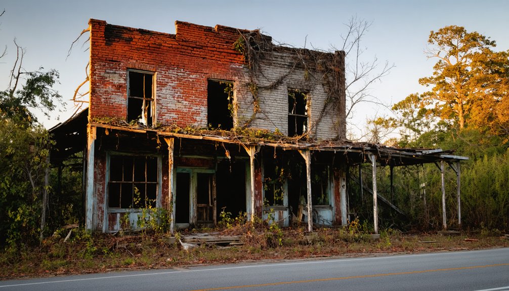
Sixes doesn’t have to be your only stop — Georgia’s gold-rush corridor is scattered with ghost towns and near-ghost towns that deepen the story considerably. Auraria is worth the detour. Once a booming gold-rush settlement predating California’s famous rush by decades, it’s now a quiet reminder of how fast fortune fades.
Community legends there echo those you’ll encounter in Sixes — buried wealth, displaced peoples, and landscapes that outlasted the ambitions poured into them. Local legends throughout Cherokee and Lumpkin counties share common threads: gold that was never recovered, families scattered by removal, and towns swallowed by time.
Stringing these stops together transforms a single visit into a full corridor road trip, giving you the broader Georgia ghost-town picture that Sixes alone can only hint at.
Driving to Sixes: Hours, Access, and What to Expect On-Site
Getting to Sixes means steering through rural Cherokee County roads west of Holly Springs, near the eastern shore of Lake Allatoona — so don’t expect highway signs pointing the way. No formal visitor center greets you here. Instead, you’ll navigate by curiosity, downloaded maps, and local legends passed down through families like the Cantrell and Hillhouse lines.
What to keep in mind before you go:
- No set hours exist — Sixes is an unincorporated community, not a managed attraction
- Historic preservation efforts are minimal, so surviving landmarks require respectful, self-guided exploration
- Road conditions vary, especially near lake-adjacent areas where flooding has reshaped the landscape
Come prepared with water, offline navigation, and a willingness to read the land itself as your guide.
Frequently Asked Questions
Which Cherokee Families Lived in Sixes Before the Forced Removal?
Like whispers carried on ancient winds, Cherokee traditions and local legends don’t name specific families here. You’ll find records point to broader Cherokee community presence, but exact family names before removal aren’t documented in available Sixes history.
Are Descendants of Original Sixes Settler Families Still in Cherokee County?
Yes, you’ll find that descendants of original Sixes settler families remain connected to Cherokee County, keeping local legends alive and honoring historical landmarks tied to surnames like Hillhouse, Cantrell, Woodall, Anderson, Wooten, and Reece.
Was Gold Ever Found in Significant Quantities at the Sixes Mine?
Georgia’s gold rush predated California’s by decades—and yes, the Sixes Mine did yield gold discoveries worth pursuing. You’ll find its mining history reflects real early-19th-century productivity, though exact output records remain historically incomplete.
What Year Did Sixes Officially Receive Its Own Post Office?
The exact year Sixes received its post office isn’t confirmed in available records, but you’ll find that ghost town history and local legends surrounding this remarkable community suggest it thrived with full civic infrastructure by the mid-1800s.
Did the Singing School in Sixes Connect to Any Regional Religious Movement?
By 1838, three churches shaped Sixes’ spiritual identity. The singing school likely tied into historical church influences and regional religious movements, connecting you to the Sacred Harp tradition sweeping the rural South during that era.
References
- https://en.wikipedia.org/wiki/List_of_ghost_towns_in_Georgia_(U.S._state)
- https://www.youtube.com/watch?v=GbGwjlNtilk
- https://www.facebook.com/thegeorgiatrust/posts/from-the-archives-didyouknow-the-ghost-town-of-auraria-outside-of-dahlonega-was-/951988906968171/
- https://goadhomepartners.com/blog/north-georgias-secret-tunnels-or-cherokee-countys-mysteries
- https://en.wikipedia.org/wiki/Sixes
- https://www.youtube.com/watch?v=a7pU0FYaO9I
- https://www.facebook.com/CherokeeCountyHistoryCenter/posts/this-travelingtuesday-takes-us-to-sixessixes-was-one-of-the-original-communities/10159786038648679/