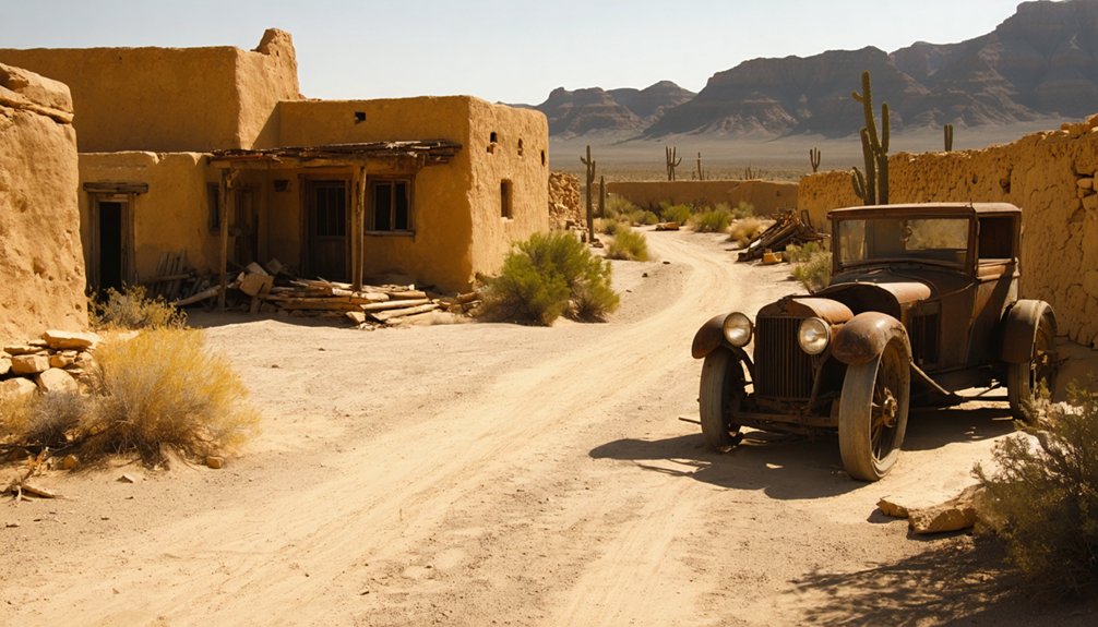
Planning a ghost town road trip to Tumco, California means heading deep into the Cargo Muchacho Mountains, about 25 miles from Yuma, Arizona, on unpaved desert tracks that demand a high-clearance vehicle. You’ll find crumbling remnants of a once-thriving gold rush community that housed 3,000 people and processed ore through massive stamp mills. Visit between late October and early March to avoid deadly summer heat. There’s far more to this haunting desert ruin than first meets the eye.
Key Takeaways
- Tumco is located in Imperial County, California, about 25 miles from Yuma, Arizona, on BLM land accessible via unpaved Ogilby Road.
- Visit between late October and early March to avoid dangerous summer temperatures exceeding 115°F.
- A high-clearance vehicle is recommended due to washboard surfaces, shifting sand, and potential seasonal washouts along the route.
- Pack at least one gallon of water per person, sun protection, sturdy boots, and a paper map for unreliable cell service areas.
- Nearby attractions include Imperial Sand Dunes and Yuma’s territorial prison, making Tumco ideal for a broader desert road trip.
What Is Tumco and Why Does This Ghost Town Still Draw Visitors?
Tucked into the Cargo Muchacho Mountains of Imperial County, Tumco is an abandoned gold-mining town that’s quietly outlasted the ambitions that built it. Once a boomtown of thousands, it cycled through names — Gold Rock Camp, Hedges, then Tumco — before the desert finally reclaimed it.
What draws you here isn’t a curated museum. It’s the raw presence of a place that produced over 200,000 ounces of gold and then simply stopped. You’ll find historical artifacts embedded in the landscape, crumbling foundations, and scattered mining equipment that no one ever hauled away.
The cemetery remains one of the most striking features on site.
Tumco sits on Bureau of Land Management land near Yuma, Arizona — accessible, ungoverned by crowds, and honest about what it is.
How to Get to Tumco, California
Getting to Tumco means committing to the desert on its own terms. Head to Imperial County and follow Ogilby Road east of the Imperial Sand Dunes. The site sits roughly 25 miles from Yuma, Arizona, on Bureau of Land Management land. No paved roads pamper you here — conditions shift with weather and season, so a high-clearance vehicle isn’t just smart, it’s necessary.
Once you arrive, you’re stepping into a landscape shaped by early mining technology — stamp mills, cyanide vats, and hand-cut mine workings still mark the terrain. Ghost town preservation rules apply since this is BLM land, meaning you look but don’t disturb.
Check road conditions before leaving, carry water, and treat the site with the respect it silently demands.
Road Conditions and BLM Access Rules You Need to Know First
Before you head out, know that Ogilby Road is an unpaved desert track where washboard surfaces and shifting sand can punish low-clearance vehicles, especially after wind events near the Imperial Sand Dunes.
Tumco sits entirely on Bureau of Land Management land, meaning you can visit freely, but collecting artifacts, disturbing mine workings, or removing anything from the site violates federal law.
Check current road conditions with the BLM’s El Centro Field Office before you go, since seasonal heat and flash flooding can make the route impassable without warning.
Ogilby Road cuts through one of Southern California’s most unforgiving desert stretches, and you’ll want to know what you’re dealing with before you commit to the drive. The road runs alongside the Imperial Sand Dunes, where blowing sand can reduce visibility and drift across the pavement without warning.
Summer heat regularly exceeds 110°F, turning mechanical trouble into a genuine emergency. You’re on Bureau of Land Management land out here, which means you’re free to explore, but you’re also responsible for your own safety and for respecting the site’s historical artifacts.
Preservation challenges are real — fragile remnants don’t survive careless visitors. Carry extra water, check your tires, and verify current road conditions before you leave. Cell service is unreliable, so plan as if you’re on your own.
BLM Land Access Rules
Because Tumco sits on Bureau of Land Management land, you’re operating under a specific set of federal rules the moment you turn off the pavement. The BLM governs what you touch, collect, and disturb here. That means the remnant mining technology—cyanide vats, stamp mill foundations, shaft openings—stays exactly where you find it. Federal law prohibits removing artifacts or disturbing structures.
The same protection extends to desert flora; pulling up vegetation carries real penalties. You’re free to explore on foot, photograph everything, and absorb the silence, but you’re not free to excavate or collect. No permits are required for day visits. Pack out everything you bring in.
Respect this land, and it stays accessible for every traveler who follows you out here.
The Best Time of Year to Make the Drive
Since Tumco sits in the Sonoran Desert near the Imperial Sand Dunes, timing your visit matters more than you might expect. Summer temperatures regularly exceed 115°F, making the site genuinely dangerous and potentially fatal for unprepared travelers.
Your best window runs from late October through early March. Winter days stay mild and clear, with temperatures ranging from the 60s to low 70s — ideal for exploring foundations, cyanide vats, and historical artifacts scattered across the site without the brutal sun overhead.
Early mornings in this cooler season also reward wildlife observing, when desert birds and jackrabbits move freely through the ruins.
Spring wildflowers occasionally transform the surrounding bajadas.
Whatever month you choose, check road conditions beforehand — Ogilby Road can shift after seasonal storms.
What’s Left at the Tumco Townsite Today?
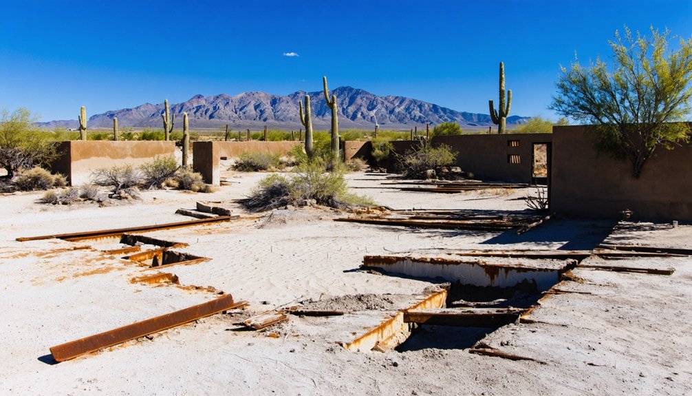
When you arrive at Tumco, you won’t find standing buildings, but what remains tells a vivid story — scattered foundations mark where a town of thousands once stood, and the mine workings cut into the surrounding Cargo Muchacho Mountains still scar the landscape.
You’ll spot the cyanide vats that once processed crushed ore, their weathered hulks serving as eerie monuments to the site’s industrial past.
The cemetery, though, stops most visitors cold — it’s one of the most striking features on the entire site, a quiet, haunting reminder of the lives that played out in this unforgiving desert.
Foundations And Mine Workings
Although no complete buildings remain standing at Tumco, the desert floor still holds its secrets. You’ll find concrete foundations scattered across the site, silent outlines of what once housed stamp mills, cyanide vats, and the water infrastructure that kept this operation alive.
That 12-mile wooden pipeline delivered roughly 100,000 gallons daily from the Colorado River — an audacious feat of desert engineering that made industrial-scale mining technology possible here.
Walk the surrounding hillsides and you’ll encounter the mine cuts themselves, carved directly into the Cargo Muchacho Mountains by workers chasing gold through brutal heat. These openings aren’t restaged or reconstructed — they’re original, unfiltered evidence of the boom.
You’re reading the landscape like a document, and Tumco rewards the curious traveler willing to look closely.
The Tumco Cemetery
The Tumco cemetery stands as the site’s most striking feature, and once you find it, you’ll understand why. Weathered markers rise from the desert floor, each one a quiet testament to the miners, laborers, and families who gambled everything on this remote stretch of California soil.
You’re walking through genuine history here. These historical artifacts aren’t behind glass — they’re exposed to the same brutal sun and wind that shaped the town itself. That rawness demands respect.
Preservation efforts on Bureau of Land Management land mean you must leave everything as you find it. No removing markers, no disturbing the ground. The freedom to explore a place like this comes with real responsibility.
Treat the cemetery as the irreplaceable open-air archive it is.
Cyanide Vats And Remnants
Beyond the cemetery, scattered across the desert floor, industrial ruins tell a different side of Tumco’s story. You’ll spot the crumbling cyanide vats where workers once processed crushed ore, extracting every last trace of gold from the rock. These concrete remnants sit quietly under the open sky, weathered but unmistakable.
Broken mining equipment dots the landscape, hinting at the mechanical intensity that once drove this operation. You can trace the outline of stamp mill foundations and follow the faint evidence of water infrastructure that carried roughly 100,000 gallons daily from the Colorado River through more than 12 miles of wooden pipeline.
Nothing here is roped off or narrated. You read the site yourself, piecing together a working desert town from what the desert chose to keep.
The Cemetery and What It Reveals About Life Here
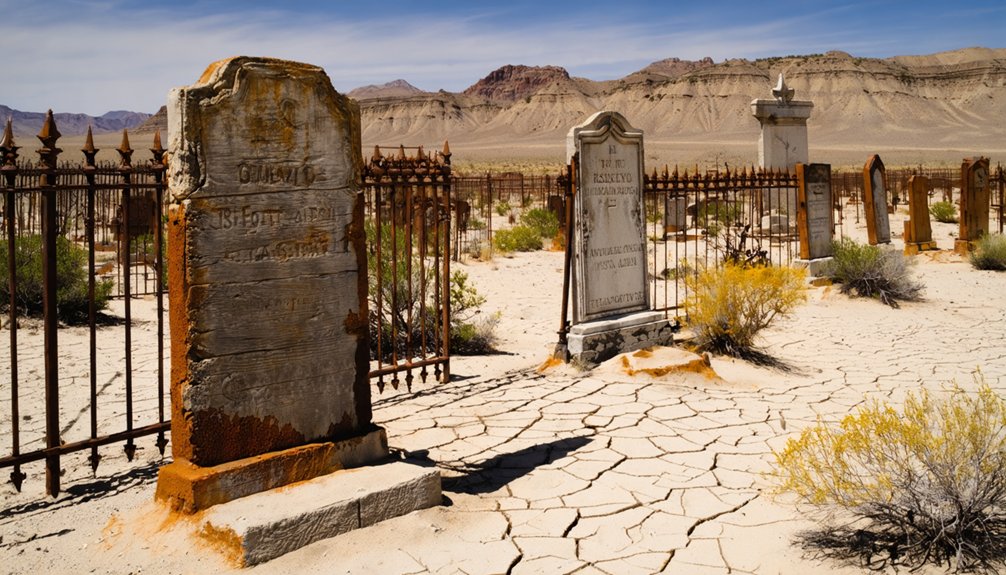
Tucked into the desert landscape at Tumco, the cemetery stands as one of the site’s most striking and sobering features. You’ll find it quietly anchoring a place where thousands once lived, worked, and died chasing gold.
The headstones and grave markers function as historical artifacts, telling stories that stamp mills and cyanide vats simply can’t. They reveal a community that included families, laborers, and dreamers enduring brutal desert conditions.
Some graves belong to children, which reframes your understanding of Tumco as more than a mining operation — it was someone’s home.
The smallest graves say what history books rarely do — people built lives here, not just fortunes.
Preservation efforts protect this ground, so you’re expected to leave everything undisturbed. Walk through respectfully, read what remains legible, and let the silence do what no interpretive sign ever could.
The Gold Rush History Behind Tumco’s Rise and Collapse
Gold came to this corner of the Sonoran Desert long before American prospectors ever heard of it. Spanish colonists and Mexican settlers worked these hills for generations before large-scale operations arrived.
By the 1890s, Hedges had become the largest town in present-day Imperial County, driven by serious mining technology — 40- to 100-stamp mills crushed ore daily while cyanide vats extracted every recoverable ounce.
None of it worked without water infrastructure. Engineers ran a 12-mile wooden pipeline from the Colorado River, delivering roughly 100,000 gallons daily into an otherwise waterless desert.
That engineering audacity built a town of 3,000 people — and when the ore thinned, the whole enterprise collapsed just as fast.
What to Pack for a Remote Desert Day Trip
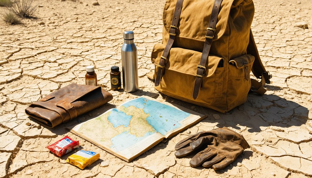
Tumco sits roughly 25 miles from Yuma with no services, no shade structures, and no guarantee your cell signal will hold — so what you pack isn’t a minor detail, it’s a safety calculation. Carry at least a gallon of water per person, sun protection, and sturdy boots — the terrain’s uneven, and desert flora like brittlebush and creosote won’t cushion a twisted ankle.
Bring a paper map; digital navigation fails in remote corridors. A camera earns its weight here, where historical artifacts — cyanide vats, foundations, mine cuts — reward close attention.
Pack out everything you bring in. BLM rules prohibit removing historical artifacts, so leave what you find exactly where the desert preserved it. Respect the site, and it’ll give you something worth carrying home in memory.
Other Desert Stops Worth the Detour
While you’re already traversing the remote stretches of Imperial County, a few nearby stops justify the extra miles. The surrounding desert rewards curious travelers willing to veer off the main route.
The remote stretches of Imperial County reward curious travelers willing to veer off the main route.
- Imperial Sand Dunes – These dramatic dunes stretch for miles along Ogilby Road, offering surreal landscapes and wildlife spotting opportunities at dawn or dusk.
- Cargo Muchacho Mountains Trails – Short hikes reveal desert flora like brittlebush and ocotillo clinging to rocky slopes, plus sweeping views toward Arizona.
- Yuma, Arizona – Just roughly 25 miles away, Yuma’s historic territorial prison and riverfront tell stories that parallel Tumco’s own frontier era.
Each stop deepens your understanding of this raw, unfiltered corner of the American Southwest without demanding much extra time.
Frequently Asked Questions
Can You Take Gold Ore Samples or Artifacts Home From Tumco?
You can’t take gold ore or artifacts home—Tumco sits on BLM land, where mineral collection and artifact ownership are strictly prohibited. Respect the desert’s haunted legacy; leave everything untouched for fellow freedom-seeking explorers.
Are Guided Tours of Tumco Ever Available Through Any Organization?
Like BLM-organized desert heritage events elsewhere, guided tours at Tumco aren’t regularly scheduled, but tour availability occasionally surfaces through local historical societies. You’ll want to check Imperial County heritage groups for rare, organized excursions into this haunting, forgotten landscape.
Was Tumco Ever Considered for Official Historic Landmark Designation?
The knowledge doesn’t confirm Tumco’s landmark designation pursuit, but you’ll find historic preservation efforts alive in its BLM-protected grounds. Explore freely—landmark designation or not, this atmospheric desert relic guards California’s raw, untamed gold-rush legacy.
How Deep Are the Abandoned Mine Shafts Visible Around the Tumco Site?
Depths unknown—that’s the thrill and the danger. The knowledge base doesn’t specify exact measurements, but don’t let curiosity pull you into abandoned tunnel exploration recklessly. Mine shaft safety matters; these desert voids could swallow you whole.
Did Tumco Ever Appear in Films or Television Productions?
You won’t find Tumco listed among confirmed filming locations or ghost town legends tied to Hollywood productions—available research doesn’t document any film or television appearances, leaving its atmospheric desert mysteries pleasantly undisturbed by cameras.
References
- https://www.youtube.com/watch?v=NCK4lDrin3U
- https://www.truckcamperadventure.com/exploring-southern-californias-tumco-ghost-town/
- https://en.wikipedia.org/wiki/Hedges
- http://www.usnomadstudio.com/theroadbook/ghost-towns-exploring-historys-ghosts/ghost-town-tumco/
- https://www.youtube.com/watch?v=W8a_a8c8-ko
- https://www.ghosttowns.com/states/ca/tumco.html
- https://www.wheelingit.us/2013/01/20/back-in-time-to-the-heyday-of-gold-hedgestumco-ghost-town/
- https://www.outdoorsocal.com/posts/tumco/
- https://www.blm.gov/sites/default/files/documents/files/public-room-california-routes-of-travel-eastern-imperial-county-neco.pdf
- https://www.desertusa.com/colorado/hedges_tumco/du_hedged.html



