Start your ghost town road trip in Marysville, heading northeast into Yuba County’s Sierra Nevada foothills toward Brownsville, perched at 2,500 feet. Founded in 1851 by sawmill builder I.E. Brown, this former gold rush settlement still holds abandoned mines, crumbling buildings, and weathered gravestones dating to 1857. Download offline maps before you go — cell service disappears fast up here. Everything you need to explore this forgotten corner of California history is just ahead.
Key Takeaways
- Brownsville, founded in 1851, sits 35 miles northeast of Marysville at 2,500 feet elevation, offering rich gold rush history and ghost town exploration.
- Start your road trip in Marysville, heading northeast through Browns Valley, ascending toward Brownsville, then continuing to Challenge Mills, Woodville, and Clipper Mills.
- Notable remnants include abandoned buildings, Beehive and Twentieth Century Wonder mines, and the Challenge Experimental Forest with gravestones dating to 1857.
- Bring a high-clearance vehicle, recovery straps, spare tire, paper maps, first-aid kit, water, and extra fuel for backcountry roads.
- Download offline maps before departing, as cell service is limited throughout the route; verify permit requirements with Plumas or Tahoe National Forest offices.
Where Is Brownsville, California, and Why It Qualifies as a Ghost Town?
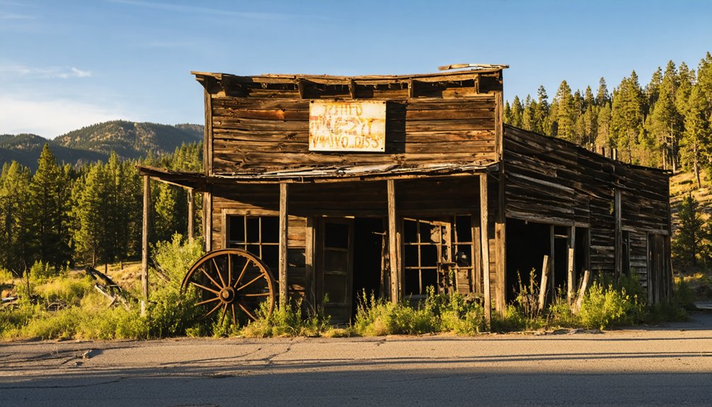
Tucked 35 miles northeast of Marysville and perched at 2,500 feet elevation in northeastern Yuba County, Brownsville sits where old pack trails once funneled fortune-seekers northward through the Sierra Nevada foothills toward the gold-rich diggings of Plumas and Butte Counties.
Named for sawmill founder I.E. Brown in 1851, the town exploded during the 1850s–1860s gold rush before fading into quiet obscurity.
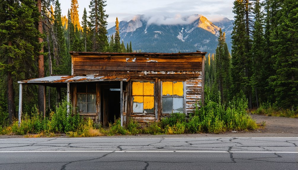
Brownsville’s significance lies in that raw, fleeting energy — a community built fast, mined hard, and largely abandoned when the gold played out.
Its ghost town characteristics emerge clearly: vanished industries, silent trails, and a landscape that outlasted its ambitions.
You’ll find no polished tourist trap here — just honest history, open roads, and the unmistakable feeling that you’ve arrived somewhere genuinely forgotten.
How to Reach Brownsville Through Yuba County’s Backroads
Getting to Brownsville means embracing Yuba County’s unhurried backroads, where two-lane highways cut through oak-studded hills and the air thickens with the smell of pine as you climb. Your route rewards backroad exploration at every bend.
- Start in Marysville, heading northeast toward Browns Valley on open, rolling terrain.
- Push through Brownsville’s elevation gain to 2,500 feet, where ghost town photography opportunities multiply fast.
- Continue northeast toward Challenge Mills, Woodville, and Clipper Mills, watching for historical markers.
- End near La Porte, connecting Yuba County’s mining corridor completely.
Pack water, keep your tank full, and download offline maps. Cell service disappears quickly out here, and that’s exactly the point — unfiltered road freedom, mile after mile.
The Gold Rush History Behind Brownsville’s Rise and Fall
When you trace Brownsville’s roots, you find a sawmill-turned-boomtown where I.E. Brown’s 1851 operation sparked a gold rush frenzy across Pennsylvania Gulch’s rich lode deposits.
By the 1850s and 1860s, miners worked claims as small as 150 square feet, pulling free gold and high-grade pockets from quartz veins threading through ancient greenstone and gabbrodiorite.
The boom didn’t last — post-1860s decline emptied the camps, and the trails that once connected Brownsville to Challenge Mills, Clipper Mills, and La Porte faded into the quiet backroads you’re driving today.
Brownsville’s Gold Rush Origins
Nestled at 2,500 feet in the Sierra Nevada foothills, Brownsville owes its very existence to the gold fever that swept California in the early 1850s.
Its historical significance runs deep, shaped by bold men chasing fortune through rugged terrain.
Here’s what defined Brownsville’s gold mining identity:
- I.E. Brown established a sawmill in 1851, giving the town its name and foundation.
- Pennsylvania Gulch became a thriving hub of activity throughout the 1850s–1860s.
- Alfred Brown’s Table Mountain Ranch anchored the surrounding mining community.
- Rich ore veins yielded between 1/7 and 1/3 ounce of gold per ton.
You’re stepping into a landscape where ambition carved trails through wilderness, and freedom meant staking your claim before anyone else arrived.
Mining Boom and Decline
At its peak in the 1850s and 1860s, Brownsville hummed with the kind of relentless ambition that turns quiet hillsides into boomtowns overnight.
Miners worked Pennsylvania Gulch using varied mining techniques, extracting free gold from quartz veins stretching one to seven feet thick. Mines like the Beehive reportedly produced $100,000, while high-grade pockets rewarded the bold and the lucky.
Then the ore shoots thinned. Public utility wars, shifting economies, and exhausted ground quietly strangled what ambition had built.
By the 1890s, the boom had faded into whisper. Today, ghost stories fill the spaces where miners once sweated and gambled their futures.
Walking these trails, you’ll feel that hunger still hanging in the mountain air, daring you to look closer.
Trails, Towns, and Legacy
Brownsville didn’t rise in isolation — it grew from a web of trails that stitched together the raw ambitions of an entire region.
Routes carrying miners, timber, and ghost town legends wound through settlements you can still trace today.
Follow the historic corridor and you’ll encounter:
- Browns Valley — the foothill gateway into gold country
- Challenge Mills — once roaring with lumber and mining folklore
- Woodville and Clipper Mills — quiet echoes of a boomtown network
- La Porte — the northern terminus where fortunes were chased
Each stop adds another layer to Brownsville’s story.
These trails weren’t just roads — they were lifelines that fed a region’s hunger for gold, freedom, and reinvention.
Walk them now and feel that hunger still.
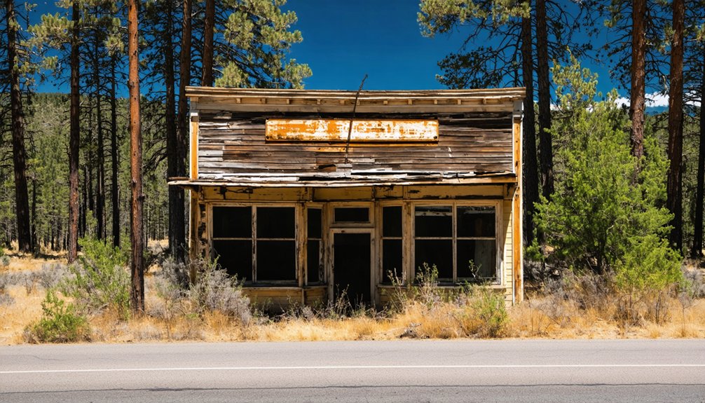
What’s Still Standing in the Brownsville District Today
Though time has weathered much of the Brownsville district, a surprising number of remnants still anchor the landscape to its gold rush roots.
You’ll find abandoned buildings scattered through the surrounding terrain, their weathered timbers whispering stories of boom-era ambition. Historical artifacts surface near old mine sites like the Beehive and Twentieth Century Wonder, rewarding those who look closely.
Abandoned buildings and buried artifacts reward those patient enough to read what the old mines left behind.
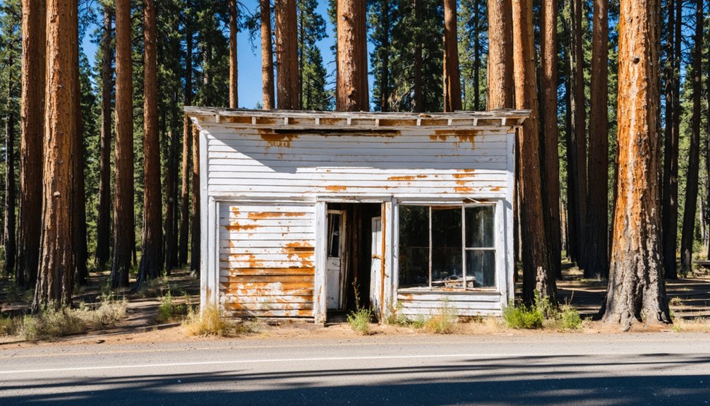
The Challenge Experimental Forest preserves meadows and gravestones dating to 1857, offering quiet, tangible connections to the people who once worked this rugged country. Greenstone outcroppings still mark ancient quartz vein lines where miners once chased free gold.
If you’re drawn to places that carry their history honestly, without restoration or rope barriers, the Brownsville district delivers exactly that kind of unfiltered, wide-open discovery.
The Mines That Shaped Brownsville’s Brief Boom Years
When you trace Brownsville’s gold rush legacy, you’ll find it built on north-striking quartz veins—one to seven feet thick—cutting through greenstone and gabbrodiorite near intrusive-metamorphic contacts, carrying free gold, pyrite, and sulfides in ore shoots that yielded up to a third of an ounce per ton.
Mines like the Beehive, known also as Mt. Hope, pulled out an estimated $100,000 in production, while operations like the Abbott, Beaver, Spanish, and Twentieth Century Wonder carved their names into the district’s short but intense history.
Under mining laws that restricted each prospector to one wet and one dry claim—neither exceeding 150 square feet—fortunes rose fast and faded just as quickly in the Pennsylvania Gulch diggings.
Key Mines Of Brownsville
During Brownsville’s peak boom years in the 1850s and 1860s, a handful of hardworking mines carved their names into the district’s gold-rush legacy along the rich veins of Pennsylvania Gulch.
Their historical significance still echoes through the Sierra foothills today.
Explore these standout operations:
- Beehive Mine – Also called Mt. Hope, it produced an impressive $100,000, making it the district’s crown jewel.
- Abbott & Arbucco Mines – Early producers that helped establish Brownsville’s mining techniques and infrastructure.
- Easy Money & Golden Key – Names that capture the adventurous spirit driving prospectors into these rugged hills.
- Twentieth Century Wonder & Spanish Mine – Later operations pushing the district’s gold extraction into new territory.
You’re chasing real history when you walk these grounds.
Gold Veins And Geology
Beneath Brownsville’s rugged Sierra foothills, the earth itself tells the story of its brief but electric gold-rush boom. The district’s chief geological features include greenstone bedrock cut through by gabbrodiorite intrusions, with amphibolite and slate formations rising to the east.
This volatile combination created ideal conditions for gold formation along north-striking quartz veins clustered near intrusive-metamorphic contacts.
You’ll find these veins ran one to seven feet thick, carrying free gold, pyrite, and sulfide minerals in concentrated ore shoots. Milling ore typically yielded one-seventh to one-third ounce of gold per ton, with occasional high-grade pockets rewarding persistent miners.
Understanding this geology sharpens your appreciation as you walk the terrain today — every rocky outcrop hints at fortunes that once drove desperate, ambitious men into these wild hills.
Mining Laws And Claims
Each miner working Brownsville’s claims operated under a strict but simple legal framework: one wet claim and one dry claim per person, neither exceeding 150 square feet.
Mining regulations kept ambition honest and claim disputes manageable.
Here’s what governed every pick-swinging prospector:
- One wet claim per miner for water-adjacent diggings
- One dry claim per miner for upland ground
- 150 square feet maximum per claim, no exceptions
- Self-enforcement kept neighbors accountable on the diggings
These rules shaped how miners carved up Pennsylvania Gulch and surrounding ground.
You’re looking at a system built for independent men who wanted fair access, not corporate dominance.
Small plots meant real opportunity for everyone willing to work hard and stake their ground.
How to Route Your Visit Through Pennsylvania Gulch and Beyond
Tracing the old pack trails that once connected California’s northern gold country, you’ll want to anchor your route in Marysville before heading northeast through Browns Valley and up into Brownsville itself, perched at 2,500 feet elevation some 35 miles from where you started.
From there, push southeast toward Pennsylvania Gulch Road, where ghost town legends and mining folklore cling to every weathered outcrop. Continue through Challenge Mills, Woodville, and Clipper Mills, weaving deeper into Yuba County’s forgotten corridors.
Detour into Rackerby and Forbestown for related lode-gold sites, then loop northwest toward Oroville, just 27 miles away. The Challenge Experimental Forest and nearby meadows holding gravestones dated 1857 reward anyone willing to leave the pavement.
This route doesn’t just connect dots — it resurrects a vanished world.
Rackerby, Clipper Mills, and Forbestown: Ghost Towns Near Brownsville
Scattered across the folds of northeastern Yuba County, Rackerby, Clipper Mills, and Forbestown each carry the muted fingerprints of a gold rush that burned bright and vanished fast.
You’ll find stories embedded in weathered timber and overgrown trails connecting these forgotten settlements to Brownsville’s legacy.
Hit these stops to make the most of your detour:
- Rackerby history — Trace lode-gold roots alongside Brownsville’s mining corridor
- Clipper Mills — Follow the old route toward La Porte through dense Sierra foothills
- Forbestown heritage — Discover remnants where farming and mining once overlapped
- Yuba County gravestones — Seek out markers dating to 1857 near historical meadows
Each site rewards the curious traveler willing to leave the pavement behind.
Gear and Permits You Need for Yuba County’s Back Country Roads
Wandering through Rackerby, Clipper Mills, and Forbestown primes you for the reality of Yuba County’s backcountry—these roads don’t coddle unprepared travelers.
Pack your gear essentials: high-clearance vehicle, recovery straps, spare tire, paper maps, and a first-aid kit. Cell service vanishes fast out here, so carry a satellite communicator. Water and extra fuel aren’t optional—they’re survival basics on isolated stretches toward Brownsville’s old diggings.
Check permit requirements before you roll. Some forest service roads cutting through Challenge Experimental Forest demand a valid recreation permit, particularly during fire season when closures shift without warning.
Verify current restrictions through the Plumas or Tahoe National Forest offices before departing. Freedom out here belongs to those who prepare honestly—not those who assume open roads wait unconditionally.
Frequently Asked Questions
What Elevation Challenges Affect Driving Conditions Around Brownsville’s 2,500-Foot Terrain?
Like a serpent coiling upward, Brownsville’s 2,500-foot rise demands your respect. You’ll tackle steep grades and winding curves, so master terrain navigation and prioritize elevation safety before conquering these adventurous mountain roads.
Are There Campgrounds Near Brownsville for Overnight Ghost Town Road Trippers?
You’ll find campgrounds near Brownsville offering solid campground amenities for your overnight stay! Explore nearby attractions like Challenge Experimental Forest and historic Clipper Mills, fueling your adventurous spirit as you chase Brownsville’s golden ghost town legacy freely.
Which Months Offer the Best Weather for Visiting Brownsville’s Outdoor Mining Sites?
At 2,500 feet elevation, you’ll find May through October offers ideal seasonal temperatures for outdoor activities. You’ll explore sun-drenched quartz veins and historic mine shafts most comfortably, chasing gold rush freedom before winter’s grip tightens.
Can Metal Detectors Be Legally Used at Brownsville’s Abandoned Mining Claim Areas?
Before swinging your detector over Brownsville’s soil, you’ll need to check metal detecting regulations carefully — historical mining artifacts on abandoned claims often fall under federal and state protections, so research land ownership and secure proper permits first.
Are There Guided Tours Available Specifically for Brownsville’s Historical Gold Rush Sites?
No formal guided tours exist, but you’ll uncover Brownsville’s historical significance yourself—tracing gold rush trails, discovering local legends whispered through Pennsylvania Gulch’s ruins, and adventuring freely through forgotten mining claims that boldly shaped California’s wild, untamed history.
References
- https://creators.spotify.com/pod/profile/abandonedamerica/episodes/What-Happened-to-Brownsville-e1ohi3l
- https://westernmininghistory.com/library/227/page1/
- https://kids.kiddle.co/Brownsville
- https://ohp.parks.ca.gov/ListedResources/Detail/465
- https://www.fs.usda.gov/psw/publications/documents/psw_gtr239/psw_gtr239_00.pdf


