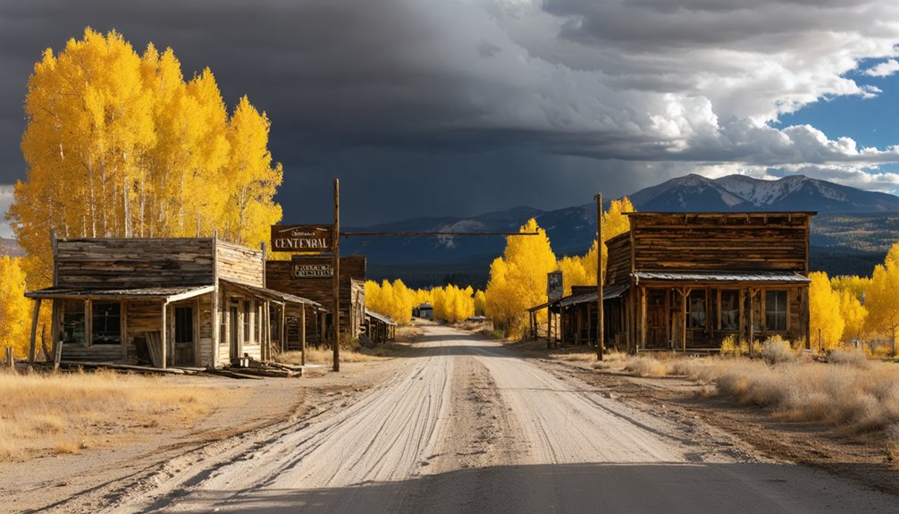
Centennial, Wyoming drops you into the heart of a copper boom that burned hot in the 1890s and collapsed just as fast. From here, you can reach ghost towns like Battle, Copperton, and Rudefeha, where bunkhouses and mill foundations still haunt the ridgelines. You’ll need a high-clearance 4WD, a printed topo map, and enough fuel to go where cell service won’t follow. There’s a whole circuit worth planning carefully.
Key Takeaways
- Centennial, along Highway 130, serves as the ideal base camp for exploring nearby copper boom ghost towns like Battle and Copperton.
- A two-day loop starting in Centennial covers abandoned copper towns, scenic byways, and historical sites like the Grand Encampment Museum.
- High-clearance 4WD vehicles are required for rough roads leading to Battle and Copperton, best visited between late June and September.
- Download offline maps, carry a printed topo map and compass, and note GPS coordinates before leaving paved roads near Centennial.
- Pack extra fuel, water, food, a first aid kit, and tow straps, as remote terrain demands full self-sufficiency.
Why the Grand Encampment Copper Boom Left So Many Ghost Towns Behind
When copper fever swept through the Sierra Madre foothills in the 1890s, it didn’t just build a single town — it scattered an entire constellation of settlements across the mountain valleys south of Centennial.
When copper fever hit, it didn’t build one town — it built a dozen, scattering settlements across the mountain valleys.
Rudefeha, Dillon, Elwood, Rambler, Battle, and Copperton all rose quickly around the copper mining operations feeding the Grand Encampment boom.
You’re tracing ghost town history when you drive these roads — the story of a company that collapsed almost overnight, leaving behind bunkhouses, mill foundations, and silence.
When the North American Copper Company failed in the early 1900s, workers simply left.
What they built didn’t disappear entirely, though. Fragments survived the decades, scattered across ridgelines and creek bottoms, waiting for road-trippers willing to chase them down on their own terms.
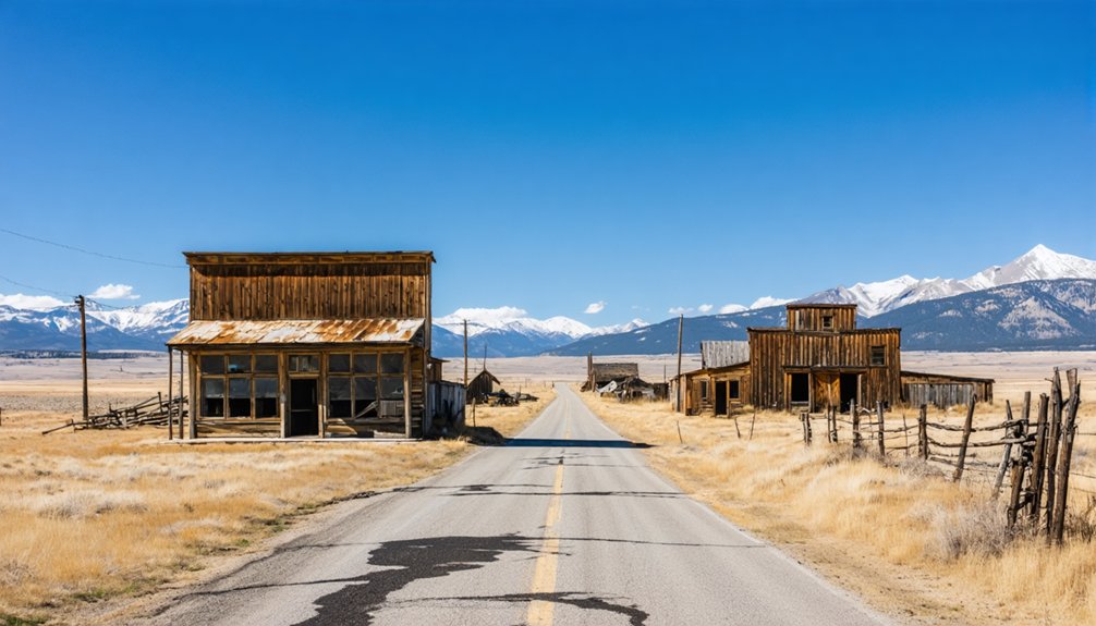
Ghost Towns You Can Actually Reach From Centennial
Starting from Centennial, you’ve got a genuine cluster of ghost towns within striking distance — and they’re not all created equal.
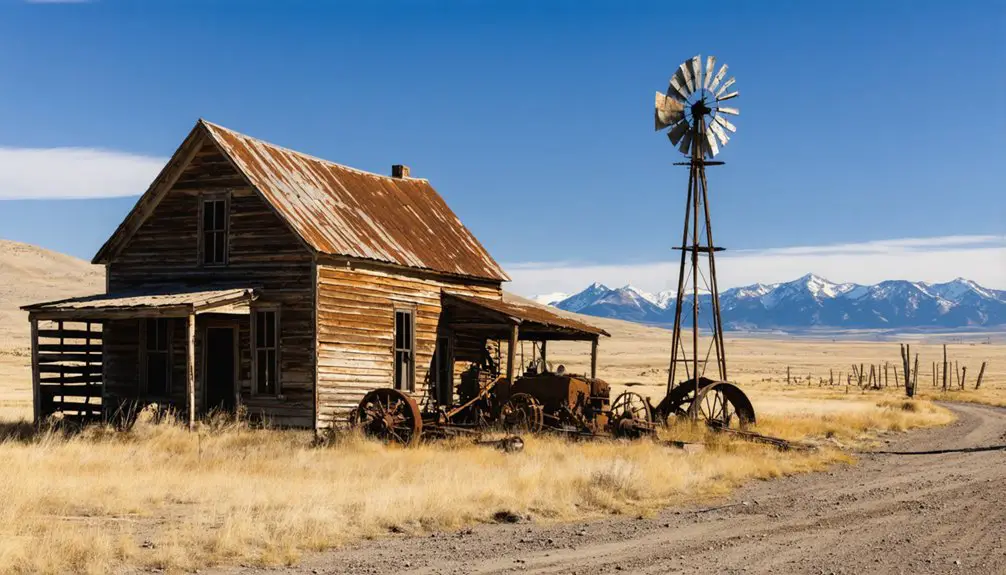
Battle sits closest, a former mining settlement demanding high-clearance wheels and rewarding you with raw mountain solitude. Nearby Copperton carries its own ghost town legends, quietly rusting against the Continental Divide backdrop.
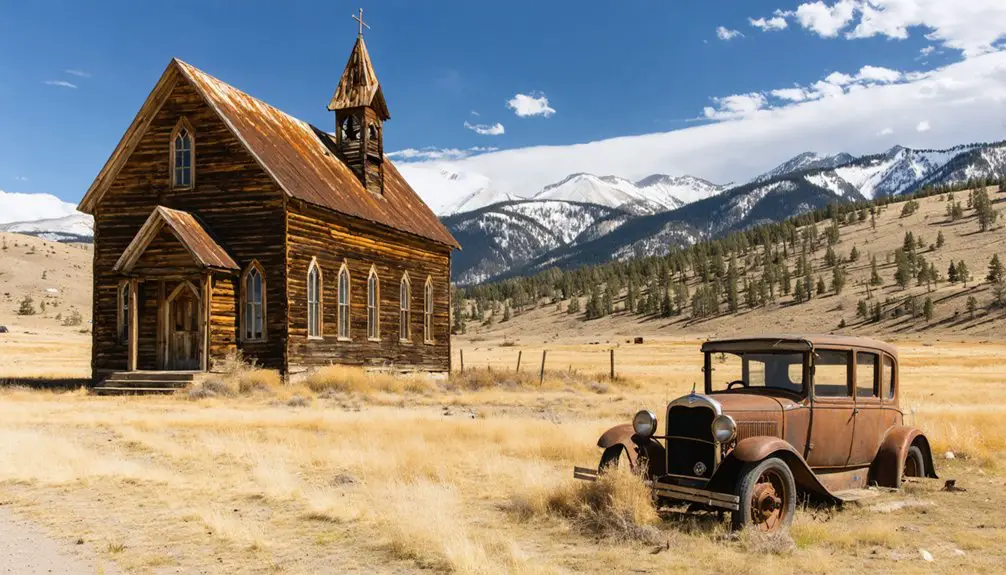
Drop south toward Encampment and you’ll find Rudefeha, Dillon, and Elwood — copper-boom settlements that collapsed almost overnight, leaving historical artifacts scattered across forest floors and foundation stones half-swallowed by sagebrush.
The Grand Encampment Museum anchors this stretch, preserving what the wilderness hasn’t reclaimed.
Farther out, Carbon and South Pass City reward the extra miles with cemeteries, original buildings, and a frontier weight that photographs can’t fully capture.
Choose your route deliberately — each site earns its visit.
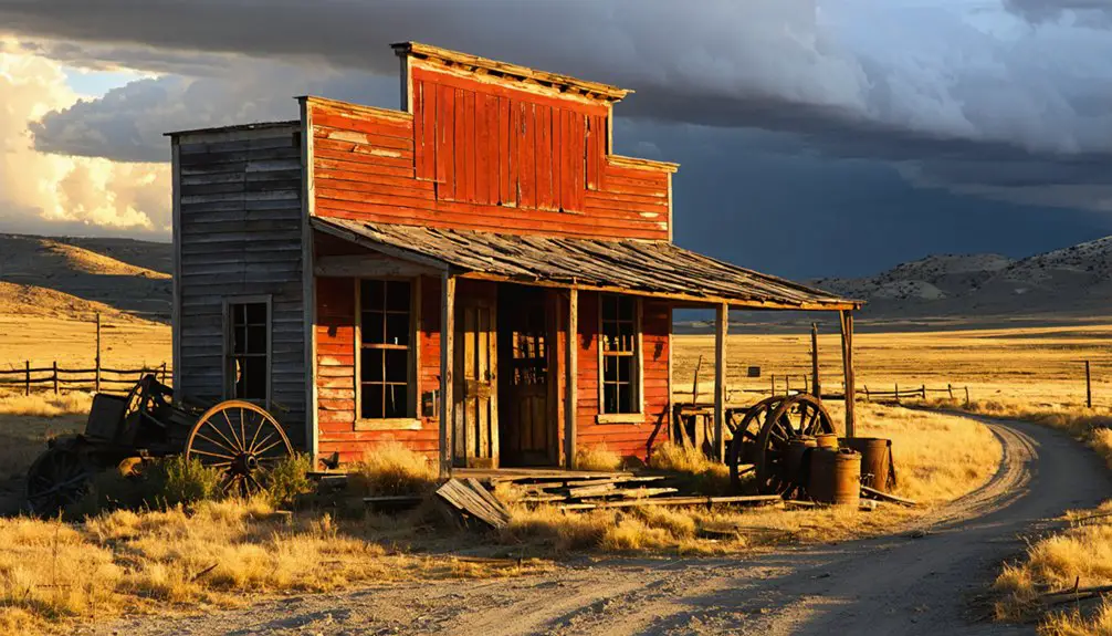
Battle and Copperton: Ruins, Access Roads, and What Survives
When you push past the pavement’s end toward Battle and Copperton, you’re tracing the bones of Wyoming’s copper boom along roads that punish anything without high clearance.
What’s left at these sites is fragmentary—collapsed timber, stone foundations, rusted hardware—but enough to conjure the frenzy that once pulled thousands into these mountains.
You’ll want to time your visit between late June and early September, when snowmelt has drained from the high passes and the forest roads are something close to forgiving.
What Remains Standing Today
Though the copper boom that animated Battle and Copperton has long since collapsed, fragments of that frantic era still cling to the landscape if you know where to look. Scattered abandoned structures interrupt the treeline — collapsed cabins, rusted foundations, and darkened timbers that once housed miners chasing fortunes.
Mining relics surface across both sites: twisted machinery, broken tramway hardware, and earthworks carved by hands long gone. You won’t find restored storefronts or interpretive signs guiding every step. What you’ll find instead is raw, unfiltered history sitting quietly beneath open Wyoming sky.
That freedom to wander unmarked terrain, piecing together what once stood, is exactly what draws explorers here. Bring curiosity, solid boots, and respect for ground that’s earned its silence.
Road Access And Conditions
Getting to Battle and Copperton isn’t a casual Sunday drive — the roads leading into these sites run rough, remote, and unforgiving outside peak summer months.
Road conditions shift fast in this high country. Spring snowmelt turns dirt tracks into axle-deep mud, and washouts can close routes without warning. You’ll want a high-clearance vehicle at minimum; 4WD becomes essential when weather turns or you’re pushing into late-season territory.
These aren’t paved heritage corridors with rest stops and guardrails. They’re old forest and county roads that haven’t forgotten their purpose — moving miners, not tourists.
Check vehicle requirements before you leave pavement behind. Carry extra fuel, water, and a paper map. Cell service disappears fast once you drop into these canyon stretches chasing copper-boom ghosts.
Best Time To Visit
Timing your visit to Battle and Copperton shapes everything — what roads you’ll find passable, what ruins you’ll actually reach, and how much daylight you’ll have to work with once you get there.
Seasonal weather dictates access more than any map does. Snow lingers near Battle Pass well into June, and early autumn storms can close the same roads without warning.
Late June through September gives you the strongest window — firm roads, longer days, and open forest routes. You’ll also encounter wildlife encounters during these months, particularly elk and mule deer moving through the timber at dusk.
Plan your drives for morning departures. The backcountry doesn’t reward late starts, and those weathered cabins deserve proper light, not a rushed scramble before dark.
What Kind of Vehicle Do You Need for These Roads?
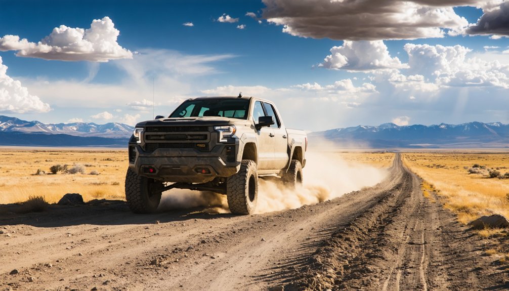
Most of the ghost towns around Centennial don’t sit politely beside paved roads waiting for you to arrive in a sedan—they’re tucked behind miles of rutted forest tracks, rocky creek crossings, and switchbacks that drain confidence fast.
Road condition varies wildly by season, recent weather, and elevation. Battle and Copperton demand serious vehicle recommendations: high-clearance 4WD isn’t optional there, it’s survival logic.
Even sites that look approachable on a map can turn punishing after a single rain. A capable truck or SUV with all-terrain tires earns its keep out here. Low-clearance vehicles will surrender before the good stuff starts.
Pack a spare, carry extra fuel, and don’t assume last year’s road matches this year’s reality. The freedom’s real—but only if you arrive prepared.
Should You Add South Pass City to Your Route?
South Pass City doesn’t just round out a ghost-town road trip—it anchors one. Its historical significance runs deep: gold rushes, frontier ambition, and sudden collapse left more than 20 original structures standing against the Wyoming sky.
The scenic routes connecting it to Centennial reward the drive alone.
Here’s what makes it worth the detour:
- Preserved buildings that feel frozen mid-abandonment
- Interpretive exhibits explaining South Pass’s gold-rush arc
- Open landscapes offering unobstructed photography along the way
- Frontier context that ties the entire region’s boom-and-bust story together
Your visitor experience here goes beyond ruins—it’s a living snapshot of westward ambition.
If you’ve got the miles left in you, South Pass City earns every one of them.
When Is the Best Time to Drive Wyoming’s Ghost Town Roads?
When you roll down Highway 130 with the Snowy Range rising ahead of you, the season underneath your tires matters more than most travelers expect.
Ghost town safety depends heavily on seasonal weather, and Wyoming’s mountain roads don’t forgive poor timing.
Summer opens the most doors. Dirt roads dry out, forest routes become passable, and sites like Battle shed their snowpack. Museums run regular hours, daylight stretches long, and you’re free to push deeper into the backcountry.
Summer is the season that unlocks everything — dry roads, open museums, and ghost towns finally free of snow.
Spring and fall carry beauty but also mud, late snow, and washed-out crossings that strand unprepared rigs. Higher elevations near Battle Pass can stay treacherous well into June.
Pick your window wisely. The ghost towns aren’t going anywhere, but the roads leading to them absolutely can close.
The Centennial Loop: A Two-Day Ghost Town Route That Actually Works
Two days is enough time to thread together a ghost-town loop that starts and ends in Centennial, pulling you through abandoned copper towns, mountain passes, and sagebrush valleys that still carry the dust of a vanished Wyoming.
Centennial History anchors your departure before the Scenic Byways carry you deeper into what’s been forgotten.
Follow this two-day skeleton:
- Day 1 morning: Drive toward Battle and Copperton via high-clearance roads near Battle Pass
- Day 1 afternoon: Descend into Encampment and walk the Grand Encampment Museum grounds
- Day 2 morning: Push toward Carbon or Rawlins for railroad-era remnants
- Day 2 afternoon: Return through open range back to Centennial
Pack fuel, water, and paper maps. These roads don’t forgive assumptions.
What to Bring When Cell Service Disappears and Fuel Stations Don’t Exist
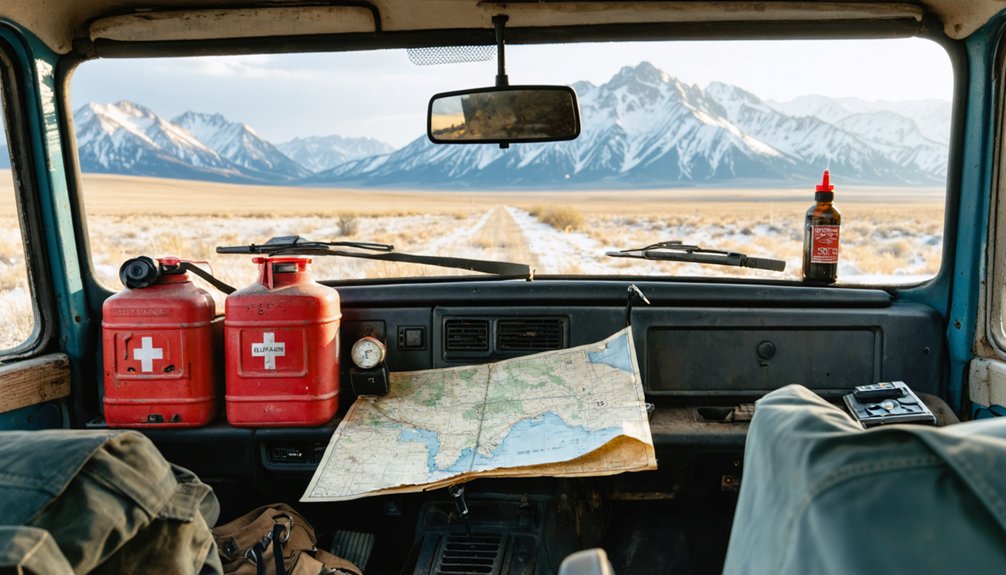
Once you leave Centennial’s pavement behind and head toward Battle or Copperton, your phone becomes little more than a paperweight, so you’ll want a printed topo map or a downloaded offline route loaded before you go.
Tuck a two-gallon fuel can behind your seat, because the stretches between Encampment, Saratoga, and the forest road turnoffs can stretch your tank further than you’d expect on a warm summer afternoon.
Pack water, a basic tool kit, and enough food for an unplanned overnight, because out here, a washed-out road or a soft shoulder isn’t an inconvenience—it’s a full renegotiation of your plans.
Cell service vanishes fast out here, often the moment you drop into a river canyon or climb above a certain elevation on the forest roads threading toward Battle or Copperton.
Don’t let a blank screen strand you on a two-track with no idea which fork leads forward. These navigation tips keep you moving:
- Download offline maps before leaving Laramie or Centennial
- Carry a printed Wyoming forest road map and a compass
- Note GPS coordinates for key turnoffs before you leave pavement
- Mark your campsite or trailhead as a waypoint immediately upon arrival
The land doesn’t care about your signal. It rewards people who prepare deliberately, who understand that freedom out here means self-sufficiency, not dependence on a network that evaporates past the last paved mile.
Emergency Fuel And Supplies
Most of the fuel stations between Centennial and the backcountry turnoffs toward Battle and Copperton aren’t suggestions — they’re your last chance, and missing them means you’re coasting on fumes down a two-track with nobody coming the other way.
Carry a certified fuel storage container with at least two extra gallons before you leave the pavement. That buffer isn’t paranoia; it’s the difference between reaching a forgotten copper camp and waiting out a cold night on a forest road.
Pack emergency kits with water, a first aid supply, basic tools, tow straps, and a paper map. These ghost towns rewarded bold explorers once, and they still do — but only the ones who showed up prepared enough to actually make it back out.
How to Shoot Weathered Cabins and Mining Ruins in Wyoming’s Open Light
Wyoming’s open light has a way of doing the work for you—if you know when to show up. Golden hour transforms rotting timber and rusted iron into something almost sacred.
Master your photography techniques by reading the land’s natural lighting conditions before you press the shutter.
- Shoot east-facing cabin walls in early morning before shadows flatten the texture
- Use overcast skies to reveal detail in weathered wood without harsh contrast
- Position ruins against sagebrush flats or mountain ridgelines for natural depth
- Late afternoon side-lighting carves dimension into collapsed foundations and broken windows
Let the silence inform your framing.
These structures won’t last forever, and neither will the light falling across them.
Why Centennial Is the Right Base Camp for This Whole Ghost Town Circuit
Once you’ve worked the light across every cracked window frame and rusted ore cart you can find, you’ll want somewhere worth coming back to—and Centennial earns that role.
It sits right along Highway 130, close enough to Battle, Copperton, and the Grand Encampment corridor that you’re not burning half your day just reaching the trailhead.
Centennial history ties directly into the same boom-and-bust cycles you’re chasing across the region, so the context follows you everywhere.
The ghost town significance of this whole circuit runs deeper when you’ve got a fixed point anchoring your loop rather than improvising daily.
From here, Saratoga, Encampment, and even South Pass City stay within reach. You move freely, shoot what you came for, and return without the scramble.
Frequently Asked Questions
Are There Entrance Fees for Visiting Wyoming Ghost Towns Near Centennial?
Like open prairie stretching endlessly, ghost town access here won’t chain your wallet—most sites are free. Entrance costs vary, though South Pass City charges a small fee. You’re free to roam Wyoming’s haunting ruins.
Can Children Safely Explore the Ghost Town Ruins in This Region?
Yes, children can enjoy ghost town exploration here, but you’ll want to supervise them closely near unstable ruins. Prioritize child safety by staying on marked paths, wearing sturdy boots, and embracing Wyoming’s beautifully untamed, freedom-filled frontier together.
Is Camping Allowed Near Battle, Copperton, or Other Remote Historic Sites?
You’ll find dispersed camping allowed on National Forest lands near Battle and Copperton, but always check current camping regulations first. Respect historic preservation rules — don’t disturb those weathered remnants whispering stories of Wyoming’s forgotten frontier souls.
Are Any Centennial-Area Ghost Towns Accessible to Visitors With Disabilities?
Like a key fitting a lock, the Grand Encampment Museum offers accessible attractions with disability accommodations, letting you roll through preserved frontier history without barriers — your freedom to explore Wyoming’s boom-and-bust past remains beautifully intact.
Do Local Guides or Tours Operate Out of Centennial for Ghost Town Trips?
No dedicated local tour options currently operate out of Centennial for guided explorations, but you’ll find freedom charting your own course through these weathered, forgotten settlements, with Encampment’s Grand Encampment Museum offering knowledgeable staff who’ll point you toward history’s hidden trails.
References
- https://ronesrvpark.com/wyoming-ghost-towns-near-casper-a-spooky-rv-trip-guide/
- https://www.rv.com/archive/wyomings-spook-route/
- https://travelwyoming.com/blog/stories/post/5-wyoming-ghost-towns-you-need-to-explore/
- https://www.wyomingcarboncounty.com/blog/123-5-ghost-towns-to-explore
- https://www.facebook.com/BucketListJourney/posts/have-you-ever-been-to-a-ghost-townon-the-road-from-casper-wyoming-to-cody-yellow/399558968408335/
- https://sites.rootsweb.com/~wytttp/ghosttowns.htm
- https://www.facebook.com/61574189575434/posts/this-ghost-town-road-trip-through-wyoming-is-unforgettable-/122155602368806319/
- https://www.youtube.com/watch?v=BwHndm7oZMo
- https://www.tripadvisor.com/Attraction_Review-g60519-d8454008-Reviews-Kirwin_Ghost_Town-Meeteetse_Wyoming.html
- https://www.facebook.com/groups/704889582866623/posts/2564162553605974/