Planning a road trip to Dearfield, Colorado’s ghost town means driving along Highway 34 in Weld County, about 15–25 miles east of Greeley. Founded in 1910 by Oliver Toussaint Jackson, Dearfield was once a thriving Black homesteading colony of nearly 700 residents before drought and the Great Depression brought it down. You’ll walk among ruins, read interpretive panels, and photograph the haunting Bella Vista Cafeteria remains. Stick around — there’s much more to uncover about this powerful piece of American history.
Key Takeaways
- Dearfield, Colorado, founded in 1910, is a historic Black homesteading ghost town located along State Highway 34 in Weld County.
- The site is accessible via paved roads, roughly 15–25 miles east of Greeley, with no four-wheel drive required.
- Walk among ruins respectfully, wearing closed-toe shoes to avoid exposed wood and broken glass on this private land.
- Photograph the Bella Vista Cafeteria ruins during early morning or late afternoon for optimal natural lighting and contrast.
- Nearby attractions include Fort Vasquez, Greeley History Museum, Centennial Village Museum, and Pawnee National Grassland for extended exploration.
What Is Dearfield, Colorado’s Ghost Town?
When most people think of Colorado ghost towns, they picture abandoned silver mines tucked into mountain passes — but Dearfield tells a different story. Founded in 1910 by entrepreneur Oliver Toussaint Jackson, Dearfield was a thriving Black homesteading colony in Weld County’s northeastern plains.
At its peak, it held roughly 700 residents and over 30 businesses, proving that freedom and self-sufficiency were worth building from the ground up.
At its height, Dearfield boasted 700 residents and 30 businesses — a testament to what determination can build.
Drought, economic hardship, and the Great Depression eventually emptied the town, leaving behind crumbling foundations and weathered walls.
Today, Dearfield stands as one of Colorado’s most culturally significant ghost towns, and ongoing historical preservation efforts by Colorado State University are keeping its story alive.
It’s a powerful reminder that American frontier history runs far deeper than gold rushes and mining camps.
The Remarkable History Behind Dearfield’s Rise and Fall
When you learn who built Dearfield, the ghost town hits differently.
Oliver Toussaint Jackson, a Denver entrepreneur, founded the settlement in 1910 as a self-sufficient Black homesteading colony. By its peak, it had grown to roughly 700 residents and 30–35 thriving businesses.
Drought, depression, and shifting economics swept through in the 1920s and beyond, gradually stripping the community down to the crumbling ruins you’ll find standing along Highway 34 today.
Jackson’s Visionary Founding
Though it began with a single man’s audacious dream, Dearfield’s story reshaped what Black land ownership could look like in early 20th-century America. Oliver Toussaint Jackson didn’t just homestead — he built a blueprint for Black agriculture and self-determination during Jim Crow’s harshest years.
Jackson’s legacy proves that freedom isn’t given; it’s cultivated.
- Jackson founded Dearfield in 1910 as a deliberate colony of Black economic independence
- He previously served as a messenger to President Grover Cleveland before turning to land
- At its peak, Dearfield supported roughly 700 residents and over 30 businesses
- Watermelon farming became the community’s agricultural trademark across eastern Colorado
- His vision prioritized racial self-sufficiency over integration into hostile systems
You’re not just visiting ruins — you’re standing inside someone’s declaration of freedom.
Dearfield’s Peak Community Growth
At its peak, Dearfield wasn’t just surviving — it was thriving, with nearly 700 residents building lives across a landscape that outsiders had written off as too harsh and too hostile for Black ambition.
The community dynamics here were remarkable: 30 to 35 businesses operated simultaneously, including a hotel, post office, grocery store, and community hall.
Agricultural practices centered heavily on watermelon cultivation, transforming what many dismissed as barren plains into one of eastern Colorado’s most productive melon-growing regions.
Neighbors depended on one another, traded with one another, and built genuine economic independence during an era when Jim Crow laws actively worked against Black prosperity elsewhere.
Dearfield proved that self-sufficiency wasn’t a dream — it was a blueprint anyone willing to work the land could follow.
Drought and Economic Decline
What the 1920s brought to Dearfield wasn’t just hardship — it was a slow unraveling. Drought impact stripped the land of its productivity, and economic shifts happening nationwide hit this resilient community especially hard.
The Great Depression delivered the final blow, scattering residents who’d built something truly remarkable.
- Persistent drought devastated crops that once fed families and fueled local commerce
- Falling agricultural prices nationwide crushed small farming operations like those in Dearfield
- Residents gradually left, seeking work and survival elsewhere
- Businesses shuttered one by one as the population dwindled
- Oliver Jackson stayed until his death in 1948, refusing to abandon what he’d built
You’re visiting land where people fought hard and held on longer than most would have.
Where Exactly Is Dearfield Located on Highway 34?
Nestled directly along State Highway 34 in Weld County, Dearfield sits roughly 15–25 miles east of Greeley in the flat, semi-arid stretch of Colorado’s Western High Plains.
Unlike typical Colorado ghost town geography hidden deep in mountain terrain, you’ll reach this site on fully paved road without any four-wheel drive required. Simply pull off along the highway shoulder or a nearby designated area and you’re there.
The site’s heritage significance sets it apart from mining-era relics. You’re standing on accessible, open plains where history visibly unfolds around you through crumbling foundations and partial walls.
Interpretive signs along Highway 34 clearly mark the location, so you won’t miss it. This ghost town rewards any freedom-seeking traveler willing to venture east of Greeley’s familiar corridors.
Driving to Dearfield From Denver, Greeley, or Fort Collins
Whether you’re starting from Denver, Greeley, or Fort Collins, reaching Dearfield is a straightforward drive along State Highway 34.
From Denver, you’ll head north on I‑25 to Greeley, then continue east on Highway 34 for 15–25 miles, making the total trip roughly 1 to 1.5 hours.
From Greeley, you’re only 15–20 minutes away, while Fort Collins drivers can expect a 45–60 minute trip heading south on I‑25 before turning east toward the site.
Routes From Major Cities
Three easy routes lead you to Dearfield, depending on where you’re starting. Use this routes overview and these travel tips to hit the road confidently.
- From Denver: Take I‑25 north to exit 246, then head east on Highway 34 past Greeley for 15–25 miles. Allow roughly 1–1.5 hours.
- From Greeley: Drive east on Highway 34 for 15–25 miles. You’ll spot the site on your left in about 15–20 minutes.
- From Fort Collins: Head south on I‑25 to Greeley, then follow Highway 34 east. Budget 45–60 minutes.
- All routes use paved roads, so no four‑wheel drive is needed.
- Pack water, sunscreen, and sturdy shoes — services near Dearfield are minimal.
Estimated Drive Times
Now that you’ve got your route locked in, knowing exactly how long you’ll spend behind the wheel helps you plan the rest of your day. From Denver, expect roughly 1 to 1.5 hours heading north on I-25 before turning east on Highway 34.
Fort Collins drivers will hit that same window at 45 to 60 minutes heading south first, then east through Greeley.
If you’re already in Greeley, ghost town accessibility couldn’t be easier — just 15 to 20 minutes east puts you right at the site. That short drive makes Dearfield’s historical significance all the more striking; you’re not grinding through mountain switchbacks to reach it.
Pack water, wear sturdy shoes, and keep your schedule flexible enough to absorb everything this remarkable place quietly holds.
Can You Actually Walk Around Dearfield Ghost Town?
Yes, you can walk around Dearfield, but it’s worth knowing what you’re stepping into before you go. The site sits on private land, so respectful visitor etiquette keeps access open for everyone.
Walking safety matters here — exposed wood, broken glass, and uneven ground demand sturdy footwear.
- Stay on visible paths and avoid leaning on or climbing fragile walls
- Wear closed-toe shoes with solid ankle support
- Don’t remove artifacts, rocks, or debris — leave everything as you find it
- Read the interpretive panels along Highway 34 before exploring the ruins
- Bring water and sun protection; there’s zero shade on the open plains
Move through the space with intention, and you’ll experience one of Colorado’s most powerful and undervisited pieces of history.
What’s Left to See at Dearfield Ghost Town Today?
Though time and the elements have claimed most of what once stood here, Dearfield still holds enough to make the drive worth it.
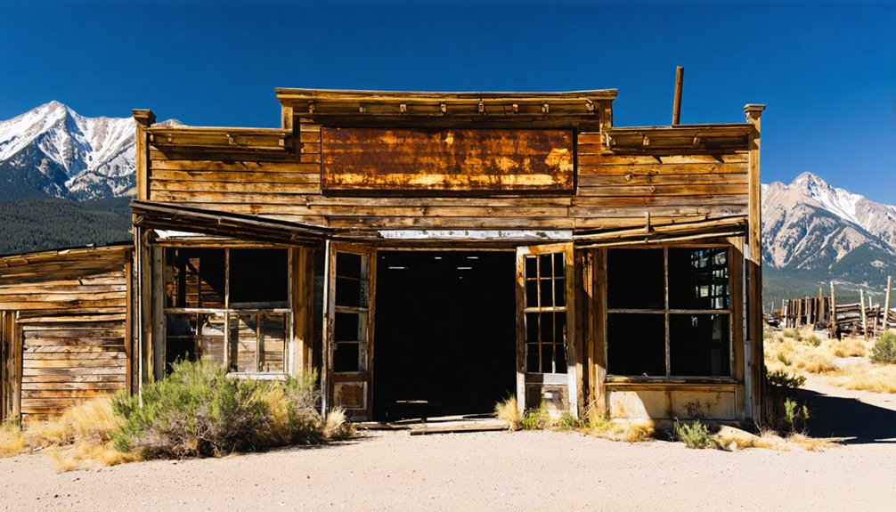
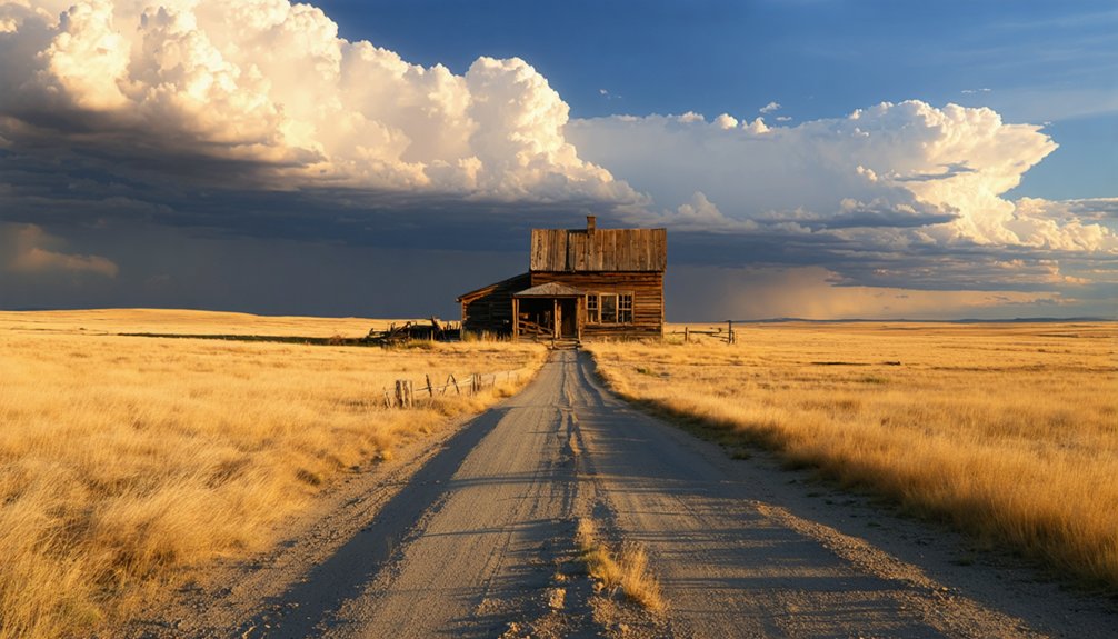
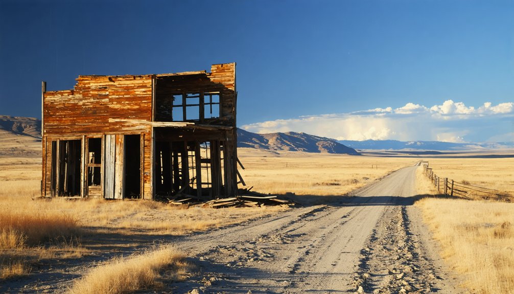
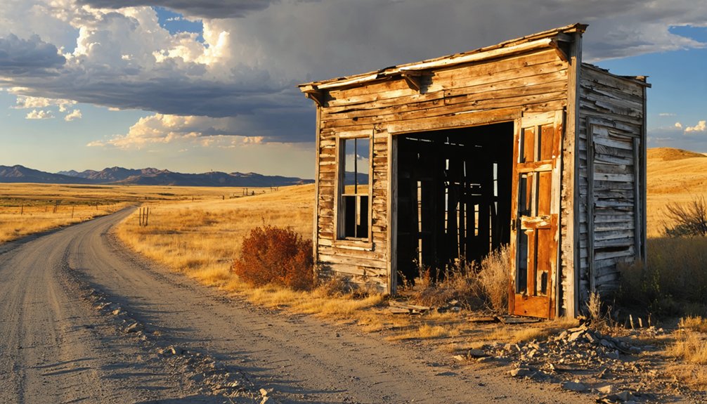
You’ll find crumbling foundations, partial walls, and scattered timber spread across an open plains landscape that once supported hundreds of families. The most striking feature is the Bella Vista Cafeteria ruins, stabilized and fenced for preservation.
Interpretive panels along Highway 34 give your ghost town exploration real context, connecting the physical remains to Dearfield’s deep cultural significance as a thriving Black homesteading community.
You’re fundamentally walking through a living history lesson.
Watch your step around exposed wood, broken glass, and uneven ground. Respect the “look, don’t touch” rule.
What’s left here is fragile, and it deserves to stay standing for the next visitor.
Where to Stand and What to Shoot at Dearfield
When you pull off Highway 34, position yourself with the open plains behind the ruins to capture the stark contrast between crumbling walls and endless sky.
The Bella Vista Cafeteria shell offers your strongest foreground subject, its partial walls and weathered texture telling the town’s story in a single frame.
Shoot in the early morning or late afternoon, when low-angle light carves deep shadows into the broken foundations and brings the site’s quiet devastation to life.
Best Camera Angles
Because Dearfield sits on flat, open plains with no tree cover or crowding structures, you’ll find that natural light and wide framing are your greatest creative tools here.
Shoot during golden hour for warm, dramatic shadows across crumbling walls. Your camera settings should prioritize low ISO and wide aperture to capture texture and depth across the vast landscape.
Apply these composition tips to maximize every shot:
- Frame ruined walls against open sky to emphasize isolation and scale
- Use foreground debris like broken wood or stone to add depth layers
- Position yourself low to the ground for dramatic perspective on standing structures
- Shoot horizontally to capture the sweeping plains stretching behind ruins
- Contrast weathered textures against clean blue sky for striking visual contrast
Key Structures To Photograph
While only a handful of structures remain standing at Dearfield, each one tells a distinct story worth capturing through your lens. The Bella Vista Cafeteria ruins are your most compelling subject — its crumbling walls and hollow windows reward both wide-angle establishing shots and tight detail work.
Apply photographic techniques like low-angle framing to emphasize the structure’s height against the open sky, reinforcing themes of resilience and loss.
Scattered foundation outlines across the flat landscape offer strong geometric compositions, particularly during golden hour when shadows define every edge.
Interpretive signage panels also make surprisingly powerful foreground elements, connecting historic preservation efforts to the visual narrative you’re building.
Shoot deliberately, respect fragile surfaces, and let the emptiness around each structure do as much storytelling as the ruins themselves.
Packing List for the Dearfield Drive
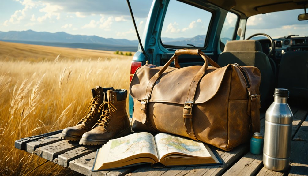
Since Dearfield sits in the open, exposed plains of northeastern Colorado with no services nearby, you’ll want to pack smart before hitting Highway 34.
The semi-arid landscape offers zero shade, unpredictable winds, and rugged terrain around crumbling ruins—so your packing essentials directly shape your experience. Respecting visitor etiquette means arriving prepared and leaving nothing behind.
- Water – Bring at least 32 oz per person; dehydration sneaks up fast on the high plains
- Sun protection – Sunscreen, sunglasses, and a wide-brim hat are non-negotiable
- Sturdy closed-toe shoes – Broken glass and uneven ground demand solid footwear
- Camera or binoculars – Capture wide-angle ruins shots without touching fragile structures
- Trash bag – Pack out everything you pack in; leave the site exactly as you found it
Greeley Museums and History Sites That Pair Well With Dearfield
Once your gear is loaded and you’ve driven Highway 34 back toward Greeley, the city rewards you with several history sites that deepen everything you just saw at Dearfield.
Greeley history comes alive at the Greeley History Museum, where exhibits on agricultural settlement and community life connect directly to the homesteading story you just witnessed firsthand.
The Union Colony Pioneer Memorial adds another layer, honoring the determined settlers who shaped this region’s identity.
For broader cultural attractions, the Union Colony Civic Center hosts rotating exhibits and performances that reflect the area’s evolving heritage.
Together, these stops transform a single ghost-town visit into a fuller picture of northeastern Colorado’s past.
You’ll leave Greeley understanding not just Dearfield’s rise and fall, but the larger human drive to build something lasting on open land.
Other Historic Sites Near Dearfield Worth a Stop
Dearfield sits inside a stretch of northeastern Colorado rich with history, and you won’t have to drive far to find other stops worth your time.
This region holds Cultural Heritage and Historic Landmarks that reward curious travelers who push beyond the ghost town itself.
- Greeley History Museum – Traces Weld County’s settlement stories through hands-on exhibits
- Union Colony Pioneer Memorial – Honors the 1870 founders who shaped northeastern Colorado’s agricultural identity
- Centennial Village Museum – An outdoor living-history site featuring restored frontier-era structures
- Fort Vasquez – A reconstructed 1830s fur-trading post south of Platteville with interpretive displays
- Pawnee National Grassland – Ancient landscape featuring the Pawnee Buttes, sacred ground with deep Indigenous and pioneer significance
Each stop deepens your understanding of the land Dearfield‘s founders once worked.
Frequently Asked Questions
Is There an Admission Fee or Donation Requested to Visit Dearfield?
You’ll find no admission fee to explore Dearfield’s historical significance, but respectful stewardship is expected. Donations supporting preservation efforts are welcomed, keeping local legends alive while you freely discover this remarkable ghost town’s powerful heritage.
Are Pets Allowed When Visiting the Dearfield Ghost Town Site?
The knowledge doesn’t confirm pet policies, but ghost town etiquette suggests you’d keep pets leashed and controlled. Since it’s private land, check with site stewards before bringing your furry companion to Dearfield.
What Is the Best Season or Month to Visit Dearfield?
Spring and fall offer you the best time to visit Dearfield, when you’ll enjoy mild temps and clear skies. Check local events in Greeley to enrich your road trip experience!
Is Cell Phone Service Reliable Along Highway 34 Near Dearfield?
Don’t expect your five-bar city bubble out here! Cell coverage along Highway 34 near Dearfield is spotty at best—network reliability fades fast on the open plains, so you’ll want to download maps and directions before leaving Greeley.
Are Guided Tours of Dearfield Ever Available for Visiting Groups?
The knowledge doesn’t confirm guided tour options or group visit availability, but you’ll find interpretive panels along Highway 34 that’ll enrich your experience. Contact Colorado State University’s preservation team for potential organized group arrangements.
References
- https://tranquiltrekker.com/central-colorado-ghost-towns-independence-pass/
- https://www.nationalgeographic.com/travel/article/ghost-towns-colorado-road-trip
- https://www.4x4explore.com/dest/dest_ghst.htm
- https://www.onlyinyourstate.com/trip-ideas/colorado/co-ghost-town-road-trip
- https://www.youtube.com/watch?v=PEZASHxQoTg
- https://www.reddit.com/r/Colorado/comments/1eux9o/looking_for_ghost_towns/
- https://www.youtube.com/watch?v=y3DIyhCoafo
- https://www.youtube.com/watch?v=8QWmACBsznI
- https://k99.com/haunted-road-trip-10-ghost-towns-you-can-drive-to-in-colorado/
- https://999thepoint.com/the-ultimate-ghost-town-road-trip-through-colorado/


