Planning a ghost town road trip to Fort Douglas, Arkansas means exploring a forgotten Civilian Conservation Corps camp tucked inside Ozark National Forest near Pelsor. You’ll find stone foundations and crumbling structures that connect you directly to New Deal-era labor history. Pair it with Rush, a collapsed zinc mining town inside Buffalo National River, and you’ve got a compelling single-day Ozarks adventure. Keep going to uncover everything you need for the trip.
Key Takeaways
- Fort Douglas, a former CCC camp in Ozark National Forest near Pelsor, Arkansas, offers a quiet ghost town experience rooted in New Deal history.
- Navigate to Fort Douglas via Arkansas Highway 123 using GPS coordinates N35 40.37, W93 14.06, with nearby towns including Clarksville and Russellville.
- Stone foundations and crumbling structures remain visible at Fort Douglas, providing tangible evidence of early federal conservation and labor history.
- Rush, Arkansas, a nearby zinc mining ghost town within Buffalo National River, features interpretive trails and crumbling structures worth combining into your trip.
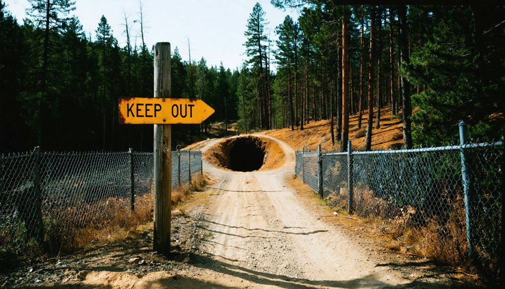
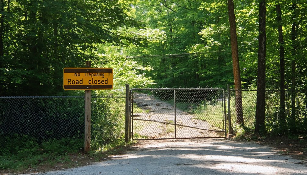
- Stay on designated trails, maintain safe distances from structures, and note that federal law prohibits removing or disturbing anything at both sites.
What Makes Fort Douglas a Ghost Town Worth Visiting?
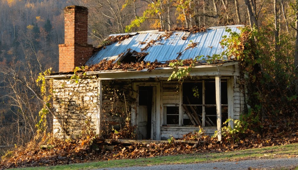
Though it lacks the dramatic skyline of a Western boom-and-bust town, Fort Douglas pulls you in with something quieter — the layered history of a Civilian Conservation Corps camp tucked into the Ozark National Forest near Pelsor, Arkansas.
You won’t find ghost town legends built on gold rushes or gunfights here. Instead, you’ll find ruins tied to early 20th-century federal labor history, where workers shaped the land during a transformative era in American conservation.
No gold rush myths. No gunfighter legends. Just the quiet ruins of men who shaped the American land.
Your hiking experiences here carry real weight. Walking among the remnants of an old CCC camp connects you to a forgotten chapter of Arkansas history that most travelers drive right past.
If you value off-the-beaten-path exploration and authentic historical discovery, Fort Douglas rewards the curious and the free-spirited alike.
The CCC History Behind Fort Douglas, Arkansas
When you visit Fort Douglas, you’re stepping onto the grounds of a former Civilian Conservation Corps camp, a New Deal-era program that put thousands of young men to work across America’s wildlands during the 1930s.
You can still find ruins and remnants scattered across the site, quiet physical evidence of the workers who once lived and labored here.
These crumbling structures connect you directly to a broader federal conservation legacy that shaped forests, parks, and public lands throughout Arkansas and the nation.
CCC Camp Origins
During the Great Depression, the federal government launched one of its most ambitious conservation efforts — the Civilian Conservation Corps — and Fort Douglas, Arkansas stands as a quiet reminder of that era.
Young men arrived here to work the land, build infrastructure, and support the nation’s natural resources at a time when opportunity was scarce. The CCC Camp at Fort Douglas carried real historical significance, operating as a base connected to school or support facilities that served the broader conservation mission.
Today, ruins and remnants still dot the landscape, giving you a tangible connection to that chapter of American history. When you visit, you’re walking through evidence of federal ambition, working-class labor, and a country determined to rebuild itself from the ground up.
Ruins And Remnants
What the CCC built here didn’t vanish when the workers left — it settled into the landscape and waited.
Today, you’ll find ruins and remnants that reward careful historical exploration. Foundations, structural outlines, and weathered materials still mark where the camp once operated, giving you a tangible connection to early federal conservation history in Arkansas.
Walking through the site, you’re stepping into a layered story that preservation efforts have kept accessible without over-developing.
The Ozark National Forest setting adds rawness to the experience — this isn’t a curated museum, it’s a remnant of real labor and purpose reclaimed by forest.
Keep your eyes open, move respectfully, and let the physical evidence speak.
The ruins don’t demand your imagination — they hold their own history firmly in place.
Federal Conservation Legacy
The Civilian Conservation Corps didn’t just plant trees and dig trails — it built the kind of infrastructure that still shows up in places like Fort Douglas decades later.
During the 1930s, the federal government deployed young workers across the country to strengthen public lands, and Arkansas was no exception. Fort Douglas served as one of those camps, its historical significance rooted in early federal conservation efforts that shaped the Ozark National Forest you’re exploring today.
When you walk through the remnants here, you’re standing inside the conservation impact of a program that transformed millions of acres of American wilderness.
It’s raw history without a visitor center to package it — just ruins, forest, and the weight of what was built here.
How To Reach Fort Douglas via Highway 123
Reaching Fort Douglas is straightforward once you’re on Arkansas Highway 123 near Pelsor, a small community tucked into the Ozark National Forest in north-central Arkansas.
The GPS coordinates N35 40.37, W93 14.06 mark the Fort Douglas access area within the Big Piney Ranger District, making navigation simple if you’re using a map or device.
Nearby towns like Clarksville, Dover, and Russellville serve as practical starting points before you head into the forest.
Highway 123 is one of those scenic routes that rewards you simply for driving it — winding terrain, dense tree cover, and a genuine sense of remoteness.
Once you arrive, you’ll find yourself stepping into quiet history far from crowded tourist corridors.
The CCC Ruins You Can Still See at Fort Douglas Today
Once you step into the Fort Douglas site, you’ll notice how the CCC-era remnants quietly assert themselves against the surrounding forest. Stone foundations, crumbling walls, and scattered structural debris mark where workers once lived and labored during one of America’s most ambitious federal programs.
The CCC architecture here reflects the practical, durable craftsmanship that defined Depression-era conservation camps across the country.
You’ll find ruins connected to what historical accounts describe as a former camp school or support facility. The historical significance of this site runs deep — it represents a moment when federal labor programs physically shaped Arkansas’s national forests.
Walk carefully around the structures, keeping a respectful distance. What remains is fragile, and preserving these ruins means future visitors can experience the same raw, unfiltered connection to history that you’re discovering today.
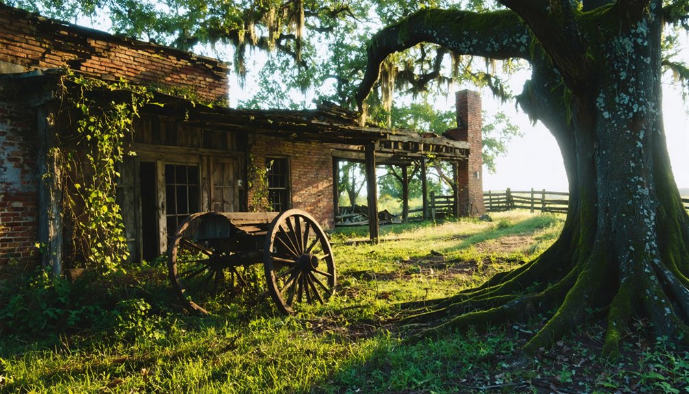
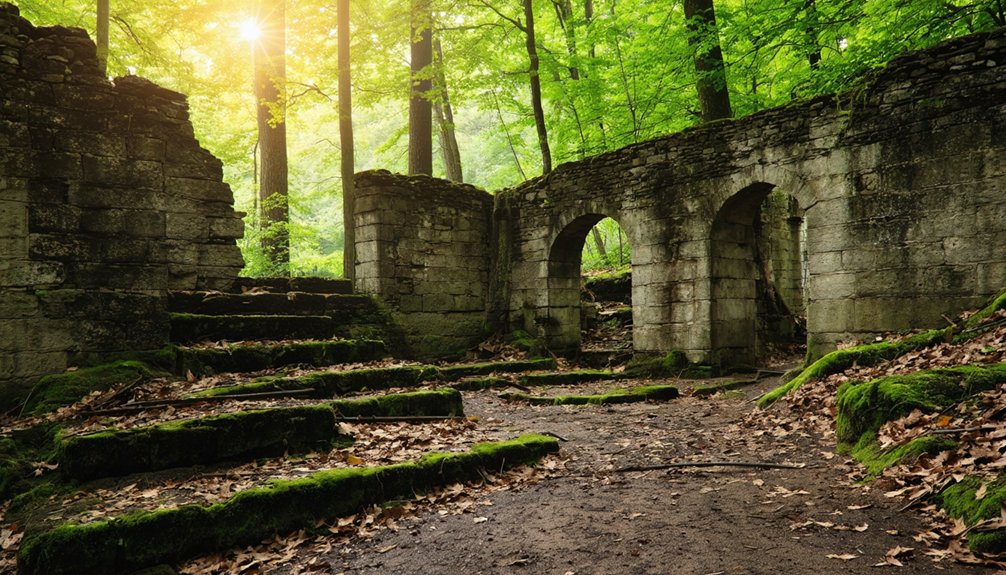
Rush, Arkansas: A Zinc Mining Ghost Town Inside Buffalo National River
From Fort Douglas, your ghost town road trip isn’t finished — it’s just shifting gears. Head toward Buffalo National River, and you’ll find Rush, Arkansas, a zinc mining ghost town that’s been frozen in time since 1972.
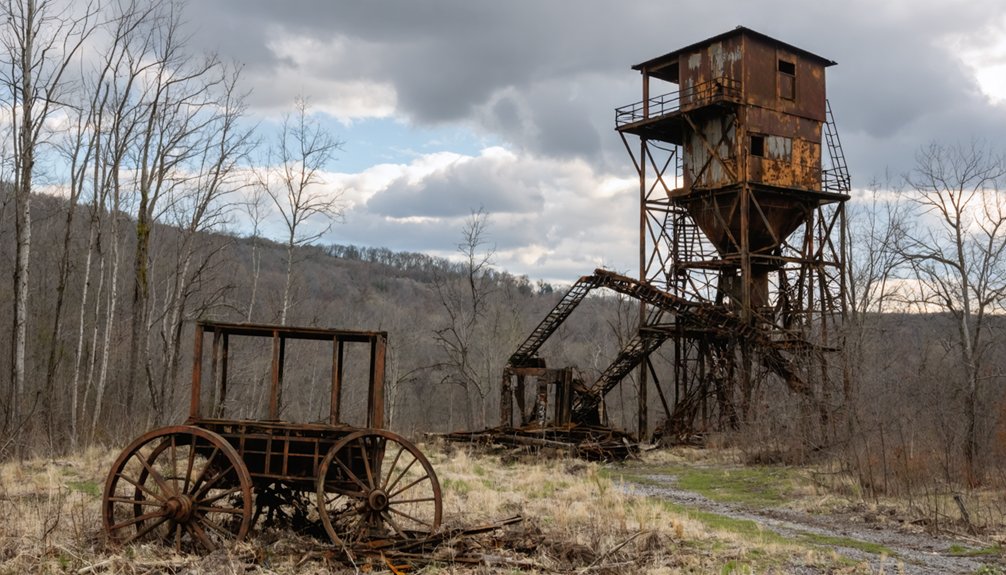
Rush’s mining history runs deep. Zinc production here exploded during World War I, and mines like the Morning Star, Yellow Rose, and Red Cloud once drove a thriving community. The Morning Star mine even produced a 13,000-pound zinc piece back in 1893.
Today, Rush attractions include interpretive trails, crumbling mine structures, and raw Ozark scenery. Hike the Morning Star Loop for a quick overview, or take the Mine Trail closer to the sealed mine entrances.
Explore freely, but respect the preservation rules — these ruins aren’t going to last forever without your help.
The Zinc Mining Boom That Built and Then Abandoned Rush
When you look into Rush’s past, you’ll find that zinc demand—especially during World War I—drove a rapid boom that transformed a quiet Ozark hollow into a bustling mining community.
Mines like Morning Star, Yellow Rose, Beulah, and Red Cloud pulled ore from the hills, with the Morning Star alone producing a remarkable 13,000-pound zinc piece back in 1893.
But once demand faded, the town couldn’t survive, and by 1972 Rush had officially become the ghost town you’ll explore today within Buffalo National River.
Zinc Demand Sparked Growth
Zinc turned Rush from a quiet Ozark hollow into a booming mining district, and the story of how it happened is worth knowing before you walk those trails.
Zinc mining began here in the 1880s, but World War I changed everything. Surging wartime demand sent zinc prices soaring, and the economic impact on Rush was immediate and dramatic.
Miners flooded in, operations expanded, and named mines like Morning Star, Yellow Rose, Beulah, and Red Cloud pushed hard to meet production demands. The Morning Star mine alone produced a remarkable 13,000-pound zinc piece back in 1893.
When the war ended and demand collapsed, Rush couldn’t survive the fall. The same forces that built the town ultimately emptied it, leaving behind the ruins you’ll explore today.
Mines That Shaped Rush
The mines themselves are what made Rush worth talking about. Names like Morning Star, Yellow Rose, Beulah, and Red Cloud weren’t just labels — they represented real operations that pulled zinc from the Arkansas hills using mining techniques that defined an era.
The Morning Star mine alone produced a 13,000-pound zinc piece in 1893, a staggering output that signaled just how resource-rich this valley was.
When demand collapsed after World War I, the miners walked away and Rush went quiet.
Today, historic preservation efforts within Buffalo National River protect what’s left. You can walk the Mine Trail and get close to sealed entrances, standing exactly where those workers once stood.
It’s raw, it’s real, and it connects you directly to a chapter of American history that most people never find.
From Boomtown To Ghost Town
Rush didn’t become a ghost town overnight — it built itself up first. Zinc demand surged during World War I, and Rush transformed from a small mining settlement into a thriving community practically overnight.
Miners flooded in, operations expanded, and the district hummed with purpose.
Then the demand collapsed.
Once the war ended, zinc prices dropped sharply, and Rush couldn’t sustain itself. Operations slowed, families left, and buildings emptied.
By 1972, Rush was officially a ghost town. Today, its mining heritage survives in the ruins and structures preserved within Buffalo National River.
You can walk through what remains and feel the weight of that rise and fall firsthand. Ghost town legends don’t get much more tangible than this — Rush lets you read the whole story in the landscape itself.
Which Rush Trails Are Open: and Which Mine Entrances Are Closed?
When you arrive at Rush, you’ll find a handful of trails winding through the historic district, each offering a different perspective on this old zinc-mining community.
The Morning Star Loop is your shortest option, keeping you close to the main ruins.
The Mine Trail pushes deeper into the landscape, bringing you near several old entrances — but don’t go inside. Mine Entrance Safety is strictly enforced here; all mine openings are closed to the public due to structural instability and dangerous air quality.
The Monte Cristo Trail gives you another solid route through the area.
Before heading out, check current Rush Trail Conditions, since Ozark weather can affect access seasonally.
Stay on marked paths, keep your distance from deteriorating structures, and respect the preservation rules posted throughout the district.
How To Visit Both Fort Douglas and Rush in One Day
Once you’ve walked the trails at Rush and taken in the mining ruins, you’re well-positioned to round out the day with a stop at Fort Douglas — and with some smart planning, both sites fit comfortably into a single Ozark drive.
Head west toward Pelsor and pick up Arkansas Highway 123, which delivers you directly to the Fort Douglas access area in the Big Piney Ranger District. The CCC-era ruins carry their own historical significance, offering a clear contrast to Rush’s mining heritage.
Along the way, Buffalo National River‘s scenic beauty makes the drive worthwhile on its own. Keep your hikes short at each stop, stay on marked trails, and you’ll cover both destinations without feeling rushed — just two ghost town gems connected by open Ozark road.
Access Roads, Closures, and Rules for Fort Douglas and Rush
Before you hit the road, you’ll want to check current conditions on Highway 123 and the Buffalo National River access routes, since seasonal weather in the Ozarks can leave dirt roads muddy, washed out, or temporarily closed.
Once you arrive at either site, posted rules require you to stay on designated trails and view crumbling structures from a safe distance rather than entering them.
Respecting these guidelines protects both you and the fragile historic remnants that make Fort Douglas and Rush worth the drive.
Road Conditions and Closures
Although both Fort Douglas and Rush sit within federally managed lands, road conditions and access rules can shift dramatically with the seasons, so you’ll want to check current status before heading out.
Arkansas winters bring mud, ice, and washouts that can render forest roads impassable. Highway 123 near Pelsor generally holds up well, but secondary dirt roads leading deeper into the Ozark National Forest are another story entirely.
Seasonal closures protect both the land and your vehicle, so treat posted signs as hard limits rather than suggestions. Before you leave home, contact the Big Piney Ranger District or check the Buffalo National River website for current road conditions and any active closures.
A quick call saves you a frustrating dead end miles from nowhere.
Rules and Safety Guidelines
Knowing the road conditions is only half the equation—once you’re out there, the rules governing these sites shape everything from where you park to how close you can get to a crumbling structure.
Ghost town etiquette isn’t optional here; it’s federal law. Both Fort Douglas and Rush fall under protected land management, meaning you don’t touch, remove, or disturb anything. Historical preservation depends entirely on visitors treating ruins as observation points, not climbing frames.
At Rush, posted signs remind you to view structures from a safe distance—unstable walls and deteriorating mine entrances aren’t invitations. Follow trail boundaries, pack out everything you bring in, and respect all closure notices.
Your freedom to explore these sites tomorrow depends on how responsibly you treat them today.
Best Times of Year To Visit Arkansas Ghost Towns in the Ozarks
Spring and fall are your sweet spots for exploring Arkansas ghost towns like Rush and Fort Douglas. Mild temperatures and manageable trail conditions make both seasons the best season for history-focused hiking.
Spring and fall are peak seasons for exploring Arkansas ghost towns, offering mild temperatures and ideal trail conditions.
Summer brings heat and humidity, while winter can close or complicate access along Highway 123.
Here’s how each season stacks up:
- Spring (March–May): Wildflowers bloom, temperatures stay comfortable, and trails dry out after winter.
- Fall (September–November): Cooler air, vivid foliage, and fewer crowds compared to peak visitation summer months.
- Winter (December–February): Possible road closures and wet trails make planning unpredictable.
Plan your visit between late March and early November for the most reliable, rewarding experience.
Frequently Asked Questions
Are Pets Allowed on the Trails at Fort Douglas and Rush?
The knowledge doesn’t confirm pet-friendly policies for Fort Douglas or Rush’s trails, so you’ll want to check ahead. Practice good trail etiquette by always keeping pets leashed and respecting these historically preserved, federally protected areas.
Is There a Fee to Enter Fort Douglas or Rush, Arkansas?
You won’t pay entry fees to explore Fort Douglas or Rush — both sites welcome you freely! Their entry regulations respect your independence while you soak in their rich historical significance within Arkansas’s stunning Ozark landscapes.
Are Restrooms or Facilities Available at Fort Douglas or Rush?
Like stepping into the wild frontier, you’ll find facilities are minimal at both sites. Don’t count on restrooms enhancing your visitor experiences, so come fully prepared to embrace ghost town history on your own rugged terms.
Can You Camp Overnight Near Fort Douglas or Rush?
You’ll find camping options within Ozark National Forest near Fort Douglas and Buffalo National River near Rush. Both areas offer sites where you can explore nearby attractions and extend your ghost town adventure overnight.
Is Cell Service Reliable Along Highway 123 Near Fort Douglas?
Don’t count on reliable cell coverage along Highway 123 near Fort Douglas. Signal strength drops considerably in these remote Ozark hollows, so you’ll want to download maps, share your itinerary, and embrace the freedom of going off-grid.
References
- https://ozarkmountainhiker.com/2022/01/15/oht-ozone-to-fort-douglas/
- https://www.facebook.com/groups/117852875570/posts/10173340363245571/
- https://onlyinark.com/places-and-travel/rush-arkansas-ghost-town/
- https://www.tiktok.com/@adventurearkansas/video/7586868075660692767
- https://www.youtube.com/watch?v=s2a3hAf5d-Y
- https://www.exploretheozarksonline.com/activities/parksnature/nationalforests/ozark/bigpiney/ftdouglas.html
- https://www.barefoottraveler.com/rush.html
- https://www.youtube.com/watch?v=JuyPrF3eLdo
- https://ozarkmountainhiker.com/2015/03/25/hiking-rush-an-arkansas-ghost-town-photo-tour/
- https://www.takahik.com/trails/fortdouglasccctrailmappics/ftdouglasccc.html