Indian Gulch sits off Highway 140 in Mariposa County, and it’s one of California’s most forgotten gold rush ghost towns. You’ll take Indian Gulch Road past Slate Gulch Road, winding toward rolling hills near Three Buttes and Rattlesnake Creek. The site holds a weathered cemetery, crumbling ruins, and deep ties to the legendary bandit Joaquin Murrieta. It’s hauntingly beautiful, privately owned, but open to respectful explorers. Everything you need to plan your trip is just ahead.
Key Takeaways
- Indian Gulch is a historic ghost town in Mariposa County, California, accessible via Indian Gulch Road off Highway 140.
- Look for Slate Gulch Road, then make a sharp left onto Indian Gulch Road, heading toward Santa Cruz Mountain and Rattlesnake Creek.
- Key attractions include a pioneer cemetery, wood store ruins, rock structures, and an E Clampus Vitus historical marker.
- Deteriorating buildings are unsafe to enter; visitors should focus on photographing headstones, crumbling structures, and historical markers.
- Respect private property boundaries while exploring, as the site is privately owned but welcomes visitors to historical landmarks.
Why Is Indian Gulch California’s Most Overlooked Ghost Town?
Why does Indian Gulch slip through the cracks of California’s gold rush mythology? While tourists flock to Bodie and Columbia, this Mariposa County settlement quietly guards its hidden history along a sharp turn off Highway 140.
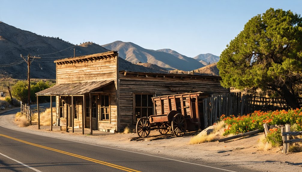
You won’t find it on most ghost town lists, yet it peaked at hundreds of residents, buzzed with saloons, hotels, and gambling halls, and reportedly sheltered bandit Joaquin Murrieta himself.
Its obscurity isn’t accidental. Mining on Rattlesnake Creek proved unprofitable early, commerce dried up by 1900, and the post office closed in 1912.
Local legends faded alongside the last residents. When Angie Solari passed around 1979, living memory disappeared with her.
What remains — a cemetery, crumbling walls, rolling hills — waits for travelers bold enough to seek it out.
How Do You Get to Indian Gulch, California?
To reach Indian Gulch, you’ll take Highway 140 into Mariposa County, where the landscape shifts into rolling hills that once drew Mexican miners and Italian settlers alike.
Watch for Slate Gulch Road, then make a sharp left onto Indian Gulch Road — a turn easy to miss if you’re not paying attention.
As you wind deeper in, the rugged terrain itself becomes your first landmark, with Santa Cruz Mountain and the striking silhouette of Three Buttes guiding you toward what little remains of this forgotten settlement.
Getting There From Highway 140
Reaching Indian Gulch takes just a few key turns off Highway 140, but you’ll want to pay close attention — the route is easy to miss.
The historical significance of this road only deepens when you realize you’re retracing paths once traveled by miners, freighters, and perhaps even outlaws whose ghost stories still echo through these hills.
Follow these directions carefully:
- Head along Highway 140 toward Mariposa County
- Watch for Slate Gulch Road as your landmark
- Turn sharp left onto Indian Gulch Road immediately after Slate Gulch Road
- Follow the road toward Santa Cruz Mountain and Rattlesnake Creek
- Look for the settlement nestled among rolling hills near Three Buttes
Miss that sharp turn, and you’ll blow right past one of California’s most forgotten chapters.
Once you’ve made that sharp left onto Indian Gulch Road, the modern world starts to fall away quickly — paved certainty giving way to the kind of dusty, winding passage that miners, freighters, and pack station operators once knew by instinct.
This stretch of your road trip carries real weight. You’re tracing the same route that once fed a settlement of hundreds, maybe thousands, of souls chasing gold near Rattlesnake Creek.
The road leads you toward rolling hills alive with livestock sounds and distant coyote calls — a landscape that still whispers ghost stories if you’re paying attention.
Stay alert for the ruins, the cemetery, and the old rock structures. They’re not marked boldly. You have to earn the discovery.
Key Landmarks Along The Way
As you close in on Indian Gulch, a handful of landmarks anchor your route and keep you from second-guessing every fork in the road. Each marker carries historical significance, quietly hinting at ghost stories from California’s restless past.
Watch for these key signposts:
- Highway 140 – your main artery into Mariposa County
- Slate Gulch Road – signals your sharp left turn is coming
- Indian Gulch Road – the final stretch into forgotten territory
- Santa Cruz Mountain – looms as a natural compass bearing
- Rattlesnake Creek – proof you’re entering the old mining corridor
These landmarks aren’t decorative—they’re functional breadcrumbs through rolling hills where bandits once roamed and miners chased uncertain fortunes.
Stay alert, trust the terrain, and let the landscape guide you forward.
How Did Indian Gulch Go From Boomtown to Ghost Town?
Indian Gulch’s boom was as fleeting as a gold pan’s glitter — mining along Rattlesnake Creek proved largely unprofitable, and by 1900, the commerce that once sustained hotels, saloons, and a dance hall had dried up almost entirely.
Cattle replaced gold as the region’s economic backbone, but ranching couldn’t sustain a community the way a boomtown’s hustle once had.
Mining Dreams Fade Fast
Although the gold glittered with promise, Indian Gulch’s mining ventures along Rattlesnake Creek never quite paid off. The mining methods proved inefficient, and economic shifts pushed settlers toward new livelihoods. By 1900, cattle replaced gold as the town’s lifeblood.
What remained after the mining dreams collapsed:
- Unprofitable diggings between the Three Buttes
- Abandoned merchandise stores and blacksmith shops
- Empty livery stables and silent saloons
- Shuttered hotels that once housed hopeful prospectors
- A post office that finally closed in 1912
You can almost feel the weight of those broken dreams walking the grounds today. Settlers who stayed reinvented themselves, trading pickaxes for cattle drives.
Indian Gulch didn’t die dramatically — it simply exhaled slowly, surrendering to the rolling hills surrounding it.
Cattle Replaces Commerce
When the gold ran out, ranchers didn’t wait around mourning empty sluice boxes — they pivoted hard toward the land itself. By 1900, cattle ranching had quietly replaced commerce as Indian Gulch’s economic backbone.
The rolling hills surrounding the settlement, once crowded with miners chasing fortune, became open range instead.
This economic shift wasn’t dramatic — it was gradual and inevitable. Stores shuttered, saloons emptied, and the steady rhythm of livestock replaced the clatter of pack trains hauling supplies.
The land, it turned out, had more to offer through grazing than through gold.
You’ll still hear that truth today when you visit. Stand near the old ruins, close your eyes, and listen — cattle sounds and distant coyotes tell the rest of the story.
Last Residents Depart
By the time the 20th century arrived, Indian Gulch had already lost its reason to exist. The post office closed in 1912, and people quietly slipped away, chasing better opportunities elsewhere. Community memories faded with each departing family.
What disappeared with them:
- Bustling saloons and dance halls
- Two hotels that once sheltered travelers
- Blacksmith shops serving freighters and miners
- Merchandise stores stocked for a thriving population
- The daily rhythm of a living town
Angie Solari, the last resident, held on longest, carrying those community memories until her passing around 1979.
When she left this world, Indian Gulch officially became a ghost town.
You’re now visiting a place where freedom-seekers once built something remarkable — and ultimately walked away from everything they’d created.
Did Joaquin Murrieta Really Hide Out in Indian Gulch?
One of Indian Gulch’s most tantalizing legends centers on Joaquin Murrieta, the infamous Gold Rush-era bandit whose name became synonymous with daring raids and frontier justice.
According to Murrieta legends, he and his notorious companion Three Fingered Jack used Indian Gulch as a hideout, exploiting its remote terrain and tight-knit community.
The bandit folklore gains credibility when you consider that Murrieta’s own relatives operated a pack station nearby, and Joaquin himself reportedly worked as a packer in the area.
Those connections gave him legitimate cover and loyal contacts. The surrounding buttes, once called Murrieta Buttes, still carry his name in local memory.
Whether fact or myth, the legend transforms your visit into something far more charged than a simple walk through a forgotten settlement.
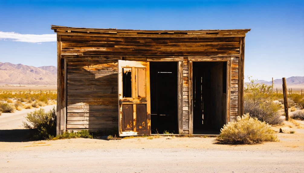
What’s Left to See at the Indian Gulch Site?
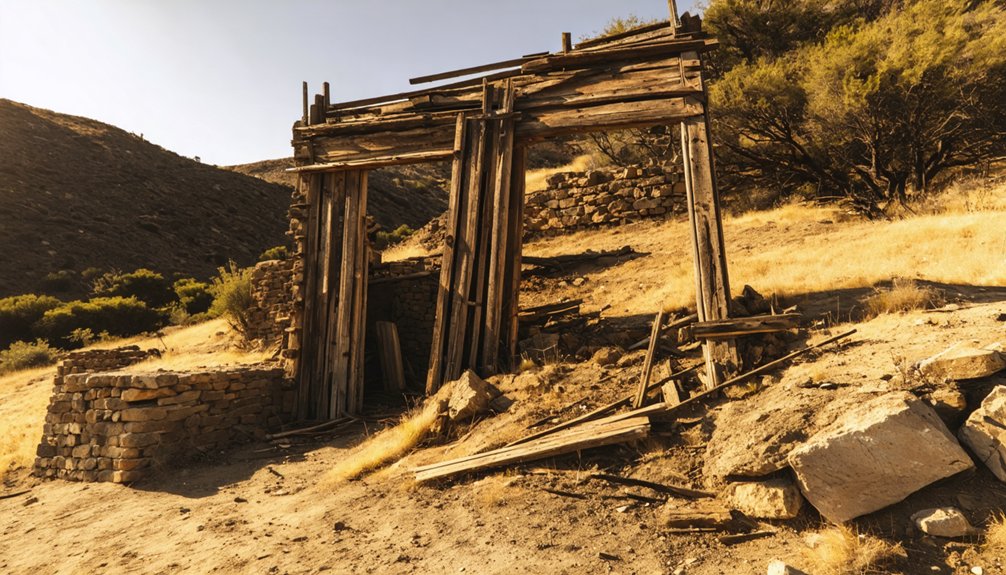
Legends fade, but the physical remnants of Indian Gulch stubbornly hold their ground. When you visit, you’ll find a quietly haunting landscape where history still breathes.
The site’s privately owned, so respect boundaries, but visitors can access the cemetery ruins and historical markers freely.
Here’s what you’ll discover:
- Cemetery with weathered headstones marking pioneer lives
- Wood store ruins slowly surrendering to time
- Rock structure standing as silent testimony
- E Clampus Vitus historical marker commemorating the town’s legacy
- Rolling hills echoing with livestock and distant coyotes
The Catholic church, built in 1885, was moved in 1973 and destroyed by fire in 1980, leaving only memory.
Come prepared for rough road access via Indian Gulch Road off Highway 140. This place rewards the curious and the bold.
Can You Still Visit Indian Gulch Today?
Yes, you can still visit Indian Gulch today, though the journey demands a little patience and respect.
Take Highway 140, turn onto Indian Gulch Road, and follow it into the rolling hills where history quietly waits. The property is privately owned, but visitors are welcome to explore the graveyard and examine the historical markers placed by E Clampus Vitus.
Don’t enter the deteriorating buildings — they’re genuinely unsafe. Instead, focus your ghost town photography on the crumbling wood store ruins, the rock structure, and the weathered cemetery headstones that tell stories no history book fully captures.
Listen for livestock and coyotes echoing across the hillsides. This place rewards those who arrive curious, move carefully, and leave everything exactly as they found it.
What Else Near Indian Gulch Is Worth the Stop?
While you’re already out on Indian Gulch Road, don’t rush back to the highway. The surrounding Mariposa County landscape carries serious historical significance and rewards curious explorers willing to wander.
Nearby landmarks connect directly to local legends and California’s wildest era:
Nearby landmarks don’t just mark geography — they anchor real stories from California’s most untamed and legendary years.
- Santa Cruz Mountain looms over the valley where Mexican miners first settled.
- Rattlesnake Creek marks the very ground where unprofitable gold claims once drew desperate men.
- Three Buttes (formerly Murrieta Buttes) ties the region to bandit Joaquin Murrieta’s rumored hideouts.
- Highway 140 corridor offers access to Mariposa’s gold rush-era courthouse and museum.
- Cathey’s Valley, founded by Andrew Cathey after 1852, sits just minutes away.
Each stop adds another layer to a story that California rarely tells loudly enough.
Frequently Asked Questions
What Was Indian Gulch’s Peak Population During Its Boomtown Years?
During its gold rush peak, you’d have found between 700 and several thousand souls there, drawn by mining techniques and fortune’s promise — a bold, free-spirited community carving life from California’s rugged, untamed hills.
Who Was the Last Known Resident to Live in Indian Gulch?
Straight from the horse’s mouth — Angie Solari was the last resident of Indian Gulch, holding on until around 1979. When you visit, you’ll walk the same grounds she once called home.
What Happened to Indian Gulch’s Catholic Church After It Was Moved?
After its 1973 church relocation, fire destroyed the Catholic church in 1980, erasing its historical significance forever. You can’t undo that loss, but you’ll still feel its spirit echoing across Indian Gulch’s untamed, free-spirited landscape.
What Elevation Is the Indian Gulch Ghost Town Site Located At?
You’ll find this ghost town history unfolding at 968 feet (295 m) above sea level. The elevation significance shapes your adventurous approach, as rolling hills embrace Indian Gulch’s weathered remains, rewarding free-spirited explorers who’ve answered the open road’s call.
Which Historical Organization Placed a Marker at Indian Gulch’s Cemetery?
E Clampus Vitus left their mark on history’s silent voices — you’ll find their Marker Significance honors Indian Gulch’s cemetery, championing Historical Preservation so you can freely explore and connect with this untamed, forgotten frontier’s enduring spirit.
References
- https://www.ghosttowns.com/states/ca/indiangulch.html
- https://mercedcountytimes.com/indian-gulch-touching-a-piece-of-history/
- http://www.gribblenation.org/2025/08/indian-gulch-road-mariposa-county.html
- https://www.alamy.com/historic-gold-rush-settlement-ruins-of-indian-gulch-est-1849-near-image3791612.html
- https://californiarevealed.org/do/28b1b1ce-5637-4855-b141-78bc9b1c2e0e
- https://en.wikipedia.org/wiki/Indian_Gulch


