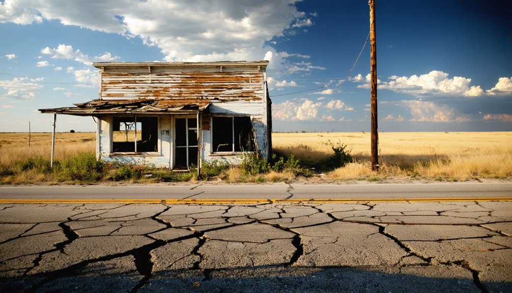
Jester, Oklahoma sits five miles southwest of Ponca City, frozen in the aftermath of a 1910s oil boom that burned bright and faded fast. You’ll find crumbling foundations, scattered oil derrick remnants, and a quiet cemetery bearing headstones from the 1920s and 1940s. Visit in spring or fall for the best conditions, and bring water, sturdy boots, and offline maps since cell service is unreliable. There’s far more to uncover about making this ghost town road trip unforgettable.
Key Takeaways
- Jester, Oklahoma, located 5 miles southwest of Ponca City, features ruins like oil wellheads, a schoolhouse foundation, and a historic cemetery.
- Access Jester via Oklahoma State Highway 77, using GPS coordinates 36.68°N, 97.12°W, and carry paper maps due to limited cell service.
- Visit during spring or fall for comfortable temperatures, stable weather, and longer daylight hours ideal for exploration.
- Nearby ghost towns Deer Creek and Blackwell can extend your trip, completing a roughly 100-mile Kay County loop.
- Pack water, snacks, sturdy boots, a camera, and offline maps to ensure a safe and prepared visit.
What Made Jester, Oklahoma a Ghost Town?
Jester, Oklahoma didn’t fade quietly — it boomed hard and collapsed fast, following the classic cycle of an oil boomtown. During the 1910s oil boom, Kay County surged with energy. Derricks crowded the land, stores opened overnight, and workers flooded in, building a real community with schools, churches, and ambition.
Then the oil ran dry.
Economic decline hit Jester from multiple directions — exhausted wells, bypassed rail lines, and the crushing weight of the 1930s Great Depression. By the 1950s, residents had scattered, buildings crumbled, and the town simply ceased to exist as a living place.
What you’ll find today are foundation stones, weathered cemetery markers, and rusted wellheads standing as quiet proof that Jester once had a pulse worth chasing.
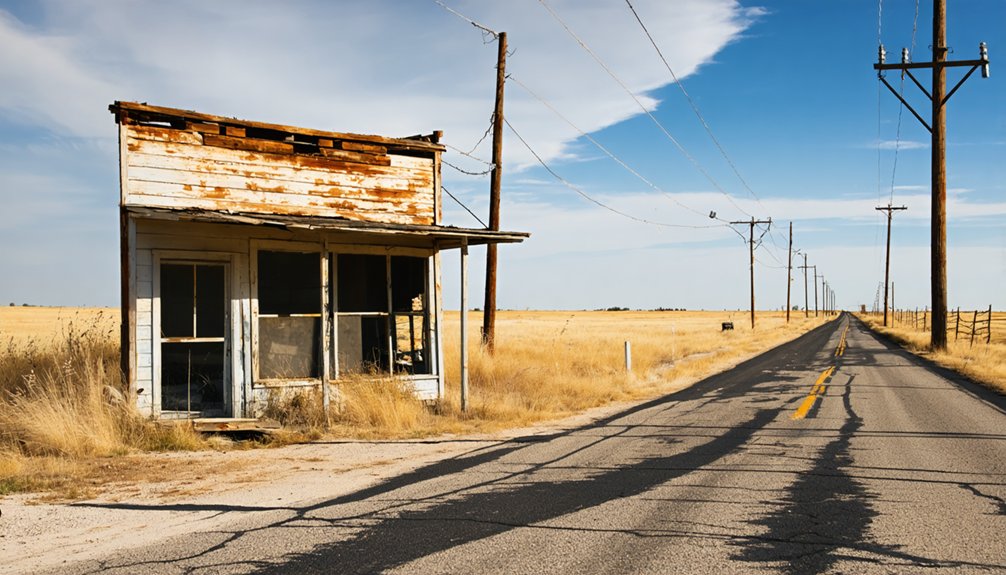
Where Exactly Is Jester and How Do You Get There?
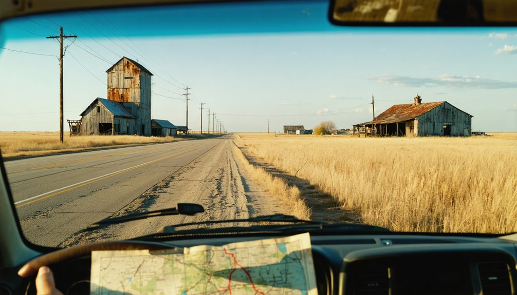
Tucked into the rural farmlands of northern Kay County, Jester sits just 5 miles southwest of Ponca City — close enough to reach in under 20 minutes, yet remote enough to feel genuinely forgotten.
To chase Jester history and ghost town legends firsthand, you’ll need a sense of direction and a full tank.
Here’s how you navigate there:
- Head south on Oklahoma State Highway 77 from Ponca City, watching pavement give way to quiet countryside.
- Use U.S. Highway 177 as your main corridor, connecting nearby towns like Tonkawa along your route.
- Plug coordinates 36.68°N, 97.12°W into your GPS, since road signs get sparse fast.
Bring paper maps.
Cell service fades, and out here, you’re genuinely on your own.
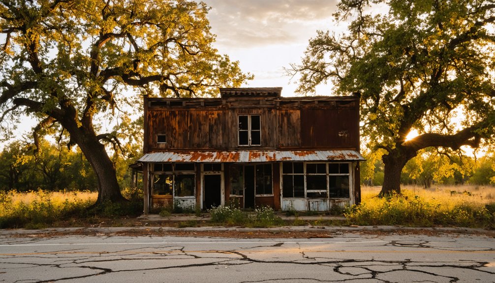
Why Spring and Fall Are the Only Smart Seasons to Visit Jester
Oklahoma summers don’t forgive curiosity — triple-digit heat bakes the open farmlands around Jester into something closer to punishment than adventure.
You’ll want to plan your visit around spring blooms or fall foliage instead, when temperatures stay manageable and the landscape rewards exploration.
Spring transforms the surrounding fields into something worth photographing — wildflowers framing crumbled foundations, soft light hitting old cemetery headstones just right.
Fall foliage adds warm color to an otherwise stark rural setting, making ruins feel cinematic rather than desolate.
Winter brings unpredictable ice storms across Kay County, while summer floods threaten low-lying areas near Bitter Creek.
Spring and fall give you stable weather, better visibility, and longer daylight.
Choose those windows, and Jester delivers the raw, unfiltered ghost town experience you’re actually chasing.
What You’ll Actually See at Jester’s Ruins
Once you’ve picked your season and made the drive out, the question shifts from when to what — and Jester doesn’t disappoint if you know where to look. These ghostly remnants speak volumes about the town’s historical significance without a single tour guide needed.
Here’s what you’ll actually encounter:
- Schoolhouse and church foundations — crumbling stone bases rising from overgrown fields, marking where community life once centered.
- Old oil wellheads and derrick scraps — rusted metal scattered across open land, showing exactly why Jester existed in the first place.
- Jester Cemetery — intact headstones dating from the 1920s through 1940s, each one a quiet record of who built this place and who stayed behind.
Walk the perimeter, read the stones, and let the silence do the talking.
Other Ghost Towns Near Jester That Deserve a Stop
Head south toward Deer Creek, where abandoned buildings line forgotten streets and local legends describe a once-thriving community swallowed by economic collapse.
Locals whisper about buried oil fortunes never recovered.
Push east to Blackwell’s outskirts, where scattered oil-era remnants tell stories of boom-and-bust cycles that shaped northern Oklahoma’s identity.
Then swing west toward Tonkawa’s forgotten edges, where crumbling structures hint at communities that railroad bypasses fundamentally erased overnight.
Each stop adds roughly 20–30 minutes to your route without backtracking notably.
You’re already out there exploring history — why stop at one?
These three destinations transform a quick Jester visit into a genuinely unforgettable full-day Oklahoma road trip.
The Ghost Town Road Trip Loop Through Jester and Kay County
Stitching together everything you’ve explored so far, the full loop through Kay County runs roughly 100 miles and fits comfortably into a single day. You’ll trace ghost town history across a landscape that once roared with oil boom energy.
- Start in Ponca City, then head south on SH-77, rolling past open farmland until Jester’s crumbling foundations and weathered cemetery markers appear.
- Swing west toward Tonkawa via US-177, where Deer Creek’s abandoned structures whisper stories of collapsed communities.
- Push east to Blackwell, where scattered oil-era remnants remind you how quickly fortune vanished once the wells ran dry.
Return north on I-35 with your windows down and your camera full. This route hands you genuine freedom — open roads, forgotten places, and unfiltered American history.
What to Pack for Your Jester Ghost Town Visit
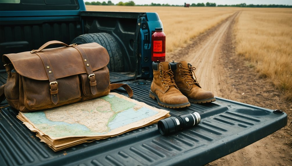
Five essentials will keep you comfortable and safe when you’re exploring Jester’s remote, service-free landscape.
First, pack enough water for a full day since no facilities exist nearby.
Second, bring printed maps or a downloaded GPS route because cell service is unreliable around these rural Kay County roads.
Third, wear sturdy boots to navigate uneven foundations and overgrown fields where Jester history literally lies underfoot.
Fourth, carry a camera to capture weathered stone bases, cemetery markers, and scattered wellheads that define authentic ghost town exploration.
Fifth, pack snacks and a first-aid kit since the nearest services sit miles away in Ponca City.
Dress in layers for spring or fall visits, and always check weather forecasts before heading out, as low-lying areas near Bitter Creek flood quickly.
How to Stay Safe and Legal Exploring Kay County Ghost Towns
Staying safe and legal while exploring Kay County’s ghost towns comes down to two simple rules: respect boundaries and prepare for the unexpected.
These forgotten places carry real risks alongside their rewards, so keep your safety precautions sharp and your legal considerations sharper.
- Stay on roadsides — Most Jester remnants sit on private farmland. Trespassing isn’t freedom; it’s a citation waiting to happen.
- Watch your footing — Crumbling foundations and rusted wellheads hide beneath tall grass, ready to twist an ankle or worse.
- Pack essentials before leaving pavement — Carry water, a paper map, and a charged phone. Cell service vanishes fast in rural Kay County’s open plains.
Respect the land, and it’ll reward you with unforgettable views.
How to Turn Jester Into a Full-Day Northern Oklahoma Road Trip
You can stretch your visit to Jester into a full-day adventure by mapping a northern Oklahoma loop that connects Kay County’s most compelling ghost sites.
Pack water, printed maps, and a charged camera since cell service is unreliable along the rural county roads linking stops like Deer Creek, Tonkawa, and Blackwell’s abandoned oil settlements.
The roughly 100-mile roundtrip from Ponca City gives you enough ground to cover without sacrificing time at each forgotten town.
Mapping Your Northern Route
A single tank of gas is all it takes to turn Jester into the centerpiece of a full-day northern Oklahoma road trip that stretches across ghost towns, oil history, and open farmland.
Start in Ponca City, head south on State Highway 77, and let the ghost town history and oil boom remnants guide your route.
Map these three stops for maximum impact:
- Jester – Rusted wellheads and crumbling foundations rise from quiet fields, frozen in the 1920s.
- Deer Creek near Tonkawa – A forgotten settlement tucked along US-177, where silence speaks louder than any historical marker.
- Blackwell’s abandoned oil district – Weathered brick storefronts and empty lots tell stories of overnight fortunes lost just as fast.
Return north on I-35 and you’ve covered 100 miles of raw Oklahoma freedom.
Must-Stop Ghost Towns
Once you’ve walked Jester’s crumbling foundations and photographed its rusted wellheads, the road practically pulls you toward the next forgotten chapter.
Head south on US-177 to Tonkawa, where ghost town legends linger around abandoned storefronts tied to oil boom history.
Deer Creek sits nearby, another casualty of exhausted reserves and empty promises.
Push east toward Blackwell, and you’ll find similar remnants scattered across Kay County’s rural backroads.
Each stop adds texture to a larger story — boomtowns that exploded overnight and vanished just as fast.
You’re not just driving between coordinates; you’re tracing the arc of an entire region’s rise and collapse.
Pack enough water, download offline maps, and keep your tank full.
Freedom out here means no services, no crowds, just open road and raw history.
Packing For The Trip
Getting the most out of this road trip starts before you leave the driveway. You’re heading into raw, rural Oklahoma where ghost town history lives in crumbling foundations and forgotten oil boom relics, so come prepared.
- Water and snacks — Pack enough for a full day; there are no convenience stores near Jester’s remote farmland stretch.
- Offline maps or GPS coordinates — Save 36.68°N, 97.12°W before you lose cell signal on those winding Kay County roads.
- Camera and sturdy boots — You’ll want to photograph weathered headstones, rusted wellheads, and stone foundations without slipping on uneven terrain.
Spring and fall offer the most comfortable temperatures for exploring.
Dress in layers, respect private property boundaries, and embrace the open road ahead.
Frequently Asked Questions
How Many Ghost Towns Does Oklahoma Have in Total?
You’ll find around 2,000 abandoned settlements scattered across Oklahoma, each carrying deep historical significance. These forgotten towns tell stories of booms and busts, inviting you to explore the state’s rich, untamed past freely.
Was Jester Ever Connected to a Railroad Line?
Yes, Jester’s railroad history boosted its town significance briefly! You’d have seen rail lines connecting this boomtown, fueling growth before a bypass cut ties, leaving this once-thriving oil hub to fade into Oklahoma’s forgotten landscape.
What County Is Jester, Oklahoma Officially Located In?
Like a hidden gem waiting to be unearthed, Jester’s historical significance and local legends are yours to discover — it’s officially nestled in Kay County, Oklahoma, where forgotten stories of oil booms still echo across the northern plains.
When Did Jester Reach Its Peak Population During the Oil Boom?
You’ll find Jester reached its peak population around 1920 during the thrilling oil boom, boasting dozens of residents and stores. After that, you’d witness a dramatic population decline as resources dried up completely.
You’ve got coordinates — 36.68°N, 97.12°W guides your ghost town navigation perfectly. As you punch them in, you’ll stumble upon Jester’s forgotten historical landmarks, where oil derricks once towered and freedom called adventurers westward.
References
- https://z94.com/explore-oklahoma-ghost-towns/
- https://www.youtube.com/watch?v=CYSGQsnt_FY
- https://savingplaces.org/guides/ghost-towns-on-route-66
- https://www.beaversbendcreativeescape.com/se-oklahoma-ghost-towns/
- https://en.wikipedia.org/wiki/List_of_ghost_towns_in_Oklahoma
- https://www.youtube.com/watch?v=TCrMouVV5Xw
- https://www.okhistory.org/publications/enc/entry?entry=GH002


