Planning a ghost town road trip to Mentmore, New Mexico means stepping into what’s left of a coal community that collapsed almost overnight after mining shut down in 1952. You’ll find a converted trading post church, scattered foundations, and an eerie quiet that tells the town’s story better than any museum could. Access it from Gallup via I-40 west, exit #16, then head north one mile. There’s much more to uncover before you go.
Key Takeaways
- Mentmore is accessible via I-40 west from Gallup, taking exit #16 and heading north for one mile.
- The site is private property, so obtain permission from the owner before exploring beyond public roads.
- Key highlights include a converted trading post now serving as a church and scattered historical foundations.
- Pack water, snacks, sturdy footwear, and offline maps, as the site lacks services and has uneven terrain.
- Nearby ghost towns like Navajo, Allison, and Gamerco can be combined for a fuller road trip experience.
What’s Left of Mentmore Today?
Though Mentmore once bustled with 500 residents, company stores, and the steady rhythm of coal operations, you’ll find little left standing today. The mining legacy that built this town has nearly vanished into the New Mexico sagebrush.
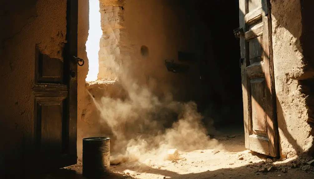
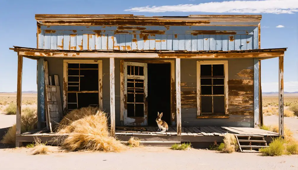
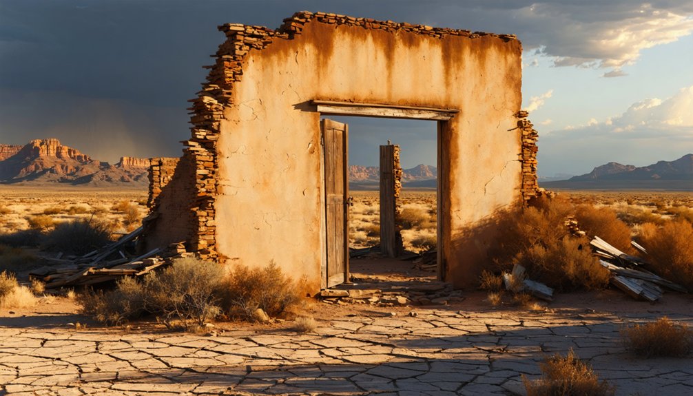
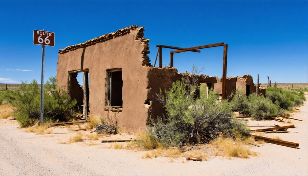
What remains is a converted trading post — now a church — and scattered foundations quietly reclaiming their place in the earth.
Walking the site connects you directly to Mentmore’s ghost town history, where families once lived in company-owned homes with electricity and running water, and children caught free buses to school in Gallup.
The mines shut down in 1952, and the town followed. Today, the land is privately owned, so respect those boundaries, take in what remains, and let the silence tell the rest of the story.
How Did Mentmore Go From Boom Town to Ghost Town?
Mentmore’s story didn’t end with the mines — it started with them. When coal demand collapsed, so did everything else. Economic shifts crushed the town fast, leaving families with no reason to stay.
Here’s how the decline unfolded:
- 1918 – George Kaseman consolidated mining operations under Defiance Coal Company, briefly strengthening Mentmore’s economy.
- 1952 – Mining operations shut down completely, triggering immediate business closures.
- Post-1952 – Residents abandoned company-owned homes as jobs vanished overnight.
- 1975 – Only a handful of houses and a combination store remained standing.
You’re fundamentally walking through a timeline of collapse when you visit. The economic shifts weren’t gradual — they were sudden and total.
Today, a converted church and scattered foundations are all that remain of what was once a thriving coal community.
How Do You Get to Mentmore From Gallup?
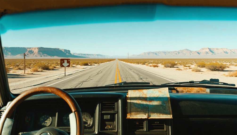
Getting to Mentmore couldn’t be simpler — take I-40 west from Gallup and exit at #16, then head north for one mile.
You’ll find yourself standing where Mentmore history unfolded, from its coal mining boom days to its quiet decline.
The site sits on private property, so respect those boundaries as you explore.
You won’t need much time here — a converted trading post turned church and scattered foundations are what remain.
But the surrounding McKinley County landscape tells its own story, with sagebrush stretching across land that once supported hundreds of miners and their families.
While you’re in the area, nearby ghost towns like Navajo, Allison, and Gamerco make perfect additions to your route, painting a vivid picture of the region’s coal-driven past.
Can You Actually Visit Mentmore as a Tourist?
You can visit Mentmore, but you’ll need to respect that the townsite sits on private property, so always seek permission before wandering beyond public access points.
What you’ll find is modest — a former trading post converted into a church and a scattering of foundations where company houses once stood.
Early morning visits on clear days offer the best light for photography and the most solitude for soaking in the quiet history of this nearly vanished coal town.
Private Property Access Rules
Before you load up the car and head west on I-40, understand one critical fact about Mentmore: the entire townsite sits on private property.
Respecting private property etiquette isn’t optional — it’s essential for ghost town preservation and your legal protection.
Follow these four rules before visiting:
- Get permission first — Contact the property owner before stepping foot on the land.
- Stay on public roads — You can view the church and foundations from established access points.
- Leave everything untouched — Don’t remove artifacts, disturb structures, or vandalize remaining foundations.
- No trespassing — Crossing unmarked boundaries without permission carries legal consequences.
True freedom means respecting others’ rights.
Honor those boundaries, and you’ll keep these fragile remnants accessible for future explorers.
What Remains To See
Once you’ve sorted out the property access question, the next natural step is figuring out what actually survives at Mentmore — and whether it’s worth the short detour off I-40.
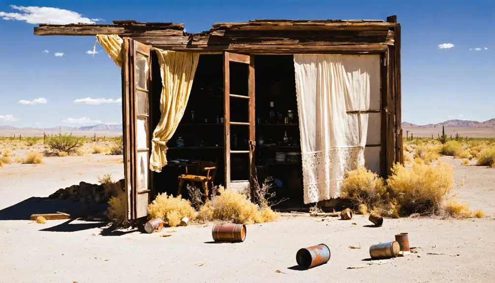
Honestly, it’s a lean site. The most recognizable structure standing today is a former trading post converted into a church. Beyond that, you’ll find scattered foundations poking through the sagebrush — quiet reminders of the company houses, school, and power plant that once supported 500 residents.
Don’t expect a dense collection of ghost town artifacts. Mentmore rewards visitors who appreciate subtle traces of mining history rather than dramatic ruins.
The landscape itself tells the story — a flat, open stretch where an entire coal community once hummed with daily life, then went silent after the mines shut down in 1952.
Best Times To Visit
Visiting Mentmore comes with a significant caveat: the townsite sits on private property, so there’s no formal public access, no designated parking area, and no posted hours.
Despite this, respectful roadside viewing remains possible year-round, and seasonal changes dramatically affect your experience.
Consider these practical timing factors:
- Spring (March–May) — Mild temperatures make roadside exploration comfortable before desert heat arrives.
- Fall (September–October) — Cooler air and clear skies enhance photography of remaining foundations.
- Avoid Summer Midday — New Mexico’s intense heat makes lingering unpleasant and potentially dangerous.
- Winter Visits — Low tourist traffic means solitude while reflecting on Mentmore’s historical significance.
Always respect property boundaries, stay on public road access points, and treat this forgotten coal town with the dignity its history deserves.
What Will You Find When You Arrive at Mentmore?
What remains of Mentmore today is a quiet study in absence. You’ll find a former trading post converted into a small church, standing as the most intact reminder of this town’s historical significance.
Scattered foundations punctuate the sagebrush, marking where company houses, a school, and a power plant once served a population of 500 coal workers. There’s little else.
That sparse landscape carries real weight, though. Walking among those crumbling foundations, you’re standing inside authentic mining heritage — a place where families lived, kids rode buses to Gallup for high school, and an entire economy ran on coal.
Those crumbling foundations aren’t ruins — they’re the actual shape of lives once lived on coal.
The mines closed in 1952, and Mentmore simply stopped. What you see now is exactly what that kind of ending looks like.
Which McKinley County Ghost Towns Are Worth Adding to Your Route?
Mentmore fits naturally into a broader loop through McKinley County’s coal-era ghost towns, and you’ve got several solid options nearby.
Each site adds another layer to Gallup history and the coal mining legacy that once defined this entire region.
- Navajo – A former coal camp with scattered remnants worth exploring.
- Allison – Another shutdown mining community sitting quietly in the sagebrush.
- Clarkville – Offers foundations and open land that reflect the area’s industrial past.
- Gamerco – One of the more intact stops, giving you a stronger sense of what these towns once looked like.
All four sit within easy driving distance of Mentmore.
Map your route before leaving Gallup, respect private property boundaries, and you’ll cover serious ground efficiently.
What Should You Bring for a Mentmore Ghost Town Visit?
Before you head out to Mentmore, pack sturdy walking shoes, water, a camera, and snacks, since you’ll find minimal shade and few modern conveniences at this remote, privately owned site.
Load offline maps or a reliable GPS app onto your phone, because cell service can be spotty along the rural roads off I-40 exit 16.
Most importantly, you’ll need to respect the private property boundaries, so research ownership beforehand and never cross fences or disturb the remaining church and foundations.
Essential Gear To Pack
Packing the right gear can make or break your visit to Mentmore’s sparse, sun-baked remains. Since you’re exploring privately owned land with minimal shade, preparation matters.
Ghost town photography demands good equipment, and capturing Mentmore’s historical significance means arriving ready.
- Camera or smartphone – Document the converted trading post church and scattered foundations before light fades.
- Water and snacks – No services exist on-site; New Mexico’s desert heat is unforgiving.
- Sturdy footwear – Uneven foundations and rocky terrain make solid boots essential.
- Printed maps or offline GPS – Cell service near Exit 16 can be unreliable, so don’t depend on connectivity.
Respect the property boundaries, travel light, and you’ll explore Mentmore’s coal-era remnants without unnecessary complications.
Making your way to Mentmore is straightforward on paper—exit I-40 at Exit 16 west of Gallup, head north one mile—but you’ll want reliable tools backing you up once you’re out there.
Cell service gets spotty in McKinley County’s high desert, so download offline map applications before leaving Gallup. Apps like Google Maps or Maps.me let you navigate without a signal.
Pair those with dedicated GPS tools mounted in your vehicle for a reliable backup layer. Mark the townsite coordinates ahead of time, since scattered foundations and a converted church don’t exactly announce themselves.
A paper map of the area never hurts either—it’s your failsafe when batteries die. Stay sharp about property boundaries, and you’ll move through the site confidently and respectfully.
Respecting Private Property
Since Mentmore sits on private property, you’ll want to arrive prepared with more than just curiosity. Property etiquette and local regulations aren’t suggestions here—they’re your roadmap to a respectful, hassle-free visit.
Pack these essentials before heading out:
- Permission documentation – Contact the landowner beforehand and carry written approval if granted.
- A detailed map – Know exactly where boundaries begin and end.
- Camera with zoom lens – Photograph foundations and the converted church without stepping into restricted zones.
- Leave-No-Trace supplies – Trash bags, closed-toe boots, and zero tolerance for removing artifacts.
Respecting boundaries keeps this historically rich site accessible for future explorers.
You’re visiting someone else’s land—treat it accordingly, and the experience rewards you fully.
Frequently Asked Questions
What Was the Original Name of Mentmore Before It Was Renamed?
You’ll find the original settlement was named Dilco, a name carrying significance tied to the Direct Coal Company that founded it in 1913. It’s only later, when the post office arrived, that it became Mentmore.
Who Purchased the Dilco Mine in 1918 and What Company Was Formed?
“History repeats itself” — In 1918, George Kaseman purchased the Dilco Mine, merging it with the Morris Mine, forming the Defiance Coal Company. This Mining History shift created lasting Economic Impact, shaping your exploration of Mentmore’s fascinating past.
How Many Grades Did the Mentmore School Teach Local Children?
You’ll find that Mentmore’s school history shaped local education through eight grades, giving kids a solid foundation right in town. For high school, you’d hop on a free bus heading straight into Gallup!
What ZIP Code Does Mentmore Still Retain Today Despite Being Abandoned?
You’d think abandoned means forgotten, but Mentmore’s ghost town history proves otherwise! Despite its empty streets, you’ll find it still retains ZIP code 87319—a small yet powerful symbol of zip code significance keeping this memory alive.
Approximately How Many People Lived in Mentmore at Its Peak Population?
At its peak, you’d have found around 500 people calling Mentmore home! This ghost town history reflects its mining significance, as coal operations once fueled a thriving community before silence claimed its streets forever.
References
- https://www.legendsofamerica.com/nm-mckinleycounty/
- https://www.visitgallup.com/blog/carbon-citys-coal-mining-legacy/
- https://en.wikipedia.org/wiki/List_of_ghost_towns_in_New_Mexico
- https://www.ghosttowns.com/states/nm/mentmore.html
- https://www.youtube.com/watch?v=yfu1BHLzrDA
- https://www.newmexico.org/places-to-visit/ghost-towns/
- https://newmexicotravelguy.com/new-mexico-ghost-towns/
- https://www.youtube.com/watch?v=ICa5i0napuw
- https://ahgp.org/nm/GhostTowns/ghost_townsnm.html
- https://www.tripadvisor.com/Tourism-g47112-Mentmore_New_Mexico-Vacations.html