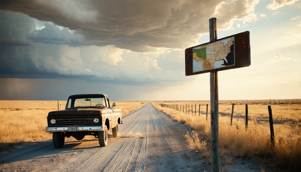
You’ll find Adobe Walls at coordinates 35.890890, -101.160420 in the Texas Panhandle, where paved roads deliver you to a windswept prairie that hasn’t changed in 150 years. The Panhandle-Plains Historical Society maintains this six-acre National Register site on Turkey Track Ranch, where granite markers rise among twisted cottonwoods and Billy Dixon’s grave overlooks the battleground where his legendary 1,538-yard rifle shot ended a three-day siege. Time your visit outside heavy rains, and you’ll discover why this remote preserve rewards those who venture beyond the obvious.
Key Takeaways
- Navigate to coordinates 35.890890, -101.160420 on paved roads, but avoid visiting during heavy rains.
- Explore the 5-acre preserve featuring granite markers, Billy Dixon’s grave, and remains of 1843 and 1874 trading posts.
- Learn about two historic battles: Kit Carson’s 1864 stand and the 1874 siege featuring Billy Dixon’s legendary shot.
- Visit the red granite monument erected in 1924 and view excavated adobe ruins from 1970s archaeological work.
- Respect National Register site boundaries and easement rights granted by landowners managing this remote prairie location.
Finding Adobe Walls: Directions and Access to Turkey Track Ranch
The high plains stretch endlessly toward the horizon as you leave Stinnett behind, a 28-mile ribbon of asphalt and caliche winding northeast toward one of the West’s most storied battlegrounds.
Your route carries you through sprawling farming operations before entering Turkey Track Ranch territory, where the Panhandle Historical Society’s 5-acre preserve awaits. Ranch ownership hasn’t closed these gates—the current owners granted easement rights, ensuring you can reach this National Register site without trespassing concerns.
Most 2WD vehicles handle the journey easily, though low-clearance cars struggle on the final approach. The road remains mostly paved, making the drive manageable for standard vehicles. Access restrictions are minimal: avoid heavy rains, respect the boundaries, and you’ll stand where twenty-eight buffalo hunters defied impossible odds.
The coordinates 35.890890, -101.160420 mark your destination, where history bleeds through prairie grass. Major archaeological excavations conducted in the 1970s unearthed artifacts that now help interpret the site’s layered past.
The Remote Prairie Landscape: What to Expect When You Arrive
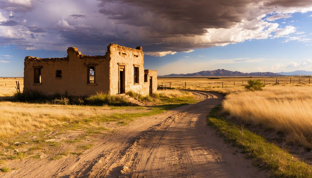
Stepping from your vehicle onto the hardpan, you’ll confront an emptiness that swallows sound and perspective. This open prairie environment stretches unbroken in every direction—the same vast tableland that greeted buffalo hunters in 1874.
Dense grasses ripple like ocean swells, concealing granite markers that would otherwise stand as the site’s only monuments. Along Bent Creek’s meandering course, weathered cottonwoods and willows punctuate the monotony, their twisted forms revealing the frontier isolation and remoteness that defined this outpost. Among these markers, one identifies the grave of Wild West legend William Billy Dixon. Dixon served as postmaster here after Adobe Walls received its post office in 1887, a position he held until 1901.
Nothing identifiable remains beyond those hidden stones. The Canadian River traces its path northward while Adobe Walls Creek opens eastward into emptiness. You’ll understand Billy Dixon’s impossible mile-long rifle shot here—the prairie ridges create natural sightlines across distances that defy modern comprehension. This landscape hasn’t changed in 150 years.
From Adobe to Sod: The Trading Posts That Defined the Frontier
Long before gunfire echoed across these grasslands, commerce carved its first foothold into the prairie. You’ll discover two distinct trading posts occupied this windswept junction. Bent, St. Vrain & Company’s 1843 operation began with tepees, showcasing log structure evolution before Mexican craftsmen arrived for adobe block processing in 1845. Their eighty-foot-square fort, with nine-foot walls, stood as evidence of permanent settlement ambitions. Despite its robust construction, Indian hostility forced sporadic occupation until the post’s complete abandonment by 1849.
Three decades later, buffalo hunters’ gold rush sparked different construction. The 1874 Myers and Leonard complex embraced sod and timber—materials born from necessity rather than permanence. Two competing stores, Hanrahan’s saloon, and O’Keefe’s blacksmith shop served 200-300 hide hunters who’d traded beaver pelts for buffalo commerce. The post’s location on the north bank of Canadian River provided strategic access to the hunting grounds that stretched across present-day Hutchinson County. Both outposts vanished, leaving only buried foundations and your imagination to reconstruct their weather-beaten facades.
The First Battle of 1864: Kit Carson’s Stand Against Tribal Warriors
Standing at Adobe Walls today, you’ll sense the desperation of November 1864, when Kit Carson‘s 400 soldiers faced a swelling tide of Kiowa and Comanche warriors—outnumbered three to one by afternoon, then possibly eight to one as riders streamed across the prairie.
He’d burned their winter village at dawn, but retreat became impossible when over 1,000 warriors encircled these crumbling adobe ruins. For six brutal hours, Carson’s howitzers roared against massed charges while his men huddled behind walls that had already witnessed one frontier’s death, now hosting another’s desperate stand.
When Carson finally fought his way back to his wagon train, he’d lost 3 killed, 15 wounded, though his forces had inflicted perhaps 100 casualties on their opponents. This marked the last time Comanche and Kiowa would force American troops to retreat, yet it signaled the beginning of the end for the plains tribes and their way of life.
Carson’s Raid and Retreat
When Kit Carson led his 335-man force east from Fort Bascom on November 12, 1864, he carried orders to strike hard at the Kiowa and Comanche winter camps along the Canadian River. His November 25th dawn attack routed Dohasan’s village, but the victory proved fleeting.
Thousands of warriors from nearby camps swarmed Adobe Walls, transforming hunter into hunted. You can almost hear those howitzer blasts echoing across the plains—decisive artillery that shattered mounted charges and saved Carson’s surrounded command. The expedition included 100 Indian scouts from the Utes and Basket Apaches who had secured concessions of sugar, coffee, and extra horses before agreeing to join. As ammunition dwindled and grass fires closed in, he ordered withdrawal.
The arduous retreat through smoke and sporadic attacks tested every man’s resolve, but Carson’s tactical brilliance preserved his force. Carson’s campaign ended with minimal casualties reported—2 soldiers killed, 10 wounded, 1 Indian killed, and 2 wounded—a testament to his defensive leadership under overwhelming odds. He’d struck the enemy’s stronghold and lived to tell it.
Outnumbered at the Ruins
Before the sun had climbed two hours past dawn on November 25, 1864, Carson’s cavalry thundered into Chief Dohäsan’s sprawling village of 176 lodges. You’d have watched women and children scatter while warriors rallied for counterattack.
By 10:00 A.M., Carson’s 335 soldiers faced something terrifying—several thousand Kiowa, Comanche, and Apache warriors converging on Adobe Walls’ crumbling adobe fortifications.
Imagine reinforcing defenses while enemy numbers swelled:
- Positioning howitzers at strategic corners
- Converting ruins into makeshift hospital
- Managing ammunition through six brutal hours
- Watching prairie grass ignite around your position
- Hearing carbines crack against charging warriors
Carson’s scouts engaged fiercely while shells dispersed massed attacks. By dusk, with ammunition dangerously low, he executed a masterful withdrawal—burning the captured village before retreating safely.
June 1874: When 28 Buffalo Hunters Faced 700 Warriors
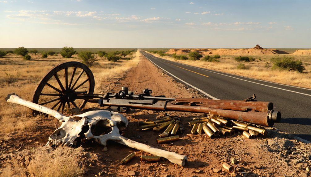
The dry Texas Panhandle air hung heavy on the morning of June 27, 1874, as twenty-eight buffalo hunters woke inside the crude adobe buildings at Adobe Walls. Within hours, Quanah Parker‘s leadership would unleash provoke an estimated 700 Comanche, Kiowa, Cheyenne, and Arapaho warriors against them.
You’ll find few stories of defiance matching this three-day siege. Native American tactics nearly succeeded—horses slaughtered, water cut off, bullets peppering adobe walls. But those Big Fifty Sharps rifles roared from windows and rooftops, creating devastating crossfire.
Warriors charged within a hundred yards before breaking against determined resistance. By battle’s end, three hunters and twenty-seven warriors lay dead. The siege collapsed, but it sparked the Red River War that’d forever change the Southern Plains.
Billy Dixon and the Legendary Mile-Long Shot
On the third day of siege, June 27, 1874, you’d have witnessed Billy Dixon—already a seasoned buffalo hunter who’d led the settlement’s founders to this bison-rich valley—borrow a .50 Sharps rifle and do something remarkable. From inside Hanrahan’s saloon, he aimed at a mounted warrior nearly a mile away on the eastern bluff and knocked him clean off his horse at 1,538 yards, a shot that still ranks among history’s longest recorded kills.
Dixon himself called it a “scratch shot,” never claiming full credit, but that single bullet changed everything—the warriors withdrew, realizing they’d ventured within range of weapons far deadlier than they’d imagined.
Dixon’s Background and Experience
Born into hardship on September 25, 1850, in Ohio County, West Virginia, Billy Dixon learned survival young—his mother died birthing her third child when he was just ten years old. He’d dreamed of Western adventures since boyhood, and by 1869, he’d transformed those dreams into reality.
Dixon’s buffalo hunting expertise made him legendary on the frontier:
- Employed ten skinners during peak operations, earning $1-$2 per hide
- Hunted across Texas Panhandle, Colorado, Kansas, and Oklahoma
- Stored wagonloads of hides at Adobe Walls
- Demonstrated remarkable marksmanship with his carbine
- Scouted territory as far south as Salt Fork of Red River
His civic and later career roles followed naturally—first sheriff of Hutchinson County, postmaster, land commissioner, and justice of the peace after retiring from frontier life in 1883.
The Historic 1,538-Yard Shot
After two grueling days of defending Adobe Walls against hundreds of Comanche, Cheyenne, and Kiowa warriors, Billy Dixon spotted trouble on the horizon. A small band of Comanche scouts sat mounted nearly a mile east—well beyond his .45 Sharps’ reach.
He borrowed a .50 Sharps buffalo rifle, its octagonal 34-inch barrel designed for impossible distances. Elevating the Big Fifty as high as it’d go, Dixon fired a single round, letting it arc through the morning air like divine intervention.
The bullet dropped 1,538 yards downrange, knocking a warrior from his saddle. Dead.
The shot accuracy and rifle performance were nothing short of legendary—some call it folklore, but Dixon called it a “scratch shot.” Whatever you believe, that thunderclap echoed freedom across the Texas plains, sending the raiders home.
Legacy and Final Resting
The frontier’s most celebrated marksman didn’t ride off into legend’s sunset—he planted roots in the very soil he’d defended. Billy Dixon transformed from warrior to builder, carving civilization from wilderness near Adobe Walls. He’d marry Olive King Dixon, who’d endure as Hutchinson County’s sole woman for three years, raising seven children in territory most considered uninhabitable.
His civilian service shaped the Panhandle:
- First postmaster at Adobe Walls for twenty years
- Inaugural sheriff of Hutchinson County
- Justice of the peace
- State land commissioner
- Orchardist and rancher on historic battleground
When death claimed him March 9, 1913, Billy Dixon’s final resting place became Oklahoma soil—yet his Medal of Honor rests in Canyon’s Great Plains Museum, bronze emblem/symbol/representation of freedom’s price on Texas prairie.
Monuments, Graves, and Archaeological Treasures at the Site
Standing sentinel over the windswept plains, a red granite monument has marked this hallowed battleground since June 27, 1924, when it was erected to honor those who fought in the desperate clash of 1874. You’ll discover preserved graves here, including William “Billy” Dixon’s final resting place—his remains relocated from Texline cemetery in 1929 to lie among his fellow fighters.
The Panhandle-Plains Historical Society maintains this six-acre tract, where historical markers detailing battles guide you through layers of frontier violence. Major excavations in the 1970s unearthed adobe trading post remains, earning the site recognition as both a Recorded Texas Historic Landmark and National Register listing in 1978.
Find these monuments along SH 207, one mile south of SH 136 near Stinnett, where history speaks without government interpretation.
Essential Preparations for Your Adobe Walls Road Trip
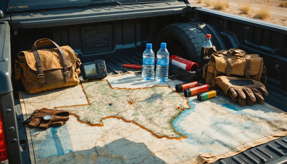
Before you set out to visit these monuments and graves that guard frontier memory, you’ll need to plot your course across one of the Texas Panhandle’s most isolated stretches. To prepare equipment and understand rural terrain, gather essentials before leaving civilization behind:
Plot your course carefully—this isolated stretch demands preparation before you leave civilization’s reach behind.
- Water and fuel: Stock up in Borger or Spearman—no services exist between
- Navigation tools: Download the Hutchinson County Museum’s driving map before losing signal
- Camera gear: Capture pronghorn herds racing across golden grasslands
- Road supplies: Pack wet wipes and trash bags for dusty gravel stops
- Wildlife awareness: Know animal encounter protocols for deer and coyote country
Your normal car handles the route fine, though tight ninety-degree turns demand respect. The gravel shifts beneath your tires as pavement surrenders to ranch roads, crossing cattle guards toward history’s battleground.
Nearby Historical Sites and Museums Worth Visiting
Borger’s Hutchinson County Historical Museum anchors your Adobe Walls pilgrimage with artifacts that breathe life into buffalo hunters’ final stand. You’ll walk through a replica trading post at 618 North Main Street, where Quanah Parker’s story unfolds through historic museum exhibits that Tuesday-through-Saturday pilgrims shouldn’t miss.
The Panhandle-Plains Historical Museum guards the actual battleground—six acres they’ve protected since 1923. Their archeological excavations in the 1970s unearthed charred posts and traders’ belongings from that violent June morning.
You’ll find the site sixteen miles down dusty roads from Highway 207, where granite monuments pierce the grass and offerings still accumulate at Billy Dixon’s grave. Freedom seekers discover truth in these windswept places—where commerce met resistance, where empires collided beneath endless Texas sky.
Frequently Asked Questions
Is Adobe Walls Actually a Ghost Town With Former Residents?
Yes, Adobe Walls qualifies as a genuine ghost town. You’ll find archaeological evidence of former inhabitants—buffalo hunters, traders, and homesteaders like Billy Dixon—who once thrived here before abandoning this windswept prairie crossroads forever.
Can I Camp Overnight at the Adobe Walls Site?
No, you can’t camp overnight at Adobe Walls—there aren’t camping facilities available to protect the site’s integrity. However, you’ll find nearby accommodation options in surrounding towns, letting you explore this haunting landmark while respecting its preserved history.
Are There Guided Tours Available at Adobe Walls?
Guided tours are unavailable at Adobe Walls, but you’ll find freedom exploring independently. The site’s historical significance can be explored through weathered markers and crumbling ruins, where you’ll walk the same ground where buffalo hunters once stood defiant.
What Happened to Quanah Parker After the 1874 Battle?
From warrior to bridge-builder, Quanah Parker’s leadership transformed after 1874. You’ll find his later life remarkable—he surrendered in 1875, became principal Comanche chief, then thrived as a rancher while befriending presidents and honoring his people’s spirit.
Why Did Buffalo Hunters Choose This Specific Location for Trading?
You’ll find hunters picked this spot where Native American trade routes crossed the Canadian River’s life-giving waters. The strategic geographic location offered defensible terrain, abundant buffalo herds, and accessible supply lines—freedom’s perfect frontier marketplace.
References
- https://texoso66.com/2021/07/29/adobe-walls/
- https://tabacrosstexas.com/2019/06/15/billy-dixon-and-adobe-walls/
- https://www.legendsofamerica.com/tx-adobewalls/
- https://texastimetravel.com/blog/echoes-of-adobe-walls/
- https://www.tshaonline.org/handbook/entries/adobe-walls-tx
- https://www.tripadvisor.com/Attraction_Review-g55512-d6890468-Reviews-Adobe_Walls-Borger_Texas.html
- https://texags.com/forums/39/topics/3290730
- https://cursedplaces.com/spot/adobe-walls
- https://www.topozone.com/texas/brewster-tx/locale/adobe-walls/
- https://www.topozone.com/texas/brewster-tx/summit/adobe-walls-mountain/


