To plan your ghost town road trip to Apua, Hawaii, drive south from Hilo on Highway 11 for roughly 50 miles until the road meets the raw Kaʻū coastline. You’ll find no signs, foundations, or tourist infrastructure—just nature’s complete reclamation of a village erased by the 1868 earthquake and tsunami. Pack water, rain gear, and offline maps before heading out. The full story of what happened here, and what surrounds it, runs much deeper.
Key Takeaways
- Apua was destroyed by an 1868 earthquake and tsunami, leaving no structures; nature has fully reclaimed the coastal landscape.
- Drive south from Hilo on Highway 11 for approximately 50 miles, where volcanic terrain replaces lush forest near the shoreline.
- Bring four-wheel drive, rain gear, water, offline maps, and sturdy footwear, as services and infrastructure are extremely sparse.
- Nearby ghost towns Honuʻapo, Kaimū, Kalapana, and Hoʻokena each tell stories of destruction by tsunamis, lava flows, and earthquakes.
- Ancient cultural sites including petroglyphs, heiau platforms, and coastal fishing ponds enrich the Kaʻū coast with deep Hawaiian heritage.
What Destroyed Apua in 1868 and Why It Was Never Rebuilt
On April 2, 1868, one of Hawaii’s most powerful earthquakes struck the Big Island, triggering a devastating tsunami that swept through the Ka’ū coast and wiped Apua off the map entirely.
The tsunami impact was catastrophic and immediate, leaving survivors with nothing to rebuild on. Unlike other communities that demonstrated community resilience by returning after disasters, Apua’s residents never came back.
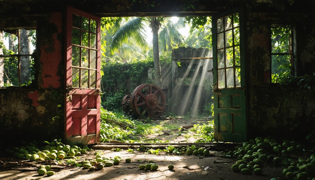
The landscape itself seemed to reject any future settlement, quickly reclaiming the land through dense vegetation and coastal erosion. No buildings survived, no street grids remained, and no reconstruction ever began.
What you’ll find today isn’t a frozen moment in time like typical ghost towns — it’s a site where nature completely erased human presence, transforming a living Hawaiian village into an archaeological memory absorbed by the surrounding environment.
Where Apua Sits Along the Kaʻū Coast Today
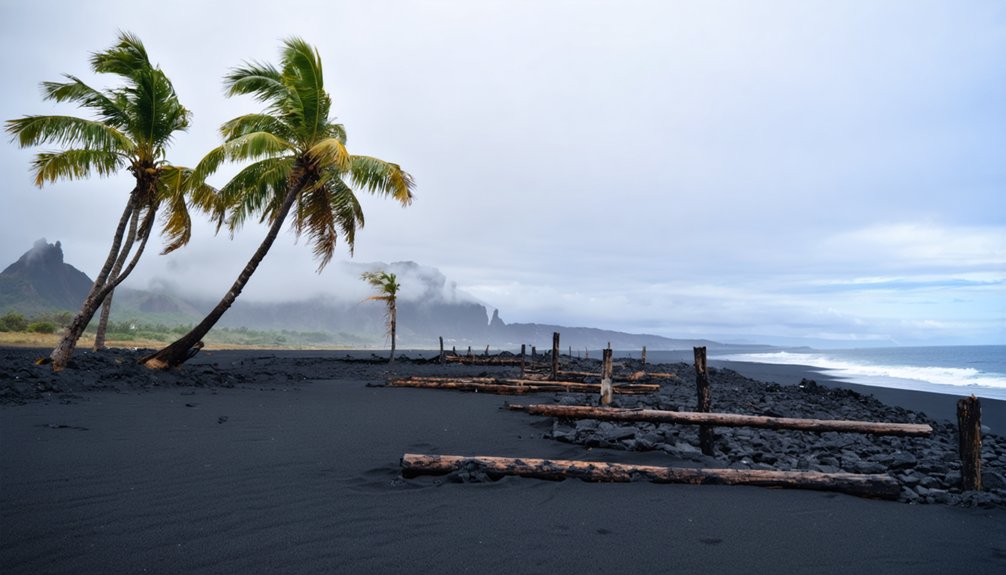
Today, Apua exists as little more than a geographical whisper along the Kaʻū coast, tucked into one of the Big Island’s most remote and rugged stretches of shoreline.
Apua geography has been dramatically reshaped by coastal erosion, volcanic activity, and relentless wave action since the 1868 disaster. You won’t find street grids, foundations, or signage marking what once stood here.
The landscape has fully reclaimed the site, blending it into the raw, windswept coastline that defines this southern edge of Hawaii. Lava fields meet ocean with little ceremony.
If you’re craving unfiltered, untouched history without tourist infrastructure, Apua delivers exactly that. It’s a place you read in the land itself rather than on any plaque.
How to Drive From Hilo to Apua on Highway 11
Getting to that raw, wordless coastline starts with a straightforward drive south out of Hilo on Highway 11.
You’ll cut through the Kaʻū district, watching the landscape shift from lush upland forest to stark volcanic terrain. The drive runs roughly 50 miles, passing through small towns before the coast opens up near the Apua area.
Pull over where the road edges closest to the shoreline and let the silence tell you where you are.
There’s no signpost marking ghost town exploration here — natural reclamation has done its quiet work thoroughly. You’re reading the land itself.
Pair this stretch with stops at Honuʻapo and Kalapana to build a full picture of how Hawaii’s coast has repeatedly absorbed, then erased, the communities built along it.
Which Ghost Towns Sit Closest to Apua on the Kaʻū Route?
As you travel the Kaʻū coast, you’ll find several ghost towns within close reach of Apua, each erased by its own natural catastrophe.
Honuʻapo, just up the coastline, suffered destruction from the 1946 tsunami, while Kaimū and Kalapana met their end beneath Kīlauea’s lava flows in 1990.
Continuing north, you’ll reach Hoʻokena, a once-thriving fishing village that declined sharply after a 1951 earthquake and subsequent storms drove its residents away.
Honuʻapo’s Tsunami Destruction
Hugging the same rugged Kaʻū coastline as Apua, Honuʻapo stands as your closest ghost town companion on this southern Big Island route.
Honuʻapo history mirrors Apua’s tragic arc — a thriving coastal community erased by unstoppable natural forces. In 1946, a devastating Pacific tsunami swept through, destroying what had been a functioning sugar-era port town. Tsunami impacts here weren’t gradual; they were sudden and total, stripping structures and displacing residents almost overnight.
Unlike Apua, Honuʻapo had already weathered decades of economic decline before the waves delivered the final blow.
Today, you’ll find remnants absorbed into shoreline vegetation, with crumbling foundations hinting at former activity. Walking this site alongside your Apua exploration deepens your understanding of how Hawaii’s coastlines have repeatedly claimed their settlements back.
Kaimū And Kalapana Buried
Shifting north along the Big Island’s eastern flank, you’ll encounter two more ghost towns swallowed not by water but by lava. Kaimū history traces back to a thriving coastal community that Kīlauea’s 1990 flows erased entirely, burying black sand beaches, homes, and roads under hardened rock.
Kalapana suffered the same fate, its neighborhoods consumed by relentless lava advancing from the volcano’s ongoing eruption.
Yet Kalapana revival efforts introduced something unexpected — a new black sand beach eventually formed where destruction once dominated. You can walk the lava fields today, spotting foundations and remnants beneath your feet.
Both towns remind you that Hawaii’s landscape constantly transforms, reclaiming or reshaping everything. Add these stops to your Kaʻū route for a vivid lesson in volcanic power.
Hoʻokena’s Post-Earthquake Decline
Continuing west along the Kaʻū coast, you’ll find Hoʻokena standing as another example of how natural disasters quietly dismantled once-active Hawaiian communities.
After the 1951 earthquake and subsequent storms battered the settlement, residents gradually abandoned what had been a thriving coastal village. Unlike Kaimū and Kalapana, lava didn’t claim Hoʻokena — relentless natural forces simply made staying impractical.
Today, Hoʻokena offers a Hōʻike Historical perspective on Coastal Resilience, showing how Hawaiian communities adapted, retreated, and ultimately surrendered ground to nature’s authority.
You’ll notice the landscape has reclaimed much of what once defined daily life here. Adding Hoʻokena to your route deepens your understanding of why the Kaʻū coast holds so many layered, quietly powerful stories of loss and transformation.
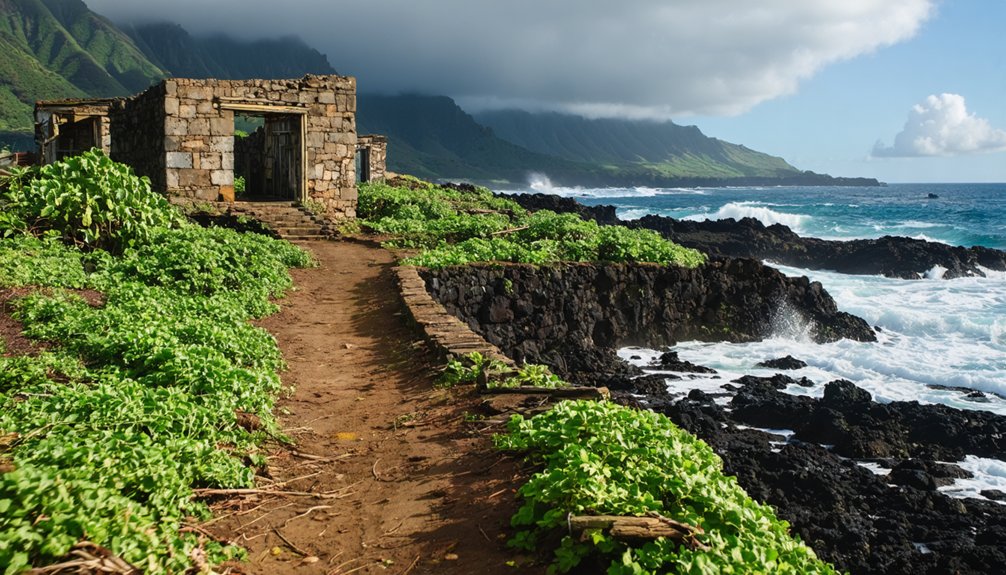
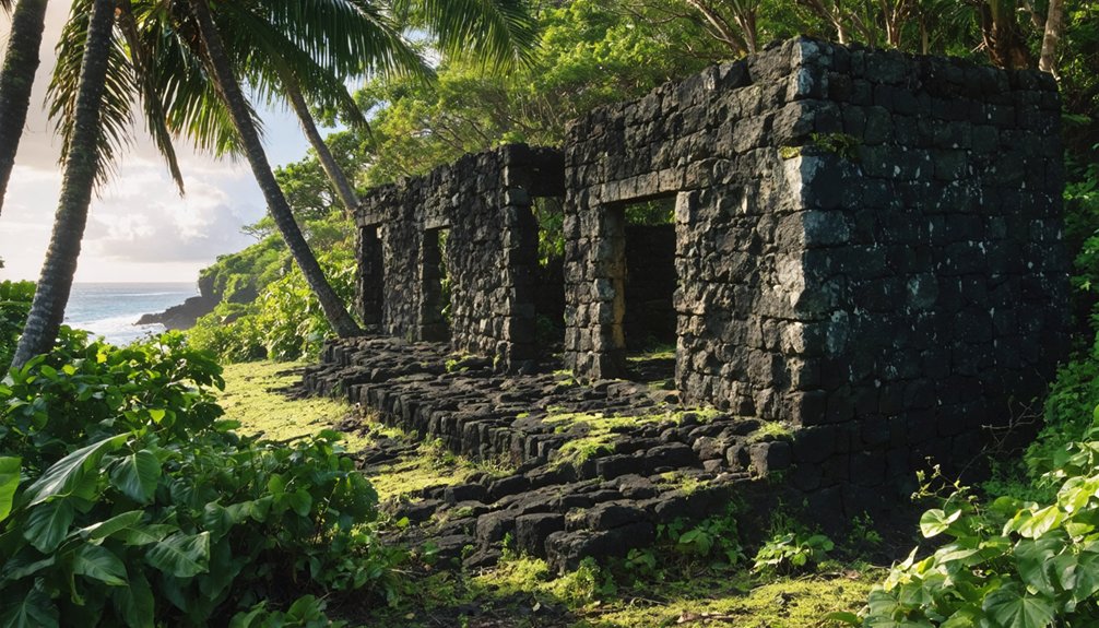
No Buildings, No Signs: What Apua Actually Looks Like on Arrival
When you arrive at Apua, there’s nothing to announce it — no weathered signpost, no crumbling foundation, no rusted gate hinting at what once stood here. The 1868 earthquake and tsunami erased this settlement so completely that the Apua landscape absorbed every trace of human presence.
Vegetation, rock, and coastline have reclaimed what families once called home.
What you’re actually encountering is a historical narrative written in absence. The story lives beneath your feet, in the soil, tide pools, and lava formations surrounding you.
No street grid survives. No walls remain. Instead, you’re standing inside a living archaeological layer, where nature has quietly buried an entire community.
That erasure is exactly what makes Apua so striking — and so worth the drive.
What Ancient Sites and Landmarks Surround Apua
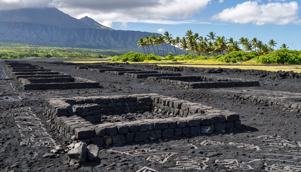
Once you step beyond Apua’s silent, reclaimed shoreline, you’ll find the surrounding Kaʻū coast rich with ancient Hawaiian cultural sites worth exploring.
Petroglyphs and ceremonial grounds lie within reach, offering tangible connections to pre-contact and 19th-century Hawaiian life that Apua itself can no longer provide.
You’ll also discover coastal fishing ponds nearby, engineered by early Hawaiians to sustain communities much like the one the 1868 disaster erased.
Nearby Petroglyphs And Ceremonial Sites
Though Apua itself has vanished beneath the landscape, the surrounding Kaʻū coast holds layers of ancient history you can still explore.
Petroglyph significance runs deep here, with carved rock images recording ceremonial practices, genealogies, and daily life from centuries past.
Nearby sites worth adding to your route include:
- Punaluʻu petroglyphs – ancient carvings etched into lava fields along the black sand coastline
- Heiau ceremonial sites – stone platforms where Hawaiians performed sacred rituals and offerings
- Fishing ponds – engineered by early Hawaiians, reflecting sophisticated resource management
- Places of refuge – coastal sanctuaries offering protection under traditional Hawaiian law
These sites transform your ghost town drive into something richer — a direct encounter with Hawaiian culture stretching far beyond the 19th century.
Coastal Fishing Ponds Nearby
Beyond the carved stones and ceremonial platforms, the Kaʻū coast holds another remarkable layer of ancient engineering: the coastal fishing ponds that once fed Hawaiian communities for generations.
These loko iʻa, or fishponds, represent sophisticated aquaculture systems that Hawaiian settlers built directly into coastal ecosystems, managing fish populations with remarkable precision.
As you explore the coastline near Apua, you’ll encounter remnants of these structures integrated into the shoreline. They reflect fishing traditions that sustained villages long before Western contact, blending ecological knowledge with practical engineering.
Walking these shores, you’re seeing more than ruins. You’re witnessing how ancient Hawaiians cultivated their environment rather than simply extracting from it.
These ponds add essential historical depth to your ghost town exploration along the Big Island coast.
What to Bring and How to Prepare for the Kaʻū Coastal Loop
Preparing for the Kaʻū Coastal Loop means thinking carefully about terrain, weather, and the remote nature of sites like Apua.
Understanding Apua history means accepting that landscape reclamation has erased structures entirely, leaving rugged, unmarked ground as your guide.
Pack smart before you head out:
- Four-wheel drive vehicle — coastal paths demand serious clearance and traction
- Rain gear and sturdy footwear — wet conditions arrive fast along Kaʻū’s coast
- Water and snacks — services are sparse between ghost town stops
- Offline maps and a charged phone — cell coverage drops in remote stretches
You’re exploring land that nature has fully reclaimed, so come self-sufficient and curious.
The reward isn’t a preserved Main Street — it’s raw Hawaiian coastline layered with powerful, largely forgotten history.
How the 1868 Disaster Shaped Settlement Along the Kaʻū Coast
When the April 2, 1868 earthquake struck Hawaii Island, it didn’t just shake the ground — it triggered a tsunami impact that swept Apua and several Kaʻū coastal settlements completely off the map.
What had been a functioning Hawaiian village vanished within hours, leaving no buildings, no streets, and no reason for survivors to return.
That single disaster permanently altered settlement patterns along this coastline. Communities that once thrived near the water’s edge were never rebuilt. People moved inland or relocated entirely, and the land quietly reclaimed what humans had abandoned.
You’re not just visiting a ghost town when you explore Apua — you’re standing inside a geography reshaped by catastrophe. The coast itself became a monument to how quickly nature can erase a community’s entire existence.
Frequently Asked Questions
Can Children Safely Visit Apua’s Rugged Coastal Terrain?
Yes, children can visit, but you’ll need to prioritize family safety and child preparedness. Wear sturdy shoes, bring water, and stay alert on Apua’s rugged coastal paths. It’s an unforgettable adventure when you’re ready!
Are Permits Required to Access Apua as an Archaeological Site?
You don’t typically need permits to visit Apua, but you’ll want to respect its archaeological significance and support conservation efforts by staying on designated paths and avoiding disturbance of any historical remnants you encounter.
Is Apua Accessible to Visitors With Mobility Limitations?
Like rugged waves meeting shore, Apua’s terrain challenges you greatly — it lacks mobility options and accessibility features. You’ll navigate uneven coastal paths with no infrastructure, making visits difficult if you have mobility limitations.
What Months Offer the Best Weather for Visiting Apua?
You’ll find the best local climate for visiting Apua between April and October. These drier months reveal prime seasonal activities, letting you freely explore the coast, archaeological traces, and Hawaii’s stunning, reclaimed natural landscape.
Are Guided Tours of Apua Available for Booking in Advance?
No dedicated guided tour options exist for Apua, but you’ll find local tour companies offering Big Island ghost town excursions that include the site. Book these adventures in advance to secure your spot!
References
- https://en.wikipedia.org/wiki/List_of_ghost_towns_in_Hawaii
- https://nvtami.com/2023/04/26/big-island-hawaii-ghost-towns/
- https://www.youtube.com/watch?v=daDv94EEpqs
- https://www.youtube.com/watch?v=3tGSM9Xl-4M
- https://www.tripadvisor.com/Attractions-g28932-Activities-c42-t226-Hawaii.html
- http://www.gribblenation.org/2017/12/throwback-thursday-aqua-fria-national.html
- https://balabanovaallover.com/humuhumunukunukuapuaa/