Planning a ghost town road trip to Basil, Kansas starts on Highway 81, winding through Kingman County’s quiet prairie roads. Founded in 1874, Basil once supported 72 residents, two general stores, and railroad connections before agricultural shifts emptied its streets. Today, you’ll find scattered foundations, root cellars, and railway traces waiting for self-guided exploration. Visit in spring or fall for the best conditions, and bring offline maps, a camera, and curiosity — there’s far more to uncover here than first meets the eye.
Key Takeaways
- Start your trip on Highway 81, following Kingman County’s paved roads to reach Basil’s overgrown streets and weathered signs.
- Visit in spring or fall for mild weather; summer requires extra water, while winter reveals hidden structural remnants.
- No reservations or guides are needed; explore foundations, root cellars, and railway traces independently at your own pace.
- Bring offline maps, printed topographic guides, and GPS tools to navigate patchy cell service and document key sites.
- Extend your road trip by visiting nearby ghost towns like Runny Meade, Centropolis, and Neoso Falls in surrounding counties.
What Is Basil, Kansas Ghost Town?
Tucked away in Kingman County, Kansas, Basil’s a ghost town that’s quietly faded into the prairie — a once-thriving railroad settlement that the modern world has largely forgotten.
The Fical brothers founded it in 1874, and it grew into a legitimate trading hub along the Hutchinson-Oklahoma-Gulf Railroad. By 1910, 72 residents called it home, supporting two general stores and a restaurant.
But agricultural shifts and economic changes hollowed it out, leaving behind foundations, overgrown streets, and territorial-period cemeteries.
Local legends add an eerie layer to an already atmospheric place. While formal preservation efforts remain minimal, GIS mapping and drone surveys now document what’s left.
You’re stepping into a raw, unfiltered slice of Kansas history — no guides, no crowds, just you and the land.
How Did Basil Go From Railroad Hub to Ghost Town?
Once a legitimate railroad hub threading commerce through Kingman County, Basil’s decline followed a familiar Kansas pattern — agricultural mechanization reshaped the economy, and the small trading posts and general stores that once sustained 72 residents simply couldn’t compete.
As farming required fewer hands and regional trade consolidated elsewhere, residents gradually packed up and left.
You can trace this collapse through the town’s cultural significance — it wasn’t just a stopping point, it was a living community with telephone lines connecting it to Kingman and rail lines pushing goods southward.
Today, preservation efforts through GIS mapping and drone surveys document what remains: scattered foundations, root cellars, and ghostly street traces.
Basil didn’t vanish overnight — it quietly surrendered to forces reshaping the entire American countryside.
What Physical Remains Can You Still See at Basil?
When you walk through what’s left of Basil, you’ll find scattered building foundations, root cellars, and old wells that hint at the town’s former life.
You can also spot railway traces where the Hutchinson-Oklahoma-Gulf Railroad once carried agricultural goods out of the county.
If you keep exploring, you’ll discover territorial-period cemeteries with still-legible markers, offering a quiet, sobering connection to the people who once called this place home.
Visible Structural Remnants
Although little remains of Basil’s once-bustling infrastructure, you’ll still find enough physical traces to piece together the town’s former layout. Scattered building foundations break through the earth, marking where general stores and homes once stood. Urban decay has claimed most structures, yet the architectural remnants tell a compelling story of a community that thrived during the railroad era.
You’ll notice railway traces and scattered rail lines still cutting across the landscape, reminding you of Basil’s former role as a transportation hub.
Root cellars and old wells dot the area, while territorial-period cemeteries preserve weathered markers from early settlers.
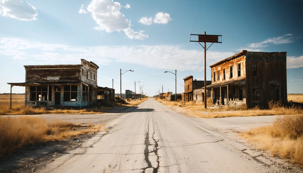
Overgrown streets grid the site in recognizable patterns, giving you a genuine sense of how residents once moved through their daily lives.
Railway And Cemetery Traces
Stretching across the landscape like ghostly veins, the old railway traces at Basil remain among the site’s most striking physical features. You’ll spot scattered rail lines that once connected this humble station to the Hutchinson-Oklahoma-Gulf Railroad, quietly testifying to the town’s former economic pulse.
Walk a little further, and you’ll discover territorial-period cemeteries bearing weathered markers that carry deep cultural significance. These graves anchor Basil’s human story in the soil, reminding you that real lives unfolded here long before abandonment claimed the town.
Historical preservation efforts, including GIS mapping and drone surveys, have documented these traces precisely. As a self-guided explorer, you’re free to move through this open landscape, reading its layers at your own pace, connecting directly with a vanished world.
How Do You Get to Basil From Highway 81?
Starting your journey on Highway 81, you’ll find Basil tucked away in Kingman County, just a short drive from the main corridor.
From Highway 81, you’ll navigate a series of paved county roads that wind through the flat Kansas landscape toward the site.
The final approach brings you directly to the ghost town’s remnants, where overgrown streets and scattered foundations await your exploration.
Highway 81 Starting Point
Highway 81 serves as your gateway to Basil, and once you’re on it, the route is straightforward. You’ll travel county roads connecting directly to this site of historical preservation and urban decay.
Follow these steps from Highway 81:
- Head west from Highway 81 onto the designated county road nearest Kingman County’s southern grid.
- Drive approximately several miles until scattered foundations and overgrown streets appear along the roadside.
- Watch for weathered street signs marking former intersections where the town once thrived.
- Park along the paved county road shoulder and begin your self-guided exploration freely.
You won’t need a guide or reservation. The open landscape invites independent discovery, letting you move at your own pace through what remains of this forgotten Kansas settlement.
Once you’re off Highway 81 and onto the county road network, steering to Basil requires a bit of attention but nothing intimidating. The paved county roads connecting the site are manageable in most vehicles, though local flora — dense prairie grasses and sprawling shrubs — can obscure signage along the quieter stretches. Keep your eyes sharp.
Weather patterns in Kingman County shift quickly, so check conditions before heading out. Spring rains can soften road shoulders, while summer heat creates shimmering mirages that distort distances. You’ll want a reliable map or downloaded offline GPS route since cellular coverage thins considerably out here.
Watch for weathered street signs marking what remains of Basil’s grid. They’re still standing, still pointing somewhere — quiet proof that this forgotten place once had an address worth finding.
Final Approach Route
How far does a stretch of open Kansas highway carry you before the land itself becomes the map? From Highway 81, you’ll navigate paved county roads directly to Basil’s ghost-touched grounds.
Follow these four steps:
- Head west off Highway 81 into Kingman County’s open terrain
- Watch for intersecting county roads that parallel old railroad traces
- Slow down where overgrown streets and weathered signs appear
- Trust the landscape — local legends guide you better than GPS here
No staff greets you. No entrance fee stops you. Preservation efforts have kept the route accessible, letting you arrive entirely on your own terms.
The road doesn’t just lead you somewhere — it returns you to something raw, unfiltered, and genuinely free.
When Is the Best Time to Visit Basil, Kansas?
Timing your visit to Basil, Kansas, can make a significant difference in what you experience at this remote ghost town. Spring and fall offer the most rewarding conditions — mild temperatures let you roam freely without summer’s brutal heat or winter’s biting winds.
Timing your visit to Basil, Kansas matters — spring and fall offer the most rewarding, comfortable conditions for exploration.
Late April through May reveals wildflowers pushing through cracked foundations, adding unexpected beauty to the decay. September and October bring crisp air and softer light, perfect for photography.
Summer visits are possible but demanding, so carry extra water. Winter strips the landscape bare, exposing structural remnants that overgrowth otherwise conceals — useful if preservation efforts or research motivate your trip.
Local folklore suggests autumn evenings carry an especially eerie atmosphere around the old cemetery markers. Whatever season you choose, arrive during daylight for safe, thorough exploration.
What Should You Bring to Basil Ghost Town?
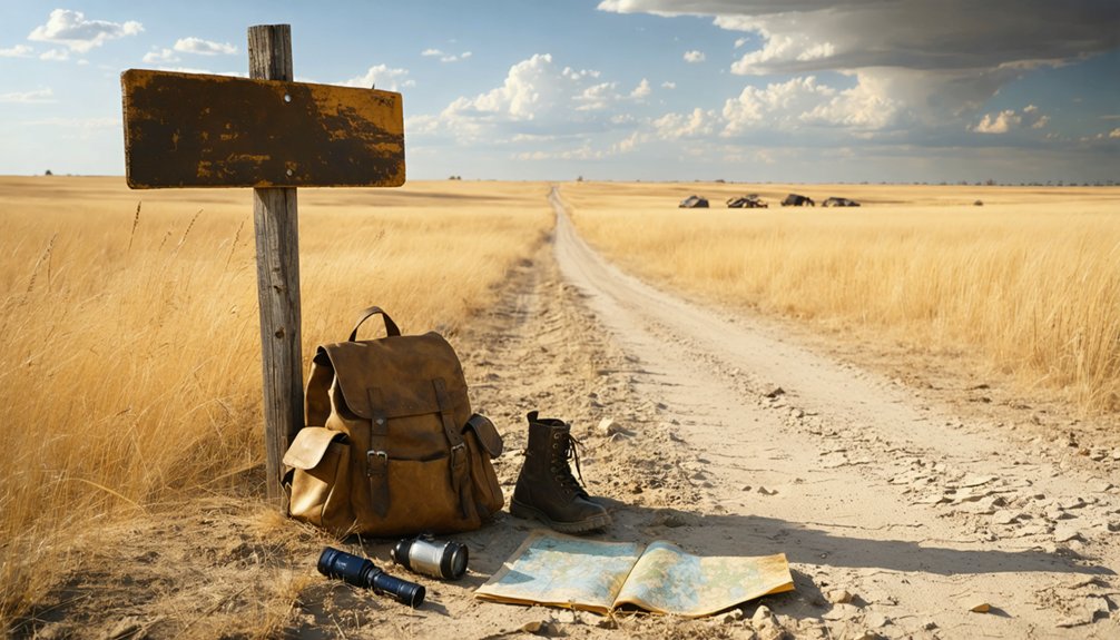
Before you head out to Basil’s overgrown streets and crumbling foundations, pack essential safety gear like sturdy boots, a first aid kit, and a flashlight to navigate the uneven terrain safely.
Since the ghost town is entirely self-guided with no staff on-site, you’ll want reliable navigation tools — download offline maps and bring printed county road guides to locate the site off Highway 81.
Don’t forget your photography equipment, including a wide-angle lens and extra batteries, because the weathered remnants, scattered foundations, and railway traces make for compelling shots you won’t want to miss.
Essential Safety Gear
Exploring Basil’s crumbling foundations and overgrown streets means venturing into terrain where hazards hide in plain sight, so you’ll want to pack smart before hitting those county roads off Highway 81.
Historical preservation efforts can’t protect every root cellar or unstable wall, and local legends won’t warn you when the ground shifts unexpectedly.
Pack these four essentials before you go:
- Sturdy boots — ankle support protects against uneven foundations and hidden debris.
- First aid kit — remote locations demand self-sufficiency when help is miles away.
- Flashlight with extra batteries — shadows inside abandoned structures conceal real dangers.
- Detailed county map or GPS — cell service is unreliable across Kingman County’s rural roads.
Stay sharp, stay free, and explore responsibly.
Exploring Kingman County’s rural road network demands more than a smartphone and good intentions, so you’ll want to arrive at Basil prepared with multiple tools. Download offline maps before leaving, since cell service gets patchy along the county roads connecting to Highway 81. Carry printed topographic maps alongside your digital backups — technology fails, paper doesn’t.
Thirteen preserved historical maps document Basil’s settlement patterns, and studying them beforehand transforms your visit from casual wandering into meaningful historical preservation work. You’ll recognize structure locations from the 1910 peak population era using modern GIS overlays available through county archives.
Mark your route waypoints in advance, noting root cellars, railway traces, and foundation clusters. Understanding urban decay means reading the landscape intentionally — and proper navigation tools let you do exactly that, freely and confidently.
Photography Equipment Checklist
Capturing Basil’s haunting landscape rewards photographers who pack intentionally, so you’ll want a versatile kit that handles both wide open prairie light and shadowed interior decay.
Historical preservation depends partly on documentation like yours, making your photography techniques genuinely meaningful beyond personal art.
- Wide-angle lens — Frames overgrown streets and scattered foundations against Kansas’s expansive sky.
- Polarizing filter — Cuts glare on weathered surfaces and deepens contrast in exterior shots.
- Portable LED panel — Illuminates root cellars and shadowed ruins without disturbing fragile structures.
- Spare batteries and memory cards — No charging stations exist here; you’re completely self-reliant.
Shoot during golden hour when raking light reveals texture across crumbling foundations, transforming decay into compelling visual storytelling that honors Basil’s forgotten history.
What Do Historical Maps and Drone Surveys Reveal About Basil?

Though the town of Basil has long faded from daily life, thirteen preserved historical maps keep its memory surprisingly intact. These documents of historical cartography reveal settlement patterns from Basil’s 1910 peak, pinpointing where general stores, railroad infrastructure, and homes once stood.
Pair those maps with modern drone imaging, and you’ll uncover something remarkable. GIS-enhanced aerial surveys overlay old structure locations onto today’s overgrown landscape, letting you see exactly where buildings once anchored this small community.
You can cross-reference what the drone captures — foundations, rail traces, old wells — against what historical records documented during Basil’s minor village years around 1912.
This combination of old maps and aerial technology transforms your visit from casual wandering into genuine discovery, giving you a sharper, more grounded understanding of what once existed here.
How to Document Your Visit to Basil Ghost Town
Once you’ve used those historical maps and drone data to understand what stood where, documenting what you actually find on the ground becomes the natural next step. You’re contributing to historical preservation every time you record what remains.
Follow these four documentation steps:
- Photograph foundations and root cellars against known 1910 map coordinates to confirm structure locations.
- Record GPS coordinates for scattered rail lines, wells, and cemetery markers you discover.
- Note visible changes since previous drone surveys to track ongoing decay.
- Prioritize visitor safety by testing ground stability before approaching old wells or weakened foundations.
Your field notes, combined with existing GIS overlays, create a richer picture of Basil’s final form. Every detail you capture helps preserve this lost town’s story independently.
Which Kansas Ghost Towns Are Near Basil?
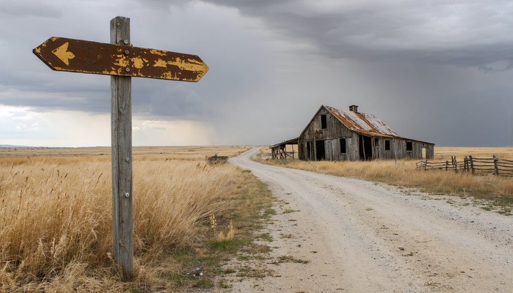
While Basil makes for a compelling destination on its own, several other ghost towns within Kansas deserve a spot on your itinerary. Runny Meade in Harper County carries its own local legends, drawing curious travelers enthusiastic to uncover forgotten history.
Beyond Basil, Kansas ghost towns like Runny Meade beckon travelers hungry for local legends and forgotten history.
Centropolis offers a haunting contrast with its population of roughly 60 and a surviving general store, giving you a rare glimpse of faded commerce.
Neoso Falls rounds out the experience with its own classification as a ghost town worth exploring.
Urban legends surrounding these abandoned communities add an extra layer of mystery to your road trip.
Together, these destinations create a rich, interconnected network of lost Kansas history, letting you chart your own course through the state’s quietly vanishing past.
What Other Kingman County Ghost Towns Are Worth the Drive?
Kingman County holds more than just Basil’s quiet ruins, and if you’ve made the drive out here, you’d be doing yourself a disservice by leaving without exploring what else the region has tucked away.
Historical preservation efforts reveal layers of forgotten settlements worth your time:
- Centropolis – A nearby ghost town with roughly 60 former residents and a surviving general store shell.
- Neoso Falls – Classified officially as a ghost town, offering raw urban decay analysis opportunities.
- Runny Meade – Harper County’s intriguing remnant sitting close enough for a detour.
- Santa Fe – Completely vanished by 1988, leaving only ground impressions behind.
Each site rewards patient explorers willing to read the land’s silent, abandoned story on their own terms.
Frequently Asked Questions
Is There an Entrance Fee to Visit Basil Ghost Town?
Like a open book of history, you’ll roam freely through Basil’s ghost town with no entrance fee. There’s no historical preservation staff or visitor facilities — you’re entirely on your own, embracing pure, unrestricted exploration.
Are Metal Detectors Allowed at the Basil Ghost Town Site?
The knowledge doesn’t specify metal detecting regulations or treasure hunting permits for Basil. You’ll want to contact Kingman County authorities directly before you bring your detector, ensuring you’re exploring this fascinating ghost town legally and responsibly.
Can You Camp Overnight Near the Basil Ghost Town Location?
Like a wild frontier spirit, you’ll need to check local camping regulations before pitching a tent near Basil. The open Kansas plains invite adventure, but wildlife encounters remind you to stay prepared and respect nature’s rules.
Is the Basil Ghost Town Site on Public or Private Land?
The knowledge doesn’t confirm whether it’s public or private land, so you’ll want to verify before exploring. Respecting boundaries honors historical preservation and keeps local legends alive for fellow freedom-seeking adventurers like you!
Are Pets Allowed When Visiting Basil Ghost Town in Kansas?
Like wind across the prairie, freedom calls—but pet policies and animal restrictions for Basil aren’t documented. You’ll want to check with Kingman County officials before bringing your furry companion to explore this haunting ghost town.
References
- https://www.youtube.com/watch?v=8dtIPX7pIqI
- https://digging-history.com/2015/02/18/ghost-town-wednesday-santa-fe-kansas/
- https://esirc.emporia.edu/bitstreams/b4b4cde4-15d4-4284-a3b5-8430fb9e324e/download
- https://ksgenweb.org/archives/1912/b/basil.html
- https://legendsofkansas.com/every-place-in-kansas-b/