
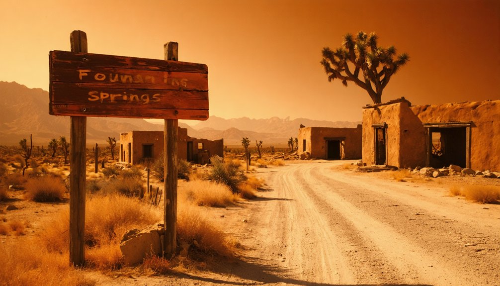
Planning a ghost town road trip to Fountain Springs, California drops you into Tulare County’s raw, unrestored history at the junction of County Roads J22 and M109. This roadside landmark served the Butterfield Overland Mail line from 1858 to 1861, connecting passengers and correspondence across the American West. There aren’t dramatic ruins here — just open land, a historical marker, and quiet atmosphere. Pack water, wear sturdy boots, and keep your GPS ready, because there’s far more to uncover about this forgotten California stop.
Key Takeaways
- Fountain Springs sits at the junction of County Roads J22 and M109 in Tulare County, with GPS coordinates 35°53′28″N, 118°54′56″W.
- The site features California Historical Landmark No. 648, with the actual settlement located approximately 1.5 miles northwest of the marker.
- Pack water, wear sturdy boots, bring sunscreen, and use a high-clearance vehicle since no amenities or paved paths exist.
- Download offline maps before visiting, as limited cell service affects navigation on rural working country roads with narrow shoulders.
- Nearby ghost towns including Tailholt, Globe, Mineral King, and Hot Springs make Fountain Springs an ideal stop on a broader road trip.
What Kind of Ghost Town Is Fountain Springs?
When you pull up to the junction of County Roads J22 and M109 in Tulare County, you won’t find a restored mining town with gift shops and guided tours.
Fountain Springs is a different kind of ghost town — a raw, roadside remnant where history lives in context rather than reconstruction.
Some places preserve history through museums and markers. Fountain Springs preserves it through absence — and that’s exactly the point.
Its historical significance comes from what it once connected. Before the Civil War, this settlement anchored critical travel routes, linking overland stages, freight wagons, and gold-rush traffic moving between Stockton and Los Angeles.
From 1858 to 1861, it served the Butterfield Overland Mail line, functioning as an essential stop between distant stations.
What remains today is a historical marker and open land. For independent travelers, that’s often enough — the freedom to stand where history moved and imagine it yourself.
The Butterfield Overland Mail Connection (1858–1861)
Before the Civil War reshaped American life, Fountain Springs had already earned its place on one of the country’s most ambitious mail routes. From 1858 to 1861, the Butterfield Overland Mail carried passengers, correspondence, and supplies across the continent, and Fountain Springs served as one of its essential stops.
The Butterfield significance here is hard to overstate. You’re standing where coaches once paused between Tule River Station, 14 miles northwest, and Mountain House, 12 miles south.
These overland routes connected California to the rest of a rapidly expanding nation, and Fountain Springs sat squarely within that network.
When you visit today, that history still shapes the landscape. The roads crossing near County Roads J22 and M109 follow corridors that once moved an entire country forward.
What Remains at the Fountain Springs Site Today?
All that stagecoach energy eventually faded, and what’s left today is quieter than you might expect.
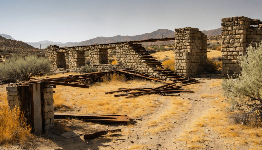
Fountain Springs doesn’t offer abandoned structures or dramatic historical remnants frozen in time. Instead, you’ll find open land near County Roads J22 and M109, where the past lives mostly in memory and signage rather than standing walls or visible ruins.
California Historical Landmark No. 648 serves as your primary anchor here. That marker grounds you in the geography and gives context to what once operated as a crucial travel junction.
You won’t need a guided tour or an entrance fee — just your own curiosity and a willingness to read the landscape. Sometimes the absence of physical remains tells its own powerful story about how completely a place can vanish.
Finding the Fountain Springs Historical Marker and Landmark Coordinates
When you’re ready to track down the Fountain Springs site, you’ll want to note that California Historical Landmark No. 648 carries the coordinates 35°53′28″N, 118°54′56″W, giving you a precise GPS target to plug into your navigation app.
The actual settlement site sits about 1.5 miles northwest of that marker, so you’re working with two distinct reference points.
To reach the area, you’ll navigate toward the intersection of County Roads J22 and M109, which serve as your most practical on-the-ground guide through Tulare County’s rural terrain.
Landmark Coordinates And Location
Although California Historical Landmark No. 648 marks the Fountain Springs site, the actual settlement lies about 1.5 miles northwest of that marker, so you’ll want to account for that gap when you’re planning your visit.
Understanding this distinction adds valuable historical context and sharpens the landmark importance for serious explorers.
Use these four location details to orient yourself:
- Landmark coordinates: 35°53′28″N, 118°54′56″W pinpoint your starting reference
- Road intersection: County Roads J22 and M109 serve as your practical navigation target
- Settlement offset: Shift 1.5 miles northwest from the marker toward the original site
- Visual cues: Watch for open terrain and sparse vegetation marking the former settlement ground
These details transform a roadside stop into a purposeful historical expedition.
Once you’ve locked in the landmark coordinates (35°53′28″N, 118°54′56″W), County Roads J22 and M109 become your practical compass on the ground.
These rural roads place you roughly 1.5 miles southeast of the actual settlement site, so understanding that gap keeps your expectations accurate.
For navigation tips, load offline maps before leaving cell service behind — rural Tulare County roads don’t always guarantee reliable signal. Cross-reference your GPS with physical mile markers when possible.
Route safety matters here because these are working country roads with limited shoulders, occasional farm equipment, and unpredictable dust conditions.
Drive at a measured pace, watch for unmarked intersections, and keep water and fuel topped off. The historical marker itself serves as your clearest physical anchor once you arrive.
Tulare County Ghost Towns Within a Day’s Drive of Fountain Springs
Tulare County holds more ghost towns than most travelers realize, and if you’re already making the drive out to Fountain Springs, you’re well-positioned to explore several of them within a single day.
These Tulare ghost towns each carry their own historical significance, rewarding curious travelers willing to wander off the main road.
- Tailholt – A rugged mining settlement with remnants scattered across brushy hillsides.
- Globe – A former farming community reduced to foundations and faded memory.
- Mineral King – A silver-mining ghost town tucked inside dramatic mountain terrain.
- Hot Springs – A weathered resort community where crumbling structures still stand quietly.
Each stop adds depth to your road trip, connecting you to California’s layered past through ruins, markers, and open landscape.
Building a Tulare County Ghost Town Road Trip Around Fountain Springs
Knowing which ghost towns sit within reach of Fountain Springs is one thing — building those stops into a coherent road trip is another.
Start by anchoring your route at Fountain Springs, using its historical context as your baseline. From there, layer in ghost town comparisons to calibrate expectations — some stops offer restored structures, others deliver little more than a marker and open sky. That contrast actually sharpens your travel itineraries, helping you pace dramatic moments against quieter, reflective ones.
Drive County Roads J22 and M109 to orient yourself, then branch outward toward complementary Tulare County sites. Treat each stop as a chapter in a larger story about California’s overland era, mining ambitions, and eventual abandonment.
The road connects it all — you just have to follow it.
Best Time of Year to Visit Fountain Springs
Timing your visit to Fountain Springs matters more than you’d expect from a roadside historic marker. Weather considerations directly shape your experience in this remote Tulare County corridor.
- Spring (March–May): Wildflowers blanket the surrounding hills, the air stays crisp, and golden light hits the landscape perfectly for photography.
- Summer (June–August): Expect intense heat exceeding 100°F. Carry extra water and plan early-morning arrivals only.
- Fall (September–November): Seasonal attractions peak here — mild temperatures, clear skies, and quieter roads make exploration genuinely comfortable.
- Winter (December–February): Occasional fog settles into the valley, creating an eerily atmospheric scene that fits the ghost-town mood beautifully.
Fall and spring give you the freest, most rewarding experience at this historic stop.
What to Bring for Fountain Springs’ Undeveloped, Off-Road Site
Preparation separates a rewarding stop from a frustrating one at Fountain Springs, where you’ll find no amenities, no paved paths, and no services waiting for you.
Pack your ghost town essentials before leaving: water for at least one full day, sturdy boots, sunscreen, and a hat.
The terrain around County Roads J22 and M109 demands solid off road preparation, so bring a vehicle with decent ground clearance and a physical map in case cell service drops.
Carry a first aid kit, snacks, and a portable phone charger.
Since the site offers only a historical marker and open land, binoculars help you survey the surroundings.
A camera captures the raw, undeveloped character that makes Fountain Springs genuinely distinct from polished ghost town attractions elsewhere in California.
Fountain Springs vs. Calico and Other California Ghost Towns
When you start comparing California ghost towns, you’ll quickly notice that preservation levels vary wildly from site to site.
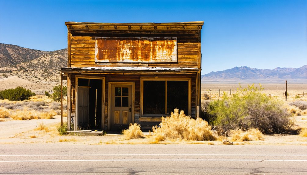
Calico Ghost Town in San Bernardino County offers restored buildings, guided tours, and museum-style attractions, while Fountain Springs greets you with little more than a roadside historical marker and open land.
Knowing the difference helps you choose ghost towns that match what you’re actually looking for — whether that’s a developed park experience or raw, unfiltered history.
Preservation Levels Vary Widely
Not all California ghost towns offer the same experience, and that gap becomes obvious the moment you compare Fountain Springs to a place like Calico Ghost Town in San Bernardino County.
Preservation challenges shape what you’ll actually find on the ground.
- Calico — Restored buildings, museums, and guided tours greet you at every turn.
- Zzyzx — Surviving structures from an abandoned Mojave resort still stand eerily intact.
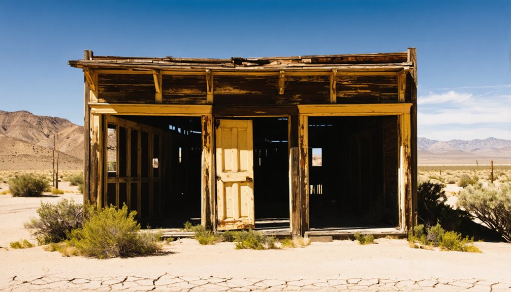
- Fountain Springs — A roadside historical marker and open landscape replace any standing structures.
- Rosalie/Valley Wells — Scattered foundations and minimal remains reward only the most determined explorers.
Understanding this spectrum sharpens your historical context before you arrive.
Fountain Springs demands imagination, not a ticket booth, making it a raw, unfiltered connection to California’s overland travel past.
Developed Parks Vs. Ruins
Choosing between a developed ghost-town park and a raw historic ruin shapes your entire road trip experience before you ever leave the driveway.
Calico Ghost Town delivers curated developed attractions, including museums, guided tours, and restored structures. You’ll get comfort and context, but you’ll trade raw authenticity for presentation.
Fountain Springs offers the opposite experience. Historic preservation here exists through a California Historical Landmark marker, not a visitor center. You’re reading the landscape yourself, standing near County Roads J22 and M109, piecing together a Butterfield Overland Mail stop from 1858.
That freedom to interpret an unpolished site appeals to travelers who want discovery, not performance.
Both approaches have merit. Your preference for structure versus exploration will determine which ghost-town style fits your road trip best.
Choosing Your Ghost Town
How you match your personality to a ghost town determines whether your road trip feels like a discovery or a disappointment.
California’s ghost towns span a wide spectrum along its travel routes, so knowing your preference sharpens your choice.
- Calico Ghost Town — Restored buildings, gift shops, and guided tours for structure-seekers
- Zzyzx — Crumbling desert resort ruins surrounded by Mojave silence and mystery
- Fountain Springs — A historic crossroads marker where overland history lives in the landscape itself
- Rosalie/Valley Wells — Scattered foundations demanding imagination over infrastructure
If you crave raw history without crowds, Fountain Springs rewards you.
If you want curated experiences, Calico delivers.
Ghost towns aren’t interchangeable — your ideal stop depends on whether you’re chasing atmosphere or amenities.
Frequently Asked Questions
Who Originally Founded Fountain Springs Before Its Establishment in 1855?
“History doesn’t record who’s first.” The knowledge doesn’t identify Fountain Springs’ Founding Families or Early Settlers before 1855. You’ll find the records remain unclear, leaving these pioneering souls’ stories waiting for you to uncover.
Was Fountain Springs Ever Considered for Official Preservation or Restoration?
You won’t find records of Fountain Springs undergoing official ghost town preservation or restoration efforts. Its historical significance lives on through California Historical Landmark No. 648, giving you a tangible connection to its storied past.
Did Any Notable Historical Figures Pass Through Fountain Springs During Its Operation?
Who didn’t pass through? Famous travelers, settlers, and mail carriers all used Fountain Springs during its historical significance as a Butterfield Overland Mail stop, meaning you’re walking where countless adventurous souls once sought freedom westward.
How Did Fountain Springs Get Its Name?
You’ll find Fountain Springs’ name origin tied directly to natural springs that once flowed at the site, giving travelers precious water along their journey — a detail that adds rich historical significance to this remarkable former California settlement.
Are There Any Recorded Accounts From Travelers Who Stopped at Fountain Springs?
From 1858–1861, hundreds of Butterfield Mail passengers passed through here. You won’t find many detailed traveler experiences documented, but ghost stories and frontier journals hint at weary souls finding rare relief at Fountain Springs’ welcoming waters.
References
- https://en.wikipedia.org/wiki/Fountain_Springs
- https://www.islands.com/1684301/californias-zzyzx-exit-mysterious-road-leads-ghost-town-strange-history/
- https://californiathroughmylens.com/calico-ghost-town/
- https://parks.sbcounty.gov/park/calico-ghost-town-regional-park/
- https://www.youtube.com/watch?v=Zee5aoB6B7s
- https://www.visitcalifornia.com/road-trips/ghost-towns/
- https://www.desertusa.com/desert-california/zzyzx.html
- https://www.facebook.com/groups/725717025311894/posts/1259445018605756/
- https://www.atlasobscura.com/lists/drink-and-dine-in-north-american-ghost-towns
- https://www.facebook.com/SecretLosAngeles.sn/posts/the-preserved-ruins-of-this-california-ghost-town-are-believed-to-be-hauntedread/1255629606606057/


