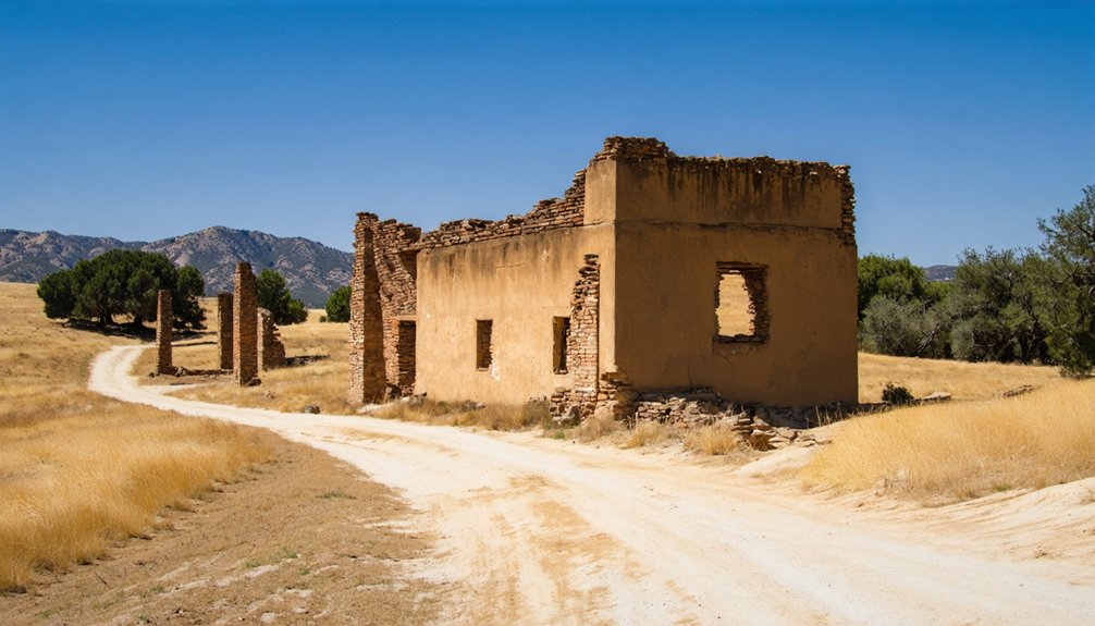
Planning a ghost town road trip to Vaca Adobe starts with heading three miles north of Kettleman City in Kings County. You’ll find a raw, unmarked relic built in 1863 by vaqueros Juan Perria and Pablo Vaca, standing near where Tulare Lake once stretched across the Central Valley. Bring water, reliable maps, and verify land access before you go. There’s far more history woven into this quiet stretch of California than first meets the eye.
Key Takeaways
- Vaca Adobe is located three miles north of Kettleman City in Kings County, California, built in 1863 by vaqueros Juan Perria and Pablo Vaca.
- The site is unmarked and may not be on public land, so research access conditions and land ownership before visiting.
- Bring water, printed maps, and a flexible mindset, as the adobe requires careful navigation to locate on modern maps.
- Pair your visit with nearby ghost towns and El Camino Viejo historical markers for a richer, broader road trip experience.
- The adobe’s history connects to the 1863–64 drought and the vanished Tulare Lake, adding significant cultural and historical depth to your visit.
What Is Vaca Adobe and Why Does It Matter?
Tucked about three miles north of Kettleman City in what’s now Kings County, Vaca Adobe—also called Vaca Dugout—is one of California’s quieter ghost-town footnotes, built in 1863 by vaqueros Juan Perria and Pablo Vaca along the El Camino Viejo travel corridor near the former shores of Tulare Lake.
Understanding Vaca significance means recognizing what this site represented: a frontier outpost tied directly to California’s cattle ranching economy at a pivotal, brutal moment.
Vaca Adobe wasn’t just a waypoint—it was a witness to California’s cattle economy at its most vulnerable and fleeting.
Historical context deepens that picture considerably. Construction began during the devastating 1863–64 drought, which wiped out most of Southern California’s cattle herds and effectively ended an era.
You won’t find grand ruins here—what you’ll find is a location that captures the raw, unfiltered reality of frontier life and the forces that erased it.
The 1863 Story Behind the Adobe and Its Builders
When Juan Perria and Pablo Vaca broke ground on their adobe in 1863, they were building into the teeth of one of California’s worst droughts. The 1863–64 drought would ultimately kill most cattle across southern California, decimating the ranching world these two vaqueros knew intimately.
Their adobe construction wasn’t just shelter — it was a working outpost tied directly to vaquero culture, cattle drives, and the dusty corridors of El Camino Viejo.
You can picture what they faced: cracked earth, dying herds, and an uncertain future carved into the western edge of the San Joaquin Valley.
Perria and Vaca built anyway, roughly three miles north of what’s now Kettleman City, close to the shrinking shoreline of Tulare Lake. That determination alone makes their story worth knowing.
Where Exactly Is Vaca Adobe Located?
If you’re plotting your route, you’ll find Vaca Adobe sitting about 3 miles north of Kettleman City in Kings County, California.
The site occupies a stretch of the Central Valley that was once part of Tulare County, placing it squarely within a region shaped by early ranching corridors and the historic El Camino Viejo.
You’re fundamentally steering toward a quiet patch of valley land that once hugged the shore of the now-vanished Tulare Lake.
Kings County Central Valley
Kings County’s flat, sun-baked landscape holds the remnants of Vaca Adobe about three miles north of Kettleman City, a location that once sat close to the shores of the now-vanished Tulare Lake.
Today, that lake is gone, drained by agricultural demands, but the Central Valley terrain still carries a quiet, stark beauty that rewards explorers willing to seek it out.
You’re standing in Kings County now, far from manicured tourist trails, where the open road stretches endlessly and history hides in plain sight.
This corner of California’s Central Valley doesn’t announce itself — you have to chase it.
If you value traveling on your own terms, discovering forgotten places like Vaca Adobe delivers exactly the kind of unscripted freedom that keeps road trippers coming back.
Near Kettleman City
Pinpointing Vaca Adobe on a modern map takes a little patience, but the search itself is part of the experience. You’ll find the site roughly three miles north of Kettleman City, tucked near the former shoreline of Tulare Lake in what’s now Kings County.
The area feels wide open and remote, rewarding travelers who crave discovery over convenience. Its historical significance runs deeper than the landscape suggests.
Vaqueros Juan Perria and Pablo Vaca built the adobe here in 1863, using it as a stopping point along El Camino Viejo‘s eastern route. That corridor once connected California’s cattle ranches across the Central Valley.
Today, Kettleman City serves as your practical landmark when guiding yourself toward this ghost town, so keep your bearings sharp and check access conditions before you head out.
How the 1863–64 Drought Turned Vaca Adobe Into a Ghost Town
When vaqueros Juan Perria and Pablo Vaca built their adobe in 1863, they couldn’t have chosen a worse moment — the catastrophic 1863–64 drought was already tightening its grip on California’s Central Valley.
The drought wiped out most of the cattle across southern California, gutting the ranching economy that had given Vaca Adobe its entire reason to exist.
Without cattle drives and the travel traffic they generated, the settlement had nothing left to sustain it, and it faded almost as quickly as it had appeared.
Drought Devastated Cattle Ranching
The timing couldn’t have been crueler: Juan Perria and Pablo Vaca finished building their adobe in 1863, the same year a catastrophic drought began strangling California’s cattle industry.
The drought impacts hit Southern California hardest, triggering a cattle decline that wiped out entire herds. Here’s what that brutal period meant for ranchers like Vaca:
- Grasslands turned to dust, leaving cattle with nothing to graze.
- Water sources dried up across the Central Valley.
- Livestock died by the thousands throughout Southern California.
- Ranch operations collapsed, abandoning outposts overnight.
You can imagine Vaca and Perria watching their investment crumble before it ever gained momentum.
Their stopping place along El Camino Viejo, barely established, quickly lost its purpose as the cattle trade evaporated around them.
Vaca Adobe’s Rapid Decline
Once the drought tightened its grip on California’s cattle country, Vaca Adobe’s fate was fundamentally sealed before the adobe dust had even settled. The 1863–64 drought decimated herds across southern California, gutting the economic factors that made stopping points like Vaca Adobe viable.
Without cattle drives moving through, the settlement lost its entire purpose almost immediately after Juan Perria and Pablo Vaca completed it in 1863.
You can see how quickly settlement patterns collapsed when the land stopped supporting ranching. Vaca Adobe never evolved into a town because there was nothing left to sustain growth.
The drought didn’t just kill cattle — it erased the network of movement that frontier outposts depended on, leaving Vaca Adobe as little more than a marker of what briefly existed near Tulare Lake’s eastern shore.
Vaca Adobe’s Place Along El Camino Viejo
Stretching along California’s Central Valley long before modern highways carved their way through the landscape, El Camino Viejo served as one of the earliest overland travel corridors connecting Southern California to the San Francisco Bay Area.
Vaca Adobe sat directly along this historic route, giving it real historical significance as a stopping point for cattle drivers and travelers moving freely through open terrain.
When you visit, consider what this location meant to those early riders:
- It offered shelter near the former Tulare Lake shoreline
- It supported eastern-route cattle drives
- It marked a known waypoint on the El Camino trail
- It connected remote ranching outposts across the valley
That layered history makes this ghost town worth tracking down.
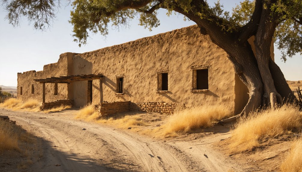
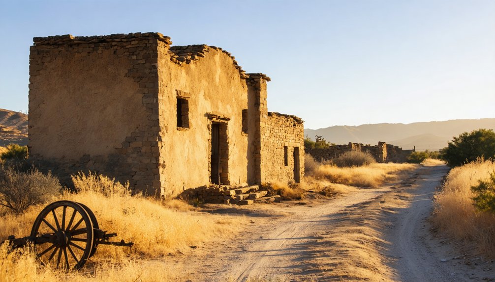
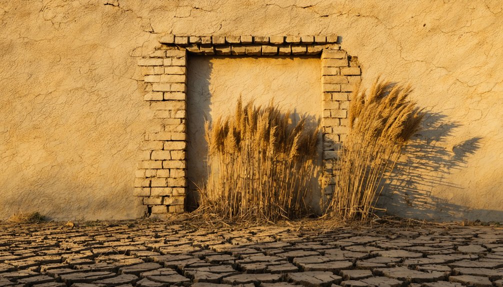
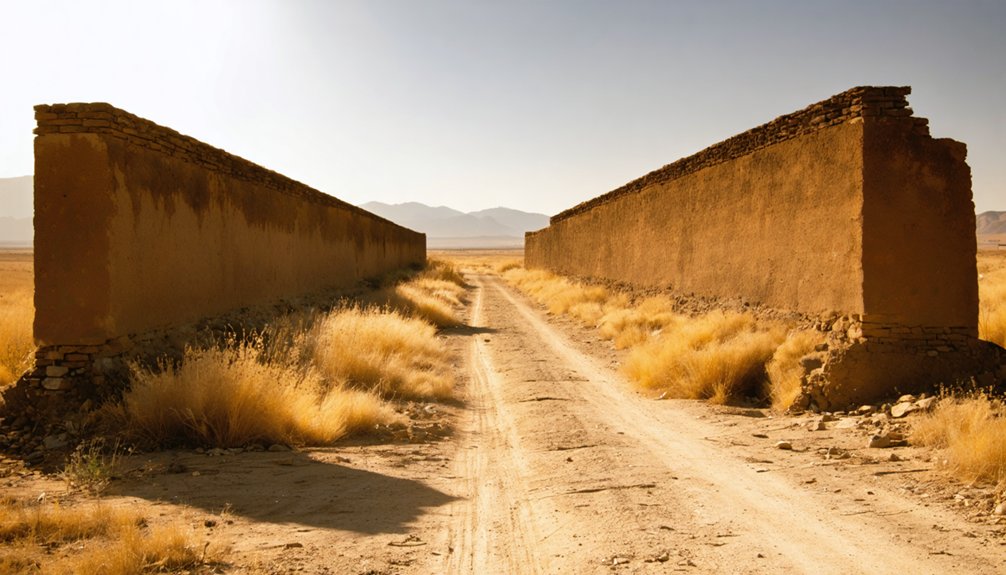
What Survives at Vaca Adobe Today
Visiting Vaca Adobe today means accepting that very little physically remains at the site. This ghost town offers no restored buildings, no interpretive signs, and no visitor facilities.
What draws you here isn’t architecture — it’s atmosphere and history embedded in the landscape itself. You’re standing near the former shore of Tulare Lake, on ground where vaqueros once stopped along El Camino Viejo during one of California’s most brutal droughts.
The land has reclaimed nearly everything. Consider this a location marker rather than a preserved attraction. Before heading out, research current access conditions carefully, since private land boundaries may restrict where you can explore.
Freedom-seekers who appreciate raw, unmarked history will find Vaca Adobe quietly rewarding despite its minimal physical presence.
How to Frame Vaca Adobe Within Tulare Lake History
When you place Vaca Adobe on the map, you’re standing just miles from what was once the shoreline of Tulare Lake, the largest freshwater lake west of the Mississippi before agriculture drained it into memory.
Cattle trails ran close to that shore, making the site a natural stopping point along the El Camino Viejo as ranchers pushed herds through the Central Valley.
The 1863–64 drought that drove Juan Perria and Pablo Vaca to build here also devastated the regional cattle economy, turning what might’ve become a lasting settlement into little more than a historical footnote.
Tulare Lake’s Vanished Shoreline
Once the largest freshwater lake west of the Mississippi, Tulare Lake has all but vanished from California’s Central Valley landscape, drained and converted to farmland by the early twentieth century. Understanding its vanished shoreline adds historical significance to your Vaca Adobe visit.
Consider these environmental changes that shaped the region:
- Tulare Lake once covered nearly 800 square miles.
- Massive drainage projects began in the 1870s.
- Agricultural reclamation eliminated the lake by the 1920s.
- Wildlife habitats and Indigenous communities were permanently displaced.
When you stand near Vaca Adobe’s former site, you’re standing where cattlemen once operated close to that living shoreline.
That water shaped every trail, every ranch, and every stopping point along El Camino Viejo. The lake’s absence defines the landscape you’ll explore today.
Cattle Trails Near The Lake
The cattle trails that once wound along Tulare Lake’s eastern shore weren’t casual paths — they were the economic lifelines of California’s Central Valley, and Vaca Adobe sat directly within that network.
When you trace the cattle routes through this region, you’re following the same corridors that vaqueros Juan Perria and Pablo Vaca traveled in 1863. The lake’s history shaped everything here — its shoreline dictated where herds could move, drink, and rest.
El Camino Viejo ran close by, connecting ranchers to broader markets across California. That intersection of water, land, and commerce made this location strategically valuable.
Today, understanding that context transforms Vaca Adobe from a forgotten ruin into a meaningful landmark within Central Valley’s deeper agricultural and frontier story.
Drought’s Impact On Settlement
Cattle trails and lake geography shaped where settlements took root, but weather determined whether they’d survive. The 1863–64 drought created brutal settlement challenges across California’s southern regions.
You can’t fully appreciate Vaca Adobe without understanding these drought effects:
- Juan Perria and Pablo Vaca built the adobe in 1863, precisely when the drought began intensifying.
- The disaster killed most cattle throughout southern California, eliminating the economic foundation supporting frontier outposts.
- Tulare Lake’s shoreline proximity offered water access, yet couldn’t offset the catastrophic livestock losses.
- The settlement never evolved beyond a temporary stopping point along El Camino Viejo.
That fragility defines Vaca Adobe’s story. You’re not visiting a thriving town’s ruins — you’re standing where survival itself became impossible.
How to Add Vaca Adobe to a Central Valley Road Trip
Planning a Central Valley road trip around Vaca Adobe means embracing the site for what it is: a historical marker rather than a polished attraction.
You’ll find this ghost town sitting roughly three miles north of Kettleman City, making it an easy detour if you’re already traveling through Kings County.
Pair your visit with Tulare Lake history, El Camino Viejo’s historic route, and nearby Central Valley landmarks to build a fuller experience.
Before heading out, research current access conditions and confirm whether the land is privately owned. Bring your own water, maps, and a flexible mindset.
Vaca Adobe rewards curiosity rather than convenience, so treat it as a layered historical stop woven into a broader journey through California’s cattle-country past.
Access, Land Boundaries, and Road Conditions Near Vaca Adobe
Before you load up the car and head toward Kettleman City, you’ll want to sort out a few practical realities about reaching Vaca Adobe.
Access routes in this part of Kings County often cross private agricultural land, and land ownership here isn’t always clearly posted.
Check these four things before you go:
- Confirm whether current land ownership requires advance permission for access.
- Research which access routes remain publicly usable versus privately controlled.
- Assess seasonal road conditions, since unpaved Central Valley roads can become impassable after rain.
- Identify the site’s approximate location roughly 3 miles north of Kettleman City using reliable mapping tools.
Respecting boundaries keeps this historical stop accessible for everyone who follows your tire tracks.
Nearby Ghost Towns Worth Pairing With Your Vaca Adobe Stop
Once you’ve sorted out the access logistics for Vaca Adobe, it makes sense to stretch that drive into something bigger. The Central Valley holds several ghost town attractions within reasonable range, and pairing them creates a fuller picture of California’s frontier era.
Explore the former settlements scattered along the El Camino Viejo corridor, where historical markers still trace early cattle-drive routes through Kings and Tulare counties.
Weathered markers along El Camino Viejo still whisper of cattle drives that shaped Kings and Tulare counties.
Kettleman City itself anchors your route geographically, giving you a practical base for branching outward.
North toward Solano County, the Peña Adobe in Vacaville connects directly to the same early settler families who built Vaca Adobe.
That stop transforms a single-site visit into a cross-county journey through intertwined ranching histories, making every mile feel deliberately earned rather than casually spent.
Frequently Asked Questions
Is Vaca Adobe Connected to the Founding of Vacaville, California?
Like roots stretching across California’s soil, yes, Vaca Adobe history ties directly to the Vaca family’s founding significance in Vacaville. You’ll discover Pablo Vaca’s legacy branched from Solano County’s early settlements to Kings County’s frontier outposts.
What Is the Peña Adobe, and How Does It Relate to Vaca Adobe?
You’ll find that the Peña Adobe history connects directly to Vaca Adobe—both share early settler roots. Built in 1842 in Vacaville, its architectural significance reflects the same pioneering Vaca and Peña family legacy shaping California’s frontier.
Were Juan Perria and Pablo Vaca Considered Vaqueros or Ranchers?
They’re considered vaqueros! Juan Perria and Pablo Vaca embraced the vaquero lifestyle, building their adobe in 1863 while practicing traditional ranching practices that defined California’s rugged, free-spirited Central Valley frontier during that era.
Did the Vaca Family Own Other Land Grants in California?
Like roots spreading wide, the Vaca family’s land grants stretched across California — you’ll find they held Rancho Los Putos in Solano County, directly tied to Vacaville’s founding and their lasting pioneer legacy.
Has Vaca Adobe Ever Appeared on Official California Historic Landmark Lists?
Based on available knowledge, there’s no confirmed listing for Vaca Adobe on official California historic landmark registries. You won’t find it meeting formal landmark criteria, though its frontier story absolutely deserves serious historic preservation consideration and recognition.
References
- https://en.wikipedia.org/wiki/Vaca_Adobe
- https://ohp.parks.ca.gov/ListedResources/Detail/534
- https://www.youtube.com/watch?v=vAx_zAqe8Rs
- https://eastbayhillpeople.com/pena-vaca-adobe-vacaville/
- https://www.visitvacaville.com/directory/pena-adobe-historical-society/
- https://walkiesthroughhistory.com/2023/01/08/pena-adobe/
- https://www.solanoarticles.com/history/index.php/weblog/more/the_vacas_and_pena_land_holdings/
- https://www.penaadobe.org/about
- https://www.facebook.com/groups/135560136633016/posts/1420214694834214/
- https://www.thereporter.com/2025/07/15/at-camp-adobe-celebrating-the-wild-west-in-vacaville/


