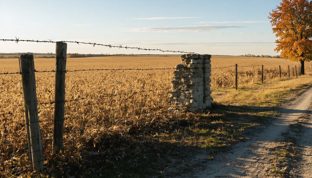
Horace, Illinois has nearly vanished, but it’s still worth the drive. You’ll find a weathered brick mercantile building anchoring the former townsite, surrounded by scattered concrete foundations hiding in the grass. Edgar County Airport now occupies most of the original land, so you’ll need to explore the perimeter rather than the core. Start in Paris, head north on Route 1, and let the landscape tell its story — there’s more here than you’d expect.
Key Takeaways
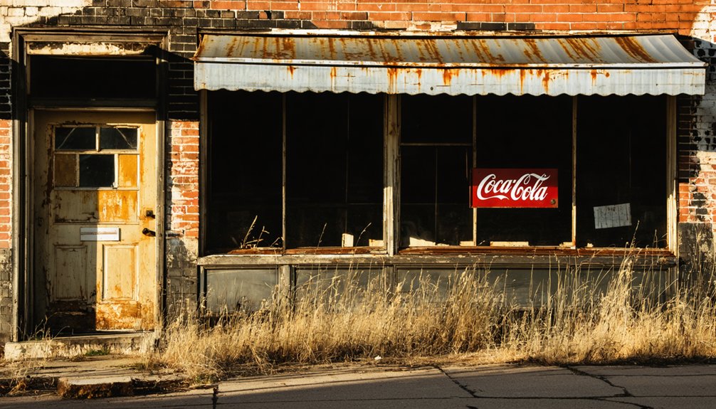
- Begin at the brick mercantile building on Route 1, the only intact structure and clearest visual marker of Horace’s original townsite.
- Drive north from Paris on Illinois Route 1 for five miles, then turn west and continue 0.8 miles to reach the former townsite.
- Edgar County Airport now occupies most of Horace, restricting access, so expect perimeter exploration rather than walking through the core area.
- Scan the airport’s western edge for scattered concrete foundations and flat terrain clusters revealing where homes and churches once stood.
- Use Paris as a base camp to efficiently visit multiple Edgar County ghost towns in a single full-day road trip.
What’s Left of Horace, Illinois Today
If you make the short drive west off Illinois Route 1, you’ll find that Horace has nearly vanished from the landscape entirely. Edgar County Airport now occupies most of the original townsite, erasing decades of community history beneath runways and infrastructure. Rural decline claimed this settlement long before concrete replaced its foundations.
What you’ll discover standing against time is a weathered brick mercantile building, its original architectural form still recognizable despite years of neglect. Scattered concrete foundations mark where churches and homes once stood, offering quiet proof of ghost town significance.
No residents remain, no restoration efforts exist, and no historical markers guide your visit. You’re fundamentally reading the landscape itself, piecing together a community that farming families once called home before economic shifts pulled them toward Paris and beyond.
The Mercantile Building and Ruins Still Standing on the Townsite
As you walk the former townsite, the weathered brick mercantile building immediately commands your attention — it’s the only structure that still stands with its original architectural form intact.
You’ll notice scattered concrete foundations pushing up through the ground, ghostly outlines marking where the church, homes, and public buildings once stood.
Don’t expect to find any surviving residential structures, though; what you see here is fundamentally a commercial shell and a handful of crumbling foundations holding the memory of Horace together.
The Brick Mercantile Stands
When you arrive at the former townsite of Horace, the weathered brick mercantile building is the first thing that commands your attention.
It’s a striking reminder of the town’s mercantile history, standing firm while everything else has crumbled or disappeared entirely. The structure retains its original architectural significance, displaying the craftsmanship of 19th-century construction that outlasted the community it once served.
You can walk around it, studying the aged brickwork and imagining farmers stopping here for supplies generations ago. No restoration crews have touched it, and no historical plaques mark its walls.
It simply stands on its own terms, raw and unpolished. For anyone craving an unfiltered connection to Illinois’s rural past, this building delivers exactly that kind of honest, undisturbed history.
Scattered Concrete Foundation Remnants
Beyond the mercantile, scattered concrete foundation remnants push up through the grass and soil across the former townsite, each one marking where a home, church, or public building once stood. Their foundation significance lies in what they silently communicate — lives were built here, communities gathered, and daily routines unfolded across this now-quiet landscape.
Walking among them, you’ll feel the historical context sharpen around you. These aren’t random slabs; they’re coordinates of a vanished world. You can crouch beside a crumbling edge and mentally reconstruct what once rose above it.
No interpretive signs guide you, no fences restrict your movement. You’re free to explore and draw your own conclusions about what Horace once meant to the people who called it home.
No Residential Structures Survive
What stands at the Horace townsite tells only half the story — the mercantile building rises from the landscape as the sole intact structure, while every home, every residence where families once slept and woke and lived their daily lives, has completely disappeared.
You won’t find a single surviving house, cabin, or dwelling anywhere across this former settlement. The agricultural heritage that sustained generations of Edgar County families left no residential footprint behind.
Only concrete foundations scattered beneath your feet hint at where those homes once stood. Lost communities like Horace remind you how completely time erases domestic life while occasionally sparing a commercial building.
Walk the grounds and let those ghost foundations speak — families built real lives here, and the land still quietly holds that memory.
How to Reach the Horace Townsite From Paris
Reaching the Horace townsite from Paris is a straightforward drive that takes you just five miles north along the main highway network of Edgar County.
Follow these driving directions for a scenic route that keeps navigation simple:
- Head north from Paris on Illinois Route 1, your primary road corridor.
- Drive approximately five miles until you spot the Edgar County Airport landmarks.
- Turn west off Route 1, traveling roughly 0.8 miles toward the former townsite.
- Watch for the weathered brick mercantile building, your clearest visual marker.
- Park safely near the site and explore on foot at your own pace.
You’ll find the location surprisingly accessible for a ghost town, making it an easy half-day detour.
The flat Midwestern landscape keeps visibility clear throughout your entire approach.
Airport Boundaries, Access Limits, and What to Expect On-Site
Once you arrive at the Horace townsite, you’ll quickly realize that Edgar County Airport now occupies most of the land where the original community once stood, placing strict boundary restrictions on where you can legally explore.
You can’t access the airport grounds without authorization, so your on-site experience is fundamentally limited to the perimeter areas and whatever remains visible from public roads.
Expect to find the weathered brick mercantile building as your primary point of interest, along with scattered concrete foundations that hint at the town’s former footprint.
Airport Boundary Restrictions
Several key boundaries define what you can and can’t access when visiting the former site of Horace. The Edgar County Airport now occupies most of the original townsite, creating real airport access and boundary limitations you’ll need to respect.
Here’s what shapes your visit:
- Airport perimeter fencing blocks direct entry to the core of the former townsite.
- Active runway zones restrict foot traffic across large portions of the land.
- The brick mercantile building sits outside restricted zones and remains reachable.
- Scattered concrete foundations near the perimeter offer glimpses without crossing boundary limitations.
- Illinois Route 1 keeps you oriented and provides safe, legal stopping points nearby.
Respecting these boundaries keeps your visit legal while still letting you connect with Horace’s surviving history.
On-Site Visitor Expectations
What you’ll actually encounter at the former site of Horace is shaped almost entirely by the Edgar County Airport’s presence. The airport occupies most of the original townsite, restricting your movement and limiting the visitor experience greatly. You won’t freely roam where homes, churches, and public buildings once stood.
What you can access reveals fragments of local legends tied to this vanished community. The weathered brick mercantile building stands as your clearest connection to Horace’s past, its original architectural form still intact despite years of neglect.
Scattered concrete foundations mark where other structures once existed, offering quiet clues beneath the open sky.
Approach this site with realistic expectations. You’re exploring remnants, not a preserved historic district. Bring curiosity, respect boundaries, and let the silence tell Horace’s story.
How to Walk the Townsite Without Missing the Key Remnants
Although the townsite of Horace is largely swallowed by the Edgar County Airport, you can still trace the ghost town’s bones if you know where to look. This rural community left quiet clues behind, and exploring them connects you directly to its ghost town history.
Follow this simple walkthrough to catch every remnant:
- Start at the brick mercantile — it’s the most intact structure and your anchor point.
- Scan the perimeter for scattered concrete foundations hiding in the grass.
- Note the flat terrain — it reveals where buildings once clustered together.
- Walk the airport’s western edge along Route 1 for the clearest historical footprint.
- Photograph foundation outlines before moving on — they’re easy to overlook.
Move deliberately, stay aware of airport boundaries, and let the land tell its story.
Other Edgar County Ghost Towns Worth Adding to the Drive

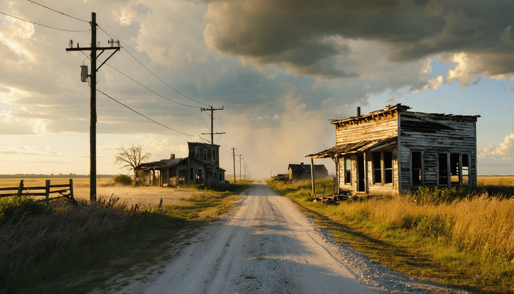
Once you’ve walked Horace’s quiet footprint, Edgar County still has more ghost town stops worth folding into your route. The county’s rural backroads connect several forgotten settlements, each carrying its own historical significance and scattered remnants worth exploring.
You’ll find abandoned buildings hiding behind overgrown tree lines, their weathered facades telling stories of communities that once thrived on agriculture and tight-knit social bonds.
Keep Paris as your base camp since it sits centrally and gives you easy access to multiple directions. Head north or south along Illinois Route 1, and you’ll cross through stretches where small hamlets once dotted the landscape.
Pair these stops with Horace to build a full-day drive through Edgar County’s layered, largely forgotten rural history.
Frequently Asked Questions
Is There an Admission Fee to Visit the Horace Ghost Town Site?
You don’t need to pay any admission fee to explore Horace’s ghost town history! You’re free to visit, uncover local legends, and wander this hauntingly accessible site anytime you desire adventure.
What Is the Best Time of Year to Visit Horace?
🌿 Spring and fall offer the best season to visit Horace. You’ll enjoy mild weather considerations, making exploration comfortable. Avoid winter’s harsh cold and summer’s intense heat for the most rewarding, freeing ghost town adventure.
Are Pets Allowed When Exploring the Horace Townsite Area?
No official pet friendly policies exist for Horace’s townsite, but you’ll want to keep your furry companion on a leash. Leash requirements typically apply near Edgar County Airport’s boundaries, so plan accordingly and explore freely!
Can Visitors Legally Photograph the Remaining Mercantile Building?
When in doubt, check it out — you can likely photograph the mercantile building, but you’ll want to respect photography etiquette and verify local regulations with Edgar County authorities before snapping your shots.
Is the Horace Site Suitable for Children or Elderly Visitors?
You’ll find Horace’s flat Midwestern terrain offers decent accessibility features for elderly visitors, while the open landscape suits family friendly activities. However, there’s minimal infrastructure, so plan accordingly for children’s comfort and mobility needs.
References
- https://www.ghosttowns.com/states/il/horace.html
- https://sites.rootsweb.com/~iltttp/ghosttowns.htm
- https://www.youtube.com/watch?v=AxFvQa1_els
- https://www.youtube.com/watch?v=DX90D-hf5QE
- https://en.wikipedia.org/wiki/List_of_ghost_towns_in_Illinois
- https://apps.apple.com/kz/app/ghosttownmap/id6761741652
- https://www.facebook.com/groups/historicroute66/posts/2402678193268358/
- https://everafterinthewoods.com/this-45-mile-illinois-trail-takes-you-through-haunting-ghost-towns-and-gorgeous-woodlands/
- https://www.onlyinyourstate.com/experiences/illinois/creepy-ghost-towns-il
- https://urbexunderground.com/ghost-towns-in-illinois/