Planning a ghost town road trip to Wasp, Tennessee means heading deep into Cherokee National Forest, where a 19th-century mining community now exists as stone foundations, collapsed cellars, and overgrown roadbeds. You’ll navigate 6.1 miles of maintained gravel road, so bring a high-clearance vehicle. Pack sturdy boots, water, a first aid kit, and an offline map since cell service is spotty. Fall offers the best visibility and terrain. Everything you need to make this trip unforgettable is just ahead.
Key Takeaways
- Wasp, Tennessee, is a former mining ghost town located within Cherokee National Forest, featuring stone foundations, collapsed cellars, and remnants of historic roadbeds.
- Access Wasp via a 6.1-mile maintained gravel road requiring a high-clearance vehicle due to loose stones and uneven terrain.
- No designated parking exists, so pull completely off the road onto stable surfaces, respecting locals and Forest Service vehicle access.
- Bring sturdy hiking boots, layered clothing, a first aid kit, ample water, and a GPS device due to spotty cell service.
- Fall offers the best visiting conditions, as thinning foliage improves ruin visibility and dry terrain makes travel more manageable.
Why Wasp, Tennessee Is Worth the Drive Into the Smokies

Few ghost towns in Tennessee reward the journey quite like Wasp does. Tucked inside the Cherokee National Forest, this former mining settlement carries a Wasp’s Legacy that speaks directly to the region’s rugged 19th-century frontier spirit.
You’re not visiting a curated museum — you’re stepping into reclaimed woodland where stone foundations, collapsed cellars, and skeletal roadbeds tell the story on their own terms.
The Historical Significance of Wasp lies in what it represents: a real community that rose, worked hard, and quietly disappeared when the coal and minerals ran out.
Wasp wasn’t abandoned — it was simply finished, its people leaving only after the land gave everything it had.
No plaques guide you. No rangers narrate the experience. You navigate it yourself, which makes the discovery entirely yours.
If you value raw, unfiltered history off the beaten path, Wasp absolutely earns the drive.
How Wasp Went From a Mining Town to a Ghost Town
Understanding why Wasp feels so eerily quiet today means looking back at what built it in the first place.
Wasp history begins during the 19th century, when coal and mineral extraction drew workers and families deep into these Tennessee mountains. The settlement grew around that economic engine, creating a real community in rugged terrain.
But when mining decline hit in the early 20th century, the town had no backup plan. Operations shut down, jobs vanished, and residents left for opportunities elsewhere.
Natural disasters accelerated the collapse, and the forest wasted no time reclaiming what people abandoned. Within decades, vegetation swallowed roads, homes, and gathering places whole.
What once supported livelihoods became overgrown wilderness. That rapid transformation from thriving settlement to silent ruins is exactly what you’ll feel when you walk through Wasp today.
How to Reach Wasp via Wolf Creek Road
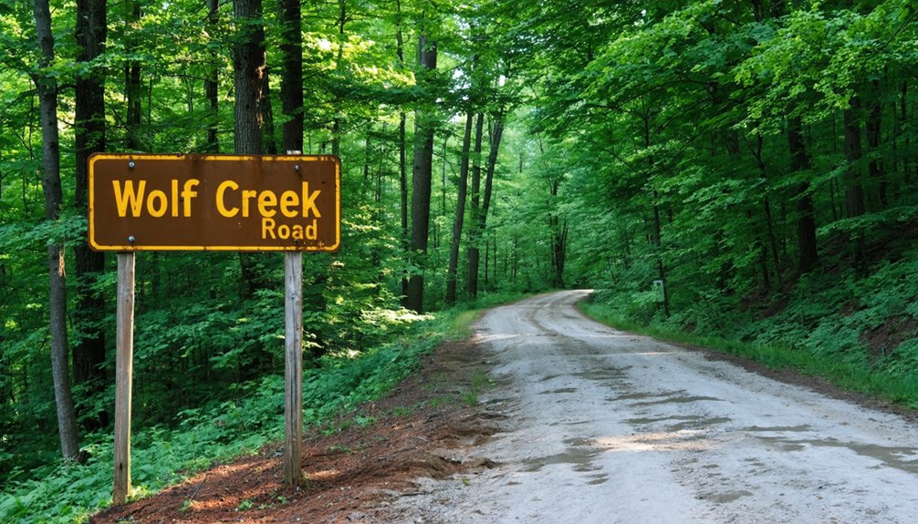
To reach Wasp, you’ll head out on Wolf Creek Road, a remote route that winds deep into the Cherokee National Forest.
Expect roughly 6.1 miles of maintained gravel terrain that demands a capable vehicle and a steady hand on the wheel.
Once you’ve reached the general vicinity of the former settlement, you’ll find no official parking markers, so you’ll need to pull off carefully and continue on foot to locate the ruins.
Starting Your Wolf Creek Drive
Wolf Creek Road is your gateway to Wasp, and it’s a route that sets the tone for the entire ghost town experience. Once you turn onto this road, you’ll leave pavement behind and commit to roughly 6.1 miles of Forest Service-maintained gravel cutting through the Cherokee National Forest.
The drive itself signals the shift from modern convenience to raw, unfiltered Tennessee wilderness. Keep your speed controlled and your eyes sharp — the terrain demands both attention and respect. This isn’t a Sunday cruise; it’s the opening chapter of genuine ghost town exploration.
Every mile narrows the distance between you and a settlement frozen in historical significance, its mining-era bones waiting beneath decades of forest regrowth. Prepare your vehicle, pack your curiosity, and embrace the remoteness ahead.
Once you’re rolling on Wolf Creek Road, the gravel announces itself immediately — loose stone pinging beneath your undercarriage, the road narrowing as Cherokee National Forest closes in on both sides.
You’ve got roughly 6.1 miles of Forest Service-maintained gravel ahead, and a few gravel road tips will keep your adventure on track.
Slow down on curves — visibility drops fast, and oncoming vehicles appear without warning. Count this among your road trip essentials: check tire pressure before departure, since sharp stone edges punish soft rubber.
No parking markers exist for Wasp specifically, so note your mileage and trust your instincts when the tree line feels significant.
The road rewards patience. Rush it, and you’ll miss the subtle signs that a forgotten town once thrived here.
Parking Near Wasp Settlement
Eventually, Wolf Creek Road delivers you to a point where forward progress stops making sense — the gravel thins, the tree canopy presses lower, and you’ll feel more than see that you’ve arrived in Wasp’s general vicinity.
No official parking markers exist here, so you’ll rely on instinct and courtesy when stopping.
Consider these parking alternatives and visitor etiquette guidelines:
- Pull completely off the road onto stable gravel shoulders, leaving the lane clear for other vehicles or Forest Service equipment.
- Avoid blocking unmarked paths or turnouts that locals and rangers may need unobstructed access to.
- Leave no trace at your stopping point — pack out everything you bring in.
From wherever you park, lace up your boots. The ruins won’t find you.
What the 6.1-Mile Gravel Drive Actually Looks Like
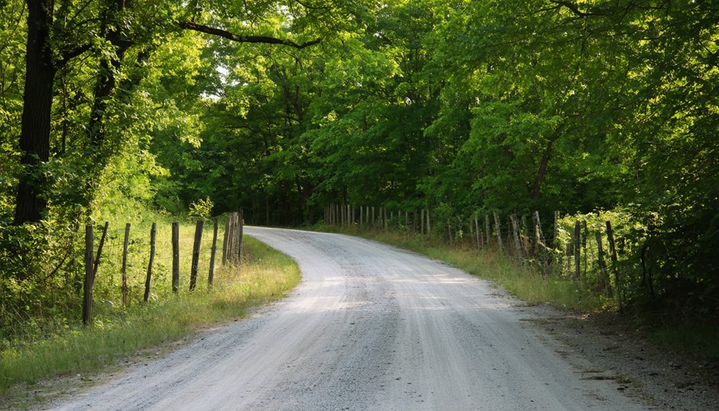
Once you turn onto Wolf Creek Road, you’ll find yourself traversing 6.1 miles of rough gravel that twists through dense forest canopy, demanding your full attention at every narrow curve.
The road’s uneven surface shifts between loose stone and compacted dirt, with tight bends that offer almost no visibility around corners, so you’ll want to keep your speed low and your horn ready.
Before heading out, make sure your vehicle has solid ground clearance, sturdy tires, and a spare, because this stretch rewards preparation and punishes overconfidence.
Road Surface And Conditions
The 6.1-mile gravel drive along Wolf Creek Road wastes no time reminding you that you’re deep in Cherokee National Forest territory.
Road conditions vary seasonally, so checking ahead before you roll out matters. The Forest Service handles gravel maintenance, but don’t expect a polished surface — this road earns its rugged reputation.
Expect these realities behind the wheel:
- Loose gravel and washboard sections that test your steering control, especially after heavy rain.
- Narrow passages where overhanging branches scrape rooflines and two vehicles barely pass each other.
- Uneven terrain with occasional ruts and embedded rocks that demand reduced speed and full attention.
A high-clearance vehicle handles this route far more comfortably than a standard sedan.
Respect the road, and it’ll deliver you straight into forgotten Tennessee history.
Snaking through Cherokee National Forest, Wolf Creek Road throws one blind curve after another at you, forcing you to creep along and hug the inside edge while loose gravel shifts under your tires.
You’ll want to keep your speed under 15 mph — gravel safety depends on it, especially where the road narrows to barely one lane. Overhanging branches slap your mirrors, and steep drop-offs appear without warning on the passenger side.
Road etiquette matters here because you’ll occasionally meet oncoming trucks; whoever has the uphill position typically holds the right of way. Pull to the widest available shoulder, stop completely, and let them pass.
The full 6.1 miles demands patience, but that slow crawl through dense forest builds the anticipation perfectly before you reach Wasp’s forgotten ruins.
Vehicle Preparation Tips
Before you point your vehicle toward Wolf Creek Road, you’ll want to run through a few critical checks that can save you from a frustrating breakdown miles from cell service.
Gravel maintenance out here is minimal, so your rig needs to handle whatever the road throws at it.
- Check tire pressure and tread depth — sharp gravel edges punish worn tires fast.
- Inspect your suspension and clearance — dips and embedded rocks demand at least moderate ground clearance for reliable vehicle safety.
- Pack a basic emergency kit — include a spare tire, jack, and jumper cables since no services exist nearby.
Prepare seriously, and you’ll cruise those 6.1 miles with confidence rather than anxiety.
Where to Park When You Arrive at the Wasp Site
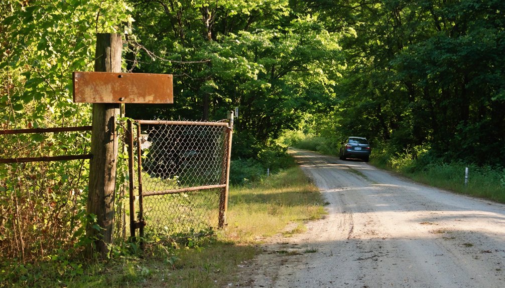
Parking at Wasp comes with zero official infrastructure — no designated lots, no marked pullouts, no signage telling you where to leave your vehicle. You’re on your own, and that’s part of the freedom here.
No lots. No signs. No hand-holding. At Wasp, parking is as wild as the land itself.
Wolf Creek Road’s gravel corridor gives you your best options — pull well off the roadway onto stable ground where you won’t block other travelers or damage vegetation. These practical parking tips keep the area accessible for everyone passing through.
Once you’ve secured your vehicle, shift into explorer mode. Hiking etiquette matters even in unmarked wilderness — stay aware of your surroundings, avoid disturbing stone foundations, and respect any unmarked grave sites you encounter.
The forest has reclaimed this land, and you’re simply a respectful guest moving through it.
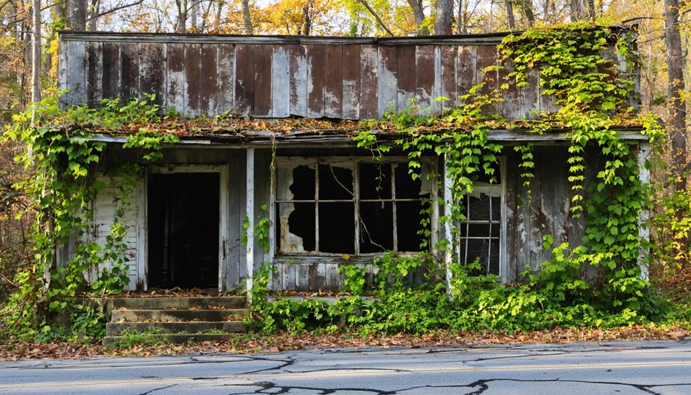
What Ruins You Can Still Find at Wasp Today?
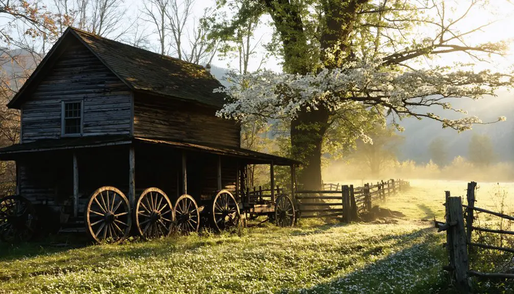
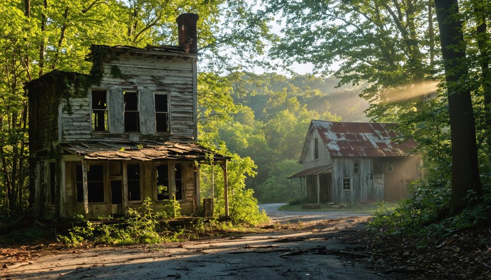
Once you push past the tree line and into Wasp’s reclaimed interior, the ruins reveal themselves slowly — stone foundations half-buried in leaf litter, cellar staircases descending into nothing, and skeletal roadbeds that once carried a living town’s daily traffic.
The Wasp architecture that survives speaks quietly but powerfully to the site’s historical significance as a 19th-century mining community.
Here’s what you can still discover:
- Stone foundations — Residential building bases scattered throughout the woodland floor
- Cellar staircases — Descending stone steps swallowed by decades of vegetation growth
- Roadbed remnants — Faint earthen paths tracing the town’s original layout
No signs mark these features, so you’ll need sharp eyes and patience to uncover what the forest hasn’t fully claimed.
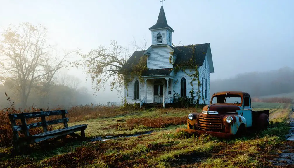
Other Ghost Towns Near Wasp for the Same Day Trip
After exploring Wasp’s stone foundations and silent roadbeds, you don’t have to end your ghost town day trip there — the Cherokee National Forest and surrounding Smokies region hold several other forgotten settlements worth tracking down on the same drive.
Farther along Tennessee’s remote gravel corridors, you’ll find additional mining-era communities slowly disappearing beneath forest canopy. These sites reward patient explorers willing to leave marked trails behind.
For ghost town photography, arrive during golden hour when filtered light dramatizes crumbling stonework beautifully. Always prioritize hiking safety by carrying a paper map, wearing sturdy boots, and telling someone your planned route before venturing into unmaintained terrain.
The Smokies don’t advertise these places — you’ve got to earn them.
What to Bring for Hiking the Wasp Ghost Town Site
Since no official signs or trail markers guide you through Wasp’s reclaimed woodland, you’ll want to pack sturdy hiking boots, layered clothing, a first aid kit, and plenty of water before stepping off the gravel road.
Charting the scattered stone foundations and overgrown roadbeds demands a reliable GPS device or a downloaded offline map, since cell service in the Cherokee National Forest can be spotty at best.
A printed topographic map serves as a solid backup, ensuring you can find your way to the ruins and back without second-guessing every fork in the undergrowth.
Essential Gear To Pack
Preparing for a hike through Wasp’s overgrown ruins means packing smart for remote, unmarked terrain deep in Cherokee National Forest.
No signs, no rangers, no safety nets — just you and the wilderness. Nail your gear essentials before hitting Wolf Creek Road, and you’ll hike with confidence.
Hiking safety depends entirely on your preparation here.
- Navigation tools — Carry a downloaded offline map and compass since cell service is unreliable in this remote hollow.
- Sturdy footwear — Wear ankle-support boots to handle uneven ground, hidden cellar openings, and dense root systems.
- First aid kit — Pack a compact kit covering cuts, sprains, and insect stings, because help isn’t close.
Own your adventure by arriving ready for whatever the forest throws at you.
Gear packed and boots laced, your next move is making sure you can actually find what you came for. Wasp doesn’t have trail markers, historical plaques, or signage pointing you toward its ruins. You’re traversing reclaimed forest on your own terms.
Download offline maps before you leave civilization — cell service along Wolf Creek Road is unreliable at best. Navigation apps like OnX Hunt or Gaia GPS let you drop custom waypoints and track your movement even without a signal.
A physical topographic map of the Cherokee National Forest serves as your backup when batteries drain. A compass rounds out your toolkit.
Between dense undergrowth and unmarked grave sites hiding beneath the vegetation, knowing your exact position isn’t optional — it’s what keeps your adventure from becoming a rescue call.
The Best Time of Year to Visit Wasp, Tennessee
Although Wasp, Tennessee doesn’t follow a formal tourist calendar, timing your visit makes a real difference in what you’ll experience on the trail. Each season shapes your exploration differently, influencing visibility, trail conditions, and local wildlife encounters.
- Spring (March–May): Wildflowers frame the stone foundations beautifully, but muddy gravel roads can challenge your vehicle.
- Fall (September–November): Thinning foliage dramatically improves ruin visibility, making it ideal for the best seasonal activities like photography and exploration.
- Summer (June–August): Long daylight hours maximize your time on site, though dense vegetation obscures many remnants.
Winter visits are possible but unpredictable.
You’ll find Wolf Creek Road’s remote terrain most forgiving during dry fall days when the forest opens up naturally.
How to Visit Wasp Without Damaging What’s Left
Knowing when to visit Wasp sets the stage, but how you move through the site matters just as much as when you arrive.
Wasp preservation depends entirely on visitors like you making conscious choices. Stay on natural pathways, and don’t disturb the stone foundations, cellar staircases, or any structural remnants you encounter. These fragments are irreplaceable.
For ghost town photography, get low, adjust your angle, and shoot without touching or repositioning anything. The ruins tell a truer story exactly where they stand.
Don’t remove artifacts, even small ones. Leave unmarked grave sites completely undisturbed and approach them with obvious respect.
You’re walking through what remains of a real community. Treat it that way, and future explorers will find the same haunting authenticity you discovered.
Frequently Asked Questions
Are There Any Cell Service or Emergency Contacts Available Near Wasp?
You’ll likely find little to no cell coverage near Wasp’s remote wilderness. Always inform someone of your plans, carry a satellite communicator, and know that emergency services face significant response delays in this rugged Cherokee National Forest terrain.
Is It Legal to Remove Artifacts or Stones Found at the Wasp Site?
You absolutely can’t take a single thing! Removing artifacts or stones violates federal law protecting artifact preservation within Cherokee National Forest. Respect Wasp’s historical significance by leaving every relic exactly where you find it.
Are Pets Allowed on the Hiking Trails Leading to Wasp Ruins?
You can bring your pets on the trails to Wasp’s ruins, but you’ll want to prioritize pet safety by keeping them leashed. Practice good trail etiquette while traversing Cherokee National Forest’s rugged, untamed wilderness.
Has Wasp, Tennessee Ever Been Featured in Documentaries or Television Programs?
Still off the beaten path, Wasp history hasn’t landed notable documentary or television coverage yet. You’ll find ghost town legends surrounding this site shared mostly through local adventurers and online communities rather than mainstream media productions.
Are There Any Restroom Facilities Accessible Along the Wolf Creek Road Route?
You won’t find dedicated restroom locations along Wolf Creek Road’s remote gravel stretch, so pack road trip essentials like portable facilities. Embrace the wild freedom of Cherokee National Forest, but always plan ahead for nature’s call!
References
- https://www.youtube.com/watch?v=wR0fmwf43cU
- https://www.onxmaps.com/offroad/trails/us/tennessee/wolf-creek-road
- https://www.onlyinyourstate.com/trip-ideas/tennessee/tn-ghost-town-road-trip
- https://www.youtube.com/watch?v=vnnmHa-cYk4
- https://en.wikipedia.org/wiki/List_of_ghost_towns_in_Tennessee
- https://www.youtube.com/watch?v=d1PuCNiGMYo
- https://www.youtube.com/watch?v=AxFvQa1_els
- https://wbkr.com/hidden-smokies-road-trip/
- https://www.youtube.com/watch?v=7mYZYhQaj4U
- https://kids.kiddle.co/List_of_ghost_towns_in_Tennessee