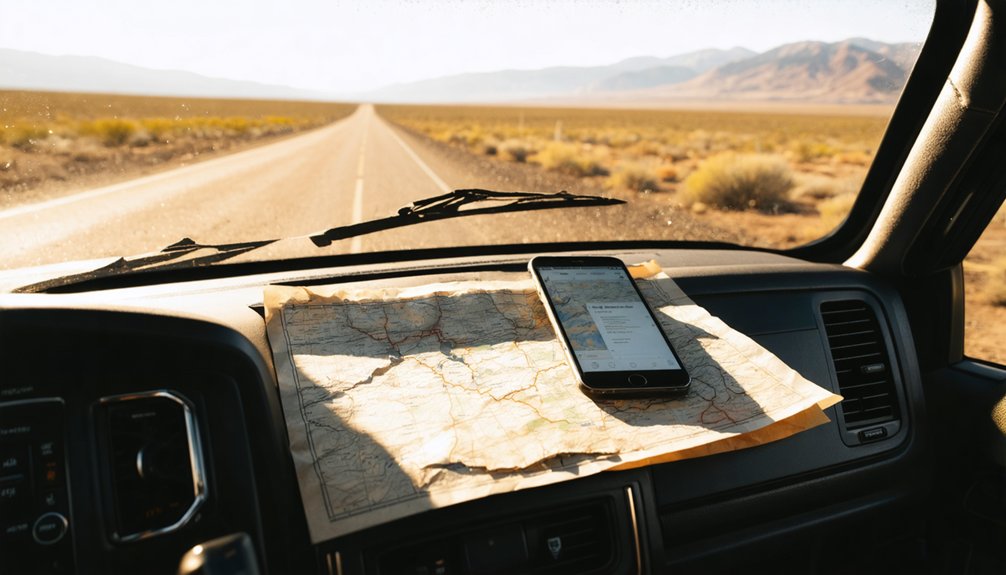
To plan your ghost town road trip to Iron Springs, Idaho, start 43 miles northwest of Council and drive 2WD roads to the trailhead. From there, you’ll hike five miles along an old wagon road into a canyon where 25 buildings once hummed with electric power. Download offline maps before you lose cell service, pack food and water for a full day, and target fall or spring for the best conditions. There’s much more waiting for you ahead.
Key Takeaways
- Iron Springs sits 43 miles northwest of Council, Idaho, requiring a 2WD drive followed by a five-mile hike along an old wagon road.
- Download offline maps, screenshot directions, and carry printed topographic maps since cell service is completely unreliable throughout the remote area.
- Visit during fall or spring for the best road conditions, as winter snow and summer heat make access significantly more challenging.
- Pack sturdy boots, trekking poles, ample water, and enough food for a full day since no assistance is available nearby.
- Combine your trip with visits to nearby ghost towns like Warrens to maximize exploration of Idaho’s rich regional mining history.
Electric Power, 25 Buildings, and One Surviving Barn
At its peak, Iron Springs was no quiet backwater — it hummed with electric power, a rarity for such a remote corner of Adams County. The Iron Springs Mining Company built roughly 25 structures here: homes, a hotel, saloons, and stores.
Iron Springs wasn’t sleepy — it crackled with electricity and ambition, boasting 25 structures in an unlikely corner of Adams County.
That electric history sets it apart from most ghost towns you’ll explore.
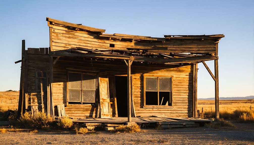
Today, surviving structures are scarce but rewarding. Most buildings have surrendered to winter snow and decades of weather, leaving foundations scattered across the landscape.
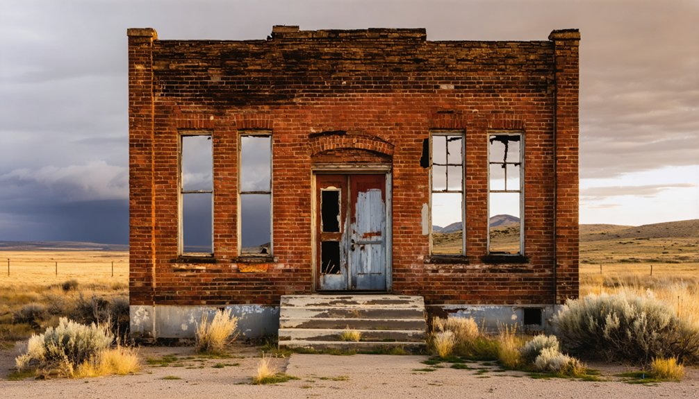
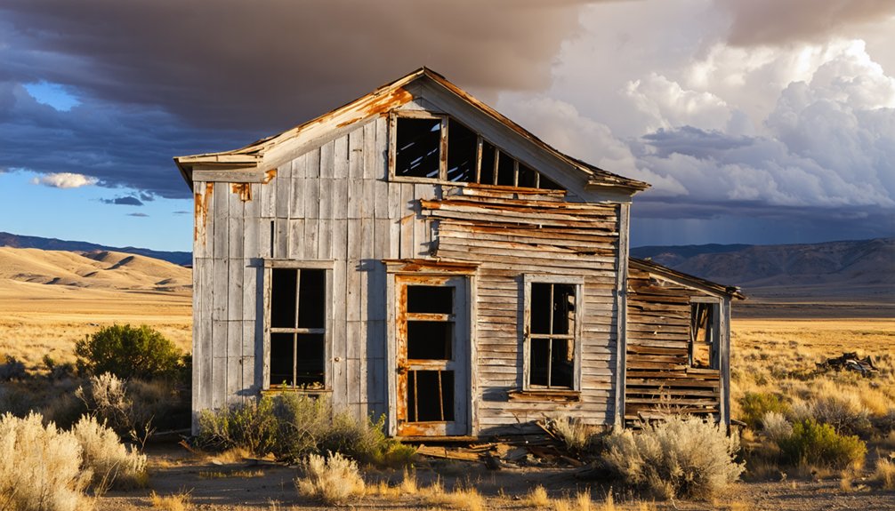
But one tin-roofed barn still stands, its gable and hay door intact — a false front added later, covered in flattened tin sheets.
You’ll want to study it carefully. It’s one of the last physical witnesses to a community that once defied its own isolation with ambition and infrastructure.
Where Iron Springs Sits in Adams County
Tucked into the remote reaches of Adams County, Iron Springs sits 43 miles northwest of Council — a placement that explains both its electric ambition and its eventual abandonment.
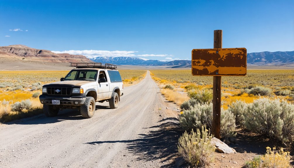
Paradise Creek threads through this isolated canyon, giving the town its water source and its character. You’ll access it via 2WD roads, then hike five miles along an old wagon road to reach it.
That distance once meant everything — it strangled supply chains, complicated transport, and ultimately drove settlers out. Yet the historical significance of this place endures in its foundations and surviving barn.
The mining legacy left behind by Iron Springs Mining Company shaped this whole corridor, including the sister community of Paradise sitting just half a mile downstream.
Distance defined Iron Springs. Now it defines your adventure.
How to Find the Trailhead Before You Lose Cell Service
Once cell service drops — and it will drop long before you reach the trailhead — you’ll be finding your way on memory, paper maps, and instinct alone.
These trail navigation tips aren’t optional luxuries; they’re survival basics for reaching Iron Springs.
Before you leave Council, download offline maps and screenshot every turn.
The access roads follow a 2WD grid system, so note your grid coordinates and landmark intersections while you still have signal.
Cell service challenges hit fast and hard in Adams County’s backcountry.
Print the relevant section of your topographic map and carry the *Southern Idaho Ghost Towns* reference book — both have guided explorers deeper into Paradise Creek country than any smartphone ever will.
Know your route cold before you leave pavement behind.
The 5-Mile Walk In on the Old Wagon Road
Once you leave your vehicle behind, you’ll follow the same worn wagon road that miners and supply teams traveled over a century ago, threading five miles through the remote Paradise Creek corridor toward Iron Springs.
The terrain’s mostly manageable on 2WD-accessible ground, but expect uneven surfaces, creek crossings, and sections where seasonal snow or mud can slow your pace.
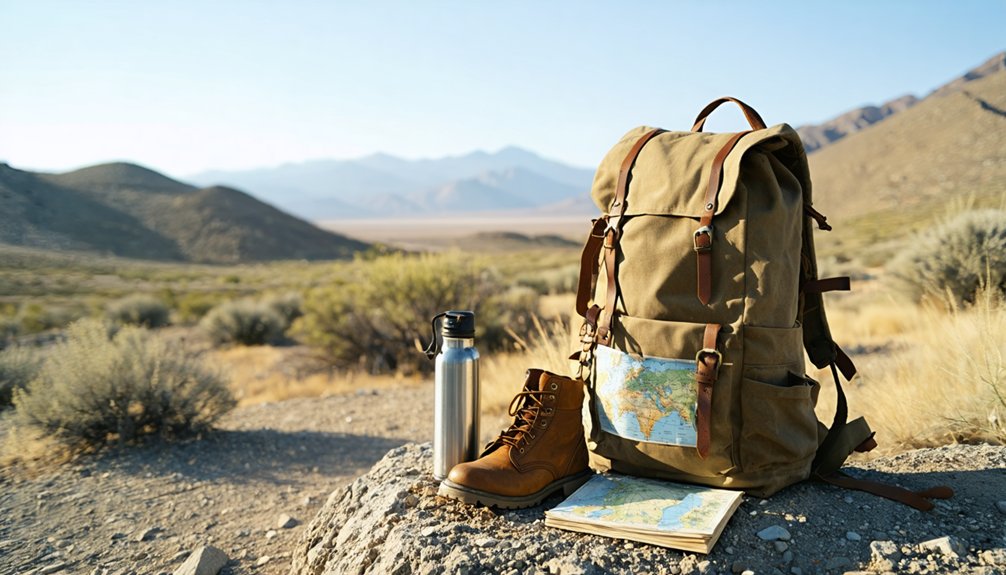
Pack water, sturdy boots, a printed topo map, and enough food for a full day, since there’s no cell service and no one coming to help if you’re caught underprepared.
Trail Conditions And Terrain
Before you reach Iron Springs, you’ll walk five miles along an old wagon road that once carried miners, supplies, and dreams into this remote stretch of the Paradise Creek drainage.
The trail challenges you with uneven ground, creek crossings, and stretches where nature has reclaimed what men once built. Terrain features shift between open meadows, dense timber, and rocky hillsides that reward patience and steady footing.
You’re walking the same route that horses and mule teams once struggled through hauling equipment for the Iron Springs Mining Company.
Wear sturdy boots, carry enough water, and budget a full day. This isn’t a casual stroll — it’s a deliberate journey into Idaho’s forgotten past, where every step connects you to a world that vanished long ago.
What To Pack Along
Five miles of old wagon road demands respect, so pack like you mean it. Your packing essentials start with sturdy boots, because this terrain doesn’t forgive casual footwear. Bring more water than you think you’ll need — Paradise Creek runs nearby, but don’t trust it untreated.
Your hiking gear should include:
- Topo map of the Lost area reference
- First aid kit for remote conditions
- Layered clothing — temperatures shift fast along the creek corridor
- Snacks with real calories, not just trail mix
- Camera or sketchbook to document foundations and that surviving tin-roof barn
You’re walking where miners once hauled equipment by mule. No cell signal, no shortcuts, no safety net.
Pack smart, move confidently, and earn every ruin you find.
What Still Stands at Iron Springs Today
Scattered across the remote Paradise Creek corridor, only a handful of structures have survived the relentless cycle of heavy snowfall and mountain weather that’s steadily reclaimed Iron Springs.
You’ll notice foundations dominating most of the townsite, silent markers of what once housed 25 homes, saloons, and stores.
The most striking piece of ghostly architecture still standing is a tin-roofed building featuring a gable and hay door, likely a livery stable or barn.
The most haunting survivor: a tin-roofed building with a gable and hay door, whispering of livery stables and frontier life.
Someone later added a false front, covering it with flattened tin sheets — a small but fascinating detail connecting you directly to Iron Springs’ mining history.
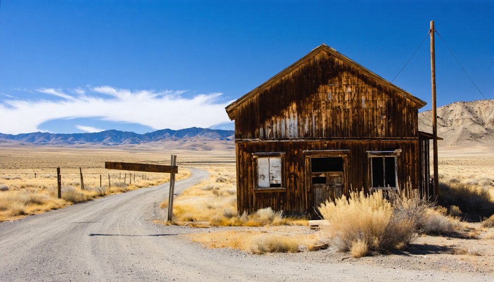
Half a mile down, Paradise offers a few additional standing structures worth exploring.
Together, both sites paint a raw, unfiltered picture of frontier ambition meeting mountain reality.
Paradise: The Sister Town Half a Mile Down the Creek
Half a mile down Paradise Creek from Iron Springs, the aptly named Paradise waits with its own quiet story to tell. This sister town shared Iron Springs’ fate — built on mining ambition, abandoned when the earth didn’t deliver.
Together, they formed a tight-knit corridor of frontier life along this remote Adams County creek, each carrying its own historical significance in Idaho’s mining chapter.
You’ll find some buildings still standing here, survivors of decades of crushing snow and brutal winters.
Walk the old wagon road between both towns and you’re retracing the daily steps of miners who hauled supplies, traded gossip, and chased fortune.
Paradise feels quieter than Iron Springs, more forgotten — which somehow makes discovering it feel even more rewarding.
Which Seasons Let You Into Iron Springs Without Getting Stuck?
If you’re planning a trip to Iron Springs, timing is everything—winter snows don’t just flatten old buildings, they close the roads entirely, cutting off access to this remote Adams County site.
Your best windows are fall and spring, when the 2WD roads dry out enough to handle the five-mile wagon-road walk without turning into a muddy trap.
Summer works too, but it’s the shoulder seasons that give you the perfect balance of passable roads and cool, comfortable hiking weather.
Best Seasons For Access
Four seasons divide the year, but only three of them welcome you to Iron Springs without a fight.
Winter closes the remote Adams County roads with snow, the same snow that’s slowly flattened what remains of those 25 abandoned buildings over decades.
Fall, spring, and summer each offer real access — pack your hiking gear accordingly, because you’re still walking five miles along an old wagon road regardless of season.
Fall brings crisp air and seasonal wildlife moving through Paradise Creek‘s corridors.
Spring thaws open the 2WD roads but keeps the mud honest.
Summer gives you the longest daylight for exploring foundations and that lone tin-roofed barn still standing.
Choose your window deliberately — Iron Springs rewards the prepared traveler and punishes the careless one.
Winter Closes The Roads
Winter doesn’t negotiate with travelers headed to Iron Springs — it simply closes the Adams County roads and ends the conversation.
Snow challenges stack up fast in this remote Paradise Creek corridor, and the 2WD roads become impassable before you’ve even reached your trailhead.
Winter access fundamentally vanishes, leaving the ghost town sealed beneath heavy drifts that have already flattened most of what time spared.
Ironically, that same snow is what crushed the remaining structures over decades — the very obstacle blocking your visit is the force dismantling your destination.
Wait it out. Late spring arrives, snowmelt retreats, and those old wagon road miles open again.
Plan for fall, summer, or spring — seasons that actually let you walk those five miles without surrendering to the mountain.
Fall And Spring Ideal
Fall and spring earn their reputations at Iron Springs the hard way — when snowmelt finally retreats and the Adams County roads dry enough to hold a vehicle, you’ve got your window.
Hit the trail in spring and you’ll catch Paradise Creek running full while spring blooms push through the same soil that once supported 25 homes and a hotel.
Come autumn and the canyon lights up with autumn colors that the Iron Springs Mining Company’s workers never had time to appreciate.
Both seasons give you passable 2WD roads and firm ground for the five-mile walk along the old wagon road.
Miss that window and you’re waiting months.
Time your visit right and the ghost town opens like it’s been expecting you.
What to Bring for Iron Springs’ Remote 10-Mile Round-Trip
Tackling the 10-mile round-trip to Iron Springs means packing smart for a remote stretch of Paradise Creek country where the nearest help is miles away.
These essential gear and hiking tips keep you moving confidently through forgotten terrain:
- Water and food – Carry more than you think you’ll need; there’s no resupply once you’re on that old wagon road.
- Sturdy footwear and trekking poles – The 2WD access roads give way to uneven trail; your ankles will thank you.
- Topographic map and compass – Cell service won’t save you out here, so navigate the lost-area terrain the old-fashioned way.
Plan for a full day, move at a leisurely pace, and let Iron Springs reveal itself on its own terms.
Other Adams County Ghost Towns Near Iron Springs
Once your pack’s loaded and Iron Springs is squared away on your itinerary, Adams County rewards the curious with more ghost towns worth chasing down.
Warrens sits nearby, offering rich mining history that mirrors Iron Springs’ own story of boom, struggle, and abandonment. These forgotten communities share DNA — placer claims, isolation, and the slow erasure of weather and time.
Ghost town exploration here isn’t just about ruins; it’s about piecing together a region that once hummed with electric ambition despite being miles from nowhere.
Plan your route to string multiple sites together across a long weekend. Each stop deepens your understanding of Idaho’s mining past and delivers the kind of raw, unfiltered history that no museum can replicate.
Frequently Asked Questions
Can I Camp Overnight Near Iron Springs or Paradise Creek?
You can camp overnight near Paradise Creek! Embrace the freedom of this remote wilderness. Follow essential camping tips, respect local wildlife, and you’ll sleep where miners once dreamed of striking it rich.
Is a Permit Required to Visit Iron Springs Ghost Town?
Like an open book of history, Iron Springs needs no ticket — ghost town access is yours freely. No permits govern visiting regulations here, but you’ll want to respect the remote, fragile remnants along Paradise Creek.
Are There Any Guided Tours Available for Iron Springs?
No official ghost town tours exist for Iron Springs, but you’ll forge your own adventure exploring its historical significance independently. Lace up your boots, grab a map, and let freedom guide you through its storied ruins!
Was Iron Springs Ever Considered for Historical Preservation Efforts?
Ironically, Iron Springs’ historical significance hasn’t sparked major preservation efforts yet. You’ll find preservation challenges abound—snow flattens buildings, weather erodes foundations. Check resources like *Southern Idaho Ghost Towns* to explore whether any efforts have since emerged.
What Mining Company Originally Operated the Iron Springs Placer Claims?
You’ll discover that the Iron Springs Mining Company originally operated the placer mining claims there. Their mining history shaped this remote Idaho frontier, where you’re free to explore electric-powered ambition carved boldly into Paradise Creek’s wild, untamed wilderness.
References
- https://www.ghosttowns.com/states/id/ironsprings.html
- https://www.youtube.com/watch?v=Xip3R2ekvgM
- https://www.therockerbox.com/adams_county_id_ghost_towns.htm
- https://history.idaho.gov/wp-content/uploads/2018/08/0064.pdf
- https://outerrealmz.com/the-amazing-ghost-towns-of-central-idaho/
- https://books.google.com/books/about/Southern_Idaho_Ghost_Towns.html?id=Oyet3Zdhj-4C
- https://www.youtube.com/watch?v=RNCaxrY62ZI
- https://skyscraperpage.com/forum/showthread.php?p=3338321
- https://collections.lib.utah.edu/details?id=423157&hl=University+of+Utah+Ski+Team