Planning a ghost town road trip near Lakewood, Iowa means chasing quiet history through Ringgold County’s vanished settlements and Lake Red Rock’s submerged streets. You’ll find intact structures in Caledonia, eerie low-water road beds, and cemeteries marking where communities once thrived. Start near the Missouri border and work your way northeast, using offline maps and printed guides through areas with spotty cell coverage. Everything you need to find these forgotten places is waiting just ahead.
Key Takeaways
- Start your route from Ringgold County near the Missouri border, visiting Caledonia’s intact store, church, and school before heading northeast.
- Lake Red Rock conceals six submerged towns; visit in late August or September when dropping water levels reveal old roads and foundations.
- Look for ghost towns using cemeteries, dead-end roads, soil depressions, clustered trees, and historical markers along county roads.
- Pack offline maps, printed brochures, layered clothing, waterproof boots, and a camera to navigate limited cell coverage areas effectively.
- Notable stops include Lesanville’s living history farm, Buckhorn’s surviving creamery, and Rockville’s old mill for authentic, untouristy exploration experiences.
Why Iowa Has More Ghost Towns Than Most People Realize
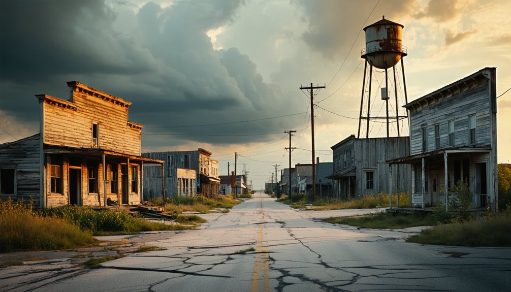
When most people picture ghost towns, they imagine the sun-bleached saloons and abandoned mine shafts of the American West — but Iowa’s quietly dissolving settlements tell a different kind of story.
Between 1880 and 1940, westward expansion, shifting rail lines, and collapsing industries erased hundreds of communities from Iowa’s History. Some vanished after quarry closures, others burned down and were never rebuilt, and some literally sank beneath reservoir waters.
You won’t find Hollywood drama here — you’ll find butter creameries, submerged cemeteries, and roads that dead-end into lakes.
These Ghost Towns’ Stories aren’t about boom-and-bust gold rushes; they’re about ordinary people whose entire worlds quietly disappeared. Iowa rewards the curious traveler willing to look past the cornfields.
Ringgold County’s Vanished Towns and Where They Used to Be
Head south to Ringgold County, near the Missouri border, where towns like Athens, Caledonia, and Lesanville once thrived and now exist only as whispers in the landscape.
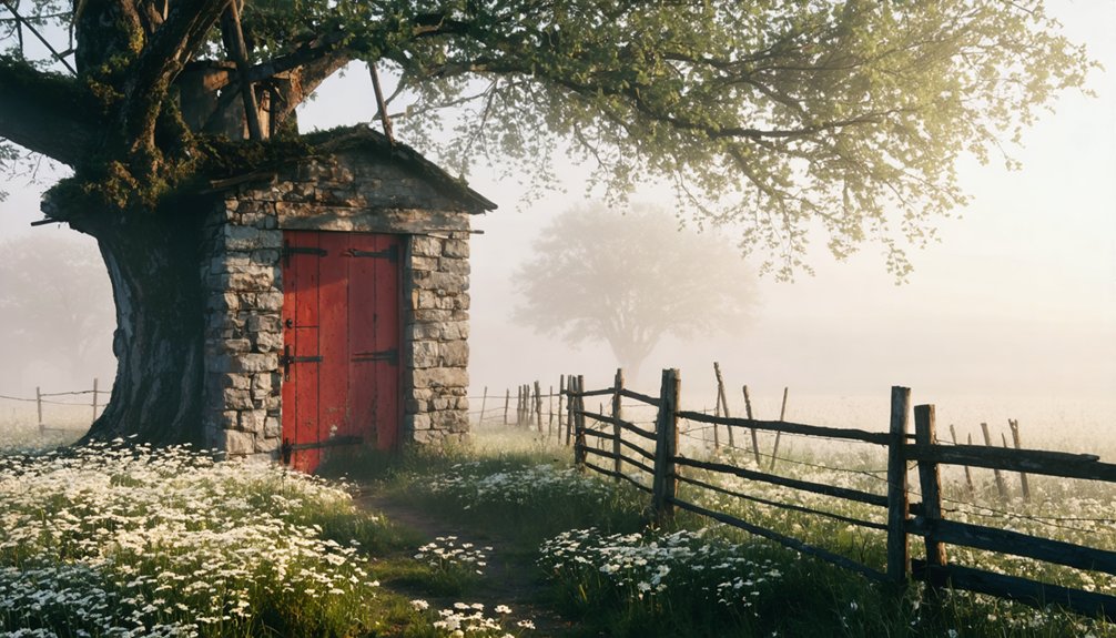
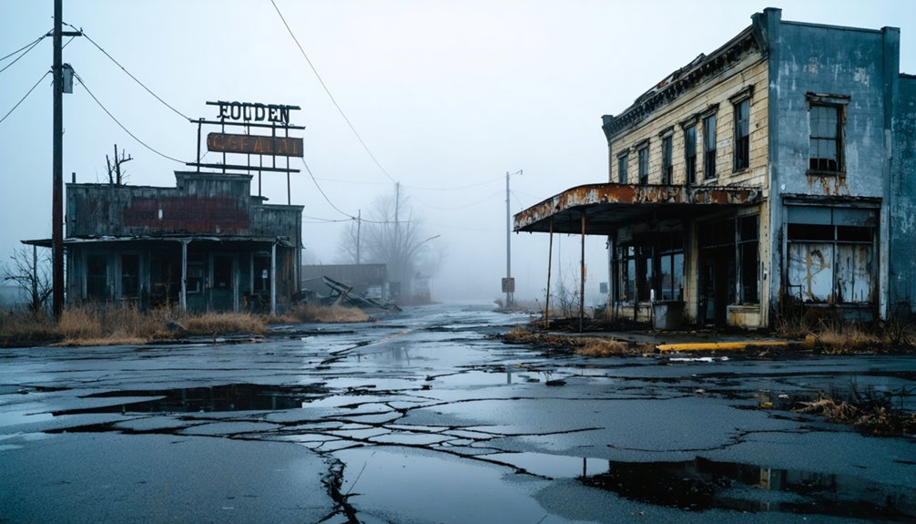
At Caledonia, you’ll still find the original store, church, and school standing quietly, the same store where Bonnie and Clyde reportedly stopped in 1933.
Lesanville, gone by 1942, now operates as a living history farm, giving you a rare chance to walk through a vanished community that’s been carefully preserved rather than simply forgotten.
Ringgold County’s Lost Towns
Ringgold County, tucked along Iowa’s southern border near Missouri, hides the bones of several towns that time quietly swallowed.
Ringgold history runs deep here — Athens once reinvented itself as New Chicago, Blackmore operated a post office until 1895, and Caledonia, named from Sir Walter Scott’s poetry, still stands with its store, church, and school intact.
Ghost town legends cling to Caledonia especially — Bonnie and Clyde‘s gang actually stopped at that old store in 1933.
Lesanville vanished entirely by 1942, now breathing again as a living history farm centered around the Lesan House.
You can walk these grounds, photograph what remains, and feel the weight of lives that once filled these forgotten crossroads.
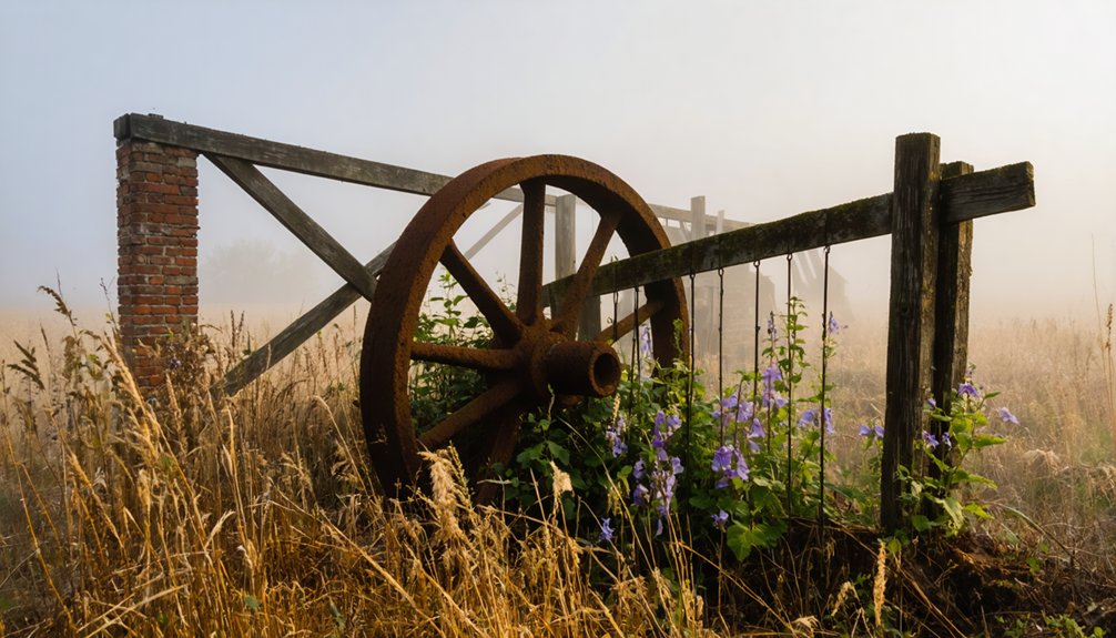
Finding Vanished Town Remnants
Scattered across Ringgold County’s rolling southern Iowa terrain, the remnants of vanished towns aren’t always obvious — but they’re there if you know what to look for.
At Caledonia, you’ll find standing proof of forgotten histories — a store, church, and school still intact, perfect for photographs.
Athens, once rechristened New Chicago, left subtler vanished landmarks; you’ll need a sharp eye and county maps to orient yourself.
Lesanville rewards curious travelers as a living history farm, where the Lesan House breathes life into what might’ve disappeared entirely.
Blackmore Corner exists mostly in old post office records now.
Wander these back roads with purpose, cross-reference historical markers, and let the landscape itself guide you — the silence between the hills speaks volumes about what once thrived here.
Lake Red Rock’s Sunken Iowa Ghost Towns and Their History
When you visit Lake Red Rock — Iowa’s largest lake — you’re actually driving past the watery graves of six towns, their homes, farms, banks, post offices, and schools now silenced beneath the surface.
Fifield, once a thriving Whitebreast settlement dating to the 1840s, and tiny Cordova, where Grace Karr once typed up the *Cordova News* for a population of just 17, are among the communities that surrendered to the rising water.
Today, you can catch ghostly glimpses of old roads that lead nowhere, their crumbling paths surfacing during low water, while the Red Rock Cemetery — the only one spared from submersion — stands watch above the lake as a lonely sentinel to what once was.
Submerged Towns And History
Beneath the surface of Lake Red Rock—Iowa’s largest lake, located in Marion County—lie the sunken remnants of six lost towns, their homes, farms, banks, post offices, and schools now swallowed by still water.
You’re exploring submerged history when you visit here, standing above communities that once thrived and then vanished beneath rising waters.
Fifield, originally the Whitebreast settlement, dates to the 1840s and survived into the 1930s before disappearing.
Tiny Cordova, with a population of just 17 in the 1950s, ceased existing by the early 1960s.
When water levels drop, roads emerge leading nowhere, creating an eerie atmosphere that draws curious travelers.
Only Red Rock Cemetery remains above water, a lone sentinel watching over everything lost below.
Exploring Remnants Today
Visiting what remains of these sunken communities today means trading conventional sightseeing for something far stranger and more atmospheric. When water levels drop, roads literally lead nowhere, vanishing beneath the surface while foundations emerge like bones.
Bring your camera, because ghost town photography doesn’t get more dramatic than foggy bridges dissolving into Lake Red Rock’s still water. You’ll find Fifield’s Dunreath Cemetery still standing on dry ground, offering a tangible connection to the Whitebreast settlement’s long history.
Local legends suggest eerie atmospheres intensify during morning fog, when seagulls gather over shallow water concealing entire neighborhoods beneath them. Grab the brochures available at the lake for detailed historical context.
You’re not just sightseeing here — you’re bearing witness to communities that time, water, and progress permanently erased.
How to See the Submerged Streets When Water Levels Drop
During drought years or late summer drawdowns, Lake Red Rock pulls back its curtain and reveals the ghost streets below. When water levels drop, you’ll spot old roadbeds cutting through the shallows, foundations emerging like bones through skin.
Watch for seagulls hovering over shallow water — they’re often marking submerged streets and structural remnants beneath.
Pelicans circling low over the shallows often signal submerged foundations and forgotten roads waiting just beneath the surface.
Time your visit for late August or early September when drawdowns typically expose the most. Arrive at dawn before wind disturbs the water’s surface. Fog rolling across the lake amplifies the eeriness considerably.
Bring polarized sunglasses to cut through glare and see deeper into the shallows. A drone gives you the aerial perspective that reveals the old town grid most clearly. Red Rock Cemetery remains your fixed landmark above water.
Which Iowa Ghost Towns Still Have Standing Structures
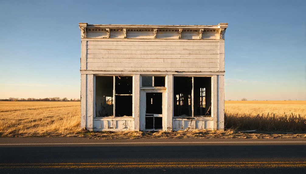
Not every Iowa ghost town has surrendered itself to water or time. Some still stand, waiting for you to find them.
Caledonia keeps its store, church, and school intact — abandoned architecture frozen with genuine historical significance. You can walk right up, photograph the weathered walls, and feel the weight of lives once lived there.
Lesanville operates as a living history farm, giving you hands-on access to Iowa’s rural past. Over in Buckhorn, a creamery building still anchors the landscape, while Rockville’s old mill and cemetery dare you to explore.
These aren’t reconstructed tourist traps — they’re authentic remnants you can reach on your own terms. Load your map, point your vehicle south, and claim these forgotten places before time finishes what it started.
Shannon City and Caledonia: Fires, Outlaws, and What Remains
Shannon City and Caledonia don’t share a county line, but they share the same stubborn refusal to disappear quietly.
Shannon City fires gutted the Ringgold County side before 1889, yet Dr. Loomis rebuilt the whole town within two years. That kind of defiance leaves marks you can still trace today.
Fire took Shannon City. Dr. Loomis gave it back.
Caledonia outlaws wrote a darker chapter. In 1933, Clyde Barrow, Bonnie Parker, Buck, and Blanche rolled through and stopped at the local store.
The store still stands. So does the church. So does the school.
You can walk through both towns and feel that resistance in the remaining walls and weathered wood.
These places didn’t surrender to fire, fugitives, or time. They’re waiting for you to show up and see that for yourself.
How to Spot What’s Left When the Town Is Mostly Gone

Most ghost towns don’t announce themselves with a sign. You’ll notice a cemetery where no town exists, a road that dead-ends into a field, or a church standing alone against an empty horizon.
Look for depressions in soil where foundations once settled, mature trees clustering unnaturally in open farmland, or stone walls half-swallowed by brush. Historical markers occasionally appear along county roads, offering brief context before the silence takes over again.
For ghost town photography, arrive at dawn or in fog — light filters differently through abandoned structures, and atmosphere matters as much as the subject.
Walk slowly. Scan the edges of fields. Let your eyes adjust to absence. The best discoveries happen when you stop rushing and start reading the landscape itself.
The Best Route Through Southern Iowa’s Lost Communities
You’ll want to start your southern Iowa ghost town loop by heading into Ringgold County from the Missouri border side, picking up the highways that thread toward Athens and Caledonia before swinging northeast toward Lake Red Rock in Marion County.
String your stops together intentionally — Caledonia’s intact store, church, and school feed naturally into the eerie lakeside roads at Red Rock, where low water sometimes exposes the foundations of swallowed towns.
Don’t rush past the detours, because the fog-draped bridges near Fifield’s remnants and the quiet pull-off at Red Rock Cemetery reward the driver willing to leave the main route behind.
Southern Iowa Highway Access
Tucked along Iowa’s southern edge near the Missouri border, Ringgold County’s ghost towns are easiest to reach via the state highway network that threads through the region’s rolling farmland.
You’ll navigate toward Athens and Caledonia using connecting state routes that drop south from Interstate 80, cutting through quiet corridors of corn and timber. These roads deliver you directly into southern Iowa attractions that most travelers completely miss.
Caledonia’s surviving store, church, and school make ideal stops for ghost town photography, their weathered facades telling stories without a single interpretive sign.
Keep your tank full and your maps downloaded offline — cell coverage thins considerably out here. The freedom of these open routes rewards explorers willing to leave the interstate behind and follow the county roads wherever they lead.
Connecting Ghost Town Stops
Once you’ve soaked in Caledonia’s weathered storefronts and snapped your photos, the real reward of southern Iowa’s ghost town circuit comes from stringing these lost communities together into a single, unhurried drive.
Layer ghost town folklore into every stop by planning this sequence:
- Caledonia → Lesanville – Walk the living history farm before history fades into farmland.
- Lesanville → Lake Red Rock – Chase eerie photography along roads that vanish into shallow water, especially during fog.
- Lake Red Rock → Buckhorn and Rockville – End with the creamery ruins and creepy mill cemetery.
You’ll cover Marion and Ringgold Counties efficiently, moving through landscapes where silence says more than any roadside marker ever could.
Scenic Detours Worth Taking
A few well-chosen detours transform this southern Iowa drive from a simple checklist into something genuinely atmospheric.
When you reach Lake Red Rock, don’t just pass through — follow the shoreline roads toward scenic overlooks where, on quiet mornings, submerged foundations emerge through shallow water like skeletal reminders of vanished lives.
Near Caledonia, hidden trails wind past the surviving church and store, pulling you deeper into a landscape that feels genuinely unchanged.
Walk them slowly. You’ll notice details no roadside stop reveals.
Between Ringgold County and Marion County, gravel backroads cut through rolling farmland that few travelers bother exploring.
Fog settles low here in autumn, turning ordinary intersections into something cinematic.
These detours add maybe an hour — but they deliver the atmosphere you actually came for.
What to Bring for a Ghost Town Road Trip in Iowa
Whether you’re traversing the foggy backroads of Lake Red Rock or picking through the standing remnants of Caledonia’s old store and church, packing smart will make the difference between a frustrating outing and an unforgettable one.
These road trip essentials keep you prepared for Iowa’s unpredictable terrain and weather:
Iowa’s unpredictable terrain and weather demand preparation — pack smart before venturing into its forgotten, fog-laden landscapes.
- Camera and drone – Ghost town photography demands wide-angle lenses for atmospheric fog shots and a drone for revealing submerged foundations during low water.
- Layered clothing and waterproof boots – Muddy cemetery paths and lakeside walks require durable footwear.
- Printed brochures and offline maps – Cell service disappears fast in Ringgold County’s rural stretches.
Pack light but purposefully, and you’ll move freely through these forgotten landscapes without missing a single eerie detail.
When to Go If You Want Fog, Low Water, and the Full Effect
Timing your visit right transforms a modest road trip into something genuinely haunting. Early morning in late autumn or winter delivers the fog photography conditions you’re chasing — thick mist rolling across Lake Red Rock’s surface, swallowing those eerie roads to nowhere whole.
You’ll feel the historical significance of submerged communities far more powerfully when foundations ghost up through shallow water at dawn. Late summer droughts drop water levels noticeably, exposing remnants that normally stay hidden.
Avoid peak summer weekends if atmosphere matters more than crowds. Overcast skies suit Ringgold County’s cemeteries and weathered storefronts better than harsh midday sun.
Check Marion County weather forecasts before heading out, and arrive early. The light, the mist, the silence — they do the storytelling for you.
Frequently Asked Questions
Are There Guided Tours Available for Iowa Ghost Town Road Trips?
You’ll find brochures available for guided exploration of Iowa’s ghost town history. Follow scenic routes through haunting landscapes, discover submerged towns at Lake Red Rock, and uncover forgotten stories that’ll ignite your adventurous, freedom-seeking spirit independently.
Can Drones Legally Be Flown Over Lake Red Rock Submerged Areas?
Dazzling drone discoveries await you! You’ll need to check current drone regulations before flying over Lake Red Rock’s submerged areas, as federal and local airspace rules actively govern flights above such protected waterways.
Is Camping Allowed Near Ringgold County Ghost Town Sites?
The knowledge doesn’t confirm camping regulations near Ringgold County’s ghost town history sites. You’ll want to contact local authorities to uncover camping regulations before pitching your tent beside these hauntingly beautiful, freedom-calling remnants of forgotten Iowa communities.
Are Any Iowa Ghost Town Sites Wheelchair Accessible for Visitors?
History’s open door welcomes you! Ghost town accessibility varies, but Caledonia’s intact store, church, and school offer historical site adaptations for easier visits. You’ll find Lesanville’s living history farm also accommodates diverse visitors exploring Iowa’s fascinating past.
Do Local Museums Sell Maps Specifically for Ghost Town Road Trips?
You’ll find brochures detailing ghost town history at Lake Red Rock, helping you uncover local attractions. Check visitor centers and local museums nearby — they’re your gateway to freedom, adventure, and exploring Iowa’s hauntingly fascinating forgotten landscapes.
References
- https://iagenweb.org/ringgold/misc/ghostowns.html
- https://www.geotab.com/ghost-towns/
- http://www.iowapbs.org/education/findiowa/media/9571/lost-towns-red-rock
- https://www.survivingateacherssalary.com/off-the-beaten-path-the-lost-towns-under-lake-red-rock-iowa/
- https://mintchiplab.marioncountyiowa.gov/assets/marion_county/maps/lost_towns_of_lake_red_rock_rural_history_buffs_brochure_96639.pdf
- https://pubs.lib.uiowa.edu/annals-of-iowa/article/7045/galley/115796/view/
- https://www.youtube.com/watch?v=1J0Qx64ZrwI