Planning a ghost town road trip to Islitas, Texas means heading deep into Webb County’s remote southwest, roughly 147 miles northwest of Laredo. Fill your tank before leaving the city, pack plenty of water, and download offline maps since cell service disappears fast out here. You’ll find weathered remnants of a coal town that peaked in 1914 and quietly vanished by the late 20th century. Stick around, because there’s far more to uncover about this forgotten corner of Texas.
Key Takeaways
- Islitas is located approximately 147 miles northwest of Laredo, Texas, accessible via winding Webb County roads requiring offline maps and fuel preparation.
- Visit during fall, winter, or spring to avoid extreme summer heat, with spring offering scenic wildflower blooms throughout the remote terrain.
- Fill up on fuel in Laredo before departing, as limited fuel stops exist along the remote northwestern route to Islitas.
- Islitas sits on private property, so obtain permission before accessing the site and exercise caution around unstable structures and foundations.
- Pack ample water, sturdy boots, a paper map, sunscreen, and a camera to ensure a safe and rewarding ghost town experience.
What Is Islitas and Why Does It Still Attract Visitors?
Tucked away in southwestern Webb County, Texas, Islitas is a ghost town that once thrived as a coal shipping hub along the Rio Grande and Pecos Valley Railroad before the mines dried up and everyone left.
At its peak in 1914, 300 residents called it home, supporting a post office, general store, and school. By 1920, the population had collapsed to 100, and by 1989, only a few abandoned houses remained on private land.
Islitas history draws curious travelers who crave raw, unfiltered American stories, the kind where boom turns to bust and nature slowly reclaims what humans built.
Ghost town exploration here isn’t about polished museums or guided tours. It’s about standing in silence where an entire community once hustled, breathed, and eventually disappeared.
Where Exactly Is Islitas, Texas Located?
Nestled in southwestern Webb County, Texas, Islitas sits at roughly 27°40’2″N, 99°39’11″W, about 147 miles northwest of Laredo via Farm Road.
You’ll reach this remote stretch by traversing the winding roads of Webb County, where the landscape stretches wide and open — perfect for adventurers craving discovery off the beaten path.
Islitas history traces back to 1882, when the Rio Grande and Pecos Valley Railroad established it as a coal shipping stop, making Texas mining the heartbeat of this once-thriving settlement.
Coal shaped Islitas from the start — born in 1882 as a vital railroad shipping hub for Texas mining.
Today, the coordinates lead you to scattered remnants of a forgotten era.
Getting there demands preparation, but the reward is standing where hundreds once lived, worked, and ultimately left behind everything.
Pack your map, fuel up, and let the open road carry you there.
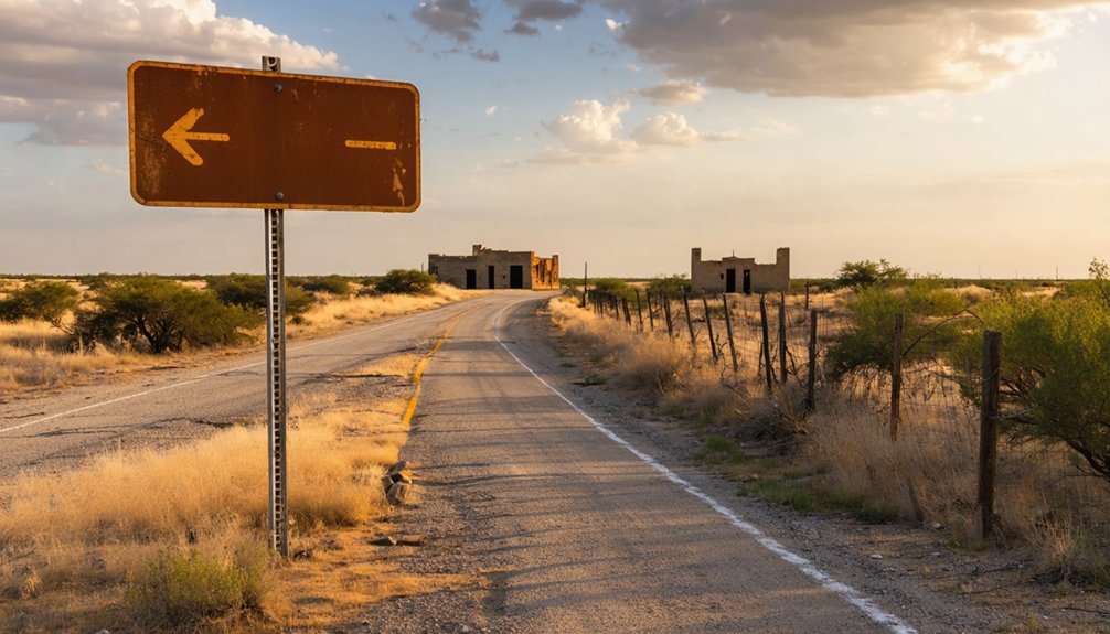
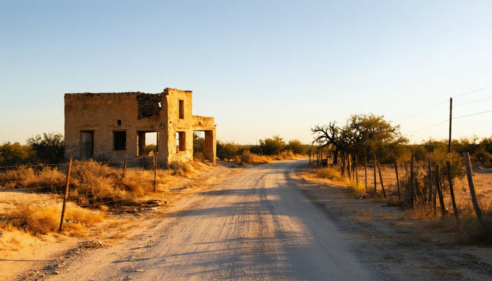
What’s Left to See at the Islitas Ghost Town Site
When you arrive at the Islitas site today, you’ll find only a few old weathered houses standing on private property, silent remnants of a town that once bustled with 300 residents.
The ruins offer a haunting snapshot of the boom-and-bust cycle that defined Texas mining communities in the early twentieth century.
You can trace the outlines of what once held a general store, a school, and the infrastructure of a working railroad coal town now swallowed by time.
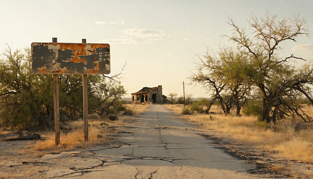
Remaining Structures Today
As you pull up to the Islitas site today, don’t expect much beyond a handful of weathered old houses sitting quietly on private land.
These abandoned structures carry deep historical significance, standing as silent proof of a once-thriving coal town that peaked at 300 residents in 1914.
You won’t find restored buildings or interpretive signs here.
What you’ll encounter is raw, unfiltered history — crumbling walls and forgotten foundations where a general store, a one-teacher school, and a functioning post office once served a working community.
By 1989, surveyors confirmed only a few structures remained.
This is the kind of ghost town that rewards curious, independent travelers.
Respect the private property boundaries, take your photographs, and let the ruins tell their own story.
Historical Ruins Overview
Beyond those weathered houses, the Islitas site offers a fragmented but fascinating physical record of its boom-and-bust past.
You’ll find echoes of the old railroad infrastructure, remnants tied to coal transport routes that once drove this community’s entire economy. The historical significance here runs deep — this was a living, breathing town of 300 people at its 1914 peak, complete with a general store, school, and post office.
Local legends surrounding the mines and the rapid exodus after closures add an eerie, compelling layer to your exploration.
Walking the grounds, you’re fundamentally reading a collapsed timeline — from railroad stop to ghost town in under four decades.
Bring your curiosity and sturdy boots, because Islitas rewards those willing to look closely at what silence leaves behind.
The Rise and Fall of Islitas as a Coal Mining Town
When you trace Islitas back to its roots, you’ll find that the Rio Grande and Pecos Valley Railroad sparked the town’s creation in 1882, turning a remote Webb County landscape into a bustling coal shipping hub.
By 1914, the population had climbed to 300 residents, supported by a post office, general store, school, and five livestock feeders.
Then the mines dried up, the people left, and by 1920 only 100 residents remained — a decline that ultimately transformed Islitas into the ghost town you’re exploring today.
Railroad Origins Spark Growth
The year 1882 marked a turning point for this remote corner of southwestern Webb County, when the Rio Grande and Pecos Valley Railroad drove its tracks through the rugged Texas landscape and put Islitas on the map.
The railroad impact was immediate — coal shipments began flowing outward, and settlers moved inward. By 1910, 200 people called this place home, and by 1914, that number climbed to 300.
A post office opened, a general store served the community, and a one-teacher school educated thirty-six local children.
The mining legacy built something real out of raw, unforgiving land. You can almost feel that energy standing among the ruins today — the ambition of people who carved a working town from nothing, following iron rails into the unknown.
Peak Population And Prosperity
By 1914, Islitas had hit its stride — 300 residents packed into a coal-dusted settlement that hummed with purpose. Population dynamics shifted fast here, fueled by coal demand and railroad access.
You’d have found a thriving pocket of frontier self-sufficiency:
- A general store stocking essentials for miners and families
- Five livestock feeders supporting local agricultural needs
- A one-teacher school educating thirty-six pupils
- A post office connecting residents to the outside world
But economic shifts don’t wait for anyone. Once the mines peaked, decline followed swiftly.
Mine Closures Drive Abandonment
Once the coal reserves thinned out, Islitas didn’t just slow down — it collapsed. The mine abandonment happened fast, pulling the town’s economic foundation right out from under its residents. By 1920, the population had plummeted from a 1914 peak of 300 people down to just 100. That’s not decline — that’s a freefall.
Economic decline hit every corner of the community. The general store shuttered, the post office closed in 1924, and families packed up and moved toward steadier work elsewhere. Nobody stayed behind to watch the dust settle.
When you visit today, you’re walking through the aftermath of that collapse — a few weathered structures on private land, standing as raw proof that resource-dependent towns live and die by what’s underground.
Best Time of Year to Visit Islitas, Texas
Planning your ghost town adventure to Islitas requires careful thought about Texas weather, since the region’s harsh climate can make or break your experience. For best visiting conditions, aim for cooler months when seasonal activities feel rewarding rather than punishing.
- Fall (October–November): Mild temperatures make exploring abandoned structures comfortable and photography stunning.
- Winter (December–February): Cool, dry air keeps rattlesnakes dormant and brush manageable for hiking.
- Spring (March–April): Wildflowers bloom across Webb County, adding dramatic contrast to crumbling ruins.
- Summer (May–September): Avoid if possible — extreme heat above 100°F turns this remote site dangerous fast.
Pack water, wear sturdy boots, and bring a map since cell service is unreliable throughout southwestern Webb County’s isolated back roads.
How to Get to Islitas From Laredo and Nearby Cities
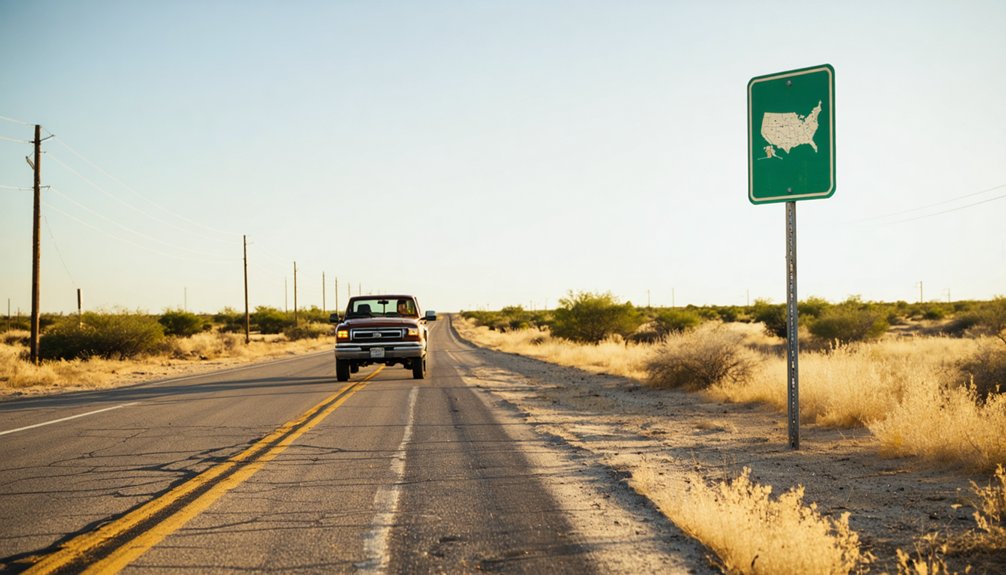
If you’re heading to Islitas from Laredo, you’ll travel approximately 147 miles northwest via Farm Road through the rugged terrain of southwestern Webb County.
Other nearby cities offer their own routes through Texas’s sprawling backcountry, so plan your drive carefully and fuel up before leaving any major hub.
The roads leading to this ghost town wind through remote land, rewarding adventurous travelers with sweeping views of the Texas landscape long before the ruins come into sight.
Driving From Laredo
Reaching Islitas from Laredo means heading northwest roughly 147 miles along Farm Road through the quiet stretches of southwestern Webb County.
You’re tracing old coal country roads, following the same routes that once carried miners and merchants deeper into Islitas history and ghost town culture.
Pack smart before you leave:
- Fill your tank in Laredo — fuel stops thin out fast heading northwest
- Download offline maps since cell service gets unreliable along Farm Road
- Bring water and snacks because the drive cuts through remote, unpopulated terrain
- Plan for daylight hours since traversing abandoned private property after dark isn’t wise
The landscape shifts dramatically as you push northwest — scrubby brush, open sky, and absolute silence replace city noise.
That isolation is exactly the point.
Nearby City Routes
Laredo’s your closest launching point, but other nearby cities offer their own paths into this forgotten slice of Texas coal history.
From San Antonio, head southwest on US-83, cutting through open ranchland before dropping into Webb County’s rugged terrain. The drive runs roughly 150 miles, rewarding you with sweeping South Texas landscapes that build anticipation for your ghost town exploration ahead.
Eagle Pass riders can swing northeast on US-277, merging onto Farm Road routes toward the site. Each approach carries its own character, threading through brushland and dry creek crossings that echo Islitas’ hardscrabble past.
Whatever route you choose, the historical significance of this abandoned coal stop hits differently when you’ve earned the miles getting there. Pack water, fuel up early, and embrace the open road.
Private Land Access and Safety Warnings at Islitas
Before you set foot anywhere near the remnants of Islitas, you need to know that the site sits on private property in southwestern Webb County. Respecting private land isn’t optional — it’s essential.
Take proper safety precautions before exploring any ghost town, especially one this remote.
Here’s what you need to handle before visiting:
- Get permission from the current landowner before entering the property
- Bring water and supplies — the location sits roughly 147 miles northwest of Laredo with limited access
- Watch your footing around deteriorating structures and unstable foundations
- Tell someone your plans — cell service is unreliable in this isolated stretch of Texas
Islitas rewards the bold traveler, but only the prepared one walks away with great stories instead of serious problems.
What to Bring to the Islitas Ghost Town Site
Packing right makes the difference between a memorable ghost town adventure and a miserable ordeal 147 miles northwest of Laredo.
You’re heading into remote southwestern Webb County, so treat this seriously. Bring plenty of water — the Texas heat shows no mercy on open terrain. Wear sturdy boots for traversing uneven ground around abandoned structures.
For ghost town photography, pack your camera, extra batteries, and a wide-angle lens to capture crumbling architecture dramatically. A detailed map matters here since cell service isn’t guaranteed.
Carry sunscreen, a hat, and insect repellent without exception. For deeper historical exploration, bring a notebook to document what you observe on private land.
Always pack out everything you bring in — respect the silence this forgotten place has earned.
Which Ghost Towns Near Islitas Are Worth the Detour?
While you’re already deep in southwestern Webb County exploring Islitas, why not stretch the trip and hunt down a few more ghost towns scattered across this historically rich stretch of Texas?
This region’s mining heritage runs deep, and neighboring settlements carry their own ghost town legends worth chasing.
Consider adding these stops to your route:
- Dolores – an abandoned ranching and mining settlement with crumbling adobe ruins
- Aguilares – a former railroad town with scattered structural remnants along old tracks
- Minerales – a small mining community echoing Islitas’ boom-and-bust story
- Bruni – a quiet, faded oil and ranching town with visible historic buildings
Each detour rewards curious travelers with raw, unfiltered Texas history that no museum can replicate.
Building a Webb County Ghost Town Road Trip Around Islitas
Now that you’ve got a shortlist of worthy detours, it’s time to string them together into a real road trip. Start in southwestern Webb County, anchoring your route around Islitas and its deep mining heritage.
From there, push outward along Farm Roads connecting nearby abandoned settlements, letting the landscape tell its story through crumbling foundations and forgotten railroad grades.
Pack water, a paper map, and a healthy respect for private property signs. Ghost town legends thrive in these stretches of South Texas brush country, where boom-and-bust cycles carved communities into existence and erased them just as fast.
Move at your own pace, stop where curiosity pulls you, and document what you find. Webb County rewards travelers who arrive prepared and leave nothing behind.
Frequently Asked Questions
Who Was the First Postmaster Appointed to Serve Islitas Residents?
R. M. Johnson was your first postmaster, appointed in 1907! You’re diving into rich postmaster history and early settlements, uncovering how this adventurous soul helped connect Islitas’ freedom-seeking residents to the wider world.
How Many Pupils Attended the One-Teacher School in Islitas?
Though it seems insignificant, that school’s educational impact shaped real lives — you’d find thirty-six pupils attending Islitas’ one-teacher school in 1907, a remarkable piece of school history echoing through this adventurous ghost town’s forgotten past.
What Railroad Line Originally Established Islitas as a Shipping Stop?
You’ll love knowing the Rio Grande and Pecos Valley Railroad originally established Islitas as a shipping stop in 1882. Its railroad history shaped the town’s shipping significance, making it an essential coal transport hub worth exploring!
How Many Livestock Feeders Operated During Islitas Peak Activity Years?
During Islitas’ peak activity years, you’ll discover five livestock feeders powered the rural economy, fueling a thriving livestock history that shaped this bold, free-spirited Texas frontier community before the mines’ collapse silenced everything forever.
When Did the Islitas Post Office Permanently Close Its Doors?
You’ll discover that Islitas history tells us the post office permanently closed its doors in 1924. Post office significance faded as population loss drained the town, ending an era of frontier communication and connection forever.
References
- https://www.tshaonline.org/handbook/entries/islitas-tx
- https://en.wikipedia.org/wiki/Islitas
- https://kids.kiddle.co/Islitas
- https://en.wikipedia.org/wiki/List_of_ghost_towns_in_Texas
- https://www.burningcompass.com/countries/united-states/states/texas/texas-ghost-towns-map.html
- https://www.wikidata.org/wiki/Q6084419
- https://texashistory.unt.edu/ark:/67531/metapth61101/m1/171/
- https://texashistory.unt.edu/ark:/67531/metapth61101/m1/167/
- https://gov.texas.gov/film/trail/terlingua-ghost-town
- https://www.tshaonline.org/handbook/entries/las-islitas-tx


