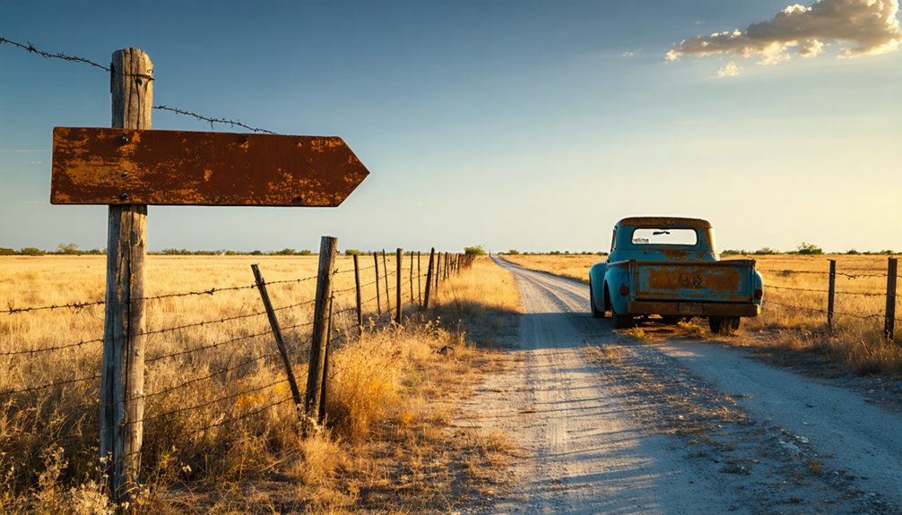
You’ll need to reach Stephens County via U.S. Highways 180 and 183, about 65 miles northeast of Abilene through north-central Texas’s remote prairie country. Plan your visit for October through early November when temperatures stay comfortable and lighting conditions enhance the stark landscape. Bring reliable navigation tools, sturdy boots, and topographic maps since Jimkurn’s complete erasure leaves no physical markers to guide you. This barren site offers nothing but windswept grass where 20 wells per acre once pumped 1,000 barrels hourly, and understanding its vanished infrastructure reveals why it’s hauntingly unique.
Key Takeaways
- Jimkurn is located in Stephens County, 65 miles northeast of Abilene, accessible via U.S. Highways 180 and 183.
- Visit October through early November for ideal temperatures and lighting, or early December and late February for comfortable weather.
- No structures remain at the site—it’s completely barren land with no railway station, post office, or building foundations.
- Bring navigation tools, sturdy boots, gloves, first-aid kit, topographic maps, and compass for remote exploration in empty terrain.
- The 1920s oil boom town vanished after 1930 when East Texas discoveries shifted investment and oil prices collapsed.
The Rise and Fall of Jimkurn’s Oil Boom Era
While the 1901 Spindletop gusher transformed Southeast Texas into an industrial powerhouse, Jimkurn’s story began two decades later as part of North Texas‘s explosive oil expansion. You’ll find this ghost town emerged during the 1920s boom, when wildcatters rushed to claim land across Limestone County.
Railway stations and post offices sprouted rapidly as economic drivers demanded infrastructure for equipment transport and personnel movement.
The town thrived briefly when wells pumped 1,000 barrels hourly and operators crammed 20 wells per acre. But market competition from Oklahoma and Louisiana fields created brutal price swings. When the 1930 East Texas discovery shifted investment eastward, oil plummeted to 15 cents per barrel. Independent operators collapsed financially, and Jimkurn’s purpose vanished overnight—another casualty of uncontrolled overproduction.
What Remains at the Barren Ghost Town Site Today
Unlike ghost towns that leave behind weathered storefronts or crumbling foundations, Jimkurn offers nothing but empty land where wildcatters once raced to stake their claims. You’ll find no documented remnants of the railway station that once served boom-era logistics, no traces of the post office that operated between 1920 and 1926. The site’s complete erasure makes it hauntingly unique among Texas’s vanished communities.
What you’re visiting is fundamentally archaeological ground zero—a landscape stripped clean by time and abandonment. While undocumented artifacts might surface beneath the soil, nothing visible marks where oil workers built their temporary civilization. This barren tract in Stephens County represents freedom in its rawest form: a place that existed entirely on its own terms, flourished briefly, then disappeared without apology or preservation efforts.
Getting to Stephens County: Routes and Highways

You’ll find Stephens County in north central Texas, about 65 miles northeast of Abilene, where U.S. Highways 180 and 183 intersect at the county seat of Breckenridge.
Highway 180 cuts east-west through the county’s center, while Highway 183 runs north-south, connecting you to neighboring counties across the rolling plateau terrain. No interstates pass through this remote stretch of Cross Timbers country, so you’re traversing state routes and two-lane highways that wind through hills rising between 995 and 1,628 feet.
Major Highway Access Points
Reaching Stephens County requires traversing a network of state highways that slice through the rolling prairies of north-central Texas. Your primary arteries include US 180‘s east-west corridor near Breckenridge, where SH 67‘s southern terminus anchors your journey northward. US 183 provides alternative access from Shackelford County to the south, while SH 67 stretches 30.77 miles through open ranchland toward Graham. The US 180 connectivity links you to Palo Pinto and parallels I-20’s distant southern route.
Critical FM road intersections mark your waypoints: FM 717 connects to Ranger and I-20 at 10.6 miles north, FM 701 leads to Eliasville at 7.2 miles, and FM 1800 branches east at 3.6 miles. FM 576 extends westward through Eolian, offering backcountry routes for explorers seeking untethered passage through forgotten landscapes.
Distance From Regional Cities
From Wichita Falls, your 90-mile southbound journey retraces the historic path of the Wichita Falls and Southern Railway that once breathed life into Jimkurn’s grain elevators and cotton gins. Travel distance factors shift dramatically when approaching from Graham, 40 miles southwest, where rural highways cut through Young County’s open rangeland before crossing into northern Stephens territory.
Breckenridge, the county seat just south of Jimkurn, sits closest at roughly 15 miles, making it your ideal base camp for ghost town exploration. Regional access considerations matter here—Stephens County’s sparse population of 9,101 means limited services dot these northern routes. You’ll traverse low-traffic farm roads past Hubbard Creek and Sandy Creek watersheds, where isolation becomes part of the adventure. Plan accordingly; gas stations and supplies grow scarce between regional hubs.
Best Time of Year to Visit Texas Ghost Towns
Timing transforms your Jimkurn ghost town experience from merely interesting to utterly unforgettable. October through early November delivers ideal seasonal temperatures—crisp mornings in the 60s perfect for exploring abandoned structures without summer’s oppressive heat. You’ll find excellent lighting conditions during these autumn months, with golden-hour sunlight casting dramatic shadows across weathered buildings and deserted streets.
Winter months offer crystalline skies for stargazing amid ruins, while spring’s wildflower blooms paint the desolate landscape in unexpected color. Avoid summer’s mid-90s temperatures that’ll drain your energy before you’ve explored half the site. Visit weekdays when possible—you’ll have crumbling facades and forgotten histories entirely to yourself.
Early December and late February provide the ultimate freedom: comfortable weather, zero crowds, and unrestricted access to Texas’s most atmospheric ghost town destinations.
Essential Gear and Supplies for Remote Site Exploration
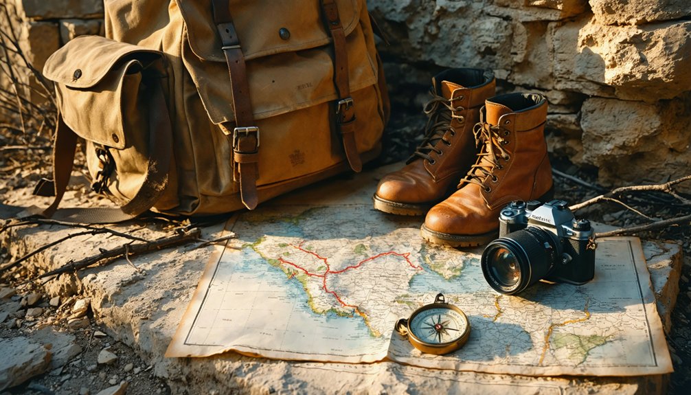
Exploring Jimkurn’s abandoned structures and surrounding backcountry demands preparation that goes beyond casual sightseeing. You’ll need reliable navigation tools to track your position across unmarked terrain, safety equipment to handle unexpected emergencies miles from help, and adaptable clothing layers that respond to Texas’s unpredictable weather swings.
These essentials transform a risky venture into a calculated adventure, letting you focus on discovery rather than survival.
When venturing into abandoned settlements like Jimkurn, you’ll need reliable navigation tools that don’t depend on cellular signals or GPS satellites. A magnetic compass—with origins tracing back to 3rd century BCE China—remains your most dependable instrument when cellular towers fail. Modern versions point toward magnetic north through opposing pole attraction, giving you directional certainty even in Texas’s most isolated corners.
Complement your compass with celestial navigation methods that ancient mariners perfected. The North Star and sun positions provide natural waypoints across open terrain. Bring detailed topographic maps and a notebook to document landmarks, distances, and points of interest. These analog tools guarantee you’ll navigate Jimkurn’s forgotten roads confidently while recording your discoveries without technological dependencies compromising your independence.
Safety and Emergency Equipment
Before stepping through Jimkurn’s weathered doorways and collapsed rooflines, you’ll need protective gear that stands between you and the hazards lurking in decayed structures. Sturdy boots with ankle support navigate uneven terrain while waterproof construction keeps feet dry. Cut-resistant gloves protect against rusty metal and broken glass—essential for handling contaminated surfaces.
A quality respirator with replaceable filters guards against mold and airborne toxins; proper hazmat training guarantees you’ll choose suitable protection for site-specific contaminants. Pack a comprehensive first-aid kit with antiseptic wipes, bandages, and emergency medications. Don’t skip the hard hat—falling debris from collapsing structures won’t announce itself.
Establish self inspection protocols before each entry, checking equipment integrity. These precautions aren’t paranoia; they’re your ticket to exploring abandoned Texas freely and safely.
Weather-Appropriate Clothing Layers
The Panhandle’s notorious temperature swings demand a strategic layering system that adapts as quickly as the weather shifts. Start with moisture-wicking synthetics against your skin—polyester outperforms cotton when morning dew soaks the grasslands. Add a fleece mid-layer or wool pullover for warmth retention, then top with a Gore-Tex shell that blocks 25-mph gusts while breathing during sun-drenched afternoons.
Insulation material comparisons reveal PrimaLoft’s superiority in damp conditions versus down’s failure when wet. You’ll need thumbloop base layers for sub-40°F mornings, packable rain pants for creek crossings, and merino wool socks that prevent blisters on uneven terrain. Layer storage options include compression sacks for your daypack—freedom means carrying versatility without bulk.
Wide-brim hats and touchscreen-compatible gloves complete your adaptive system.
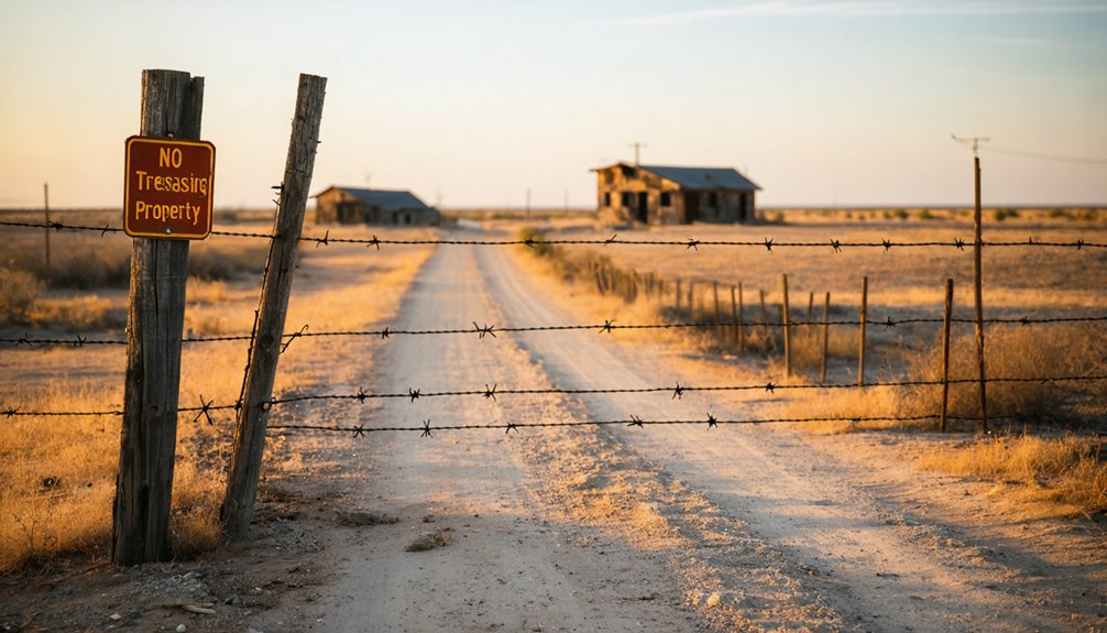
Exploring Jimkurn’s abandoned structures requires understanding Texas’s strict private property laws, as most ghost towns sit on privately owned land where trespassing carries serious legal consequences. Before venturing to this Stephens County ghost town north of Breckenridge, you’ll need to research current ownership and secure explicit permission from landowners. Respecting landowner preferences isn’t just courteous—it’s legally mandatory. Observing trespassing laws protects your freedom to explore while honoring property rights that Texans fiercely defend.
Consider these realities when planning your visit:
- Criminal trespassing charges can result in fines up to $2,000 and potential jail time
- “No Directions Available” often signals deliberately restricted access to discourage visitors
- Landowners may deny access without explanation—their property, their choice
- Posted signage carries legal weight whether you saw it or not
Nearby Ghost Towns to Add to Your Itinerary
North Texas harbors dozens of forgotten settlements within a few hours’ drive of Jimkurn, each offering distinct architectural remnants and historical narratives that’ll deepen your understanding of frontier boom-and-bust cycles.
These forgotten North Texas settlements stand as silent witnesses to the region’s turbulent cycles of promise and abandonment.
Medicine Mound’s dolomite formations and preserved Hicks-Cobb General Store reveal local residents’ perspectives on ceremonial Comanche grounds.
Belle Plain’s crumbling college ruins showcase unique architectural features from its 1880s educational heyday, while its cemetery documents pioneer struggles through weathered headstones.
Terlingua’s adobe structures and silent churches exemplify mining-era construction, earning recognition as one of America’s spookiest destinations.
Toyah’s furnished buildings—including its reputedly haunted high school—provide eerie glimpses into semi-abandoned community life.
Glenrio’s 1950s neon signs and Route 66 gas stations capture mid-century roadside culture along the Texas-New Mexico border.
Photography Tips for Capturing Abandoned Oil Settlements
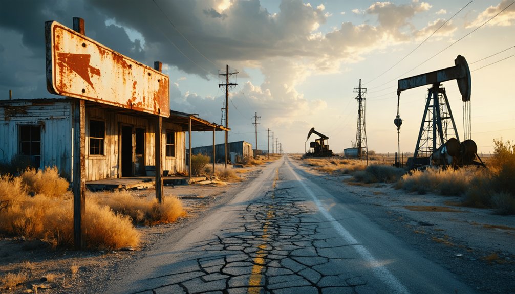
Capturing these weathered landscapes requires more than pointing your camera at rusted machinery and crumbling foundations. You’ll need compelling lighting techniques—shoot during golden hour when warm light softens decay, or embrace blue-hour‘s moody tones for haunting atmospheres.
Scout locations beforehand to identify compositions that frame structures against vast wilderness, emphasizing isolation. Use wide-angle lenses to convey scale, and incorporate leading lines from abandoned roads or pipelines for depth.
Transform raw captures with atmospheric post processing styles that enhance the desolate mood:
- Subtle vignetting draws eyes toward forgotten pumpjacks standing sentinel
- Increased contrast amplifies textures in weathered wood and peeling paint
- Desaturated tones evoke timelessness in industrial remnants
- Grain effects add vintage authenticity to your exploration narratives
Pack tripods for stability when exploring dimly-lit interiors where stories linger.
Safety Considerations for Exploring Deserted Locations
While the allure of abandoned oil settlements draws photographers and history enthusiasts to places like Jimkurn, the reality of these decaying structures demands respect and preparation. Your physical precautions start before you enter—scout exteriors to identify exits and structural weaknesses. Never explore alone; bring at least two companions, proper identification, and essential gear including flashlights, respirators for asbestos protection, and first-aid supplies.
Stay near walls where supports remain strongest, and constantly watch for falling debris overhead.
Legal considerations matter equally. Verify property access and obtain owner permission beforehand, as trespassing charges can end your exploration days quickly. Trust your instincts—if something feels wrong, exit immediately. Your freedom to explore these haunting remnants depends on respecting both safety protocols and property rights.
Accommodations and Services in Stephens County
You’ll find Breckenridge, the Stephens County seat located just south of Jimkurn, serves as your essential base camp for exploring this remote ghost town. The town’s hotels provide comfortable accommodations after dusty backroad adventures, while its restaurants offer Texas-style meals to fuel your expedition.
Before heading north into Jimkurn’s isolated terrain, stock up on gas and provisions at Breckenridge’s well-equipped stations—you won’t find services in the abandoned settlements ahead.
Nearby Lodging Options
Since Jimkurn sits in rural Stephens County without any commercial services of its own, you’ll need to plan your accommodations in the surrounding towns. Stephenville offers the most options, from Hampton Inn & Suites to La Quinta Inn & Wyndham, many with pet friendly accommodations for your four-legged travel companions.
Breckenridge provides alternatives like Ridge Motel and Hotel Breckenridge.
For unconventional stays, consider:
- Lost Creek RV Park – Pull in with your rig and settle into gravel sites surrounded by Texas wilderness
- Wildcatter Ranch & Resort – Experience authentic ranch life with modern luxuries
- Gallery House Bed & Breakfast – Wake to home-cooked meals before your ghost town exploration
- Airbnb GRAND LODGE – Gather your entire crew in a 16-sleeper cabin
Both towns feature dining options nearby, ensuring you’re fueled for adventure.
Essential Supplies and Fuel
The ghost town of Jimkurn won’t greet you with convenience stores or gas stations—this stretch of Stephens County demands preparation before you arrive. You’ll need to fuel up and stock supplies in Breckenridge, the county seat located south of the ghost town, where you’ll find reliable options.
Graham, positioned to the northeast, offers another checkpoint for essentials. Grocery store availability concentrates in these two towns, so load your cooler and fill your tank before venturing into rural territory.
Medical facility locations are similarly distant from Jimkurn—Breckenridge hosts the nearest hospital and urgent care services. Pack extra water, snacks, and a full gas tank. Your self-sufficiency determines your exploration range in this remote landscape.
Frequently Asked Questions
Who Was Jim Kurn and Why Was the Town Named After Him?
Like whispers fading into desert wind, Jim Kurn’s identity remains mysterious—no records confirm he was a prominent local figure. You’ll find only speculation about this name’s historical significance, as documentation vanished with the oil boom’s end.
Are There Any Historical Photographs or Documents of Jimkurn Available Online?
You won’t find vintage photos of Jimkurn online—they’ve vanished like the town itself. Local newspaper archives from the boom period exist in regional museums, but they’re not digitized yet, keeping Jimkurn’s visual history frustratingly out of reach.
What Specific Oil Companies Operated in Jimkurn During the Boom?
Records don’t reveal specific oil company operations in tiny Jimkurn itself—you’ll find the real action happened at nearby Ranger and Desdemona. Boom era population statistics remain elusive for this fleeting railway stop that vanished quickly.
Can Metal Detectors Be Used to Find Artifacts at the Site?
Metal detectors can’t legally be used at Jimkurn without traversing strict legal restrictions and private property concerns. You’ll need landowner permission and must avoid disturbing century-old artifacts protected under Texas law, limiting your exploration freedom considerably.
Did Any Residents Leave Behind Recorded Memories or Oral Histories?
The past vanished like smoke—no personal accounts survived Jimkurn’s brief existence. You’ll find only abandoned belongings might whisper stories through rusted relics, but residents left no recorded memories, diaries, or oral histories behind.


