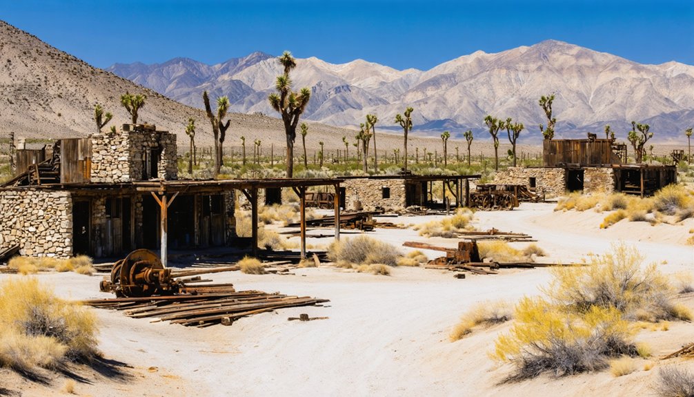
Kearsarge, California sits tucked along the eastern Sierra Nevada, where a once-thriving 1860s silver and gold mining town now rests as a quiet ghost town amid dramatic mountain scenery. You’ll find faint stone foundations, rusted ore tipples, and sweeping views along trails leading toward Kearsarge Pass. Access Onion Valley Road from Independence and visit between late May and early September before snow closes the route. Everything you need to plan your trip is right ahead.
Key Takeaways
- Kearsarge, a former 1860s silver and gold mining town in the eastern Sierra Nevada, peaked with over 1,000 residents before fading by the 1880s.
- Access the site via Onion Valley Road from Independence, covering 13 miles; GPS navigation and offline topographic maps are strongly recommended.
- Visit between late May and early September, as heavy snow closes roads and early October storms risk stranding travelers.
- A 5-mile trail climbs 2,600 feet to Kearsarge Pass, passing rusted ore tipples and stone foundations from 1860s mining operations.
- Nearby stops include Independence’s Eastern California Museum, Keeler’s salt mining remnants, and Lone Pine’s 1872 earthquake history.
What Is the Ghost Town of Kearsarge, California?
Tucked along the high eastern slope of the Sierra Nevada mountains, Kearsarge is a California ghost town that once bustled with over 1,000 residents during its 1860s mining boom. Woodcutters discovered the site in 1864, and prospectors quickly followed, extracting silver-laced gold ore worth over $650 per ton.
Named after the Union warship USS Kearsarge, the town even competed to become Inyo County’s seat before fading by the 1880s.
Today, you’ll find a flat, desert landscape where a thriving community once stood. Avalanches, earthquakes, and 1998 flash floods erased most traces, though scant mining relics and tumbled stone foundations still whisper the town’s dramatic past.
If you’re drawn to historical artifacts and wide-open wilderness, Kearsarge delivers a raw, unfiltered glimpse into California’s frontier history.
How Kearsarge Rose and Fell in Just Two Decades
Kearsarge’s story is a classic boom-and-bust arc compressed into roughly twenty years. When prospectors struck silver-laced gold ore hitting $650 per ton, the town exploded to over 1,000 residents within two years. You can almost picture the urgency — tunnels driven into mountainsides, mills running, people dreaming of making Kearsarge the Inyo County seat.
But nature had other plans. A catastrophic avalanche in 1867 tore through town, and the 1872 Lone Pine earthquake finished what the snow started, destroying the settlement and altering the river’s course.
Mining history here reads like a cautionary tale. By 1888, the buildings stood empty, the mill removed. The historical artifacts you’d hope to find today? Gone — wiped clean by 1998 flash floods, leaving only flat desert behind.
What’s Actually Left to See at the Townsite Today
What you’ll find at the Kearsarge townsite today is, honestly, not much — and that’s part of what makes it so striking. The 1998 flash floods erased most visible remnants, leaving behind a flat, open desert expanse that offers little hint of the thousand-plus souls who once hustled here.
Still, if you look carefully, you’ll spot tumbled stone foundations and rusted ore tipples — modest historical artifacts that quietly anchor you to the past. Environmental preservation efforts within Inyo National Forest keep the site protected, so what little remains stays undisturbed.
The real reward isn’t a preserved townscape — it’s the raw Sierra Nevada backdrop, the silence, and the freedom to roam terrain where prospectors once struck gold worth $650 a ton. That feeling alone is worth the drive.
When to Visit Kearsarge Before Snow Closes the Road
Timing your visit to Kearsarge matters more than most ghost town trips, because Onion Valley Road — your 13-mile lifeline from Independence — closes under heavy snow each winter and doesn’t reliably reopen until late spring. Hit this window right, and you’ll walk mining history’s ground under clear skies.
Best times to visit:
- Late May through June — Road typically reopens; wildflowers frame scattered historical artifacts
- July through August — Peak access window with longest daylight hours
- Early September — Crowds thin while conditions stay stable
- Avoid October onwards — Early storms can strand unprepared travelers fast
- Check road status — Contact Inyo National Forest before departing Independence
Don’t gamble on shoulder seasons without confirming access — Kearsarge’s remote elevation punishes assumptions quickly.
What to Pack Before You Drive Out to Kearsarge
Before you head out to this remote high-desert ghost town, you’ll need to pack smart or risk a serious situation. Toss in essential survival gear—a first aid kit, emergency blanket, and a multi-tool—since the nearest help sits 13 miles back down Onion Valley Road in Independence.
Round out your kit with detailed topographic maps, a compass, and enough water for at least two days, because this unforgiving Sierra Nevada terrain doesn’t forgive careless preparation.
Essential Survival Gear
Packing the right gear could mean the difference between a memorable desert adventure and a dangerous situation when you’re headed out to Kearsarge. The remote high desert terrain demands respect, especially when you’re exploring historical artifacts and supporting preservation efforts by staying on designated paths.
Pack these five essentials before you roll out:
- Water – Carry at least one gallon per person, per day
- Navigation tools – Bring a paper map and compass; cell service is unreliable
- Sun protection – Pack SPF 50+ sunscreen, sunglasses, and a wide-brim hat
- First aid kit – Include blister care, wound wraps, and pain relievers
- Emergency shelter – A compact mylar blanket handles sudden temperature drops fast
Don’t underestimate this landscape; it rewards the prepared and punishes the careless.
Once you’ve got your gear sorted, knowing exactly where you’re going becomes your next priority — and out here, that’s not as straightforward as punching an address into Google Maps. Cell service vanishes fast once you leave Independence, so download offline topographic maps through apps like Gaia GPS or CalTopo before you hit the road.
Grab a physical USGS quad map covering the Kearsarge Peak area — it’ll show you the elevation shifts, trail intersections, and terrain features that digital screens miss. The 13-mile Onion Valley Road is your primary artery. From there, John Muir Wilderness trails lead you toward scattered stone foundations and rusted ore tipples where local legends were born and historic architecture crumbled into desert silence.
Paper maps don’t lose battery. Always bring both.
Food and Water Supplies
Kearsarge sits at a punishing elevation with no services, no stores, and no safety net — so what you carry in is all you’ve got. Independence, 13 miles down Onion Valley Road, offers your last chance to grab supplies before the desert swallows you whole. Skip local cuisine options out here — there aren’t any.
Pack smart with these essentials:
- Water purification tablets or a filter for emergency backcountry use
- Minimum two liters of water per person for the visit
- High-calorie snacks like nuts, jerky, and energy bars
- Extra food reserves in case weather delays your return
- Electrolyte packets to combat altitude-related dehydration
You’re on your own out there — own it.
How to Get to the Kearsarge Ghost Town Site
Reaching the Kearsarge ghost town site takes you along one of California’s most scenic mountain approaches. From Independence, California, head west onto Onion Valley Road and follow it for 13 miles into the Sierra Nevada’s eastern slope. Independence itself sits about 8 miles east of the original townsite, making it your ideal launching point.
As you climb, you’ll notice the terrain shifting from high desert into rugged alpine wilderness within Inyo National Forest.
Park at the Onion Valley trailhead, then access the flat desert site via John Muir Wilderness trails.
Scant historical artifacts remain, including tumbled stone foundations and rusted mining relics scattered across the terrain.
GPS coordinates help here, since the site blends seamlessly into the surrounding landscape, leaving little to distinguish it visually.
Can You Hike Into the John Muir Wilderness From Kearsarge?
Once you’ve explored the flat desert remnants of Kearsarge’s ghost town, you can access the John Muir Wilderness directly from the Onion Valley Road trailhead just 13 miles from Independence.
From there, the Kearsarge Pass Trail climbs through stunning High Sierra terrain, giving you a front-row view of the granitic peaks that once loomed over this booming mining settlement.
It’s one of the most accessible wilderness entry points in the Eastern Sierra, making your ghost town road trip do double duty as a serious alpine adventure.
Accessing John Muir Wilderness
While the ghost town itself offers little more than flat desert and faint stone foundations, it serves as a compelling launching point for exploring the John Muir Wilderness. Accessible via Onion Valley Road, you’ll find trails weaving through dramatic Sierra Nevada terrain where historical artifacts and mining remnants still dot the landscape.
Here’s what you can explore from this gateway:
- Kearsarge Pass Trail – a stunning 5-mile climb to 11,760 feet
- Onion Valley Trailhead – your primary access point into the wilderness
- Rusted ore tipples – scattered mining remnants along lower trail sections
- Granitic peaks – towering above timberline near 12,621-foot Kearsarge Peak
- Backcountry campsites – offering raw, unrestricted freedom deep within the wilderness
You’re not just visiting history—you’re stepping directly into it.
Onion Valley Road Trailhead
Sitting at the end of a 13-mile climb from Independence, the Onion Valley Road Trailhead is your direct gateway into the John Muir Wilderness—and yes, you can absolutely hike in from here. You’ll gain serious elevation quickly, threading through rugged granite terrain toward Kearsarge Pass.
Along the way, keep your eyes open for mining remnants scattered across the hillsides—subtle echoes of the boomtown that once thrived here. Tumbled stone foundations and rusted historical artifacts break through the scrub, rewarding observant hikers with tangible connections to Kearsarge’s gold-rush past.
The trailhead offers parking, restrooms, and clear signage, making your entry into the wilderness straightforward. Pack layers, because temperatures shift dramatically as you climb toward the 11,760-foot pass overlooking the iconic Kearsarge Lakes basin.
Kearsarge Pass Trail
From the Onion Valley Road Trailhead, the Kearsarge Pass Trail absolutely delivers—climbing roughly 2,600 feet over five miles to reach an 11,760-foot summit overlooking the Kings Canyon backcountry and the shimmering Kearsarge Lakes basin.
You’ll hike directly through the heart of the old Kearsarge Mining District, where mining history surrounds every switchback. Keep your eyes open for historical artifacts scattered along the route.
- Rusted ore tipples peeking through granite debris
- Tumbled stone foundations from 1860s mining operations
- Remnants of the original prospectors’ supply routes
- Wildflower meadows framing abandoned claim sites
- Panoramic views stretching toward the High Sierra crest
The John Muir Wilderness opens completely once you crest the pass—raw, unfiltered freedom with zero crowds and maximum payoff for every step you’ve earned.
Nearby Sites Worth Adding to Your Kearsarge Route
Stretching along U.S. Route 395, the Eastern Sierra offers compelling stops that complement your Kearsarge visit. Head 38 miles north to Keeler, a quietly fading settlement where historical artifacts from its salt mining era still dot the landscape. You’ll find rusted machinery and crumbling structures that echo Kearsarge’s own mining history in vivid ways.
Independence, just 8 miles east of the ghost town site, houses the Eastern California Museum, where you can examine regional mining artifacts and deepen your understanding of Inyo County’s boom-and-bust past.
Lone Pine, further south, connects you to the 1872 earthquake history that devastated Kearsarge itself.
Each stop layers your road trip with richer context, turning a single ghost town visit into a full Eastern Sierra historical expedition worth every mile.
Frequently Asked Questions
Is Camping Allowed Overnight at the Kearsarge Ghost Town Site?
The knowledge doesn’t confirm camping regulations or overnight restrictions at Kearsarge’s ghost town site. You’ll want to check directly with Inyo National Forest rangers, who can clarify what’s permitted within the John Muir Wilderness boundaries.
Are There Guided Tours Available for the Kearsarge Ghost Town Area?
You won’t find formal guided tours, but you can join guided explorations through John Muir Wilderness trails. Rangers occasionally support historical preservation efforts, helping you uncover Kearsarge’s fascinating past through self-guided adventures that embrace your freedom to explore.
Can You Find Gold or Artifacts at the Kearsarge Townsite Legally?
You’ll find a million rules here! Historical artifacts and gold prospecting are strictly regulated on Inyo National Forest land. You can’t legally remove anything, but you’re free to explore, photograph, and soak in Kearsarge’s wild, rugged history.
Is the Kearsarge Site Accessible to Visitors With Mobility Limitations?
You’ll find Kearsarge’s rugged desert terrain challenging without accessible pathways or wheelchair accommodations. The 13-mile Onion Valley Road leads you there, but the remote, uneven site demands careful planning if you’ve got mobility limitations.
Are Permits Required to Visit the Kearsarge Ghost Town Site?
You don’t need permits to roam freely here! You’ll access Kearsarge’s ghost town trails without bureaucratic hurdles, though Inyo National Forest’s historical preservation guidelines and visitor safety practices guarantee you’re exploring this wild, untamed desert site responsibly.
References
- https://en.wikipedia.org/wiki/Kearsarge
- https://nvtami.com/2024/04/26/owens-valley-ghost-towns/
- https://www.legendsofamerica.com/ca-deathvalleyghosttownscalifornia/
- https://www.facebook.com/californialandmarkfoundation/videos/california-ghost-town-bodie-california-is-one-of-the-best-preserved-boomtowns-fr/1639090977198276/
- https://www.ghosttowns.com/states/ca/kearsarge.html
- https://www.destination4x4.com/kearsarge-california-inyo-county-ghostotwn/
- https://www.youtube.com/watch?v=QC3NEZsCSpQ
- https://kids.kiddle.co/Kearsarge
- http://www.raydunakin.com/Site/Kearsarge_CA.html
- https://californialocal.com/localnews/statewide/ca/article/show/51711-10-california-ghost-towns-to-see/



