La Balize doesn’t exist anymore — the Mississippi River made sure of that. You’re chasing a French colonial ghost that once controlled access to North America’s interior, now buried beneath open water and shifting marsh in Plaquemines Parish. Take Louisiana Highway 23 south, refuel in Belle Chasse, and bring offline maps because cell service disappears fast out here. There’s nothing left standing, but the story of how it vanished makes the journey unforgettable — and there’s far more to uncover.
Key Takeaways
- La Balize, established in the early 1700s as a French colonial outpost, was a critical gateway controlling Mississippi River access.
- No physical remnants exist today; open water and marsh have completely replaced the former settlement’s streets and structures.
- Access La Balize via Louisiana Highway 23 in Plaquemines Parish; refuel in Belle Chasse due to limited gas stations ahead.
- Visit between October and April to avoid summer heat, mosquitoes, and storms that make travel significantly more challenging.
- Carry offline maps, tide charts, extra water, and a paper map, as cell service is extremely limited in this area.
What Is La Balize and Why Did It Disappear?
Before Louisiana had proper cities dotting its coastline, La Balize stood at the mouth of the Mississippi River as one of the earliest European settlements in the region—a scrappy, waterlogged outpost that French colonists built to guide ships through the delta’s treacherous channels.
Before New Orleans existed, La Balize was already fighting the Mississippi—and losing ground with every flood.
You’re looking at a place that shaped river commerce long before New Orleans earned its name.
But the Mississippi doesn’t negotiate. Flooding, erosion, and relentless hurricane seasons swallowed La Balize piece by piece, leaving it among Louisiana’s most haunting disappearing communities.
The La Balize legends that survived speak to a settlement constantly fighting nature—and ultimately losing.
What remains isn’t a ruin you can photograph but a story etched into shifting sediment, reminding you that the river always reclaims what humans dare to build along its edge.
The Rise and Fall of La Balize: A Mississippi River History
When you trace La Balize’s story back to its origins, you find a French colonial outpost established in the early 1700s at the mouth of the Mississippi River, built to guide ships into the delta.
The river that gave the settlement its purpose also sealed its fate, as shifting currents, relentless flooding, and storm surges eroded the land beneath it.
La Balize’s Early Founding
Few settlements in American history carry as much geographic weight as La Balize, the small French outpost established near the mouth of the Mississippi River in the early 18th century.
Its early settlement marked France’s bold claim over one of North America’s most powerful waterways. You can almost feel the historic significance when you consider what this outpost represented:
- Gateway control – La Balize guarded river access long before the United States existed
- Colonial ambition – France used it to assert dominance over interior North America
- Maritime necessity – pilots stationed here guided ships safely upstream
This forgotten post reminds you that freedom and commerce once depended entirely on whoever controlled this volatile, shifting delta ground.
River Forces Reshape Settlement
The Mississippi River never cared much about human plans. Its river dynamics constantly reshaped the land beneath La Balize’s feet, swallowing docks, undermining structures, and redrawing the shoreline season by season.
You can almost feel the erosion impact when you study old maps — entire streets simply vanish between decades. These landscape transformations weren’t gradual inconveniences; they were decisive endings.
Environmental influences like flooding, hurricanes, and sediment shifts dictated settlement patterns more powerfully than any colonial ambition ever could. La Balize couldn’t survive what the river decided.
That’s precisely where its ghost town significance lives. The historical narratives surrounding this lost community remind you that nature writes the final chapter.
Its cultural heritage endures not in standing walls, but in the story the vanished shoreline still tells.
La Balize Disappears Completely
By the time La Balize finally disappeared, the river had already been dismantling it for generations. Floods, erosion, and hurricanes stripped away what settlers had built piece by piece until nothing remained worth saving.
Its historical significance lives in what it represents — a warning written in water and mud about building permanence in impermanent places. The ghost town legends surrounding La Balize draw curious travelers who understand that freedom sometimes means accepting what can’t be held.
Three forces sealed La Balize’s fate:
- Repeated flooding weakened every structure and foundation
- Shoreline erosion swallowed land faster than residents could respond
- Hurricane devastation delivered final, irreversible blows
You’re not visiting ruins here. You’re standing where a community once fought the river — and lost completely.
Why La Balize Vanished: and Why Other Louisiana Towns Did Too
Louisiana didn’t lose its ghost towns by accident—floods, hurricanes, river-course shifts, and relentless coastal erosion quietly swallowed settlements that once thrived along the Mississippi Delta.
La Balize’s ghost town origins trace back to exactly these forces. The river that once gave the town life eventually undermined it, and rising waters finished what erosion started.
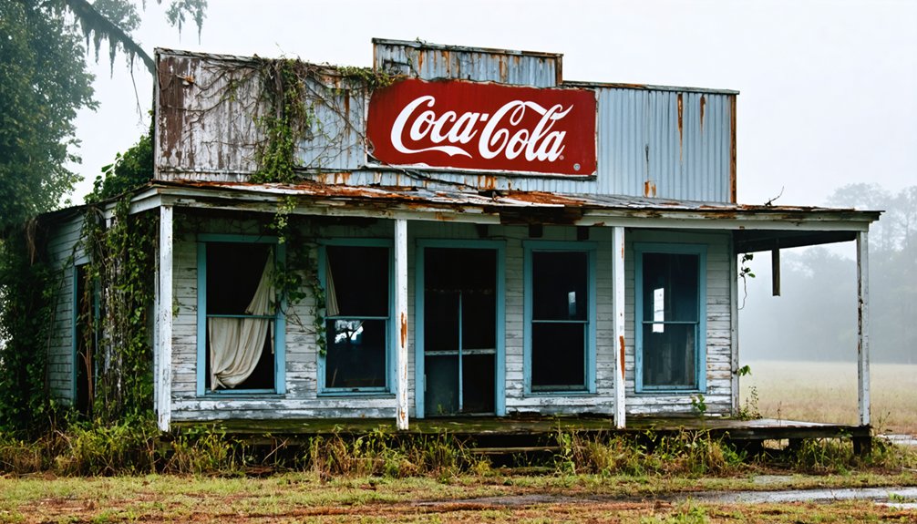
You’ll find this same pattern repeating across Louisiana’s abandoned landscape. Ruddock disappeared after catastrophic flooding. Morrisonville was relocated when petrochemical expansion threatened its soil.
Waterloo and Taft faded as industry and infrastructure shifted elsewhere. River erosion didn’t just reshape geography—it erased communities, livelihoods, and generations of history.
When you understand why these towns vanished, the road trip stops feeling like sightseeing and starts feeling like bearing witness to something irreplaceable.
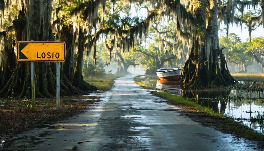
How to Reach La Balize in Plaquemines Parish
To reach La Balize, you’ll first need to make your way into Plaquemines Parish, a long, narrow finger of Louisiana that stretches deep into the Gulf along the Mississippi River’s final miles.
Once you’re in the parish, Louisiana Highway 23 becomes your main artery, carrying you south through small communities, levee roads, and marshland that grows more open and wild the farther down you travel.
The lower you push along the River Road, the more the landscape shifts from working town to something quieter and older, hinting at the forgotten settlements that once lined these banks.
Getting To Plaquemines Parish
Plaquemines Parish stretches south of New Orleans like a long finger pointing into the Gulf, and reaching it means committing to one road — Louisiana Highway 23, the only real artery threading through the parish toward the lower Mississippi.
This drive feels deliberate, like the land itself is filtering out casual visitors from those genuinely chasing Plaquemines history and its abandoned settlements.
Before you go, keep these three things in mind:
- Fill your tank in Belle Chasse — gas stations thin out quickly heading south.
- Check ferry schedules — some crossings operate on limited hours.
- Download offline maps — cell service gets unreliable past Buras.
The further south you travel, the more the modern world fades, and the ghost towns start feeling less like history and more like memory.
Once you’ve left Belle Chasse behind, Highway 23 becomes your only compass, running south through marsh and levee country until the road itself starts to feel borrowed from the river.
You’ll pass small communities that tell the story of Louisiana’s shifting settlement patterns — towns that rose because the Mississippi needed them and shrank when it didn’t. River navigation once dictated everything here: where pilots anchored, where traders stopped, where families built.
As you drive deeper into Plaquemines Parish, the landscape narrows between water and sky, and the illusion of solid ground becomes harder to maintain.
Keep your tank full before leaving Empire or Buras. Services thin out fast, and the lower you go, the more the delta reminds you who’s actually in charge.
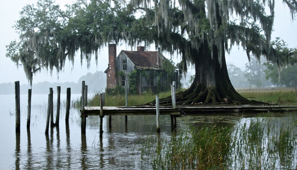
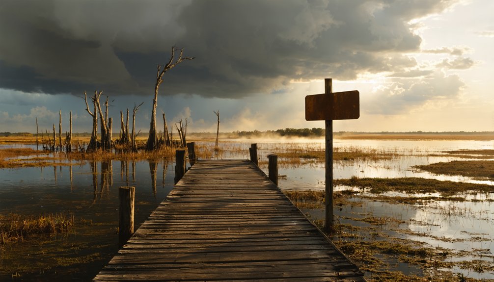
What You’ll Actually Find at La Balize Today
Unlike many ghost towns where crumbling walls and rusted relics still tell a story, La Balize has almost completely surrendered to the Mississippi River and the surrounding marsh.
Don’t expect historical remnants or ghostly encounters around every bend. Instead, you’ll find:
- Open water and marsh where streets and structures once stood
- River navigation markers that hint at La Balize’s former role in Mississippi commerce
- Sweeping delta landscapes that reward travelers who appreciate raw, unfiltered history
You’re fundamentally reading absence here — the land itself is the artifact.
The river erased what people built, leaving only wind, water, and silence. That’s exactly what makes this stop unforgettable for anyone craving authentic exploration beyond sanitized tourist destinations.
When to Go: Best Seasons for a La Balize Road Trip
Timing your visit to La Balize can mean the difference between a rewarding delta experience and a miserable slog through heat and humidity.
The best times to make this drive fall between October and April, when Louisiana’s brutal summer heat finally loosens its grip.
Fall offers golden marsh light and cooler breezes off the river, making outdoor exploration genuinely pleasant.
Winter stays mild enough for comfortable walking, and you’ll share the road with almost nobody.
Spring brings seasonal highlights like wildflowers along the levees and active birdlife throughout Plaquemines Parish’s wetlands.
Avoid summer entirely if you can — the combination of oppressive heat, mosquitoes, and afternoon storms makes delta travel genuinely punishing.
Plan your escape during the cooler months and you’ll experience Louisiana’s forgotten river landscape at its most atmospheric.
Pair La Balize With Pilottown for a Full River Day
If you’re already making the drive deep into Plaquemines Parish, pairing La Balize with Pilottown turns a single historical stop into a full river day worth the effort.
Both communities trace their roots to river commerce, and together they tell a richer story of how the lower Mississippi once shaped entire ways of life.
Both communities grew from the river’s demands, and together they reveal how the Mississippi once defined everything.
Plan your combined visit around three priorities:
- Understand Pilottown history — river pilots once lived here year-round, guiding vessels through treacherous delta waters.
- Connect the commerce threads — La Balize and Pilottown both served as critical gateways for ships entering the Mississippi.
- Read the landscape — marshes, erosion, and isolation explain why both communities faded.
You’ll leave with a visceral sense of how the river gives and quietly takes away.
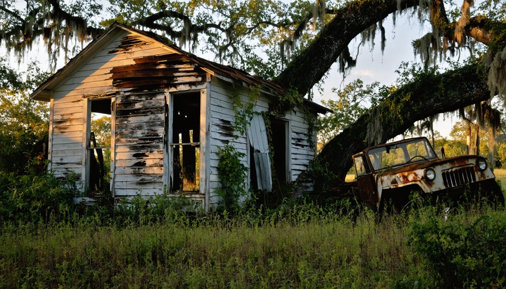
Other Louisiana Ghost Towns Worth Adding to Your Route
Plaquemines Parish deserves the spotlight, but Louisiana’s ghost-town map stretches well beyond the river’s mouth. A few detours can transform your trip into a genuine lost-town circuit.
Ruddock, once a thriving hub, now stands as one of the state’s most referenced abandoned settlements. Waterloo in Pointe Coupee Parish adds inland texture, reminding you how far river commerce once reached across Louisiana’s landscape.
Taft in St. Charles Parish and Morrisonville in Ascension Parish round out a route that covers remarkable geographic and historical ground. Each town carries its own story of flood, erosion, or economic collapse.
String them together with La Balize and Pilottown, and you’ve built an itinerary that honors Louisiana’s forgotten communities on your own unhurried terms.
Marshes, Tides, and No Cell Service: Staying Safe Out Here
Venturing into Plaquemines Parish means trading cell towers and convenience stores for open marsh, shifting tides, and a silence that feels older than the roads themselves.
Out here, cell towers give way to open marsh, shifting tides, and silence older than the roads themselves.
Marsh navigation and tide safety aren’t optional considerations out here — they’re survival basics.
Before you go:
- Download offline maps — signal disappears fast once you head south of Belle Chasse.
- Check tide charts — low-lying roads flood without warning, and tide safety means knowing when water reclaims the land.
- Tell someone your route — marsh navigation goes sideways when nobody knows where you are.
Carry extra water, a paper map, and a charged backup battery.
This delta doesn’t forgive careless planning. Respect the landscape, and it rewards you with something rare — genuine solitude and history you can almost touch.
Your Day-by-Day Plaquemines Parish Ghost Town Itinerary
Three days gives you just enough time to feel the weight of what Plaquemines Parish has lost without rushing past it.
You’ll spend Day One tracing the river road south.
Day Two pushes into the delta stops closest to where La Balize once stood.
And Day Three loops back through the broader parish to catch the ghost towns that round out the story.
Each day builds on the last, so you leave with a clear sense of how water, time, and silence erased entire communities from the Louisiana map.
Day One River Drive
Once you cross into Plaquemines Parish, the landscape shifts almost immediately—levees rise on both sides of the road, the Mississippi presses close, and you start to feel how thinly settled this long, narrow finger of Louisiana really is.
Day one focuses on river exploration and the historical significance of communities the water eventually swallowed.
Plan your first day around these three stops:
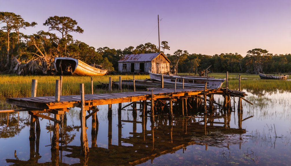
- Empire – A working fishing community that hints at how river towns once thrived here.
- Buras – A quiet town carrying visible scars from past hurricanes and floods.
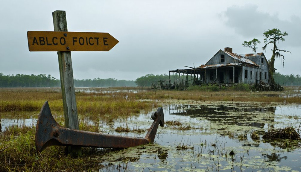
- Pilottown – An abandoned river settlement where Mississippi navigation history feels immediate and raw.
Drive slowly. The road south tells the story before you ever reach La Balize itself.
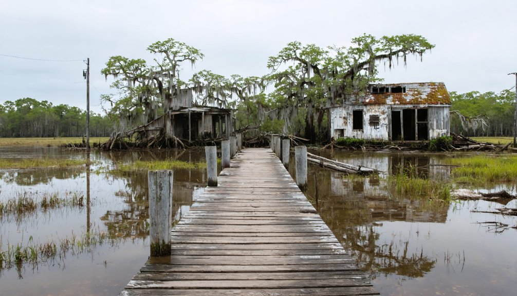
Day Two Delta Stops
Day two asks you to slow down even further. Push deeper into Plaquemines Parish toward Pilottown, a semi-abandoned river community that still carries the ghost stories of Mississippi River pilots who once guided massive vessels through treacherous delta waters.
You’ll feel the isolation immediately — marsh stretching in every direction, the river pressing close, civilization fading behind you.
Pilottown’s historical significance rivals La Balize itself, representing an entire industry that shaped American commerce and then quietly disappeared. Walk what remains, photograph the weathered structures, and let the silence do its work.
The delta doesn’t rush you here. These forgotten communities reward the traveler who resists checking a box and instead chooses to actually absorb what it means when a whole way of life simply vanishes.
Day Three Parish Loop
Complete your parish loop with these three anchoring stops:
- Pilottown – A semi-abandoned river community carrying real ghost stories of Mississippi navigation crews who once waited here between voyages.
- Fort Jackson – A Civil War fortification that controlled the lower river, now preserved and hauntingly still.
- Phoenix community area – A reminder of how hurricanes and flooding quietly erased whole neighborhoods from Louisiana maps.
Each stop adds texture to the broader story you’ve been tracing since day one: water giveth, and water absolutely taketh away.
Frequently Asked Questions
Are There Guided Tours Specifically Focused on La Balize’s Ghost Town History?
You won’t find dedicated ghost town tours highlighting La Balize’s historical significance, but you can explore its haunting legacy independently, letting the river’s forgotten whispers guide your own unforgettable, freedom-filled journey through Louisiana’s lost delta settlements.
Can Children Safely Enjoy a La Balize Ghost Town Road Trip?
Yes, you can bring your children along! Focus on child friendly activities like storytelling and scenic river views. Follow basic safety tips — stay on marked paths, watch for uneven terrain, and you’ll create unforgettable, adventurous family memories together.
Are Photography Permits Required for Shooting in Plaquemines Parish Marsh Areas?
Like a wild bird taking flight, you’re free to shoot here — but check local photography regulations before heading out, as marsh access rules in Plaquemines Parish can shift depending on land ownership and jurisdiction.
What Local Historians or Organizations Specialize in Louisiana Ghost Town Research?
You’ll find ghost town preservation expertise through the Louisiana Historical Association and Plaquemines Parish historical societies. They’re treasure troves of local folklore, connecting you to passionate researchers who’ve dedicated their lives to uncovering Louisiana’s beautifully forgotten, vanished communities.
Are There Any Annual Events or Commemorations Held Honoring La Balize’s History?
Like a candle flickering in forgotten winds, La Balize holds no confirmed ghost town festivals or historical reenactments today. You’ll find its history lives quietly in Plaquemines Parish’s broader commemorations honoring Louisiana’s lost river communities.
References
- https://107jamz.com/ghostly-road-trips-8-of-the-most-haunted-roads-in-louisiana/
- https://www.youtube.com/watch?v=yxoiGQrwtas
- https://en.wikipedia.org/wiki/List_of_ghost_towns_in_Louisiana
- https://1130thetiger.com/these-3-louisiana-ghost-towns-are-just-a-road-trip-away/
- https://www.onlyinyourstate.com/trip-ideas/louisiana/haunted-road-trip-la
- https://www.visitcalifornia.com/now/road-trip-california-ghost-towns/?kui=E7kpKOgr9CsvlaPE5i_TLA
- https://cajuntravel.com/blog/haunted-louisiana-road-trip/
- https://thebayouinsider.substack.com/p/ghost-towns-and-forgotten-roads-louisianas
- https://classicrock1051.com/16-ghost-towns-in-louisiana/
- https://www.hertz.com/p/american-road-trip-planner/west-coast/ghost-towns-of-the-west